|
 |
 Автор: Williams Автор: Williams
 Дата: 15 сентября 2022 Дата: 15 сентября 2022
 Просмотров: 1 023 Просмотров: 1 023 |
| |
Leica GeoMoS Monitor v8.1.1.113
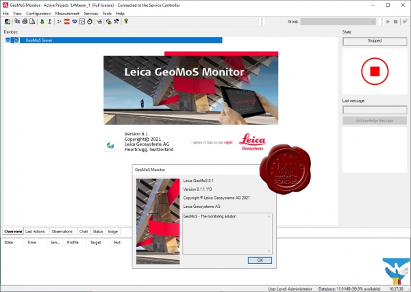
Leica GeoMoS — это гибкое комплексное профессиональное решение, отвечающее всем современным требованиям к системам контроля и обеспечивающее необходимую оперативность в принятии решений. Программные продукты семейства Leica GeoMoS прекрасно адаптируются к конкретным потребностям любого пользователя благодаря масштабируемости, дополнительным компонентам и различным видам лицензий. Комплексное решение для мониторинга обеспечивает высокую точность и надежность и подходит как для кратковременных, так и для долгосрочных проектов.
Leica GeoMoS поддерживает подключение к любым датчикам и программным средствам как от компании Leica Geosystems, так и от сторонних производителей. Гибкие возможности обмена данными обеспечивают эффективное подключение и управление датчиками, а также мгновенное сохранение и анализ данных. Программный интерфейс Leica GeoMoS позволяет организовать обмен данными между GeoMoS и собственной системой заказчика. Автоматизация передачи потоковых данных с помощью множества открытых стандартов позволяет легко и эффективно интегрировать любые датчики. GeoMoS Monitor обеспечивает непрерывный цикл измерений в соответствии с планом использования датчиков и может хранить все важные данные в одной реляционной базе данных.
Встроенные средства обнаружения отклонений, проверки данных, фильтрации и автоматического выполнения повторных измерений обеспечивают точность и надежность сбора геодезических, геотехнических данных, данных о состоянии окружающей среды и любых других данных от датчиков. Если результаты проверки критических предельных величин или текущее состояние системы требуют вмешательства, то соответствующее оповещение своевременно рассылается всем ответственным лицам с использованием различных средств связи (электронная почта, СМС и система сигнализации). Сложные математические расчеты, а также сочетание наблюдений от различных датчиков обеспечивают высокую надежность мониторинга.
Leica GeoMoS Imaging представляет собой модуль расширения для существующего решения GeoMoS. Данная технология дистанционного мониторинга предоставляет графическую информацию для ведения документации, проведения проверок и выявления проблем. Система визирования в реальном времени управляется с помощью манипулятора и позволяет вести непрерывную запись в рамках мониторинга проектов. Это помогает сотрудникам работать эффективнее и предоставляет необходимую информацию для оперативного принятия точных решений.
Мощная, универсальная и гибкая в настройке служба GeoMoS Now! обеспечивает доступ к результатам в любое время и в любом месте. Она может быть установлена как локально, так и в облаке. Получайте точные и оперативные отчеты о состоянии проектов. Простая настройка графиков, изображений, карт, таблиц и результатов измерения деформаций не требует специальных познаний в веб-дизайне. Добавляйте внешние ссылки на ваш проект или используйте систему GeoMoS Now! Программный интерфейс позволяет безопасно размещать информацию о проекте на любой сторонней веб-странице. Кроме того, он позволяет открыть доступ к просмотру проекта нескольким пользователям и рассылать настроенные отчеты неограниченному числу получателей. |
| |
 Читать статью дальше (комментариев - 8)
| |
|
 |
 Автор: Williams Автор: Williams
 Дата: 14 сентября 2022 Дата: 14 сентября 2022
 Просмотров: 1 850 Просмотров: 1 850 |
| |
Hexagon GeoMedia Suite 2022 v16.7.0.210
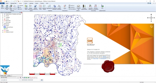
Maps present data visually, allowing you to visualize location and gain other information from your data. Making the information-gathering process easier—making a good map—requires powerful analytical tools and clear symbolization. Whether updating land and tax records, analyzing traffic flow and accidents, or determining the best locations for evacuation centers, GeoMedia combines tabular and geographic data to produce actionable information.
GeoMedia is a powerful, flexible GIS management platform that lets you aggregate data from a variety of sources and analyze them in unison to extract clear, actionable information. It provides simultaneous access to geospatial data in almost any form and displays it in a single unified map view for efficient processing, analysis, presentation, and sharing. GeoMedia’s functionality makes it ideal for extracting information from an array of dynamically changing data to support informed, smarter decision-making.
Utility organizations use GeoMedia to better plan, operate, and manage assets using geospatial intelligence and smart workflows.
GeoMedia tools and analytics help city leaders increase the quality of urban services, engage with the community, and decrease overall costs and resource consumption.
Public safety agencies use GeoMedia to analyze live queries for fast results, determine event hotspots for mitigation, and run historical queries for future insight.
GeoMedia assists transportation agencies with managing and analyzing their networks, generating reports, and determining appropriate actions to ensure safety on their roadways.
GeoMedia gives defense analysts immediate data integration and visualization to detect targets and points of interest in order to make fast, informed, mission critical decisions. |
| |
 Читать статью дальше (комментариев - 12)
| |
|
 |
 Автор: Williams Автор: Williams
 Дата: 13 сентября 2022 Дата: 13 сентября 2022
 Просмотров: 1 456 Просмотров: 1 456 |
| |
Leica Hexagon GeoCompressor 2022 v16.7.0.1963
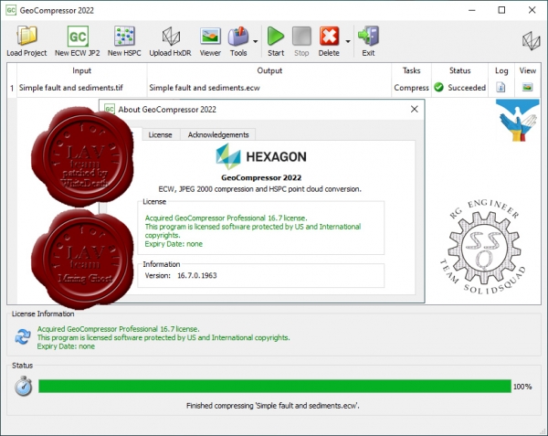
GeoCompressor 2022 (Windows), is a stand-alone data preparation tool to rapidly compress imagery data to ECW or JPEG 2000 file formats. This release extends this core capability to also cover a variety of user experience improvements, including regional localization support.
GeoCompressor 2022 also provides incremental performance improvements and bug fixes, valued by our Data Provider customers seeking to compress ever-growing project sizes on commodity hardware. |
| |
 Читать статью дальше (комментариев - 12)
| |
|
 |
 Автор: Williams Автор: Williams
 Дата: 12 сентября 2022 Дата: 12 сентября 2022
 Просмотров: 1 389 Просмотров: 1 389 |
| |
Leica Hexagon Spider Suite v7.8.0.9445
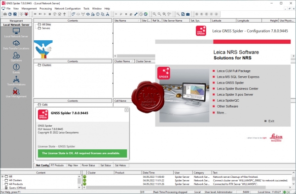
Пакет ПО Leica Spider — это решение для инфраструктуры ГНСС-сетей, реализующее простой доступ ко всем имеющимся данным спутниковой навигации из единого удобного интерфейса. С ним полевые бригады и их коллеги в офисе смогут работать эффективнее.
Вы сможете работать максимально эффективно, когда все данные будут отображаться в одном представлении, а доступ к ним можно будет получить из любой точки мира в любой момент. Программное решение Spider подходит для любых задач и сфер применения, так как оно поддерживает все спутниковые системы, все виды датчиков и все стандарты, помогая вам успешно вести бизнес.
Пакет программного обеспечения Spider Software Suite — первое веб-решение для управления сервисами для работы в реальном времени и постобработки данных. Приложения Spider Software Suite теперь доступны операторам и пользователям из любой точки мира и в любой момент.
Благодаря поддержке открытых стандартов пакет программного обеспечения Spider совместим со всеми ГНСС-приемниками и может передавать данные коррекции на все модели роверов.
Решение Leica Spider Business Center объединяет все, что нужно для эффективной эксплуатации инфраструктуры, включая средства управления пользователями и контроля доступа, мониторинга состояния сети и роверов. Оно предоставляет пользователям доступ к информации о состоянии оборудования и сервисы постобработки.
Преимущества:
- Эффективность и безопасность: сконцентрируйтесь на том, что вы делаете лучше всего.
- Удобство работы как на месте, так и дистанционно.
- Сокращение расходов на инфраструктуру и техническую поддержку.
- Защита инвестиций благодаря возможности обновления и расширения решения.
- ГНСС-решение, ориентированное на будущее.
Spider — это чрезвычайно гибкая платформа для управления ГНСС-инфраструктурой. Кроме того, решения Spider Suite можно использовать для управления крупными сейсмическими сетями и оперативного мониторинга в реальном времени критически важной инфраструктуры, например зданий, мостов, шахт или аэропортов. Модульная архитектура платформы легко масштабируется в соответствии с потребностями и бюджетом заказчика.
Программное обеспечение GNSS Spider позволяет вам предоставлять данные коррекции, используя способ, формат данных и канал связи, наиболее подходящие для ваших клиентов (роверов). Это расширяет базу потенциальных заказчиков. Для оптимальной совместимости с системами ваших клиентов предусмотрена поддержка различных стандартных отраслевых форматов (например, RTCM) и технологий (в частности, Ntrip).
Решение подойдет для разных областей, включая топосъемку, сбор данных по активам, управление оборудованием и точное земледелие, поскольку может реализовать позиционирование с разным уровнем точности, за несколько секунд определяя координаты с допуском от нескольких дециметров до сантиметров.
Модуль Spider Positioning получает данные в непрерывном потоковом или периодическом режиме. Он автоматически непрерывно рассчитывает координаты станции как в реальном времени, так и при последующей обработке данных. Проверенные на практике алгоритмы мониторинга в модуле Spider Positioning обеспечивают великолепную точность и надежность даже при использовании одночастотных приемников. Результаты, полученные модулем Spider Positioning, удобно анализировать с помощью решений Leica SpiderQC и Leica GeoMoS. Получать доступ к ним можно онлайн с помощью Leica SpiderWeb. |
| |
 Читать статью дальше (комментариев - 11)
| |
|
 |
 Автор: Williams Автор: Williams
 Дата: 10 сентября 2022 Дата: 10 сентября 2022
 Просмотров: 6 006 Просмотров: 6 006 |
| |
Leica Cyclone 2022.1.0 build 8224 x64
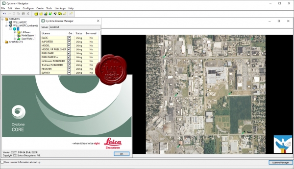
Leica Cyclone является лучшим на рынке программным обеспечением для обработки облаков точек. Это семейство программных модулей, обеспечивающих самый широкий диапазон технологических процессов при лазерном 3D-сканировании в машиностроении, геодезии, строительстве и смежных областях.
Для организаций, которым необходимо добавить данные облаков точек в свои технологические процессы, Leica Cyclone является единственным решением, способным сформировать все необходимые результаты. В отличие от ПО других поставщиков, Leica Cyclone эффективно работает в соответствии с любыми проектными требованиями, принося прибыль вашей организации.
Ключевой компонент комплексного решения — семейство Cyclone. Различные модули Cyclone проведут пользователя от начала и до конца технологического цикла при реализации проектов любого типа, предусматривающих работу с облаками точек.
Существуют модули, позволяющие использовать такие операции сбора данных на объектах с помощью лазерных сканеров Leica Geosystems, как маршрутная съемка, задний отсчет, визирование с обратными засечками, а также привязку данных сканерами Leica RTC360 с помощью визуальной инерциальной системы (VIS) для обеспечения комплексных сбора и регистрации данных на уровне профессиональной топографической съемки. Функциональность таких модулей включает процедуры автоматизации, работающие в режиме диалога с пользователем и выполняющие большинство задач за него, и богатейший набор инструментов для обеспечения и контроля качества, а также настройки и анализа процессов съемки.
Существуют и другие модули, предназначенные для формирования широкого спектра выходных материалов: от отчетов и карт до 3D-моделей, фильмов, анимированных роликов и компактных форматов 3D-данных, которые можно свободно пересылать по Интернету. Эти модули могут использоваться в различных процессах широкого спектра отраслей, включая проектирование сооружений, создание 3D-моделей готовых сооружений, топографическую съемку, информационное моделирование зданий и многие другие.
Используя файлы в разработанном компанией Leica Geosystems формате универсального проектного файла (LGS), пользователи могут передавать данные цифровой реальности между Cyclone и любым использующим технологию HDS программным обеспечением.
Для большего удобства использования, комплекс состоит из отдельных программных модулей, используемых для разных целей:
|
| |
 Читать статью дальше (комментариев - 26)
| |
|
 |
 Автор: Williams Автор: Williams
 Дата: 9 сентября 2022 Дата: 9 сентября 2022
 Просмотров: 3 102 Просмотров: 3 102 |
| |
Trimble Tekla Structures 2022 SP4 build 18156
Tekla Structures - комплексное решение, которое позволяет значительно увеличить производительность проектирования промышленных и гражданских зданий с использованием различных конструкционных материалов, таких как: металлоконструкции, сборные железобетонные изделия и монолитные бетонные конструкции.
Tekla Structures представляет собой программное обеспечение информационного моделирования зданий (BIM), которое позволяет создавать точные, подробные, удобные для конструирования 3D модели из любого материала и любой сложности и управлять ими. Модели Tekla Structures можно использовать во всем процессе строительства от эскизов до производства, монтажа и управления строительными работами.
Tekla Structures можно использовать с другими существующими приложениями или отдельно как платформу для разработки собственных рабочих процессов. Открытая платформа поддерживает совместимость и стандартизацию. Tekla Structures стыкуется с различными системами через Tekla Open API через программный интерфейс приложения, который внедряется с использованием технологии Microsoft.NET. Например, Tekla Structures поддерживает следующие стандартные форматы: IFC, CIS/2, SDNF и DSTV. Tekla Structures поддерживает собственные форматы, например DWG, DXF и DGN.
Конфигурации Tekla Structures:
- Tekla Structures, Full Detailing представляет собой универсальную конфигурацию, содержащую модули деталировки металлических конструкции, сборных железобетонных изделий и монолитных бетонных изделий. Предусмотрено создание трехмерных моделей конструкций из стали и бетона, а также автоматическая генерация чертежей КМ и КМД.
- Tekla Structures, Steel Detailing представляет собой конфигурацию, предназначенную для проектирования металлоконструкций. Пользователь может создавать детальные трехмерные модели любых металлических конструкций и получать соответствующие данные для производства и монтажа, используемые всеми участниками проекта.
- Tekla Structures, Precast Concrete Detailing представляет собой стандартную конфигурацию, дополненную важными функциями деталировки сборных железобетонных конструкций. Пользователь может создавать детальные трехмерные модели бетонных конструкций и получать соответствующие данные по производству и монтажу, используемые совместно со всеми участниками проекта.
- Tekla Structures, Reinforced Concrete Detailing представляет собой стандартную конфигурацию, дополненную важными функциями деталировку монолитных железобетонных изделий. Пользователь может создавать детальные трехмерные модели монолитных железобетонных изделий и получать соответствующие данные по производству и монтажу, используемые совместно со всеми участниками проекта.
- Tekla Structures, Engineering представляет собой стандартную конфигурацию, позволяющую выполнять синхронизированное конструирование. Проектировщики металлоконструкций и инженеры, проектирующие внутренние инженерные системы, могут сотрудничать в рамках совместно используемой модели.
|
| |
 Читать статью дальше (комментариев - 16)
| |
|
 |
 Автор: Williams Автор: Williams
 Дата: 7 сентября 2022 Дата: 7 сентября 2022
 Просмотров: 1 974 Просмотров: 1 974 |
| |
CSoft WiseImage Pro v22.0.3654.2021 for Autodesk AutoCAD 2018-2022 (2023-optionally)
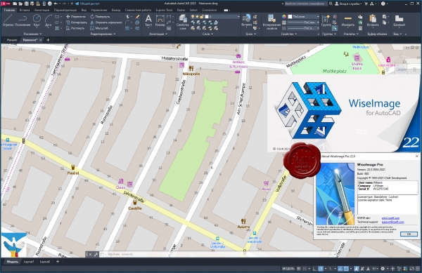
WiseImage for Windows is the new generation of 2D standalone, raster to vector conversion software with raster editing and drawing revision features. WiseImage allows you to make fast changes do editing and correction or automatic and semi-automatic raster-to-vector conversion of technical drawings, scanned maps, plans, drafts, sketches and other graphics. WiseImage is acquainted for its greater editing and cleanup tools outside the CAD surroundings. It combines raster and vector with CAD functionality and image processing skills effortlessly, everything in single cost-cutting software.
WiseImage — мощный интеллектуальный редактор и векторизатор цветного, полутонового и монохромного растра. С его помощью можно повышать качество сканированных чертежей, эскизов, карт и другой графической информации, редактировать их и преобразовывать в векторный вид. Благодаря реализованной в WiseImage технологии интеллектуального растрового и гибридного редактирования этот продукт стал признанным лидером в своей области. Редактирование растра с использованием САПР-технологий позволяет обрабатывать растровые объекты теми же способами, которые применяются для работы с векторами в традиционных системах автоматизированного проектирования. Полная поддержка многостраничных файлов, механизм интеллектуального растрового выбора, настройка интерфейса в стиле Windows XP, поддержка прямого сканирования и печати, а также открытая архитектура делают WiseImage оптимальным выбором для обработки растровых изображений, векторизации и двумерного черчения. |
| |
 Читать статью дальше (комментариев - 15)
| |
|
 |
 Автор: Williams Автор: Williams
 Дата: 6 сентября 2022 Дата: 6 сентября 2022
 Просмотров: 1 515 Просмотров: 1 515 |
| |
CSoft WiseImage Pro Standalone v22.0.1741.1862 x32+x64
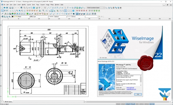
WiseImage for Windows is the new generation of 2D standalone, raster to vector conversion software with raster editing and drawing revision features. WiseImage allows you to make fast changes do editing and correction or automatic and semi-automatic raster-to-vector conversion of technical drawings, scanned maps, plans, drafts, sketches and other graphics. WiseImage is acquainted for its greater editing and cleanup tools outside the CAD surroundings. It combines raster and vector with CAD functionality and image processing skills effortlessly, everything in single cost-cutting software.
WiseImage — мощный интеллектуальный редактор и векторизатор цветного, полутонового и монохромного растра. С его помощью можно повышать качество сканированных чертежей, эскизов, карт и другой графической информации, редактировать их и преобразовывать в векторный вид. Благодаря реализованной в WiseImage технологии интеллектуального растрового и гибридного редактирования этот продукт стал признанным лидером в своей области. Редактирование растра с использованием САПР-технологий позволяет обрабатывать растровые объекты теми же способами, которые применяются для работы с векторами в традиционных системах автоматизированного проектирования. Полная поддержка многостраничных файлов, механизм интеллектуального растрового выбора, настройка интерфейса в стиле Windows XP, поддержка прямого сканирования и печати, а также открытая архитектура делают WiseImage оптимальным выбором для обработки растровых изображений, векторизации и двумерного черчения. |
| |
 Читать статью дальше (комментариев - 20)
| |
|
 |
 Автор: Williams Автор: Williams
 Дата: 5 сентября 2022 Дата: 5 сентября 2022
 Просмотров: 5 518 Просмотров: 5 518 |
| |
Hexagon ERDAS IMAGINE 2022 v16.7.0.1216
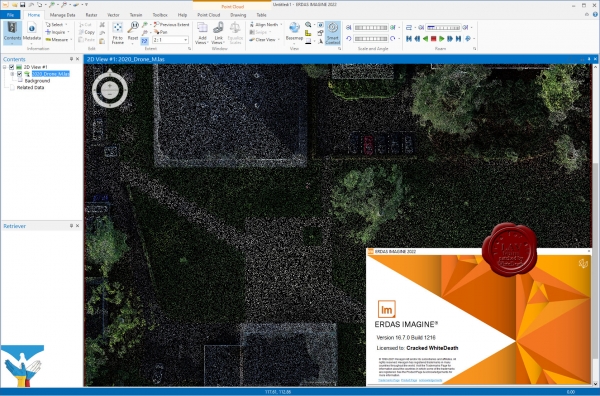
Geographic imaging professionals need to process vast amounts of geospatial data every day — often relying on software designed for other purposes and add-on applications that create almost as many problems as they solve. Save both time and money, leverage existing data investments, and improve your image analysis capabilities with ERDAS IMAGINE.
ERDAS IMAGINE provides true value, consolidating remote sensing, photogrammetry, LiDAR analysis, basic vector analysis, and radar processing into a single product.
ERDAS IMAGINE simplifies image classification and segmentation, orthorectification, mosaicking, reprojection, elevation extraction, and image interpretation.
Powerful algorithms and data processing functions work behind the scenes so you can concentrate on your analyses.
ERDAS IMAGINE offers K-Means, ISODATA, object-based image segmentation, Machine Learning and Deep Learning Artificial Intelligence algorithms.
The Spatial Modeler’s graphical editing environment provides flexibility to capture domain expertise and turn it into re-usable algorithms.
ERDAS IMAGINE fully enables the display, editing, and analysis of point clouds derived from LiDAR or point correlation of stereo pairs. |
| |
 Читать статью дальше (комментариев - 41)
| |
|
 |
 Автор: Williams Автор: Williams
 Дата: 4 сентября 2022 Дата: 4 сентября 2022
 Просмотров: 4 549 Просмотров: 4 549 |
| |
Leica Infinity v4.0.0
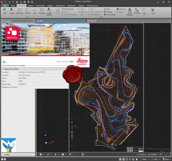
Leica Infinity - интуитивно понятное офисное программное обеспечение от компании Leica Geosystems - пришло на смену Leica Geo Office. Геодезическая съемка сегодня предполагает наличие возможности гибко и быстро обрабатывать полевые данные и информацию их офиса в любом месте и передавать их. Сегодня более, чем когда-либо прежде, существует потребность в едином Рабочем процессе для всех проектов. Для реализации этой потребности и было разработано Leica Infinity : дружественная, интеллектуальная программная платформа с интеллектуальной информационной архитектурой, которая открывает безграничные возможности по организации рабочего процесса. В результате получаем повышение эффективности, прозрачности и просто улучшения всего процесса съемки.
Опционально программа имеет следующие модули и возможности:
- Обработка данных тахеометрии.
- Обработка нивелирования с возможностью уравнивания по высоте.
- 3D уравнивание.
- Работа с поверхностями.
- Работа с результатами сканирования.
- Обработка одночастотных и многочастотных GNSS.
Leica Infinity осуществит для Вашего проекта комплексную обработку различных видов данных: TPS, GNSS , изображения, сканирование. Многочисленные форматы данных можно легко редактировать, архивировать и экспортировать в CAD-приложения(системы проектирования) без потери целостности и «борьбы» с трудностями, часто встречающимися при преобразованиях. Это относится не только к данным от различных типов инструментов, но и данных, полученных с разных сайтов и от изыскательских команд. |
| |
 Читать статью дальше (комментариев - 22)
| |
|
 |
| ПОИСК ПО САЙТУ |
 |
|
 |
| КАЛЕНДАРЬ | | |
 |
| « Октябрь 2025 » |
|---|
| Пн | Вт | Ср | Чт | Пт | Сб | Вс |
|---|
| | 1 | 2 | 3 | 4 | 5 | | 6 | 7 | 8 | 9 | 10 | 11 | 12 | | 13 | 14 | 15 | 16 | 17 | 18 | 19 | | 20 | 21 | 22 | 23 | 24 | 25 | 26 | | 27 | 28 | 29 | 30 | 31 | |
|
 | |
| |
|