|
 |
 Автор: Williams Автор: Williams
 Дата: 11 декабря 2022 Дата: 11 декабря 2022
 Просмотров: 2 180 Просмотров: 2 180 |
| |
Leica Hexagon MinePlan (ex. MineSight) 2022 Release 4
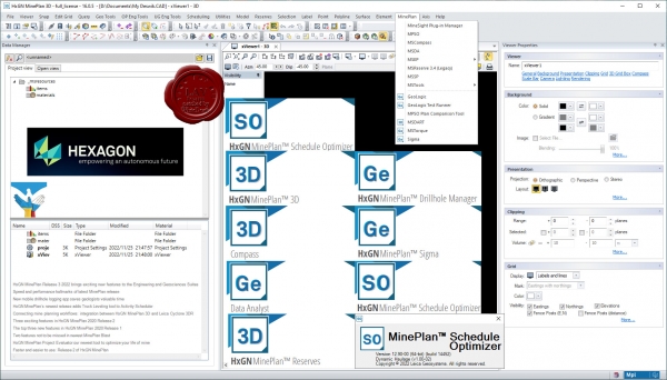
HxGN MinePlan provides geologists and engineers with powerful 3D modeling and data visualization. It supports seamless workflows, from exploration to production and it's backed by more than 50 years of innovation in partnership with thousands of global users.
Productive mines depend on being able to build detailed geological surfaces and solids. Statistical and geo-statistical analysis of project data is essential to producing an accurate block model with confidence.
Click here to interactively explore your own life-of-mine journey.
Geosciences
The Geosciences suite empowers resource geologists to store, manage and analyse drillhole data.
Open pit engineering
MinePlan open pit engineering suite offers software packages that help you improve efficiency and make informed decisions.
Underground engineering
CAD offers solutions for underground design challenges, including 3D visualisation and tools for pillar design, plus more.
HxGN MinePlan Survey
MinePlan Survey allows for management of survey data throughout the mining lifecycle using a comprehensive software solution. |
| |
 Читать статью дальше (комментариев - 15)
| |
|
 |
 Автор: Williams Автор: Williams
 Дата: 18 октября 2022 Дата: 18 октября 2022
 Просмотров: 1 430 Просмотров: 1 430 |
| |
Leica Hexagon HxMap v4.1.0
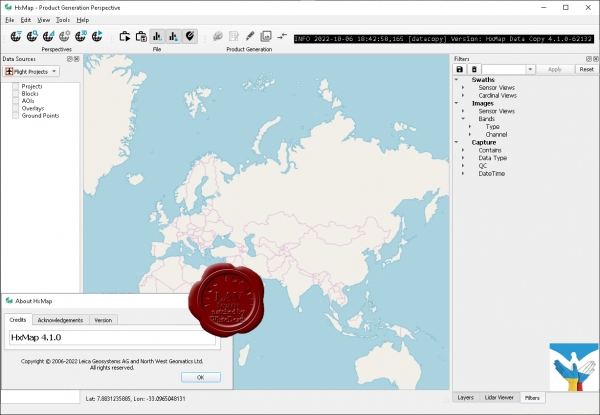
The increased need for up-to-date geospatial information in many of the traditional applications as well as in emerging areas such as navigation or location-based apps requires a new approach to data processing: rapid updates over large areas in the shortest possible time. To be a true No 1, the world’s most efficient airborne sensors still rely on an efficient and fast data processing workflow.
By introducing HxMap, the unified high-performance multi-sensor workflow platform, Leica Geosystems offers exactly what the industry has been waiting for: a fast, intuitive and efficient post-processing platform, that allows you to produce all known data products within one single interface.
The Leica HxMap common sensor post-processing platform offers the following modules to meet your needs:
HxMap Enabler: Enabler
HxMap Provider: Ingest, Raw QC, Workflow Manager, Point Cloud Generator, Projection Engine
HxMap Core Image: APM, Aerial Triangulation, Infocloud, Ortho Generator
HxMap Core LiDAR: AutoCalibration, Registration, Colour Encoding, Data Metrics, LiDAR QC
HxMap 3D Modeller: City Modeller, Texture Mapper, 3D Editor, Building Finder
Leica HxMap intuitively guides you along a common processing workflow. Starting from data download, raw QC, data ingest all the way to the final product generation. Depending on the input data, additional steps like aerial triangulation, radiometric adjustments and LiDAR point cloud registration are available.
Furthermore, the HxMap product generator allows a large number of products to be generated by the push of a button: referenced images, orthophotos, info clouds, point clouds as well as 3D city models.
These features build the right solution for large oblique projects, country-wide orthophoto or LiDAR mapping for small engineering projects alike.
To reach highest efficiency the data acquisition has been tightly integrated with the post processing workflow. Thus, HxMap can be enabled for individual sensor types. For flexible production, scalable and application-specific software modules are bundled with the matching hardware, namely Leica RealCity, Leica RealWorld and Leica RealTerrain.
RealCity supports you with your smart city and 3D city modelling applications, RealWorld is designed for Leica RCD30 and Leica DMCIII large area imaging projects in 2D and Leica RealTerrain is particularly effective for LiDAR mapping. To get the most out of your HxMap installation we highly recommend including both Core Image and Core LiDAR for all of our hybrid sensors. |
| |
 Читать статью дальше (комментариев - 11)
| |
|
 |
 Автор: Williams Автор: Williams
 Дата: 14 сентября 2022 Дата: 14 сентября 2022
 Просмотров: 1 840 Просмотров: 1 840 |
| |
Hexagon GeoMedia Suite 2022 v16.7.0.210
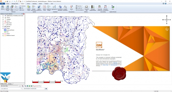
Maps present data visually, allowing you to visualize location and gain other information from your data. Making the information-gathering process easier—making a good map—requires powerful analytical tools and clear symbolization. Whether updating land and tax records, analyzing traffic flow and accidents, or determining the best locations for evacuation centers, GeoMedia combines tabular and geographic data to produce actionable information.
GeoMedia is a powerful, flexible GIS management platform that lets you aggregate data from a variety of sources and analyze them in unison to extract clear, actionable information. It provides simultaneous access to geospatial data in almost any form and displays it in a single unified map view for efficient processing, analysis, presentation, and sharing. GeoMedia’s functionality makes it ideal for extracting information from an array of dynamically changing data to support informed, smarter decision-making.
Utility organizations use GeoMedia to better plan, operate, and manage assets using geospatial intelligence and smart workflows.
GeoMedia tools and analytics help city leaders increase the quality of urban services, engage with the community, and decrease overall costs and resource consumption.
Public safety agencies use GeoMedia to analyze live queries for fast results, determine event hotspots for mitigation, and run historical queries for future insight.
GeoMedia assists transportation agencies with managing and analyzing their networks, generating reports, and determining appropriate actions to ensure safety on their roadways.
GeoMedia gives defense analysts immediate data integration and visualization to detect targets and points of interest in order to make fast, informed, mission critical decisions. |
| |
 Читать статью дальше (комментариев - 12)
| |
|
 |
 Автор: Williams Автор: Williams
 Дата: 13 сентября 2022 Дата: 13 сентября 2022
 Просмотров: 1 449 Просмотров: 1 449 |
| |
Leica Hexagon GeoCompressor 2022 v16.7.0.1963
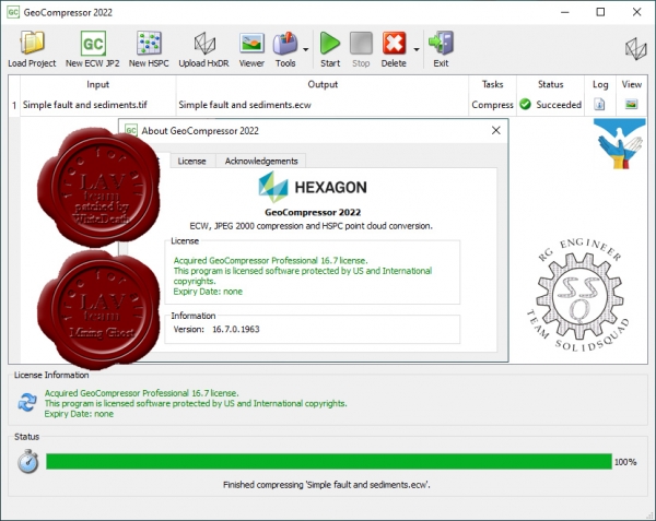
GeoCompressor 2022 (Windows), is a stand-alone data preparation tool to rapidly compress imagery data to ECW or JPEG 2000 file formats. This release extends this core capability to also cover a variety of user experience improvements, including regional localization support.
GeoCompressor 2022 also provides incremental performance improvements and bug fixes, valued by our Data Provider customers seeking to compress ever-growing project sizes on commodity hardware. |
| |
 Читать статью дальше (комментариев - 12)
| |
|
 |
 Автор: Williams Автор: Williams
 Дата: 12 сентября 2022 Дата: 12 сентября 2022
 Просмотров: 1 382 Просмотров: 1 382 |
| |
Leica Hexagon Spider Suite v7.8.0.9445
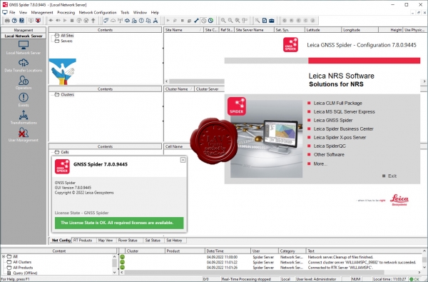
Пакет ПО Leica Spider — это решение для инфраструктуры ГНСС-сетей, реализующее простой доступ ко всем имеющимся данным спутниковой навигации из единого удобного интерфейса. С ним полевые бригады и их коллеги в офисе смогут работать эффективнее.
Вы сможете работать максимально эффективно, когда все данные будут отображаться в одном представлении, а доступ к ним можно будет получить из любой точки мира в любой момент. Программное решение Spider подходит для любых задач и сфер применения, так как оно поддерживает все спутниковые системы, все виды датчиков и все стандарты, помогая вам успешно вести бизнес.
Пакет программного обеспечения Spider Software Suite — первое веб-решение для управления сервисами для работы в реальном времени и постобработки данных. Приложения Spider Software Suite теперь доступны операторам и пользователям из любой точки мира и в любой момент.
Благодаря поддержке открытых стандартов пакет программного обеспечения Spider совместим со всеми ГНСС-приемниками и может передавать данные коррекции на все модели роверов.
Решение Leica Spider Business Center объединяет все, что нужно для эффективной эксплуатации инфраструктуры, включая средства управления пользователями и контроля доступа, мониторинга состояния сети и роверов. Оно предоставляет пользователям доступ к информации о состоянии оборудования и сервисы постобработки.
Преимущества:
- Эффективность и безопасность: сконцентрируйтесь на том, что вы делаете лучше всего.
- Удобство работы как на месте, так и дистанционно.
- Сокращение расходов на инфраструктуру и техническую поддержку.
- Защита инвестиций благодаря возможности обновления и расширения решения.
- ГНСС-решение, ориентированное на будущее.
Spider — это чрезвычайно гибкая платформа для управления ГНСС-инфраструктурой. Кроме того, решения Spider Suite можно использовать для управления крупными сейсмическими сетями и оперативного мониторинга в реальном времени критически важной инфраструктуры, например зданий, мостов, шахт или аэропортов. Модульная архитектура платформы легко масштабируется в соответствии с потребностями и бюджетом заказчика.
Программное обеспечение GNSS Spider позволяет вам предоставлять данные коррекции, используя способ, формат данных и канал связи, наиболее подходящие для ваших клиентов (роверов). Это расширяет базу потенциальных заказчиков. Для оптимальной совместимости с системами ваших клиентов предусмотрена поддержка различных стандартных отраслевых форматов (например, RTCM) и технологий (в частности, Ntrip).
Решение подойдет для разных областей, включая топосъемку, сбор данных по активам, управление оборудованием и точное земледелие, поскольку может реализовать позиционирование с разным уровнем точности, за несколько секунд определяя координаты с допуском от нескольких дециметров до сантиметров.
Модуль Spider Positioning получает данные в непрерывном потоковом или периодическом режиме. Он автоматически непрерывно рассчитывает координаты станции как в реальном времени, так и при последующей обработке данных. Проверенные на практике алгоритмы мониторинга в модуле Spider Positioning обеспечивают великолепную точность и надежность даже при использовании одночастотных приемников. Результаты, полученные модулем Spider Positioning, удобно анализировать с помощью решений Leica SpiderQC и Leica GeoMoS. Получать доступ к ним можно онлайн с помощью Leica SpiderWeb. |
| |
 Читать статью дальше (комментариев - 11)
| |
|
 |
 Автор: Williams Автор: Williams
 Дата: 5 сентября 2022 Дата: 5 сентября 2022
 Просмотров: 5 477 Просмотров: 5 477 |
| |
Hexagon ERDAS IMAGINE 2022 v16.7.0.1216
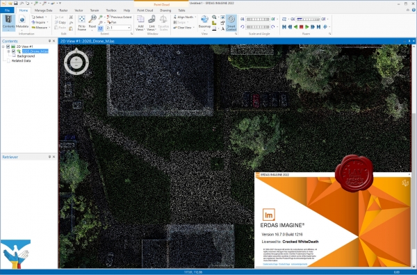
Geographic imaging professionals need to process vast amounts of geospatial data every day — often relying on software designed for other purposes and add-on applications that create almost as many problems as they solve. Save both time and money, leverage existing data investments, and improve your image analysis capabilities with ERDAS IMAGINE.
ERDAS IMAGINE provides true value, consolidating remote sensing, photogrammetry, LiDAR analysis, basic vector analysis, and radar processing into a single product.
ERDAS IMAGINE simplifies image classification and segmentation, orthorectification, mosaicking, reprojection, elevation extraction, and image interpretation.
Powerful algorithms and data processing functions work behind the scenes so you can concentrate on your analyses.
ERDAS IMAGINE offers K-Means, ISODATA, object-based image segmentation, Machine Learning and Deep Learning Artificial Intelligence algorithms.
The Spatial Modeler’s graphical editing environment provides flexibility to capture domain expertise and turn it into re-usable algorithms.
ERDAS IMAGINE fully enables the display, editing, and analysis of point clouds derived from LiDAR or point correlation of stereo pairs. |
| |
 Читать статью дальше (комментариев - 41)
| |
|
 |
 Автор: Williams Автор: Williams
 Дата: 18 июня 2019 Дата: 18 июня 2019
 Просмотров: 6 617 Просмотров: 6 617 |
| |
Hexagon CAESAR II 2019 v11.00.00.4800 build 190424
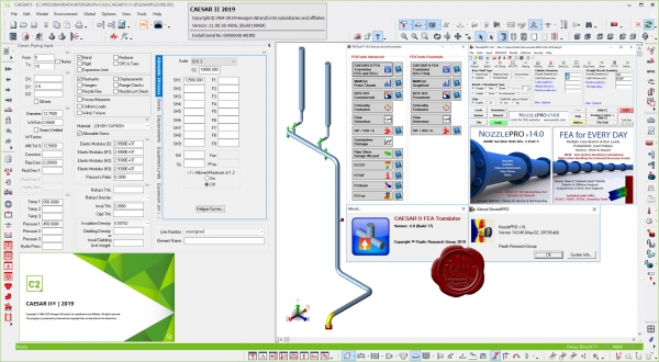
CAESAR II is the world’s most widely used pipe flexibility and stress analysis software, CAESAR II is a complete solution that enables quick and accurate analysis of piping systems subjected to a wide variety of loads, taking into account weight, pressure, thermal, seismic and other static and dynamic conditions, based on user-defined variables and accepted industry guidelines. CAESAR II analyzes piping systems of any size or complexity, whether the need is to design a new system or trouble-shoot an existing one. And, CAESAR II features the only bi-directional link between analysis and CAD design, allowing engineers and designers to easily share information while keeping the drawing and related data in sync.
|
| |
 Читать статью дальше (комментариев - 28)
| |
|
 |
| ПОИСК ПО САЙТУ |
 |
|
 |
| КАЛЕНДАРЬ | | |
 |
| « Август 2025 » |
|---|
| Пн | Вт | Ср | Чт | Пт | Сб | Вс |
|---|
| | 1 | 2 | 3 | | 4 | 5 | 6 | 7 | 8 | 9 | 10 | | 11 | 12 | 13 | 14 | 15 | 16 | 17 | | 18 | 19 | 20 | 21 | 22 | 23 | 24 | | 25 | 26 | 27 | 28 | 29 | 30 | 31 |
|
 | |
| |
|