|
 |
 Автор: Williams Автор: Williams
 Дата: 4 июля 2023 Дата: 4 июля 2023
 Просмотров: 528 Просмотров: 528 |
| |
Hexagon Vero Cabinet Vision 2023.1
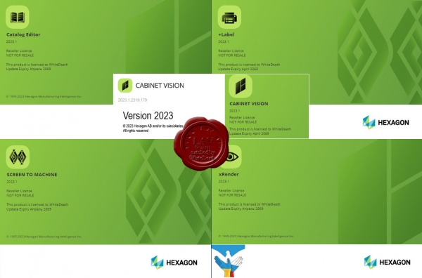
Cabinet Vision makes it simple for furniture, woodworking, or casegood manufacturers of all sizes to play to their strengths, by using a single, fully modular software package to go from design to manufacture. With Cabinet Vision you buy only the features you need. This allows you to evolve and grow your software usage in line with your business, making Cabinet Vision highly scalable and cost-effective. Enhanced usability makes it even easier to visualise and efficiently perform a full range of tasks, while responding to changing design requirements, whether making high-end bespoke pieces or basic elements. Fast, practical and precise, Cabinet Vision excels at rapidly and seamlessly converting designs into all the information you need on the factory floor to manage manufacturing process. And an intuitively simple parametric function means you can capitalise on previous bespoke designs by resizing elements without reprogramming. The result is a faithful reproduction of designs and the reduction of both time-consuming processes and human error. Cabinet Vision also enables you to support sales with features that include the production of professional reports that help customers understand and visualise the scope of services as well as the end product. Cabinet Vision provides you with a choice of core components that enable you to enhance productivity and improve quality and customer service within your chosen specialism..Each core component provides layout, cut listing, basic rendering and primary estimating functions. Once you have chosen the core package that suits your needs, you can then opt to add specific modules, known as multipliers, in line with your individual manufacturing processes, business focus, customer requirements and employee growth plans. Further additions are also available to enhance the capability of each multiplier, depending on the depth of functionality you seek. |
| |
 Читать статью дальше (комментариев - 9)
| |
|
 |
 Автор: Williams Автор: Williams
 Дата: 3 июля 2023 Дата: 3 июля 2023
 Просмотров: 527 Просмотров: 527 |
| |
Hexagon Vero REcreate 2023.1
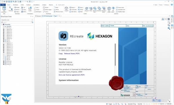
Discover REcreate, the reverse engineering software that reduces workflow complexity to create a faster and more flexible design, production and inspection environment.
REcreate takes the complexity out of reverse engineering to create a smarter, faster and more flexible design and production environment for modelling new products and for repairing or replacing parts.
Highly flexible, REcreate stands apart from traditional reverse engineering software by incorporating a CAD system that can create 2D drawings as well as CAD models. REcreate fits into any existing production workflow and is versatile enough to be used as a standalone product, working with machines that don’t use CAM data, or as part of an end-to-end CAD to CAM solution. Other key functionalities include direct modelling, which makes it easy for users to form the shape the require.
The ease-of-use and interoperability of REcreate make it simple for users to capture data by connecting directly to scanning devices or importing mesh, solid, surface or point cloud data. They can model designs in a single environment using a full array of modelling data and manufacture using CAD/CAM – as well as validate quality. And they can start at whichever point in the reverse engineering process that best suits their needs.
With REcreate manufacturers and OEMs can:
- Reconstruct legacy parts.
- Develop innovative products from existing parts.
- Ensure a precise fit for new components.
- Create CAD for parts when none exist.
- Up date design files to reflect changes that occurred during manufacturing or prototyping.
And because REcreate is designed to operate with a wide range of third-party systems, it can be used either as a fully end-to-end reverse engineering solution or as a complement to existing technology. |
| |
 Читать статью дальше (комментариев - 8)
| |
|
 |
 Автор: Williams Автор: Williams
 Дата: 30 июня 2023 Дата: 30 июня 2023
 Просмотров: 267 Просмотров: 267 |
| |
Hexagon (ex. Vero, ex. Planit) Edgecam Suite 2022.0
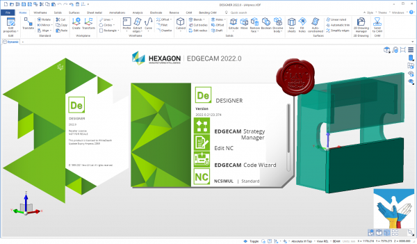
Edgecam - автоматизированное создание управляющих программ для станков с ЧПУ. Разработка принадлежит англиЦкой компании Pathtrace Technology, которая, в свою очередь, является подразделением группы Planit Holdings plc, специализирующейся на создании CAD/CAM систем мирового класса, ориентированных на машиностроение, деревообработку, мебельную промышленность и розничную торговлю.
Planit Edgecam является ведущим международным партнером по САМ-системам компании Autodesk - Global Preferred Computer Aided Manufacturing (CAM) Partner. Помимо этого, Planit Edgecam имеет статус Сертифицированного Приложения для SolidWorks, Autodesk Inventor и Solid Edge.
Модули Planit Edgecam позволяют осуществлять призматическую и поверхностную фрезерную обработку, сложную токарную обработку по нескольким осям, простую фрезерную или токарную обработку, ротационную и многопозиционную фрезерную обработку, обработку целых групп деталей и комплектующих.
Библиотека инструментов повышения производительности Planit Edgecam Productivity Toolbox представляет собой целый набор функций, повышающих эффективность работы с программой. Среди них отличные возможности для моделирования траектории обработки, уникальный мастер постпроцессоров, современная библиотека инструментов, интуитивные и гибкие коммуникации с оборудованием, система управления работой на основе web.
Благодаря Edgecam Solid Machinist, мощной системе, интегрированной в пакет Edgecam, компания Pathtrace занимает лидирующие позиции на рынке CAD/CAM.
Модуль Edgecam Solid Machinist позволяет загружать файлы Autodesk Inventor, Pro/ENGINEER, SolidWorks, Solid Edge CATIA V5 напрямую в Edgecam. |
| |
 Читать статью дальше (комментариев - 3)
| |
|
 |
 Автор: Williams Автор: Williams
 Дата: 1 апреля 2023 Дата: 1 апреля 2023
 Просмотров: 2 435 Просмотров: 2 435 |
| |
Leica Hexagon MinePlan (ex. MineSight) 2023 Release 1
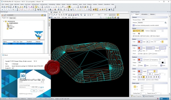
HxGN MinePlan provides geologists and engineers with powerful 3D modeling and data visualization. It supports seamless workflows, from exploration to production and it's backed by more than 50 years of innovation in partnership with thousands of global users.
Productive mines depend on being able to build detailed geological surfaces and solids. Statistical and geo-statistical analysis of project data is essential to producing an accurate block model with confidence.
Click here to interactively explore your own life-of-mine journey.
Geosciences
The Geosciences suite empowers resource geologists to store, manage and analyse drillhole data.
Open pit engineering
MinePlan open pit engineering suite offers software packages that help you improve efficiency and make informed decisions.
Underground engineering
CAD offers solutions for underground design challenges, including 3D visualisation and tools for pillar design, plus more.
HxGN MinePlan Survey
MinePlan Survey allows for management of survey data throughout the mining lifecycle using a comprehensive software solution. |
| |
 Читать статью дальше (комментариев - 12)
| |
|
 |
 Автор: Williams Автор: Williams
 Дата: 16 февраля 2023 Дата: 16 февраля 2023
 Просмотров: 1 023 Просмотров: 1 023 |
| |
Leica Hexagon HxMap v4.2.0
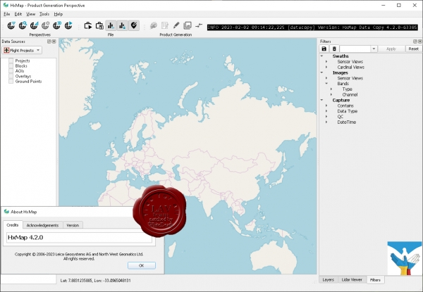
The increased need for up-to-date geospatial information in many of the traditional applications as well as in emerging areas such as navigation or location-based apps requires a new approach to data processing: rapid updates over large areas in the shortest possible time. To be a true No 1, the world’s most efficient airborne sensors still rely on an efficient and fast data processing workflow.
By introducing HxMap, the unified high-performance multi-sensor workflow platform, Leica Geosystems offers exactly what the industry has been waiting for: a fast, intuitive and efficient post-processing platform, that allows you to produce all known data products within one single interface.
The Leica HxMap common sensor post-processing platform offers the following modules to meet your needs:
- HxMap Enabler: Enabler
- HxMap Provider: Ingest, Raw QC, Workflow Manager, Point Cloud Generator, Projection Engine
- HxMap Core Image: APM, Aerial Triangulation, Infocloud, Ortho Generator
- HxMap Core LiDAR: AutoCalibration, Registration, Colour Encoding, Data Metrics, LiDAR QC
- HxMap 3D Modeller: City Modeller, Texture Mapper, 3D Editor, Building Finder
Leica HxMap intuitively guides you along a common processing workflow. Starting from data download, raw QC, data ingest all the way to the final product generation. Depending on the input data, additional steps like aerial triangulation, radiometric adjustments and LiDAR point cloud registration are available.
Furthermore, the HxMap product generator allows a large number of products to be generated by the push of a button: referenced images, orthophotos, info clouds, point clouds as well as 3D city models.
These features build the right solution for large oblique projects, country-wide orthophoto or LiDAR mapping for small engineering projects alike.
To reach highest efficiency the data acquisition has been tightly integrated with the post processing workflow. Thus, HxMap can be enabled for individual sensor types. For flexible production, scalable and application-specific software modules are bundled with the matching hardware, namely Leica RealCity, Leica RealWorld and Leica RealTerrain.
RealCity supports you with your smart city and 3D city modelling applications, RealWorld is designed for Leica RCD30 and Leica DMCIII large area imaging projects in 2D and Leica RealTerrain is particularly effective for LiDAR mapping. To get the most out of your HxMap installation we highly recommend including both Core Image and Core LiDAR for all of our hybrid sensors. |
| |
 Читать статью дальше (комментариев - 7)
| |
|
 |
 Автор: Williams Автор: Williams
 Дата: 6 февраля 2023 Дата: 6 февраля 2023
 Просмотров: 673 Просмотров: 673 |
| |
Hexagon (ex. MSC) Cradle CFD 2022.1
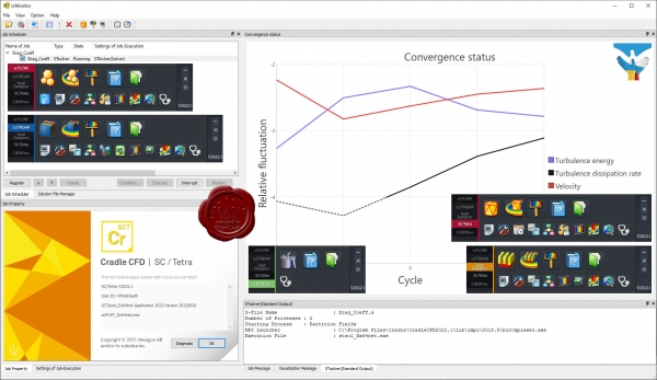
Cradle CFD is a series of practical, state-of-the-art CFD simulation and visualization software. Embracing remarkable processing speed, refined technology, and proven practicality verified by high user satisfaction, it has been in use for diverse applications, such as Automotive, Aerospace, Electronics, Building and Architecture, Civil Engineering, Fans, Machinery, and Marine developments, to solve thermal and fluid problems. Incorporating the reinforced Multiphysics co-simulation and chained simulation capability to achieve couplings with Structural, Acoustic, Electromagnetic, Mechanical, One-Dimensional, Optimization, Thermal Environment, 3D CAD and other relative analysis tools, as well as award-winning postprocessing feature to generate visually powerful simulation graphics, Cradle CFD enables any level users to process advanced simulations.
|
| |
 Читать статью дальше (комментариев - 5)
| |
|
 |
 Автор: Williams Автор: Williams
 Дата: 11 декабря 2022 Дата: 11 декабря 2022
 Просмотров: 2 096 Просмотров: 2 096 |
| |
Leica Hexagon MinePlan (ex. MineSight) 2022 Release 4
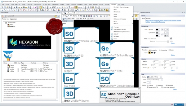
HxGN MinePlan provides geologists and engineers with powerful 3D modeling and data visualization. It supports seamless workflows, from exploration to production and it's backed by more than 50 years of innovation in partnership with thousands of global users.
Productive mines depend on being able to build detailed geological surfaces and solids. Statistical and geo-statistical analysis of project data is essential to producing an accurate block model with confidence.
Click here to interactively explore your own life-of-mine journey.
Geosciences
The Geosciences suite empowers resource geologists to store, manage and analyse drillhole data.
Open pit engineering
MinePlan open pit engineering suite offers software packages that help you improve efficiency and make informed decisions.
Underground engineering
CAD offers solutions for underground design challenges, including 3D visualisation and tools for pillar design, plus more.
HxGN MinePlan Survey
MinePlan Survey allows for management of survey data throughout the mining lifecycle using a comprehensive software solution. |
| |
 Читать статью дальше (комментариев - 14)
| |
|
 |
 Автор: Williams Автор: Williams
 Дата: 18 октября 2022 Дата: 18 октября 2022
 Просмотров: 1 417 Просмотров: 1 417 |
| |
Leica Hexagon HxMap v4.1.0
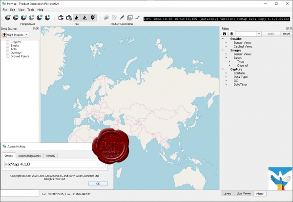
The increased need for up-to-date geospatial information in many of the traditional applications as well as in emerging areas such as navigation or location-based apps requires a new approach to data processing: rapid updates over large areas in the shortest possible time. To be a true No 1, the world’s most efficient airborne sensors still rely on an efficient and fast data processing workflow.
By introducing HxMap, the unified high-performance multi-sensor workflow platform, Leica Geosystems offers exactly what the industry has been waiting for: a fast, intuitive and efficient post-processing platform, that allows you to produce all known data products within one single interface.
The Leica HxMap common sensor post-processing platform offers the following modules to meet your needs:
HxMap Enabler: Enabler
HxMap Provider: Ingest, Raw QC, Workflow Manager, Point Cloud Generator, Projection Engine
HxMap Core Image: APM, Aerial Triangulation, Infocloud, Ortho Generator
HxMap Core LiDAR: AutoCalibration, Registration, Colour Encoding, Data Metrics, LiDAR QC
HxMap 3D Modeller: City Modeller, Texture Mapper, 3D Editor, Building Finder
Leica HxMap intuitively guides you along a common processing workflow. Starting from data download, raw QC, data ingest all the way to the final product generation. Depending on the input data, additional steps like aerial triangulation, radiometric adjustments and LiDAR point cloud registration are available.
Furthermore, the HxMap product generator allows a large number of products to be generated by the push of a button: referenced images, orthophotos, info clouds, point clouds as well as 3D city models.
These features build the right solution for large oblique projects, country-wide orthophoto or LiDAR mapping for small engineering projects alike.
To reach highest efficiency the data acquisition has been tightly integrated with the post processing workflow. Thus, HxMap can be enabled for individual sensor types. For flexible production, scalable and application-specific software modules are bundled with the matching hardware, namely Leica RealCity, Leica RealWorld and Leica RealTerrain.
RealCity supports you with your smart city and 3D city modelling applications, RealWorld is designed for Leica RCD30 and Leica DMCIII large area imaging projects in 2D and Leica RealTerrain is particularly effective for LiDAR mapping. To get the most out of your HxMap installation we highly recommend including both Core Image and Core LiDAR for all of our hybrid sensors. |
| |
 Читать статью дальше (комментариев - 11)
| |
|
 |
 Автор: Williams Автор: Williams
 Дата: 14 сентября 2022 Дата: 14 сентября 2022
 Просмотров: 1 618 Просмотров: 1 618 |
| |
Hexagon GeoMedia Suite 2022 v16.7.0.210
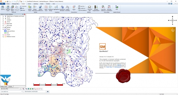
Maps present data visually, allowing you to visualize location and gain other information from your data. Making the information-gathering process easier—making a good map—requires powerful analytical tools and clear symbolization. Whether updating land and tax records, analyzing traffic flow and accidents, or determining the best locations for evacuation centers, GeoMedia combines tabular and geographic data to produce actionable information.
GeoMedia is a powerful, flexible GIS management platform that lets you aggregate data from a variety of sources and analyze them in unison to extract clear, actionable information. It provides simultaneous access to geospatial data in almost any form and displays it in a single unified map view for efficient processing, analysis, presentation, and sharing. GeoMedia’s functionality makes it ideal for extracting information from an array of dynamically changing data to support informed, smarter decision-making.
Utility organizations use GeoMedia to better plan, operate, and manage assets using geospatial intelligence and smart workflows.
GeoMedia tools and analytics help city leaders increase the quality of urban services, engage with the community, and decrease overall costs and resource consumption.
Public safety agencies use GeoMedia to analyze live queries for fast results, determine event hotspots for mitigation, and run historical queries for future insight.
GeoMedia assists transportation agencies with managing and analyzing their networks, generating reports, and determining appropriate actions to ensure safety on their roadways.
GeoMedia gives defense analysts immediate data integration and visualization to detect targets and points of interest in order to make fast, informed, mission critical decisions. |
| |
 Читать статью дальше (комментариев - 12)
| |
|
 |
| ПОИСК ПО САЙТУ |
 |
|
 |
| КАЛЕНДАРЬ | | |
 |
| « Май 2024 » |
|---|
| Пн | Вт | Ср | Чт | Пт | Сб | Вс |
|---|
| | 1 | 2 | 3 | 4 | 5 | | 6 | 7 | 8 | 9 | 10 | 11 | 12 | | 13 | 14 | 15 | 16 | 17 | 18 | 19 | | 20 | 21 | 22 | 23 | 24 | 25 | 26 | | 27 | 28 | 29 | 30 | 31 | |
|
 | |
| |
|