|
 |
 Автор: Williams Автор: Williams
 Дата: 3 февраля 2024 Дата: 3 февраля 2024
 Просмотров: 3 449 Просмотров: 3 449 |
| |
Agisoft Metashape Pro v2.1.0 build 17532
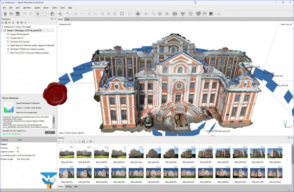
Agisoft Metashape Professional - это передовое программное обеспечение, максимально раскрывающее возможности фотограмметрии, а также включающее в себя технологии машинного обучения для анализа и пост-обработки, что позволяет получать максимально точные результаты.
Metashape позволяет обрабатывать изображения, получаемые с помощью RGB- или мультиспектральных камер, включая мультикамерные системы, преобразовывать снимки в плотные облака точек, текстурированные полигональные модели, геопривязанные ортофотопланы и цифровые модели рельефа/местности (ЦМР/ЦММ).
Дальнейшая постобработка позволяет удалять тени и искажения текстур с поверхности моделей, рассчитывать вегетационные индексы и составлять файлы предписаний для агротехнических мероприятий, автоматически классифицировать плотные облака точек и т.д.
Возможность экспорта во все внешние пакеты для постобработки делает Agisoft Metashape Professional универсальным фотограмметрическим инструментом.
Подробнее тут |
| |
 Читать статью дальше (комментариев - 23)
| |
|
|
Автор: Williams
Дата: 2 февраля 2024
Просмотров: 960 |
| |
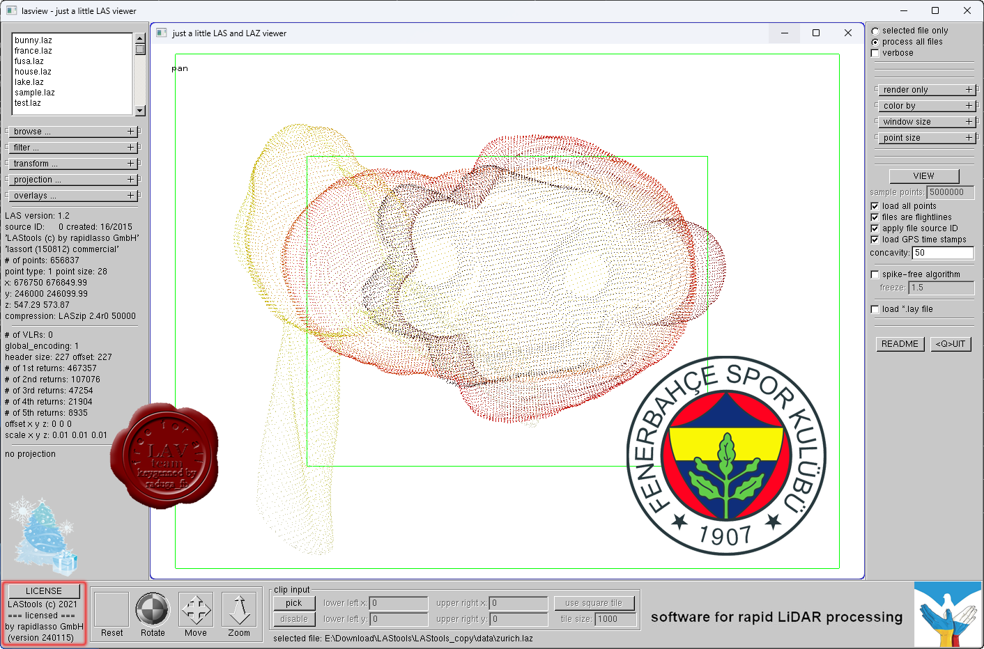
rapidlasso LAStools Suite 2024

Our LiDAR processing tools are widely known for their blazing speeds and high productivity. Our software combines robust algorithms with efficient I/O and clever memory management to achieve high throughput for data sets containing billions of points.
Our popular LAStools software suite has deep market penetration and is heavily used in the commercial sector, government agencies, research labs, and educational institutions alike — filtering, tiling, rasterizing, triangulating, converting, clipping, quality-checking, etc. TeraBytes of LiDAR every day.
Our open-source LiDAR compressor LASzip has become the de facto industry standard for compressed LiDAR. It has won the 2012 Geospatial World Forum Technology Innovation Award and was voted 2nd place for “most innovative product” at INTERGEO 2012. |
| |
Читать статью дальше (комментариев - 7)
| |
|
|
Автор: Williams
Дата: 1 февраля 2024
Просмотров: 504 |
| |
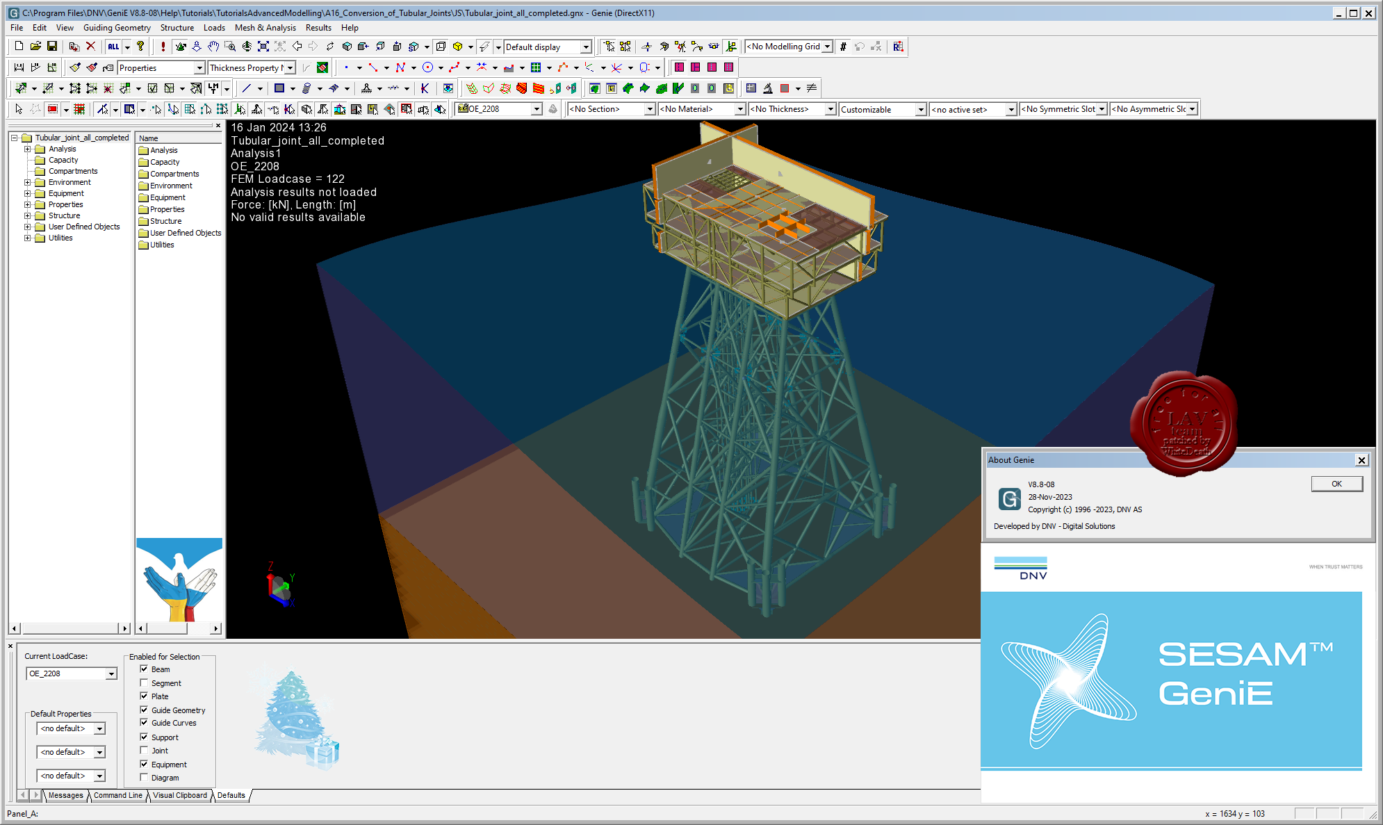
DNV GeniE v8.8-08

GeniE is conceptual modelling of offshore and maritime structures.
It's a powerful FEM modelling and analysis tool for innovation, flexibility and efficiency in offshore structural engineering.
GeniE is a tool for concept (high level geometry) modelling of beams, flat plates and stiffened shells. Load modelling includes equipment (with automatic load transfer), explicit loads, wind loads and generation of compartments in floating structures.
The concept model, or parts of it, can be meshed using a variety of beam, plate and shell finite element types. The mesh may be refined or modified using a comprehensive set of mesh editing features, whereupon the mesh quality may be verified.
Through running the modules Wajac and Sestra from the GeniE user interface, environmental loads (wave, current, buoyance and wind) may be calculated and a finite element stress analysis performed, including for jacket structures a pile-soil-structure interaction via the module Splice. |
| |
Читать статью дальше (комментариев - 4)
| |
|
|
Автор: Williams
Дата: 31 января 2024
Просмотров: 427 |
| |
Eliis PaleoScan 2023.1.1 r41699
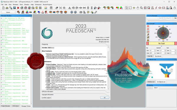 PaleoScan is a seismic interpretation software based on a semi-automated approach that produces chrono-stratigraphically consistent geological models. This unique technology, patented in 2009, allows our clients to accelerate their seismic interpretation cycle, scan the subsurface in real time to focus on high potential areas and identify hydrocarbon accumulation or CO2 storage areas... Another significant advantage of PaleoScan is its ability to produce a 3D geological model of the entire seismic cube, which allows the visualization and interpretation of the geological reservoirs as well as the overlying layers up to the seabed, in order to establish a reliable ranking of the storage reservoirs, taking into consideration the risks inherent to gas injection. PaleoScan is a seismic interpretation software based on a semi-automated approach that produces chrono-stratigraphically consistent geological models. This unique technology, patented in 2009, allows our clients to accelerate their seismic interpretation cycle, scan the subsurface in real time to focus on high potential areas and identify hydrocarbon accumulation or CO2 storage areas... Another significant advantage of PaleoScan is its ability to produce a 3D geological model of the entire seismic cube, which allows the visualization and interpretation of the geological reservoirs as well as the overlying layers up to the seabed, in order to establish a reliable ranking of the storage reservoirs, taking into consideration the risks inherent to gas injection.
At the confluence of powerful algorithms, computational power and data analysis, our revolutionary technology pushes your seismic interpretation to an unprecedented level. We can deliver a substantial qualitative and quantitative change to E&P businesses by creating new opportunities for energy supply enhancement, reducing risk and making timely and enlightened decisions.
Running on Windows, our platform offers a great panel of E&P workflows from basin-scale evaluation to prospect maturation. It includes our first-class automated horizon tracking step and the associated supervised Relative Geological Time model, and our fully automated fault extraction tool … just to quote a few!
Our intuitive interface coupled with an embedded cross-correlation tool dramatically increases your screening capacity, enables better predictions, and triggers early stage sweet spotting. In addition, powerful editing and visualizing tools help to refine the interpretation and perform real-time preview on the iterative Relative Geological Time model creation process. |
| |
Читать статью дальше (комментариев - 4)
| |
|
|
Автор: Williams
Дата: 30 января 2024
Просмотров: 870 |
| |
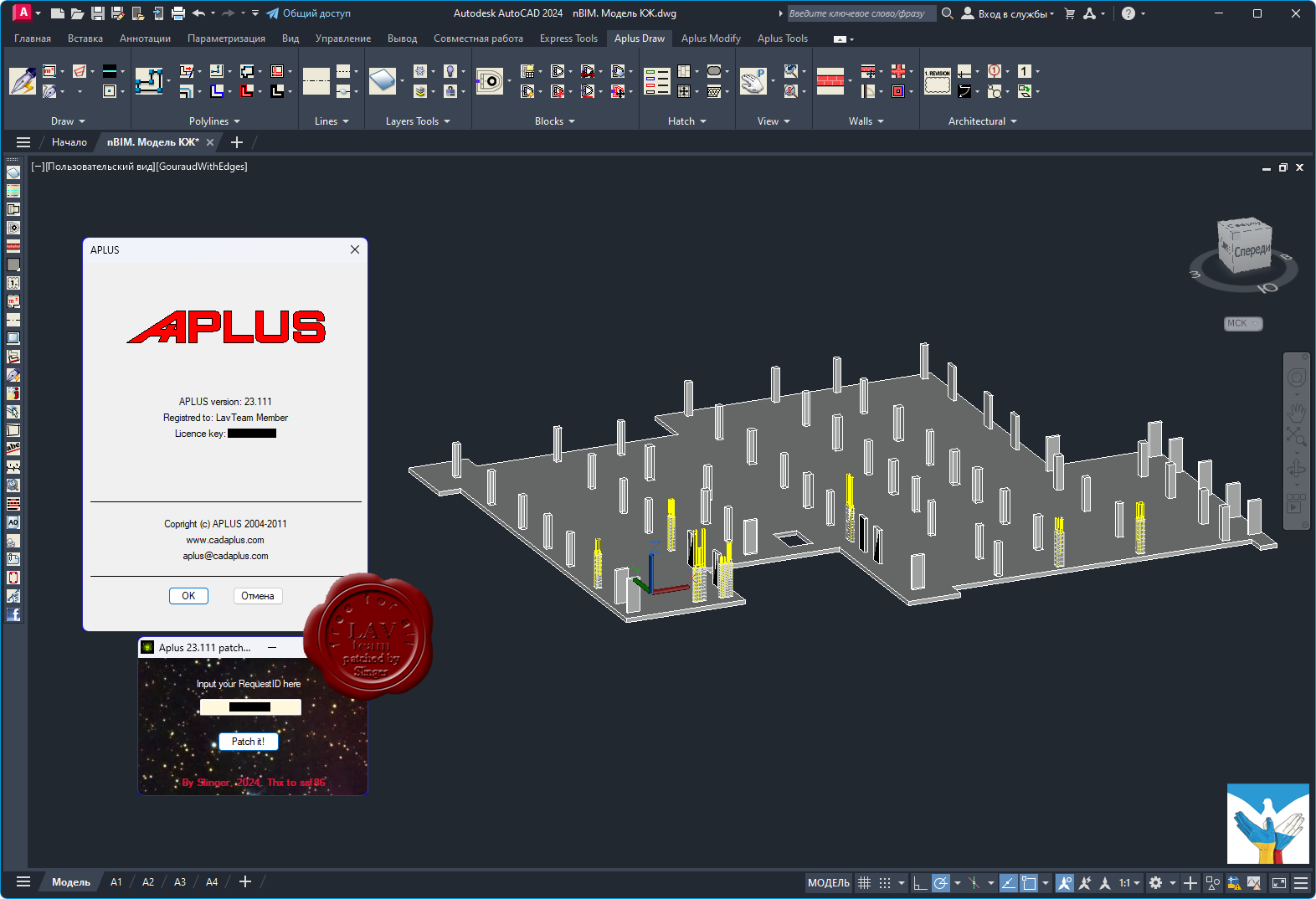
Cadaplus APLUS v23.111
 APLUS - это надстройка для Autodesk AutoCAD, повышающая функциональность путем добавления новых команд для ускорения разработки проекта. APLUS состоит из 2-х частей: команды для AutoCAD (APLUS) и набор блоков (BIINDEX). APLUS - это надстройка для Autodesk AutoCAD, повышающая функциональность путем добавления новых команд для ускорения разработки проекта. APLUS состоит из 2-х частей: команды для AutoCAD (APLUS) и набор блоков (BIINDEX).
О нововведения можно почитать тут
Обучающее видео тут и здесь |
| |
Читать статью дальше (комментариев - 10)
| |
|
|
Автор: Williams
Дата: 29 января 2024
Просмотров: 214 |
| |
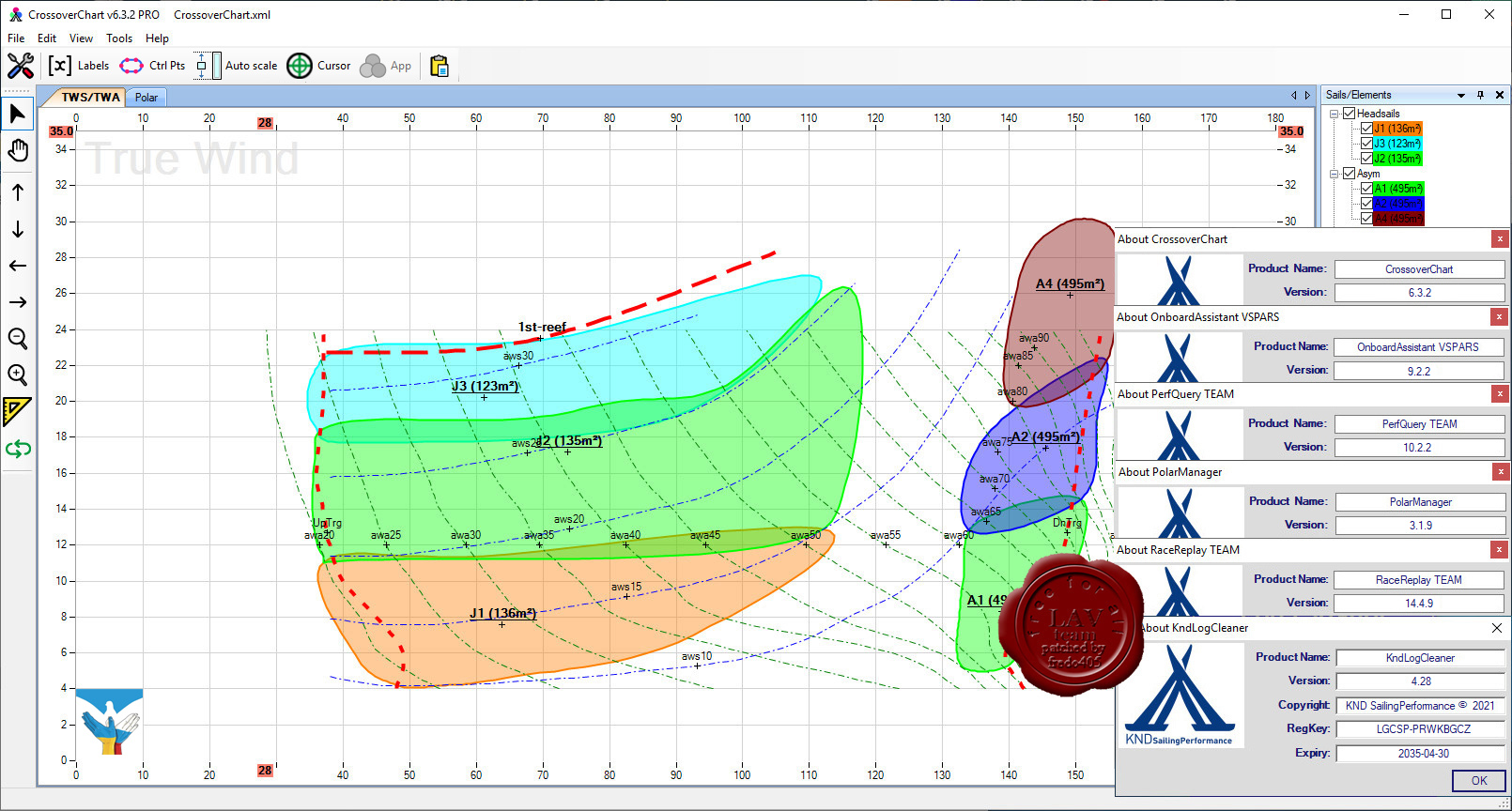
KND SailingPerformance software Suite, January, 2024
CrossoverChart v6.3.2, KndLogCleaner v4.28, OnboardAssistant v9.2.2, PerfQuery v10.2.2, PolarManager v3.1.9, RaceReplay v14.4.9
 CrossoverChart. Create and maintain sail crossover. Never have to think twice about which is the optimal sail for the current weather! Start building your crossover from scratch or import information from your sail designer. Update and refine the crossover using past or live sailing data for quick and accurate decisions. CrossoverChart. Create and maintain sail crossover. Never have to think twice about which is the optimal sail for the current weather! Start building your crossover from scratch or import information from your sail designer. Update and refine the crossover using past or live sailing data for quick and accurate decisions.
KNDLogCleaner. Clean-up your logs before use with our tools. Data logs come in all shapes and forms depending on how they were generated. If required this pre-processing tool lets you tidy your log up before it can be used with the rest of the tools.
OnboardAssistant. Manually log events while sailing. This program, specifically customized for ondeck touch screen devices, lets you document your day while you are sailing. It lets you create variables for information not collected by your electronics, such as which sails are up, who is at the helm, what mast you are using, your level of ballast, etc…
PerfQuery. Add the power of databases to your performance analysis. Make end of regattas/season reports, continuously update your polars, crossovers and targets based on multiple sailing sessions. Get the exact statistics of the life of your sails and gear, and much more.
PolarManager. View and manage your polars. This is the most intuitive program out there to view and edit your polars, giving you the ability to easily convert them from one format to another, overlay multiple polars, and even import sailing data for more accurate modification.
RaceReplay. Replay and analyze your sailing data. Upload your data log in order to replay your data. Use advanced algorithms for identifying calibration issues. View the data using a number of graphs and statistical modules. Create your performance reports. Update your polars, crossovers and targets based on your analysis. Synchronize audio, photo and videos to your track. |
| |
Читать статью дальше (комментариев - 2)
| |
|
|
Автор: Williams
Дата: 28 января 2024
Просмотров: 263 |
| |
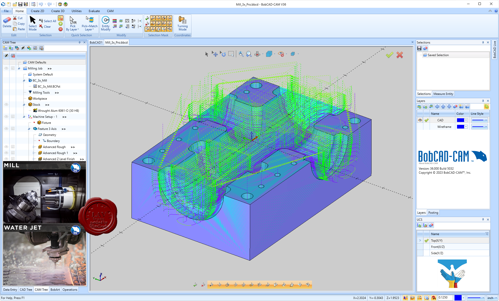
BobCAD-CAM Release V36 SP0 (standalone), V11 SP0 (for SolidWorks)
 BobCAD-CAM - Computer-Aided Design (CAD) и Computer-Aided Machining (CAM) программное обеспечение разработано для инженеров, имеет доступный и простой в использовании интерфейс и ЧПУ программирование, что значительно сократит время программирования и обработку, как простых так и сложных задач. BobCAD-CAM - Computer-Aided Design (CAD) и Computer-Aided Machining (CAM) программное обеспечение разработано для инженеров, имеет доступный и простой в использовании интерфейс и ЧПУ программирование, что значительно сократит время программирования и обработку, как простых так и сложных задач.
BobCAD-CAM ЧПУ для Laser, Plasma, & WaterJet
- BobCAD-CAM ЧПУ программное обеспечение для лазерной, плазменной и гидроабразивной машины предлагает мощные возможности 2-5 -координатного резки с полностью интегрированной системой CAD, которая позволяет переходить плавно от создания вашей модели до назначения передовых стратегии обработки маршрута для программирования вашего G-кода. CAD-CAM программное обеспечение предлагает различные варианты инструментов, чтобы дать вам полный контроль над резанием ваших деталей.
- CAD-CAM ЧПУ программное обеспечение для лазерной, плазменной и гидроабразивной машин обеспечивает необходимой для машины, от простой 2-координатной к комплексной многокоординатной резке. Она включает в себя полный спектр современных и полностью ассоциативных стратегий обработки с помощью простого интерфейса, чтобы сделать программирование более быстрым и простым, даже для новых или случайных пользователей. Технология Dynamic Machining Strategies минимизирует время программирования, позволяет назначить несколько стратегий обработки для одной функции в то время как расширенные функциональные возможности моделирования позволяют проверить и подтвердить вашу работу.
BobCAD-CAM CAD Design
- BobCAD-CAM Computer-Aided Design (CAD) - программное обеспечение, обеспечивает передовыми 2D и 3D дизайн технологиями с интуитивно понятным интерфейсом, что делает создание и редактирование простых и сложных деталей проще и эффективнее, чем когда-либо.
- Параметры настроек программного обеспечения дают вам возможность адаптировать свой дизайн интерфейса для повышения производительности вашего рабочего процесса, экономя время проектирования на каждом проекте. BobCAD-CAM обеспечивает одним из крупнейших выбором профессиональных инструментов рисования и моделирования между CAD продуктами, доступними в своей ценовой категории.
- Использование более 100 простых в использовании геометрических инструментов для быстрого и эффективного создания и редактирования сложных моделей деталей. Широкий спектр мощных каркасных, поверхностных и твердых моделей инструментов проектирования обеспечивают производительность, необходимую для создания всего, начиная от простых плоских моделей до сложных 3D-моделей со сложными деталями. BobCAD-CAM программное обеспечение легкое в использовании для новых или случайных пользователей, и в то же время достаточно мощное, чтобы удовлетворить потребности опытного дизайнера.
BobCAD-CAM Mill CAD-CAM
- BobCAD-CAM Mill программное обеспечение для обработки обеспечивает передовые возможности 2.5, 3, 4, и 5 -координатнои обработки с полностью интегрированной системой проектирования CAD, позволяет плавно перейти от разработки модели детали к созданию маршрута реза. Программное обеспечение CAD-CAM для фрезерования предлагает мощные возможности, чтобы позволить вам выполнить высокоскоростную обработку и многоосевые операции, в полной мере используют возможности вашего ЧПУ станка. BobCAD-CAD для фрезерования обеспечивается инструментами ЧПУ программирования, которые гарантируют скорость и эффективность в разработке моделей и фрезерования.
- BobCAD-CAM Mill программное обеспечение для фрезерования гарантирует функциональность, необходимую для завершения всего, начиная от простого 2,5 координатной резки к сложной 4 и 5 -координатной одновременного фрезерования.
- Она включает в себя полный спектр современных и полностью ассоциативных стратегий обработки с помощью простого интерфейса, чтобы сделать программирование быстрым и простым, даже для новых или случайных пользователей.
- Технология Dynamic Machining Strategies минимизирует время программирования, позволяет назначить несколько стратегий обработки для одной функции, в то время как расширенные функциональные возможности моделирования позволяют проверить и подтвердить вашу работу.
- BobCAD-CAM Mill 3 Axis программное обеспечение обеспечивает мощную систему проектирования и полностью ассоциативную платформу ЧПУ программирования для простой и сложной 2D и 3D обработки деталей.
- BobCAD-CAM Mill 4 Axis программное обеспечение предлагает высокопроизводительную функциональность и опции траекторий Mill 3 axis продукта, включая мощную CAD дизайн платформу, мастер интерфейса, Dynamic Machining Strategies технологию и многое другое.
- BobCAD-CAM Mill 5 Axis программное обеспечение предлагает высокопроизводительную функциональность и опции траекторий Mill 4 axis продукта, включая мощную CAD дизайн платформу, мастер интерфейса, Dynamic Machining Strategies технологию и многое другое. Она также включает в себя дополнительную 5-координатную чистку, SWARF обработку, многокоординатность.
- BobCAD-CAM Mill Express загружается с мощными функциями. Он предлагает полный CAD дизайн и твердотельные возможности моделирования для простых и сложных задач, включает в себя интуитивно понятный интерфейс, который упрощает настройку обработки маршрута.
BobCAD-CAM Mill Turn CAD-CAM
- Mill Turn является полным многозадачным CAD-CAM программным обеспечением, которое сочетает в себе все функциональные возможности ЧПУ программирования, фрезерного и токарного в единую модернизированную многоосевую обработку. BobCAD-CAM многозадачное ЧПУ программное обеспечение обеспечивает высоко производительные характеристики и простой в использовании интерфейс, разработанный для выполнения сложных требований программирования токарно-фрезерной обработки.
- Mill Turn ЧПУ CAD-CAM программное обеспечение предоставляет все, начиная от простого 2-кординатного токарного и 3, 4 -координатного фрезерования до полных 4 и 5 -координатних возможностей одновременного фрезерования. Она включает в себя полный спектр современных и полностью ассоциативных стратегий обработки с помощью простого интерфейса, чтобы сделать программирование более быстрым и простым. BobCAD-CAM дает вам контроль легкого программирования на безперпендикулярны многокоординатные инструменты движения, необходимые для машин со сложными особенностями и углами соединения, которые находятся во многих сложных деталях, таких как, различные медицинские компоненты, сложные клапаны, держатели для инструментов, инструменты бурения нефтяных скважин, и многие другие.
BobCAD-CAM Lathe CAD-CAM
- BobCAD-CAD программное обеспечение для 2-координатного токарного станка и токарных центров предлагает модернизированную CAD дизайн платформу и полностью ассоциативную модель программирования станков. Lathe CAD-CAM позволяет легко установить дополнительные 2 координаты для OD и ID черновой обработки, конечной обработки, нарезания резьбы, обработки канавок, расточки, сверление, и вырезания. Lathe CAD-CAM программное обеспечение является комплексным решением ЧПУ программирования для ваших токарных простых и сложных деталей.
- CAD-CAM Lathe для ЧПУ станка позволяет проектировать или импортировать детали и легко назначать эффективные стратегии обработки маршрута с помощью интуитивно понятного интерфейса. Технология Dynamic Machining Strategies минимизирует время программирования, позволяет назначить несколько стратегий обработки для одной функции в то время как расширенные функциональные возможности моделирования позволяют проверить и подтвердить вашу работу.
BobCAD-CAM Wire EDM CAD-CAM
- Wire EDM (электроэрозионная обработка) это - полное, каркасное, поверхностное и твердотельное моделированием CAD-CAM системы, обеспечивающей точность резки легким в использовании ЧПУ программным обеспечением. Позволяет создавать и импортировать часть модели, назначать стратегии электроэрозионной обработки и генерировать G-коды, специфические для вашей машины.
- Программное обеспечение Wire EDM предлагает интуитивную понятную систему для настройки точности резки ваших производственных деталей. Этот продукт дает результаты, которые соответствуют строгим требованиям резки, изготовлением пресс-форм и инструментов.
- Создание 2 и 4 -координатного маршруту ЧПУ программирования быстрое и легкое с помощью CAD-CAM для Wire EDM. Программное обеспечение позволяет настроить открытые и закрытые, внутри и снаружи формы программирования и дает вам возможность настроить независимых ввода и вывода, glue stops, и многое другое для полного программирования электроэрозионной обработки, работает с Mitsubishi, Japax, Brothers, Fanuc, Sodick и другой ЧПУ электроэрозионной обработкой.
BobCAD-CAM BobART
- BobART доступен в качестве дополнительного модуля к любому из фрезерных CAD-CAM программных продуктов. Это позволяет применять креативные произведения искусства для ЧПУ изготовления деталей. Это программное обеспечение позволяет сделать картинку или рисунок и конвертировать его в рельефную модель или векторную геометрию, которые могут быть обработаны с помощью ЧПУ фрезеровки, гидроабразивной, лазерной или сверлильной машины.
- Просто откройте файл изображения, и вы всего в нескольких шагах от гравировки с мощным CAM программированием. ЧПУ фрезерное программное обеспечение и инструмент CAD проектирования, предназначенные для обработки дерева, изготовление ювелирных изделий, механической обработки, гравировальных работ, изготовление пресс-форм, и многое другое.
- BobCAD-CAM BobART программное обеспечение легкое в использовании для новых или случайных пользователей, и в то же время достаточно мощное, чтобы удовлетворить потребности опытного дизайнера. Художественные особенности BobART включают: возможность поворота моделей, рельефность модели с импортируемых STL файлов, хранения компонентов или всего проекта, как STL, доступ к 64 различных уровней векторных цветов, использование пользовательских секций, для большего контроля над созданием ваших рельефных моделей и многое другое. От начальной 2 до 3 -координатной обработки, интегрированное и полностью ассоциативное CAM программное обеспечение предоставляет средства для создания некоторых наиболее сложных и удивительных художественных результатов.
|
| |
Читать статью дальше (комментариев - 1)
| |
|
|
Автор: Williams
Дата: 26 января 2024
Просмотров: 546 |
| |
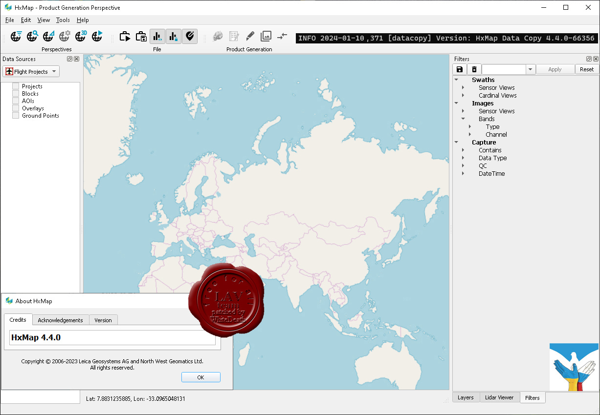
Leica Hexagon HxMap v4.4.0

The increased need for up-to-date geospatial information in many of the traditional applications as well as in emerging areas such as navigation or location-based apps requires a new approach to data processing: rapid updates over large areas in the shortest possible time. To be a true No 1, the world’s most efficient airborne sensors still rely on an efficient and fast data processing workflow.
By introducing HxMap, the unified high-performance multi-sensor workflow platform, Leica Geosystems offers exactly what the industry has been waiting for: a fast, intuitive and efficient post-processing platform, that allows you to produce all known data products within one single interface.
The Leica HxMap common sensor post-processing platform offers the following modules to meet your needs:
- HxMap Enabler: Enabler
- HxMap Provider: Ingest, Raw QC, Workflow Manager, Point Cloud Generator, Projection Engine
- HxMap Core Image: APM, Aerial Triangulation, Infocloud, Ortho Generator
- HxMap Core LiDAR: AutoCalibration, Registration, Colour Encoding, Data Metrics, LiDAR QC
- HxMap 3D Modeller: City Modeller, Texture Mapper, 3D Editor, Building Finder
Leica HxMap intuitively guides you along a common processing workflow. Starting from data download, raw QC, data ingest all the way to the final product generation. Depending on the input data, additional steps like aerial triangulation, radiometric adjustments and LiDAR point cloud registration are available.
Furthermore, the HxMap product generator allows a large number of products to be generated by the push of a button: referenced images, orthophotos, info clouds, point clouds as well as 3D city models.
These features build the right solution for large oblique projects, country-wide orthophoto or LiDAR mapping for small engineering projects alike.
To reach highest efficiency the data acquisition has been tightly integrated with the post processing workflow. Thus, HxMap can be enabled for individual sensor types. For flexible production, scalable and application-specific software modules are bundled with the matching hardware, namely Leica RealCity, Leica RealWorld and Leica RealTerrain.
RealCity supports you with your smart city and 3D city modelling applications, RealWorld is designed for Leica RCD30 and Leica DMCIII large area imaging projects in 2D and Leica RealTerrain is particularly effective for LiDAR mapping. To get the most out of your HxMap installation we highly recommend including both Core Image and Core LiDAR for all of our hybrid sensors.
Release notes |
| |
Читать статью дальше (комментариев - 3)
| |
|
|
Автор: Williams
Дата: 25 января 2024
Просмотров: 1 025 |
| |
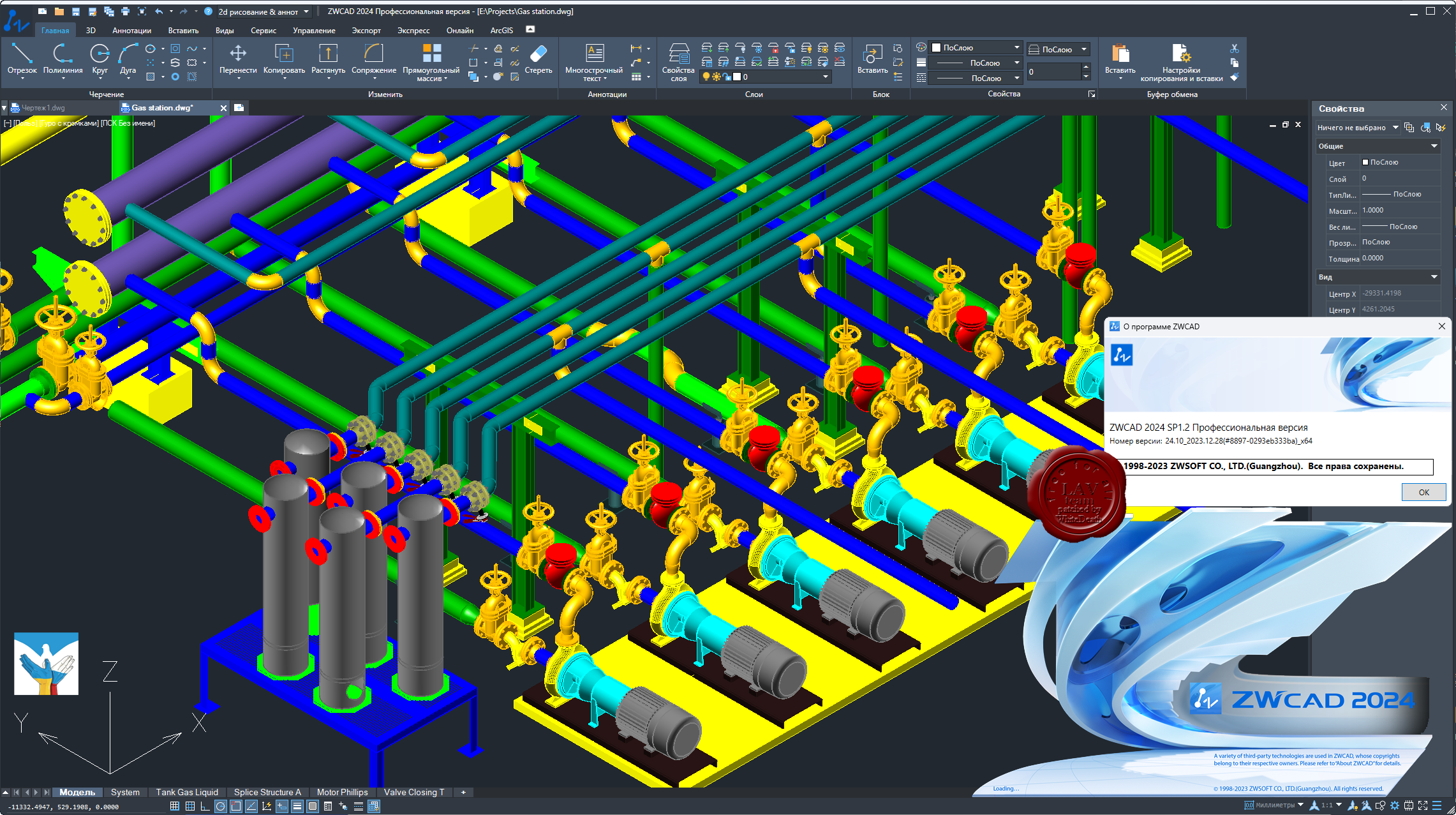
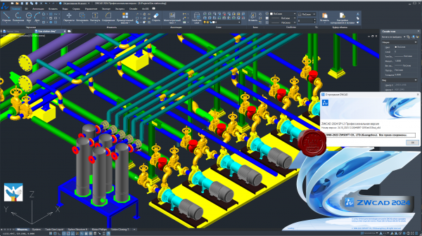
ZwSoft ZWCAD 2024 SP1.2 Pro ENG+RUS x32+x64
 ZWCAD Professional - мощная система для 2D/3D проектирования и создания чертежей с полной поддержкой формата DWG, привычным интерфейсом и уникальными функциями, дающими значительное удобство в работе: умным выбором объектов по заданным критериям, сравнением чертежей, жестами мышью, голосовыми метками, умной печатью и многими другими. Являясь результатом постоянного совершенствования в течение более 20 лет, ZWCAD 2023 представляет собой надежное и эффективное решение САПР, которое выводит процесс проектирования на высочайший уровень. ZWCAD Professional - мощная система для 2D/3D проектирования и создания чертежей с полной поддержкой формата DWG, привычным интерфейсом и уникальными функциями, дающими значительное удобство в работе: умным выбором объектов по заданным критериям, сравнением чертежей, жестами мышью, голосовыми метками, умной печатью и многими другими. Являясь результатом постоянного совершенствования в течение более 20 лет, ZWCAD 2023 представляет собой надежное и эффективное решение САПР, которое выводит процесс проектирования на высочайший уровень.
Осуществляя поддержку программных интерфейсов .Net, VBA и ZRX, ZWCAD Professional позволяет использовать существующие, а также разрабатывать собственные специализированные решения для автоматизации работы инженеров, конструкторов, архитекторов и других специалистов. |
| |
Читать статью дальше (комментариев - 4)
| |
|
|
| ПОИСК ПО САЙТУ |
|
|
|
|