|
 |
 Автор: Williams Автор: Williams
 Дата: 15 июля 2013 Дата: 15 июля 2013
 Просмотров: 8 382 Просмотров: 8 382 |
| |
Bentley MicroStation PowerDraft V8i SS3 08.11.09.459
 MicroStation PowerDraft is the premier application for the production of all types of project documentation for engineers, architects, geospatial professionals, constructors, and owners who need to document, detail, and map infrastructure projects. As a companion product to information modeling products from Bentley and others, MicroStation PowerDraft users can easily and reliably incorporate existing data and document projects of any scale in order to produce precise physical and digital deliverables. Its unmatched fidelity working with DWG and DGN data and extensive interoperability support for other data types like point clouds, geospatially referenced data, and raster imagery ensures that users can work seamlessly with an entire project team incorporating any information into their final hardcopy and digital deliverables. In addition to the traditional printed drawings and details, MicroStation PowerDraft enables the production of information-rich PDFs, innovative hypermodels, large plots, and plot sets. MicroStation PowerDraft is a cost-effective and extremely robust tool that meets the documentation needs of infrastructure teams across every discipline. MicroStation PowerDraft is relied upon for speed, power, precision, and confidence by design and construction firms and infrastructure owners in 87 countries throughout the world. Learn more about how MicroStation PowerDraft can save you time and money in the production of all types of infrastructure project deliverables. |
| |
 Читать статью дальше (комментариев - 8)
| |
|
|
Автор: Williams
Дата: 15 июля 2013
Просмотров: 1 225 |
| |
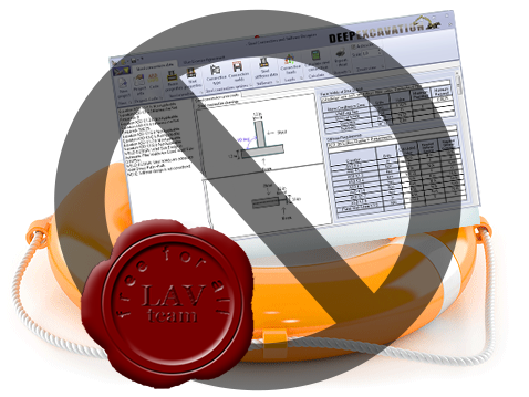
Вроде как вытались помочь разработчикам из Deep Excavation ... Ну, по крайней мере, выстроить как-то отношения с ними. А они:
Dear Sirs,
The website lavteam.org is shown to be hosted at your servers. The website owners of lavteam.org are conducting massive software piracy and have violated our trademarks and copyrights.
Under copyright law, lavteam.org is liable for up to $150000 per violated software program. Lavteam has violated atleast 5 of our software programs, and our maximum total damages by their actions are $750000.
We officially request that you confirm the identity of the persons holding the website, which is hosted by your servers. Please confirm if the following information matches your records. If you do not reveal this information we will officially consider to file a claim against your company with our Russian lawyers for the maximum of our damages.
Truly yours,
Dimitrios Konstantakos, P.E.
CEO Deep Excavation LLC
Ну, что на сие хочется сказать.
Во-первых, ну как можно покупать инженерный софт у компании, CEO которой с трудом считает до трех?!?
Во-вторых, компания абсолютно не гибка - все советы им по "борьбе с пиратством", как то, выпустить триал-демо-студенческую версию с разного рода ограничениями не принимаются к рассмотрению. Т.е. КУПИТЕ СРАЗУ продукт компании, CEO которой с трудом считает до трех :-)
В третьих, они просто жлобы. Слезная история про уволенного программиста - ложь от начала до конца. Опровержение их слов, равно как и список клиентов и партнеров там же. Последним (клиентам и партнерам Dee Exav) хочется тоже сказать - не покупайте софт у компании, CEO которой с трудом считает до трех, зато отлично считает деньги в чужом кармане!!!
Спасибо. |
| |
Читать статью дальше (комментариев - 18)
| |
|
|
Автор: Williams
Дата: 12 июля 2013
Просмотров: 3 395 |
| |
StructurePoint Concrete Software Solutions:
spBeam v3.50, spColumn v4.81, spFrame v1.50, spMats v7.51, spSlab v3.50, spWall v4.02
spBeam - for analysis, design, and investigation of reinforced concrete beams, joist and one-way slab systems.
spColumn - for design and investigation of rectangular, round, and irregular concrete columns including slenderness effects.
spFrame - multi-purpose structural modeling and finite element analysis package for two- and three-dimensional buildings and structures with robust, straightforward, quick yet simple interface.
spMats - for analysis, design and investigation of concrete foundations, mats, combined footings, pile caps, slabs on grade, underground and buried structures.
spSlab - for analysis, design, and investigation of elevated reinforced concrete beams, joist, one-way, two-way and slab band systems.
spWall - ror analysis design and investigation of reinforced concrete, precast, ICF, tilt-up, retaining and architectural walls.
More info. |
| |
Читать статью дальше (комментариев - 10)
| |
|
|
Автор: Williams
Дата: 11 июля 2013
Просмотров: 4 882 |
| |
RockWare RockWorks 16 v2013.7.12
RockWorks - приложение, используемое для обработки геологических данных и просмотра результатов. RockWorks включает в себя модули по точечному картографированию, построению изолиний, поверхностей (в т.ч. объемных), моделированию вертикальных разрезов скважин, построения стратиграфических шкал, графиков, диаграмм, статистическому и гидрохимическому анализу, преобразованию проекций, трехмерному представлению данных. |
| |
Читать статью дальше (комментариев - 31)
| |
|
|
Автор: Williams
Дата: 9 июля 2013
Просмотров: 1 366 |
| |
XYZworks FieldWorks v3.19
 The Fieldworks program is an easy to use and powerful program for Land Surveying and Construction Layout applications which features full screen data entry, and fast, accurate execution. It uses the latest and most advanced Pocket PC hardware to provide unparalleled features and computation speed, and the Windows CE operating system to make it easy to learn and use. Fieldworks has been available for PocketPC’s longer than any other surveying software, since May 2000. FieldWorks boasts such features as single keystroke measurement, easy to read display, simple transfer of data to and from your office PC, and plenty of storage capacity (600,000 points in a 64MB device, expandable.) The large display shows over 4 times as much information as most products, including full screen plotting. Fieldworks runs on a wide variety of different computers and downloads data from a wide variety of field equipment, both optical and GPS. Easy to integrate GPS with total stations in the same job. Easy to upgrade to a full CAD system using our optional PocketCAD addins to pick points from a drawing and plot-as-you-go based on point descriptions. There is a desktop version available so that you can use the same powerful software in the office and the field. |
| |
Читать статью дальше (комментариев - 3)
| |
|
|
| ПОИСК ПО САЙТУ |
|
|
|
| КАЛЕНДАРЬ | | |
|
| « Октябрь 2025 » |
|---|
| Пн | Вт | Ср | Чт | Пт | Сб | Вс |
|---|
| | 1 | 2 | 3 | 4 | 5 | | 6 | 7 | 8 | 9 | 10 | 11 | 12 | | 13 | 14 | 15 | 16 | 17 | 18 | 19 | | 20 | 21 | 22 | 23 | 24 | 25 | 26 | | 27 | 28 | 29 | 30 | 31 | |
|
| |
| |
|


