ГЛАВНАЯ             ФОРУМ             КОНТАКТЫ             RSS             20-YEARS ARCHIVE ПРОФИЛЬ
 
Логин:  
Пароль:  
 Чужой ПК
    Регистрация
    Вспомнить пароль

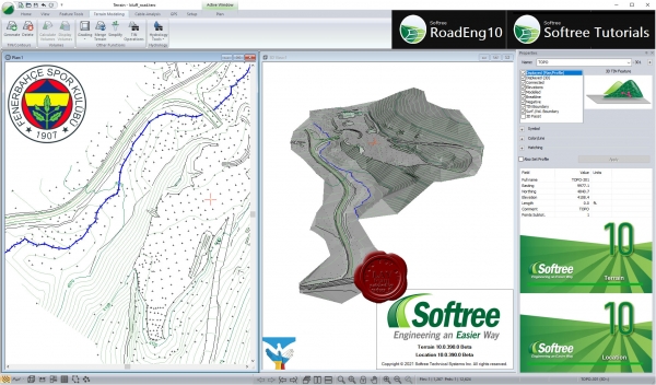
Softree TerrainTools9 v9.0.463 Software
 
Softree TerrainTools9 v9.0.463 + Tutorials

Softree TerrainTools9 v9.0.463

Ideal for 3D site design, handling survey data, stockpile volume calculations, mine surveying, quantity takeoffs, pad and pond design, geological mapping, surface contouring and visualization, and landfill site design. Includes functions for: surveying, coordinate geometry, image manipulation, digital terrain modeling, contouring, volume and earthwork calculations, design, grading, visualization and report generation.

LiDAR Import & Thinning Control
Create surface models from large LiDAR and UAV datasets. Have complete control over your point data thinning functionality. Thinning to polygons, corridors, coordinates regions, or exterior regions. 

Survey Data Management
Import and management of a variety of survey and file formats, including: total station, LiDAR, ASCII, DWG, DGN, USGS DEM, LandXMl and image formats (TIFF, BMP, JPG). Total station data can be included with automatic control of linear features, breaklines and symbology. Import georeferenced background imagery from our Live Maps tool.

Digital Terrain & Surface Modelling
A complete set of functions for creating a 3D surfaces and Digital Terrain Model (DTM), including break lines and boundary areas. Contours can be generated at user specified intervals with full control of color, line types and labels. Contours can be updated at any time.

Site Design and Grading
Site design made easy with intuitive grading functions, feature creation and design of polygonal shapes such as ponds, pads, pits etc.

Volume Calculations & Reporting
Calculate stockpile volumes using average end-area method. Easily calculate volumes between entire surfaces. Set a boundary feature and determine the polygon's surface properties (surface area, volume, average slope and aspect). Calculate volumes between surfaces or enclosed within a single surface.

Feature Tools
Format features with annotation, line-type, symbols and hatching control. Manipulate features by moving, sizing, rotating, breaking, joining. Easily manage feature properties: modelled, displayed, draped, breakline, connected, and boundary. 

3D Display
3D window shows a perspective display of features and TIN surfaces. Includes drive-through mode for use with linear features.

Output Sheet Creation
Create your own customized output sheet with plan, profile windows, title blocks, legends and more. Export your output sheet for use with Avenza PDF Maps. 

Watershed & Hydrology Tools
Easily determine catchment areas of the TIN model and create corresponding features. The automatic calculation of watershed areas is based on a regular grid. The user can choose the grid cell size. An additional drainage area feature allows users to determine the drainage area associated with a specific point, useful in culvert design projects (new Version 10 feature).

Cable Logging Planning
In the forest-industry version, includes complete functionality for cable planning analysis. Analyze payload, clearance, and line tensions. Evaluate different types of equipment and logging configurations. Plot various carriage positions for a given midspan deflection (third point method). 

CAD Engine Not Required
Terrain Tools does not require a CAD engine to run. It is a stand-alone program designed for engineering over drafting. It is compatible with AutoCAD and Bentley products and can be saved in standard output formats: LandXML, DXN, DGN, DWG and more.
    Читать статью дальше  (комментариев - 12)


Softree Optimal9 v9.0.463 Software
 
Softree Optimal9 v9.0.463 + Tutorials

Softree Optimal9 v9.0.463

Optimize Your Geometric Road Design. Estimate & Reduce Your Earthwork Costs. Design roads, highways, and corridors that cost less to build. Adding optimization software to your geometric design process allows you to deliver the lowest-cost design. It also allows you to design faster.


Softree Optimal is a patented alignment optimization program. It can optimize an alignment vertically and horizontally. Generate the lowest cost vertical alignment based on the ground surface, the preliminary horizontal alignment, and the design parameters and constraints entered by the user. Utilize new horizontal alignment optimization functionality to further refine and improve your design.

Optimize Your Corridor Design: Vertically and Horizontally
Consistently find the lowest-cost vertical alignment design that satisfies your design constraints & standards. Vertical optimization on its own typically brings down construction costs by 10-30% or more, depending on the project. Horizontally optimization works within a defined range of IP movement. Resulting improvements over 50% cost reduction are not uncommon.

Design Time Costing
Built-in costing models allow you to calculate your alignment's subgrade construction costs as you design. Quantitively compare multiple alignments and design variables based on construction cost. Know your cost & reduce it.

Optimized Material Movement Schedule
Our Opti-Haul graphic is a detailed plan for visually analyzing optimal material movement. Similar to a mass haul, but with more detail, it includes movement by material and by direction. Opti-Haul graphic (and data export) gives users a prescriptive plan to reduce their haulage costs and make construction jobs more efficient.

Stand-Alone Software or Embedded into RoadEng
Softree Optimal is sold as it's own stand-alone program or is embedded within the full framework of RoadEng. In both options, you can benefit from the patented alignment optimization methods. A Direct interface for exporting cross-sections (assemblies) is available for Civil 3D.

Check Feasibility
Define your design standards and constraints ensure your alignment automatically meets your criteria. Check the feasibility of proposed designs and constraints. View your constraints through the visual feedback of the profile window (including display of the vertical band)

Automatically Balance Mass Haul with Smart Pits
Softree Optimal will look to internally balance your corridor. If not possible, Softree Optimal with leverage Smart Pits. Define available pit locations capacities, distance from the alignment, and preparation cost and Optimal will select the most appropriate ones.
    Читать статью дальше  (комментариев - 9)


Softree RoadEng10 v10.0.390 Software
 
Softree RoadEng10 v10.0.390 + Tutorials

Softree RoadEng10 v10.0.390

RoadEng is an interactive civil engineering design software for road, rail, and pipeline projects. Faster, lighter, easier and specialized for the design of rural infrastructure, RoadEng significantly speeds up the corridor design process. Built from the ground up to work with surfaces, cross-sections, and alignments, RoadEng handles larger data sets in ways other civil design software cannot. No additional CAD software required. You don’t need to struggle with complicated and expensive CAD software. No need to learn and re-learn complicated software for complex highway interchanges and other things you don’t do.


RoadEng Features & Functions.

Geometric Road & Corridor Design
Geometric corridor design in a simple and intuitive user interface. Visualize your road design in 3D, plan, profile and section views simultaneously. Make a change to the project, dynamically watch all of the windows update.

Site Design
A variety of simple, but powerful features are available for site design and grading. Create virtually anything in 3D: bridge sites, terracing, pipes, surfaces, channels, ditches, pads or sub-surface zones.

Terrain Modelling & Survey Data Management
Create digital terrain models (TIN) from almost any topo data, including large point sets (like UAV or LiDAR data) with over 10,000,000 points. Create contours, labels, and customize your display with slope vectors, and color shading for slope, aspect, and elevation.

Cross-Section & Template Control
Your cross-section template is an essential building block for your corridor design. RoadEng’s flexible template editor allows you to assemble typical sections using a library of customizable components. Account for ditches, pavement, sub-base materials, varying lane widths, cut slopes, variable height fill slopes, curbs, sidewalks etc. Visualize the template in typical sections (or at a specific station) prior to implementing in your design.

Earthwork Volumes & Costs As You Design
Get your earthwork and material volumes, as well as the sub-grade construction costs. With earthwork costing data as you design, you can adjust your design based on cost. Compare costs for design alternatives. Know preliminary construction costs before you build.

Watershed & Hydrology Tools
Easily determine catchment areas of the TIN model and create corresponding features. The automatic calculation of watershed areas is based on a regular grid. The user can choose the grid cell size. An additional drainage area feature allows users to determine the drainage area associated with a specific point, useful in culvert design projects.

Culvert Design
RoadEng includes two primary methods for the design of culverts, cross drains and fish passages. Add simple culverts using the culvert editor panel in RoadEng's Location Module. Culverts can also be designed in more detail using multiple alignment functionality.

Easily Include Web-Imagery 
Live Maps tool provides direct online access to free imagery and low-resolution DEM data. Automatically georeferenced and brought into the background of it into your project.

GPS-Enabled Field Solutions
Designed to work on all Windows 10-enabled tablets and compatible with most internal/external GPS devices. GPS integration in all modules allows you to view where you are in Plan, Profile, or Section view at any time. Create GPS tracks on your primary survey data. Create georeferenced PDFs for use with Avenza Maps.

Output & Sharing
Easily share and showcase your design with Multi-Plot Report Builder. Print out plan, profile, and cross-section data as one document. Simplify your presentation of deliverables with single document control. Output sheets interactively update with your design. Easily output and share with other programs. RoadEng and Softree Optimal both work alone, or it can integrate into other CAD or GIS-based engineering systems. Easy export to machine control through LandXML.

Road Reclamation & Decommissioning
Planning road reclamation and decommissioning is easily completed using RoadEng. RoadEng’s simple user interface allows the user to customize their road geometry to meet project requirements and communicate expectations to builders. Planners have the ability to use variable cut and fill slopes that automatically adjust to target separate features (such as edge of existing road prism). Other useful features include design time costing, and being able to easily track material handling and movement along the entire alignment.
    Читать статью дальше  (комментариев - 17)


ПОИСК ПО САЙТУ

Что ищем:
Расширенный поиск

КАЛЕНДАРЬ
 
«    Январь 2025    »
ПнВтСрЧтПтСбВс
 12345
6789101112
13141516171819
20212223242526
2728293031 
 

ОБЛАКО ТЭГОВ


НАВИГАЦИЯ
 
 
НАШ ОПРОС


DONATE LAVteam
 
bitcoin

Donate.
 

ДРУЗЬЯ
 
BASARUNET.ORG SOFT
 

СКИН


LAVteam: 1999-2025