|
 |
 Автор: Williams Автор: Williams
 Дата: 22 апреля 2024 Дата: 22 апреля 2024
 Просмотров: 737 Просмотров: 737 |
| |
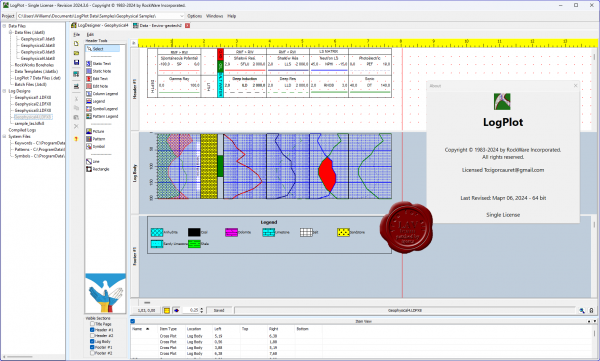
RockWare LogPlot 2024.3.6

LogPlot is an easy-to-use log plotting program with a flexible log layout and intuitive data editor. LogPlot software has been used by geoscientists since 1983 to display their geotechnical, environmental, geophysical, mud/gas, and mining data as a graphic boring log.
Plot single-page logs for shallow borings or multi-page/continuous logs for deep wells. Share logs with clients via PDF or post HTML log pages on your website. Export single pages or continuous logs to JPG, BMP, TIFF, and PNG images. |
| |
 Читать статью дальше (комментариев - 7)
| |
|
 |
 Автор: Williams Автор: Williams
 Дата: 13 августа 2022 Дата: 13 августа 2022
 Просмотров: 2 187 Просмотров: 2 187 |
| |
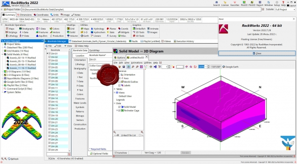
RockWare RockWorks 2022.7.28 x64

RockWorks is the standard in the environmental, geotechnical, petroleum, and mining industries for surface and subsurface data visualization, with popular tools such as maps, logs, cross sections, fence diagrams, solid models and volume calculations. RockWorks offers numerous options for analyzing your surface and subsurface data, and accepts many different data types, such as stratigraphy, lithology, downhole geochemistry / geophysics / geotechnical measurements, color intervals, fractures, and aquifer data.
Display RockWorks graphic output in its built-in 2D and 3D viewing/editing windows, or export to CAD, Google Earth, and other GIS programs. Use the ReportWorks module to create page layouts for reports and posters.
RockWorks is offered with three feature levels so you can buy just the program tools you need:
Basic: All Utilities programs, plus Borehole Manager maps, logs, log sections. 5 items per playlist, 3 faults.
Standard: All Basic level tools, plus Borehole Manager modeling: lithology, stratigraphy, geophysical/geochemical/geotechnical, aquifers, colors, fractures. 5 items per playlist, 3 faults.
Advanced: All Standard level tools, plus SQL-server database support, program automation (scripting), Borehole Manager petroleum production diagrams. Unlimited items per playlist, unlimited faults. |
| |
 Читать статью дальше (комментариев - 12)
| |
|
 |
 Автор: Williams Автор: Williams
 Дата: 17 февраля 2022 Дата: 17 февраля 2022
 Просмотров: 1 857 Просмотров: 1 857 |
| |
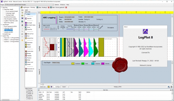
RockWare LogPlot 8 2022.1.31 x32+x64

LogPlot is an easy-to-use log plotting program with a flexible log layout and intuitive data editor. LogPlot software has been used by geoscientists since 1983 to display their geotechnical, environmental, geophysical, mud/gas, and mining data as a graphic boring log.
Plot single-page logs for shallow borings or multi-page/continuous logs for deep wells. Share logs with clients via PDF or post HTML log pages on your website. Export single pages or continuous logs to JPG, BMP, TIFF, and PNG images. |
| |
 Читать статью дальше (комментариев - 12)
| |
|
 |
 Автор: Williams Автор: Williams
 Дата: 15 февраля 2022 Дата: 15 февраля 2022
 Просмотров: 1 902 Просмотров: 1 902 |
| |
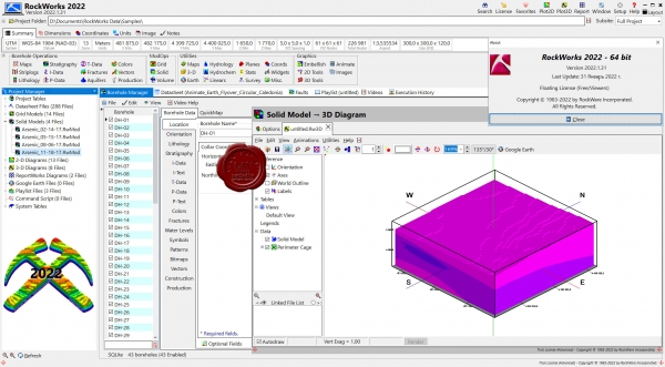
RockWare RockWorks 2022.1.31 x64 repack

RockWorks is the standard in the environmental, geotechnical, petroleum, and mining industries for surface and subsurface data visualization, with popular tools such as maps, logs, cross sections, fence diagrams, solid models and volume calculations. RockWorks offers numerous options for analyzing your surface and subsurface data, and accepts many different data types, such as stratigraphy, lithology, downhole geochemistry / geophysics / geotechnical measurements, color intervals, fractures, and aquifer data.
Display RockWorks graphic output in its built-in 2D and 3D viewing/editing windows, or export to CAD, Google Earth, and other GIS programs. Use the ReportWorks module to create page layouts for reports and posters.
RockWorks is offered with three feature levels so you can buy just the program tools you need:
- Basic: All Utilities programs, plus Borehole Manager maps, logs, log sections. 5 items per playlist, 3 faults.
- Standard: All Basic level tools, plus Borehole Manager modeling: lithology, stratigraphy, geophysical/geochemical/geotechnical, aquifers, colors, fractures. 5 items per playlist, 3 faults.
- Advanced: All Standard level tools, plus SQL-server database support, program automation (scripting), Borehole Manager petroleum production diagrams. Unlimited items per playlist, unlimited faults.
|
| |
 Читать статью дальше (комментариев - 17)
| |
|
 |
 Автор: Williams Автор: Williams
 Дата: 12 февраля 2022 Дата: 12 февраля 2022
 Просмотров: 1 163 Просмотров: 1 163 |
| |
RockWare RockWorks 2022.1.31 x64

RockWorks is the standard in the environmental, geotechnical, petroleum, and mining industries for surface and subsurface data visualization, with popular tools such as maps, logs, cross sections, fence diagrams, solid models and volume calculations. RockWorks offers numerous options for analyzing your surface and subsurface data, and accepts many different data types, such as stratigraphy, lithology, downhole geochemistry / geophysics / geotechnical measurements, color intervals, fractures, and aquifer data.
Display RockWorks graphic output in its built-in 2D and 3D viewing/editing windows, or export to CAD, Google Earth, and other GIS programs. Use the ReportWorks module to create page layouts for reports and posters.
RockWorks is offered with three feature levels so you can buy just the program tools you need:
- Basic: All Utilities programs, plus Borehole Manager maps, logs, log sections. 5 items per playlist, 3 faults.
- Standard: All Basic level tools, plus Borehole Manager modeling: lithology, stratigraphy, geophysical/geochemical/geotechnical, aquifers, colors, fractures. 5 items per playlist, 3 faults.
- Advanced: All Standard level tools, plus SQL-server database support, program automation (scripting), Borehole Manager petroleum production diagrams. Unlimited items per playlist, unlimited faults.
|
| |
 Читать статью дальше (комментариев - 7)
| |
|
 |
 Автор: Williams Автор: Williams
 Дата: 20 декабря 2017 Дата: 20 декабря 2017
 Просмотров: 1 157 Просмотров: 1 157 |
| |
RockWare AqQA v1.5.0

ПО от компании RockWare включает в себя модули по точечному картографированию, построению изолиний, поверхностей (в т.ч. объемных), моделированию вертикальных разрезов скважин, построения стратиграфических шкал, графиков, диаграмм, статистическому и гидрохимическому анализу, преобразованию проекций, трехмерному представлению данных. RockWare AqQA - как раз программа для работ по гидрохимическому анализу.
AqQA is software for water analyses: unit conversion, ion balance, sample mixing, basic fluid properties calculations, water chemistry diagrams (Piper, Stiff), and more. Imagine you could keep the results of your chemical analyses in a spreadsheet developed especially for the purpose. A spreadsheet that knows how to convert units, check your analyses for internal consistency, graph your data in the ways you want it graphed, and so on. |
| |
 Читать статью дальше (комментариев - 11)
| |
|
 |
 Автор: Williams Автор: Williams
 Дата: 25 января 2014 Дата: 25 января 2014
 Просмотров: 2 129 Просмотров: 2 129 |
| |
RockWare QuickSurf v6.0.121202 x86+x64
for Autodesk AutoCAD 2013-2014
QuickSurf is a fast, powerful general purpose surface modeling system running inside of AutoCAD 2000 - 2014. Thousands of people use QuickSurf daily for generation and annotation of contour maps, profiles, sections and volumetric computation. QuickSurf converts surface mapping data such as point or break line data into contours, grids, triangulated irregular networks, and triangulated grids. A suite of sophisticated tools allows you to manipulate modeled surfaces into high quality finished maps and perform a variety of engineering computations. QuickSurf meets the needs of a broad range of professional disciplines such as civil, environmental, petroleum and mining engineering, geologic mapping and exploration, surveying, photogrammetry and topographic mapping, landscape architecture, oceanography and surface visualization. |
| |
 Читать статью дальше (комментариев - 12)
| |
|
 |
 Автор: Williams Автор: Williams
 Дата: 11 июля 2013 Дата: 11 июля 2013
 Просмотров: 4 876 Просмотров: 4 876 |
| |
RockWare RockWorks 16 v2013.7.12
RockWorks - приложение, используемое для обработки геологических данных и просмотра результатов. RockWorks включает в себя модули по точечному картографированию, построению изолиний, поверхностей (в т.ч. объемных), моделированию вертикальных разрезов скважин, построения стратиграфических шкал, графиков, диаграмм, статистическому и гидрохимическому анализу, преобразованию проекций, трехмерному представлению данных. |
| |
 Читать статью дальше (комментариев - 31)
| |
|
 |
 Автор: Williams Автор: Williams
 Дата: 14 декабря 2012 Дата: 14 декабря 2012
 Просмотров: 2 184 Просмотров: 2 184 |
| |
RockWare QuickSurf v6.0.121202 x86+x64
for Autodesk AutoCAD 2013
QuickSurf is a fast, powerful general purpose surface modeling system running inside of AutoCAD 2000 - 2013. Thousands of people use QuickSurf daily for generation and annotation of contour maps, profiles, sections and volumetric computation. QuickSurf converts surface mapping data such as point or break line data into contours, grids, triangulated irregular networks, and triangulated grids. A suite of sophisticated tools allows you to manipulate modeled surfaces into high quality finished maps and perform a variety of engineering computations. QuickSurf meets the needs of a broad range of professional disciplines such as civil, environmental, petroleum and mining engineering, geologic mapping and exploration, surveying, photogrammetry and topographic mapping, landscape architecture, oceanography and surface visualization. |
| |
 Читать статью дальше (комментариев - 9)
| |
|
 |
| ПОИСК ПО САЙТУ |
 |
|
 |
| КАЛЕНДАРЬ | | |
 |
| « Июль 2025 » |
|---|
| Пн | Вт | Ср | Чт | Пт | Сб | Вс |
|---|
| | 1 | 2 | 3 | 4 | 5 | 6 | | 7 | 8 | 9 | 10 | 11 | 12 | 13 | | 14 | 15 | 16 | 17 | 18 | 19 | 20 | | 21 | 22 | 23 | 24 | 25 | 26 | 27 | | 28 | 29 | 30 | 31 | |
|
 | |
| |
|