|
 |
 Автор: Williams Автор: Williams
 Дата: 17 декабря 2023 Дата: 17 декабря 2023
 Просмотров: 1 020 Просмотров: 1 020 |
| |
Aspen Technology Subsurface Science & Engineering Suite 2023 v14.2
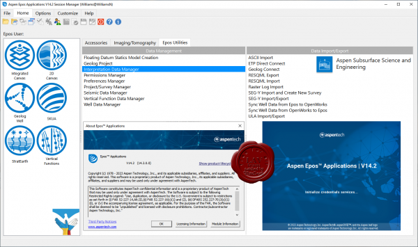
Emerson PARADIGM is now Aspen Technology Subsurface Science & Engineering Suite.
Subsurface Science & Engineering is end-to-end geoscience and modeling solutions for optimization across subsurface engineering and operations. Empower decision makers to reduce uncertainty, improve confidence, minimize risk and support responsible asset management.
We are pleased to announce the availability of the aspenONE Subsurface Science and Engineering (SSE) Suite V14.1 release. This release is an update of the AspenTech SSE product suite (previously Emerson E&P Software), and integrates all AspenTech SSE products into a single offering.
The following products are included in this release: Aspen Epos, Aspen Echos, Aspen GeoDepth, Aspen EarthStudy 360, Aspen SeisEarth (includes QSI and Explorer), Aspen Geolog, Aspen METTE, Aspen OpsLink, Aspen ResView, Aspen RMS, Aspen SKUA (includes StratEarth), Aspen Sysdrill, Aspen Tempest. |
| |
 Читать статью дальше (комментариев - 6)
| |
|
 |
 Автор: Williams Автор: Williams
 Дата: 23 июня 2023 Дата: 23 июня 2023
 Просмотров: 1 656 Просмотров: 1 656 |
| |
Aspen Technology Subsurface Science & Engineering Suite 2023 V14.1 build 26.05.2023
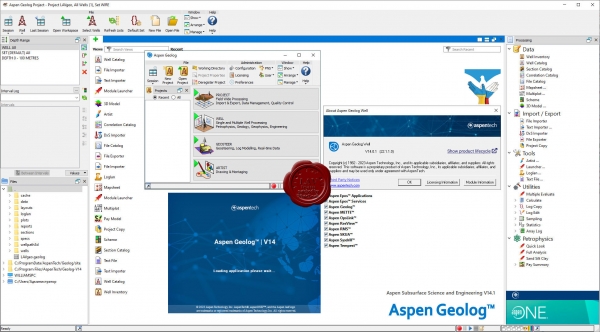
Emerson PARADIGM is now Aspen Technology Subsurface Science & Engineering Suite.
Subsurface Science & Engineering is end-to-end geoscience and modeling solutions for optimization across subsurface engineering and operations. Empower decision makers to reduce uncertainty, improve confidence, minimize risk and support responsible asset management.
We are pleased to announce the availability of the aspenONE Subsurface Science and Engineering (SSE) Suite V14.1 release. This release is an update of the AspenTech SSE product suite (previously Emerson E&P Software), and integrates all AspenTech SSE products into a single offering.
The following products are included in this release: Aspen Epos, Aspen Echos, Aspen GeoDepth, Aspen EarthStudy 360, Aspen SeisEarth (includes QSI and Explorer), Aspen Geolog, Aspen METTE, Aspen OpsLink, Aspen ResView, Aspen RMS, Aspen SKUA (includes StratEarth), Aspen Sysdrill, Aspen Tempest. |
| |
 Читать статью дальше (комментариев - 20)
| |
|
 |
 Автор: Williams Автор: Williams
 Дата: 4 апреля 2023 Дата: 4 апреля 2023
 Просмотров: 2 253 Просмотров: 2 253 |
| |
Aspen Technology Subsurface Science And Engineering Suite 2023 V14.01 build 28.02.2023
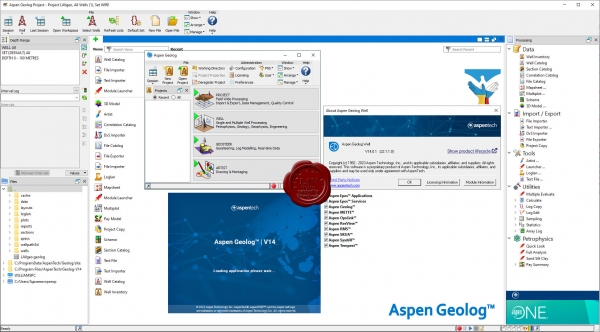
Emerson PARADIGM is now Aspen Technology Subsurface Science & Engineering Suite.
Subsurface Science & Engineering is end-to-end geoscience and modeling solutions for optimization across subsurface engineering and operations. Empower decision makers to reduce uncertainty, improve confidence, minimize risk and support responsible asset management.
We are pleased to announce the availability of the aspenONE Subsurface Science and Engineering (SSE) Suite V14.0.1 release. This release is an update of the AspenTech SSE product suite (previously Emerson E&P Software), and integrates all AspenTech SSE products into a single offering.
The following products are included in this release: Aspen Epos, Aspen Echos, Aspen GeoDepth, Aspen EarthStudy 360, Aspen SeisEarth (includes QSI and Explorer), Aspen Geolog, Aspen METTE, Aspen OpsLink, Aspen ResView, Aspen RMS, Aspen SKUA (includes StratEarth), Aspen Sysdrill, Aspen Tempest. |
| |
 Читать статью дальше (комментариев - 25)
| |
|
 |
 Автор: Williams Автор: Williams
 Дата: 17 сентября 2022 Дата: 17 сентября 2022
 Просмотров: 1 088 Просмотров: 1 088 |
| |
Emerson Paradigm SKUA-GOCAD 22 build 2022.06.20
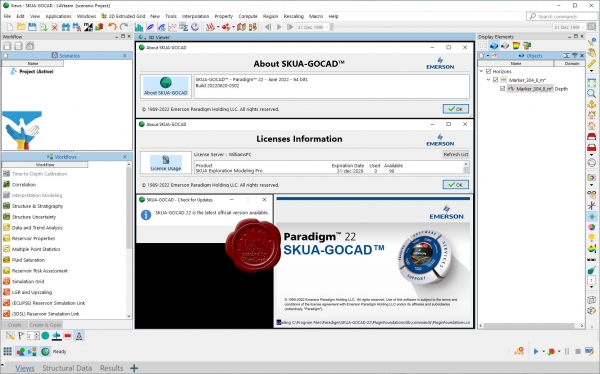
Система Paradigm GOCAD вот уже в течение более чем 20 лет является ведущей в отрасли в части предоставления наиболее передовых средств сейсмического и геологического моделирования, а также моделирования коллекторов. В 2013 г. система GOCAD была объединена с системой Paradigm SKUA с целью создания прикладной программы для моделирования, отличающейся наиболее передовыми технологиями из числа имеющихся на рынке. Единый комплект продуктов SKUA-GOCAD теперь поставляется как в автономной конфигурации, так и в составе системы Paradigm Epos. Проекты, выполненные в любой из систем GOCAD или SKUA, могут загружаться в прикладную программу SKUA-GOCAD, и может проводиться обмен рабочими процессами между системами SKUA и GOCAD.
SKUA-GOCAD входит в качестве неотъемлемой составляющей в следующие технологии компании Paradigm:
- Обработка сейсмических данных и построение изображений (в т.ч. скорости распространения сейсмических волн);
- Интерпретация и моделирование (сейсмическая интерпретация; геологическая интерпретация; проверка интерпретации; моделирование геологической среды);
- Определение характеристик коллектора (в т.ч. моделирование коллектора);
- Разработка коллектора (моделирование динамики коллекторов; гидродинамическое моделирование);
- Проектирование скважин, технологии бурения и геонавигация.
|
| |
 Читать статью дальше (комментариев - 12)
| |
|
 |
 Автор: Williams Автор: Williams
 Дата: 16 сентября 2022 Дата: 16 сентября 2022
 Просмотров: 1 393 Просмотров: 1 393 |
| |
Emerson Paradigm 22 build 2022.06.20
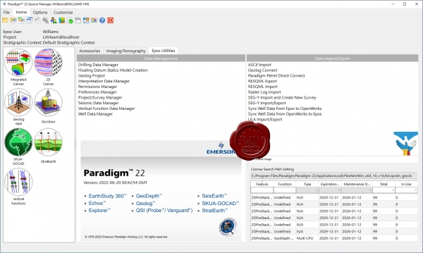
Oil and gas E&P companies, challenged by the need to handle the massive amounts of data that are now available to them, are in need of advanced technologies to help them optimize their work. Emerson Paradigm, the leading technological innovator in the industry, has included in the Paradigm 18 release solutions aimed at providing more accurate results in less time, and with less effort on the part of the user. Through automation, integration, collaboration, and product optimization, Paradigm 18 enhances your work experience and provides the solutions you need in today’s rapidly-changing world.
- Artificial intelligence capabilities enable quick and reliable identification of geologic facies from seismic and wellbore data.
- Unification of the user interface and data management enables faster results with less effort.
- Support for applications running on the Cloud makes it easier than ever for remote teams to work together.
- High resolution processing, imaging, interpretation and modeling result in more accurate earth models.
More info |
| |
 Читать статью дальше (комментариев - 16)
| |
|
 |
 Автор: Williams Автор: Williams
 Дата: 5 марта 2019 Дата: 5 марта 2019
 Просмотров: 3 619 Просмотров: 3 619 |
| |
Emerson Paradigm 18 build 2018.06.28

Oil and gas E&P companies, challenged by the need to handle the massive amounts of data that are now available to them, are in need of advanced technologies to help them optimize their work. Emerson Paradigm, the leading technological innovator in the industry, has included in the Paradigm 18 release solutions aimed at providing more accurate results in less time, and with less effort on the part of the user. Through automation, integration, collaboration, and product optimization, Paradigm 18 enhances your work experience and provides the solutions you need in today’s rapidly-changing world.
- Artificial intelligence capabilities enable quick and reliable identification of geologic facies from seismic and wellbore data.
- Unification of the user interface and data management enables faster results with less effort.
- Support for applications running on the Cloud makes it easier than ever for remote teams to work together.
- High resolution processing, imaging, interpretation and modeling result in more accurate earth models.
More info |
| |
 Читать статью дальше (комментариев - 25)
| |
|
 |
 Автор: Williams Автор: Williams
 Дата: 14 ноября 2017 Дата: 14 ноября 2017
 Просмотров: 4 613 Просмотров: 4 613 |
| |
Paradigm 17 Full Suite

High-definition seismic acquisition and well log data are now common among oil and gas companies. But having spent significant amounts on acquiring the data, organizations still lack the tools to extract the deeper levels of information available. The challenge extends from data processing and imaging to tying to logs, performing interpretations, honoring complex geology in the model, and outputting it all into simulation. With this in mind, and based on a long history of innovation, Paradigm has undertaken to create the first high-definition software platform to ensure that investments in data acquisition result in added value to drilling, completion and production. In Paradigm 17, the latest version of our solution suite, we leverage a high-definition platform, cloud computing, and the integration of Machine Learning, along with advanced technology and seamless integration, to improve asset team effectiveness in achieving superior decision-making results.
Paradigm 17 enables users to:
- Work within a truly integrated ecosystem, for everything from well log analysis to seismic imaging, interpretation, and modeling.
- Gain a deeper understanding of assets through the use of all available data in integrated workflows, including the consolidation of interpretation windows in a single application in SeisEarth.
- Recover, process and visualize all available data from seismic for better imaging and property distribution.
- Use the multi-2D line framework for processing and imaging to maximize productivity and minimize manual intervention.
- Better identify sweet spots through advanced well log analysis.
- Perform detailed interpretation of high angle and horizontal wells with the help of advanced 3D petrophysics, and use extended engineering capabilities to plan, complete, and produce with greater confidence.
- Benefit from Machine Learning technology to extrapolate property probabilities away from the well bore.
More info. |
| |
 Читать статью дальше (комментариев - 28)
| |
|
 |
 Автор: Williams Автор: Williams
 Дата: 11 июня 2012 Дата: 11 июня 2012
 Просмотров: 2 862 Просмотров: 2 862 |
| |
Paradigm Geolog 7 v2011.1 x64
 Paradigm Geolog объединяет в себе новые средства анализа промыслово-геофизических данных, превосходное графическое представление и гибкую модульную структуру, а также удобную пользовательскую среду для создания отраслевых стандартов петрофизического анализа, управления скважинными данными и геологической интерпретации.
Paradigm Geolog реализует все автоматизированные процедуры, начиная с загрузки и редактирования каротажных данных, и вплоть до интерпретации ГИС, представления и документирования результатов в общей среде, что исключает необходимость использования отдельных приложений для решения каждой задачи.
Модульная структура Paradigm Geolog обеспечивает возможность работы в универсальной среде, которая может настраиваться под неопытных пользователей, не жертвуя при этом глубиной и широтой охвата, которые необходимы для опытных пользователей.
Анализ петрофизической неопределенности. Новый модуль - функциональный блок объединения, позволяет легко генерировать различные сценарии, используя различные значения параметров, и облегчает будущий анализ, проводимый методом Монте-Карло. Новые виды отображения данных облегчают сравнения различных сценариев.
Модуль Correlator. Усовершенствования включают реализацию разбиения ствола с учетом точек поворота. Теперь планшеты могут включать немонотонно упорядоченные данные, а также могут отображаться цвета разделительных линий и атрибуты заполнения. При моделировании усовершенствованная функция интерактивного выделения объектов для упрощения интерпретации обеспечивает начальное выделение объектов.
Модуль Geosteer используется для построения разреза вдоль траекторий горизонтальных стволов, импортированных в Paradigm Geolog из внешних приложений. |
| |
 Читать статью дальше (комментариев - 13)
| |
|
 |
| ПОИСК ПО САЙТУ |
 |
|
 |
| КАЛЕНДАРЬ | | |
 |
| « Сентябрь 2025 » |
|---|
| Пн | Вт | Ср | Чт | Пт | Сб | Вс |
|---|
| 1 | 2 | 3 | 4 | 5 | 6 | 7 | | 8 | 9 | 10 | 11 | 12 | 13 | 14 | | 15 | 16 | 17 | 18 | 19 | 20 | 21 | | 22 | 23 | 24 | 25 | 26 | 27 | 28 | | 29 | 30 | |
|
 | |
| |
|