|
 |
 Автор: Williams Автор: Williams
 Дата: 10 апреля 2023 Дата: 10 апреля 2023
 Просмотров: 12 593 Просмотров: 12 593 |
| |
CSoft СПДС GraphiCS 2023 v23.0.3744
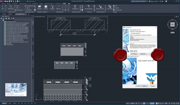
СПДС GraphiCS — приложение для быстрого и эффективного проектирования по ГОСТ.
Интеллектуальные объекты СПДС автоматизируют безошибочное выполнение требований ГОСТ 21.101−2020 по оформлению проектно-технической документации, одновременно позволяя подготовить чертежи в едином стандарте предприятия.
Мощный функционал параметрических объектов значительно ускоряет проектирование, а автоматические отчеты исключают сметные ошибки в проекте.
Приложение является уникальным инструментом для подготовки проектной документации всех разделов проектирования и одновременно инструментом стандартизации работы проектировщиков. Программа повысит производительность труда любой проектной организации.
|
| |
 Читать статью дальше (комментариев - 67)
| |
|
|
Автор: Williams
Дата: 9 апреля 2023
Просмотров: 742 |
| |
CSI CSiPlant v8.0.0 build 1220

CSiPlant is an integrated engineering software product for analysis and design of piping systems and frame structures, including piping code compliance checks with stress-intensification and flexibility factors that are automatically calculated and applied.
|
| |
Читать статью дальше (комментариев - 12)
| |
|
|
Автор: Williams
Дата: 8 апреля 2023
Просмотров: 542 |
| |
Insight Numerics in:Flux v3.0

in:Flux is CFD software that analyses ventilation and gas dispersion within complex geometries. It is aimed at all engineers, including those who have never previously performed a CFD themselves. The speed and simplicity of in:Flux is unrivaled. Organizations can now carry out CFD modeling at a fraction of the time and cost associated with other CFD products.
- The only CFD software specifically designed for dispersion and ventilation analyses, eliminating the need of expertise to ‘tweak’ general purpose codes.
- Interface directly with many CAD formats (DGN, DWG, DXF, IGES, STEP, OBJ, STL), no approximations are made to the CAD geometry.
- All meshing, boundary conditions, and numerical setup is automated.
- Post-processing visuals can be added after calculations have finished rather than hope planes defined prior to the simulation contain relevant information.
- Once the process is understood, multiple simulations can be set up very quickly as simulations are automatically scheduled without the need of scripting.
|
| |
Читать статью дальше (комментариев - 7)
| |
|
|
Автор: Williams
Дата: 7 апреля 2023
Просмотров: 497 |
| |
Insight Numerics Detect3D v2.54

Detect3D is the most accurate and trusted 3D fire and gas mapping tool for the design and assessment of detector layouts. Using the integrated design environment, line-of-sight flame detectors, and point and open-path gas detectors can be interactively positioned and oriented within any geometry. The user can highlight zero-visibility zones and interactively adjust the position or orientation of the detectors and receive real-time feedback. Detect3D is the ONLY fire and gas mapping tool on the market that can be installed on Windows workstations.
Features:
- Import CAD in Microstation (.dgn), Autodesk AutoCAD (.dxf), STEP, IGES, OBJ and Stereolithography (.stl) formats.
- Define multiple fire zones and assign hazard categories for each one.
- Export the isovolumes to CAD so they can be loaded back in to your CAD software.
- Output auto-generated reports showing coverage statistics for each fire zone in pdf and MS Excel formats.
Fire:
- All obstructions are accounted for automatically - no need to represent the geometry using simplified primitive shapes such as spheres and cylinders. What is in your CAD file is what will obstruct the detector.
- The obstruction of the detector's field-of-view (FOV) is accurately calculated in full 3D by casting thousands of rays.
- Import flame detectors from our manufacturer's database or create a custom flame detector field-of-view.
Gas:
- Interactively re-position or re-orient detectors and receive immediate feedback for the improved layout.
- Add detectors one at a time or add them in a one or two dimensional array to expidite your design process.
- Quickly highlight zero-visibility areas within each fire zone using 3D isovolumes and 2D contour plots.
Acoustic:
- Using technologies akin to that used for concert hall design, Insight Numerics is in development of algorithms to quickly assest the acoustic soundscape of process areas to enable engineers to optimally position acoustic gas leak detectors.
|
| |
Читать статью дальше (комментариев - 6)
| |
|
|
Автор: Williams
Дата: 6 апреля 2023
Просмотров: 1 525 |
| |
Autodesk FormIt Pro 2023.1

Autodesk FormIt предназначен для непрерывного информационного моделирования зданий (BIM), поддерживаемого в Revit (путем синхронизации проектов в облаке) С помощью Autodesk FormIt можно создавать четкие презентации для клиентов, которые будут дорабатываться в ходе подготовки и технико-экономических обоснований. FormIt позволяет использовать компоновку расположения, анализ и интуитивные 3D-эскизы, а затем передавать модель в Revit для составления спецификаций и выполнения количественного анализа.
Release notes |
| |
Читать статью дальше (комментариев - 10)
| |
|
|
Автор: Williams
Дата: 5 апреля 2023
Просмотров: 223 |
| |
Lixoft monolix Suite 2023 R1

Lixoft develops modeling and simulation software for advanced model-based drug development. Its products offer powerful and easy solutions for population analysis in pre-clinical, clinical trials and in treatment individualization.
The Monolix Suite comprises three main applications.
- PKanalix. Graphical and interactive software for non-compartmental and compartmental analysis.
- Monolix. Easy, fast and powerful tool for parameter estimation in non-linear mixed effect models, model diagnosis and assessment, and advanced graphical representation.
- Simulx. A powerful and flexible simulator for clinical trial pharmacometrics.
|
| |
Читать статью дальше (комментариев - 3)
| |
|
|
Автор: Williams
Дата: 4 апреля 2023
Просмотров: 2 237 |
| |
Aspen Technology Subsurface Science And Engineering Suite 2023 V14.01 build 28.02.2023

Emerson PARADIGM is now Aspen Technology Subsurface Science & Engineering Suite.
Subsurface Science & Engineering is end-to-end geoscience and modeling solutions for optimization across subsurface engineering and operations. Empower decision makers to reduce uncertainty, improve confidence, minimize risk and support responsible asset management.
We are pleased to announce the availability of the aspenONE Subsurface Science and Engineering (SSE) Suite V14.0.1 release. This release is an update of the AspenTech SSE product suite (previously Emerson E&P Software), and integrates all AspenTech SSE products into a single offering.
The following products are included in this release: Aspen Epos, Aspen Echos, Aspen GeoDepth, Aspen EarthStudy 360, Aspen SeisEarth (includes QSI and Explorer), Aspen Geolog, Aspen METTE, Aspen OpsLink, Aspen ResView, Aspen RMS, Aspen SKUA (includes StratEarth), Aspen Sysdrill, Aspen Tempest. |
| |
Читать статью дальше (комментариев - 25)
| |
|
|
Автор: Williams
Дата: 3 апреля 2023
Просмотров: 2 736 |
| |
Hydrology Studio Suite 2023
Culvert Studio v2.0.0.27, Channel Studio v2.0.0.22, Hydrology Studio v3.0.0.27, Stormwater Studio v3.0.0.31, Studio Express v1.0.0.13

The Hydrology Studio Suite is a collection of five superb drainage design programs that will streamline and standardize your stormwater design processes while adding a consistent, professional look throughout your firm.
Culvert Studio. Was designed to be a culvert modeler that is as easy to use as it is beautiful to look at. Everything is right in front of you, leaving you to be more productive, and not searching for dialog boxes. Use it once and you’ll be hooked. It’ll be the culvert design software you’ll prefer to use – and love – on every project.
Channel Studio. Is easy-to-use software for modeling open channel systems. Compute water surface profiles for any open channel including bridge structures, culvert crossings and inline weirs. Perfect for site development projects.
Hydrology Studio. From complex watershed modeling to pre- and post-development drainage studies with detention ponds, Hydrology Studio makes stormwater design a breeze. This is exceptional hydrology software – simple to use – free to download.
Stormwater Studio. Finally, stand-alone storm sewer design software with an intuitive user interface. Featuring automated design & analysis capabilities; energy-based water surface profile calculations; user definable design constraints and very simple work flows.
Studio Express. The simple hydraulic calculator tool to do pipe, open channel, orifice, weir, inlet, hydrology and groundwater mounding calculations, on the fly. |
| |
Читать статью дальше (комментариев - 27)
| |
|
|
Автор: Williams
Дата: 2 апреля 2023
Просмотров: 5 182 |
| |
Trimble Tekla Structural Designer Suite 2023 SP0
Designer v23.0.0.245, Tedds v25.0.0001, Engineering Library v25.0.0001

Tekla Structural Designer - мощный инструмент для анализа и проектирования зданий, созданного для инженеров-проектировщиков, работающих в сфере проектирования коммерческих строительных объектов. Tekla Structural Designer дополняет основную программу Tekla Structures и позволяет полноценно использовать все преимущества 3D-моделирования, благодаря единому рабочему процессу, включающему и анализ и проектирование. Tekla Structural Designer - это интеллектуальная загрузка данных, широкий набор аналитических функций, полная автоматизация проектирования, высокое качество документации и готовая полноценная система BIM-моделирования. Все это помогает инженерам повысить эффективность и сократить расходы/издержки при создании проектов.
Tekla Structural Designer предлагает мощные инструменты для работы с железобетонными и металлическими конструкциями, позволяя инженерам быстро сравнивать различные варианты схем проектирования, эффективно управлять изменениями, а также создавать удобную среду для совместной работы. Полностью автоматизированное проектирование и анализ, улучшенные инструменты и повышенная производительность позволяют инженерам предлагать больше альтернативных вариантов проектов, независимо от размера и сложности объекта, тем самым обеспечивая высокое качество обслуживания заказчика.
Эффективное использование BIM-технологий - именно это было в умах разработчиков при создании Tekla Structural Designer. Используя Tekla Structural Designer, инженеры могут неоднократно синхронизировать модели с Tekla Structures и другими программами без ущерба для ключевых проектных данных. Постоянный аудит инструментов в Tekla Structural Designer позволяет инженерам видеть, что было добавлено, изменено или удалено в процессе интеграции, тем самым уменьшая риск ошибок и повышая эффективность сотрудничества с другими членами команды проекта, в том числе техниками, переработчиками и архитекторами. Tekla Structural Designer создает внутреннюю связь и эффективную коммуникацию между всеми специалистами, работающими над проектом.
|
| |
Читать статью дальше (комментариев - 37)
| |
|
|
Автор: Williams
Дата: 1 апреля 2023
Просмотров: 2 494 |
| |
Leica Hexagon MinePlan (ex. MineSight) 2023 Release 1

HxGN MinePlan provides geologists and engineers with powerful 3D modeling and data visualization. It supports seamless workflows, from exploration to production and it's backed by more than 50 years of innovation in partnership with thousands of global users.
Productive mines depend on being able to build detailed geological surfaces and solids. Statistical and geo-statistical analysis of project data is essential to producing an accurate block model with confidence.
Click here to interactively explore your own life-of-mine journey.
Geosciences
The Geosciences suite empowers resource geologists to store, manage and analyse drillhole data.
Open pit engineering
MinePlan open pit engineering suite offers software packages that help you improve efficiency and make informed decisions.
Underground engineering
CAD offers solutions for underground design challenges, including 3D visualisation and tools for pillar design, plus more.
HxGN MinePlan Survey
MinePlan Survey allows for management of survey data throughout the mining lifecycle using a comprehensive software solution. |
| |
Читать статью дальше (комментариев - 12)
| |
|
|
| ПОИСК ПО САЙТУ |
|
|
|
| КАЛЕНДАРЬ | | |
|
| « Июль 2025 » |
|---|
| Пн | Вт | Ср | Чт | Пт | Сб | Вс |
|---|
| | 1 | 2 | 3 | 4 | 5 | 6 | | 7 | 8 | 9 | 10 | 11 | 12 | 13 | | 14 | 15 | 16 | 17 | 18 | 19 | 20 | | 21 | 22 | 23 | 24 | 25 | 26 | 27 | | 28 | 29 | 30 | 31 | |
|
| |
| |
|


