|
 |
 Автор: Williams Автор: Williams
 Дата: 3 октября 2023 Дата: 3 октября 2023
 Просмотров: 532 Просмотров: 532 |
| |
CADopia Pro 2023 v22.3.1.4100
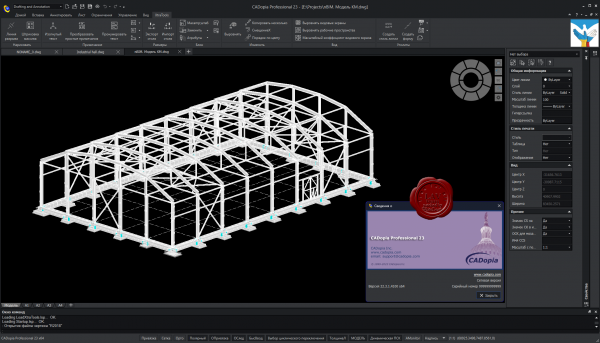
CADopia - доступный аналог AutoCAD, совместимый с форматом файлов DWG. Построен на основе кода IntelliCAD.
CADopia is a powerful Computer-Aided-Design software for engineers, architects, designers and drafters — virtually anyone who creates, edits, or views professional drawings. CADopia is available in 12 languages – Chinese, Czech, English, French, German, Italian, Japanese, Korean, Polish, Portuguese, Russian, and Spanish.
CADopia Professional Services can help you maximize the returns on your investment in CAD technology. CADopia provides upfront consulting services, custom application development, staff training,technical support, and project outsourcing solutions. |
| |
 Читать статью дальше (комментариев - 2)
| |
|
 |
 Автор: Williams Автор: Williams
 Дата: 2 октября 2023 Дата: 2 октября 2023
 Просмотров: 384 Просмотров: 384 |
| |
Avenir LoopCAD 2023 MJ8 Edition v23.0.0180
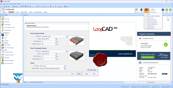
LoopCAD is the premiere software for the fast creation of professional quality circuit layout drawings for radiant heating systems. The all-new LoopCAD 2014 offers advanced design features including integrated heating and cooling load calculations, detailed hydronic calculations, snowmelt design, 3D CAD views, and compatibility with OEM design methods and materials. And now the MJ8 Edition provides ACCA-Approved Manual J (8th Edition) calculations for residential heating and cooling loads. LoopCAD is the easiest, most powerful radiant heating design tool available.
LoopCAD is available in three different editions to better match your needs. The available OEM Add-ons work seamlessly with all editions of LoopCAD. For a list of functionality and new features in each edition.
Standard Edition:
- Floorplan drawing and importing (PDF, AutoCAD, JPG)
- Automated circuit (loop) generation.
- Freehand circuit (loop) drawing.
- Hydronic calculations based on manual input of heat loads (no automated heat loss calculations)
- 3D drawing views.
- OEM Add‐ons for detailed materials lists/quotations.
Professional Edition - all features in Standard Edition, plus:
- Automated heat loss calculations as you draw.
- ASHRAE and CSA residential heat loss calculations.
MJ8 Edition - all features in Professional Edition, plus:
- ACCA‐Approved Manual J (8th Edition) residential heating and cooling load calculations.
Tutorials |
| |
 Читать статью дальше (комментариев - 3)
| |
|
 |
 Автор: Williams Автор: Williams
 Дата: 1 октября 2023 Дата: 1 октября 2023
 Просмотров: 381 Просмотров: 381 |
| |
Avenir HeatCAD 2023 MJ8 Edition v23.0.0080
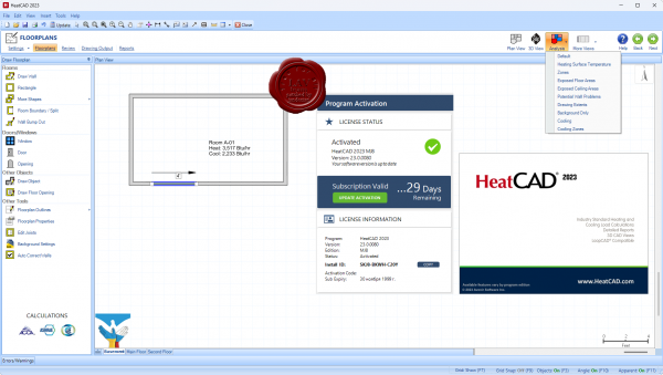
HeatCAD is a drawing-based software for fast and accurate calculation of residential heating and cooling loads. The Standard Edition supports ASHRAE and CSA residential heat loss calculations. The MJ8 Edition provides ACCA-Approved Manual J (8th Edition) calculations for residential heating and cooling loads. HeatCAD delivers advanced design features including integrated load calculations, automatic detection of unheated surfaces, and 3D CAD views.
More info
Tutorials |
| |
 Читать статью дальше (комментариев - 4)
| |
|
 |
 Автор: Williams Автор: Williams
 Дата: 30 сентября 2023 Дата: 30 сентября 2023
 Просмотров: 389 Просмотров: 389 |
| |
Flownex Simulation Environment 2023 v8.15.0.5222
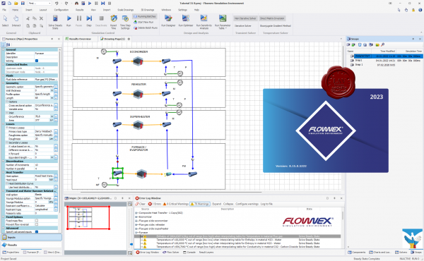
Flownex Simulation Environment delivers technology that enables you to study how systems will behave in the real world, where fluid is the driving factor. Flownex system simulation relays the overall effect of changing specific properties on components, allowing clients to examine extensively all possible variations of a system in the design and optimization of systems.
Flownex Simulation Environment provides turbomachinery engineers with an easy to use, off-the-shelf tool for modelling combustion chambers, secondary air systems, blade cooling flows, lubrication systems with oil-air mixtures, as well as overall cycle integration and operation.
Blade Cooling
By coupling 1D flow Flownex models with 3D heat transfer models in ANSYS Mechanical or CFX, a detailed turbine blade cooling simulation can be conducted. Flownex contains industry-standard pressure drop and heat transfer correlations for typical turbine blade features such as turbulator strips and pedestals. This allows designers to rapidly see the effects of their design changes on the maximum blade temperatures and cooling airflow rate.
COMBUSTION CHAMBER
Preliminary combustor design requires that an extensive number of geometrical and operational conditions be evaluated and compared. Especially during this phase, Flownex is an essential tool for combustor design engineers as it accurately captures important parameters such as the mass flow rate distribution through air admission holes, associated pressure losses as well as liner wall temperatures. Networks can be easily configured and solved within a few seconds. This result in substantial development cost savings because of the reduction in the number of detailed 3D simulations and rig tests required. A further advantage is the ability to use the Flownex results as boundary conditions for subsequent localized 3D models.
LUBRICATION SYSTEM
The primary use of Flownex in lubrication systems is used to determine optimum drain line sizes given the limited space inside the engine. This requires two-phase pressure drop calculations in lines with oil-air mixtures. In parallel with this engineers can determine whether or not scavenge pumps are required for fluid transportation in the drain lines and, if so, what the pumping requirement will be.
SECONDARY & COOLANT FLOW
Flownex includes a comprehensive rotating component library for analysing the secondary air system of a gas turbine engine. This enables engineers to quantify the bleed air consumption and flow distribution through the entire system. Furthermore, coupling Flownex with Ansys Mechanical enables engineers to perform detailed thermal studies of critical rotating components. Flownex includes:
- Real gas models.
- Windage power calculation.
- Choking calculations.
- User-defined HTCs.
Release notes |
| |
 Читать статью дальше (комментариев - 2)
| |
|
 |
 Автор: Williams Автор: Williams
 Дата: 29 сентября 2023 Дата: 29 сентября 2023
 Просмотров: 578 Просмотров: 578 |
| |
Schrodinger Suite 2023-3 Commercial Version Windows+Linux
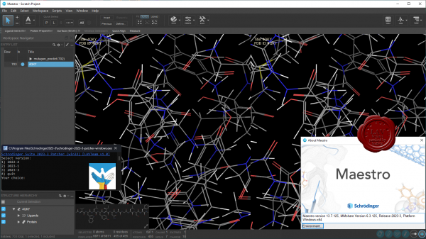
Schrodinger is a scientific leader in computational chemistry, providing software solutions and services for life sciences and materials research. Schrodinger aims to provide integrated software solutions and services that truly meet its customers' needs. We want to empower researchers around the world to achieve their goals of improving human health and quality of life through advanced computational techniques that transform the way chemists design compounds and materials. By building and deploying breakthrough scientific software solutions and forming collaborations and partnerships, we help scientists accelerate their research and development activities, reduce costs, and make novel discoveries that might otherwise not be possible.
Schrodinger software suite is a drug design software using both ligand and structure-based methods. Schrodinger provides accurate, reliable, and high performance computational technology to solve real-world problems in life science research. It provides superior solutions and services for the design, selection, and optimization of novel drug candidates. Schrцdinger's predictive models will enable drug discovery scientists to assess properties of chemical compounds early in the discovery process and to select drug candidates that have optimal profiles. The predictive power of Schrцdinger's software allows scientists to accelerate their research and development activities, reduce research costs, and make novel discoveries that might not be possible with other computational or experimental approaches. |
| |
 Читать статью дальше (комментариев - 3)
| |
|
 |
 Автор: Williams Автор: Williams
 Дата: 28 сентября 2023 Дата: 28 сентября 2023
 Просмотров: 678 Просмотров: 678 |
| |
Bentley ADINA Ultimate 2023 CONNECT Edition version 23.00.00.306
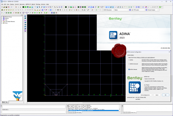 ADINA (Automatic Dynamic Incremental Nonlinear Analysis) - универсальная программа, работающая на основе метода конечных элементов, используемой для инженерных линейных и нелинейных расчётов. ADINA позволяет решать структурные и температурные задачи, рассчитывать течение, проводить мультифизические и электростатические симуляции. Внедрение программы при разработке или производстве продукта является лучшим решением для снижения затрат на производство прототипов и сокращения времени их тестирования. Современные расчётные методы, лежащие в основе программы ADINA , выгодно отличают её от остальных программ благодаря точным и надёжным результатам решения нелинейных задач. ADINA (Automatic Dynamic Incremental Nonlinear Analysis) - универсальная программа, работающая на основе метода конечных элементов, используемой для инженерных линейных и нелинейных расчётов. ADINA позволяет решать структурные и температурные задачи, рассчитывать течение, проводить мультифизические и электростатические симуляции. Внедрение программы при разработке или производстве продукта является лучшим решением для снижения затрат на производство прототипов и сокращения времени их тестирования. Современные расчётные методы, лежащие в основе программы ADINA , выгодно отличают её от остальных программ благодаря точным и надёжным результатам решения нелинейных задач.
Основные функциональные возможности пакета:
- Линейный анализ конструкций.
- Высоконелинейный анализ конструкций.
- Тепловой анализ.
- Гидродинамика.
- Взаимодействие потоков с конструкциями.
NX Nastran использует ADINA как модуль нелинейных расчетов.
Пакет ADINA состоит из следующих модулей:
- ADINA Structures - модуль расчёта статической и динамической прочности твёрдых тел и конструкций. Расчёт может быть проведён как в линейной, так и в высоконелинейной постановке с учётом нелинейности материала, больших деформаций и контакта.
- ADINA CFD – программный комплекс для моделирования течений сжимаемой и несжимаемой жидкости, использующий конечно-объемную и конечно-элементную дискретизацию.
- ADINA Thermal - программный модуль для решения задач теплопереноса в твёрдых телах и конструкциях.
- ADINA-FSI - модуль, предназначенный для анализа взаимодействия потока и конструкции, причём возможно рассмотрение высоконелинейного поведения материала вследствие больших перемещений, неупругости, контакта и температурной зависимости.
- ADINA-TMC - программный модуль, предназначенный для решения связанных термопрочностных задач, когда термические явления влияют на прочностные, и наоборот.
- ADINA User Interface (AUI) - пре- и постпроцессорный модуль, дающий возможность создавать и редактировать геометрические и конечно-элементные модели и осуществлять визуализацию результатов расчёта. Совместим со всеми модулями комплекса.
Дополнительные модули:
- ADINA Modeler (ADINA M) - встраиваемый в AUI модуль, использующий графическое ядро Parasolid и обеспечивающий твёрдотельное моделирование и прямое взаимодействие с другими CAD-системами, использующими Parasolid (Unigraphics, SolidWorks, Solid Edge)
- TRANSOR for I-DEAS, Patran - отдельный модуль, дающий возможность импортировать в ADINA и экспортировать из ADINA файлы данных в форматах I-DEAS и MSC.Patran
|
| |
 Читать статью дальше (комментариев - 5)
| |
|
 |
 Автор: Williams Автор: Williams
 Дата: 27 сентября 2023 Дата: 27 сентября 2023
 Просмотров: 319 Просмотров: 319 |
| |
Hexagon Vero REcreate 2023.2
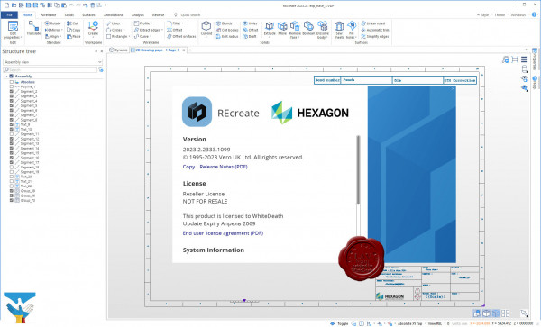
Discover REcreate, the reverse engineering software that reduces workflow complexity to create a faster and more flexible design, production and inspection environment.
REcreate takes the complexity out of reverse engineering to create a smarter, faster and more flexible design and production environment for modelling new products and for repairing or replacing parts.
Highly flexible, REcreate stands apart from traditional reverse engineering software by incorporating a CAD system that can create 2D drawings as well as CAD models. REcreate fits into any existing production workflow and is versatile enough to be used as a standalone product, working with machines that don’t use CAM data, or as part of an end-to-end CAD to CAM solution. Other key functionalities include direct modelling, which makes it easy for users to form the shape the require.
The ease-of-use and interoperability of REcreate make it simple for users to capture data by connecting directly to scanning devices or importing mesh, solid, surface or point cloud data. They can model designs in a single environment using a full array of modelling data and manufacture using CAD/CAM – as well as validate quality. And they can start at whichever point in the reverse engineering process that best suits their needs.
With REcreate manufacturers and OEMs can:
- Reconstruct legacy parts.
- Develop innovative products from existing parts.
- Ensure a precise fit for new components.
- Create CAD for parts when none exist.
- Up date design files to reflect changes that occurred during manufacturing or prototyping.
And because REcreate is designed to operate with a wide range of third-party systems, it can be used either as a fully end-to-end reverse engineering solution or as a complement to existing technology. |
| |
 Читать статью дальше (комментариев - 0)
| |
|
 |
 Автор: Williams Автор: Williams
 Дата: 26 сентября 2023 Дата: 26 сентября 2023
 Просмотров: 199 Просмотров: 199 |
| |
Engineering Technologies Associates Dynaform v7.0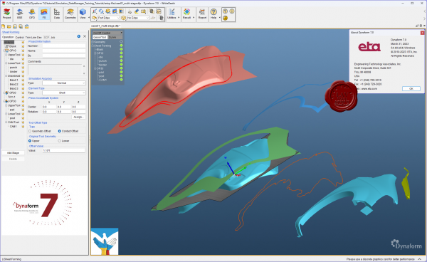
ETA Dynaform - специализированный программный комплекс, ориентированный на моделирование процессов листовой штамповки и использующий в качестве ядра математический аппарат программы LS-DYNA. Пре- и постпроцессинг Dynaform построен с учетом всех специфических особенностей техпроцесса - он автоматизирует стандартные операции подготовки расчетной схемы и функции оценки и интерпретации результатов анализа и базируется на общепринятой терминологии, знакомой каждому инженеру-технологу. Инструментарий программы включает:
-
Автоматическое построение сеток;
-
Адаптивные сетки с анимацией истории построения;
-
Обширную библиотеку промышленных материалов;
-
Автоматизированное позиционирование инструмента;
-
Вовлечение явлений потери устойчивости листа – коробления;
-
Расчет тангенциальных усилий под прижимами (тормозными ребрами);
-
Расчет упругой разгрузки изделия;
-
Высококачественную визуализацию всех результатов и анимацию;
-
Построение предельной диаграммы ”формуемости”.
Dynaform - a complete die-system evaluation tool for the automotive industry. Dynaform encompasses the entire die system process in one simple interface. Simulating every detail during the design stage, Dynaform ensures the highest quality formed part and best manufacturing process. The system guides the engineer through cost estimation, quoting, die evaluation and formability. Dynaform makes it possible to completely bypass soft tooling, reduce overall tryout time, lower costs, increase productivity and provide complete confidence in die system design. Makes possible evaluation alternative designs and materials. Dynaform’s tube forming simulation now supports multi-stage tube forming, including tube bending, tube pre-forming, tube hydroforming, trimming, and annealing. The simulations can accurately predict failures like wrinkles, cracks, spring back, and feasibility of hydroforming. No matter what process you are using or which stage you are focusing on, you can easily find the function you are looking for. Dynaform’s bending table now supports editing, inserting, and deleting operations. Users can now also import the bending table manually or automatically generate it from the center line. Our bending table generation algorithm improvements now serve to save users significant amounts of time generating tables. Hydroforming in Dynaform now supports comprehensive die face design including tube end extensions, centerline auto calculating, quick generating of die separating lines, mesh model separation based on separating lines, and more. Instead of switching to CAD software to create the tools, users can finish almost all major FEA model preparation works in Dynaform. Dynaform’s forming simulation software makes it possible to uncover design flaws early in the process. Using the various modules engineers can more-fully evaluate alternative–and unconventional–designs. Doing so helps ensure higher quality outcomes. |
| |
 Читать статью дальше (комментариев - 0)
| |
|
 |
 Автор: Williams Автор: Williams
 Дата: 25 сентября 2023 Дата: 25 сентября 2023
 Просмотров: 806 Просмотров: 806 |
| |
Applied Flow Technology Fathom 2023 v13.0.1100
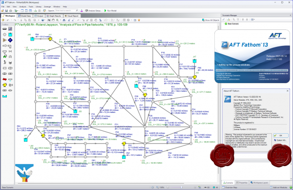 Applied Flow Technology Fathom - программно-аналитический комплекс моделирования потока в трубопроводе. Удобный графический интерфейс, встроенная библиотека оборудования, арматуры и флюидов, широкие аналитические возможности, схематическое изображение создаваемого объекта, все это реализовано в AFT Fathom и предоставляет инженеру проектировщику возможность системного подхода в реализации проектов любой сложности. AFT Fathom обладает большим спектром возможностей не являясь при этом компромиссом между функциональностью и сложностью в освоении и использовании. Applied Flow Technology Fathom - программно-аналитический комплекс моделирования потока в трубопроводе. Удобный графический интерфейс, встроенная библиотека оборудования, арматуры и флюидов, широкие аналитические возможности, схематическое изображение создаваемого объекта, все это реализовано в AFT Fathom и предоставляет инженеру проектировщику возможность системного подхода в реализации проектов любой сложности. AFT Fathom обладает большим спектром возможностей не являясь при этом компромиссом между функциональностью и сложностью в освоении и использовании.
Features:
- Advanced hydraulic solver
- Detailed modeling for centrifugal and positive displacement pumps
- Scenario Manager to track all design variants and operational possibilities in a single model file
- Pump vs. system curve generation including individual head curves and composite efficiency
- Thermal analysis including piping heat transfer and heat exchanger modeling
- Supports Newtonian and non-Newtonian fluids, including non-settling slurries
- Optional ChempakTM add-on utility provides a thermophysical database of almost 700 fluids
AFT Fathom add-on modules:
- Settling Slurry (SSL) - models the effects of pumping fluids containing settling solids using the Wilson/GIW method
- Extended Time Simulation (XTS) - models dynamic system behavior
- Goal Seek and Control (GSC) - identifies input parameters that yield desired output values and simulates control functions
- Automated Sizing (APS and ANS) - automate the process of sizing pipelines and piping networks based on required conditions, such as maximum pressure or minimum flow, to reduce cost or weight
Improvements:
1. Added the capability to copy Warnings and Design Alerts from the Output Primary Window.
2. Fixed an issue that could cause the application to freeze when generating certain graphs in property windows.
3. Fixed an issue that caused the Undefined Objects panel to open unexpectedly after visiting the Pipes and Junctions panel in Analysis Setup.
4. Corrected a program behavior that allowed users to check out both ANS Module and GSC Module at the same time, which should not be allowed.
5. Improved Analysis Setup 'Same as Parent' feature to support more data fields.
6. Fixed an issue that caused Output to clear without warning if junctions were moved on the Workspace with ctrl+click.
7. When switching between Design Alerts for junctions of the same type, the previously checked (selected) items would remain selected. This was only a display issue and did not actually change the Design Alert.
8. Fixed an issue in Graph Results where Opening Select Palette window then canceling resets all colors - it does not keep the previous colors.
9. Fixed various issues with Output right-click menu command visibility.
10. Fixed an issue where the "Batch Run Status" form ends up behind the main application form.
11. Fixed Issue: Model Data tab not showing updated parameters after using Global Edit.
12. Changed the behavior of the Scenario Tree in the Quick Access Panel. The tree will now keep its collapse/expand state for all nodes after a 'clone', 'create child', or 'delete' operations.
13. Fixed an issue where the Property Window during Import will float over all other windows.
14. Fixed an issue where the Quick Access Panel (QAP) properties tab not updating after selecting a workspace object using the Search tool.
15. Fixed several language phrases that were not translating properly.
16. Changed Output Grid right-click logic to allow quick graph plots in more cases, such as columns with some numeric and some N/A data.
17. Fixed an issue that prevented Submerged Pump modeled junctions from being exported to EPANET.
18. Added junction name to the Design Alert report in the Output.
19. Fixed an issue that prevented annotations from translating on the workspace when Arrange->Scale/Flip Workspace was used.
20. Updated the Startup window's Model Preference's pane to require the user to click "Remember My Preferences and Hide" in order to apply the selection in the Units section.
21. Corrected a program behavior that allowed users to check out both ANS Module and GSC Module at the same time, which should not be allowed.
22. Fixed an issue where models could be run while Sliding Friction Coefficient value was not yet entered in Slurry Definition, in cases where it should have been required to run.
23. Fixed an issue that caused Relief Valves to be defined when Exit Temperature was not entered and should have been required.
Video tutorials |
| |
 Читать статью дальше (комментариев - 10)
| |
|
 |
 Автор: Williams Автор: Williams
 Дата: 24 сентября 2023 Дата: 24 сентября 2023
 Просмотров: 3 865 Просмотров: 3 865 |
| |
Carlosn Layout v1.09
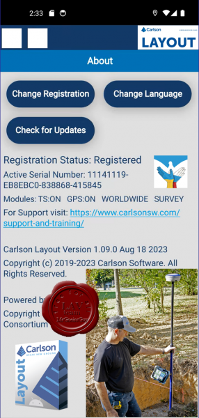
Carlosn Layout - программа на платформе Android является эффективным, доступным и простым в использовании решением для работы в полевых условиях с GNNS приемниками, инженерными и роботизированными тахеометрами. В основе Layout лежит опыт компании Carlson в области разработки программных решений для работы в поле, а также проверенная временем техническая поддержка.
Уникальность Layout заключается в поддержке самого большого списка популярного и нового геодезического оборудования, возможности выполнять задачи координатной геометрии в поле, а также работать с различными форматами файлов, включая DWG и DXF.
КЛЮЧЕВЫЕ ОСОБЕННОСТИ
-
Поддержка большинства известных GNSS приемников и тахеометров
-
Интуитивно понятный интерфейс пользователя требует меньше времени на изучение программы
-
Полная поддержка работы с DXF и DWG файлами чертежей на базе нового мобильного графического ядра IntellICAD
-
Поддерживает все библиотеки систем координат Carlson
-
Совместим со стандартными форматами файлов координат Carlson CRD и CRDB
-
Возможность использования Google Drive, Dropbox и других облачных хранилищ для простого обмена проектами
-
Возможность использования карт Google, OpenStreeMap, ArcGIS или локальных сервисов в качестве подложки
-
Прием GNSS RTK поправок через мобильный телефон, встроенный модем, встроенное или внешнее радио
-
Вынос точек с использованием поверхностей (ЦММ) или фиксированных отметок
-
Разбивка по расстоянию и смещению от линии на чертеже или между точек
-
Простая проверка отметок поверхности (ЦММ) или фиксированных отметок без создания точек
|
| |
 Читать статью дальше (комментариев - 76)
| |
|
 |
| ПОИСК ПО САЙТУ |
 |
|
 |
| КАЛЕНДАРЬ | | |
 |
| « Октябрь 2025 » |
|---|
| Пн | Вт | Ср | Чт | Пт | Сб | Вс |
|---|
| | 1 | 2 | 3 | 4 | 5 | | 6 | 7 | 8 | 9 | 10 | 11 | 12 | | 13 | 14 | 15 | 16 | 17 | 18 | 19 | | 20 | 21 | 22 | 23 | 24 | 25 | 26 | | 27 | 28 | 29 | 30 | 31 | |
|
 | |
| |
|