|
 |
 Автор: Williams Автор: Williams
 Дата: 5 декабря 2023 Дата: 5 декабря 2023
 Просмотров: 294 Просмотров: 294 |
| |
Hexagon Vero REcreate 2023.3
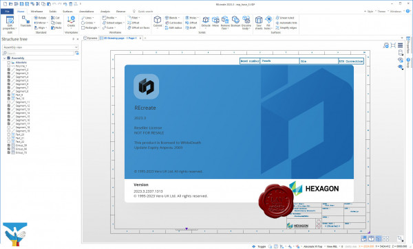
Discover REcreate, the reverse engineering software that reduces workflow complexity to create a faster and more flexible design, production and inspection environment.
REcreate takes the complexity out of reverse engineering to create a smarter, faster and more flexible design and production environment for modelling new products and for repairing or replacing parts.
Highly flexible, REcreate stands apart from traditional reverse engineering software by incorporating a CAD system that can create 2D drawings as well as CAD models. REcreate fits into any existing production workflow and is versatile enough to be used as a standalone product, working with machines that don’t use CAM data, or as part of an end-to-end CAD to CAM solution. Other key functionalities include direct modelling, which makes it easy for users to form the shape the require.
The ease-of-use and interoperability of REcreate make it simple for users to capture data by connecting directly to scanning devices or importing mesh, solid, surface or point cloud data. They can model designs in a single environment using a full array of modelling data and manufacture using CAD/CAM – as well as validate quality. And they can start at whichever point in the reverse engineering process that best suits their needs.
With REcreate manufacturers and OEMs can:
- Reconstruct legacy parts.
- Develop innovative products from existing parts.
- Ensure a precise fit for new components.
- Create CAD for parts when none exist.
- Up date design files to reflect changes that occurred during manufacturing or prototyping.
And because REcreate is designed to operate with a wide range of third-party systems, it can be used either as a fully end-to-end reverse engineering solution or as a complement to existing technology. |
| |
 Читать статью дальше (комментариев - 0)
| |
|
 |
 Автор: Williams Автор: Williams
 Дата: 4 декабря 2023 Дата: 4 декабря 2023
 Просмотров: 1 443 Просмотров: 1 443 |
| |
Bentley Open series 2023
Bentley OpenRail Designer 2023 version 23.00.00.129
Bentley OpenRoads Designer 2023 version 23.00.00.129
Bentley OpenSite Designer 2023 version 23.00.00.129
Bentley OpenRail ConceptStation 2023 version 23.00.00.78
Bentley OpenRoads ConceptStation 2023 version 23.00.00.78
Bentley OpenTunnel Designer 2023 version 23.00.00.130 added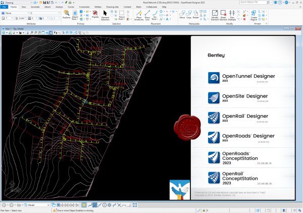
OpenRoads Designer служит для проектирования автомобильных дорог и в целом дорожной инфраструктуры. Но с некоторых пор программа включает в себя набор функций для подготовки и анализа маркшейдерских работ: расчет объема работ, проектирование бортов карьера по шаблону, создание, редактирование и обновление трехмерных поверхностей, подсчет объемов полезных ископаемых, расчет объема земляных работ, построение профилей и многое другое. OpenRoads Designer создает разбивочные планы, планы организации рельефа, план земляных масс и сводный план сетей, которые возможно оформить в полном соответствии с российскими нормами. Также данное ПО имеет обширный набор функций в части проведения изысканий: работа с многообъемными облаками точек (что очень важно, имея лазерный сканер на предприятии) и проведение над ним – классификации, построения сечений, проецирование элементов на облако точек; а также создание цифровой модели местности, работа с данными тахеометрической съемки, подключение растровых форматов и их редактирование.
OpenRail служит для комплексного проектирования инфраструктуры железных дорог от создания концепции до завершения строительства и ввода в эксплуатацию. Приложение даёт 3D модель реальности для мгновенного интерактивного параметрического моделирования железнодорожных транспортных коридоров. С помощью OpenRail Designer можно реализовывать дизайн-проекты подземного метро, легкорельсового транспорта, рельсового транспорта пригородного сообщения или высокоскоростных железных дорог, включая проекты рельсовых путей, станций, парков, воздушных линий электропередачи.
OpenSite Designer - единственный правильный выбор для проектирования генплана. Это программное решение включает в себя возможности комплексного детального проектирования для быстрого моделирования и анализа проекта генплана, оптимизации и количественной оценки земляных работ, проектирования дренажных и подземных коммуникаций, а также автоматизированного выпуска проектной документации.
OpenRail ConceptStation gives you rail, electrification, tunnel, and bridge conceptual design capabilities to help you create intelligent models in context. Evaluate conceptual design options with real-world data and cost analysis to rapidly determine optimal designs. Utilize data acquisition, reality modeling, and conceptual design to eliminate high-cost and high-risk items in the preliminary and planning design stages of your rail network projects.
OpenRoads ConceptStation enables you to create conceptual road and bridge designs to evaluate more options during the planning and pre-bid stage of your project. You can design more efficiently, identify high-risk items, and minimize costs. Easily visualize and analyze real-world traffic patterns leveraging design-time visualization with 3D modeling and traffic analysis, as OpenRoads ConceptStation provides interoperability with VISSIM. |
| |
 Читать статью дальше (комментариев - 11)
| |
|
 |
 Автор: Williams Автор: Williams
 Дата: 2 декабря 2023 Дата: 2 декабря 2023
 Просмотров: 301 Просмотров: 301 |
| |
MathWorks RoadRunner R2023b Update 4 Windows + Linux
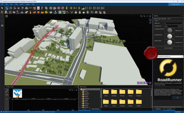
RoadRunner is an interactive editor that lets you design 3D scenes for simulating and testing automated driving systems. You can customize roadway scenes by creating region-specific road signs and markings. You can insert signs, signals, guardrails, and road damage, as well as foliage, buildings, and other 3D models. RoadRunner provides tools for setting and configuring traffic signal timing, phases, and vehicle paths at intersections.
RoadRunner supports the visualization of lidar point cloud, aerial imagery, and GIS data. You can import and export road networks using OpenDRIVE. 3D scenes built with RoadRunner can be exported in FBX, glTF, OpenFlight, OpenSceneGraph, OBJ, and USD formats. The exported scenes can be used in automated driving simulators and game engines, including CARLA, Vires VTD, NVIDIA DRIVE Sim, rFpro, Baidu Apollo, Cognata, Unity, and Unreal Engine.
RoadRunner Asset Library lets you quickly populate your 3D scenes with a large set of realistic and visually consistent 3D models. RoadRunner Scene Builder lets you automatically generate 3D road models from HD maps. |
| |
 Читать статью дальше (комментариев - 0)
| |
|
 |
 Автор: Williams Автор: Williams
 Дата: 1 декабря 2023 Дата: 1 декабря 2023
 Просмотров: 1 542 Просмотров: 1 542 |
| |
SeismoSoft Seismo Suite 2024 Release-1 Build-1
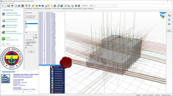
SeismoBuild is an innovative Finite Element package wholly and exclusively dedicated to seismic assessment and strengthening of reinforced concrete structures that is targeted to the design office. It is the only civil engineering software worldwide that is totally committed to structural assessment and retrofitting.
SeismoStruct is an award-winning Finite Element package capable of predicting the large displacement behaviour of space frames under static or dynamic loading, taking into account both geometric nonlinearities and material inelasticity.
SeismoSelect is an easy and efficient way to search, select, scale and download ground motion data from different strong motion databases that are available on-line. Different criteria may be employed as the parameters of interest, with which to carry out the searches. These include a target response spectrum, different ground motion parameters (e.g. PGA, PGV, Arias or Housner Intensity), information regarding the event (e.g. magnitude, faulting style location, date) or the recording site (e.g. Vs30, epicentral distance)
SeismoSignal constitutes an easy and efficient way for signal processing of strong-motion data, featuring a user-friendly visual interface and being capable of deriving a number of strong-motion parameters often required by engineer seismologists and earthquake engineers.
SeismoMatch is an application capable of adjusting earthquake accelerograms to match a specific target response spectrum, using the wavelets algorithm proposed by Abrahamson and Hancock or the algorithm proposed by Al Atik and Abrahamson. After loading some accelerograms and defining the target response spectrum, users need only to define the spectral matching algorithm, adjust the spectral matching period range, set the required tolerance and the spectral matching is executed.
SeismoArtif is an application capable of generating artificial earthquake accelerograms matched to a specific target response spectrum using different calculation methods and varied assumptions. It is noted that the use of real accelerograms and spectrum matching techniques, together with records selection tools, tends to be recommended for the derivation of suites of records for use in nonlinear dynamic analysis of structures. However, in those cases where access to real accelerograms is, for whatever reason, challenging or inappropriate, then a tool such as SeismoArtif will be of pertinence and usefulness.
SeismoSpect constitutes a simple and efficient platform for signal processing that allows to create a personal library of ground motion records and save them all in a single file making it easy to handle and share large numbers of records.
FRP Designer provides an efficient solution for designing FRP strengthening of reinforced concrete columns and beams by computing the strength of reinforced concrete members strengthened with FRP laminates. |
| |
 Читать статью дальше (комментариев - 19)
| |
|
 |
 Автор: Williams Автор: Williams
 Дата: 30 ноября 2023 Дата: 30 ноября 2023
 Просмотров: 640 Просмотров: 640 |
| |
Hexagon Cabinet Vision 2023.3
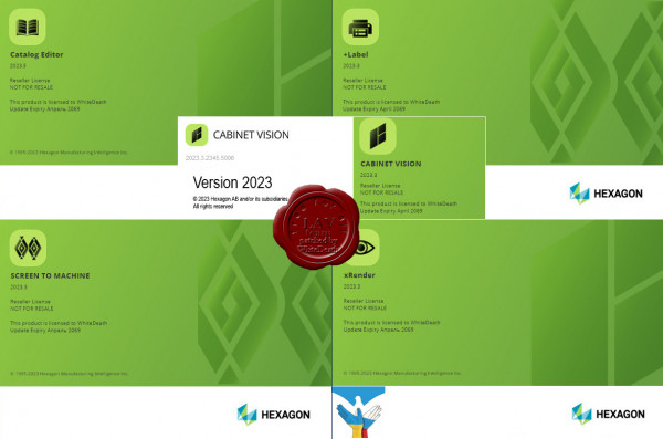
Cabinet Vision makes it simple for furniture, woodworking, or casegood manufacturers of all sizes to play to their strengths, by using a single, fully modular software package to go from design to manufacture. With Cabinet Vision you buy only the features you need. This allows you to evolve and grow your software usage in line with your business, making Cabinet Vision highly scalable and cost-effective. Enhanced usability makes it even easier to visualise and efficiently perform a full range of tasks, while responding to changing design requirements, whether making high-end bespoke pieces or basic elements. Fast, practical and precise, Cabinet Vision excels at rapidly and seamlessly converting designs into all the information you need on the factory floor to manage manufacturing process. And an intuitively simple parametric function means you can capitalise on previous bespoke designs by resizing elements without reprogramming. The result is a faithful reproduction of designs and the reduction of both time-consuming processes and human error. Cabinet Vision also enables you to support sales with features that include the production of professional reports that help customers understand and visualise the scope of services as well as the end product. Cabinet Vision provides you with a choice of core components that enable you to enhance productivity and improve quality and customer service within your chosen specialism..Each core component provides layout, cut listing, basic rendering and primary estimating functions. Once you have chosen the core package that suits your needs, you can then opt to add specific modules, known as multipliers, in line with your individual manufacturing processes, business focus, customer requirements and employee growth plans. Further additions are also available to enhance the capability of each multiplier, depending on the depth of functionality you seek. |
| |
 Читать статью дальше (комментариев - 11)
| |
|
 |
 Автор: Williams Автор: Williams
 Дата: 29 ноября 2023 Дата: 29 ноября 2023
 Просмотров: 195 Просмотров: 195 |
| |
Thermo Fisher Scientific PerGeos 2023.1.1
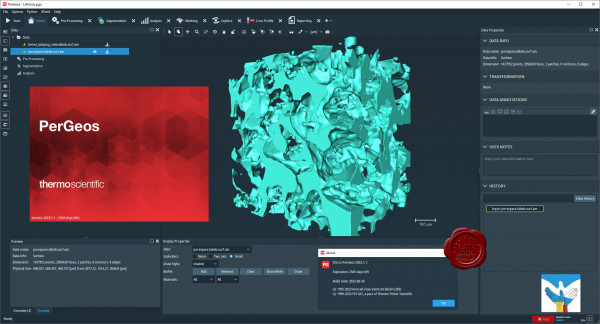 Thermo Scientific PerGeos Software is a robust platform that enables E&P engineers to understand the quality and performance of hydrocarbon reservoirs. PerGeos Software is the industry’s first digital rock solution designed to help geoscientists rapidly interpret digital rock imagery so that E&P engineers can quickly and easily obtain meaningful, actionable data. Its visualization, processing, and analysis of 2D and 3D digital rock imagery enables improved evaluation of reservoir quality and faster understanding of static and dynamic rock properties that impact production. PerGeos Software can be used as a standalone software platform or bundled with a variety of applications to customize the user experience with additional functionality for digital core analysis. Thermo Scientific PerGeos Software is a robust platform that enables E&P engineers to understand the quality and performance of hydrocarbon reservoirs. PerGeos Software is the industry’s first digital rock solution designed to help geoscientists rapidly interpret digital rock imagery so that E&P engineers can quickly and easily obtain meaningful, actionable data. Its visualization, processing, and analysis of 2D and 3D digital rock imagery enables improved evaluation of reservoir quality and faster understanding of static and dynamic rock properties that impact production. PerGeos Software can be used as a standalone software platform or bundled with a variety of applications to customize the user experience with additional functionality for digital core analysis.
Key benefits of PerGeos Software include:
- Collaborative core analysis: Multi-disciplinary sharing of information to build a common rock model.
- Consistency in data processing and modeling: Automated workflows to streamline efficiency and implement best practices.
- Confidence in results: Multi-scale, multi-modal image analysis to help users validate observations and properties from a variety of datasets.
- Customized for oil and gas: The most advanced set of artifact removal and analytical tools on the market, designed specifically for oil and gas reservoir characterization and digital rock analysis.
PerGeos Software helps petrographers, geologists, core analysts, and petrophysicists with qualitative and quantitative rock analysis via its suite of image processing, filtering, and segmentation tools. These tools help users understand and share reservoir information. |
| |
 Читать статью дальше (комментариев - 0)
| |
|
 |
 Автор: Williams Автор: Williams
 Дата: 28 ноября 2023 Дата: 28 ноября 2023
 Просмотров: 227 Просмотров: 227 |
| |
Thermo Fisher Scientific Amira/Avizo 2023.1.1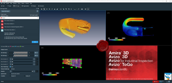
AVIZO is materials characterization and quality control software for imaging data analysis and quality assurance. Analysis and visualization of your imaging data allows better understanding of your materials structure, properties and performances. No matter what scale and data modality you use, your organization profile (large industrial company, core imaging facility, national or local service laboratory, academic institution) AVIZO provides optimized workflows for advanced materials characterization and quality control from a single environment. AVIZO is universal, reliable, fully automatable and customizable digital analytical labs. Materials scientists and engineers can innovate faster, produce more reliable and better performing materials and processes while reducing cost and time to discoveries.
AMIRA is software for biomedical and life science research. Powerful, multifaceted 2D–5D software for visualization, processing and analysis of microscopy imaging serving Life and Biomedical Sciences. AMIRA is a powerful, comprehensive, and versatile 2D–5D solution for visualizing, analyzing and understanding life science and biomedical research data from many image modalities, including Optical and Electron Microscopy, CT, MRI and other imaging techniques. With incredible speed and flexibility, Amira Software supports advanced 2D–5D bioimaging workflows in research areas ranging from structural and cellular biology to tissue imaging, neuroscience, preclinical imaging and bioengineering. From any 3D image data, including time series and multi-channel, AMIRA delivers a comprehensive range of data visualization, processing and analysis capabilities. Amira Software allows life science and biomedical researchers to gain invaluable insights into their data, at different scales and from any modality. |
| |
 Читать статью дальше (комментариев - 0)
| |
|
 |
 Автор: Williams Автор: Williams
 Дата: 27 ноября 2023 Дата: 27 ноября 2023
 Просмотров: 1 064 Просмотров: 1 064 |
| |
Bentley Open series 2023
Bentley OpenRail Designer 2023 version 23.00.00.129
Bentley OpenRoads Designer 2023 version 23.00.00.129
Bentley OpenSite Designer 2023 version 23.00.00.129
Bentley OpenRail ConceptStation 2023 version 23.00.00.78
Bentley OpenRoads ConceptStation 2023 version 23.00.00.78
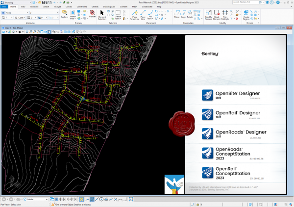
OpenRoads Designer служит для проектирования автомобильных дорог и в целом дорожной инфраструктуры. Но с некоторых пор программа включает в себя набор функций для подготовки и анализа маркшейдерских работ: расчет объема работ, проектирование бортов карьера по шаблону, создание, редактирование и обновление трехмерных поверхностей, подсчет объемов полезных ископаемых, расчет объема земляных работ, построение профилей и многое другое. OpenRoads Designer создает разбивочные планы, планы организации рельефа, план земляных масс и сводный план сетей, которые возможно оформить в полном соответствии с российскими нормами. Также данное ПО имеет обширный набор функций в части проведения изысканий: работа с многообъемными облаками точек (что очень важно, имея лазерный сканер на предприятии) и проведение над ним – классификации, построения сечений, проецирование элементов на облако точек; а также создание цифровой модели местности, работа с данными тахеометрической съемки, подключение растровых форматов и их редактирование.
OpenRail служит для комплексного проектирования инфраструктуры железных дорог от создания концепции до завершения строительства и ввода в эксплуатацию. Приложение даёт 3D модель реальности для мгновенного интерактивного параметрического моделирования железнодорожных транспортных коридоров. С помощью OpenRail Designer можно реализовывать дизайн-проекты подземного метро, легкорельсового транспорта, рельсового транспорта пригородного сообщения или высокоскоростных железных дорог, включая проекты рельсовых путей, станций, парков, воздушных линий электропередачи.
OpenSite Designer - единственный правильный выбор для проектирования генплана. Это программное решение включает в себя возможности комплексного детального проектирования для быстрого моделирования и анализа проекта генплана, оптимизации и количественной оценки земляных работ, проектирования дренажных и подземных коммуникаций, а также автоматизированного выпуска проектной документации.
OpenRail ConceptStation gives you rail, electrification, tunnel, and bridge conceptual design capabilities to help you create intelligent models in context. Evaluate conceptual design options with real-world data and cost analysis to rapidly determine optimal designs. Utilize data acquisition, reality modeling, and conceptual design to eliminate high-cost and high-risk items in the preliminary and planning design stages of your rail network projects.
OpenRoads ConceptStation enables you to create conceptual road and bridge designs to evaluate more options during the planning and pre-bid stage of your project. You can design more efficiently, identify high-risk items, and minimize costs. Easily visualize and analyze real-world traffic patterns leveraging design-time visualization with 3D modeling and traffic analysis, as OpenRoads ConceptStation provides interoperability with VISSIM. |
| |
 Читать статью дальше (комментариев - 14)
| |
|
 |
| ПОИСК ПО САЙТУ |
 |
|
 |
| КАЛЕНДАРЬ | | |
 |
| « Октябрь 2025 » |
|---|
| Пн | Вт | Ср | Чт | Пт | Сб | Вс |
|---|
| | 1 | 2 | 3 | 4 | 5 | | 6 | 7 | 8 | 9 | 10 | 11 | 12 | | 13 | 14 | 15 | 16 | 17 | 18 | 19 | | 20 | 21 | 22 | 23 | 24 | 25 | 26 | | 27 | 28 | 29 | 30 | 31 | |
|
 | |
| |
|