|
 |
 Автор: Williams Автор: Williams
 Дата: 20 января 2024 Дата: 20 января 2024
 Просмотров: 1 015 Просмотров: 1 015 |
| |
Bentley Offshore Structural Analysis version 24.00.00.722
MOSES, Maxsurf, Multiframe
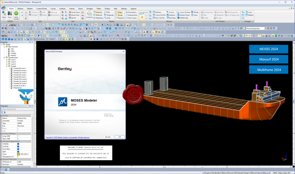
Analysis and design of offshore platforms and vessels are some of the greatest technical challenges in the offshore engineering profession. To address this, Bentley proudly offers SACS, MOSES and Maxsurf – a range of software proven in offshore and marine industry-specific capabilities.
MOSES is integrated offshore simulation software. This advanced hydrostatic and hydrodynamic software ensures that you can apply industry best practices to installation and design sequences, while exploring design alternatives within a unified modeling environment. Bentley MOSES integrated simulation software helps you minimize offshore project risks with optimal designs. Easily analyze floating systems across a range of operating conditions using simulation language to define environmental conditions, specify mooring configurations, and run integrated solvers in a unified environment. Use interactive graphical tools specific to offshore structures to prepare models of your vessels and floating systems. Help ensure accurate loading definition by visualizing tank and compartment models during modification. Leverage comprehensive and customizable scripting tools and pre-defined macros to explore design alternatives and manage complex installation sequences.
These modules are included in MOSES ULTIMATE:
- MOSES Solver: Allows you to consider all type of forces acting on your floating systems, including hydrostatic, hydrodynamic, inertial, and mooring forces.
- MOSES Language: Provides a unique, flexible, and powerful way of specifying system behavior and analyzing performance for different installations and operational conditions.
- Hull Modeler: Gives you an interactive way to create 3D hull shapes.
- Stability Modeler: Allows you to model compartmentation and load case management.
- Motions Modeler: Provides the tools for modeling environmental and mooring inputs.
- Hull Mesher: Enables you to graphically represent structural models.
- Basic Connectors: Offer a generalized way of modeling lifting slings, anchor lines, mooring lines, nonlinear springs, pins, fenders, and other items that connect two bodies or a body to the ground. Connectors can be tension-only or compression-only and custom connectors can be defined.
- Strip Theory: Provides a fast and proven way to predict the motions of your vessel. It is well suited for barge transports and any vessel that is slender in its L/B (length/beam) ratio.
- 3D Diffraction: Allows you to predict motions for non-ship shaped hulls and account for surge. Adaptive meshing automatically increases panel mesh density as required.
- Time Domain: Perform time-history simulations on single or multi-body systems to predict performance. The Time Domain module can perform a time history simulation on any single or multi-body system. Starting from the frequency domain results, and taking into account mooring, current, and wave forces, the Time Domain module provides fast computation of full system response. Customizable reporting and automatic generation of system response animations allow easy understanding and communication of results.
- Pipe and Rod Elements: Handle mooring line dynamics with accurate calculations or response, including accounting for large deflections. This allows modelling and analysis of anchor lines, mooring lines, TLP (tension leg platform) tendons, rigid risers, and pipelines.
- Structural Solver: Enable structural analysis, as well as spectral fatigue analysis of topside and cargo structures. It supports beam and plate elements and can import structures from SACS.
- Jacket Launch: Perform six-degree-of-freedom time domain simulations of jacket launches from a barge into water.
- Generalized Degrees of Freedom: Understand the effect of structural deformation and flexibility on buoyancy, frequency response, and loadout calculations. It can also be used to consider the hydrodynamic interaction between two vessels.
Maxsurf is naval architecture software ideal for the design of marine vessels. Maxsurf includes capabilities for hull modeling, stability, motions and resistance prediction, structural modeling, structural analysis, and export to vessel detailing. Maxsurf operates from a single parametric 3D model in order to ensure smooth communication and coordination across various involved in the project. Ensure compliance with international stability criteria and balance vessel performance requirements using integrated analysis tools. Perform a range of analyses including intact and damaged stability, resistance and motions prediction, and structural analysis. Create complex 3D hull forms for any type of vessel using wizards and interactive sketch tools. Systematically explore design alternatives by making measured changes to models with easy-to-use tools. Apply transformations to increase the productivity of the initial hull design process. Perform faster hull form variation and analysis with team-based concurrent modeling on a common 3D parametric model. Easily visualize and assess design alternatives within a consistent graphical environment with smooth data flow.
Multiframe Structural Engineering Software provides linear and non-linear analysis, static and dynamic options and buckling calculations. These analysis options are complemented by a full range of analysis-related modeling tools like master-slave, prescribed displacements, springs, thermal effects, offset members, additional masses and much more. Other modules allow you to draw section shapes and install them in the sections library and perform design checks for a range of design codes. Multiframe Automation allows you to prepare design calculations in Excel and link them directly with your Multiframe model. An ever expanding range of design add-ons also allows you to simplify steel code checking and optimization. |
| |
 Читать статью дальше (комментариев - 12)
| |
|
 |
 Автор: Williams Автор: Williams
 Дата: 18 января 2024 Дата: 18 января 2024
 Просмотров: 117 Просмотров: 117 |
| |
BioSolvetIT SeeSAR v13.0.5
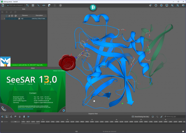 SeeSAR fosters innovation during every step of your drug design process. The app includes all tools vital for handling your compounds and target structures which have been fine-tuned to the needs of any chemist. Helpful features such as ADME properties assessment, comprehensive color coding, unoccupied binding pocket visualization, and many others, support you in making sound and interactive decisions. All our tools are based on solid and transparent science cited in over a thousand publications. Follow the button if you want to learn more about the science behind SeeSAR. SeeSAR fosters innovation during every step of your drug design process. The app includes all tools vital for handling your compounds and target structures which have been fine-tuned to the needs of any chemist. Helpful features such as ADME properties assessment, comprehensive color coding, unoccupied binding pocket visualization, and many others, support you in making sound and interactive decisions. All our tools are based on solid and transparent science cited in over a thousand publications. Follow the button if you want to learn more about the science behind SeeSAR.
Drag and drop your protein, or search comfortably in an online database. Within seconds, your target is prepared and you can get started.
Modify your protein according to your needs. Explore rotamers, introduce mutations, and customize side chains.
SeeSAR automatically detects the binding site of a ligand for you. In addition, you can precisely expand it by adding individual residues — or with a single click to find empty pockets in your protein.
Modify molecules to your taste in 2D or 3D on-the-fly. Once you are done, the molecules are directly prepared for your tasks.
Estimate affinities and interpret the results using the visualized HYDE score. Filter your compounds for relevant parameters, calculate ADME properties, and gain full control over ligand-target interactions.
Ideate without limits! Discover new scaffolds, explore, and grow into free cavities, or link molecules using fragment libraries for elegant solutions.
Dock your compounds with one single click! Screen libraries for actives, and instinctively evaluate your results.
Align your compounds without the need of a target structure based on their molecular similarity.
Change log |
| |
 Читать статью дальше (комментариев - 1)
| |
|
 |
 Автор: Williams Автор: Williams
 Дата: 17 января 2024 Дата: 17 января 2024
 Просмотров: 430 Просмотров: 430 |
| |
ANSYS Rocky 2024 R1
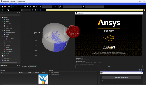 ROCKY – эффективное программное обеспечение для моделирования сыпучих сред методом дискретных элементов (МДЭ или DEM – Discrete Element Method), позволяет быстро и максимально реалистично моделировать поведение потока частиц сыпучего материала с необходимыми свойствами в любых процессах и аппаратах. ROCKY – эффективное программное обеспечение для моделирования сыпучих сред методом дискретных элементов (МДЭ или DEM – Discrete Element Method), позволяет быстро и максимально реалистично моделировать поведение потока частиц сыпучего материала с необходимыми свойствами в любых процессах и аппаратах.
ROCKY – современное программное обеспечение для моделирования технологических процессов с сыпучими материалами и соответствующего оборудования. В программном продукте используется метод дискретных элементов (Discrete Element Method - DEM), который позволяет быстро и точно рассчитать поведение потока частиц различных форм и размеров при его движении по конвейерным линиям, на вибрационных грохотах, в мельницах, дробилках и других видах обрабатывающего и транспортного оборудования.
Программный продукт ROCKY был создан на основе 20-летнего опыта разработки расчетных методик с использованием технологий DEM в компании Granular Dynamics International LLC, подразделении Conveyor Dynamics, Inc. Дальнейшее развитие продукта будет осуществляться в рамках бразильской компанией ESSS. Изначально развитие продукта происходило применительно к задачам обогащения полезных ископаемых, с ориентацией на расчет движения частиц в цилиндрических мельницах и системах непрерывного транспорта. С выходом новых версий, возможности ROCKY значительно расширились, и позволяют выполнять более широкий спектр задач, например, расчет и визуализацию абразивного износа рабочих поверхностей оборудования, расчет воздушных потоков, возникающих при движении частиц сыпучего материала при транспортировании, и многое другое.
От других программных решений, использующих метод DEM, ROCKY отличается прежде всего возможностями использования реалистичных несферических частиц, моделирования их разрушения без потери массы и объема, а также расчета и визуализации абразивного износа рабочих поверхностей элементов оборудования. Благодаря возможности создавать реалистичные формы частиц, которые ведут себя так же, как и реальные частицы, с учетом различных условий ”текучести” в ROCKY можно смоделировать работу практически любой установки.
Функциональные возможности
- Эффективные вычисления;
- Вычисления двойной точности (с использованием соответствующей функции GPU);
- Широкий диапазон задания гранулометрического состава;
- Несферические частицы;
- Учет реологии сухих и влажных материалов;
- Расчет и трехмерная визуализация абразивного износа поверхностей;
- Задание вращения, поступательного и вибрационного движения элементов оборудования;
- Простой импорт 3D CAD геометрических моделей, понятное задание исходных данных и граничных условий расчета;
- Интеграция с конечно-элементными решателями ANSYS;
- Управление анимацией результатов моделирования и создание панорамных видеоотчётов.
ROCKY и ANSYS
Сыпучие материалы широко используются и перерабатываются в различных отраслях промышленности на протяжении веков. Однако до сих пор существуют дефицит точных сведений о их поведении в различных условиях. В некоторых случаях сыпучие материалы ведут себя как дискретные твердые тела, в других как жидкости или даже подвергаются компрессионному воздействию как газы.
Растет необходимость создания достоверной прогностической модели поведения сыпучих материалов с учетом воздействия на элементы оборудования, тем самым, обеспечивается решение конструкторских задач при модернизации или создании нового инновационного оборудования.
Простейший случай взаимодействия типа ”частица-геометрия” (particle-to-structure interaction - PSI) включает передачу из решателя DEM (например, Rocky) набора данных о силовых нагрузках со стороны частиц сыпучего материала на элементы конструкции. Решатель ANSYS (или другой FEM - решатель) обеспечивает расчет отклика конструкции на силовое воздействие потока частиц. ROCKY содержит быстрый и точный алгоритм выполнения совместных расчетов методами DEM и FEM для несовпадающих расчетных сеток. |
| |
 Читать статью дальше (комментариев - 3)
| |
|
 |
 Автор: Williams Автор: Williams
 Дата: 14 января 2024 Дата: 14 января 2024
 Просмотров: 3 871 Просмотров: 3 871 |
| |
Bentley Seequent PLAXIS 2D / 3D Ultimate 23.02.01.1079 - online installers
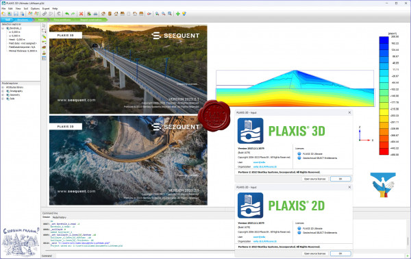
PLAXIS - программная система, основанная на методе конечных-элементов, используемая для решения задач инженерной геотехники, проектирования и инженерной геологии. Представляет собой пакет вычислительных программ для конечно-элементного расчёта напряжённо-деформированного состояния сооружений, фундаментов и оснований.
PLAXIS 2D. Выполняйте геотехнический 2D анализ деформаций и устойчивости с помощью PLAXIS 2D WorkSuite, мощного пакета инструментов для анализа методом конечных элементов и предельного равновесия, который включает специализированный функционал для анализа вибраций, грунтовых вод и теплового потока.
PLAXIS 3D. Выполняйте 3D анализ деформаций и устойчивости в своем следующем геотехническом проекте с использованием PLAXIS 3D WorkSuite. Он представляет собой пакет для анализа методом конечных элементов и предельного равновесия, который включает в себя специализированный функционал для анализа вибраций и грунтовых вод. |
| |
 Читать статью дальше (комментариев - 25)
| |
|
 |
 Автор: Williams Автор: Williams
 Дата: 12 января 2024 Дата: 12 января 2024
 Просмотров: 257 Просмотров: 257 |
| |
ANSYS Electromagnetics Suite 2024 R1
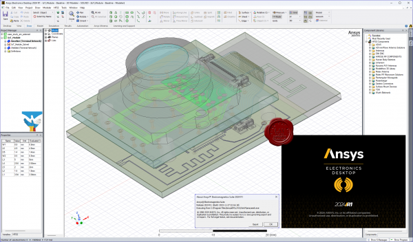 ANSYS is the leading provider of electromagnetic simulation software, engineers rely on our electromagnetic field solvers and system simulation products to design communication and networking systems, integrated circuits (ICs), printed circuit boards (PCBs) and electromechanical systems. ANSYS signal integrity analysis products are ideal for designing high-speed serial channels, parallel buses and complete power delivery systems found in modern high-speed electronic devices. Our RF and Microwave design and simulation software enables engineers to design, simulate and validate high-frequency components and antennas found in communication systems, mobile devices, computers, radio and radar. ANSYS electromechanical simulation software is ideal for the design of electromechanical and power electronics components and systems common to the automotive, aerospace and industrial automation industries. ANSYS brings clarity and insight to customers' most complex design challenges through fast, accurate and reliable engineering simulation. Our technology enables organizations no matter their industry to predict with confidence that their products will thrive in the real world. Customers trust our software to help ensure product integrity and drive business success through innovation. Founded in 1970, ANSYS employs more than 2,500 professionals, many of them expert in engineering fields such as finite element analysis, computational fluid dynamics, electronics and electromagnetics, and design optimization. Headquartered south of Pittsburgh, U.S.A., ANSYS has more than 75 strategic sales locations throughout the world with a network of channel partners in 40+ countries. ANSYS is the leading provider of electromagnetic simulation software, engineers rely on our electromagnetic field solvers and system simulation products to design communication and networking systems, integrated circuits (ICs), printed circuit boards (PCBs) and electromechanical systems. ANSYS signal integrity analysis products are ideal for designing high-speed serial channels, parallel buses and complete power delivery systems found in modern high-speed electronic devices. Our RF and Microwave design and simulation software enables engineers to design, simulate and validate high-frequency components and antennas found in communication systems, mobile devices, computers, radio and radar. ANSYS electromechanical simulation software is ideal for the design of electromechanical and power electronics components and systems common to the automotive, aerospace and industrial automation industries. ANSYS brings clarity and insight to customers' most complex design challenges through fast, accurate and reliable engineering simulation. Our technology enables organizations no matter their industry to predict with confidence that their products will thrive in the real world. Customers trust our software to help ensure product integrity and drive business success through innovation. Founded in 1970, ANSYS employs more than 2,500 professionals, many of them expert in engineering fields such as finite element analysis, computational fluid dynamics, electronics and electromagnetics, and design optimization. Headquartered south of Pittsburgh, U.S.A., ANSYS has more than 75 strategic sales locations throughout the world with a network of channel partners in 40+ countries.
|
| |
 Читать статью дальше (комментариев - 1)
| |
|
 |
 Автор: Williams Автор: Williams
 Дата: 9 января 2024 Дата: 9 января 2024
 Просмотров: 1 570 Просмотров: 1 570 |
| |
ANSYS products 2024 R1
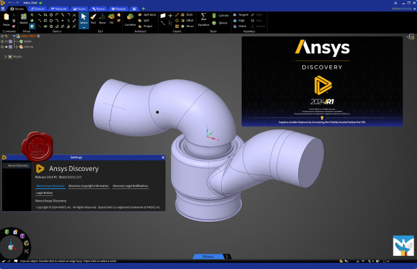 ANSYS - многоцелевой конечно-элементный пакет для проведения анализа в широкой области инженерных дисциплин. Это универсальный, "тяжелый" конечно элементный пакет, предназначенный для решения в единой среде на одной и той же конечно-элементной модели задач по прочности, теплу, электромагнетизму, гидрогазодинамике, многодисциплинарного связанного анализа и оптимизации на основе всех выше приведенных типов анализа. ANSYS - многоцелевой конечно-элементный пакет для проведения анализа в широкой области инженерных дисциплин. Это универсальный, "тяжелый" конечно элементный пакет, предназначенный для решения в единой среде на одной и той же конечно-элементной модели задач по прочности, теплу, электромагнетизму, гидрогазодинамике, многодисциплинарного связанного анализа и оптимизации на основе всех выше приведенных типов анализа.
Сотни новых возможностей ANSYS согласуются с общей стратегией развития компании – разработка универсального и многофункционального программного обеспечения, соответствующего изменяющимся требованиям клиентов. Новый релиз разрабатывался с учетом требований клиентов, активно использующих стратегию ANSYS, которая получила название Simulation Driven Product Development.
Семейство продуктов ANSYS
Professional
Высокоэффективный комбинированный пакет, предназначен для расчета линейных статических задач прочности, модального анализа, стационарных и нестационарных задач теплофизики, включая теплопроводность, конвекцию и радиационный обмен. ANSYS Professional ориентирован на инженеров среднего звена.
Structural
Полный прочностной пакет (за исключением функций расчета гидрогазодинамики, тепла, электромагнетизма), включает функции прочностного анализа, расчеты линейной прочности, нелинейности (деформации, упругость, пластичность, текучесть, расчет элементов на растяжение-сжатие и др.). Контактные задачи. Частотная область динамического анализа (гармонический, спектральный, вибрации). Динамический анализ неустановившихся процессов; устойчивость конструкций; механика разрушений линейных и нелинейных задач для изделий из композиционных и армированных материалов, включая температурные воздействия. Совместный анализ, акустика.
Mechanical
Этот пакет прочностного анализа и тепла (за исключением функций расчета гидрогазодинамики и электромагнетизма) является наиболее универсальным модулем, позволяющим выполнять большинство линейных и нелинейных задач конечно-элементного анализа. Включает в себя все возможности, перечисленные в Structural, в сочетании с функциями расчета тепла (стационарный и нестационарный режимы, теплопроводность, радиация, конвекция).
Multiphysics
Наиболее полный пакет, включающий в себя все возможные физические дисциплины (прочность и тепло), а также электромагнитный анализ (магнитостатика, электростатика, электропроводность, низкочастотный гармонический анализ, высокочастотный анализ) и гидрогазодинамику (стационарная и нестационарная, сжимаемые и несжимаемые, ламинарные и турбулентные потоки; естественная и вынужденная конвекция, сопряженный теплоперенос; вязкие и многокомпонентные течения; фильтрация).
Emag
Специальный модуль расчета электростатики и магнитостатики, низкочастотного и высокочастотного анализа, нестационарных задач.
LS-DYNA
Программа высоконелинейных расчетов LS-DYNA, интегрированная в среду ANSYS, объединяет в одной программной оболочке традиционные методы решения с обращением матриц, специализированные контактные алгоритмы, множество уравнений состояния и метод интегрирования, что позволяет численно моделировать процессы формования материалов, анализа аварийных столкновений и ударов при конечных деформациях, при нелинейном поведении материала и контактном взаимодействии большого числа тел. С использованием LS-DYNA могут быть решены задачи динамического поведения предварительно напряженных конструкций и задачи исследования разгрузки конструкций, подвергнутых большим деформациям.
ICEM CFD
Комплексная система генерации любых типов расчетных сеток имеющая прямой интерфейс с CAD системами (Pro/E, Catia, Unigraphics,I-DEAS, SDRC, ICEM Surf). Экспорт сетки, более чем в 100 пакетов гидрогазодинамического и структурного анализа. Анализ и исправление геометрии, пре и пост-процессинг, адаптивная оптимизация сетки - это лишь основные ключевые моменты, позволяющие ускорить генерацию качественной сетки на основе любой геометрии.
CFX
Программный комплекс, сочетающий уникальные возможности анализа гидрогазодинамических процессов, многофазных потоков, химической кинетики, горения, радиационного теплообмена и многих других. CFX обеспечивает принципиально новый уровень решения задач вычислительной гидрогазодинамики за счет уникального сочетания технологий, начиная от прямого интерфейса к большинству CAD систем и заканчивая возможностью проводить сопряженный жидкостно-структурный анализ совместно с ANSYS Multiphysics. Широкий выбор моделей турбулентности, в сочетании с линейным решателем с технологией "Algebraic Coupled Multigrid" позволяет добиться высокой точности результатов при решении различного класса задач.
Workbench
Новое поколение программных продуктов, в основе которых современный объектно-ориентированный подход к инженерному анализу, используя при этом возможности решателей ANSYS. Эта среда инженерного анализа предоставляет уникальные возможности по интеграции с CAD системами (в том числе двунаправленную ассоциативную связь). Можно сочетать процесс проектирования в CAD пакете с получением достоверных данных расчетов и проведением оптимизации конструкции.
PrepPost
Отдельный пре- и постпроцессор с полным набором возможностей по созданию, импорту и экспорту геометрических моделей, по построению, импорту и экспорту конечно-элементных сеток, по постановке задачи и обработке результатов (визуализация, листинг, операции над результатами и др.). Является полнофункциональной рабочей средой и обладает всеми ее функциями за исключением собственно решения задачи. Возможно использование нескольких рабочих мест ANSYS PrepPost в комбинации с любым расчетным продуктом.
Геометрический моделировщик
Предназначен для создания геометрических моделей с помощью графических примитивов, операций с ними и их параметрического описания. Построение твердотельной модели в ANSYS возможно с помощью комбинации двух вариантов: при помощи булевых операций набора готовых примитивов или при помощи последовательного иерархического построения, начиная с опорных точек, затем - линий, сплайнов и далее - до твердого тела. Наличие этих вариантов построения дает гибкие возможности для быстрого создания сложных моделей. Поддерживается двусторонний обмен данных посредством импорта моделей с большинством CAD-систем, включая UG, Pro/E, а также чтение нейтральных геометрических форматов IGES, SAT, STEP и др.
Параллельные и многопроцессорные системы
Дополнительный модуль параллельных вычислений Parallel Performance for ANSYS позволяет решать большие задачи как на кластерах. |
| |
 Читать статью дальше (комментариев - 6)
| |
|
 |
 Автор: Williams Автор: Williams
 Дата: 7 января 2024 Дата: 7 января 2024
 Просмотров: 417 Просмотров: 417 |
| |
Flownex Simulation Environment 2023.1 v8.15.1.5364
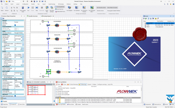
Flownex Simulation Environment delivers technology that enables you to study how systems will behave in the real world, where fluid is the driving factor. Flownex system simulation relays the overall effect of changing specific properties on components, allowing clients to examine extensively all possible variations of a system in the design and optimization of systems.
Flownex Simulation Environment provides turbomachinery engineers with an easy to use, off-the-shelf tool for modelling combustion chambers, secondary air systems, blade cooling flows, lubrication systems with oil-air mixtures, as well as overall cycle integration and operation.
Blade Cooling
By coupling 1D flow Flownex models with 3D heat transfer models in ANSYS Mechanical or CFX, a detailed turbine blade cooling simulation can be conducted. Flownex contains industry-standard pressure drop and heat transfer correlations for typical turbine blade features such as turbulator strips and pedestals. This allows designers to rapidly see the effects of their design changes on the maximum blade temperatures and cooling airflow rate.
COMBUSTION CHAMBER
Preliminary combustor design requires that an extensive number of geometrical and operational conditions be evaluated and compared. Especially during this phase, Flownex is an essential tool for combustor design engineers as it accurately captures important parameters such as the mass flow rate distribution through air admission holes, associated pressure losses as well as liner wall temperatures. Networks can be easily configured and solved within a few seconds. This result in substantial development cost savings because of the reduction in the number of detailed 3D simulations and rig tests required. A further advantage is the ability to use the Flownex results as boundary conditions for subsequent localized 3D models.
LUBRICATION SYSTEM
The primary use of Flownex in lubrication systems is used to determine optimum drain line sizes given the limited space inside the engine. This requires two-phase pressure drop calculations in lines with oil-air mixtures. In parallel with this engineers can determine whether or not scavenge pumps are required for fluid transportation in the drain lines and, if so, what the pumping requirement will be.
SECONDARY & COOLANT FLOW
Flownex includes a comprehensive rotating component library for analysing the secondary air system of a gas turbine engine. This enables engineers to quantify the bleed air consumption and flow distribution through the entire system. Furthermore, coupling Flownex with Ansys Mechanical enables engineers to perform detailed thermal studies of critical rotating components. Flownex includes:
- Real gas models.
- Windage power calculation.
- Choking calculations.
- User-defined HTCs.
Release notes |
| |
 Читать статью дальше (комментариев - 1)
| |
|
 |
| ПОИСК ПО САЙТУ |
 |
|
 |
| КАЛЕНДАРЬ | | |
 |
| « Октябрь 2025 » |
|---|
| Пн | Вт | Ср | Чт | Пт | Сб | Вс |
|---|
| | 1 | 2 | 3 | 4 | 5 | | 6 | 7 | 8 | 9 | 10 | 11 | 12 | | 13 | 14 | 15 | 16 | 17 | 18 | 19 | | 20 | 21 | 22 | 23 | 24 | 25 | 26 | | 27 | 28 | 29 | 30 | 31 | |
|
 | |
| |
|