|
 |
 Автор: Williams Автор: Williams
 Дата: 5 мая 2024 Дата: 5 мая 2024
 Просмотров: 209 Просмотров: 209 |
| |
JSOL Corporation JMAG-Designer v23.1
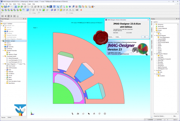 JMAG is a simulation software used to develop and design electric devices. JMAG was originally released in 1983 as a tool to support the design of devices such as motors, actuators, circuit components, and antennas. JMAG is a simulation software used to develop and design electric devices. JMAG was originally released in 1983 as a tool to support the design of devices such as motors, actuators, circuit components, and antennas.
JMAG incorporates simulation technology to accurately analyze a wide range of physical phenomena that include complicated geometry, various material properties, structure at the center of electromagnetic fields and thermal properties. JMAG has an interface capable of linking to third-party software and a portion of the JMAG analysis functions can also be executed from many of the major CAD and CAE systems.
JMAG is actively used to analyze designs at a system level that includes drive circuits by utilizing links to power electronic simulators. Engineers use JMAG for the development of drive motors for electric vehicles.
More info |
| |
 Читать статью дальше (комментариев - 1)
| |
|
 |
 Автор: Williams Автор: Williams
 Дата: 4 мая 2024 Дата: 4 мая 2024
 Просмотров: 994 Просмотров: 994 |
| |
nanoSoft nanoCAD BIM Водопровод Канализация 2024 v24.0
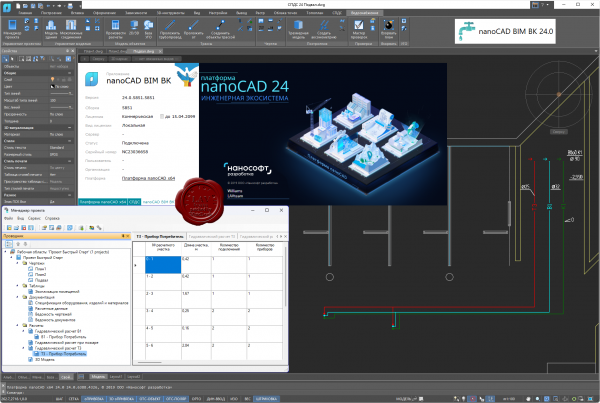
nanoCAD BIM Водопровод Канализация - BIM/ТИМ-решение на платформе nanoCAD для проектирования и расчета моделей внутренних систем водоснабжения, канализации и пожаротушения.
Задачи
- Проектирование систем водоснабжения и канализации.
- Проектирование автоматических систем пожаротушения.
- Автоматическая и ручная расстановка оборудования.
- Автоматические расчеты модели и оборудования.
- Автоматическое формирование отчетов и спецификаций.
- Автоматические проверки модели на корректность ее построения.
Преимущества
- Расчет и оформление документации по российским стандартам. Оформление документации по требованиям российских нормативных документов. Строгое соответствие расчетов указаниям СП 30.13330.2020 и СП 485.1311500.2020, автоматический подбор арматуры, приборов, диаметра труб.
- Работа с базами данных производителей оборудования. Базы моделей оборудования включают трубопроводы и фитинги к ним, запорную арматуру, сантехнические приборы, спецоборудование. Все базы открыты для редактирования и пополнения.
- Корректная взаимосвязь 3D-моделей и 2D-чертежей. Функционал программы позволяет автоматически получить корректную 3D-модель по 2D-чертежам, не прибегая к дополнительной ручной доработке модели.
- Автоматическое формирование отчетных документов. Формирование широкого перечня проектных документов (планы расположения оборудования и прокладки трубопроводов, аксонометрические схемы, гидравлические отчеты, спецификация и т.д.)
Ключевые возможности
- Гидравлический расчет водоснабжения и канализации. Соответствие требованиям СНиП 2.04.01-85*, СП 30.13330.2012, СП 30.13330.16 и СП 30.13330.2020. При проведении расчета программа просчитывает трехмерную модель систем, вычисляет среднюю скорость воды и гидравлического уклона. На основе этих расчетов осуществляется подбор арматуры, приборов, диаметра труб и формируется отчет по каждой системе.
- Расчет противопожарного водопровода. Соответствие требованиям СНиП 2.04.01-85*, СП 30.13330.2012, СП 30.13330.16 и СП 30.13330.2020 как противопожарного водопровода, так и хозяйственно-питьевого с подключенными ПК. Расход воды на пожарные краны определяется по таблице СП 10.13130.2020. Программа самостоятельно подбирает диаметр и арматуру для противопожарного водопровода. Также формируется гидравлический отчет.
- Расчет установки водяного спринклерного и дренчерного пожаротушения. Поддерживается выполнение расчета как по отдельности, так и совмещенного с системой внутреннего противопожарного водопровода согласно СП 485.1311500.2020. Существует возможность настраивать характеристики помещений или зон пожаротушения, выполнять расчеты тупиковых и кольцевых систем, выводить отчет по спринклерам для каждого помещения.
|
| |
 Читать статью дальше (комментариев - 6)
| |
|
 |
 Автор: Williams Автор: Williams
 Дата: 3 мая 2024 Дата: 3 мая 2024
 Просмотров: 316 Просмотров: 316 |
| |
Flownex Simulation Environment 2024 v8.16.0.5519
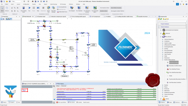
Flownex Simulation Environment delivers technology that enables you to study how systems will behave in the real world, where fluid is the driving factor. Flownex system simulation relays the overall effect of changing specific properties on components, allowing clients to examine extensively all possible variations of a system in the design and optimization of systems.
Flownex Simulation Environment provides turbomachinery engineers with an easy to use, off-the-shelf tool for modelling combustion chambers, secondary air systems, blade cooling flows, lubrication systems with oil-air mixtures, as well as overall cycle integration and operation.
Blade Cooling
By coupling 1D flow Flownex models with 3D heat transfer models in ANSYS Mechanical or CFX, a detailed turbine blade cooling simulation can be conducted. Flownex contains industry-standard pressure drop and heat transfer correlations for typical turbine blade features such as turbulator strips and pedestals. This allows designers to rapidly see the effects of their design changes on the maximum blade temperatures and cooling airflow rate.
COMBUSTION CHAMBER
Preliminary combustor design requires that an extensive number of geometrical and operational conditions be evaluated and compared. Especially during this phase, Flownex is an essential tool for combustor design engineers as it accurately captures important parameters such as the mass flow rate distribution through air admission holes, associated pressure losses as well as liner wall temperatures. Networks can be easily configured and solved within a few seconds. This result in substantial development cost savings because of the reduction in the number of detailed 3D simulations and rig tests required. A further advantage is the ability to use the Flownex results as boundary conditions for subsequent localized 3D models.
LUBRICATION SYSTEM
The primary use of Flownex in lubrication systems is used to determine optimum drain line sizes given the limited space inside the engine. This requires two-phase pressure drop calculations in lines with oil-air mixtures. In parallel with this engineers can determine whether or not scavenge pumps are required for fluid transportation in the drain lines and, if so, what the pumping requirement will be.
SECONDARY & COOLANT FLOW
Flownex includes a comprehensive rotating component library for analysing the secondary air system of a gas turbine engine. This enables engineers to quantify the bleed air consumption and flow distribution through the entire system. Furthermore, coupling Flownex with Ansys Mechanical enables engineers to perform detailed thermal studies of critical rotating components. Flownex includes:
- Real gas models.
- Windage power calculation.
- Choking calculations.
- User-defined HTCs.
Release notes |
| |
 Читать статью дальше (комментариев - 0)
| |
|
 |
 Автор: Williams Автор: Williams
 Дата: 2 мая 2024 Дата: 2 мая 2024
 Просмотров: 542 Просмотров: 542 |
| |
Lindo What'sBest! v19.0.1.1 x64
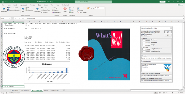
What'sBest! is an add-in to Excel that allows you to build large scale optimization models in a free form layout within a spreadsheet. What'sBest! combines the proven power of Linear, Nonlinear (convex and nonconvex/Global), Quadratic, Quadratically Constrained, Second Order Cone, Semi-Definite, Stochastic, and Integer optimization with Microsoft Excel -- the most popular and flexible business modeling environment in use today. The recently released What'sBest! 15.0 includes a number of significant enhancements and new features.
Enhancements to the Simplex solvers boost performance on linear models. Large models solve an average of 20% faster using primal simplex and 15% faster for dual simplex.
New symmetry detection capabilities dramatically reduce the time required to prove optimality on certain classes of models with integer variables. Performance has been improved on Markowitz portfolio problems with minimum buy quantities, and/or limit on number of instruments at nonzero level. Other enhancements provide faster solutions on certain task assignment-like models.
Stability and robustness of the Global solver has been improved through several enhancements to quadratic recognition and range reduction. Improved exploitation of convexity of certain ratio constraints, e.g., as found in heat exchanger network design problems.
Several new functions and constraint types are recognized, e.g., the =WBALLDIFF() All Different constraint, for general integer variables. The =WBALLDIFF() function allows one to specify a set of integer variables, such that each variable in the set must have a unique value, different from all other variables in the set. |
| |
 Читать статью дальше (комментариев - 9)
| |
|
 |
 Автор: Williams Автор: Williams
 Дата: 30 апреля 2024 Дата: 30 апреля 2024
 Просмотров: 1 131 Просмотров: 1 131 |
| |
nanoSoft nanoCAD BIM Отопление 2024 v24.0
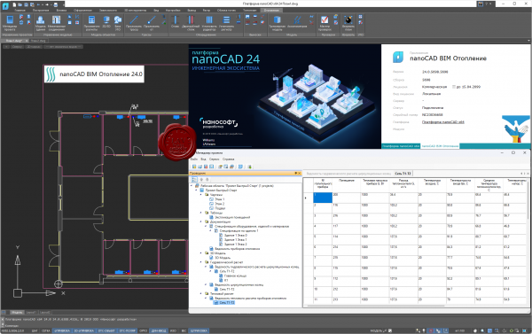
nanoCAD BIM Отопление - BIM/ТИМ-решение на Платформе nanoCAD для проектирования и расчета моделей систем отопления зданий и сооружений.
Задачи:
- Проектирование систем отопления.
- Автоматизация прокладки двухтрубной системы.
- Автоматические расчеты модели и оборудования.
- Автоматическая генерация аксонометрических схем.
- Автоматическое формирование отчетов и спецификаций.
- Автоматические проверки модели на корректность ее построения.
Преимущества продукта:
- Оформление документации по российским нормативным документам. Строгое соответствие требованиям СП 60.13330.2020, гидравлический и тепловой расчет с подбором арматуры, отопительных приборов, диаметра труб.
- Базы моделей оборудования включают трубопроводы, запорную арматуру, отопительные приборы, спецоборудование. Все базы открыты для редактирования и пополнения.
- Функционал программы позволяет автоматически получить корректную 3D-модель по 2D-чертежам, не прибегая к дополнительной ручной доработке модели.
- Автоматически формируется широкий спектр проектных документов: планы расположения оборудования и прокладки трубопроводов, аксонометрические схемы, гидравлические и тепловые отчеты, спецификация и т.д.
Ключевые возможности:
- Гидравлический расчет системы отопления. Соответствие требованиям СП 60.13330.2020. При выполнении расчета программа просчитывает трехмерную модель системы, вычисляет скорости движения, потери давления в трубах и на местных сопротивлениях. По результатам этих расчетов осуществляется подбор арматуры, приборов, диаметра труб и формируется отчет по каждой системе.
- Тепловой расчет системы отопления. Соответствие требованиям СП 60.13330.2020. При выполнении расчета программа анализирует параметры каждого участка сети. На участках производится расчет тепловой нагрузки, расхода теплоносителя. По результатам расчета осуществляется подбор числа секций радиаторов и формируется тепловой отчет по каждой системе.
- Автоматическое создание аксонометрических схем. Программа nanoCAD BIM Отопление автоматически формирует аксонометрическую схему, тогда как подавляющее большинство зарубежных решений создает изометрию, не предусмотренную ГОСТ. Все табличные формы отвечают требованиям ГОСТ 21.602-2016 и ГОСТ 21.110-2013, а основная надпись на чертежах – ГОСТ Р 21.101-2020.
|
| |
 Читать статью дальше (комментариев - 6)
| |
|
 |
 Автор: Williams Автор: Williams
 Дата: 29 апреля 2024 Дата: 29 апреля 2024
 Просмотров: 2 370 Просмотров: 2 370 |
| |
САПРОТОН NormCAD v11.12.2 x32+x64
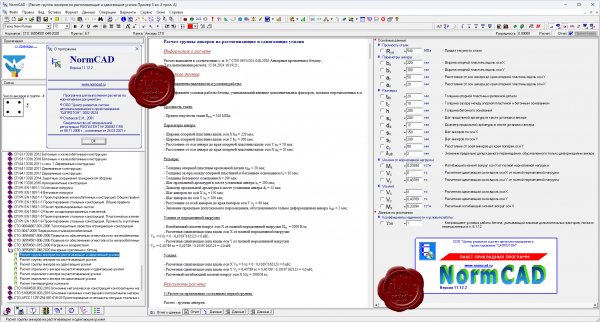
NormCAD выполняет расчеты строительных конструкций по СНиП и готовит проектную документацию для представления заказчику и в органы экспертизы:
- расчет стальных конструкций (расчет балок, колонн сплошного и составного сечения, профнастила и узлов ферм из гнутых профилей);
- расчет железобетонных конструкций (расчет балок, колонн, стен и плит: подбор арматуры, проверка сечений - в т.ч. тавровых и двутавровых, косое внецентренное сжатие, расчет круглых колонн и колонн с распределенной арматурой, трещиностойкость, проверка прогиба, расчет на смятие и продавливание);
- расчет каменных и армокаменных конструкций (проверка сечений - прямоугольных и тавровых на центральное и внецентренное сжатие, растяжение, срез, трещиностойкость и смятие);
- расчет фундаментов;
- теплотехнический расчет (сопротивление теплопередаче и паропроницанию стен, покрытий, перекрытий и светопрозрачных конструкций);
- другие строительные и машиностроительные расчеты.
Главное преимущество - на сегодня это единственная программа, в которой расчет оформляется в виде текстового документа (в формате Word), подобному созданному опытным конструктором вручную, что позволяет легко проконтролировать любую часть расчета.
О новом в версии 11.12.2 тут |
| |
 Читать статью дальше (комментариев - 16)
| |
|
 |
 Автор: Williams Автор: Williams
 Дата: 27 апреля 2024 Дата: 27 апреля 2024
 Просмотров: 2 899 Просмотров: 2 899 |
| |
Bentley Seequent PLAXIS 2D / 3D Ultimate 24.01.00.1060 - online installers
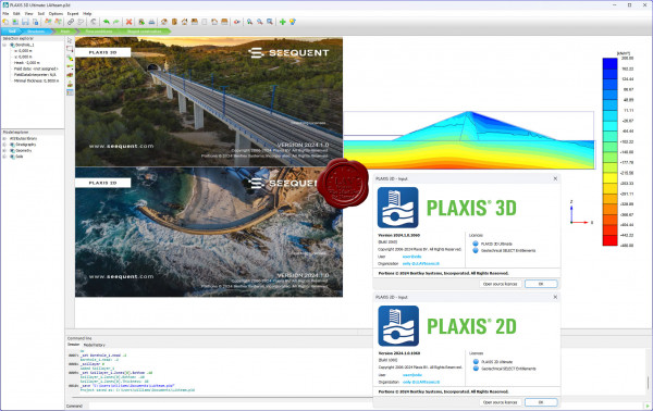 PLAXIS - программная система, основанная на методе конечных-элементов, используемая для решения задач инженерной геотехники, проектирования и инженерной геологии. Представляет собой пакет вычислительных программ для конечно-элементного расчёта напряжённо-деформированного состояния сооружений, фундаментов и оснований. PLAXIS - программная система, основанная на методе конечных-элементов, используемая для решения задач инженерной геотехники, проектирования и инженерной геологии. Представляет собой пакет вычислительных программ для конечно-элементного расчёта напряжённо-деформированного состояния сооружений, фундаментов и оснований.
PLAXIS 2D. Выполняйте геотехнический 2D анализ деформаций и устойчивости с помощью PLAXIS 2D WorkSuite, мощного пакета инструментов для анализа методом конечных элементов и предельного равновесия, который включает специализированный функционал для анализа вибраций, грунтовых вод и теплового потока.
PLAXIS 3D. Выполняйте 3D анализ деформаций и устойчивости в своем следующем геотехническом проекте с использованием PLAXIS 3D WorkSuite. Он представляет собой пакет для анализа методом конечных элементов и предельного равновесия, который включает в себя специализированный функционал для анализа вибраций и грунтовых вод. |
| |
 Читать статью дальше (комментариев - 12)
| |
|
 |
 Автор: Williams Автор: Williams
 Дата: 26 апреля 2024 Дата: 26 апреля 2024
 Просмотров: 452 Просмотров: 452 |
| |
LimitState RING v4.0.6.30301
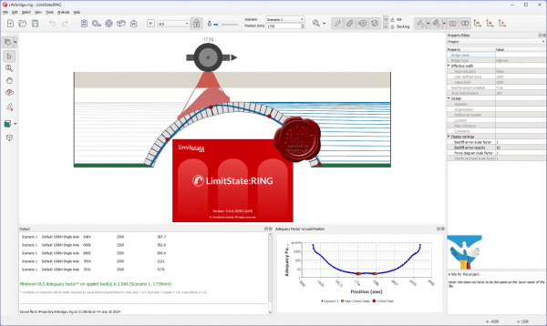
LimitState RING is the popular software product for the analysis of masonry arch bridges - designed from the ground up with the needs of professional engineers in mind:
- Modern, intuitive user interface.
- Multi-ring, multi-span analysis (no need to balance thrusts).
- Use a wide range of built-in and user-defined arch profiles.
- Include local defects such as mortar loss and weak masonry.
- Undertake support settlement analyses.
- View moment, shear and normal force diagrams.
- Allocate separate properties to nearsurface and deep fill.
- Model reinforcement.
LimitState RING uses rigorous mathematical optimization to directly identify a wide range of potential modes of response, including those involving:
- Hinging and/or masonry failure.
- Radial sliding.
- Ring separation.
- Single or multi-spans.
- Support movement.
|
| |
 Читать статью дальше (комментариев - 3)
| |
|
 |
 Автор: Williams Автор: Williams
 Дата: 25 апреля 2024 Дата: 25 апреля 2024
 Просмотров: 2 010 Просмотров: 2 010 |
| |
nanoSoft nanoCAD Suite 2024 v24.0 Multilingual
(English, French, German, Korean, Spanish)
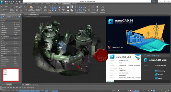
nanoCAD is a modern computer-aided design (CAD) platform that provides designers with powerful capabilities in 2D drafting and 3D modeling. nanoCAD can be used on its own as a cost-effective DWG-editor, or customized with essential modules: Construction, Mechanica, Raster, Topoplan and 3D Solid Modeling.
More info |
| |
 Читать статью дальше (комментариев - 15)
| |
|
 |
| ПОИСК ПО САЙТУ |
 |
|
 |
| КАЛЕНДАРЬ | | |
 |
| « Октябрь 2025 » |
|---|
| Пн | Вт | Ср | Чт | Пт | Сб | Вс |
|---|
| | 1 | 2 | 3 | 4 | 5 | | 6 | 7 | 8 | 9 | 10 | 11 | 12 | | 13 | 14 | 15 | 16 | 17 | 18 | 19 | | 20 | 21 | 22 | 23 | 24 | 25 | 26 | | 27 | 28 | 29 | 30 | 31 | |
|
 | |
| |
|