|
 |
 Автор: Williams Автор: Williams
 Дата: 24 июня 2019 Дата: 24 июня 2019
 Просмотров: 2 144 Просмотров: 2 144 |
| |
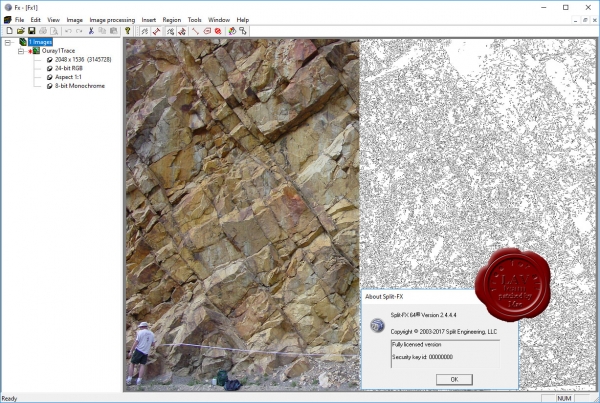
Split Engineering Split-FX v2.4.4.4 x64

The Split-FX software allows rock mass site characterization to be carried out in a safe and timely manner. Split-FX is a software package to process three dimensional point cloud data from LIDAR scans and photogrammetry. Quickly and easily generate detailed information regarding:
- Cell Mapping and pre-rock blast conditions, including in-situ block size and joint spacing.
- Cross sections analysis for slope instability, rockfall modeling and accurate measurement of burden.
- Change detection for rockfall and ground movement.
The results of a field survey can be automatically processed with the Split-FX software, resulting in three-dimensional information about the rock mass, including stereonets of fracture orientation and distributions of fracture size and roughness estimation. From start to finish, you can accurately characterize the fracturing at a field site in less time than it takes to make a few strike and dip measurements manually.
As opposed to traditional rock characterization where measurements on the face are required, LIDAR scanning and analysis can be conducted at significant distances from the rock face. This allows rock mass characterization to be carried out in situations where access to the face is not possible due to safety or other concerns. Also, the Split-FX software can produce a database of thousands of fractures for a rock site in less time than just a few fractures could be characterized using traditional techniques. Finally, the Split-FX software eliminates human bias by automating the process of collecting and processing rock mass data.
The software can view and edit point clouds, view digital images, create triangulated meshes, register point clouds and perform general point cloud measurements of distance, area and volume.
|
| |
 Читать статью дальше (комментариев - 5)
| |
|
 |
 Автор: Williams Автор: Williams
 Дата: 22 июня 2019 Дата: 22 июня 2019
 Просмотров: 1 871 Просмотров: 1 871 |
| |
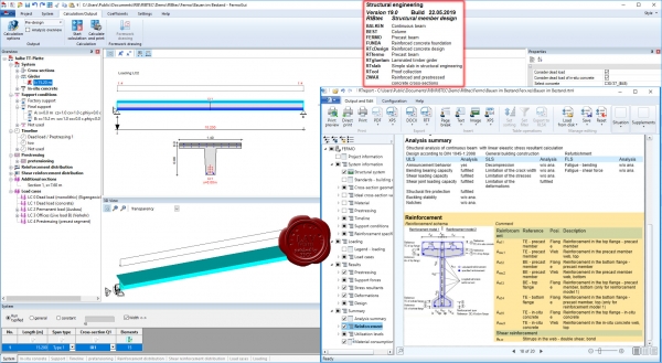
RIBtec v19.0 build 22.05.2019

RIBtec is an integrated software which allows structural member design and CAD/ FEM-applications at the same time for structural and soil engineering as well as for sophisticated tunnel and bridge constructions. A wide range of multi-purpose tools are available which cover routine work as well as challenging engineering tasks in the high-end range. RIBtec includes all structural engineering tools. An object oriented, context sensitive functionality under Windows is the base for excellent comfort in application and high security in usage. All applications have the background of more than 45 years of software development in the area of structural and geotechnical analysis, design and construction. The available engineering tools are supplemented by an overall office- and project-management application.
|
| |
 Читать статью дальше (комментариев - 12)
| |
|
 |
 Автор: Williams Автор: Williams
 Дата: 17 июня 2019 Дата: 17 июня 2019
 Просмотров: 647 Просмотров: 647 |
| |
Howden Group (ex. Chasm Consulting) VentSim Design Premium v5.1.4.5
As part of Howden’s strategy to become the world’s leading provider of mine ventilation solutions, we are pleased to announce the acquisition of Chasm Consulting and its world leading products Ventsim/PumpSim. Providing industry-leading 3D design and simulation capability, the Ventsim/PumpSim software is widely used among the global mine ventilation community. Howden will now offer a full suite of solutions for mine ventilation, from modelling and design software to full turnkey projects including main and auxiliary fans, instrumentation, automation and Ventilation on Demand via the Simsmart product line.
Ventsim was originally introduced to mining operations in 1994 to help visually design, improve and optimize underground ventilation systems. It is now licensed to over 1000 mine sites, consultants, universities, governments and research agencies around the world. The new Ventsim Visual ventilation software was released in 2009 and offers a graphically rich and dynamic ventilation environment with many more features than the original Ventsim Classic. Ventsim Visual is available in three versions: Standard, Advanced and Premium.
Ventsim Visual Standard is a lower cost version based on incompressible flow simulation routines and includes dynamic animated 3D graphics showing real airway dimensions and shapes together with animated air flows. Colours show over 30 different data types including airflow, velocities, various pressures and costs. In addition, the Standard version comes with contaminant spread routines to help predict steady state flow of gases, dust, fumes and smoke.
Ventsim Visual Advanced uses advanced compressible flow modelling, including automatic density and fan curve adjustment, automatic natural ventilation simulation and prediction of temperatures and humidity due to rock strata, auto compression, diesel equipment and electric motors.
Ventsim Visual Premium includes all features of Ventsim Visual Advanced as well as VentFIRE fire simulation, VentLog ventilation survey record software, and the optional LiveView remote data connection and display module. |
| |
 Читать статью дальше (комментариев - 3)
| |
|
 |
 Автор: Williams Автор: Williams
 Дата: 12 июня 2019 Дата: 12 июня 2019
 Просмотров: 8 336 Просмотров: 8 336 |
| |
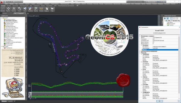
ГЕОНИКА CSoft GeoniCS 2015 v15.0.6.22 x64

GeoniCS - отечественная технологическая линия на платформах AutoCAD и nanoCAD для обработки данных геодезических и инженерно-геологических изысканий, создания и ведения геоинформационного ресурса территории и промобъектов, геоинженерного проектирования в области гражданского, промышленного и транспортного строительства.
Модуль «Топоплан» - это ядро программы, позволяющее создавать топографические планы, вести базу точек съемки проекта, строить трехмерную модель рельефа и проводить анализ полученной поверхности. На основе построенной модели рельефа программа позволяет решать целый ряд прикладных задач.
Модуль «Генплан» используется при проектировании промышленных объектов различного назначения, а также объектов гражданского строительства. Модуль обеспечивает полное соответствие требованиям ГОСТ 21.508–93 «Правила выполнения рабочей документации генеральных планов предприятий, сооружений и жилищно-гражданских объектов».
Модуль «Сети» позволяет проектировать внешние инженерные сети и оформлять необходимые выходные документы.
Модуль «Трассы» позволяет проектировать линейно-протяженные объекты и оформлять необходимые выходные документы.
Модуль «Сечения» позволяет получить черные сечения и спроектировать красные. Оформление сечений (поперечников) присутствует в полной мере. Далее возможно создание 3D модели – коридора.
Модуль «Геомодель» предназначен для оформление данных геологических исследований и построение 3D модели для геологии.
|
| |
 Читать статью дальше (комментариев - 24)
| |
|
 |
 Автор: Williams Автор: Williams
 Дата: 10 июня 2019 Дата: 10 июня 2019
 Просмотров: 8 767 Просмотров: 8 767 |
| |
Dassault Systemes GEOVIA (ex. Gemcom) Surpac v6.7.4 x64
Gemcom Surpac является ведущей программой для геологоразведочных и горнодобывающих предприятий. Графический интерфейс разработан на языке Java. Используя передовую структуру обработки информации, Gemcom Surpac дает возможность работать с данными других программных продуктов и объектами, созданными при помощи большинства горно-геологических и геоинформационных программ.
Геологический модуль
Основой геологического модуля является база данных по разведочным выработкам. Геологический модуль предоставляет пользователю следующие возможности:
- ввод данных из журналов разведочного бурения;
- редактирование геологических данных по скважинам, пополнение базы данных результатами лабораторных анализов;
- интеграция данных по скважинам с графическими построениями;
- манипуляция с данными по геологоразведочным скважинам (простые и сложные пересчеты, композирование данных и т.д.);
- обработка данных методом классического статистического анализа геологоразведочной информации (по данным опробования) с выводом на печать графиков гистограмм, таблиц и результатов их анализа;
- полный геостатистический анализ любых трехмерных данных, включая расчет и моделирование вариограмм, карт вариаций изменчивости и оценку пространственной анизотропии минерализации;
- подсчет запасов различными методами (методом геологических разрезов в пределах объемных моделей, с использование блочных моделей, и т.д.);
- редактирование и модернизация графической и математической геологической модели.
Модуль обработки маркшейдерских данных и БВР
Данный модуль предоставляет пользователю следующие возможности:
- обработка данных ручной маркшейдерской съемки (теодолитный ход и др.);
- ввод и обработка данных цифровых маркшейдерских приборов;
- построение фактических контуров отработки по данным маркшейдерских съемок;
- генерация производственных отчетов;
- визуализация горных работ, выдача графической документации;
- проектирование сетей взрывных скважин, включая оконтуривающие наклонные скважины, автонумерация скважин, загрузка их в базу данных.
Объемное и блочное моделирование
Данный модуль предоставляет пользователю следующие возможности:
- возможность построения триангуляционных моделей любых объектов и поверхностей;
- наличие развитых инструментов создания параллельных сечений и пересекающихся полилиний в каркасных моделях, а также инструментов редактирования (сложение, вычитание, пересечение, изменение триангуляционной сети);
- построение и модернизация блочных моделей с заданным размером элементарных блоков и интерполяций содержаний в элементарных блоках моделей.
Модуль оптимизации и планирования
Данный модуль предоставляет пользователю следующие возможности:
- возможность разработки перспективного плана ведения открытых горных работ, создания отчетных документов;
- возможность решения задач оптимизации конечных контуров карьера, этапов его отработки и календарного плана горного предприятия;
- возможность детального проектирования карьера;
- возможность разработки и корректировки оперативного плана ведения открытых горных работ с использованием имитационного моделирования работы транспортно-погрузочных комплексов;
- визуализация плана горных работ, выдача графической документации;
- интеграция модуля планирования горных работ с модулями обслуживания горного оборудования, материально-технического снабжения, финансовым модулем;
- возможность создания и поддержки сетки технологических (пользовательских) координат.
|
| |
 Читать статью дальше (комментариев - 35)
| |
|
 |
 Автор: Williams Автор: Williams
 Дата: 7 июня 2019 Дата: 7 июня 2019
 Просмотров: 2 506 Просмотров: 2 506 |
| |
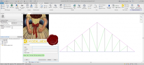
KobiLabs Kobi Toolkit for Revit 2012-2020

Kobi Toolkit are a series of add-in utilities for Autodesk Revit Architecture, Structure and MEP. The tools extend the capabilities of Revit in key areas. They are easy to use and make working in Revit easier.
|
| |
 Читать статью дальше (комментариев - 13)
| |
|
 |
| ПОИСК ПО САЙТУ |
 |
|
 |
| КАЛЕНДАРЬ | | |
 |
| « Октябрь 2025 » |
|---|
| Пн | Вт | Ср | Чт | Пт | Сб | Вс |
|---|
| | 1 | 2 | 3 | 4 | 5 | | 6 | 7 | 8 | 9 | 10 | 11 | 12 | | 13 | 14 | 15 | 16 | 17 | 18 | 19 | | 20 | 21 | 22 | 23 | 24 | 25 | 26 | | 27 | 28 | 29 | 30 | 31 | |
|
 | |
| |
|