|
 |
 Автор: Williams Автор: Williams
 Дата: 20 сентября 2025 Дата: 20 сентября 2025
 Просмотров: 244 Просмотров: 244 |
| |
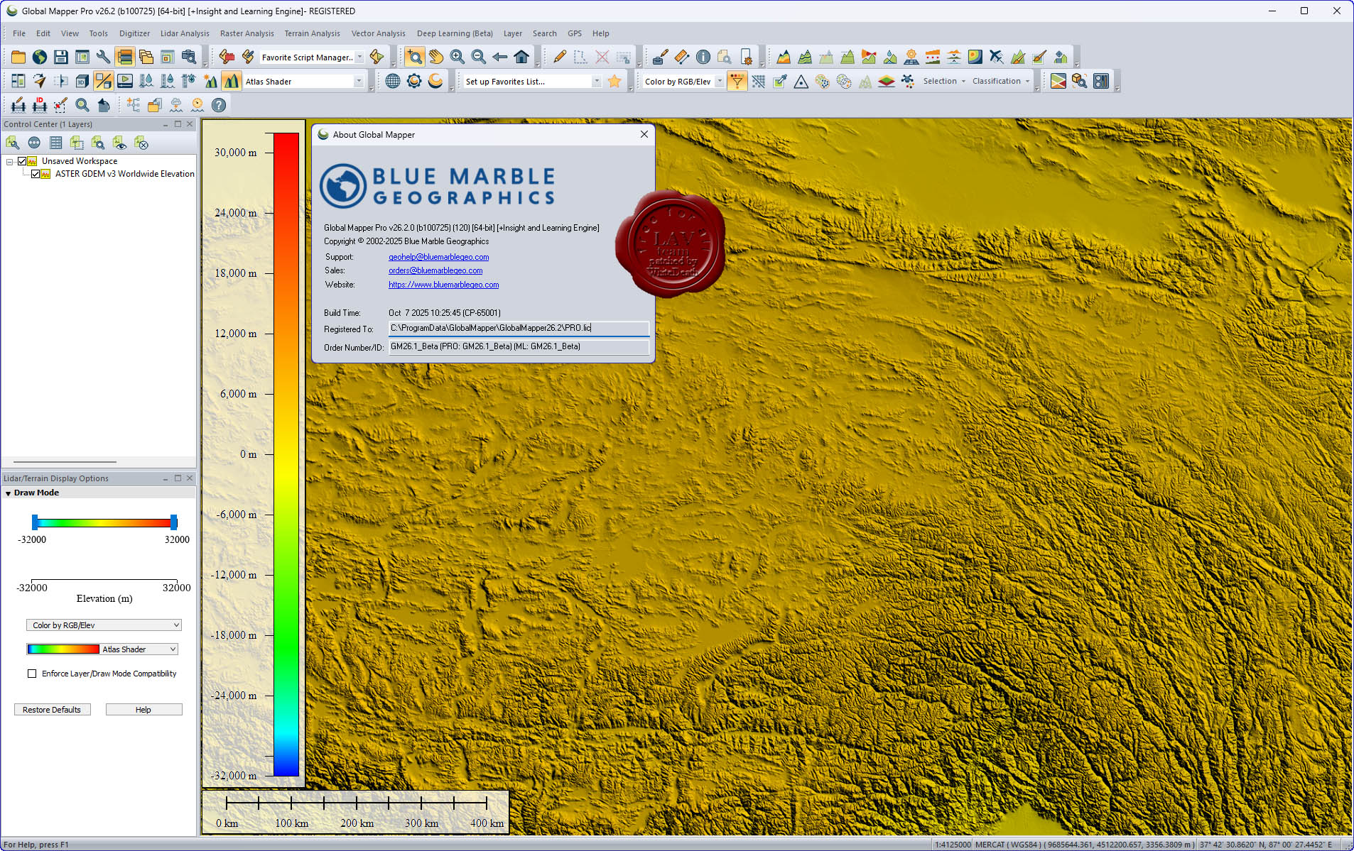
Blue Marble Global Mapper Pro v26.2 build 100725
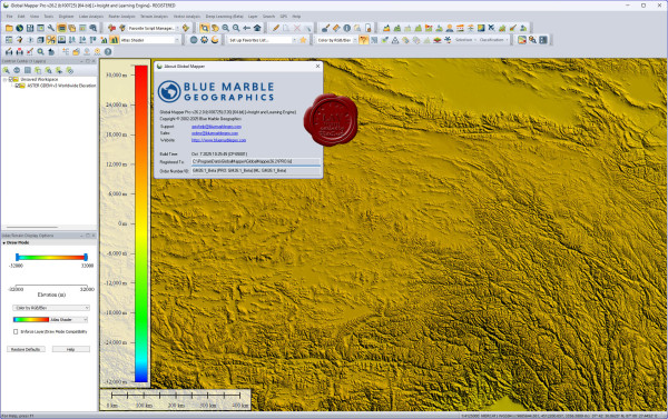
Вышла новая версия программы для просмотра карт и векторных изображений - Global Mapper v26.2
Global Mapper позволяет не только просматривать но и преобразовывать или редактировать, а даже и распечатывать всевозможные карты и векторные наборы данных. Global Mapper позволяет вам загружать ваши данные как слои ( только с условием, что вы работаете в Digital Elevation Model), или же как отсканированную карту, если вам надо изобразить местность в 3D. Есть также хорошая особенность, что позволяет вести работу в реальном времени. Происходит это путем загрузки данных с GPS приемника который подключен к компьютеру.
Global Mapper поддерживает огромнейшее число форматов. Работать с ней легко и просто, интерфейс не перенасыщен различными опциями, вы можете смело работать в ней и не задумываться о том, куда нажать, что бы сделать что - то. |
| |
 Читать статью дальше (комментариев - 2)
| |
|
|
Автор: Williams
Дата: 19 сентября 2025
Просмотров: 219 |
| |
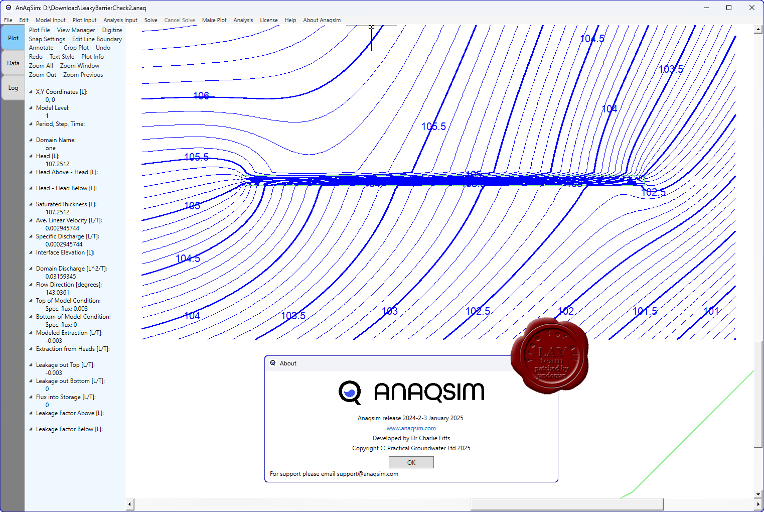
Practical Groundwater (ex. Fitts Geosolutions) AnAqSim 2024.2.3

AnAqSim (Analytic Aquifer Simulator) служит для моделирования подземных вод с использованием аналитического (meshless) подхода.
В отличие от классических численных методов (сетки, элементы, конечные разности и т.д.), AnAqSim основан на аналитическом элемент-методе (Analytic Element Method, AEM), что позволяет моделировать потоки грунтовых вод без необходимости строить сетку по всему пространству модели.
Программа использует субдомены - части модели, внутри которых задаются свои параметры, что облегчает моделирование неоднородных и анизотропных зон.
Поддерживает многослойные модели (аквиферные системы), а также временные (трансцессивные) расчёты (то есть изменение условий с течением времени).
Имеются функции для моделирования солёно-водного взаимодействия (например, пресная–солёная граница) в подходящих условиях.
Существует поддержка работы с анизотропией: можно задавать разные гидравлические проводимости в разных направлениях.
Следует учесть, что как и любой метод, AEM имеет свои предположения и ограничения (например, в ряде случаев точность около сложных границ или нелинейных процессов может быть ограничена). |
| |
Читать статью дальше (комментариев - 0)
| |
|
|
Автор: Williams
Дата: 17 сентября 2025
Просмотров: 350 |
| |
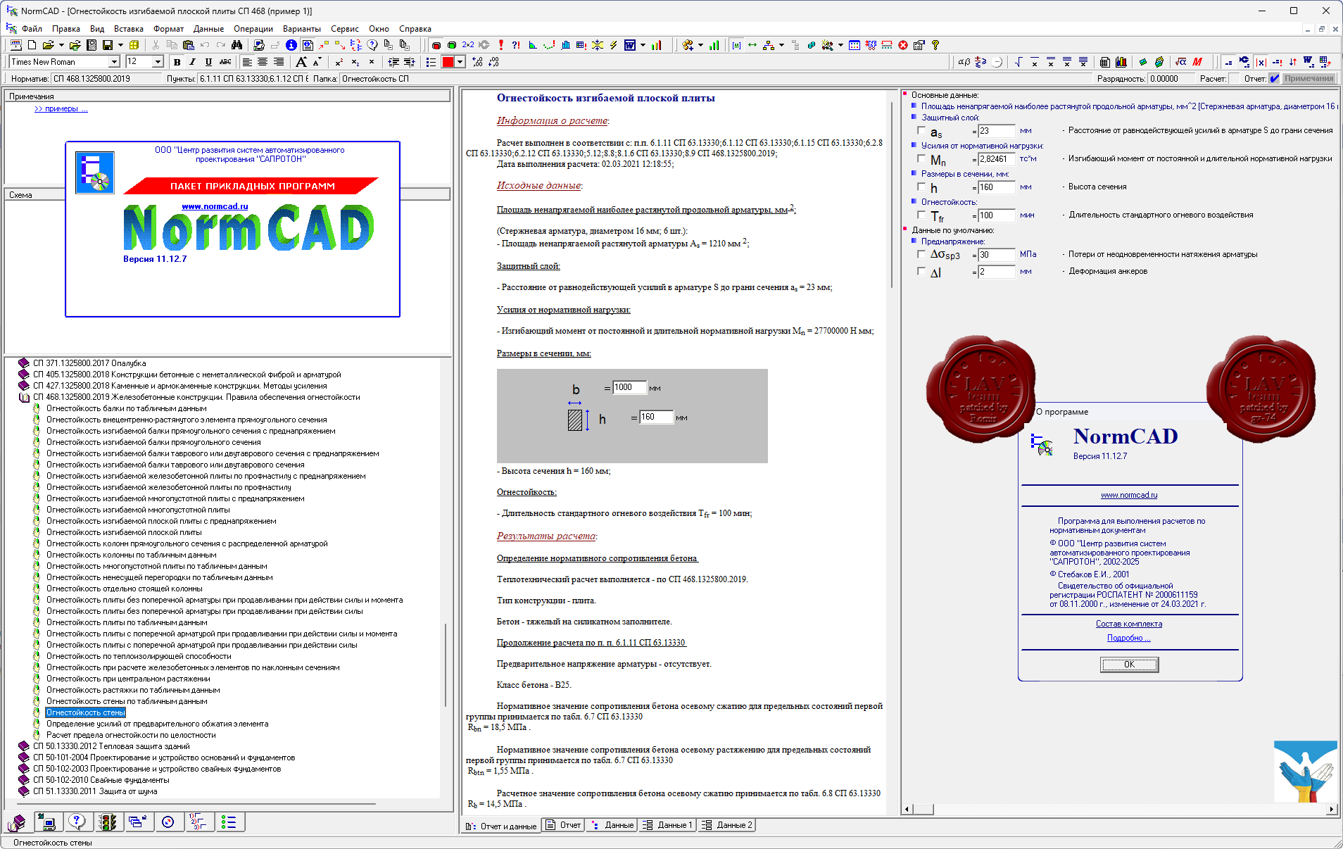
САПРОТОН NormCAD v11.12.7 x32+x64

NormCAD выполняет расчеты строительных конструкций по СНиП и готовит проектную документацию для представления заказчику и в органы экспертизы:
- расчет стальных конструкций (расчет балок, колонн сплошного и составного сечения, профнастила и узлов ферм из гнутых профилей);
- расчет железобетонных конструкций (расчет балок, колонн, стен и плит: подбор арматуры, проверка сечений - в т.ч. тавровых и двутавровых, косое внецентренное сжатие, расчет круглых колонн и колонн с распределенной арматурой, трещиностойкость, проверка прогиба, расчет на смятие и продавливание);
- расчет каменных и армокаменных конструкций (проверка сечений - прямоугольных и тавровых на центральное и внецентренное сжатие, растяжение, срез, трещиностойкость и смятие);
- расчет фундаментов;
- теплотехнический расчет (сопротивление теплопередаче и паропроницанию стен, покрытий, перекрытий и светопрозрачных конструкций);
- другие строительные и машиностроительные расчеты.
Главное преимущество - на сегодня это единственная программа, в которой расчет оформляется в виде текстового документа (в формате Word), подобному созданному опытным конструктором вручную, что позволяет легко проконтролировать любую часть расчета.
О новом в версии 11.12.7 |
| |
Читать статью дальше (комментариев - 5)
| |
|
|
Автор: Williams
Дата: 15 сентября 2025
Просмотров: 283 |
| |
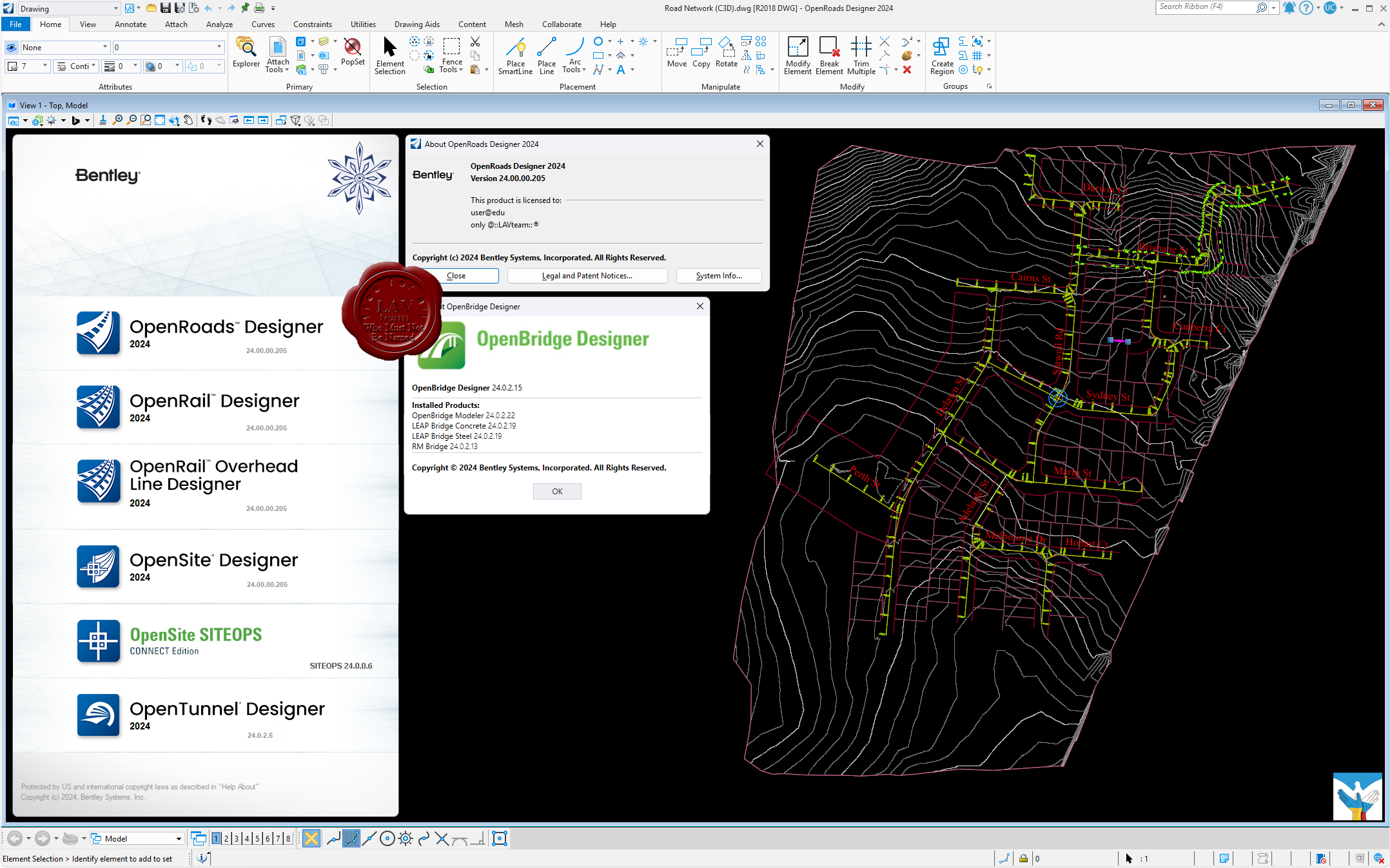
Bentley OpenBridge Designer 2024 24.00.02.015 *new
Bentley OpenRail Designer 2024 24.00.00.205
Bentley OpenRail Overhead Line Designer 2024 24.00.00.205
Bentley OpenRoads Designer 2024 24.00.00.205
Bentley OpenSite Designer 2024 24.00.00.205
Bentley OpenTunnel Designer 2024 24.00.02.006 *new

OpenBridge Designer - полностью интегрированное приложение, которое создает результаты, полученные непосредственно из моделей мостов. Используйте один продукт для создания физических и аналитических моделей на протяжении всего жизненного цикла мостов всех типов.
OpenRail Designer – инновационное приложение для предварительного и рабочего проектирования железнодорожной инфраструктуры любого размера. Это многофункциональное решение, которое позволяет выполнять разнообразные комплексные задачи, такие как проектирование депо/станций, туннелей, моделирование путей, расстановку стрелочных переводов, проектирование контактной сети, проектирование канализационных и ливневых сетей и подземных коммуникаций и создание отчетов. В OpenRail Designer доступна поддержка широкого спектра международных стандартов, обеспечивающих гибкость и контроль, необходимые для работы с реальными сценариями в проектах железнодорожной инфраструктуры по всему миру. Приложение позволяет визуализировать этапы строительства и технического обслуживания железнодорожной инфраструктуры и подходит для работы над проектами легкорельсового транспорта, метро, городских трамваев, высокоскоростных железных дорог и поездов на магнитной подушке.
OpenRail Overhead Line Designer представляет новую комплексную среду моделирования для проектирования железнодорожных подвесных линий и путей. Это ПО, совместно разработанное компаниями Bentley Systems и Siemens Mobility, сочетает в себе технологию OpenRail Designer и возможности Sicat Master. Приложение внедряет 3D-технологии в мир систем подвесных контактных линий, выводя реализацию рабочих процессов за пределы традиционного планирования за счет разработки цифровых двойников, собирающих информацию об активах на протяжении всего их жизненного цикла. Внедрение технологии цифрового двойника позволит значительно сократить время производства строительной документации, включая планировку, отчеты и подробные структурные монтажные схемы.
OpenRoads Designer служит для проектирования автомобильных дорог и в целом дорожной инфраструктуры. Но с некоторых пор программа включает в себя набор функций для подготовки и анализа маркшейдерских работ: расчет объема работ, проектирование бортов карьера по шаблону, создание, редактирование и обновление трехмерных поверхностей, подсчет объемов полезных ископаемых, расчет объема земляных работ, построение профилей и многое другое. OpenRoads Designer создает разбивочные планы, планы организации рельефа, план земляных масс и сводный план сетей, которые возможно оформить в полном соответствии с российскими нормами. Также данное ПО имеет обширный набор функций в части проведения изысканий: работа с многообъемными облаками точек (что очень важно, имея лазерный сканер на предприятии) и проведение над ним – классификации, построения сечений, проецирование элементов на облако точек; а также создание цифровой модели местности, работа с данными тахеометрической съемки, подключение растровых форматов и их редактирование.
OpenSite Designer - единственный правильный выбор для проектирования генплана. Это программное решение включает в себя возможности комплексного детального проектирования для быстрого моделирования и анализа проекта генплана, оптимизации и количественной оценки земляных работ, проектирования дренажных и подземных коммуникаций, а также автоматизированного выпуска проектной документации.
OpenTunnel Designer предназначен для моделирования и проектирования тоннелей и представляет собой инструмент, которые может использоваться специалистами различных дисциплин для облегчения работ по созданию тоннельной инфраструктуры, а также хранения в рамках единого приложения с интуитивным интерфейсом информации, которой могут воспользоваться все сотрудники рабочей группы. OpenTunnel Designer синхронизируется с программными продуктами Seequent для геологического и геотехнического анализа, позволяя сформировать комплексный рабочий процесс и централизованное пространство для работы с данными. |
| |
Читать статью дальше (комментариев - 7)
| |
|
|
Автор: Williams
Дата: 8 сентября 2025
Просмотров: 266 |
| |
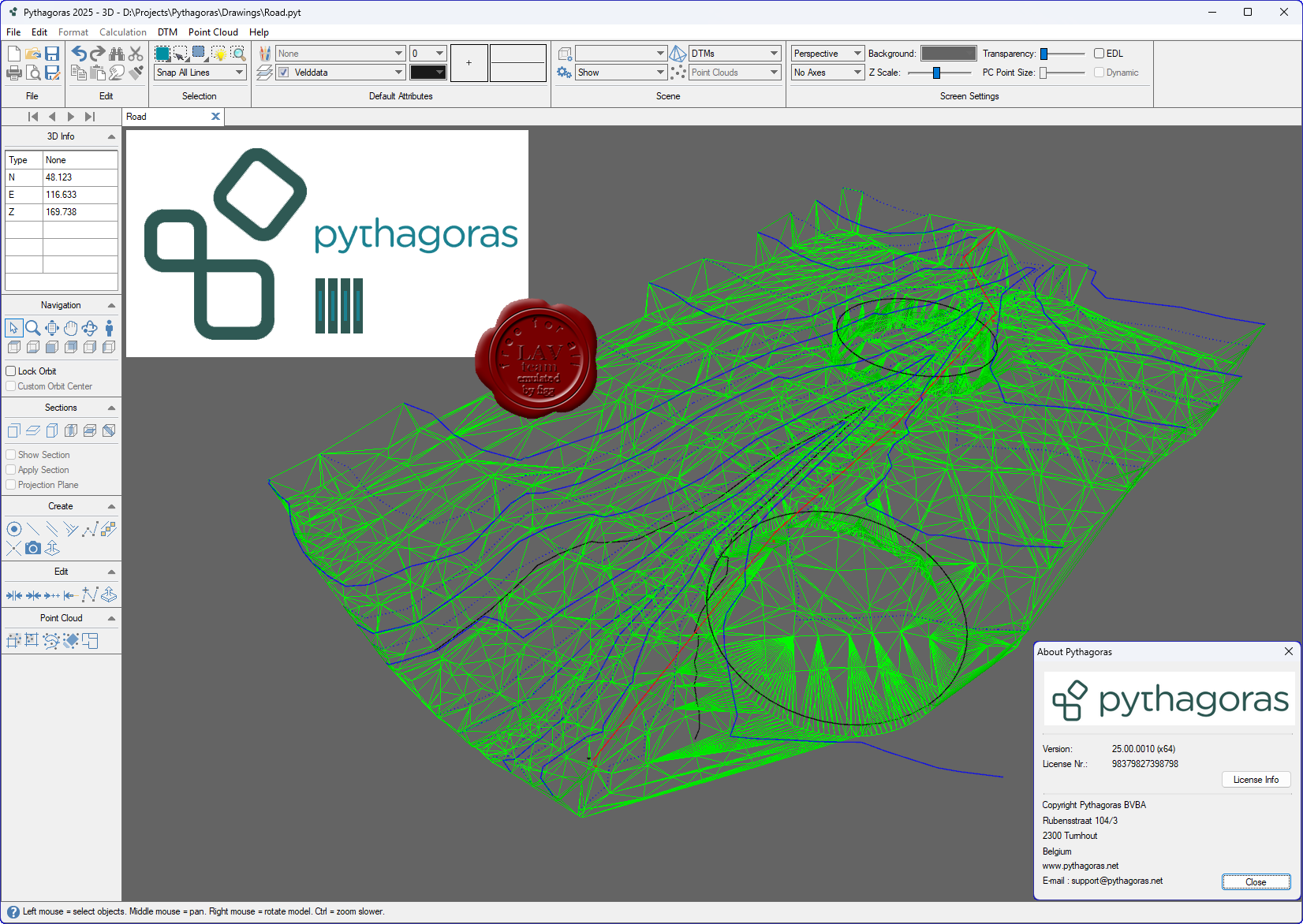
Pythagoras CAD+GIS v25.00.0010

Сегодня для геодезиста доступно множество специальных программ, и часто для начинающего геодеза встает вопрос – с какой программы начать? Следует понимать, что «идеальной» программы вам найти так и не светит. Можно встретить в Интернете утверждения типа «я работаю только в GeoniCS, CREDO, AutoCad» - но это не более, чем частные мнения. Каждая из программ призвана решать определенный спектр задач. То, что подойдет кадастровому инженеру – покажется отстоем топографу-изыскателю или тому, кто работает на стройке.
Поэтому сразу очертим круг задач для Pythagoras CAD:
- Для начинающих. Если вы ранее никогда не сталкивались с геодезическими программами - Pythagoras CAD вам подойдет для обучения, поскольку программа очень проста в освоении, есть подробная инструкция, и Pythagoras CAD решает практически все типовые задачи в области геодезии.
- Для кадастра. Подходит довольно плохо, поскольку не поддерживает основные форматы описания кадастровых участков (для Украины это форматы IN4 и новый XML). Для кадастра советую освоить программу Digitals.
- Для топографа. Подходит. Позволяет быстро отрисовать топоплан в условных знаках, построить горизонтали и т.д. Однако во многих организациях существует стандарт оформления топопланов в той или иной программе. Например в своей работе все полевые планы, абриса и рабочие чертежи я веду в Pythagoras CAD, а при сдаче объекта мне приходиться переводить чертеж под стандарты предприятия (программа на базе AutoCad)
- Для строительного геодезиста. Вариант идеальный, поскольку позволяет вести геодезическую карту объекта со всеми данными (схему обоснования, импортировать генплан, строить исполнительные и д.р.)
- Для маркшейдера. Не подходит абсолютно в силу специфики работы.
|
| |
Читать статью дальше (комментариев - 0)
| |
|
|
Автор: Williams
Дата: 3 сентября 2025
Просмотров: 123 |
| |
Unity Technologies Pixyz Studio 2025.4.2.1
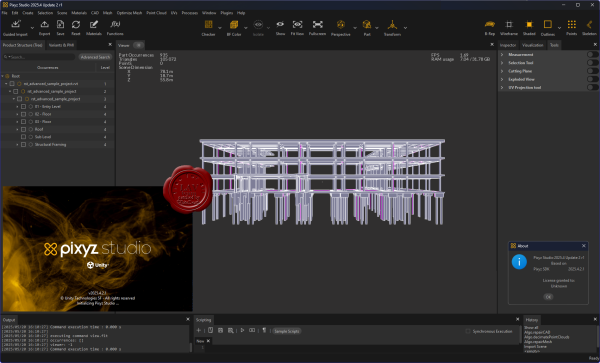 Pixyz Studio is a unique 3D data preparation tool providing the best-in-class tessellation algorithm, enabling the transformation of CAD data from industry-leading solutions (Catia, NX, SolidWorks…) into lightweight, optimized meshes. Pixyz Studio is a unique 3D data preparation tool providing the best-in-class tessellation algorithm, enabling the transformation of CAD data from industry-leading solutions (Catia, NX, SolidWorks…) into lightweight, optimized meshes.
Pixyz Studio’s interactive user interface gives access to a large set of features and algorithms for 3D data optimization. It also embeds a Python API, allowing advanced users to create powerful scripts and plugins, to automate complex data preparation tasks.
Pixyz Studio helps companies leverage their 3D/CAD data, preparing it for Real-time 3D use, and for any visualization scenario. |
| |
Читать статью дальше (комментариев - 3)
| |
|
|
Автор: Williams
Дата: 2 сентября 2025
Просмотров: 138 |
| |
Simio Enterprise 2025 v19.280.48282
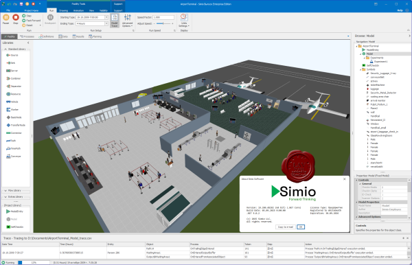
Many simulation packages are built on out-dated 2D technology that limits your ability to visualize your process or capture 3D spatial relationships in your system. Some of these older products limit you to 2D only models, while others offer expensive/complex 3D add-ons that require you to build a separate 3D visualization of your system, and then tie these two separate components together. These extra steps add unnecessary work and time to your project, and make your model and animation difficult to edit and maintain.
In contrast, Simio provides a true object-based 3D modeling environment which lets you construct your 3D model in a single step from a top-down 2D view, and then instantly switch to a 3D view of your system. You simply drag and place your 3D objects from an Object Library into your facility view of the model.
All Simio model-building products directly integrate with Google Warehouse to allow you to quickly download from a massive library of freely available 3D symbols to easily and quickly add realism to your models.
More info |
| |
Читать статью дальше (комментариев - 0)
| |
|
|
Автор: Williams
Дата: 27 августа 2025
Просмотров: 323 |
| |
StruSoft FEM-Design Suite v24.00.004

FEM-Design is an advanced modeling software for finite element analysis and design of load-bearing concrete, steel and timber structures according to Eurocode. The unique user-friendly working environment is based on the familiar CAD tools what makes the model creation and structure editing simple and intuitive. The quick and easy nature of FEM-Design makes it ideal for all types of construction tasks from single element design to global stability analysis of large structures and makes it the best practical tool for structural engineers.
Features:
- The structural model is created easily in 3D with intuitive CAD-tools or imported from BIM-software.
- The finite element mesh is generated and optimized automatically.
- The Auto Design feature helps to choose the most efficient cross-section or reinforcement arrangement.
- Resultant and connection forces in shell elements can be easily assessed.
- Results are shown in a variety of 3D-graphs, contour lines, color palettes or sections.
- Auto-updated project reports can be created from within the built-in FEM-Design documentation editor.
Theory manual
Release notes
Whats new |
| |
Читать статью дальше (комментариев - 4)
| |
|
|
| ПОИСК ПО САЙТУ |
|
|
|
| КАЛЕНДАРЬ | | |
|
| « Октябрь 2025 » |
|---|
| Пн | Вт | Ср | Чт | Пт | Сб | Вс |
|---|
| | 1 | 2 | 3 | 4 | 5 | | 6 | 7 | 8 | 9 | 10 | 11 | 12 | | 13 | 14 | 15 | 16 | 17 | 18 | 19 | | 20 | 21 | 22 | 23 | 24 | 25 | 26 | | 27 | 28 | 29 | 30 | 31 | |
|
| |
| |
|