|
 |
 Автор: Williams Автор: Williams
 Дата: 18 марта 2021 Дата: 18 марта 2021
 Просмотров: 7 183 Просмотров: 7 183 |
| |
ESRI ArcGIS Pro v2.5 FULL ISO ENG/RUS
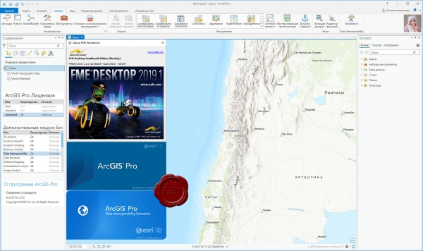
ArcGIS Pro – это новейшее настольное приложение для создания и работы с пространственными данными. В нем есть инструменты для визуализации, анализа, компиляции и публикации данных.
ArcGIS Pro организует ресурсы, используемые в вашей работе, в проекты. В проекте находятся карты, компоновки, слои, таблицы, задания, инструменты и подключения к серверам, базам данных, папкам и стилям. Проекты также включают в себя ресурсы с портала вашей организации или ArcGIS Online.
- Создайте проект или начните работу, открыв шаблон проекта, созданного Esri или другими участниками сообщества.
- Ресурсы можно добавлять из папок, с портала или из ArcGIS Online, указывая их или находя по ключевым словам.
- Убедитесь, что сохранили ваш проект, чтобы он был готов к работе в следующем сеансе работы в ArcGIS Pro.
- Если вы хотите организовать общий доступ к проекту, можно создать шаблоны проектов для использования другими при начале работы или упаковать проект и его данные.
С помощью ArcGIS Pro можно визуализировать как 2D, так и 3D данные.
- Карты отображают 2D-данные, а сцены - 3D. Более подробно о работе с 3D в ArcGIS Pro.
- В одном проекте можно хранить столько карт, сколько необходимо, можно открыть несколько карт сразу и просматривать их одновременно. Связывайте виды], чтобы при перемещении и масштабировании экстент всех карт обновлялся одновременно.
- Быстрая работа с картой возможна благодаря встроенным функциям навигации и горячим клавишам клавиатуры и мыши, с их помощью исследовать данные стало гораздо удобнее.
- Создавайте эффектные карты, применяя надписи, символы и всплывающие окна.
- Для отображения данных в формате, доступном для печати и экспорта, в проекте можно создать компоновки.
Геообработка предоставляет богатый набор инструментов для выполнения пространственного анализа и управления ГИС-данными в автоматическом режиме. Используйте ArcGIS Pro для анализа и управления ГИС-данными, создавайте инструменты для автоматизации рабочего процесса и решения комплексных задач.
- Выбрав подходящий инструмент геообработки, укажите местоположение входного и выходного наборов данных, настройте влияющие на процесс дополнительные параметры и запустите его.
- ArcGIS Pro содержит множество встроенных инструментов, но можно создать свои собственные.\
- Воспользуйтесь ModelBuilder – визуальным конструктором, который позволяет создать блок-схему или модель процессов пространственного анализа или управления данными.
- Автоматизируйте анализ, конвертацию и управление данными, картографирование с помощью библиотек скриптов Python и ArcPy.
- Включайте дополнительные модули для расширения аналитических возможностей, в т.ч. сетевых, пространственных и геостатистических функций.
С помощью ArcGIS Pro можно создавать и редактировать различные виды объектов: города, здания, дороги, леса, реки, горы и любые другие пространственные явления, при этом можно интегрировать в проекте данные из различных источников. Есть возможность визуализировать слои для редактирования как в 2D, так и в 3D, таким образом можно рассматривать пространственные объекты с любой перспективы.
- Разработайте схему данных для построения модели мира.
- Редактирование включает создание, обновление и поддержание геопространственной информации, которая хранится и организуется в слоях.
- Можно создавать новые объекты в слое, цифруя их на карте и добавляя атрибуты для задания их характеристик.
- Можно обновлять существующие пространственные объекты, чтобы отражать их текущее состояние на основании свежеполученных данных или поступающей из поля информации.
- Добавьте дополнительный модуль Data Reviewer для проверки качества данных.
- Для управления корпоративными рабочими процессами интегрируйте Workflow Manager в свою организацию.
Используя задачи, ГИС-администратор может разработать серию шагов, следуя которым пользователь выполнит необходимые операции, соответствующие стандартам организации. Задача – это набор преднастроенных шагов, которые помогут вам и другим пользователям выполнить рабочий или бизнес-процесс.
- Создавайте задачи для выполнения любой функции в ArcGIS Pro.
- Шаги в задаче могут выполняться вручную, либо запускаться автоматически. Шаги могут быть обязательными или дополнительными.
- Записывайте действия, чтобы затем легко воспроизвести их в виде отдельных шагов задачи.
Публикация своей работы – это важная часть ArcGIS Pro. Опубликовать можно все: от целых проектов до карт, слоев и прочих компонентов.
- В целях сотрудничества с другими пользователями, можно построить шаблоны проектов для применения их в начале работы или опубликовать имеющиеся файлы проекта и его элементы на ArcGIS Online или портале.
- Веб-карты можно использовать повторно в ArcGIS Pro, а также на всей платформе ArcGIS, в том числе в браузерах и на мобильных устройствах.
- Для общего доступа при помощи пакета создается сжатый файл, содержащий ГИС данные. Теперь можно упаковать проект целиком или его слои, чтобы поделиться ими с другими.
- Перед публикацией ресурсов ArcGIS Pro может проверить вашу работу на наличие ошибок и замечаний и дать рекомендации по улучшению производительности. Если ArcGIS Pro что-нибудь найдет, будет показано сообщение со ссылкой на раздел справки с информацией о том, как исправить эту ошибку.
- После создания карты или компоновки можно экспортировать ее в другой формат или вывести на печать. Поддерживается ряд стандартных файловых форматов.
ArcGIS Pro - the next generation Desktop GIS for visualizing, editing, and performing analysis using local content, or content from your ArcGIS Online or Portal for ArcGIS organization. Full ISO consists of these addons:
- ArcGIS Pro Offline Help (optional) - ArcGIS Pro Help files are installed on your local machine, allowing you to access the help offline. The ArcGIS Pro application must be installed prior to installing the ArcGIS Pro Offline Help.
- ArcGIS Pro SDK for Microsoft .NET (optional) - allows you to extend the capabilities of the ArcGIS Pro application.
- ArcGIS Pro Database Support (optional) - The ProDatabaseSupport.zip file contains all the files necessary to enable Esri ST_Geometry and ST_Raster data types in an enterprise RDBMS or SQLite database. The ProDatabaseSupport.zip file contains files for each supported DBMS and operating system.
- ArcGIS Pro Coordinate Systems Data (optional) - Contains the data files required for the GEOCON transformation method and vertical transformation files for the United States (VERTCON and GEOID12B) and the world (EGM2008) for use with an ArcGIS Pro per user install.
- ArcGIS Coordinate Systems Data (optional) - Contains the data files required for the GEOCON transformation method and vertical transformation files for the United States (VERTCON and GEOID12B) and the world (EGM2008) for use with either ArcMap, ArcGIS Enterprise, ArcGIS Engine, or an ArcGIS Pro per machine install.
- ArcGIS Raster Data (optional) - Currently contains a compressed global elevation model primarily required by users of Ortho Mapping workflows who work offline and don’t have better elevation data required for orthorectification of satellite imagery or to initiate some photogrammetric workflows.
- ArcGIS Data Interoperability for Pro - ArcGIS Data Interoperability provides the ability to build complex spatial extraction, transformation, and loading (ETL) tools for data validation, migration, and distribution.
|
| |
 Читать статью дальше (комментариев - 39)
| |
|
 |
 Автор: Williams Автор: Williams
 Дата: 12 марта 2021 Дата: 12 марта 2021
 Просмотров: 7 253 Просмотров: 7 253 |
| |
ESRI ArcGIS Pro v2.5
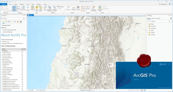
ArcGIS Pro – это новейшее настольное приложение для создания и работы с пространственными данными. В нем есть инструменты для визуализации, анализа, компиляции и публикации данных.
ArcGIS Pro организует ресурсы, используемые в вашей работе, в проекты. В проекте находятся карты, компоновки, слои, таблицы, задания, инструменты и подключения к серверам, базам данных, папкам и стилям. Проекты также включают в себя ресурсы с портала вашей организации или ArcGIS Online.
- Создайте проект или начните работу, открыв шаблон проекта, созданного Esri или другими участниками сообщества.
- Ресурсы можно добавлять из папок, с портала или из ArcGIS Online, указывая их или находя по ключевым словам.
- Убедитесь, что сохранили ваш проект, чтобы он был готов к работе в следующем сеансе работы в ArcGIS Pro.
- Если вы хотите организовать общий доступ к проекту, можно создать шаблоны проектов для использования другими при начале работы или упаковать проект и его данные.
С помощью ArcGIS Pro можно визуализировать как 2D, так и 3D данные.
- Карты отображают 2D-данные, а сцены - 3D. Более подробно о работе с 3D в ArcGIS Pro.
- В одном проекте можно хранить столько карт, сколько необходимо, можно открыть несколько карт сразу и просматривать их одновременно. Связывайте виды], чтобы при перемещении и масштабировании экстент всех карт обновлялся одновременно.
- Быстрая работа с картой возможна благодаря встроенным функциям навигации и горячим клавишам клавиатуры и мыши, с их помощью исследовать данные стало гораздо удобнее.
- Создавайте эффектные карты, применяя надписи, символы и всплывающие окна.
- Для отображения данных в формате, доступном для печати и экспорта, в проекте можно создать компоновки.
Геообработка предоставляет богатый набор инструментов для выполнения пространственного анализа и управления ГИС-данными в автоматическом режиме. Используйте ArcGIS Pro для анализа и управления ГИС-данными, создавайте инструменты для автоматизации рабочего процесса и решения комплексных задач.
- Выбрав подходящий инструмент геообработки, укажите местоположение входного и выходного наборов данных, настройте влияющие на процесс дополнительные параметры и запустите его.
- ArcGIS Pro содержит множество встроенных инструментов, но можно создать свои собственные.
- Воспользуйтесь ModelBuilder – визуальным конструктором, который позволяет создать блок-схему или модель процессов пространственного анализа или управления данными.
- Автоматизируйте анализ, конвертацию и управление данными, картографирование с помощью библиотек скриптов Python и ArcPy.
- Включайте дополнительные модули для расширения аналитических возможностей, в т.ч. сетевых, пространственных и геостатистических функций.
С помощью ArcGIS Pro можно создавать и редактировать различные виды объектов: города, здания, дороги, леса, реки, горы и любые другие пространственные явления, при этом можно интегрировать в проекте данные из различных источников. Есть возможность визуализировать слои для редактирования как в 2D, так и в 3D, таким образом можно рассматривать пространственные объекты с любой перспективы.
- Разработайте схему данных для построения модели мира.
- Редактирование включает создание, обновление и поддержание геопространственной информации, которая хранится и организуется в слоях.
- Можно создавать новые объекты в слое, цифруя их на карте и добавляя атрибуты для задания их характеристик.
- Можно обновлять существующие пространственные объекты, чтобы отражать их текущее состояние на основании свежеполученных данных или поступающей из поля информации.
- Добавьте дополнительный модуль Data Reviewer для проверки качества данных.
- Для управления корпоративными рабочими процессами интегрируйте Workflow Manager в свою организацию.
Используя задачи, ГИС-администратор может разработать серию шагов, следуя которым пользователь выполнит необходимые операции, соответствующие стандартам организации. Задача – это набор преднастроенных шагов, которые помогут вам и другим пользователям выполнить рабочий или бизнес-процесс.
- Создавайте задачи для выполнения любой функции в ArcGIS Pro.
- Шаги в задаче могут выполняться вручную, либо запускаться автоматически. Шаги могут быть обязательными или дополнительными.
- Записывайте действия, чтобы затем легко воспроизвести их в виде отдельных шагов задачи.
Публикация своей работы – это важная часть ArcGIS Pro. Опубликовать можно все: от целых проектов до карт, слоев и прочих компонентов.
- В целях сотрудничества с другими пользователями, можно построить шаблоны проектов для применения их в начале работы или опубликовать имеющиеся файлы проекта и его элементы на ArcGIS Online или портале.
- Веб-карты можно использовать повторно в ArcGIS Pro, а также на всей платформе ArcGIS, в том числе в браузерах и на мобильных устройствах.
- Для общего доступа при помощи пакета создается сжатый файл, содержащий ГИС данные. Теперь можно упаковать проект целиком или его слои, чтобы поделиться ими с другими.
- Перед публикацией ресурсов ArcGIS Pro может проверить вашу работу на наличие ошибок и замечаний и дать рекомендации по улучшению производительности. Если ArcGIS Pro что-нибудь найдет, будет показано сообщение со ссылкой на раздел справки с информацией о том, как исправить эту ошибку.
- После создания карты или компоновки можно экспортировать ее в другой формат или вывести на печать. Поддерживается ряд стандартных файловых форматов.
|
| |
 Читать статью дальше (комментариев - 51)
| |
|
 |
 Автор: Williams Автор: Williams
 Дата: 7 марта 2021 Дата: 7 марта 2021
 Просмотров: 1 719 Просмотров: 1 719 |
| |
Wilpen L. Gorr, Kristen S. Kurland - GIS Tutorial 1 for ArcGIS Pro: A Platform Workbook, 1st Edition
Esri Press, 2020
epub, 470 pages, english
ISBN: 9781589484665
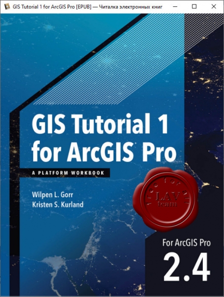
GIS Tutorial 1 for ArcGIS Pro features step-by-step exercises for learning GIS focusing on the latest desktop and online technologies. Building on Esri’s best-selling GIS Tutorial series for analysts, developers, students, managers, and others, this workbook teaches readers how to make maps, work with spatial data, and solve problems quickly using the ArcGIS platform.
Tutorial data, companion & data assignments, supplements containing updates can be downloaded from here |
| |
 Читать статью дальше (комментариев - 12)
| |
|
 |
 Автор: Williams Автор: Williams
 Дата: 18 февраля 2021 Дата: 18 февраля 2021
 Просмотров: 2 998 Просмотров: 2 998 |
| |
Wilpen L. Gorr, Kristen S. Kurland - GIS Tutorial for ArcGIS Desktop 10.8 7th Edition
Esri Press, 2020
pdf, 660 pages, english
ISBN: 9781589486140
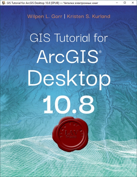
GIS Tutorial for ArcGIS Desktop 10.8 is the updated replacement for GIS Tutorial 1: Basic Workbook, 10.3 Edition, a classic textbook for teaching ArcGIS Desktop.
GIS Tutorial for ArcGIS Desktop 10.8 teaches the fundamentals of using ArcGIS Desktop, the popular professional geographic information systems (GIS) application from Esri. Rooted in the science of geography, GIS is a framework for gathering, managing, and analyzing data using map visualizations and location intelligence. GIS and ArcGIS have become the mainstay of many businesses, organizations, and institutions.
Updated with new images and simplified steps for using the latest version of the software, GIS Tutorial for ArcGIS Desktop 10.8 introduces readers to the tools and functionality of ArcGIS Desktop 10.8. Learn how to use ArcMap and ArcCatalog to make maps, work with spatial data, and analyze spatial data for proximity analysis and site suitability analysis. Gain hands-on experience using ArcGIS 3D Analyst, ArcGIS Spatial Analyst, and ArcGIS Network Analyst extensions, as well as ArcGIS Online and other software products.
Each chapter is designed from decades of GIS teaching experience by authors Wilpen L. Gorr (ret.) and Kristen S. Kurland, professors at Carnegie Mellon University in Pittsburgh, Pennsylvania. Incorporating proven teaching methods in detailed exercises, "Your Turn" sections, and homework assignments, this book is suited to learning GIS in the classroom or by self-learners. Data for completing the exercises is available for free download.
Renewing a proven standard: GIS Tutorial for ArcGIS Desktop 10.8 helps users explore GIS concepts, apply ArcGIS software, and instill GIS skills, regardless of learning style. |
| |
 Читать статью дальше (комментариев - 22)
| |
|
 |
 Автор: Williams Автор: Williams
 Дата: 8 января 2021 Дата: 8 января 2021
 Просмотров: 3 465 Просмотров: 3 465 |
| |
Udemy - GIS Data Analysis with ArcGIS Desktop:
Advanced GIS Spatial Analysis, GIS Training & Tutorials, 2020/06
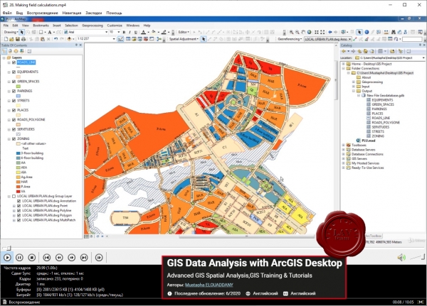
The preparation of data and the constitution of the database is an essential stage of GIS projects. In most cases, this is the most delicate and costly phase in terms of time and investment. Particular attention is therefore paid to this step to meet the needs of structuring and enhancing data. Indeed, without data the GIS solution will have no importance because the outputs and the results of the system largely depend on the quantity and the quality of the data integrated in the database. For this, the work of structuring the GIS database from all the data available at the level of "Ministry of cohesion of the territory" constitutes the primary need and a sine qua non condition for the success of the GIS project.
It is a GIS project on the constitution and structuring of the GIS database of "Ministry of cohesion of the territory". It thus covers the operations of data acquisition, preparation and integration. Thus, the missions of this project are:
- Data acquisition and preparation
- Migration and structuring of data in GIS format (conversion of data from CAD format (AutoCAD) to GIS format)
- Using spatial analysis
- Constitution of the GIS database
|
| |
 Читать статью дальше (комментариев - 21)
| |
|
 |
 Автор: Williams Автор: Williams
 Дата: 22 октября 2020 Дата: 22 октября 2020
 Просмотров: 2 259 Просмотров: 2 259 |
| |
Michael Law, Amy Collins - Getting to Know ArcGIS Pro v2.6
Esri Press, 2020
pdf, 236 pages, english
eISBN: 9781589486362
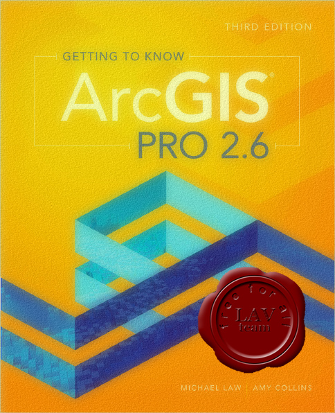
Continuing the tradition of the best-selling Getting to Know series, Getting to Know ArcGIS Pro 2.6 teaches new and existing GIS users how to get started solving problems using ArcGIS Pro. Using ArcGIS Pro for these tasks allows you to understand complex data with the leading GIS software that many businesses and organizations use every day.
Getting to Know ArcGIS Pro 2.6 introduces the basic tools and capabilities of ArcGIS Pro through practical project workflows that demonstrate best practices for productivity. Explore spatial relationships, building a geodatabase, 3D GIS, project presentation, and more. Learn how to navigate ArcGIS Pro and ArcGIS Online by visualizing, querying, creating, editing, analyzing, and presenting geospatial data in both 2D and 3D environments. Using figures to show each step, Getting to Know ArcGIS Pro 2.6 demystifies complicated process like developing a geoprocessing model, using Python to write a script tool, and the creation of space-time cubes. Cartographic techniques for both web and physical maps are included.
Each chapter begins with a prompt using a real-world scenario in a different industry to help you explore how ArcGIS Pro can be applied for operational efficiency, analysis, and problem solving. A summary and glossary terms at the end of every chapter help reinforce the lessons and skills learned.
Ideal for students, self-learners, and seasoned professionals looking to learn a new GIS product, Getting to Know ArcGIS Pro 2.6 is a broad textbook and desk reference designed to leave users feeling confident in using ArcGIS Pro on their own. |
| |
 Читать статью дальше (комментариев - 12)
| |
|
 |
 Автор: Williams Автор: Williams
 Дата: 10 сентября 2020 Дата: 10 сентября 2020
 Просмотров: 2 212 Просмотров: 2 212 |
| |
Michael Law - Getting to Know Arcgis Desktop
Esri Press, 2018
pdf, 856 pages, english
e-ISBN 978-1-589-48511-2
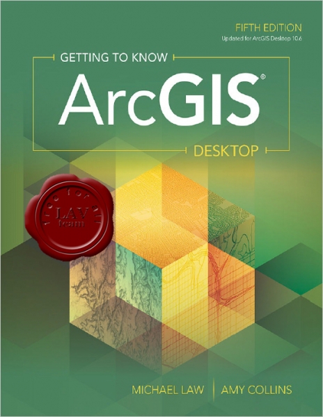
Getting to Know ArcGIS Desktop, fifth edition, is a comprehensive introduction to the features and tools of ArcGIS Desktop. Through hands-on exercises, readers will discover, use, make, and share maps with meaningful content. They will also learn how to build geodatabases, query data, analyze geospatial data, and more. The latest edition has been updated to the most current version of ArcGIS Desktop 10.6. Getting to Know ArcGIS Desktopis suited for classroom use, independent study, and as a reference. |
| |
 Читать статью дальше (комментариев - 15)
| |
|
 |
 Автор: Williams Автор: Williams
 Дата: 9 августа 2020 Дата: 9 августа 2020
 Просмотров: 2 309 Просмотров: 2 309 |
| |
Tripp Corbin - Learning ArcGIS Pro 2, Second Edition
+ training files
Packt, 2020
pdf, 535 pages, english
ISBN: 978-1-83921-022-8
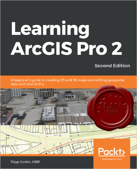
Armed with powerful tools to visualize, maintain, and analyze data, ArcGIS Pro 2 is Esri's newest desktop geographic information system (GIS) application that uses the modern ribbon interface and a 64-bit processor to make using GIS faster and more efficient. This second edition of Learning ArcGIS Pro will show you how you can use this powerful desktop GIS application to create maps, perform spatial analysis, and maintain data.
The book begins by showing you how to install ArcGIS and listing the software and hardware prerequisites. You’ll then understand the concept of named user licensing and learn how to navigate the new ribbon interface to leverage the power of ArcGIS Pro for managing geospatial data. Once you’ve got to grips with the new interface, you’ll build your first GIS project and understand how to use the different project resources available. The book shows you how to create 2D and 3D maps by adding layers and setting and managing the symbology and labeling. You’ll also discover how to use the analysis tool to visualize geospatial data. In later chapters, you’ll be introduced to Arcade, the new lightweight expression language for ArcGIS, and then advance to creating complex labels using Arcade expressions. Finally, you'll use Python scripts to automate and standardize tasks and models in ArcGIS Pro.
By the end of this ArcGIS Pro book, you’ll have developed the core skills needed for using ArcGIS Pro 2.x competently. |
| |
 Читать статью дальше (комментариев - 10)
| |
|
 |
 Автор: Williams Автор: Williams
 Дата: 5 августа 2020 Дата: 5 августа 2020
 Просмотров: 2 354 Просмотров: 2 354 |
| |
Wilpen Gorr, Kristen Kurland - GIS Tutorial 1 for ArcGIS Pro 2.4: A Platform Workbook (GIS Tutorials), 2 Edition
ESRI, 2020
epub, 702 pages, english
e-ISBN: 978-1-589-48590-7
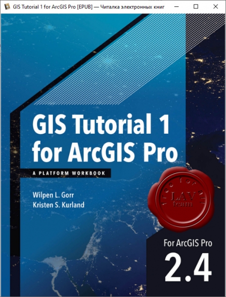
GIS Tutorial 1 for ArcGIS Pro: A Platform Workbook is an introductory text for learning ArcGIS Pro, the premier professional desktop GIS application. In-depth exercises that use ArcGIS Pro, ArcGIS Online, and other ArcGIS apps show readers how to make maps, how to create and analyze spatial data, and how to manage systems with GIS.
GIS Tutorial 1 for ArcGIS Pro: A Platform Workbook engages readers in:
- Obtaining spatial data and building a geodatabase for collecting, editing, and processing data.
- Exploring the functionalities of ArcGIS Pro, ArcGIS Online, and apps; understanding the elements of map design; and creating map layouts, story maps, dashboards, and 3D maps.
- Analyzing spatial data using buffers and street network-based service areas, locating facilities, and conducting cluster analysis.
- Automating GIS through macros for monitoring and optimal routing of service deliveries with data input in the field using a mobile app.
- Carrying out real-world applications for health care, crime, government services, planning, and marketing.
Incorporating proven teaching methods in detailed exercises, "Your Turn" sections, and expanded homework assignments, GIS Tutorial 1 for ArcGIS Pro: A Platform Workbook is suited to learning GIS in a classroom. Wilpen Gorr and Kristen Kurland have written the top-selling GIS Tutorial 1: Basic Workbook, GIS Tutorial for Health, and GIS Tutorial for Crime Analysis. |
| |
 Читать статью дальше (комментариев - 15)
| |
|
 |
| ПОИСК ПО САЙТУ |
 |
|
 |
| КАЛЕНДАРЬ | | |
 |
| « Август 2025 » |
|---|
| Пн | Вт | Ср | Чт | Пт | Сб | Вс |
|---|
| | 1 | 2 | 3 | | 4 | 5 | 6 | 7 | 8 | 9 | 10 | | 11 | 12 | 13 | 14 | 15 | 16 | 17 | | 18 | 19 | 20 | 21 | 22 | 23 | 24 | | 25 | 26 | 27 | 28 | 29 | 30 | 31 |
|
 | |
| |
|