|
 |
 Автор: Williams Автор: Williams
 Дата: 20 октября 2024 Дата: 20 октября 2024
 Просмотров: 1 572 Просмотров: 1 572 |
| |
Arqcom CAD-Earth v8.1.5 for AutoCAD 2017-2025
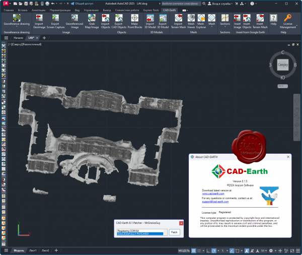
CAD-Earth is designed to easily import/export images, objects and terrain meshes between Google Earth and major CAD programs and create dynamic contour lines and profiles.
Features:
- Import Google Earth image to CAD.
- Export CAD screenshot to Google Earth.
- Insert georeferenced images.
- Import Google Earth objects to CAD.
- Export CAD objects to Google Earth.
- Import Google Earth terrain.
- More than 3000 supported coordinate systems worldwide.
- Cross section from mesh.
- Profile from mesh.
|
| |
 Читать статью дальше (комментариев - 16)
| |
|
|
Автор: Williams
Дата: 29 июня 2023
Просмотров: 2 261 |
| |
Arqcom CAD-Earth v8.0.3 for AutoCAD 2021-2024
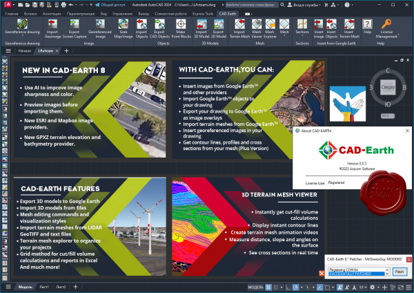
CAD-Earth is designed to easily import/export images, objects and terrain meshes between Google Earth and major CAD programs and create dynamic contour lines and profiles.
Features:
- Import Google Earth image to CAD.
- Export CAD screenshot to Google Earth.
- Insert georeferenced images.
- Import Google Earth objects to CAD.
- Export CAD objects to Google Earth.
- Import Google Earth terrain.
- More than 3000 supported coordinate systems worldwide.
- Cross section from mesh.
- Profile from mesh.
|
| |
Читать статью дальше (комментариев - 25)
| |
|
|
Автор: Williams
Дата: 23 сентября 2021
Просмотров: 2 413 |
| |
ArqCOM CivilCAD Suite build September, 2021
for AutoCAD, BricsCAD, ZWCAD

CivilCAD, creado por ARQCOM, es el software diseñado para crear funciones adicionales que automatizan y simplifican las tareas dentro de AutoCAD Full, Bricscad PRO y ZWCAD+ Professional, cubriendo diversas necesidades del profesional de la Ingeniería Civil y Topografía de habla hispana; utilizado por dependencias de gobierno, constructoras y universidades.
Con CivilCAD, puede obtener rápidamente perfiles, secciones, curvas de nivel, cálculo de volúmenes en plataformas y vialidades, cuadros de construcción, subdivisión de polígonos, entre otras más de 100 rutinas.
La licencia base de CivilCAD sólo incluye rutinas de topografía básica (ver rutinas). Existen 6 módulos adicionales que agregan rutinas especializadas a su licencia base de CivilCAD y son:
- Cálculo de Redes de Agua Potable
- Cálculo de Redes de Alcantarillado
- Diseño de Carreteras SCT
- Exportación de Datos al Programa Curva Masa SCT
- Cálculo de Redes de Alcantarillado Pluvial ADSInterfase con Google Earth
|
| |
Читать статью дальше (комментариев - 22)
| |
|
|
Автор: Williams
Дата: 19 сентября 2021
Просмотров: 4 195 |
| |
Arqcom CAD-Earth v7.0.2 for AutoCAD 2018-2022

CAD-Earth is designed to easily import/export images, objects and terrain meshes between Google Earth and major CAD programs and create dynamic contour lines and profiles.
Features:
- Import Google Earth image to CAD.
- Export CAD screenshot to Google Earth.
- Insert georeferenced images.
- Import Google Earth objects to CAD.
- Export CAD objects to Google Earth.
- Import Google Earth terrain.
- More than 3000 supported coordinate systems worldwide.
- Cross section from mesh.
- Profile from mesh.
|
| |
Читать статью дальше (комментариев - 32)
| |
|
|
Автор: Williams
Дата: 23 октября 2020
Просмотров: 4 218 |
| |
Arqcom CAD-Earth v6.1.9 for AutoCAD 2017-2021, BricsCAD 19-20

CAD-Earth is designed to easily import/export images, objects and terrain meshes between Google Earth and major CAD programs and create dynamic contour lines and profiles.
Features:
- Import Google Earth image to CAD.
- Export CAD screenshot to Google Earth.
- Insert georeferenced images.
- Import Google Earth objects to CAD.
- Export CAD objects to Google Earth.
- Import Google Earth terrain.
- More than 3000 supported coordinate systems worldwide.
- Cross section from mesh.
- Profile from mesh.
|
| |
Читать статью дальше (комментариев - 30)
| |
|
|
Автор: Williams
Дата: 19 октября 2020
Просмотров: 4 090 |
| |
ArqCOM CivilCAD Suite build October, 2020
for any version of AutoCAD, ZWCAD, BricsCAD

CivilCAD, creado por ARQCOM, es el software diseñado para crear funciones adicionales que automatizan y simplifican las tareas dentro de AutoCAD Full, Bricscad PRO y ZWCAD+ Professional, cubriendo diversas necesidades del profesional de la Ingeniería Civil y Topografía de habla hispana; utilizado por dependencias de gobierno, constructoras y universidades.
Con CivilCAD, puede obtener rápidamente perfiles, secciones, curvas de nivel, cálculo de volúmenes en plataformas y vialidades, cuadros de construcción, subdivisión de polígonos, entre otras más de 100 rutinas.
La licencia base de CivilCAD sólo incluye rutinas de topografía básica (ver rutinas). Existen 6 módulos adicionales que agregan rutinas especializadas a su licencia base de CivilCAD y son:
- Cálculo de Redes de Agua Potable
- Cálculo de Redes de Alcantarillado
- Diseño de Carreteras SCT
- Exportación de Datos al Programa Curva Masa SCT
- Cálculo de Redes de Alcantarillado Pluvial ADS
- Interfase con Google Earth
|
| |
Читать статью дальше (комментариев - 22)
| |
|
|
Автор: Williams
Дата: 22 марта 2020
Просмотров: 5 986 |
| |
Arqcom CAD-Earth v6.0.8/6 for AutoCAD 2019-2020

CAD-Earth is designed to easily import/export images, objects and terrain meshes between Google Earth and major CAD programs and create dynamic contour lines and profiles.
Features:
- Import Google Earth image to CAD.
- Export CAD screenshot to Google Earth.
- Insert georeferenced images.
- Import Google Earth objects to CAD.
- Export CAD objects to Google Earth.
- Import Google Earth terrain.
- More than 3000 supported coordinate systems worldwide.
- Cross section from mesh.
- Profile from mesh.
|
| |
Читать статью дальше (комментариев - 25)
| |
|
|
Автор: Williams
Дата: 30 июня 2019
Просмотров: 4 915 |
| |
Arqcom CAD-Earth v6.0 for AutoCAD 2019-2020
CAD-Earth is designed to easily import/export images, objects and terrain meshes between Google Earth and major CAD programs and create dynamic contour lines and profiles.
Features:
- Import Google Earth image to CAD.
- Export CAD screenshot to Google Earth.
- Insert georeferenced images.
- Import Google Earth objects to CAD.
- Export CAD objects to Google Earth.
- Import Google Earth terrain.
- More than 3000 supported coordinate systems worldwide.
- Cross section from mesh.
- Profile from mesh.
|
| |
Читать статью дальше (комментариев - 20)
| |
|
|
Автор: Williams
Дата: 29 июня 2019
Просмотров: 3 458 |
| |
Arqcom CAD-Earth v5.1.22 for AutoCAD 2010-2020, BricsCAD v15-19, ZWCAD 2014-2018

CAD-Earth is designed to easily import/export images, objects and terrain meshes between Google Earth and major CAD programs and create dynamic contour lines and profiles.
Features:
- Import Google Earth image to CAD.
- Export CAD screenshot to Google Earth.
- Insert georeferenced images.
- Import Google Earth objects to CAD.
- Export CAD objects to Google Earth.
- Import Google Earth terrain.
- More than 3000 supported coordinate systems worldwide.
- Cross section from mesh.
- Profile from mesh.
What can we do with CAD-Earth (v5.1):
|
| |
Читать статью дальше (комментариев - 23)
| |
|
|
Автор: Williams
Дата: 9 сентября 2016
Просмотров: 12 610 |
| |
Arqcom CAD-Earth v5.1 for AutoCAD 2010-2017, BricsCAD v14-16

CAD-Earth is designed to easily import/export images, objects and terrain meshes between Google Earth and major CAD programs and create dynamic contour lines and profiles.
Features:
- Import Google Earth image to CAD.
- Export CAD screenshot to Google Earth.
- Insert georeferenced images.
- Import Google Earth objects to CAD.
- Export CAD objects to Google Earth.
- Import Google Earth terrain.
- More than 3000 supported coordinate systems worldwide.
- Cross section from mesh.
- Profile from mesh.
Google Earth plugin can be downloaded from here.
What can we do with CAD-Earth (v5.1):
|
| |
Читать статью дальше (комментариев - 31)
| |
|
|
| ПОИСК ПО САЙТУ |
|
|
|
| КАЛЕНДАРЬ | | |
|
| « Октябрь 2025 » |
|---|
| Пн | Вт | Ср | Чт | Пт | Сб | Вс |
|---|
| | 1 | 2 | 3 | 4 | 5 | | 6 | 7 | 8 | 9 | 10 | 11 | 12 | | 13 | 14 | 15 | 16 | 17 | 18 | 19 | | 20 | 21 | 22 | 23 | 24 | 25 | 26 | | 27 | 28 | 29 | 30 | 31 | |
|
| |
| |
|


