|
 |
 Автор: Williams Автор: Williams
 Дата: 9 марта 2023 Дата: 9 марта 2023
 Просмотров: 454 Просмотров: 454 |
| |
Unity Technologies Pixyz Review 2022.1.1.4
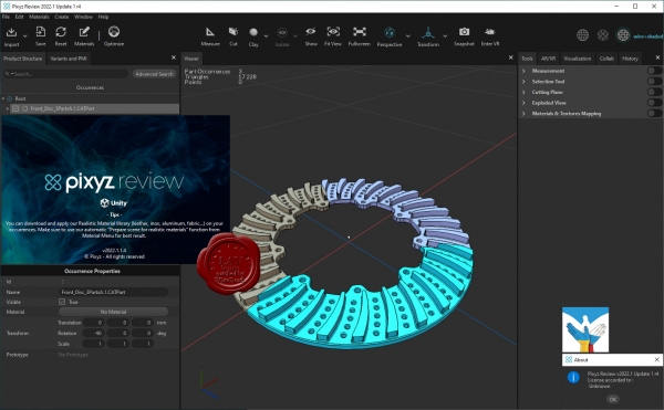
We believe 3D data should be accessible for study to anyone. Use Pixyz Review to instantly review, collaborate and interact with complex assemblies in desktop and/or VR.
Simply drag & drop your files. No conversion, no concern about formats: Pixyz Review deals with most native CAD, Mesh and Point Clouds files.
Study immediately your product – forget about lags. Navigate through dense product hierarchy, inspect and analyze large or complex assemblies with Pixyz Review’s powerful viewer.
Connect your headset, grab your controllers and switch to Virtual Reality. No VR expertise required. Analyze or interact with your model, fully immersed and focused. |
| |
 Читать статью дальше (комментариев - 6)
| |
|
 |
 Автор: Williams Автор: Williams
 Дата: 8 марта 2023 Дата: 8 марта 2023
 Просмотров: 567 Просмотров: 567 |
| |
Unity Technologies Pixyz Studio 2022.1.1.4
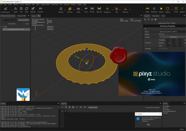
Pixyz Studio is a unique 3D data preparation tool providing the best-in-class tessellation algorithm, enabling the transformation of CAD data from industry-leading solutions (Catia, NX, SolidWorks…) into lightweight, optimized meshes.
Pixyz Studio’s interactive user interface gives access to a large set of features and algorithms for 3D data optimization. It also embeds a Python API, allowing advanced users to create powerful scripts and plugins, to automate complex data preparation tasks.
Pixyz Studio helps companies leverage their 3D/CAD data, preparing it for Real-time 3D use, and for any visualization scenario.
|
| |
 Читать статью дальше (комментариев - 7)
| |
|
 |
 Автор: Williams Автор: Williams
 Дата: 7 марта 2023 Дата: 7 марта 2023
 Просмотров: 724 Просмотров: 724 |
| |
Ellis PaleoScan 2022.2.0 r39011
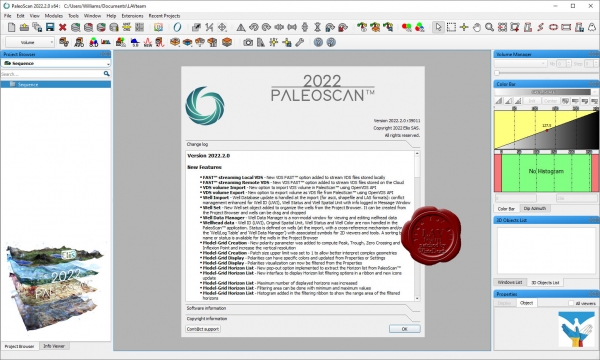
PaleoScan is a new generation of 3D seismic interpretation software, where geoscientists build a geological model while interpreting seismic volumes. With this new release, Eliis continues to innovate in seismic interpretation and brings more tools to interpret larger seismic datasets, with added speed and precision. The 2022 version brings more options to complete the workflow from exploration to reservoir characterization, with various new tools: complete 2D interpretation workflow, velocity modeling, cross plots from logs, coordinates reference system management.
|
| |
 Читать статью дальше (комментариев - 9)
| |
|
 |
 Автор: Williams Автор: Williams
 Дата: 6 марта 2023 Дата: 6 марта 2023
 Просмотров: 3 833 Просмотров: 3 833 |
| |
Leica Cyclone 2023.0.0 build 8304
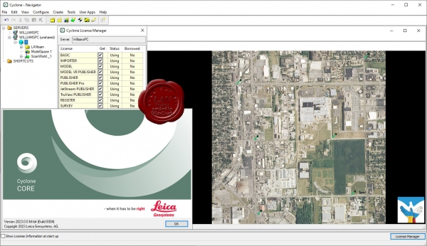
Leica Cyclone является лучшим на рынке программным обеспечением для обработки облаков точек. Это семейство программных модулей, обеспечивающих самый широкий диапазон технологических процессов при лазерном 3D-сканировании в машиностроении, геодезии, строительстве и смежных областях.
Для организаций, которым необходимо добавить данные облаков точек в свои технологические процессы, Leica Cyclone является единственным решением, способным сформировать все необходимые результаты. В отличие от ПО других поставщиков, Leica Cyclone эффективно работает в соответствии с любыми проектными требованиями, принося прибыль вашей организации.
Ключевой компонент комплексного решения — семейство Cyclone. Различные модули Cyclone проведут пользователя от начала и до конца технологического цикла при реализации проектов любого типа, предусматривающих работу с облаками точек.
Существуют модули, позволяющие использовать такие операции сбора данных на объектах с помощью лазерных сканеров Leica Geosystems, как маршрутная съемка, задний отсчет, визирование с обратными засечками, а также привязку данных сканерами Leica RTC360 с помощью визуальной инерциальной системы (VIS) для обеспечения комплексных сбора и регистрации данных на уровне профессиональной топографической съемки. Функциональность таких модулей включает процедуры автоматизации, работающие в режиме диалога с пользователем и выполняющие большинство задач за него, и богатейший набор инструментов для обеспечения и контроля качества, а также настройки и анализа процессов съемки.
Существуют и другие модули, предназначенные для формирования широкого спектра выходных материалов: от отчетов и карт до 3D-моделей, фильмов, анимированных роликов и компактных форматов 3D-данных, которые можно свободно пересылать по Интернету. Эти модули могут использоваться в различных процессах широкого спектра отраслей, включая проектирование сооружений, создание 3D-моделей готовых сооружений, топографическую съемку, информационное моделирование зданий и многие другие.
Используя файлы в разработанном компанией Leica Geosystems формате универсального проектного файла (LGS), пользователи могут передавать данные цифровой реальности между Cyclone и любым использующим технологию HDS программным обеспечением.
Для большего удобства использования, комплекс состоит из отдельных программных модулей, используемых для разных целей:
|
| |
 Читать статью дальше (комментариев - 24)
| |
|
 |
 Автор: Williams Автор: Williams
 Дата: 5 марта 2023 Дата: 5 марта 2023
 Просмотров: 953 Просмотров: 953 |
| |
Blue Marble Geographic Calculator 2023 build 1183
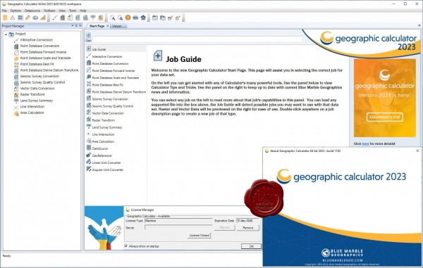
Geographic Calculator is a powerful geodetic application with particular strength in survey, seismic, and energy exploration. In addition to single point, point database, and file conversion tools, this highly accurate transformation software includes many specialized tools such as Canadian DLS (Dominion Land Survey) Land Grid tools, Seismic Survey Conversion tools, Area of Use tools for guiding users, HTDP, Geoid Creation tools, and much more. Geographic Calculator supports a wide range of file formats with support from the largest geodetic parameter database available anywhere. When transformations have to be correct, consistent and certifiable, GIS professionals around the world choose Geographic Calculator. |
| |
 Читать статью дальше (комментариев - 8)
| |
|
 |
 Автор: Williams Автор: Williams
 Дата: 3 марта 2023 Дата: 3 марта 2023
 Просмотров: 6 546 Просмотров: 6 546 |
| |
Blue Marble Global Mapper Pro v24.1.0 build 021423 repack
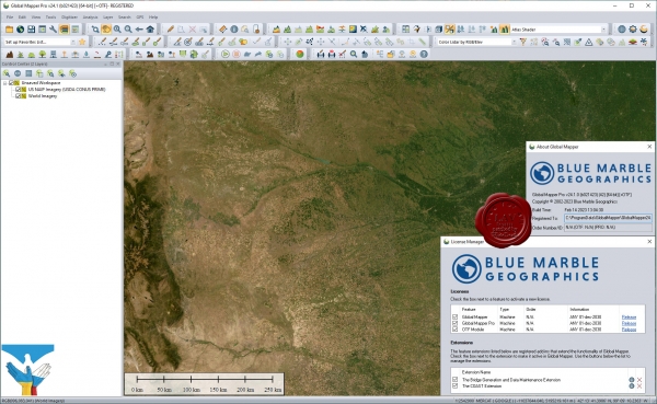
Вышла новая версия программы для просмотра карт и векторных изображений - Global Mapper v24.1
Global Mapper позволяет не только просматривать но и преобразовывать или редактировать, а даже и распечатывать всевозможные карты и векторные наборы данных. Global Mapper позволяет вам загружать ваши данные как слои ( только с условием, что вы работаете в Digital Elevation Model), или же как отсканированную карту, если вам надо изобразить местность в 3D. Есть также хорошая особенность, что позволяет вести работу в реальном времени. Происходит это путем загрузки данных с GPS приемника который подключен к компьютеру.
Global Mapper поддерживает огромнейшее число форматов. Работать с ней легко и просто, интерфейс не перенасыщен различными опциями, вы можете смело работать в ней и не задумываться о том, куда нажать, что бы сделать что - то.
|
| |
 Читать статью дальше (комментариев - 41)
| |
|
 |
 Автор: Williams Автор: Williams
 Дата: 2 марта 2023 Дата: 2 марта 2023
 Просмотров: 1 185 Просмотров: 1 185 |
| |
TopoGrafix ExpertGPS Pro v8.37
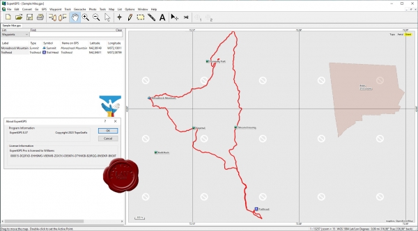
ExpertGPS is the ultimate GPS map software for planning outdoor adventures. View GPS waypoints and tracklogs from any handheld GPS receiver over aerial photos and US topographic maps. Plan your next outdoor adventure over scanned USGS topo maps and send a route directly to your GPS receiver to guide you in the field. View your GPS tracklog over an aerial photo to see exactly where you went.
ExpertGPS handles all your mapping and data-conversion jobs. You'll be able to convert any GPS, GIS, or CAD data to or from GPX, Google Earth KML or KMZ, Excel CSV or TXT, SHP shapefiles, or AutoCAD DXF drawings in two clicks. You can reproject data in any geographic format (lat-lon, UTM, US State Plane) and change datums instantly. With ExpertGPS, you'll be able to calculate acreage, measure distance, elevation and grade.
ExpertGPS downloads aerial photos and topo maps for any location in the US, saving the maps to your hard drive. Disconnect your laptop and head out on a trip, and all of your data is available.
Whether you're discovering a new trail or scouting a 400 acre parcel, ExpertGPS gives you the maps and tools you need to get the job done. No other software makes it this easy to add your own data to maps and aerial photos. |
| |
 Читать статью дальше (комментариев - 14)
| |
|
 |
 Автор: Williams Автор: Williams
 Дата: 1 марта 2023 Дата: 1 марта 2023
 Просмотров: 2 978 Просмотров: 2 978 |
| |
Bentley MicroStation 2023 CONNECT Edition Update 17 build 10.17.02.061 - online installer
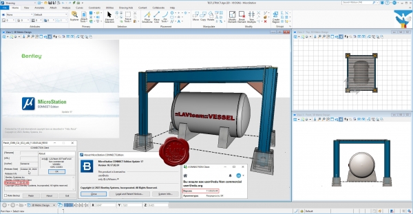
MicroStation - самая производительная, наиболее доступная и совместимая САПР-платформа для проектирования, строительства и эксплуатации мировой инфраструктуры.
Вам, вероятно, известно, что 95% инфраструктуры в мире проектируется, строится и поддерживается с применением файлов форматов DGN и DWG. При помощи MicroStation пользователи имеют возможность непосредственно редактировать содержимое обоих форматов файлов одновременно. Эта возможность превращает MicroStation в платформу для обеспечения совместимости, являющуюся обязательным атрибутом.
MicroStation также является платформой для инноваций, расположенной в центре полного спектра вертикальных программных приложений, обеспечивающей пользователей возможностью индивидуализации приложений с помощью VBA, а также возможностью "вертикального роста" при помощи узкоспециализированных решений для увеличения производительности при поддержании полной целостности данных по всему проекту.
С учетом лишь из этих двух соображений, то, что MicroStation используется всеми, включая архитекторов, инженеров, картографов и подрядчиков по проектам в области архитектуры, строительства и инженерного проектирования, не должно вызывать удивления. За счет этого данная система становится стандартом для лучших проектировщиков мира, являющихся участниками рейтинга ENR Global 150. |
| |
 Читать статью дальше (комментариев - 15)
| |
|
 |
 Автор: Williams Автор: Williams
 Дата: 28 февраля 2023 Дата: 28 февраля 2023
 Просмотров: 737 Просмотров: 737 |
| |
B&B-AGEMA Thermodynamic Design Tool 2021 v2.14
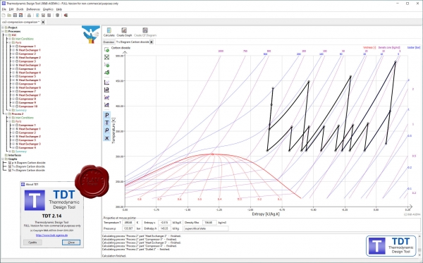
The TDT-software (Thermodynamic Design Tool) is an easy to use and efficient tool for analyzing, designing and dimensioning of thermodynamic processes.
It comprises process media based on NIST Refprop (there are more than 100 fluids and numerous mixtures available; such as air, water/steam, CO2, hydrogen, common alkanes and refrigerants or mixtures composed of them), whose change in state is calculated taking into account real gas effects. The thermodynamic process sequences can be visualized and scaled by common diagrams (e.g. h-s, T-s, p-T) and calculated values are precisely listed in tables.
TDT supplies to the user an easy and interactive graphical user interface and a huge number of options for setting up the thermodynamic process according to the individual requirements. Predefined turbomachinery components such as compressor/pump, combustion chamber, turbine, condenser and heat exchanger form basic elements and can be extended by additional process branches and/or loss correlations. Depending on the components, only few input values such as efficiency, outlet pressure or pressure ratio, heat or temperature change as well as pressure or mass losses are necessary to configure the single elements.
As an example, TDT has been used for optimization of a multi-stage inter-cooled compression process of CO2 for a power plant concept with Carbon Capture & Storage (CCS) technology.
TDT is continuously further developed by B&B-AGEMA and has been applied in a huge number of industrial projects. |
| |
 Читать статью дальше (комментариев - 6)
| |
|
 |
| ПОИСК ПО САЙТУ |
 |
|
 |
| КАЛЕНДАРЬ | | |
 |
| « Октябрь 2025 » |
|---|
| Пн | Вт | Ср | Чт | Пт | Сб | Вс |
|---|
| | 1 | 2 | 3 | 4 | 5 | | 6 | 7 | 8 | 9 | 10 | 11 | 12 | | 13 | 14 | 15 | 16 | 17 | 18 | 19 | | 20 | 21 | 22 | 23 | 24 | 25 | 26 | | 27 | 28 | 29 | 30 | 31 | |
|
 | |
| |
|