|
 |
 Автор: Williams Автор: Williams
 Дата: 7 октября 2023 Дата: 7 октября 2023
 Просмотров: 1 924 Просмотров: 1 924 |
| |
ZSoil v23.54
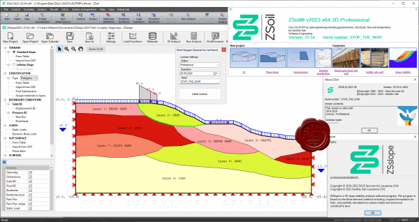
ZSoil is the Windows-Based Finite Element Software offering a unified approach to numerical simulation of soil and rock mechanics, above & underground structures, excavations, soil-structure interaction and underground flow, including dynamics, thermal and moisture migration analysis. ZSoil is available for Windows 10 & 11.
ZSOIL is the first integrated computer code that offered a unified approach to most of the natural processes encountered in geotechnical and foundation engineering, including stability, consolidation, creep and underground flow, excavations and soil-structure interactions. Typical engineering problems that are being handled worldwide with ZSOIL are: foundation and earthwork construction, include tunnels, underground storage facilities, metro stations, mining, cut or fill in highways, railroads, dams, temporary and final retaining structures, water-front and excavation systems with complex excavation sequences, hydraulic structures, and buildings.
ZSOIL is a continuously upgraded geotechnical, foundation and underground flow engineering software based on the finite-element method and written in the MS-Windows environment. The program has been used with great success in forensic analysis and design studies, covering without exception all possible scenarios encountered in real world case studies.
ZSOIL has been developed at Zace Services Ltd since 1982. The latest versions were developed by a team led by A.Truty, K.Podles & Th.Zimmermann, with research experience at the Swiss Federal Institute of Technology (EPFL), U.C.Berkeley, and Caltech.
More info |
| |
 Читать статью дальше (комментариев - 19)
| |
|
 |
 Автор: Williams Автор: Williams
 Дата: 6 октября 2023 Дата: 6 октября 2023
 Просмотров: 320 Просмотров: 320 |
| |
AutoForm Forming R11.0
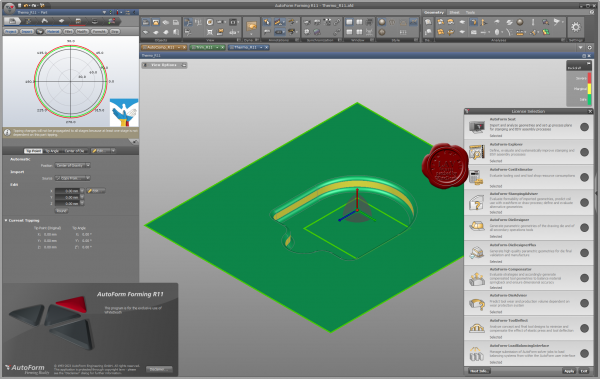
AutoForm is the global leader in the engineering software for sheet metal forming and BiW assembly.
AutoForm Forming offers you a portfolio of software products with a wide range of powerful features for the digital planning and validation of sheet metal processes and parts.
More info |
| |
 Читать статью дальше (комментариев - 3)
| |
|
 |
 Автор: Williams Автор: Williams
 Дата: 5 октября 2023 Дата: 5 октября 2023
 Просмотров: 5 145 Просмотров: 5 145 |
| |
Blue Marble Global Mapper Pro v25.0 build 092623
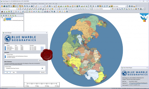
Вышла новая версия программы для просмотра карт и векторных изображений - Global Mapper v25.0
Global Mapper позволяет не только просматривать но и преобразовывать или редактировать, а даже и распечатывать всевозможные карты и векторные наборы данных. Global Mapper позволяет вам загружать ваши данные как слои ( только с условием, что вы работаете в Digital Elevation Model), или же как отсканированную карту, если вам надо изобразить местность в 3D. Есть также хорошая особенность, что позволяет вести работу в реальном времени. Происходит это путем загрузки данных с GPS приемника который подключен к компьютеру.
Global Mapper поддерживает огромнейшее число форматов. Работать с ней легко и просто, интерфейс не перенасыщен различными опциями, вы можете смело работать в ней и не задумываться о том, куда нажать, что бы сделать что - то. |
| |
 Читать статью дальше (комментариев - 37)
| |
|
 |
 Автор: Williams Автор: Williams
 Дата: 4 октября 2023 Дата: 4 октября 2023
 Просмотров: 1 315 Просмотров: 1 315 |
| |
ZwSoft ZWCAD 2024 SP1 Pro
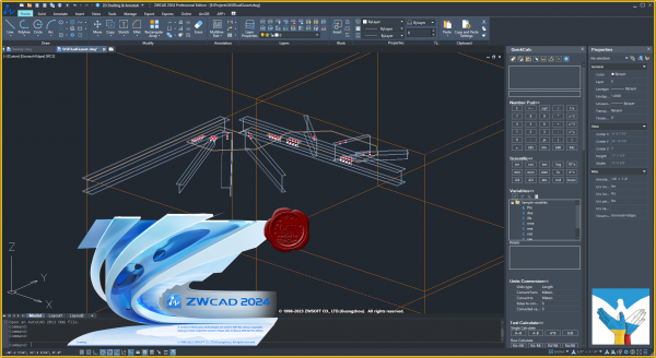
ZWCAD Professional - мощная система для 2D/3D проектирования и создания чертежей с полной поддержкой формата DWG, привычным интерфейсом и уникальными функциями, дающими значительное удобство в работе: умным выбором объектов по заданным критериям, сравнением чертежей, жестами мышью, голосовыми метками, умной печатью и многими другими. Являясь результатом постоянного совершенствования в течение более 20 лет, ZWCAD 2023 представляет собой надежное и эффективное решение САПР, которое выводит процесс проектирования на высочайший уровень.
Осуществляя поддержку программных интерфейсов .Net, VBA и ZRX, ZWCAD Professional позволяет использовать существующие, а также разрабатывать собственные специализированные решения для автоматизации работы инженеров, конструкторов, архитекторов и других специалистов. |
| |
 Читать статью дальше (комментариев - 8)
| |
|
 |
 Автор: Williams Автор: Williams
 Дата: 3 октября 2023 Дата: 3 октября 2023
 Просмотров: 532 Просмотров: 532 |
| |
CADopia Pro 2023 v22.3.1.4100
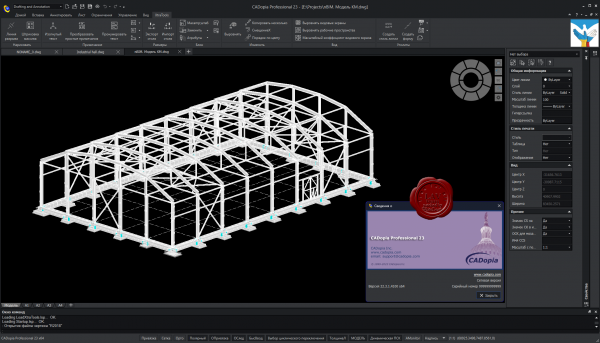
CADopia - доступный аналог AutoCAD, совместимый с форматом файлов DWG. Построен на основе кода IntelliCAD.
CADopia is a powerful Computer-Aided-Design software for engineers, architects, designers and drafters — virtually anyone who creates, edits, or views professional drawings. CADopia is available in 12 languages – Chinese, Czech, English, French, German, Italian, Japanese, Korean, Polish, Portuguese, Russian, and Spanish.
CADopia Professional Services can help you maximize the returns on your investment in CAD technology. CADopia provides upfront consulting services, custom application development, staff training,technical support, and project outsourcing solutions. |
| |
 Читать статью дальше (комментариев - 2)
| |
|
 |
 Автор: Williams Автор: Williams
 Дата: 2 октября 2023 Дата: 2 октября 2023
 Просмотров: 382 Просмотров: 382 |
| |
Avenir LoopCAD 2023 MJ8 Edition v23.0.0180
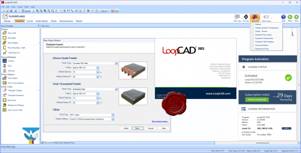
LoopCAD is the premiere software for the fast creation of professional quality circuit layout drawings for radiant heating systems. The all-new LoopCAD 2014 offers advanced design features including integrated heating and cooling load calculations, detailed hydronic calculations, snowmelt design, 3D CAD views, and compatibility with OEM design methods and materials. And now the MJ8 Edition provides ACCA-Approved Manual J (8th Edition) calculations for residential heating and cooling loads. LoopCAD is the easiest, most powerful radiant heating design tool available.
LoopCAD is available in three different editions to better match your needs. The available OEM Add-ons work seamlessly with all editions of LoopCAD. For a list of functionality and new features in each edition.
Standard Edition:
- Floorplan drawing and importing (PDF, AutoCAD, JPG)
- Automated circuit (loop) generation.
- Freehand circuit (loop) drawing.
- Hydronic calculations based on manual input of heat loads (no automated heat loss calculations)
- 3D drawing views.
- OEM Add‐ons for detailed materials lists/quotations.
Professional Edition - all features in Standard Edition, plus:
- Automated heat loss calculations as you draw.
- ASHRAE and CSA residential heat loss calculations.
MJ8 Edition - all features in Professional Edition, plus:
- ACCA‐Approved Manual J (8th Edition) residential heating and cooling load calculations.
Tutorials |
| |
 Читать статью дальше (комментариев - 3)
| |
|
 |
 Автор: Williams Автор: Williams
 Дата: 1 октября 2023 Дата: 1 октября 2023
 Просмотров: 380 Просмотров: 380 |
| |
Avenir HeatCAD 2023 MJ8 Edition v23.0.0080
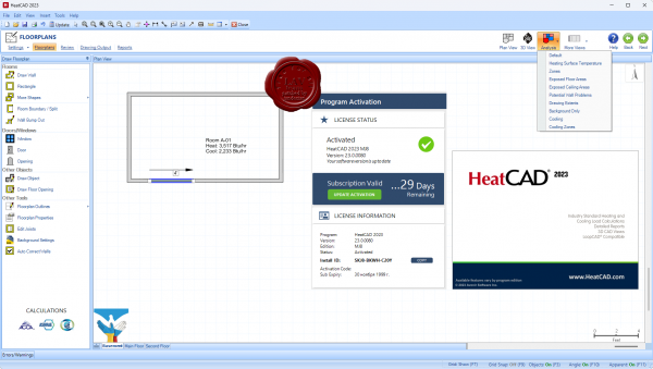
HeatCAD is a drawing-based software for fast and accurate calculation of residential heating and cooling loads. The Standard Edition supports ASHRAE and CSA residential heat loss calculations. The MJ8 Edition provides ACCA-Approved Manual J (8th Edition) calculations for residential heating and cooling loads. HeatCAD delivers advanced design features including integrated load calculations, automatic detection of unheated surfaces, and 3D CAD views.
More info
Tutorials |
| |
 Читать статью дальше (комментариев - 4)
| |
|
 |
 Автор: Williams Автор: Williams
 Дата: 30 сентября 2023 Дата: 30 сентября 2023
 Просмотров: 389 Просмотров: 389 |
| |
Flownex Simulation Environment 2023 v8.15.0.5222
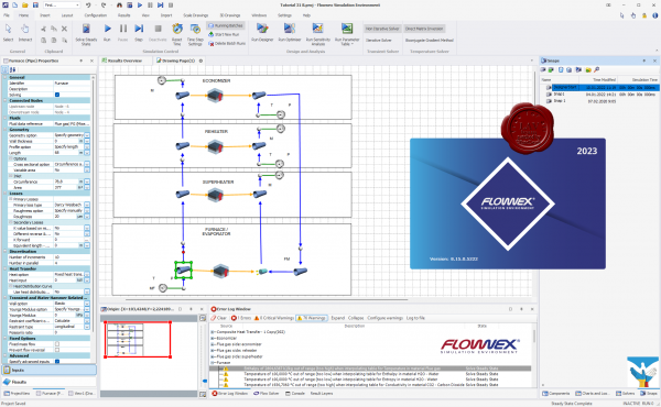
Flownex Simulation Environment delivers technology that enables you to study how systems will behave in the real world, where fluid is the driving factor. Flownex system simulation relays the overall effect of changing specific properties on components, allowing clients to examine extensively all possible variations of a system in the design and optimization of systems.
Flownex Simulation Environment provides turbomachinery engineers with an easy to use, off-the-shelf tool for modelling combustion chambers, secondary air systems, blade cooling flows, lubrication systems with oil-air mixtures, as well as overall cycle integration and operation.
Blade Cooling
By coupling 1D flow Flownex models with 3D heat transfer models in ANSYS Mechanical or CFX, a detailed turbine blade cooling simulation can be conducted. Flownex contains industry-standard pressure drop and heat transfer correlations for typical turbine blade features such as turbulator strips and pedestals. This allows designers to rapidly see the effects of their design changes on the maximum blade temperatures and cooling airflow rate.
COMBUSTION CHAMBER
Preliminary combustor design requires that an extensive number of geometrical and operational conditions be evaluated and compared. Especially during this phase, Flownex is an essential tool for combustor design engineers as it accurately captures important parameters such as the mass flow rate distribution through air admission holes, associated pressure losses as well as liner wall temperatures. Networks can be easily configured and solved within a few seconds. This result in substantial development cost savings because of the reduction in the number of detailed 3D simulations and rig tests required. A further advantage is the ability to use the Flownex results as boundary conditions for subsequent localized 3D models.
LUBRICATION SYSTEM
The primary use of Flownex in lubrication systems is used to determine optimum drain line sizes given the limited space inside the engine. This requires two-phase pressure drop calculations in lines with oil-air mixtures. In parallel with this engineers can determine whether or not scavenge pumps are required for fluid transportation in the drain lines and, if so, what the pumping requirement will be.
SECONDARY & COOLANT FLOW
Flownex includes a comprehensive rotating component library for analysing the secondary air system of a gas turbine engine. This enables engineers to quantify the bleed air consumption and flow distribution through the entire system. Furthermore, coupling Flownex with Ansys Mechanical enables engineers to perform detailed thermal studies of critical rotating components. Flownex includes:
- Real gas models.
- Windage power calculation.
- Choking calculations.
- User-defined HTCs.
Release notes |
| |
 Читать статью дальше (комментариев - 2)
| |
|
 |
 Автор: Williams Автор: Williams
 Дата: 29 сентября 2023 Дата: 29 сентября 2023
 Просмотров: 578 Просмотров: 578 |
| |
Schrodinger Suite 2023-3 Commercial Version Windows+Linux
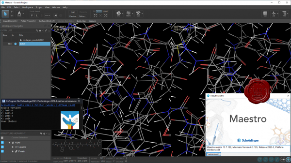
Schrodinger is a scientific leader in computational chemistry, providing software solutions and services for life sciences and materials research. Schrodinger aims to provide integrated software solutions and services that truly meet its customers' needs. We want to empower researchers around the world to achieve their goals of improving human health and quality of life through advanced computational techniques that transform the way chemists design compounds and materials. By building and deploying breakthrough scientific software solutions and forming collaborations and partnerships, we help scientists accelerate their research and development activities, reduce costs, and make novel discoveries that might otherwise not be possible.
Schrodinger software suite is a drug design software using both ligand and structure-based methods. Schrodinger provides accurate, reliable, and high performance computational technology to solve real-world problems in life science research. It provides superior solutions and services for the design, selection, and optimization of novel drug candidates. Schrцdinger's predictive models will enable drug discovery scientists to assess properties of chemical compounds early in the discovery process and to select drug candidates that have optimal profiles. The predictive power of Schrцdinger's software allows scientists to accelerate their research and development activities, reduce research costs, and make novel discoveries that might not be possible with other computational or experimental approaches. |
| |
 Читать статью дальше (комментариев - 3)
| |
|
 |
 Автор: Williams Автор: Williams
 Дата: 28 сентября 2023 Дата: 28 сентября 2023
 Просмотров: 678 Просмотров: 678 |
| |
Bentley ADINA Ultimate 2023 CONNECT Edition version 23.00.00.306
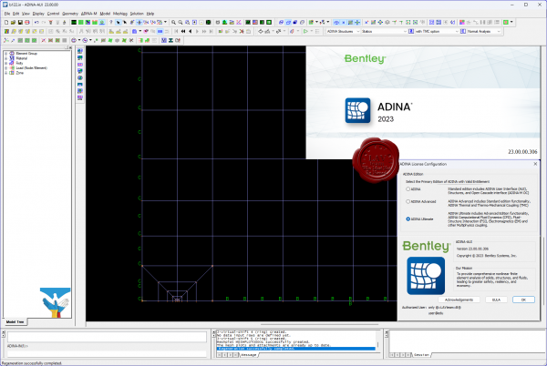 ADINA (Automatic Dynamic Incremental Nonlinear Analysis) - универсальная программа, работающая на основе метода конечных элементов, используемой для инженерных линейных и нелинейных расчётов. ADINA позволяет решать структурные и температурные задачи, рассчитывать течение, проводить мультифизические и электростатические симуляции. Внедрение программы при разработке или производстве продукта является лучшим решением для снижения затрат на производство прототипов и сокращения времени их тестирования. Современные расчётные методы, лежащие в основе программы ADINA , выгодно отличают её от остальных программ благодаря точным и надёжным результатам решения нелинейных задач. ADINA (Automatic Dynamic Incremental Nonlinear Analysis) - универсальная программа, работающая на основе метода конечных элементов, используемой для инженерных линейных и нелинейных расчётов. ADINA позволяет решать структурные и температурные задачи, рассчитывать течение, проводить мультифизические и электростатические симуляции. Внедрение программы при разработке или производстве продукта является лучшим решением для снижения затрат на производство прототипов и сокращения времени их тестирования. Современные расчётные методы, лежащие в основе программы ADINA , выгодно отличают её от остальных программ благодаря точным и надёжным результатам решения нелинейных задач.
Основные функциональные возможности пакета:
- Линейный анализ конструкций.
- Высоконелинейный анализ конструкций.
- Тепловой анализ.
- Гидродинамика.
- Взаимодействие потоков с конструкциями.
NX Nastran использует ADINA как модуль нелинейных расчетов.
Пакет ADINA состоит из следующих модулей:
- ADINA Structures - модуль расчёта статической и динамической прочности твёрдых тел и конструкций. Расчёт может быть проведён как в линейной, так и в высоконелинейной постановке с учётом нелинейности материала, больших деформаций и контакта.
- ADINA CFD – программный комплекс для моделирования течений сжимаемой и несжимаемой жидкости, использующий конечно-объемную и конечно-элементную дискретизацию.
- ADINA Thermal - программный модуль для решения задач теплопереноса в твёрдых телах и конструкциях.
- ADINA-FSI - модуль, предназначенный для анализа взаимодействия потока и конструкции, причём возможно рассмотрение высоконелинейного поведения материала вследствие больших перемещений, неупругости, контакта и температурной зависимости.
- ADINA-TMC - программный модуль, предназначенный для решения связанных термопрочностных задач, когда термические явления влияют на прочностные, и наоборот.
- ADINA User Interface (AUI) - пре- и постпроцессорный модуль, дающий возможность создавать и редактировать геометрические и конечно-элементные модели и осуществлять визуализацию результатов расчёта. Совместим со всеми модулями комплекса.
Дополнительные модули:
- ADINA Modeler (ADINA M) - встраиваемый в AUI модуль, использующий графическое ядро Parasolid и обеспечивающий твёрдотельное моделирование и прямое взаимодействие с другими CAD-системами, использующими Parasolid (Unigraphics, SolidWorks, Solid Edge)
- TRANSOR for I-DEAS, Patran - отдельный модуль, дающий возможность импортировать в ADINA и экспортировать из ADINA файлы данных в форматах I-DEAS и MSC.Patran
|
| |
 Читать статью дальше (комментариев - 5)
| |
|
 |
| ПОИСК ПО САЙТУ |
 |
|
 |
| КАЛЕНДАРЬ | | |
 |
| « Октябрь 2025 » |
|---|
| Пн | Вт | Ср | Чт | Пт | Сб | Вс |
|---|
| | 1 | 2 | 3 | 4 | 5 | | 6 | 7 | 8 | 9 | 10 | 11 | 12 | | 13 | 14 | 15 | 16 | 17 | 18 | 19 | | 20 | 21 | 22 | 23 | 24 | 25 | 26 | | 27 | 28 | 29 | 30 | 31 | |
|
 | |
| |
|