|
 |
 Автор: Williams Автор: Williams
 Дата: 23 февраля 2024 Дата: 23 февраля 2024
 Просмотров: 1 371 Просмотров: 1 371 |
| |
Netcad GIS 2024 v8.5.5.1077
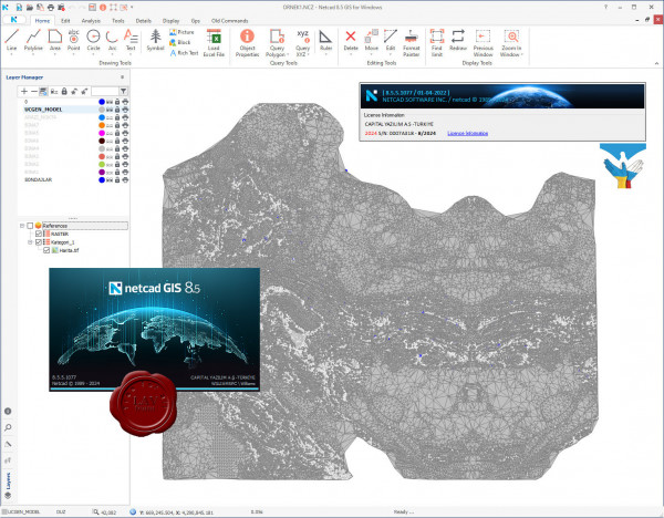
For more than 30 years, we have been producing solutions for the needs of professionals from different professional disciplines. With the agile software development philosophy, we aim to develop continuously in line with user needs and expectations.
With Netcad GIS, we offer our users the freedom of the CAD environment and the advantages of the rule-based structure of the GIS environment at the same time. We support these two spatial data formats, which we believe complementing each other in geographic data production processes, with dynamic CAD & GIS integration.
With its approach of integrated CAD and GIS solutions, Netcad GIS is designed to meet many different demands from different sectors and users. For many engineering and planning disciplines, demands such as mapping, design, calculation, data conversion, reporting, analysis are met with rich data format support. Netcad GIS is a geographic data source that supports a wide range of spatial information sources in international standards.
With the advanced data organization tools and the module capabilities customized for different professional specialization areas, needs-oriented projects can be produced. All different modules developed for professional needs run smoothly on Netcad GIS.
More info (EN)
More info (RUS)
More info (TR) |
| |
 Читать статью дальше (комментариев - 7)
| |
|
 |
 Автор: Williams Автор: Williams
 Дата: 22 февраля 2024 Дата: 22 февраля 2024
 Просмотров: 5 261 Просмотров: 5 261 |
| |
Blue Marble Global Mapper Pro v25.1 build 021424
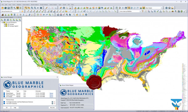
Вышла новая версия программы для просмотра карт и векторных изображений - Global Mapper v25.1
Global Mapper позволяет не только просматривать но и преобразовывать или редактировать, а даже и распечатывать всевозможные карты и векторные наборы данных. Global Mapper позволяет вам загружать ваши данные как слои ( только с условием, что вы работаете в Digital Elevation Model), или же как отсканированную карту, если вам надо изобразить местность в 3D. Есть также хорошая особенность, что позволяет вести работу в реальном времени. Происходит это путем загрузки данных с GPS приемника который подключен к компьютеру.
Global Mapper поддерживает огромнейшее число форматов. Работать с ней легко и просто, интерфейс не перенасыщен различными опциями, вы можете смело работать в ней и не задумываться о том, куда нажать, что бы сделать что - то. |
| |
 Читать статью дальше (комментариев - 26)
| |
|
 |
 Автор: Williams Автор: Williams
 Дата: 21 февраля 2024 Дата: 21 февраля 2024
 Просмотров: 1 132 Просмотров: 1 132 |
| |
StruSoft FEM-Design Suite v23.00.001
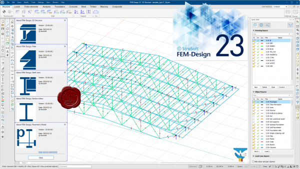
FEM-Design is an advanced modeling software for finite element analysis and design of load-bearing concrete, steel and timber structures according to Eurocode. The unique user-friendly working environment is based on the familiar CAD tools what makes the model creation and structure editing simple and intuitive. The quick and easy nature of FEM-Design makes it ideal for all types of construction tasks from single element design to global stability analysis of large structures and makes it the best practical tool for structural engineers.
Features:
- The structural model is created easily in 3D with intuitive CAD-tools or imported from BIM-software.
- The finite element mesh is generated and optimized automatically.
- The Auto Design feature helps to choose the most efficient cross-section or reinforcement arrangement.
- Resultant and connection forces in shell elements can be easily assessed.
- Results are shown in a variety of 3D-graphs, contour lines, color palettes or sections.
- Auto-updated project reports can be created from within the built-in FEM-Design documentation editor.
Theory manual
Release notes
Whats new |
| |
 Читать статью дальше (комментариев - 5)
| |
|
 |
 Автор: Williams Автор: Williams
 Дата: 20 февраля 2024 Дата: 20 февраля 2024
 Просмотров: 688 Просмотров: 688 |
| |
dGB Earth Sciences OpendTect v7.0.4
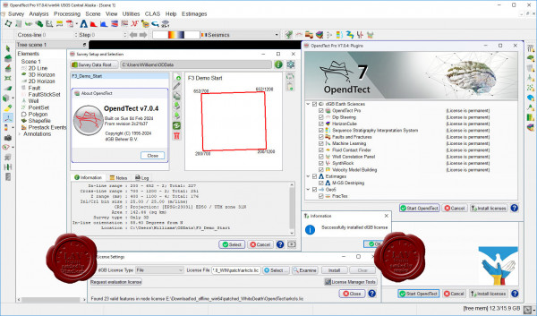
OpendTect is a free, open source seismic interpretation system and software development platform. The system supports all tools needed for visualizing, analyzing and interpreting 2D, 3D and 4D seismic data. It is widely used for Geo-Radar interpretation as well.
dGB's software products can be split into two parts: open source and closed source.
The open source part is OpendTect, a seismic interpretation software system for processing, visualizing and interpreting multi-volume seismic data, and for fast-track development of innovative interpretation tools.
The closed source part starts with OpendTect Pro, a commercial layer on top of OpendTect with a lot of extra functionalities, especially for professionals. OpendTect Pro can be extended by renting or purchasing commercial plugins that offer unique seismic interpretation workflows. |
| |
 Читать статью дальше (комментариев - 5)
| |
|
 |
 Автор: Williams Автор: Williams
 Дата: 19 февраля 2024 Дата: 19 февраля 2024
 Просмотров: 785 Просмотров: 785 |
| |
Aquaveo Groundwater Modeling System Premium v10.8.3
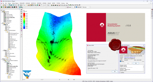
Aquaveo GMS - комплексная среда моделирования подземных вод с системой предварительной графический обработки информации.
Aquaveo GMS легко взаимодействует с MODFLOW и рядом других моделей по моделированию подземных вод и предоставляет расширенные графические возможности для просмотра и калибровки результатов моделирования.
What's new
Bug's fixed
Nice pricing |
| |
 Читать статью дальше (комментариев - 4)
| |
|
 |
 Автор: Williams Автор: Williams
 Дата: 18 февраля 2024 Дата: 18 февраля 2024
 Просмотров: 580 Просмотров: 580 |
| |
Missler TopSolid 2024 v7.18.400.0
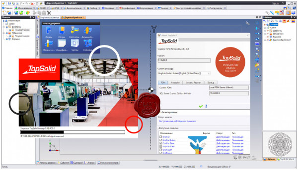
TopSolid является CAD/CAM/CAE&PDM интегрированной параметрической системой высокого уровня, охватывающая весь процесс проектирования и производства в масштабах предприятия.
С помощью Missler TopSolid Вы можете:
- создавать CAD-модели и чертежи деталей и сборок;
- проводить кинематический и МКЭ (FEM) анализы;
- проектировать пресс-формы, штампы, электроды, работать с листовыми материалами;
- получать развертки и осуществлять раскрой;
- конструировать мебель и изделия из дерева;
- строить системы трубопроводов;
- передавать данные между отдельными модулями системы, осуществлять импорт/экспорт данных из других систем;
- получать управляющие программы для станков с ЧПУ (токарная, фрезерная, многоосевая обработка, лазерная и газо-плазменная резки, электроэрозионная прошивка и вырезка, контроль по программе на координатно-измерительных машинах);
- вводить данные с помощью координатно-измерительных машин (КИМ), а также использовать обширные библиотеки стандартных деталей, агрегатов и инструмента.
Модули Missler TopSolid:
- TopSolid'Design - интегрированное решение для создания СAD моделей и чертежей.
- TopSolid'Mold - интегрированное решение для создания и разработки пресс-форм.
- TopSolid'Progress - интегрированное решение для проектирования и разработки штампов.
- TopSolid'Electrode - интегрированное решение для проектирования электродов.
- TopSolid'PunchCut - интегрированное решение для создания управляющих программ ЧПУ для вырубки, лазерной, плазменной резки и резки водоабразивным составом.
- TopSolid'Wire - интегрированное решение для электроэрозионной резки проволочным электродом.
- TopSolid'Cam - интегрированное решение для создания управляющих программ для станков с ЧПУ.
- TopSolid'Castor - интегрированное решение для анализа методом конечных элементов (FEM - анализ)
- TopSolid'Control - модуль для проведения измерений на трехкоординатных измерительных машинах с ЧПУ.
- TopSolid'Wood - модуль для проектирования изделий из дерева (мебель, деревянные конструкции...)
- TopSolid'Pdm - интегрированный модуль для управления данными проекта.
- TopSolid'Erp - модуль для оперативного планирования процесса производства.
|
| |
 Читать статью дальше (комментариев - 0)
| |
|
 |
 Автор: Williams Автор: Williams
 Дата: 16 февраля 2024 Дата: 16 февраля 2024
 Просмотров: 686 Просмотров: 686 |
| |
Schrodinger Suite 2024-1 Commercial Version Windows+Linux
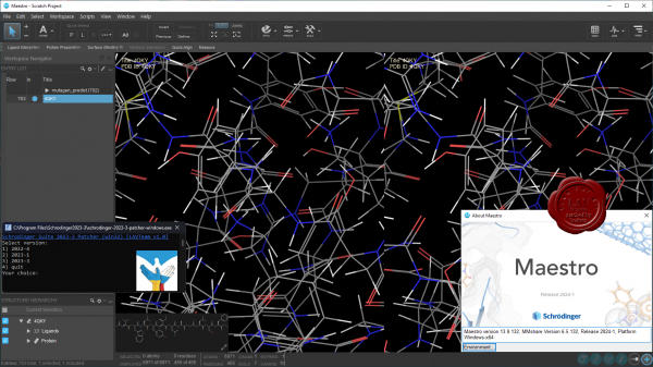 Schrodinger is a scientific leader in computational chemistry, providing software solutions and services for life sciences and materials research. Schrodinger aims to provide integrated software solutions and services that truly meet its customers' needs. We want to empower researchers around the world to achieve their goals of improving human health and quality of life through advanced computational techniques that transform the way chemists design compounds and materials. By building and deploying breakthrough scientific software solutions and forming collaborations and partnerships, we help scientists accelerate their research and development activities, reduce costs, and make novel discoveries that might otherwise not be possible. Schrodinger is a scientific leader in computational chemistry, providing software solutions and services for life sciences and materials research. Schrodinger aims to provide integrated software solutions and services that truly meet its customers' needs. We want to empower researchers around the world to achieve their goals of improving human health and quality of life through advanced computational techniques that transform the way chemists design compounds and materials. By building and deploying breakthrough scientific software solutions and forming collaborations and partnerships, we help scientists accelerate their research and development activities, reduce costs, and make novel discoveries that might otherwise not be possible.
Schrodinger software suite is a drug design software using both ligand and structure-based methods. Schrodinger provides accurate, reliable, and high performance computational technology to solve real-world problems in life science research. It provides superior solutions and services for the design, selection, and optimization of novel drug candidates. Schrodinger's predictive models will enable drug discovery scientists to assess properties of chemical compounds early in the discovery process and to select drug candidates that have optimal profiles. The predictive power of Schrodinger's software allows scientists to accelerate their research and development activities, reduce research costs, and make novel discoveries that might not be possible with other computational or experimental approaches. |
| |
 Читать статью дальше (комментариев - 8)
| |
|
 |
 Автор: Williams Автор: Williams
 Дата: 15 февраля 2024 Дата: 15 февраля 2024
 Просмотров: 2 471 Просмотров: 2 471 |
| |
Bentley MicroStation 2023 CONNECT Edition version 23.00.02.71
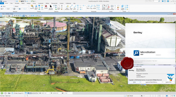
MicroStation - самая производительная, наиболее доступная и совместимая САПР-платформа для проектирования, строительства и эксплуатации мировой инфраструктуры.
Вам, вероятно, известно, что 95% инфраструктуры в мире проектируется, строится и поддерживается с применением файлов форматов DGN и DWG. При помощи MicroStation пользователи имеют возможность непосредственно редактировать содержимое обоих форматов файлов одновременно. Эта возможность превращает MicroStation в платформу для обеспечения совместимости, являющуюся обязательным атрибутом.
MicroStation также является платформой для инноваций, расположенной в центре полного спектра вертикальных программных приложений, обеспечивающей пользователей возможностью индивидуализации приложений с помощью VBA, а также возможностью "вертикального роста" при помощи узкоспециализированных решений для увеличения производительности при поддержании полной целостности данных по всему проекту.
С учетом лишь из этих двух соображений, то, что MicroStation используется всеми, включая архитекторов, инженеров, картографов и подрядчиков по проектам в области архитектуры, строительства и инженерного проектирования, не должно вызывать удивления. За счет этого данная система становится стандартом для лучших проектировщиков мира, являющихся участниками рейтинга ENR Global 150. |
| |
 Читать статью дальше (комментариев - 15)
| |
|
 |
 Автор: Williams Автор: Williams
 Дата: 14 февраля 2024 Дата: 14 февраля 2024
 Просмотров: 1 700 Просмотров: 1 700 |
| |
Leica Hexagon MinePlan (ex. MineSight) 2023 Release 3
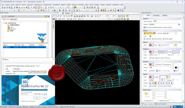 HxGN MinePlan provides geologists and engineers with powerful 3D modeling and data visualization. It supports seamless workflows, from exploration to production and it's backed by more than 50 years of innovation in partnership with thousands of global users. HxGN MinePlan provides geologists and engineers with powerful 3D modeling and data visualization. It supports seamless workflows, from exploration to production and it's backed by more than 50 years of innovation in partnership with thousands of global users.
Productive mines depend on being able to build detailed geological surfaces and solids. Statistical and geo-statistical analysis of project data is essential to producing an accurate block model with confidence.
Geosciences
The Geosciences suite empowers resource geologists to store, manage and analyse drillhole data.
Open pit engineering
MinePlan open pit engineering suite offers software packages that help you improve efficiency and make informed decisions.
Underground engineering
CAD offers solutions for underground design challenges, including 3D visualisation and tools for pillar design, plus more.
HxGN MinePlan Survey
MinePlan Survey allows for management of survey data throughout the mining lifecycle using a comprehensive software solution. |
| |
 Читать статью дальше (комментариев - 9)
| |
|
 |
| ПОИСК ПО САЙТУ |
 |
|
 |
| КАЛЕНДАРЬ | | |
 |
| « Октябрь 2025 » |
|---|
| Пн | Вт | Ср | Чт | Пт | Сб | Вс |
|---|
| | 1 | 2 | 3 | 4 | 5 | | 6 | 7 | 8 | 9 | 10 | 11 | 12 | | 13 | 14 | 15 | 16 | 17 | 18 | 19 | | 20 | 21 | 22 | 23 | 24 | 25 | 26 | | 27 | 28 | 29 | 30 | 31 | |
|
 | |
| |
|