|
 |
 Автор: Williams Автор: Williams
 Дата: 4 марта 2024 Дата: 4 марта 2024
 Просмотров: 180 Просмотров: 180 |
| |
FIFTY2 Technology PreonLab v6.1.1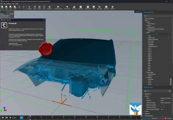
FIFTY2 PreonLab - CFD simulation tool for the analysis of fluids and their behavior in and around the vehicle.
The difference between classic CFD and PreonLab is quickly explained. Classical CFD is based on mesh creation, for PreonLab a different approach was chosen: Smoothed-Particle Hydrodynamics (SPH) is the basis of the revolutionary PREON technology.
Without the need for a mesh, all hydrodynamic challenges can be solved quickly and, most importantly, easily. PreonLab provides you with reliable results that are impressively visualized.
Here we go! PreonLab 6.1 is out now.
It is loaded with new features and improvements, enabling new engineering possibilities and applications. Empowered by the new GPU capabilities, PreonLab 6.1 takes another leap forward in efficient computing, delivering results even quicker.
- Enhanced GPU performance: PreonLab’s GPU implementation just got a significant boost. Not only does PreonLab 6.1 support multi-GPU computing now, but it also enables continuous particle size (CPS), dynamic sampling, and adaptive sampling on GPU, making your simulations even more efficient.
- Airflow and Car Suspension Model (CSM): PreonLab 6.1 also enables airflow import and CSM support for simulations on GPU. These are some of the key application enablers making it possible to simulate various use cases also on GPU.
- Snow Model on GPU: Snow modeling has been an important part of existing PreonLab capabilities. We are thrilled to announce that our snow model is now also available on the GPU platform.
- Enhanced Thermodynamics: Convective boundary condition has been added to the list of available boundary conditions. Convective Boundary Conditions can represent a more physical heat transfer, that predominantly occurs due to convective heat transport at fluid-fluid or fluid-solid interfaces. It is designed to conveniently represent natural or forced convection of heated solid bodies or fluids, in applications like heat exchangers, heat sinks, and even e-motors.
|
| |
 Читать статью дальше (комментариев - 3)
| |
|
 |
 Автор: Williams Автор: Williams
 Дата: 3 марта 2024 Дата: 3 марта 2024
 Просмотров: 2 405 Просмотров: 2 405 |
| |
Bentley Seequent GEO-SLOPE GeoStudio 2024.1.0.1406
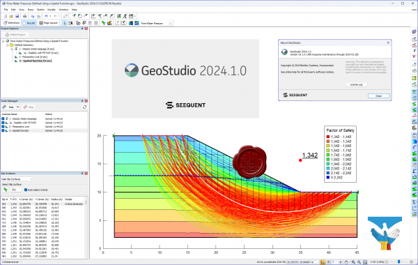 GEO-SLOPE GeoStudio - программный комплекс для решения инженерно-геологических задач и моделирования грунтовых конструкций. Данны пакет состоит из 8 продуктов: SLOPE/W - анализ устойчивости откосов; QUAKE / W - динамический анализ землетрясения; AIR / W - анализ потока воздуха; SEEP / W - анализ просачивания грунтовых вод; TEMP / W - геотермальный анализ; VADOSE/W - анализ зон аэрации и анализ почвенного покрова; SIGMA / W - анализ напряженно-деформированного состояния; CTRAN / W - анализ загрязнений транспорта. GEO-SLOPE GeoStudio - программный комплекс для решения инженерно-геологических задач и моделирования грунтовых конструкций. Данны пакет состоит из 8 продуктов: SLOPE/W - анализ устойчивости откосов; QUAKE / W - динамический анализ землетрясения; AIR / W - анализ потока воздуха; SEEP / W - анализ просачивания грунтовых вод; TEMP / W - геотермальный анализ; VADOSE/W - анализ зон аэрации и анализ почвенного покрова; SIGMA / W - анализ напряженно-деформированного состояния; CTRAN / W - анализ загрязнений транспорта.
GeoStudio is a product suite for geotechnical and geo-environmental modeling, broad enough to handle all your modeling needs. The suite consists of 8 products: SLOPE/W for slope stability; SEEP/W for groundwater seepage; SIGMA/W for stress-deformation; QUAKE/W for dynamic earthquake; TEMP/W for geothermal; CTRAN/W for contaminant transport; AIR/W for air flow; VADOSE/W for vadose zone & covers.
More info
Examples can be found here |
| |
 Читать статью дальше (комментариев - 30)
| |
|
 |
 Автор: Williams Автор: Williams
 Дата: 2 марта 2024 Дата: 2 марта 2024
 Просмотров: 792 Просмотров: 792 |
| |
Meteotest Meteonorm v8.2.0
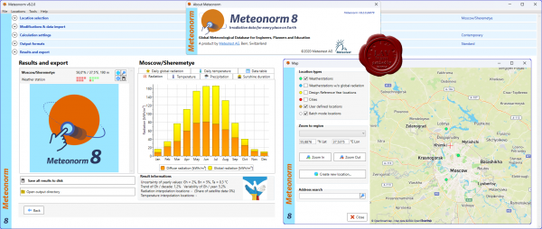 Meteonorm is a software tool that allows you to access data about solar radiation and other weather parameters around the world. Although the program has a straightforward interface, the correct interpretation of the data provided depends on knowledge well beyond being able to use the software. Meteonorm is a software tool that allows you to access data about solar radiation and other weather parameters around the world. Although the program has a straightforward interface, the correct interpretation of the data provided depends on knowledge well beyond being able to use the software.
Luckily, you can easily configure the program if you follow a series of steps suggested by the wizard. First, you need to pick the desired locations from those available. Second, you should decide on the data source and the way to process the information. Third, it is necessary to set the calculation methods, including radiation and temperature periods, with the possibility of adding scenarios for future periods.
Fourth, you can set the output formats from a wide range that comprises not only Meteonorm data but also Building Simulation, PV, Solar Thermal and General Use. What is more, you can even customize the output format to your specific needs. Finally, you will be presented with the results, including graphs portraying such meteorological parameters as daily temperature, radiation, temperature, precipitation, sunshine radiation and daily global radiation. Likewise, you can also visualize the exact figures from a table and export these results to disk.
Meteonorm is not only a software program but a meteorological service as well. As a result, the quality of the data depends on the reliability of the service. In this respect, you should know that Meteonorm is widely recognized as one of the leading services of this kind in the world and used as a standard for solar energy simulations.
In this regard, it offers more than 30 meteorological parameters collected over several years. It receives weather reports from a wide network of more than 8000 ground meteorological stations around the globe as well as five geostationary satellites. However, there have been concerns about the methods used to model data as well as the uneven distribution of the stations.
All in all, Meteonorm is undoubtedly a great source of data for all kinds of activities that require evaluating meteorological parameters, such as architecture, cooling systems, agriculture, forestry and others. It also has the advantage of being quite affordable; yet, there are other similar tools available and it is always a good idea to check what is best for you. |
| |
 Читать статью дальше (комментариев - 5)
| |
|
 |
 Автор: Williams Автор: Williams
 Дата: 1 марта 2024 Дата: 1 марта 2024
 Просмотров: 1 179 Просмотров: 1 179 |
| |
Trimble eCognition Developer v10.4
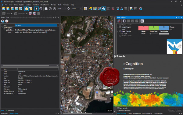
eCognition Developer представляет собой мощную среду разработки для объектно-ориентированного анализа изображений. Он используется в науках о Земле для разработки наборов правил для автоматического анализа данных дистанционного зондирования.
More info
New features in eCognition 10.4 |
| |
 Читать статью дальше (комментариев - 7)
| |
|
 |
 Автор: Williams Автор: Williams
 Дата: 29 февраля 2024 Дата: 29 февраля 2024
 Просмотров: 165 Просмотров: 165 |
| |
Cadence 6SigmaET Celsius EC Solver 2023.2 HF4
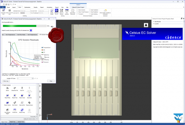 Компания Cadence анонсировала новую программу для анализа тепловыделения – Celsius Thermal Solver. Этот симулятор использует методы конечных элементов (FEA) и вычислительной гидродинамики (CFD) для обнаружения перегрева микросхем, печатных плат и корпусов приборов с учетом тепловыделения, теплопередачи и конвекционной передачи тепла. Celsius получает полную информацию о конструкции корпуса и топологии печатной платы из инструментов САПР , в т. ч. из проектов САПР печатных плат Cadence Allegro или OrCAD. Более того, Celsius может получить информацию о детальной конструкции самой микросхемы, если речь идет об анализе тепловыделения и нагрева внутри ее корпуса. Таким функционалом могут заинтересоваться отечественные разработчики микросхем процессоров, которые пользуются САПР Cadence для проектирования СБИС и корпусов/подложек микросхем (САПР для разработки подложек Cadence Allegro Package Designer/System In Package является расширенной версией САПР печатных плат Cadence Allegro PCB Designer). Симулятор Celsius легко интегрируется в программное обеспечение для проектирования электроники Cadence. Топология компонентов и геометрические параметры печатной платы считываются из файлов Cadence собственного формата. Для представления геометрических параметров трехмерной конструкции прибора, а также трехмерных объектов на печатных платах и в компонентах, используются файлы нейтральных форматов, например STEP. Таким образом, Celsius предоставляет дополнительные удобства пользователям САПР, отделяя геометрические параметры системы от топологии текущего проекта: если параметры конструкции изменятся, разработчику не потребуется заново подгружать данные о топологии платы. Celsius выполняет моделирование с учетом зависимости режимов тепловыделения от времени, например с изменением электрического тока, или с учетом временны́х характеристик, смены режимов работы и профилей мощности, которые можно получить из программного обеспечения для проектирования электроники. Возможность быстро установить величину электрического сопротивления объектов и рассеиваемой на них мощности, легко и просто проводить тепловой анализ, а также учитывать детализованную геометрию объектов и их физическое расположение обеспечивает точные результаты моделирования. Компания Cadence анонсировала новую программу для анализа тепловыделения – Celsius Thermal Solver. Этот симулятор использует методы конечных элементов (FEA) и вычислительной гидродинамики (CFD) для обнаружения перегрева микросхем, печатных плат и корпусов приборов с учетом тепловыделения, теплопередачи и конвекционной передачи тепла. Celsius получает полную информацию о конструкции корпуса и топологии печатной платы из инструментов САПР , в т. ч. из проектов САПР печатных плат Cadence Allegro или OrCAD. Более того, Celsius может получить информацию о детальной конструкции самой микросхемы, если речь идет об анализе тепловыделения и нагрева внутри ее корпуса. Таким функционалом могут заинтересоваться отечественные разработчики микросхем процессоров, которые пользуются САПР Cadence для проектирования СБИС и корпусов/подложек микросхем (САПР для разработки подложек Cadence Allegro Package Designer/System In Package является расширенной версией САПР печатных плат Cadence Allegro PCB Designer). Симулятор Celsius легко интегрируется в программное обеспечение для проектирования электроники Cadence. Топология компонентов и геометрические параметры печатной платы считываются из файлов Cadence собственного формата. Для представления геометрических параметров трехмерной конструкции прибора, а также трехмерных объектов на печатных платах и в компонентах, используются файлы нейтральных форматов, например STEP. Таким образом, Celsius предоставляет дополнительные удобства пользователям САПР, отделяя геометрические параметры системы от топологии текущего проекта: если параметры конструкции изменятся, разработчику не потребуется заново подгружать данные о топологии платы. Celsius выполняет моделирование с учетом зависимости режимов тепловыделения от времени, например с изменением электрического тока, или с учетом временны́х характеристик, смены режимов работы и профилей мощности, которые можно получить из программного обеспечения для проектирования электроники. Возможность быстро установить величину электрического сопротивления объектов и рассеиваемой на них мощности, легко и просто проводить тепловой анализ, а также учитывать детализованную геометрию объектов и их физическое расположение обеспечивает точные результаты моделирования.
The Cadence Celsius EC Solver technology (formerly 6SigmaET by Future Facilities) is designed specifically to enable electronic system designers to address today’s most challenging thermal/electronics cooling management problems quickly and accurately. The Celsius EC Solver utilizes a powerful computational engine and meshing technology that enables designers to model and analyze complex designs to not only reduce the risks of product failures but also to optimize thermal solutions to maximize performance. |
| |
 Читать статью дальше (комментариев - 0)
| |
|
 |
 Автор: Williams Автор: Williams
 Дата: 28 февраля 2024 Дата: 28 февраля 2024
 Просмотров: 231 Просмотров: 231 |
| |
Cadence 6SigmaDCX DataCenter Design Pro 2023.2 HF4
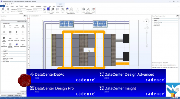 Cadence is a pivotal leader in electronic systems design, building upon more than 30 years of computational software expertise. The company applies its underlying Intelligent System Design strategy to deliver software, hardware, and IP that turn design concepts into reality. Cadence is a pivotal leader in electronic systems design, building upon more than 30 years of computational software expertise. The company applies its underlying Intelligent System Design strategy to deliver software, hardware, and IP that turn design concepts into reality.
Cadence DataCenter Design Software and Insight Platform (formerly Future Facilities 6SigmaDCX product line) offers physics-based simulation software for the next generation of data center design and management to maximize operational performance.
6SigmaRoom by Future Facilities Ltd. has been rebranded into two distinct product offerings from Cadence Design Systems: DataCenter Design and DataCenter Insight. See About DataCenter 2023.2 for more information about these two product offerings.
DataCenter Design and DataCenter Insight Desktop 2023.2 follow on directly from 6SigmaRoom Release 17.1, so all known and fixed issues that applied to 6SigmaRoom Release 17.1 also apply to DataCenter Design and DataCenter Insight Desktop 2023.2 |
| |
 Читать статью дальше (комментариев - 0)
| |
|
 |
 Автор: Williams Автор: Williams
 Дата: 27 февраля 2024 Дата: 27 февраля 2024
 Просмотров: 1 350 Просмотров: 1 350 |
| |
Aquaveo Watershed Modeling System v11.2.8
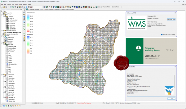 Aquaveo WMS является ведущим решением для 1D-гидрологического , 1D-гидравлического и 2D-распределенного гидрологического моделирования. Aquaveo WMS содержит мощные инструменты для топографической обработки данных, автоматизированного разграничения бассейна, расчета геометрических параметров. Aquaveo WMS является ведущим решением для 1D-гидрологического , 1D-гидравлического и 2D-распределенного гидрологического моделирования. Aquaveo WMS содержит мощные инструменты для топографической обработки данных, автоматизированного разграничения бассейна, расчета геометрических параметров.
Aquaveo tutorials can be download from here
Whats new |
| |
 Читать статью дальше (комментариев - 14)
| |
|
 |
 Автор: Williams Автор: Williams
 Дата: 26 февраля 2024 Дата: 26 февраля 2024
 Просмотров: 279 Просмотров: 279 |
| |
Cadence Design Systems Fidelity 2023.2.1
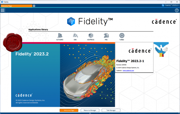
The computational fluid dynamics (CFD) industry faces increasing demand for efficiency, fidelity, and speed. Don’t settle for tried-and-true solutions when you step into environments that have yet to be developed. Improved real behavioral modeling of systems yields greater degrees of fidelity and security for the products you send out into the world. The requirements for multidisciplinary modeling, analysis, and optimization are vast and include:
- Conjugate Heat Transfer (CHT) coupling flow and heat transfer
- Fluid-structure interactions (FSI)
- Fluid-chemistry and multiphase interactions such as combustion
- Aeroacoustics coupling flow and noise
Fidelity CFD is the end-to-end solution for all CFD-related applications. The dedicated tools within the Fidelity CFD environment can solve each step of the simulation process quickly and efficiently. Furthermore, Fidelity CFD was designed with ease-of-use in mind with an intuitive and application-driven interface or through automated processes with the Python API or optimization module available.
The software necessary for realistic modeling of fluid flows grows increasingly competent and complex. Using the Fidelity CFD environment, you can trust any computational challenge to be handled with both accuracy and speed. Custom fit this CFD simulation software to solve the difficulties you are experiencing in your design and verification cycle.
With CFD workflows being reassessed every cycle to optimize and improve for greater levels of fidelity and speed, Fidelity CFD serves your simulation necessities by offering a highly automated, customizable solution. |
| |
 Читать статью дальше (комментариев - 0)
| |
|
 |
 Автор: Williams Автор: Williams
 Дата: 25 февраля 2024 Дата: 25 февраля 2024
 Просмотров: 526 Просмотров: 526 |
| |
Graebert ARES Commander 2024 SP3
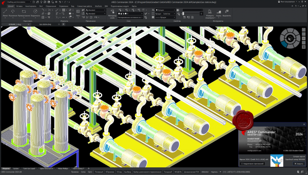
ARES Commander is desktop CAD for Windows, MacOS and Linux just like the traditional CAD software you may already be familiar with.
Experience the agility of ARES Commander to create and modify DWG drawings in 2D and 3D on your computers. Leverage the drafting and design features that you've come to expect for your DWG files. ARES Commander brings your CAD efficiency to the next level with smarter productivity tools and a unique concept: The Trinity of CAD.
Compare AutoCAD and ARES Commander |
| |
 Читать статью дальше (комментариев - 1)
| |
|
 |
 Автор: Williams Автор: Williams
 Дата: 24 февраля 2024 Дата: 24 февраля 2024
 Просмотров: 420 Просмотров: 420 |
| |
MathWorks RoadRunner R2023b Update 6
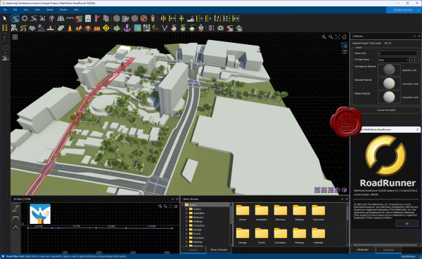
RoadRunner is an interactive editor that lets you design 3D scenes for simulating and testing automated driving systems. You can customize roadway scenes by creating region-specific road signs and markings. You can insert signs, signals, guardrails, and road damage, as well as foliage, buildings, and other 3D models. RoadRunner provides tools for setting and configuring traffic signal timing, phases, and vehicle paths at intersections.
RoadRunner supports the visualization of lidar point cloud, aerial imagery, and GIS data. You can import and export road networks using OpenDRIVE. 3D scenes built with RoadRunner can be exported in FBX, glTF, OpenFlight, OpenSceneGraph, OBJ, and USD formats. The exported scenes can be used in automated driving simulators and game engines, including CARLA, Vires VTD, NVIDIA DRIVE Sim, rFpro, Baidu Apollo, Cognata, Unity, and Unreal Engine.
RoadRunner Asset Library lets you quickly populate your 3D scenes with a large set of realistic and visually consistent 3D models. RoadRunner Scene Builder lets you automatically generate 3D road models from HD maps. |
| |
 Читать статью дальше (комментариев - 0)
| |
|
 |
| ПОИСК ПО САЙТУ |
 |
|
 |
| КАЛЕНДАРЬ | | |
 |
| « Октябрь 2025 » |
|---|
| Пн | Вт | Ср | Чт | Пт | Сб | Вс |
|---|
| | 1 | 2 | 3 | 4 | 5 | | 6 | 7 | 8 | 9 | 10 | 11 | 12 | | 13 | 14 | 15 | 16 | 17 | 18 | 19 | | 20 | 21 | 22 | 23 | 24 | 25 | 26 | | 27 | 28 | 29 | 30 | 31 | |
|
 | |
| |
|