|
 |
 Автор: Williams Автор: Williams
 Дата: 25 января 2025 Дата: 25 января 2025
 Просмотров: 509 Просмотров: 509 |
| |
Virto Solar Virto.CAD v1.12.0.2
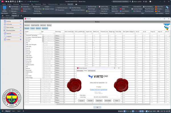
Virto.CAD is a powerful PV design plugin for AutoCAD and BricsCAD to speed up the design and engineering process of large-scale solar plants.
It allows EPC, engineering firms and developers in the solar industry to create detailed drawings and calculations for Commercial & Industrial and utility-scale ground-mount PV projects. |
| |
 Читать статью дальше (комментариев - 5)
| |
|
 |
 Автор: Williams Автор: Williams
 Дата: 24 января 2025 Дата: 24 января 2025
 Просмотров: 1 093 Просмотров: 1 093 |
| |
GeoLogismiki Suite 01/2025
BLogPro v3.0.1.3, CLiq v3.5.3.10, CPeT-IT v3.9.5.5
LiqSVs v2.3.2.11, 2D Section Maker v4.1.1.3, SPAS 2019 v4.1.1.5
SteinN Pro v3.1.0.1, SteinP 3DT v3.1.0.11, SPTCorr Pro v4.0.1.9, StoneC 2D v6.2.1.6
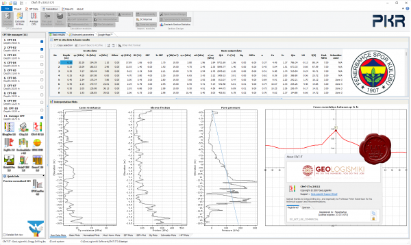
BLogPro. Creation of a geotechnical borehole data sheet specially adjusted for the Geotechnical Engineer. Technical log data and stratigraphy are some of the supported input.
CPeT-IT. Interpretation and presentation of Cone Penetration Test data using the latest Dr. Robertson methodology. Analytical tabular results and reports quickly and easy.
CLiq. Assessment of soil liquefaction from data acquired with Cone Penetration Test, using the latest and most widely used methodologies.
LiqSVs. Soil liquefaction assessment using insitu data acquired with Standard Penetration Test or Shear wave in situ tests, utilizing the most widely used methods.
SectionMaker. An external add-on module for CPeT-IT that helps in the creation of 2D cross sections using the typical geotechnical sections defined in the software.
SPAS 2019 is a SCPTu and downhole test analysis software that perfroms analysis for both S and P seismic waves. Supports multiple boreholes in one project file.
SPTCorr. Estimate various soil mechanical parameters from Standard Penetration Test (SPT), a widely and most frequently used in-situ test for geotechnical exploration.
SteinN Pro can be used for contacting preliminary settlements calculation below a rectangular footing. All calculations are contacted according to DIN 4019.
SteinP 3DT performs elastic settlements calculation below a footing in 2D plane. Various footing shapes are supported and inclination of soil layers in 3D.
StoneC. Estimate soil improvement under a grid of stone columns (vibro replacement) according to Priebe methodology. Calculations for rectangular and circular installation grid. |
| |
 Читать статью дальше (комментариев - 10)
| |
|
 |
 Автор: Williams Автор: Williams
 Дата: 23 января 2025 Дата: 23 января 2025
 Просмотров: 911 Просмотров: 911 |
| |
Applied Imagery Quick Terrain Modeller v8.4.3.1.1 build 82946 USA Edition
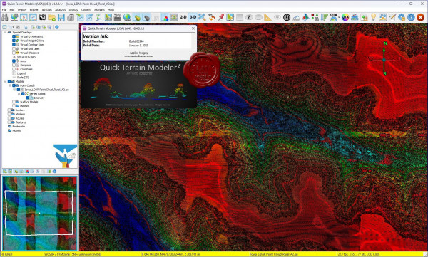
Quick Terrain Modeler is the world's premier 3D point cloud and terrain visualization software package. Designed for use with LiDAR, but flexible enough to accommodate other 3D data sources, Quick Terrain Modeler provides an easy to use software experience that allows users to work with significantly more data, render larger models, analyze data faster, and export a variety of products. These benefits enable very powerful, yet simple and intuitive, terrain exploitation.
More info
Sample and training data can be found here |
| |
 Читать статью дальше (комментариев - 6)
| |
|
 |
 Автор: Williams Автор: Williams
 Дата: 22 января 2025 Дата: 22 января 2025
 Просмотров: 673 Просмотров: 673 |
| |
Bentley OpenBuildings 2024
Designer v24.00.00.72, Speedikon v24.00.00.29

Почему OpenBuildings, больше, чем BIM. Ответ кроется в прошлом названии программы - AECOsim. Как правило, все современные BIM-решения, которые позиционируются, как комплексные, можно описать только тремя буквами: AEC – архитектура, инженерные сети, строительство. AECOsim кроме этого есть функционал для эксплуатации, к тому же в OpenBuildings в рамках одного файла легко можно объединить проект здания с большими инфраструктурными проектами.
7 причин, почему стоит работать в OpenBuildings:
- Упрощение процесса проектирования
- Подключение существующей реальности
- Создание архитектурных решений, конструктивных решений, комплексных инженерных систем
- Совместимость с вычислительным проектированием
- Управление данными и отчетностью
- Всесторонняя совместимость и взаимодействие
- Визуализация
С OpenBuildings вы получите огромную библиотеку предварительно разработанных 3D-моделей различных архитектурных, конструктивных и инженерных компонентов, а также электрические символы.
Одной из наиболее важных частей моделирования OpenBuildings является то, что в нем есть возможность объединенного рабочего пространства. Это рабочий процесс, в котором разные специалисты могут работать над разными частями проекта, а затем объединять в один комплексный проект, который будет содержать все проектные и BIM данные.
Для анализа проекта и корректировки ваших решений, особенно на ранних этапах проекта, когда нет данных от смежников, вы можете воспользоваться моделированием реальности для создания точной цифровой копии любого объекта от помещения до целого города. Программа может обрабатывать облака точек, фотографии, 3д фотографии, сетки реальности.
Каждый элемент модели можно снабдить ссылками которые будут ссылаться либо на чертежи, либо на офисные документы ворд, пдф, эксель и дргие. Гипермоделирование - это особенность, уникальная для решения Bentley, основанного на технологии Power-Platform, которая накладывает чертежи на модель.
OpenBuildings может интегрировать в себя разные типы файлов: 3D Object file, Sketchup File, 3D Max file, Revit Family, DWG/DXF, gbXML (энергетический анализ), 3dm – Rhino.
Благодаря многообразию решений Бентли на платформе MicroStation все специалисты от ГИС до ПРОЕКТИРОВАНИЯ, СТРОИТЕЛЬСТВА, ДОРОГ И МОСТОВ получают междисциплинарную координацию с эталонной технологией MicroStation и ее федеративным подходом. Таким образом, платформа MicroStation и ее формат файла dgn представляют собой среду общего моделирования. За время существования проекта создается много данных. Каждый участник проекта должен иметь доступ к нужным данным в нужное время в нужном формате.
OpenBuildings Speedikon is best-in-class building design and documentation software, empowering architects and design engineers to plan, analyze, and document buildings of varying sizes and complexity. It provides a high-quality, level-of-detail (LOD)-dependent representation suitable for diverse applications. The software features robust capabilities for seamless standardization and customization, ensuring flexibility in design processes. Additionally, users gain access to the latest integrated version of MicroStation, providing the benefits of its advanced features.
OpenBuildings Speedikon enhances design processes by enabling work in a floor plan view where z-coordinates are intelligently managed through reference planes. Right from the start, it integrates 2D and 3D views, allowing simultaneous observation and manipulation. OpenBuildings Speedikon also facilitates the rapid creation of intelligent, parametric models that are rich in content properties for various building components. Advanced view filter technology allows users to visualize the results of their drawings immediately. With just a click or two, the quality of representation can be adjusted based on the required LOD for specific use cases. The software features an integrated Project Manager, which simplifies the organization and management of projects. Its robust data format ensures compatibility, permitting the opening and editing of legacy data up to fifteen years old without the need for conversion. |
| |
 Читать статью дальше (комментариев - 5)
| |
|
 |
 Автор: Williams Автор: Williams
 Дата: 21 января 2025 Дата: 21 января 2025
 Просмотров: 899 Просмотров: 899 |
| |
Dlubal COMPOSITE-BEAM v8.36.01.162532
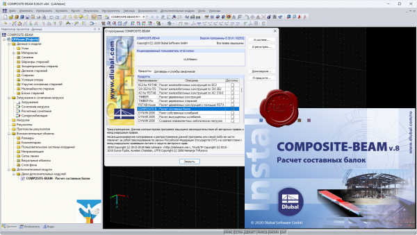
The COMPOSITE-BEAM program performs design of composite beams according to ENV 1994‑1‑1:1992‑10
Features:
- Single-span and continuous beams with definable boundary conditions.
- Automatic determination of effective cross-sections.
- Free arrangement of construction supports for construction stage.
- Free definition of concentrated, linear and linearly variable loads as fixed and variable loads with specification of concrete age on loading.
- Freely definable construction loads as well as moving construction loads.
- Automatic load combination.
- Calculation of cross-section properties according to Method 1 or 2.
- Calculation of elastic internal forces with RSTAB.
- Redistribution of moments.
- Design of bending and shear force resistance with interaction.
- Determination of required shear connectors and their distribution.
- Design of longitudinal shear force resistance.
- Results of governing support reactions for construction and composite stage including loads of construction supports.
- Lateral-torsional buckling analysis.
- Analysis for limitation of crack widths.
- Design of natural frequency.
|
| |
 Читать статью дальше (комментариев - 4)
| |
|
 |
 Автор: Williams Автор: Williams
 Дата: 19 января 2025 Дата: 19 января 2025
 Просмотров: 1 062 Просмотров: 1 062 |
| |
KobiLabs Kobi Toolkit v2025.1.95 for Autodesk AutoCAD 2020-2025
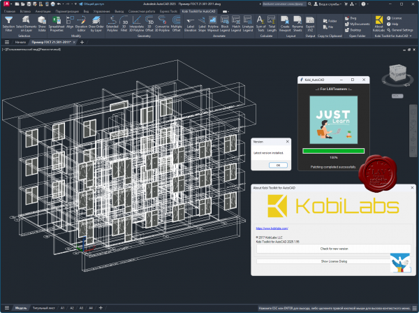
KobiLabs is a team of engineers and developers with more than 100 man years experience in CAD/BIM consultation and software development.
All of our senior developers have extensive experience in C++, .NET and jаvascript, as well as database systems MS SQL, MongoDB and others.
By developing our own software – used globally by companies large and small – we have gained valuable experience in building software for the
Autodesk platform and helping customers use the software to its fullest potential.
Our customers are primarily architects, structural and civil engineers, but our experiences also covers fields such as mechanical engineering, piping and surveying. Our customers work with different software platforms (mostly Revit, AutoCAD, Civil 3D, Tekla and similar). Our development experience includes CAD/BIM plugins and desktop and web applications. |
| |
 Читать статью дальше (комментариев - 12)
| |
|
 |
 Автор: Williams Автор: Williams
 Дата: 18 января 2025 Дата: 18 января 2025
 Просмотров: 747 Просмотров: 747 |
| |
RushForth Tools for Autodesk Revit 2021-2025
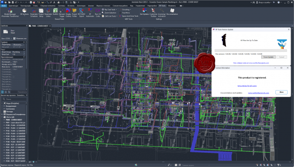 RushForth Tools for Revit saves hundreds of hours linking Revit to Excel, managing shared parameters, extracting Excel data or table formatting, etc. RushForth Tools for Revit saves hundreds of hours linking Revit to Excel, managing shared parameters, extracting Excel data or table formatting, etc.
MAIN FEATURES
Perform advanced filtering of elements by parameter or property values.
Export element data to Excel for advanced manipulation, concatenation, and calculations.
Import modified data from Excel into Revit elements.
Search and export model data including parameters, locations, owner of elements, etc.
PARAMETER TRANSFORMER
Perform advanced filtering of elements by parameter or property values
Synchronize element data with Excel for advanced manipulation, concatenation, and calculations
Find and replace text in parameter values
Edit Key Schedules using Excel
Purge categories or filtered selection out of a model
Insert existing views onto existing sheets by specifying a sheet number in Excel
PARAMETER SCHEDULER
Instantly make families compatible with standard schedules and tags by simply selecting your preset parameter list
Import/Export shared parameters to/from families or projects
Review existing project schedules and automatically add missing shared parameters to scheduled elements
Batch process multiple families
Make downloaded content be compatible with any of your preset schedules
Convert existing family parameters to shared parameters that can show up in schedules and tags
PARAMETER LINKER
Link parameter values between elements and between linked models
Link detail items on a Revit Diagram to the floor plan equipment they represent
Link non-schedulable parameters and properties to parameters that can be scheduled or tagged
Allows non-licensed users to access the tool and maintain existing links in smart models without having to purchase the software
DRAFTXL
Import Excel tables into Revit drafting views preserving fonts and formatting
Manage and update imported Excel tables
3D SECTIONS
Quickly create a 3D view for a selected region, selected elements, selected level, or the ceiling space of your current level
Show all elements and worksets by default for quick coordination and visualization
PROJECT SETUP
Automatically create views and sheets based on the number of levels in your project and your templates
Create dependent views from scope boxes or matching settings in a linked model
Copy elements from linked model: Title blocks, scope boxes, match lines, true north, etc.
Create unplaced rooms or placeholder sheets from Excel lists
Automatically place new or existing views onto desired sheets
RAY CAST TOOLS
Automatically place element instances on the walls, ceilings, and floors of multiple spaces in the chosen directions (up, down, left, right, ceiling, floor)
Automatically place element instances around the perimeter of selected spaces at desired intervals
Move selected elements to the closest wall, ceiling, or floor |
| |
 Читать статью дальше (комментариев - 4)
| |
|
 |
 Автор: Williams Автор: Williams
 Дата: 17 января 2025 Дата: 17 января 2025
 Просмотров: 913 Просмотров: 913 |
| |
Graitec PowerPack 2025.1 for Advance Steel
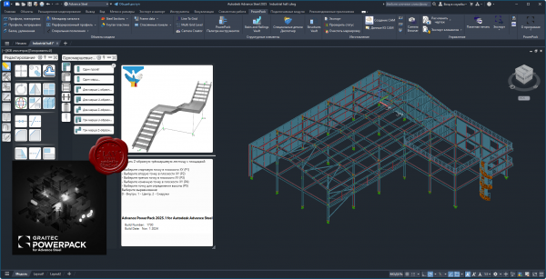
PowerPack for Autodesk Advance Steel is an essential productivity companion for the professionals in the AEC industry, extending and pushing the boundaries of Advance Steel. A user-centric powerful extension, the PowerPack for Advance Steel is designed to help delivering projects with increased productivity and efficiency, enhancing tools to provide better control and accuracy, improving everyday work.
KEY FEATURE 1: Multi Grid Level
The Multi Grid Level tool allows the user to quickly create grid lines and levels within the Advance Steel model space, combining also with options to create model views and cameras within those model views.
KEY FEATURE 2: Camera Creator/Browser
The ‘Camera Creator’ is designed to allow users to quickly create a series of new cameras within the model space, it allows the user to remain within the dialog and change the parameters for each camera placed. This tool is design to compliment the previous Grid tools that allow for use of Cameras within dedicated model views, this is aimed at allowing the user the ability to place cameras as bespoke locations to predefined View orientations, with provision for used defined orientation based upon current model UC. In addition, the Camera Browser is an additionnal tool to allow the user management of the multiple camera instances within the model space, allowing for the selection and editing of their parameters.
KEY FEATURE 3: Connection Vault
PowerPack for Advance Steel extends the standard library with a variety of parametric and intelligent advanced connections: Threaded Rod Connection, Tube to Tube Connection, Purlin Connection, Plates on Profile, Plate for Multiple Bracings, Curved End Plate – Plate & Grating Stiffeners.
KEY FEATURE 4: IGES/STEP export
The IGES/STEP export functionality is the key to the collaboration with manufacturers. Formats are widely requested by many manufacturers for designing moulds or for pricing manufactured parts, the export in IGES and STEP formats completes the PowerPack solution. These types of file formats are helping the user to be more productive when it comes to sending files to third applications for the fabrication process.
KEY FEATURE 5: Platform Cover Creator
Automatically create grating or plate cover based on the selected supporting members. Platform Cover Creator is one of the stars of the PowerPack thanks to its versatility. The joint helps to automatically create grating or plate cover based on selected members, and gives the user many possibilities.
KEY FEATURE 6: Stairs and Railings
The Stairs and Railings module in the Graitec PowerPack for Autodesk Advance Steel simplifies stair and railing design, offering extensive customization options for precise and visually appealing configurations. Create varying flight arrangements, from single flights to multi-flights with different shapes, and incorporate plate or grating landings. With options for open or closed stringers made from beams or plates, users have detailed control over the design parameters. This module streamlines the design process, enhances productivity, and ensures structurally sound and aesthetically pleasing stairs and railings.
KEY FEATURE 7: Transmission Towers
The 'Transmission Towers Command' under the new Towers Designer allows users to create intricate structural frameworks for transmission towers with ease. The command is highly customizable, letting users define cage arrangements, segment divisions, and bracing schemes for each tower. It also allows for variations in tower arm arrangements and the addition of a tower top element. The command enhances productivity by automating the creation of complex tower structures, offering numerous bracing schemes, and providing options for multiple configurations and section size selection. |
| |
 Читать статью дальше (комментариев - 4)
| |
|
 |
 Автор: Williams Автор: Williams
 Дата: 16 января 2025 Дата: 16 января 2025
 Просмотров: 807 Просмотров: 807 |
| |
Furix BetterWMF 2025 v7.55 for Autodesk AutoCAD 2019-2025
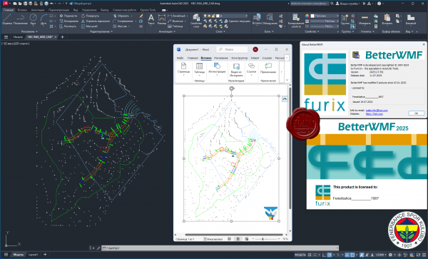
BetterWMF solves AutoCAD problems related to copying and pasting drawings into other software packages like Microsoft Word. If you have ever tried to insert an AutoCAD picture into for example a Microsoft Office document you may have noticed several problems: To start with, you will get unwanted borders. The resulting size of a picture is the same as the graphics area of the AutoCAD window at the time of creation, rather than matching the selected objects. This usually means that pictures copied from AutoCAD to other Windows applications will have a large blank area to the top or right. Also when you print the document with the picture you will notice that all lines will become equally (very) thin. Finally you will have discovered that it is very difficult to size your picture to an accurate scale. For each of these problems individual, clumsy workarounds are possible, with varying degrees of success. The real solution is BetterWMF.
With BetterWMF no workaround is necessary: Just load an ARX inside AutoCAD or run Bclipbrd.exe outside AutoCAD and any picture you cut and paste from AutoCAD to another program will be improved on-the-fly.
The resulting picture will be exactly the size of your selected entities. Using the options you can modify the picture in several other ways. For example, you can turn the picture into black-and-white, assign width to the lines based on their color or set a fixed size for the picture as it will appear in other programs. Besides pasting the improved picture immediately into another application, you can also save it for later use. This can be done by using the clipboard or from within AutoCAD by using the new function BWMFOUT which improves on the standard function WMFOUT. |
| |
 Читать статью дальше (комментариев - 7)
| |
|
 |
| ПОИСК ПО САЙТУ |
 |
|
 |
| КАЛЕНДАРЬ | | |
 |
| « Октябрь 2025 » |
|---|
| Пн | Вт | Ср | Чт | Пт | Сб | Вс |
|---|
| | 1 | 2 | 3 | 4 | 5 | | 6 | 7 | 8 | 9 | 10 | 11 | 12 | | 13 | 14 | 15 | 16 | 17 | 18 | 19 | | 20 | 21 | 22 | 23 | 24 | 25 | 26 | | 27 | 28 | 29 | 30 | 31 | |
|
 | |
| |
|