|
 |
 Автор: Williams Автор: Williams
 Дата: 8 января 2020 Дата: 8 января 2020
 Просмотров: 2 966 Просмотров: 2 966 |
| |
Srinivasan Chandrasekaran - Advanced Steel Design of Structures
CRC Press, 2019
pdf, 303 pages, english
ISBN: 978-0-367232-90-0

Advanced Steel Design of Structures examines the design principles of steel members under special loads and covers special geometric forms and conditions not typically presented in standard design books. It explains advanced concepts in a simple manner using numerous illustrative examples and MATLAB codes.
Features:
- Provides analysis of members under unsymmetrical bending
- Includes coverage of structures with special geometry and their use in offshore applications for ultra-deep water oil and gas exploration
- Presents numerical modeling and analysis of steel members under fire conditions, impact, and blast loads
- Includes MATLAB examples that will aid in the capacity building of civil engineering students approaching this complex subject
Written for a broad audience, the presentation of design concepts of steel members will be suitable for upper-level undergraduate students. The advanced design theories for offshore structures under special loads will be an attractive feature for post-graduate students and researchers. Practicing engineers will also find the book useful, as it includes numerous solved examples and practical tutorials. |
| |
 Читать статью дальше (комментариев - 9)
| |
|
 |
 Автор: Williams Автор: Williams
 Дата: 7 января 2020 Дата: 7 января 2020
 Просмотров: 1 863 Просмотров: 1 863 |
| |
Bentley CivilStorm CONNECT Edition Update 2 v10.02.03.03 build 21/11/2019
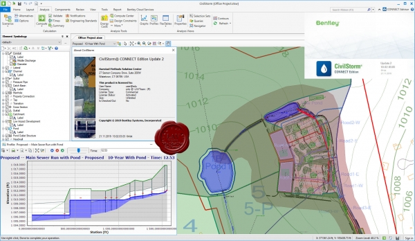
Bentley CivilStorm предназначен для точного моделирования каждого аспекта системы ливневой канализации, включая осадки, поверхностный сток, перехват и отвод стока, безнапорный и напорный трубопровод, водоемы для аккумуляции стоков, водовыпуски, открытые каналы, водопропускные трубы и т.д.
CivilStorm is a fully dynamic, multi-platform, hydraulic modeling solution developed for the analysis of complex stormwater systems. Engineers can analyze these systems using built-in hydraulic and hydrology tools and a variety of wet-weather calibration methods. From stormwater master plan development to water quality studies, CivilStorm provides an easy-to-use environment for engineers to analyze, design, and operate stormwater systems.
|
| |
 Читать статью дальше (комментариев - 7)
| |
|
 |
 Автор: Williams Автор: Williams
 Дата: 5 января 2020 Дата: 5 января 2020
 Просмотров: 11 706 Просмотров: 11 706 |
| |
Leica Cyclone Enterprise Elite v9.2.0 build 5745 x64
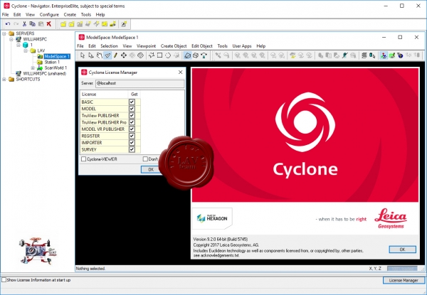
Leica Cyclone является ведущим на рынке программным обеспечением для обработки облаков точек, полученных методом лазерного сканирования. Это семейство программных модулей, которые обеспечивают широкий набор вариантов рабочего процесса для проектов 3D лазерного сканирования в проектировании, геодезии, строительстве и смежных отраслях.
Благодаря модульному строению Leica Cyclone является эффективным комплексным решением ряда повседневных задач современного проектирования, строительства, геодезии, позволяя обрабатывать огромные облака точек от стандартной топографической съемки до результатов детального сканирования сложных стратегических объектов современной инфраструктуры.
На сегодняшний день Leica Cyclone представлен следующими модулями:
Cyclone-REGISTER
Модуль Cyclone REGISTER является самым популярным программным обеспечением для сшивки и геопривязки данных лазерного сканирования в единую систему координат. Точная сшивка и геопривязка является обязательным условием для успешной и точной обработки данных сканирования с нескольких точек стояния прибора. Пользователю предоставляется возможность воспользоваться несколькими методами привязки. В автоматическом или ручном режиме, по отсканированным маркам на объекте, или используя 2D сшивку, по перекрытиям полученных облаков точек с соседних точек стояния сканера. Также в модуле реализована привязка данных к местным системам координат.
Cyclone-MODEL
Непревзойденная универсальность и производительность делают Cyclone-MODEL самым популярным автономным программным обеспечение для анализа разнообразных данных лазерного сканирования и преобразования данных в конечные результаты. Среди его преимуществ, мощная визуализация облака точек, навигации, плюс наиболее полный набор инструментов. Эти инструменты охватывают широкий спектр применения в различных отраслях проектирования и мониторинга (машиностроение, строительство, обследование объектов культурного наследия, криминалистика и другие области).
Cyclone-SURVEY
Модуль, позволяющий использовать данные лазерного сканирования в топографии, а именно:
- Отрисовка горизонталей, профилей и сечений;
- Создание триангуляционных (TIN) моделей;
- Расчет площадей поверхностей и объемов;
- Создание ортофотоизображений.
Cyclone-IMPORTER
Модуль, обеспечивающий возможность работы в Leica Cyclone с данными лазерного сканирования, полученными со сканеров сторонних производителей: Faro; Riegl; Optech; Z+F; DotProduct.
Cyclone-BASIC
Осуществляет возможность импорта и конвертации данных в общие форматы обмена (las, ptx, pts, e57 и т.д.), с возможностью последующей обработки в поддерживаемых данные форматы программах.
Cyclone-SERVER
Cyclone-SERVER является автономным программным обеспечением, позволяющим значительно снизить время на выполнение проекта, за счет увеличения количества специалистов, выполняющих обработку. Это особенно полезно для крупных проектов, когда задействована большая команда специалистов и каждый может самостоятельно выполнять свою часть объема работ. Cyclone-SERVER использует мощный клиент/сервер, чтобы позволить нескольким сотрудникам офиса, одновременно получить доступ к данным облаков точек, импортированным изображениям и поверхностям. Это исключает обременительные копирование данных и процессы синхронизации, освобождает место на диске, и обеспечивает более надежный доступ к данным проекта в сетевых средах.
Leica TruView and Cyclone-PUBLISHER
Cyclone PUBLISHER в сочетании с Leica TruView подойдет для пользователей, которым часто приходится обмениваться данными сканирования и контролировать процесс обработки данных дистанционно. Cyclone PUBLISHER организует экспорт данных из Cyclone и представляет их в виде стандартных html-страниц. Бесплатное приложение Leica TruView дает возможность открывать эти файлы в браузере Microsoft Internet Explorer, просматривать облака точек, а также выполнять контрольные измерения и расставлять необходимые примечания непосредственно на отсканированном объекте или на его элементах. Все действия выполняются дистанционно, посредством компьютера, имеющего доступ в Internet. |
| |
 Читать статью дальше (комментариев - 33)
| |
|
 |
 Автор: Williams Автор: Williams
 Дата: 4 января 2020 Дата: 4 января 2020
 Просмотров: 3 399 Просмотров: 3 399 |
| |
SmartDraft v19.1.1 for AutoCAD 2012-2020, Civil 3D 2012-2020
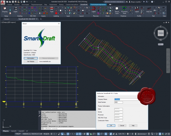
SmartDraft, established in 1989, set its mission to provide powerful productivity tools for Civil Engineers, Surveyors, Land Planners, and Mapping professionals, with a focus on providing low cost and comprehensive software solutions. SmartDraft provides the Engineering communities with the tools necessary to create civil engineering plan sets more rapidly and consistently than AutoCAD products straight out of the box. Why? The computer does what it is good at - repetition and following directions. What this means to you, the Design Professional, is that you can spend less time trying to manually make your plan sets follow standards and instead focus on making sure they contain the necessary design information.
MODULES:
SmartDraft Suite is our comprehensive set of AutoCAD® productivity enhancements. Suite provides tools for labeling plan and profile design, site layout, managing block (symbol) libraries, point placement and labeling, and many general drafting enhancements. These tools are tailored to civil engineers, surveyors, mapping professionals, and drafting professionals. SmartDraft PConnect and HEC-RAS Tools are optional addition to SmartDraft Suite.
SmartDraft Survey is a subset of SmartDraft Suite which focuses on surveyors and mapping professionals. Survey provides tools to label and modify labels of lines and curves with bearings, distances, deltas, radii, tangents, etc. Survey also offers tools to place and label points, create closure reports, and write legal descriptions from polylines or parcels, as well as tools for planview layout. SmartDraft PConnect is an optional addition to SmartDraft Survey
SmartDraft PConnect is an easy to use and superior point-connection tool designed to combine the best features of attributed point coding with an easily controlled, yet powerful, 2D and 3D line control language. PConnect's enhanced suffix codes give the operator increased flexibility and the ability to produce automated linework and layering. PConnect can use your company's specific description keys, combined with its suffix codes, to create robust geometry from surveyed data collected in the field. The linework is drawn on specified layers as defined by a Description Key Style file.
SmartDraft Construction Notes tools automates the process of placing construction notes and creating a construction notes table or list. Use reference symbol only, leaders with reference symbol, multiple leader with reference symbol, leaders with text, or leader, reference symbol, and text Once the construction note reference symbols are placed, a construction notes table can be created from the symbols.
SmartDraft HEC-RAS Tools provide an excellent set of tools for exchanging data between Civil 3D and HEC-RAS. Create a HEC-RAS data file from section lines, an alignment, and a surface. Create section lines at specified stations along an alignment. Import a HEC-RAS floodplain line into Civil 3D. Draw HEC-HAS Cross Section in Civil 3D.
|
| |
 Читать статью дальше (комментариев - 20)
| |
|
 |
 Автор: Williams Автор: Williams
 Дата: 3 января 2020 Дата: 3 января 2020
 Просмотров: 1 524 Просмотров: 1 524 |
| |
Bentley StormCAD CONNECT Edition Update 2 v10.02.03.03 build 21/11/2019
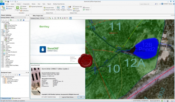
StormCAD is a comprehensive modeling software program for the design and analysis of storm sewer systems. StormCAD provides calculations for catchment runoff, inlet capacity, and gutters and pipe network flow. StormCAD determines intercepted flow at network inlets, and routes bypass flow to selected bypass targets. Inlets can be computed using the U.S. Federal Highway Administration (FHWA) HEC-22 methodology and users can choose from grate, curb, slot, ditch, and combination inlet types. Engineers can use a variety of methods to compute headloss, including HEC-22 Energy and AASHTO. StormCAD uses the Rational Method to calculate peak flows in the storm sewer design, or accepts direct input of known flows for inlet inflows. StormCAD allows users to specify Intensity-Duration-Frequency data using equations or tables. Modelers can then plot the IDF curves, and reuse their data for other projects in that region. Engineers can work with an unlimited number of sub-watershed areas and C coefficients for each inlet watershed. The constraint-based design features in StormCAD allow modelers to automatically design gravity piping and structures. The design is flexible enough to allow users to specify the elements to be designed, from a single pipe size to the entire system, by simply entering the appropriate design conditions: minimum/maximum velocities, covers, and slopes; pipe elevation offsets (including whether or not to allow drop structures), maximum spread and depth for inlets in sag; and minimum efficiency for inlets on grade.
Bentley StormCAD является программным обеспечением для комплексной разработки и анализа систем ливневой канализации. Интуитивный интерфейс программы делает как никогда легким процесс разработки и анализа систем ливневой канализации от уличного стока до водовыпускного отверстия. Bentley StormCAD обеспечивает расчеты объёма стока, интенсивности входного потока, ливневого стока и потока в трубопроводе. Bentley StormCAD является готовым решением, что позволяет использовать его автономно, или в AutoCAD. Независимо от используемой платформы, программное обеспечение Bentley StormCAD содержит единый набор файлов с данными модели для надлежащей функциональной совместимости с каждой из платформ. Автономный интерфейс предоставляет легкие в использовании инструменты компоновки модели, поддержку фона сложной структуры, утилиты преобразования из CAD, GIS и баз данных, а также неограниченное число уровней отмены и восстановления операций компоновки. Кроме этого, пользователи AutoCAD могут добавить функции интеграции AutoCAD для создания, компоновки и построения диаграмм моделей с прецизионной точностью в среде, которая уже стала для них привычной. Bentley StormCAD определяет перехват потока водоприемниками коллекторной системы и направляет поток по обводным каналам к выбранным конечным точкам. Водоприемники могут быть рассчитаны по методике Федерального управления шоссейных дорог США (FHWA) HEC-22, а в качестве водоприемников можно выбирать решетки, бордюры, люки, кюветы и их комбинации. Инженеры могут использовать разнообразные методы вычисления потери напора, включая методы HEC-22 Energy и AASHTO. Bentley StormCAD используется для определения докритических, критических и закритических условий с помощью надежных стандартных медленно изменяющихся пошаговых алгоритмов. Bentley StormCAD рассчитывает потери напора на трение потока с помощью формул Маннинга, Куттера, Дарси-Вейсбаха и Хазен-Вильямса, а также позволяет выбирать отрезки трубопровода круглой, квадратной, сводчатой или эллиптической формы и отрезки канализации неправильной, трапецеидальной или треугольной формы. Bentley StormCAD использует рациональный метод расчета расхода пика паводка при проектировании коллектора ливневой канализации. Вместо расхода, рассчитанного рациональным методом, Bentley StormCAD также допускает непосредственный ввод известных значений расхода для приточных водоприемников. Допускается вводить или импортировать данные о времени концентрации водосбора, или указывать минимальное допустимое время концентрации для предотвращения превышения объёма максимального стока для небольших водоприемников. Bentley StormCAD позволяет указывать данные интенсивности, продолжительности и частоты осадков (IDF) с помощью формул (включая Hydro-35) или таблиц. При выполнении моделирования можно затем строить кривые IDF и повторно использовать их данные для других проектов в этом регионе. Инженер может работать с неограниченным числом областей водосбора и использовать C-коэффициенты для каждого водоприемника водосбора. Bentley StormCAD позволяет вводить внешние сточные бассейны, дополнительные и переходящие потоки для моделирования внешних стоков, вносящих вклад в нагрузку любого водоприемника. Bentley StormCAD предоставляет несколько методов вычисления времени прохождения, включая полную скорость внутри трубы, нормальную скорость, среднюю конечную скорость и средневзвешенное значение скорости.
|
| |
 Читать статью дальше (комментариев - 8)
| |
|
 |
 Автор: Williams Автор: Williams
 Дата: 2 января 2020 Дата: 2 января 2020
 Просмотров: 1 682 Просмотров: 1 682 |
| |
Western University DYNA v6.1
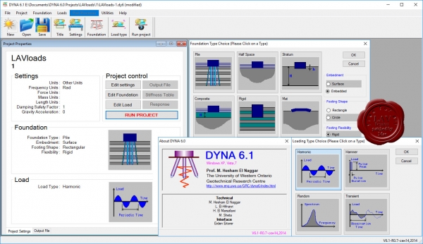
The DYNA program returns the response of rigid foundations to all types of dynamic loads. The rotation of centrifugal or reciprocating machines, shock-producing machines, earthquakes, traffic and other sources of dynamic forces can produce these loads. The foundation can be supporting a single or multiple machines. The response to harmonic loading for a flexible, rectangular mat on elastic half-space or on a group of piles can also be calculated. The stiffness and damping constants of the foundation (needed for the analysis) are evaluated within the program for surface foundations, embedded foundations and piles, pile interaction in a group and other features. For rigid footings, all six degrees of freedom are considered as coupled. The foundation stiffness and damping constants (matrices) are also returned for possible use in soil-structure interaction analysis. These constants are available for rigid footings, flexible mats (caps) on piles, or piles without any connecting cap, and also for flexible mats on elastic half-space.
|
| |
 Читать статью дальше (комментариев - 16)
| |
|
 |
 Автор: Williams Автор: Williams
 Дата: 31 декабря 2019 Дата: 31 декабря 2019
 Просмотров: 867 Просмотров: 867 |
| |
Bentley CivilStorm CONNECT Edition Update 2 v10.02.02.04 build 04/09/2019
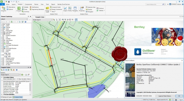
Bentley CivilStorm предназначен для точного моделирования каждого аспекта системы ливневой канализации, включая осадки, поверхностный сток, перехват и отвод стока, безнапорный и напорный трубопровод, водоемы для аккумуляции стоков, водовыпуски, открытые каналы, водопропускные трубы и т.д.
CivilStorm is a fully dynamic, multi-platform, hydraulic modeling solution developed for the analysis of complex stormwater systems. Engineers can analyze these systems using built-in hydraulic and hydrology tools and a variety of wet-weather calibration methods. From stormwater master plan development to water quality studies, CivilStorm provides an easy-to-use environment for engineers to analyze, design, and operate stormwater systems.
|
| |
 Читать статью дальше (комментариев - 6)
| |
|
 |
 Автор: Williams Автор: Williams
 Дата: 30 декабря 2019 Дата: 30 декабря 2019
 Просмотров: 5 784 Просмотров: 5 784 |
| |
Act-3D Lumion Pro v10.0
Lumion - программа по визуализации (рендеринга) 3D компьютерной графики и анимации, предназначена для работы с архитектурой, в строительстве, в дизайне в целом, для создания пейзажей и садовой архитектуры. Использованием GPU через HLSL отличается от других программ, предназначенных для той же цели. Пользовательский интерфейс формируется усилиями видеокарты и основан на просмотре данной сцены в режиме реального времени. Степень точности отображения в режиме реального времени в программе позволяет снизить требования к сложности управления до минимума.
Lumion allows any architect to transform their CAD designs into strikingly beautiful renders without any prior training. Whether communicating your project to a client, collaborating with your team using realistic visualizations, or making a last-minute design change, Lumion 8 dials up the power to allow fast, stress-free rendering with results sure to make you smile.
|
| |
 Читать статью дальше (комментариев - 25)
| |
|
 |
 Автор: Williams Автор: Williams
 Дата: 28 декабря 2019 Дата: 28 декабря 2019
 Просмотров: 2 028 Просмотров: 2 028 |
| |
Siemens Simcenter FEMAP 2020.1 MP1
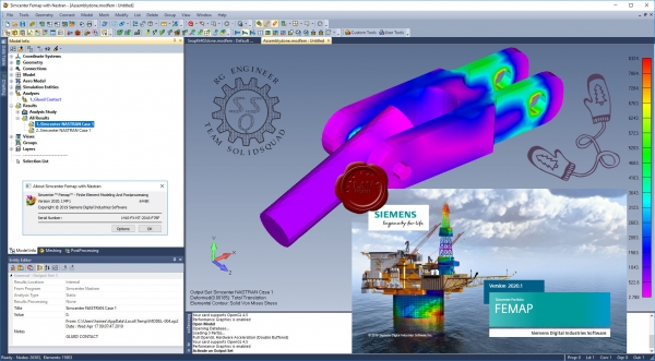
Femap – независимый от САПР пре- и постпроцессор от Siemens PLM Software для проведения инженерного анализа методом конечных элементов (МКЭ) (Finite Element Analysis – FEA). Femap является связующим звеном между пользователем и решателем - ядром, осуществляющим вычисления в задачах инженерного анализа. Система Femap, интегрированная с решателем NX Nastran, входит в линейку продуктов Velocity Series и является независимой полнофункциональной средой для моделирования, имитации и оценки результатов анализа характеристик изделия. Femap 11.3 x64 на базе решателя NX Nastran 10p2 x64 позволяет проводить анализ динамики и прочности конструкций, машин и сооружений, получать решение нестационарных нелинейных пространственных задач, задач механики композитов и композитных структур, строительной и технологической механики, проводить анализ теплопереноса, получать решение задач механики жидкости и газа, связанных многодисциплинарных задач.
Базовые модули Femap с NX Nastran позволяют проводить основные виды инженерного анализа, такие как линейный статический анализ, анализ частот и форм свободных колебаний, анализ потери устойчивости конструкций, анализ задач стационарного и нестационарного теплообмена, базовые возможности нелинейного анализа. Базовый нелинейный анализ включает учет таких нелинейностей, как геометрическая (большие деформации, перемещения, следящие нагрузки) и физическая (учет нелинейных материалов – пластичности, ползучести, вязкоупругости), учет контактного взаимодействия при малых перемещениях – «линейный» контакт, учет контакта с условием сплошности. Расширенный нелинейный модуль (Advanced Nonlinear) используется при анализе больших нелинейностей (в том числе деформирование [Эластомер|эластомеров], учет пространственного контактного взаимодействия), сочетании различных видов нелинейностей, а также при моделировании и расчете быстропротекающих нелинейных динамических процессов на основе явной схемы интегрирования. Femap включает три дополнительных модуля: Femap Flow Solver – позволяет осуществлять анализ гидро- и газодинамики; Femap Advanced Thermal Solver – предоставляет набор возможностей для анализа тепломассопереноса, включая моделирование жидкостных каналов, связанной конвекции и анализ гидро-, газодинамических потоков; Femap Thermal Solver – решение для температурного анализа и анализа теплопереноса. Femap используется специалистами проектных организаций для моделирования сложных конструкций, систем и процессов, таких как, спутники, самолеты, электронная аппаратура военного назначения, тяжелое строительное оборудование, подъемные краны, морской транспорт и технологическое оборудование. Femap обеспечивает решение сложных задач инженерного анализа в различных отраслях, например, таких как авиационно-космическая, вертолетостроение, оборонная промышленность и судостроение. |
| |
 Читать статью дальше (комментариев - 4)
| |
|
 |
| ПОИСК ПО САЙТУ |
 |
|
 |
| КАЛЕНДАРЬ | | |
 |
| « Октябрь 2025 » |
|---|
| Пн | Вт | Ср | Чт | Пт | Сб | Вс |
|---|
| | 1 | 2 | 3 | 4 | 5 | | 6 | 7 | 8 | 9 | 10 | 11 | 12 | | 13 | 14 | 15 | 16 | 17 | 18 | 19 | | 20 | 21 | 22 | 23 | 24 | 25 | 26 | | 27 | 28 | 29 | 30 | 31 | |
|
 | |
| |
|