|
 |
 Автор: Williams Автор: Williams
 Дата: 3 апреля 2020 Дата: 3 апреля 2020
 Просмотров: 20 217 Просмотров: 20 217 |
| |
Autodesk AutoCAD 2021 x64 Multilingual
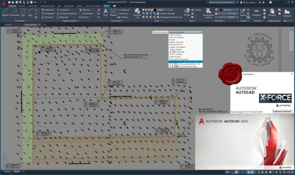
Autodesk AutoCAD является мировым лидером среди решений для 2D- и 3D-проектирования. Будучи более наглядным, 3D моделирование позволяет ускорить проектные работы и выпуск документации, совместно использовать модели и развивать новые идеи. Для AutoCAD доступны тысячи надстроек, что позволяет удовлетворить потребности самого широкого круга клиентов.
Autodesk не поддерживает 32-битные операционные системы: link
Информация о раздаче
- Исходный материал для создания сборки - оригинальные ESD-дистрибутивы.
- Добавлена возможность установки VBA.
- Добавлена возможность установки Visual Studio Code.
- Приложение Autodesk Licensing заменено на версию 9.2.2.2501 от 08.08.19 г.
- Удалены приложения Autodesk Desktop App, Autodesk Single Sign On Component и Autodesk Genuine Service.
- Проведены технические улучшения, избавляющие конечного пользователя от ряда проблем при установке программы.
- Добавлена инструкция по установке и активации.
|
| |
 Читать статью дальше (комментариев - 51)
| |
|
 |
 Автор: Williams Автор: Williams
 Дата: 2 апреля 2020 Дата: 2 апреля 2020
 Просмотров: 1 820 Просмотров: 1 820 |
| |
Integrated Engineering Software VisualFoundation v10.00.0001
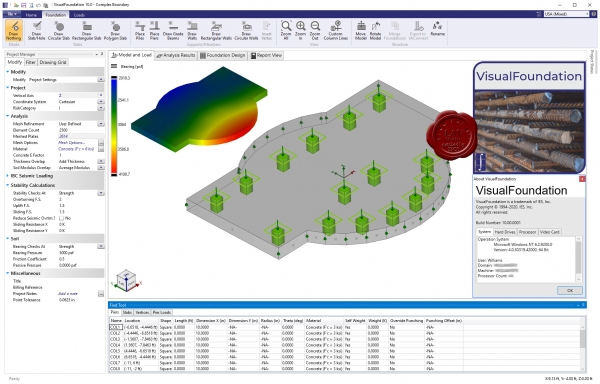
IES, Inc. creates high quality structural design software for engineering and related professionals. Your solution for general analysis, frames, trusses, shear wall systems, foundations, retaining walls, floor systems and more in steel, wood, concrete, aluminum, cold-formed, and masonry.
Why use VisualFoundation? You have choices in the marketplace, for mat footings -even among IES tools! VisualFoundation shines in a number of areas:
- Dedicated to foundations, so easier to use than VisualAnalysis for this task.
- Automated modeling - the FEA model is built and refined automatically.
- Incorporate the effects of walls and beams in the slab.
- Over 2500 companies use IES tools: one part-time support person at IES!
Major Benefits and Abilities:
- Mat foundation analysis and design.
- Complex mat boundaries, including circular and polygonal templates.
- Generate copies of modeling elements using rectangular or circular patterns.
- Multiple mat thicknesses or soil properties.
- Holes in mats.
- Combined footings.
- Wall footings.
- Walls, grade beams, columns and pile supports.
- Unlimited model size.
- Support for codes: IBC, ASCE 7, ACI 318.
- Automated FEA meshing and soil-spring supports.
- Sophisticated thick-plate finite element formulation.
- Import & Export DXF files.
- Import & Export with VisualAnalysis.
- Improved usability: easy graphics and toolbar commands.
|
| |
 Читать статью дальше (комментариев - 10)
| |
|
 |
 Автор: Williams Автор: Williams
 Дата: 1 апреля 2020 Дата: 1 апреля 2020
 Просмотров: 1 651 Просмотров: 1 651 |
| |
Integrated Engineering Software VisualAnalysis v19.00.0004
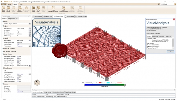
IES, Inc. creates high quality structural design software for engineering and related professionals. Your solution for general analysis, frames, trusses, shear wall systems, foundations, retaining walls, floor systems and more in steel, wood, concrete, aluminum, cold-formed, and masonry.
What will VisualAnalysis do for you? General purpose analysis and design of just about anything.
Why use VisualAnalysis? You have choices in the marketplace for general-purpose FEA tools but VisualAnalysis shines in a number of areas:
- Excellent for everyday projects.
- Great for unusual projects, and large, complicated models.
- Three feature and price levels available: Compare Levels.
- Building-code support is optional, use it for mechanical applications too.
- Extremely versatile: model just about anything!
- Reporting is extremely powerful and very flexible (save your own styles)
- So easy to use, most customers are productive within hours of installing.
- Over 3000 companies use IES tools: one part-time support person at IES!
- BIM support: VARevitLink provides two-way integration with Autodesk Revit Structure.
|
| |
 Читать статью дальше (комментариев - 11)
| |
|
 |
 Автор: Williams Автор: Williams
 Дата: 31 марта 2020 Дата: 31 марта 2020
 Просмотров: 3 048 Просмотров: 3 048 |
| |
Rarlab WinRAR v5.90 bra+chi+eng+ger+rus+spa+tur x32+x64
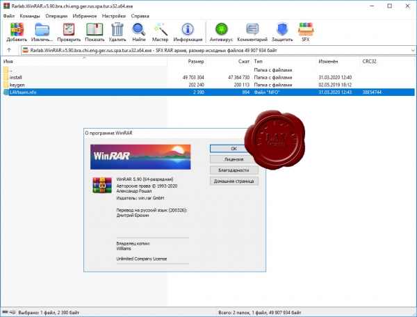
Архиватор RAR является самой распространенной программой после операционной системы и браузера, ведь большинство программ и в Интернете, и у пользователей хранятся в сжатом виде в архивах.
WinRAR – мощная утилита для создания и управления архивами, содержащая целый спектр дополнительных полезных функций. Программа WinRAR ежедневно используется миллионами людей во всем мире для экономии места на ПК и быстрой передачи файлов.
WinRAR больше не поддерживает Windows 98, Windows Me, Windows NT.
What's new in the latest version:
Version 5.90
1. RAR compression speed is improved for CPUs with 16 and more cores.
2. "Fastest" method (-m1 command line equivalent) typically achieves
a higher compression ratio for highly compressible data types
when creating RAR5 archives.
3. Maximum number of utilized threads is increased from 32 to 64.
Command line -mt<threads> switch accepts values from 1 to 64.
4. "Multithreading" parameter on "General" page of WinRAR settings
is replaced with "Threads" input field, where you can specify
the desired number of CPU threads. It can take values from 1 to
maximum number of available logical CPU units.
5. WinRAR displays packed and unpacked folder sizes when browsing
archive contents.
6. "Total folders" field is added to list of archive parameters
displayed by WinRAR "Info" command. Same field is added to
"Archive" page in archive properties in Windows Explorer.
7. Window including a progress bar and "Cancel" button is displayed
if reading archive contents takes noticeable time.
It can be useful for archive formats with slower access to contents,
such as large TAR based archives like .tar.gz and tar.bz2.
8. Archiving and extraction progress windows, also as progress windows
for some other commands, can be resized.
9. "Repair" performance for RAR5 archives with recovery record
and without data shifts is improved. It deteriorated in WinRAR 5.80
and is now restored to original level.
10. Password prompt is not issued when performing recovery record based
repair for RAR5 archives with encrypted file names.
This command can be performed without providing a password.
11. If folder for converted archives in "Convert archives" command
does not exist, WinRAR attempts to create it. Previous versions
failed to create converted archives in non-existent destination folder.
12. Added extraction support for GZIP archives with optional header
checksum field.
13. Bugs fixed:
a) "Repair" command could erroneously display "Recovery record is
corrupt" message when processing an archive with valid recovery
record. This message did not prevent further repair operation;
b) if quick open information option was set to "Do not add" in default
compression profile and this profile was loaded by some command
or dialog, WinRAR ignored quick open information when browsing
contents of RAR archives. For example, it happened after opening
archiving or password dialogs;
c) Ctrl+C "Copy" shortcut key did not work in archive comment window;
d) if "Put each file to separate archive" and "Archives in subfolders"
options were set, WinRAR ignored the destination path specified
in archive name field. |
| |
 Читать статью дальше (комментариев - 13)
| |
|
 |
 Автор: Williams Автор: Williams
 Дата: 30 марта 2020 Дата: 30 марта 2020
 Просмотров: 3 967 Просмотров: 3 967 |
| |
nanoSoft nanoCAD СПДС Стройплощадка v7.0.2629.4105 x64
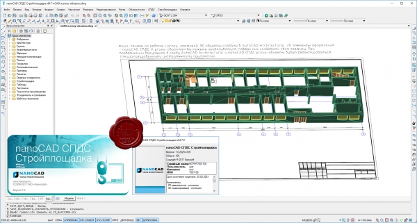
nanoCAD СПДС Стройплощадка — приложение, расширяющее функционал nanoCAD СПДС и предназначенное для разработки ПОС и ППР. Графическим ядром является nanoCAD, а в качестве инструментов оформления используется весь встроенный функционал nanoCAD СПДС. Цель программы — ускорить подготовку графической и текстовой конструкторской документации в рамках разделов ПОС и ППР.
Задачи, решаемые программой:
- работа с иерархической структурой выполняемых работ из классификаторов ГЭСН и ЕНИР в составе проекта и генерация выходной документации по ним;
- экспорт структуры проекта в сметные программы и системы управления проектом;
- расчеты временного электро- и водоснабжения;
- оформление строительного генерального плана;
- нанесение обозначений временных дорог, перекрестков, уширений и площадок;
- простановка различных видов зон с привязкой к технике и по произвольной траектории;
- параметрические обозначения откосов, насыпей и выемок;
- работа с базой данных дорожных знаков и знаков безопасности;
- выбор из базы по заданным критериям и простановка на чертеже параметрических видов различной строительной техники;
- решение задачи горизонтального (наклонного) направленного бурения (ГНБ).
По всем решаемым задачам автоматически формируются необходимые выходные документы в виде табличных форм. Программа успешно прошла сертификацию и имеет соответствующий сертификатом соответствия. |
| |
 Читать статью дальше (комментариев - 18)
| |
|
 |
 Автор: Williams Автор: Williams
 Дата: 29 марта 2020 Дата: 29 марта 2020
 Просмотров: 1 902 Просмотров: 1 902 |
| |
MathWave Technologies EasyFit v5.6
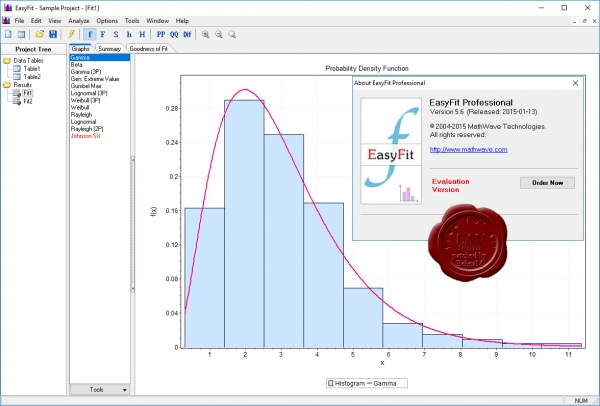
EasyFit allows to automatically or manually fit a large number of distributions to your data and select the best model in seconds. It can be used as a stand-alone application or with Microsoft Excel, enabling you to solve a wide range of business problems with only a basic knowledge of statistics.
Benefits of EasyFit:
- save time: reduce your analysis times by 70-95% over manual methods
- save money: prevent analysis errors and make better business decisions
- ensure the high quality of your projects
- get started fast: EasyFit is extremely easy to learn & use
|
| |
 Читать статью дальше (комментариев - 14)
| |
|
 |
 Автор: Williams Автор: Williams
 Дата: 27 марта 2020 Дата: 27 марта 2020
 Просмотров: 1 363 Просмотров: 1 363 |
| |
Applied Flow Technology Impulse v7.0.1122 build 2020.01.30
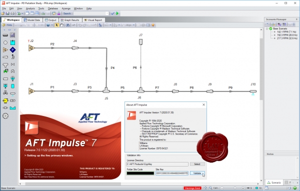
Applied Flow Technology Impulse - набор инструментальных средств предоставляющих возможность работы с моделью в интерактивном режиме через графический интерфейс, инструментарий включает встроенную библиотеку экспертных знаний по проблеме гидроудара. Applied Flow Technology Impulse позволяет создавать проект-дизайн системы трубопровода с большей степенью защищенности, надежности и безопасности исключая потенциально опасные эффекты гидроудара и других нежелательных неустановившихся режимов.
Primary Features of AFT Impulse 7
- Advanced transient solver based on Method of Characteristics.
- Built-in steady-state solver to automatically initialize waterhammer transient.
- Detailed pump inertial modelling for trips and start-ups including state-of-the-art, four quadrant methods.
- Built-in library of fluids and fittings.
- Models liquid column separation caused by transient cavitation.
- Extensive cavitation modelling.
- Scenario Manager to track all design variants and operational possibilities in a single model file with data linkage.
- Comprehensive relief valve modelling.
- Integrated graphing and reporting.
- Animation features to dynamically graph transients.
- Create video files from animations to share your results.
- Generates force imbalance files that can be automatically read into CAESAR II and TRIFLEX pipe stress dynamic models.
- Built-in intelligence to guide you in building better models.
|
| |
 Читать статью дальше (комментариев - 7)
| |
|
 |
 Автор: Williams Автор: Williams
 Дата: 26 марта 2020 Дата: 26 марта 2020
 Просмотров: 685 Просмотров: 685 |
| |
Applied Flow Technology Arrow v7.0.1207 build 2019.12.11
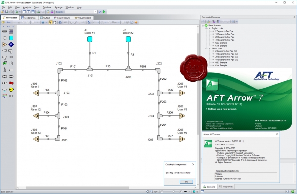
Applied Flow Technology Arrow - отличная программа для гидравлического расчета различных разветвленных сетей со сжимаемыми средами (включает также расчет теплопотерь) Осуществляет анализ системы при скоростях вплоть до звуковой (также включен анализ сети при звуковом ударе)
|
| |
 Читать статью дальше (комментариев - 8)
| |
|
 |
 Автор: Williams Автор: Williams
 Дата: 25 марта 2020 Дата: 25 марта 2020
 Просмотров: 1 189 Просмотров: 1 189 |
| |
Applied Flow Technology Fathom v11.0.1103 build 2020.03.19
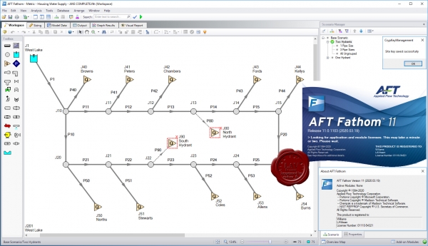
Applied Flow Technology Fathom - программно-аналитический комплекс моделирования потока в трубопроводе. Удобный графический интерфейс, встроенная библиотека оборудования, арматуры и флюидов, широкие аналитические возможности, схематическое изображение создаваемого объекта, все это реализовано в AFT Fathom и предоставляет инженеру проектировщику возможность системного подхода в реализации проектов любой сложности. AFT Fathom обладает большим спектром возможностей не являясь при этом компромиссом между функциональностью и сложностью в освоении и использовании.
Features:
- Advanced hydraulic solver
- Detailed modeling for centrifugal and positive displacement pumps
- Scenario Manager to track all design variants and operational possibilities in a single model file
- Pump vs. system curve generation including individual head curves and composite efficiency
- Thermal analysis including piping heat transfer and heat exchanger modeling
- Supports Newtonian and non-Newtonian fluids, including non-settling slurries
- Optional ChempakTM add-on utility provides a thermophysical database of almost 700 fluids
AFT Fathom add-on modules:
- Settling Slurry (SSL) - models the effects of pumping fluids containing settling solids using the Wilson/GIW method
- Extended Time Simulation (XTS) - models dynamic system behavior
- Goal Seek and Control (GSC) - identifies input parameters that yield desired output values and simulates control functions
- Automated Sizing (APS and ANS) - automate the process of sizing pipelines and piping networks based on required conditions, such as maximum pressure or minimum flow, to reduce cost or weight
New features
|
| |
 Читать статью дальше (комментариев - 12)
| |
|
 |
| ПОИСК ПО САЙТУ |
 |
|
 |
| КАЛЕНДАРЬ | | |
 |
| « Октябрь 2025 » |
|---|
| Пн | Вт | Ср | Чт | Пт | Сб | Вс |
|---|
| | 1 | 2 | 3 | 4 | 5 | | 6 | 7 | 8 | 9 | 10 | 11 | 12 | | 13 | 14 | 15 | 16 | 17 | 18 | 19 | | 20 | 21 | 22 | 23 | 24 | 25 | 26 | | 27 | 28 | 29 | 30 | 31 | |
|
 | |
| |
|