|
 |
 Автор: Williams Автор: Williams
 Дата: 10 июня 2020 Дата: 10 июня 2020
 Просмотров: 2 147 Просмотров: 2 147 |
| |
Schlumberger OilField Manager 2019.1

OFM is a powerful suite of modules developed by Schlumberger Information Solutions, designed to aid in the day-to-day surveillance and management of oil and gas fields. OFM provides an intuitive, user-friendly interface enabling you to view, enhance, and analyze production and reservoir data within the Microsoft Windows environment. Using OFM 2014, you can perform basic or complex analyses for individual or multiple completions, groups of wells, an entire field, or several fields. OFM is the ideal tool for reservoir production environments and users. It is ideally suited for the occasional user, yet sophisticated enough for the experienced geoscientist or petrophysicist, whether at the well site, office, or home. |
| |
 Читать статью дальше (комментариев - 16)
| |
|
|
Автор: Williams
Дата: 8 июня 2020
Просмотров: 2 253 |
| |
DotSoft ToolPac v20.0.0.0

In the never ending quest for faster AutoCAD/BricsCAD systems, users go the extra mile to purchase the fastest hardware. Faster processors, graphics cards, etc., are implemented in an attempt to speed up the processing of drawings. These improvements come at great expense and only provide a marginal gain in the amount of time it takes to actually complete a drawing. This expensive hardware is often underutilized as the operator wastes time doing repetitive tasks in the struggle to finalize a drawing.
If you do only one upgrade to your system this year, it should be the implementation of productivity software. Our ToolPac product was designed to eliminate the numerous bottlenecks in AutoCAD and BricsCAD. It contains over 750 functions designed with one purpose in mind, to save you time.
ToolPac is in use today by thousands of architects, engineers, and designers! This comprehensive collection of productivity tools works with AutoCAD 2007 or higher (LT not supported) or BricsCAD v12 Pro or higher. It works equally well in all environments, including Architectural, Engineering, Civil, Mechanical and Design.
|
| |
Читать статью дальше (комментариев - 8)
| |
|
|
Автор: Williams
Дата: 6 июня 2020
Просмотров: 2 413 |
| |
nFrames SURE v4.1.1

SURE is specifically designed for aerial image datasets captured with large frame nadir cameras, oblique cameras and hybrid systems with additional LiDAR sensors. Without limitation in image resolution, it empowers the production of 3D Meshes, True Orthophotos, Point Clouds and Digital Surface Models on common workstation hardware and in cluster environments. Simple to setup and operate, SURE is compliant with mapping industry standards and accessible for web streaming technologies. Connect seamlessly with interfaces such as various Aerotriangulation import options, shapefile definitions and several output formats.
|
| |
Читать статью дальше (комментариев - 16)
| |
|
|
Автор: Williams
Дата: 4 июня 2020
Просмотров: 4 872 |
| |
Trimble Tekla Structural Design Suite 2020: Designer v20.0.2.33, Tedds v22.1.0000

Tekla Structural Designer - мощный инструмент для анализа и проектирования зданий, созданного для инженеров-проектировщиков, работающих в сфере проектирования коммерческих строительных объектов. Tekla Structural Designer дополняет основную программу Tekla Structures и позволяет полноценно использовать все преимущества 3D-моделирования, благодаря единому рабочему процессу, включающему и анализ и проектирование. Tekla Structural Designer - это интеллектуальная загрузка данных, широкий набор аналитических функций, полная автоматизация проектирования, высокое качество документации и готовая полноценная система BIM-моделирования. Все это помогает инженерам повысить эффективность и сократить расходы/издержки при создании проектов.
Tekla Structural Designer предлагает мощные инструменты для работы с железобетонными и металлическими конструкциями, позволяя инженерам быстро сравнивать различные варианты схем проектирования, эффективно управлять изменениями, а также создавать удобную среду для совместной работы. Полностью автоматизированное проектирование и анализ, улучшенные инструменты и повышенная производительность позволяют инженерам предлагать больше альтернативных вариантов проектов, независимо от размера и сложности объекта, тем самым обеспечивая высокое качество обслуживания заказчика.
Эффективное использование BIM-технологий - именно это было в умах разработчиков при создании Tekla Structural Designer. Используя Tekla Structural Designer, инженеры могут неоднократно синхронизировать модели с Tekla Structures и другими программами без ущерба для ключевых проектных данных. Постоянный аудит инструментов в Tekla Structural Designer позволяет инженерам видеть, что было добавлено, изменено или удалено в процессе интеграции, тем самым уменьшая риск ошибок и повышая эффективность сотрудничества с другими членами команды проекта, в том числе техниками, переработчиками и архитекторами. Tekla Structural Designer создает внутреннюю связь и эффективную коммуникацию между всеми специалистами, работающими над проектом.
Tedds automates your daily structural calculations. |
| |
Читать статью дальше (комментариев - 23)
| |
|
|
Автор: Williams
Дата: 2 июня 2020
Просмотров: 4 242 |
| |
CSoft Project Studio CS 2019 ЭЛЕКТРИКА v19.0.4969.4969

Программный продукт Project StudioCS Электрика предназначен для автоматизированного проектирования в части силового электрооборудования (ЭМ), внутреннего (ЭО) и наружного (ЭН) электроосвещения промышленных и гражданских объектов.
Функционал программы позволяет инженеру-проектировщику сосредоточить внимание на решении концептуальных вопросов, освободившись от трудоемкой рутинной работы: маркировки оборудования, проведения необходимых расчетов, подсчета всего оборудования, изделий, материалов и сведения их в спецификацию, составления кабельного журнала, формирования принципиальных схем сети. При этом риск появления в проектной документации ошибок, вызванных действием так называемого «человеческого фактора», сведен к минимуму. Таким образом Project StudioCS Электрика позволяет существенно сократить сроки проектирования и при этом повысить качество проектной документации.
Project StudioCS Электрика позволяет решить следующие задачи:
- проведение всех необходимых светотехнических расчетов;
- проведение всех необходимых электротехнических расчетов;
- расстановка оборудования и прокладка кабельных трасс;
- выбор уставок защитных аппаратов и сечений кабелей;
- кабельная раскладка по кабельным трассам;
- формирование информационной модели (BIM);
- интеграция с другими BIM-системами (Revit, ARCHICAD, Tekla, Allplan и т.д.);
- формирование проектной документации.
|
| |
Читать статью дальше (комментариев - 15)
| |
|
|
Автор: Williams
Дата: 31 мая 2020
Просмотров: 1 307 |
| |
S.T.S. WinRoad 2020 v25.1.1.2646

Il package WinROAD è un potente strumento software finalizzato alla risoluzione di problematiche topografiche, di modellazione 3D del terreno, di progettazione stradale e di progettazione di reti tecnologiche. Winroad si interfaccia e si integra con gli altri programmi della STS costituendo un Ambiente di Progettazione Integrata (A.P.I.) che permette la gestione unitaria ed automatizzata di tutte le fasi progettuali di un opera. WinROAD vanta, tra le tante caratteristiche, alcune innovative peculiarità. Una di queste è senz'altro quella di essere un applicativo di WinCAD, un potente CAD tridimensionale a 32 bit appositamente sviluppato dalla STS per il disegno tecnico ingegneristico. Ciò consente all'utente di "miscelare", secondo le proprie necessità, i comandi della procedura stradale con quelli propri del CAD. Grazie a questa particolare caratteristica WinROAD consente di ottenere elaborati grafici altamente professionali, senza dover ricorrere a farraginose operazioni di interscambio di dati, tramite file DXF, tra la procedura stradale ed il CAD esterno.
Программа служит для топографической, кадастровая съемкок, моделирование ландшафта, проектирования автомобильных и железных дорог. |
| |
Читать статью дальше (комментариев - 11)
| |
|
|
Автор: Williams
Дата: 29 мая 2020
Просмотров: 17 270 |
| |
Pix4Dmapper Enterprise v4.5.6
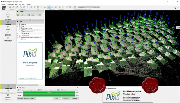
Pix4Dmapper is the leading photogrammetry software for professional drone mapping.
|
| |
Читать статью дальше (комментариев - 64)
| |
|
|
Автор: Williams
Дата: 27 мая 2020
Просмотров: 1 706 |
| |
CADprofi 2020.05 build 200402

CADprofi HVAC & Piping - параметрическое CAD-приложение для проектирования технического оборудования зданий. Поддерживаются все виды технических установок: отопление, вентиляция, кондиционирование воздуха, трубопроводы и воздуховоды.
CADprofi Mechanical содержит широкий набор унифицированных деталей, стальной арматуры, стальных профилей и других компонентов, соответствующих стандартам DIN, EN, ISO и национальным нормам. Библиотека включает в себя болты, винты, шайбы, гайки, соединения, заклепки, шпильки, уголки, и детали, используемые в конструкции теплообменников и других устройств. Отличный редактор схем и проектов значительно облегчает создание чертежей гидравлических и пневматических систем.
CADprofi Architectural может быть использовано чтобы создать строительные планы, поперечные сечения и вид с фасада. Удобные функции приложения облегчают проектирование многослойных стен, архитектурное определение размеров, и быстрое создание описания конструкций. Модуль включает в себя полную библиотеку окон, дверей, мебели, и других объектов обстановки. Как дополнительная особенность, приложение может использоваться, чтобы проектировать планы эвакуации и пожаротушения.
CADprofi Electrical может быть использовано для проектирования сложных объектов, таких как электроснабжения, освещения, низковольтных систем, телекоммуникации, систем безопасности и антенных установок. Приложение содержит несколько тысяч электрических элементов и символов (светильники, распределительные устройства и многое другое) Приложение предоставляет легкий способ проектировать проводку и кабельные каналы. Среди наиболее полезных функций автоматическая нумерация (адресация) электрических цепей, и удобное проектирование и редактирование схемы подключения проводов.
|
| |
Читать статью дальше (комментариев - 7)
| |
|
|
Автор: Williams
Дата: 25 мая 2020
Просмотров: 1 360 |
| |
TRL TRANSYT v16.0.0.8411

TRANSYT is a software suite containing a macroscopic traffic model, a signal optimiser, and a simulation model for the purpose of designing, evaluating and modelling everything from single isolated road junctions to large mixed signal-controlled and priority control traffic networks.
Signal timings at road junctions have an important effect on levels of traffic congestion, both at the junction itself and at surrounding junctions which may be signalised or priority-controlled. Ensuring traffic signals are timed effectively is one of the most cost-effective methods for reducing congestion.
Based on decades of research and development, TRANSYT is a now a comprehensive global product used for optimising traffic signals at single junctions and large traffic networks of mixed control. It is designed specifically to give quick solutions with minimal user input, and also more considered solutions when needed.
TRANSYT modelling can feed into many processes – Its signal plans used for fixed time signals; cableless linking facilities; SCOOT base timings; vehicle actuation maximum timings and also used to predict the performance of the aforementioned.
Furthermore, through the addition of a simulation model, TRANSYT’s capability is extended to include the modelling of non-cyclic signalling scenarios.
TRANSYT is used across the globe by traffic engineers, traffic modellers, junction designers, students and tutors, working for local authorities; municipal, state and regional authorities; consultancies of all sizes from multi-nationals to the smallest businesses; universities; other educational establishments.
TRANSYT can model mixed networks of signalised and unsignalised junctions. Furthermore, when used in conjunction with a Junctions licence, it has the capability to predict the performance of priority junctions using standard ARCADY PICADY geometric data. |
| |
Читать статью дальше (комментариев - 7)
| |
|
|
Автор: Williams
Дата: 23 мая 2020
Просмотров: 1 841 |
| |
Marshall Day Acoustics INSUL v9.0.22

INSUL is a program for predicting the sound insulation of walls, floors, roofs, ceilings and windows. Impact sound and rain noise of floors and roof. The programme can make good estimates of the Transmission Loss (TL) or Impact Sound (Ln) in 1/3 octave bands and Weighted Sound Reduction Index (STC or Rw) or Impact Rating (IIC/LnTw) for use in noise transfer calculations or acoustical design or specification.
INSUL can be used to quickly evaluate new materials and systems, or to investigate the effects of changes to existing designs. It models materials using well known elastic plate theory including allowances for thick panel effects as published by Ljunggren, Rindell and others. More complex partitions are modelled using work by Sharp, Cremer and others.
INSUL has been available for over 15 years, and has undergone considerable improvements over this time. It has evolved over many releases and into a very easy to use tool that takes advantage of the Windows and Mac environments, and has been refined by continued comparison with laboratory tests to provide acceptable accuracy for a wide range of constructions. Test data can be entered for easy comparison with predictions and constructions can be saved for later recall. INSUL takes account of finite size effects which are very important when predicting small samples such as windows and also for normal elements at low frequencies. Like any prediction tool INSUL is not a substitute for measurement. However, comparisons with test data indicate that INSUL reliably predicts STC values to within 3dB for most constructions. INSUL will greatly enhance the ability of acoustic consultants and product manufacturers to quickly and confidently specify constructions in order to achieve a desired airborne sound insulation.
INSUL takes account of finite size effects which are very important when predicting small samples such as windows and also for normal elements at low frequencies. Like any prediction tool INSUL is not a substitute for measurement. However, comparisons with test data indicate that INSUL reliably predicts STC values to within 3dB for most constructions. INSUL will greatly enhance the ability of acoustic consultants and product manufacturers to quickly and confidently specify constructions in order to achieve a desired airborne sound insulation. |
| |
Читать статью дальше (комментариев - 14)
| |
|
|
| ПОИСК ПО САЙТУ |
|
|
|
| КАЛЕНДАРЬ | | |
|
| « Октябрь 2025 » |
|---|
| Пн | Вт | Ср | Чт | Пт | Сб | Вс |
|---|
| | 1 | 2 | 3 | 4 | 5 | | 6 | 7 | 8 | 9 | 10 | 11 | 12 | | 13 | 14 | 15 | 16 | 17 | 18 | 19 | | 20 | 21 | 22 | 23 | 24 | 25 | 26 | | 27 | 28 | 29 | 30 | 31 | |
|
| |
| |
|


