|
 |
 Автор: Williams Автор: Williams
 Дата: 12 июня 2022 Дата: 12 июня 2022
 Просмотров: 1 474 Просмотров: 1 474 |
| |
TechnoSoft AMETank v14.3.11
with the new extended to 19 July 2024 keygen
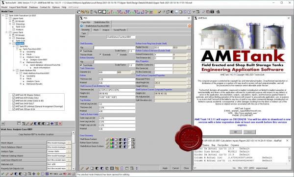 AMETank enables the rapid configuration, design, and detailing of above-ground shop-built and field-erected storage tanks. Design calculations conform to API 650. Calculations include seismic, internal and external pressures, and wind loading. AMETank supports a fully interactive 3D graphical user interface. The configuration and layout of the tank shell, floor, roof and structure, and subsystems is facilitated through intuitive menus with options customized specifically for tank design. The plates layout and fabrication details are provided. Output for NC machines is supported. Detailed assembly and components fabrication drawings for all substructures, appurtenances, ladders, platforms, stairs, and any other subsystems are supported. A complete design can be configured and detailed in less than two hours including the automatic generation of tank 3D geometry with production details, To-scale drawings, bill of material, and weight & cost reports. Also TechnoSoft provides services for laser scanning and digital reconstruction of tanks, terminals, refineries, and other assets. Assessments include bottom and foundation settlement, shell roundness and verticality, structural column verticality, and floating roof to shell operation. Tank calibration and generation of strapping tables is available. Inspection and integrity analysis services are available. Inspection services include a large array of NDE technologies including ultrasonic, magnetic particle, liquid penetrant, visual, magnetic flux leakage, and vacuum box testing. Tank report calculations on corrosion rates, safe fill height, seismic evaluation, maximum working pressure, and other evaluations as per API 653 are supported. |
| |
 Читать статью дальше (комментариев - 22)
| |
|
 |
 Автор: Williams Автор: Williams
 Дата: 11 июня 2022 Дата: 11 июня 2022
 Просмотров: 3 040 Просмотров: 3 040 |
| |
Graitec Advance Design 2023
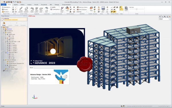
Graitec Advance - программный комплекс проектирования металлоконструкций.
Advance Design was specifically developed for industry professionals that require a superior solution for the structural analysis and design of Reinforced Concrete and Steel structures according to the latest versions of Eurocodes (EC0, EC1, EC2, EC3 and EC8). Advance Design features include easy modeling, a powerful FEM analysis engine, top-level design wizards, automated post-processing of results and automated reports. Achieve a new level of computer-assisted engineering with Advance Design. |
| |
 Читать статью дальше (комментариев - 22)
| |
|
 |
 Автор: Williams Автор: Williams
 Дата: 9 июня 2022 Дата: 9 июня 2022
 Просмотров: 523 Просмотров: 523 |
| |
Weise SiGe-Manager 2022 2022.0.0.9
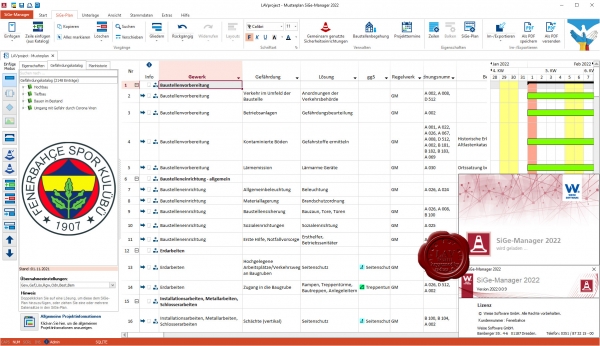
Untersuchungen zufolge gehen zwei Drittel aller Unfälle auf Baustellen auf Fehler im Vorfeld der Bauausführung, mangelnde Organisation und Abstimmung zurück. Die Sicherheits- und Gesundheitsschutzkoordination (SiGe) hat zum Ziel, die Sicherheit auf Baustellen zu verbessern, Unfallzahlen, Ausfallzeiten und dadurch bedingte Folgekosten zu senken.
Doch der Arbeitsaufwand für SiGe-Koordinatoren ist hoch. Der SiGe-Manager 2022 vereinfacht die Konzeption und Koordination von SiGe-Maßnahmen und minimiert den Zeitaufwand für mit der SiGe-Koordination beauftragte Architekten, Ingenieure, Bauleiter oder Projektsteuerer. Besonders erwähnenswert ist ein Modul zur automatischen Generierung einer Baustellenordnung inkl. Projektdaten, Inhaltsverzeichnis, Gliederung und Symbolen.
Darüber hinaus beinhaltet das Programm zahlreiche Zusatzfunktionen wie z.B. Vorlagen, Gesetze, Checklisten zur Baustellenbegehung, ein Modul zur automatischen Generierung einer Baustellenordnung sowie eine Kostenlose App mit Gefährdungskatalog. |
| |
 Читать статью дальше (комментариев - 4)
| |
|
 |
 Автор: Williams Автор: Williams
 Дата: 8 июня 2022 Дата: 8 июня 2022
 Просмотров: 512 Просмотров: 512 |
| |
Weise PrintForm 2022 2022.0.0.0
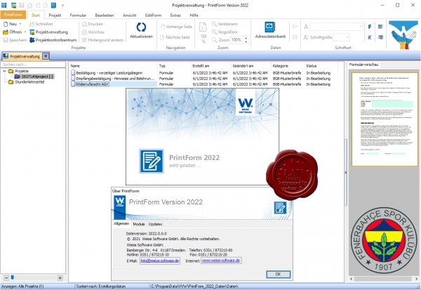
Mit PrintForm erhalten Sie eine umfassende Formularsoftware, die speziell fьr den Baubereich konzipiert und hergestellt wurde. In 8 themenspezifischen Modulen stehen Ihnen derzeit ьber 2400 Vordrucke zur Verfьgung. Die Module kцnnen einzeln erworben und beliebig miteinander kombiniert werden.
Bei der Entwicklung wurde besonders darauf geachtet, Ihre Arbeitsablдufe effizient zu gestalten und Ihnen zeitraubende Mehrfacheingaben abzunehmen. Die zentrale Adressdatenbank verwaltet nicht nur Adressen von Personen, Firmen und Behцrden sondern auch Grundstьcksdaten und Angaben zum Bauvorhaben. Per Mausklick werden diese Daten dann automatisch in die entsprechenden Formulare ьbernommen.
PrintForm ist mehr als eine bauspezifische Vorlagensammlung, Verwaltungs- und Ausfьllhilfe fьr Vordrucke. Diverse Funktionen und Automatismen vereinfachen Arbeitsablдufe und machen sie effizienter. So stellt etwa eine editierbare dressdatenbank alle Adressen und Informationen zu Grundstьcken, Bauvorhaben, Behцrden oder Baubeteiligten bereit. Wichtige Daten werden somit nur einmal erfasst und kцnnen dann automatisch in allen Vordrucken ьbernommen werden. Enthalten Eingabefelder Zahlenwerte und sind diese mathematisch miteinander verknьpft, ьbernehmen Rechenfunktionen die Berechnung. Das erьbrigt zeitraubende Mehrfacheingaben oder Taschenrechner und beugt Fehlerquellen vor.
Darьber hinaus verfьgt PrintForm ьber zahlreiche nьtzliche Funktionen wie etwa einen automatisierten Formularversand, eine interne Textverarbeitung inklusive Serienbrieffunktion, einen PDF-Export mit integriertem E-Mail-Verteiler, uvm. |
| |
 Читать статью дальше (комментариев - 5)
| |
|
 |
 Автор: Williams Автор: Williams
 Дата: 6 июня 2022 Дата: 6 июня 2022
 Просмотров: 1 191 Просмотров: 1 191 |
| |
Weise Project-Manager 2022 2022.0.0.7
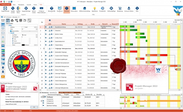
Mit der Ressourcenplanung lassen sich jetzt neben Bauzeiten auch der Einsatz von Personal, Geraten, Fahrzeugen oder anderen Betriebsmitteln projektubergreifend planen. Anhand ubersichtlicher Grafiken sieht man auf einen Blick, wer, wo und wann mit welcher Auslastung, auf welcher Baustelle eingeplant ist, welche Arbeiten wann beendet sein mussen und welches Gerat wann wieder zur Verfugung steht. Das hilft, die richtigen Mitarbeiter zur richtigen Zeit und ihren Fahigkeiten entsprechend einzusetzen, passende Teams zusammenzustellen und schnell zu reagieren, sobald ein Mitarbeiter ausfallt. Zu personellen Ressourcen lassen sich Auslastungsgrade, Abwesenheitszeiten und Urlaubszeiten definieren. Ressourcen konnen eine konkrete Person, eine abstrakte Personengruppe oder Betriebsmittel und Material sein.Um die Kosten einer Ressource zu berechnen, kann man entweder auf bestehende Kostendaten zugreifen oder diese neu eingeben. Bei Planungsanderungen verschieben sich alle abhangigen Elemente automatisch mit, so dass die Konsequenzen sofort erkennbar sind. Sollte es dabei zu Konflikten mit anderen Gewerken oder Baustellen kommen, werden diese angezeigt. Dank umfangreicher Auswertungsmoglichkeiten und Reports haben Projektverantwortliche alle Personal- und sonstigen Unternehmensressourcen stets im Blick. Ausgewertet werden Ressourcen, deren Auslastung und Kosten sowie Abwesenheitszeiten in Form von Diagrammen, Wocheneinsatzplanen und Jahresubersichten, Kostenubersichten und Kostenverlaufen, Meilensteinlisten oder Soll/Ist-Vergleichen. |
| |
 Читать статью дальше (комментариев - 7)
| |
|
 |
 Автор: Williams Автор: Williams
 Дата: 4 июня 2022 Дата: 4 июня 2022
 Просмотров: 808 Просмотров: 808 |
| |
Weise Fluchtplan 2022 2022.0.0.17
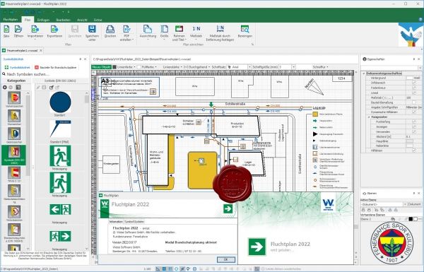
Mit der Software Fluchtplan kцnnen Architekten und Ingenieure, Brandschutz- und Sicherheitsbeauftragte, Arbeitssicherheitsfachkrдfte, Gutachter oder Facility Manager Flucht- und Rettungsplдne gemдЯ DIN ISO 23601 und DGUV 9 mehrsprachig erstellen. Darьber hinaus lassen sich auch Feuerwehrplдne nach DIN 14095 inklusive normgerechter Symbolik und Feuerwehrlaufkarten generieren. Die Plдne kцnnen ganz einfach von Grund auf neu generiert werden oder auf Grundlage von DXF-, DWG- oder PDF-Dateien eingelesen werden.
Dieses Modul ermoglicht es Brandschutzvisualisierungsplane (LP 1 bis LP 4), Brandschutzausfuhrungsplane (LP 5) und Brandschutzdokumentationsplane (LP 9) nach den Vorgaben der VDI Richtlinie VDI 3819 (Entwurf) zu erstellen. Es stehen dabei zahlreiche Symbole fur Bauteile und brandschutzrelevante Anlagen und Einrichtungen zur Verfugung. |
| |
 Читать статью дальше (комментариев - 8)
| |
|
 |
| ПОИСК ПО САЙТУ |
 |
|
 |
| КАЛЕНДАРЬ | | |
 |
| « Октябрь 2025 » |
|---|
| Пн | Вт | Ср | Чт | Пт | Сб | Вс |
|---|
| | 1 | 2 | 3 | 4 | 5 | | 6 | 7 | 8 | 9 | 10 | 11 | 12 | | 13 | 14 | 15 | 16 | 17 | 18 | 19 | | 20 | 21 | 22 | 23 | 24 | 25 | 26 | | 27 | 28 | 29 | 30 | 31 | |
|
 | |
| |
|