|
 |
 Автор: Williams Автор: Williams
 Дата: 7 августа 2023 Дата: 7 августа 2023
 Просмотров: 300 Просмотров: 300 |
| |
Technia BRIGADE Plus 2023.2
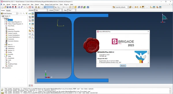 BRIGADE/Plus provides an easy-to-use environment for modeling of all types of bridges and civil structures. The intuitive user-interface integrates modeling, analysis and visualization of results. The parametric, feature-based, concept enables efficient modelling of complex structures. BRIGADE/Plus provides an easy-to-use environment for modeling of all types of bridges and civil structures. The intuitive user-interface integrates modeling, analysis and visualization of results. The parametric, feature-based, concept enables efficient modelling of complex structures.
Software includes predefined loads, vehicles and load combinations in accordance with a wide range of design codes including the Eurocodes with various National Annexes.
BRIGADE/Plus offers a complete range of advanced capabilities such as transient- and steady state dynamic analysis, non-linear material models and contact interactions. The results are easily visualized in 3D plots and 2D graphs. The integrated report generator can be used for efficient creation of input and result reports. Results can be automatically exported to the reinforcement module ConcreteDesigner or to customers own tool for design of reinforcement.
|
| |
 Читать статью дальше (комментариев - 1)
| |
|
 |
 Автор: Williams Автор: Williams
 Дата: 6 августа 2023 Дата: 6 августа 2023
 Просмотров: 989 Просмотров: 989 |
| |
RUNET software STEELexpress version 17.07/2023
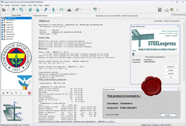
With STEELexpress you can easily design structural elements of structural steel.
Classification of cross-sections, Resistance of cross-sections in single and combined actions, Flexural and lateral buckling resistance of members. Design of connections. Design of beams, columns, roof and floor structures. Design one floor frames and two floor frames. Design of purlins and bracing systems. Design of footings of steel structures.Design of composite steel and concrete structures, according to Eurocode 4. Parameters according to National Annex of Eurocode. Detailed reports with references to Eurocode paragraphs and necessary drawings. Tables with all international steel profiles with dimensions, resistance and buckling resistance values. User defined steel section properties. Welded steel sections formed by the user.
A combined detailed report is produced for the designed steel components. Assumptions and references to design codes are shown in the report. The user can select the applicable National Annex. The design code parameters, as well as default values, can be adjusted by the user. Design Charts and Tables for use and understanding of Eurocode 3 are included in the program. For frame structures the program's CAD modulus automatic generates detailed drawings of the structure and the joints. |
| |
 Читать статью дальше (комментариев - 3)
| |
|
 |
 Автор: Williams Автор: Williams
 Дата: 5 августа 2023 Дата: 5 августа 2023
 Просмотров: 1 617 Просмотров: 1 617 |
| |
CSI SAFE v21.1.0.2330
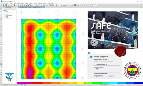
CSI SAFE - программный комплекс для проектирования железобетонных перекрытий, фундаментов и фундаментных плит. Каждый аспект процесса проектирования конструкций, от создания геометрии конструкции до выпуска чертежей, интегрирован в одну простую и интуитивно понятную рабочую среду ПК SAFE. Создание модели производится с использованием интеллектуальных инструментов рисования, или с использованием опций импорта из CAD-системы, электронных таблиц или базы данных. Плиты или фундаменты могут быть любой формы и могут иметь круглые и криволинейные очертания. Как в плитах, так и в балках, может быть смоделировано пост-напряжение (натяжение на бетон). Плиты перекрытий могут быть плоскими, а также иметь ребра в одном или в обоих направлениях. В модель могут быть включены колонны, связи, стены и наклонные плиты, соединяющие перекрытие с верхним и нижним перекрытиями. Стены могут быть смоделированы как прямолинейными, так и изогнутыми в плане. |
| |
 Читать статью дальше (комментариев - 16)
| |
|
 |
 Автор: Williams Автор: Williams
 Дата: 4 августа 2023 Дата: 4 августа 2023
 Просмотров: 399 Просмотров: 399 |
| |
Leica Hexagon HxMap v4.3.0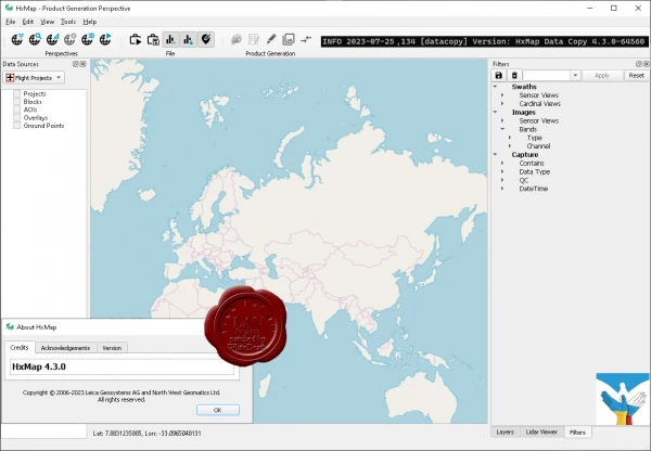
The increased need for up-to-date geospatial information in many of the traditional applications as well as in emerging areas such as navigation or location-based apps requires a new approach to data processing: rapid updates over large areas in the shortest possible time. To be a true No 1, the world’s most efficient airborne sensors still rely on an efficient and fast data processing workflow.
By introducing HxMap, the unified high-performance multi-sensor workflow platform, Leica Geosystems offers exactly what the industry has been waiting for: a fast, intuitive and efficient post-processing platform, that allows you to produce all known data products within one single interface.
The Leica HxMap common sensor post-processing platform offers the following modules to meet your needs:
- HxMap Enabler: Enabler
- HxMap Provider: Ingest, Raw QC, Workflow Manager, Point Cloud Generator, Projection Engine
- HxMap Core Image: APM, Aerial Triangulation, Infocloud, Ortho Generator
- HxMap Core LiDAR: AutoCalibration, Registration, Colour Encoding, Data Metrics, LiDAR QC
- HxMap 3D Modeller: City Modeller, Texture Mapper, 3D Editor, Building Finder
Leica HxMap intuitively guides you along a common processing workflow. Starting from data download, raw QC, data ingest all the way to the final product generation. Depending on the input data, additional steps like aerial triangulation, radiometric adjustments and LiDAR point cloud registration are available.
Furthermore, the HxMap product generator allows a large number of products to be generated by the push of a button: referenced images, orthophotos, info clouds, point clouds as well as 3D city models.
These features build the right solution for large oblique projects, country-wide orthophoto or LiDAR mapping for small engineering projects alike.
To reach highest efficiency the data acquisition has been tightly integrated with the post processing workflow. Thus, HxMap can be enabled for individual sensor types. For flexible production, scalable and application-specific software modules are bundled with the matching hardware, namely Leica RealCity, Leica RealWorld and Leica RealTerrain.
RealCity supports you with your smart city and 3D city modelling applications, RealWorld is designed for Leica RCD30 and Leica DMCIII large area imaging projects in 2D and Leica RealTerrain is particularly effective for LiDAR mapping. To get the most out of your HxMap installation we highly recommend including both Core Image and Core LiDAR for all of our hybrid sensors.
Release notes |
| |
 Читать статью дальше (комментариев - 1)
| |
|
 |
 Автор: Williams Автор: Williams
 Дата: 3 августа 2023 Дата: 3 августа 2023
 Просмотров: 484 Просмотров: 484 |
| |
Cadcorp Suite 2023 x64
SIS Desktop v9.1, SIS WebMap v9.1, GeognoSIS v9.1, and other minor apps
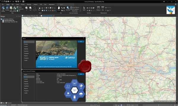
Cadcorp helps organisations derive meaningful and actionable intelligence from data. We do this with an extensive range of GIS software, spatial data and consultancy services designed to better inform decision-making. With our technical knowledge and expertise, we know how to support our customers in realising the benefits of location information.
The Cadcorp Spatial Information System - Cadcorp SIS - is an integrated family of geospatial software comprising desktop, server, web and developer products. It has been designed to meet the needs of end-users and application developers alike, for use in all phases of spatial data management - from creation, through to application development, deployment and data distribution.
Cadcorp SIS Desktop is able to provide the creation and management of geographical information, advanced spatial analysis, support for Ordnance Survey® data, 3D analysis and connections to over 300 different formats of spatial data, including common spatial databases such as PostGIS, Oracle and Microsoft SQL Server, all out of the box.
Cadcorp SIS WebMap is a sophisticated yet easy-to-use web mapping application. It provides advanced capabilities for presenting and interrogating spatial data, accessed through a familiar and responsive interface. It has been designed to run on mobile devices, tablets and PCs.
Cadcorp GeognoSIS makes the wide-ranging functionality of Cadcorp SIS available over the web for interactive mapping applications, or over a corporate intranet or extranet for enterprise-wide deployment of GIS applications and mapping services. It can publish maps to any system that accepts OGC, Microsoft Bing Maps and Google Maps services. |
| |
 Читать статью дальше (комментариев - 12)
| |
|
 |
 Автор: Williams Автор: Williams
 Дата: 2 августа 2023 Дата: 2 августа 2023
 Просмотров: 9 685 Просмотров: 9 685 |
| |
SCAD (Structure CAD) Office v23.1.1.1 build 11.22.2022
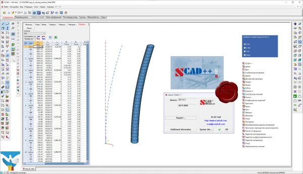 SCAD Office — система нового поколения, разработанная инженерами для инженеров и реализованная коллективом опытных программистов. В состав системы входит высокопроизводительный вычислительный комплекс SCAD, а также ряд проектирующих и вспомогательных программ, которые позволяют комплексно решать вопросы расчета и проектирования стальных и железобетонных конструкций. Система постоянно развивается, совершенствуются интерфейс пользователя и вычислительные возможности, включаются новые проектирующие компоненты. SCAD Office — система нового поколения, разработанная инженерами для инженеров и реализованная коллективом опытных программистов. В состав системы входит высокопроизводительный вычислительный комплекс SCAD, а также ряд проектирующих и вспомогательных программ, которые позволяют комплексно решать вопросы расчета и проектирования стальных и железобетонных конструкций. Система постоянно развивается, совершенствуются интерфейс пользователя и вычислительные возможности, включаются новые проектирующие компоненты.
SCAD Office сертифицирован на соответствие ГОСТ Р ИСО/МЭК 9126-93, ГОСТ 28195-89, ГОСТ Р ИСО 9127-94, РД 50-34.698-90
Соответствие СНиП подтверждено сертификатом Госстроя России.
SCAD Office включает следующие программы:
- SCAD — вычислительный комплекс для прочностного анализа конструкций методом конечных элементов
- КРИСТАЛЛ — расчет элементов стальных конструкций
- АРБАТ — подбор арматуры и экспертиза элементов железобетонных конструкций
- КАМИН — расчет каменных и армокаменных конструкций
- ДЕКОР — расчет деревяных конструкций
- ЗАПРОС — расчет элементов оснований и фундаментов
- ОТКОС — анализ устойчивости откосов и склонов
- ВЕСТ — расчет нагрузок по СНиП «Нагрузки и воздействия» и ДБН
- МОНОЛИТ — проектирование монолитных ребристых перекрытий
- КОМЕТА, КОМЕТА-2 — расчет и проектирование узлов стальных конструкций
- КРОСС — расчет коэффициентов постели зданий и сооружений на упругом основании
- КОНСТРУКТОР СЕЧЕНИЙ — формирование и расчет геометрических характеристик сечений из прокатных профилей и листов
- КОНСУЛ — построение произвольных сечений и расчет их геометрических характеристик на основе теории сплошных стержней
- ТОНУС — построение произвольных сечений и расчет их геометрических характеристик на основе теории тонкостенных стержней
- СЕЗАМ — поиск эквивалентных сечений
- КоКон — справочник по коэффициентам концентрации напряжений и коэффициентам интенсивности напряжений
- КУСТ — расчетно-теоретический справочник проектировщика
Verification examples |
| |
 Читать статью дальше (комментариев - 45)
| |
|
 |
 Автор: Williams Автор: Williams
 Дата: 1 августа 2023 Дата: 1 августа 2023
 Просмотров: 398 Просмотров: 398 |
| |
Aquaveo Groundwater Modeling System Premium v10.7.6
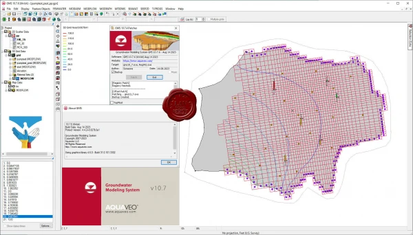
Aquaveo GMS - комплексная среда моделирования подземных вод с системой предварительной графический обработки информации. Aquaveo GMS легко взаимодействует с MODFLOW и рядом других моделей по моделированию подземных вод и предоставляет расширенные графические возможности для просмотра и калибровки результатов моделирования.
What's new
Bug's fixed
Nice pricing |
| |
 Читать статью дальше (комментариев - 2)
| |
|
 |
 Автор: Williams Автор: Williams
 Дата: 31 июля 2023 Дата: 31 июля 2023
 Просмотров: 1 047 Просмотров: 1 047 |
| |
RUNET software BETONexpress version 24.07/2023
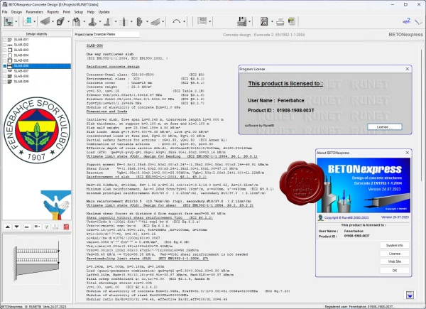
With BETONexpress you can easily design structural elements of reinforced concrete. For each structural element, you specify the basic dimensions, loads and material properties, and you obtain the detailed concrete design in ultimate limit state (ULS), and in serviceability limit state (SLS).
The dimensioning is according to Eurocode 2, EN 1992-1-1:2004, Design of concrete structures, General rules and rules for buildings, with supplement of Eurocode 7, EN 1997-1:2004, Geotechnical design – General rules, for geotechnical analysis (footings, retaining walls), Eurocode 0, EN 1990:2002, for load combinations, and Eurocode 8 for seismic loading. The last EN versions of the Eurocodes are implemented. You can also compute the capacity of slabs, beams and columns strengthened with FRP (fibre-reinforced polymers). Regular and light weight aggregate concrete included.
The program's CAD modulus automatic generates detailed drawings of the structure and the reinforcement. A combined detailed report and reinforcing steel schedule is produced for the designed concrete components. Assumptions and references to design codes are shown in the report. The reinforcing steel schedule can be edited with a specialised editor which is included. The user can select the applicable National Annex. The design code parameters, as well as default values, can be adjusted by the user. Design Charts and Tables for use and understanding of Eurocode 2 are included n the program. In addition a set of engineering tools are included in the program. |
| |
 Читать статью дальше (комментариев - 9)
| |
|
 |
 Автор: Williams Автор: Williams
 Дата: 29 июля 2023 Дата: 29 июля 2023
 Просмотров: 195 Просмотров: 195 |
| |
Structural Vibration Solutions DEWESoft ARTeMIS Modal Pro v7.2.2.4
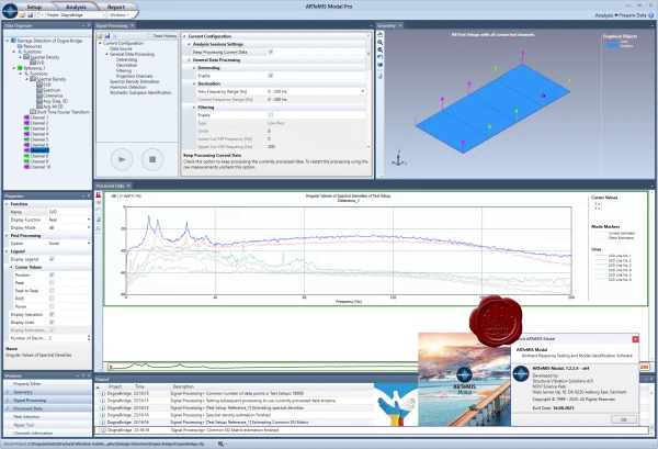 This is the basic version of ARTeMIS Modal having a frequency domain method for Operational Modal Analysis, and optionally direct data acquisition support and frequency domain methods for Experimental Modal Analysis. It is the software that allows you to get both modal analysis and operating deflection shapes analysis at a favorable entry price. The software includes setup tasks allowing you to create a project from scratch. There is a geometry generator where test geometries can be made in an object oriented manner, or you can upload gerometries into the software from various popular file formats. Measurements for Operational Modal Analysis and Operating Defection Shapes analysis can be loaded from more than 20 different file formats. Measurements channels can be assigned to the right geometry nodes and directions using drag and drop features. The software has a variety of built-in signal processing tools that can be used to enhance the performance of the analysis methods. In the basic version there are tools for detrending, decimation and filtering of the raw data as well as spectral density estimation. There is alsp an automatic selection of the so-called projection channels for more effective processing. The basic version has the effective Frequency Domain Decomposition (FDD) method for Operational Modal Analysis. There are various validation features available, such as mode shape animation and the Modal Assurance Criterion. In addition, it has time and frequency domain Operating Deflection Shapes analysis. It also comes with a built-in report generator which allow you to produce predefined reports in Microsoft Word and Microsoft Power Point. The basic version seamlessly integrates with the Direct Hardware Control, and Experimental Modal Analysis plugins. This opens up for direct measurements for Operational Modal Analysis as well as e.g. direct impact testing for Experimental Modal Analysis. This is the basic version of ARTeMIS Modal having a frequency domain method for Operational Modal Analysis, and optionally direct data acquisition support and frequency domain methods for Experimental Modal Analysis. It is the software that allows you to get both modal analysis and operating deflection shapes analysis at a favorable entry price. The software includes setup tasks allowing you to create a project from scratch. There is a geometry generator where test geometries can be made in an object oriented manner, or you can upload gerometries into the software from various popular file formats. Measurements for Operational Modal Analysis and Operating Defection Shapes analysis can be loaded from more than 20 different file formats. Measurements channels can be assigned to the right geometry nodes and directions using drag and drop features. The software has a variety of built-in signal processing tools that can be used to enhance the performance of the analysis methods. In the basic version there are tools for detrending, decimation and filtering of the raw data as well as spectral density estimation. There is alsp an automatic selection of the so-called projection channels for more effective processing. The basic version has the effective Frequency Domain Decomposition (FDD) method for Operational Modal Analysis. There are various validation features available, such as mode shape animation and the Modal Assurance Criterion. In addition, it has time and frequency domain Operating Deflection Shapes analysis. It also comes with a built-in report generator which allow you to produce predefined reports in Microsoft Word and Microsoft Power Point. The basic version seamlessly integrates with the Direct Hardware Control, and Experimental Modal Analysis plugins. This opens up for direct measurements for Operational Modal Analysis as well as e.g. direct impact testing for Experimental Modal Analysis.
Standard is the mid-size version of ARTeMIS Modal that, besides all the tasks and features of the basic version, also includes additional frequency domain methods for Operational Modal Analysis and more validation features. This version includes signal processing for detection of harmonic peaks in the spectrum. Harmonic peaks are caused by the presence of rotating components during measurements of a structure. During operational modal analysis of rotating machinery, it is important to be able to distinguish peaks of structural modes from peaks caused by the excitation. Two additional Frequency Domain Decomposition methods are available, that can estimate mode shapes and natural frequencies with more accuracy. On top, these methods also provide an estimate of the damping ratios. Modal parameters from the three built-in modal estimators can be validated against each other in a special designed validation task. In addition, modes obtained from external tools can be imported through Universal File Format and validated against internally produced results. The Standard version seamlessly integrates with the Direct Hardware Control and Experimental Modal Analysis plugins.
In addition to all features and tasks of the Basic and Standard versions, this version has up to five different time domain methods for Operational Modal Analysis. The methods are all of the very fast en efficient Crystal Clear Stochastic Subspace Identification (CC-SSI) type. These methods estimate the modal parameters directly from the measured time series, and some methods even estimate the uncertainties of the modal parameters. This version also includes effective peak reduction techniques, that can be used for pre-processing of the measurements. It can effectively remove selected peaks that can be e-g. servere harmonic peaks caused by the presence of rotating components during measurements of a structure. The Pro version seamlessly integrates with the Direct Hardware Control and Experimental Modal Analysis plugins. It also integrates with the Structural Health Monitoring plugins for Damage Detection, Modal Parameter History tracking and Interstory Drift Analysis. An Automatic File Upload plugin is also available. With this plugin, files being dumped in a designated folder will automatically be uploaded and processed by the software. In this way, modal parameter estimation and damage detection can be performed automatically with user interaction. |
| |
 Читать статью дальше (комментариев - 0)
| |
|
 |
| ПОИСК ПО САЙТУ |
 |
|
 |
| КАЛЕНДАРЬ | | |
 |
| « Октябрь 2025 » |
|---|
| Пн | Вт | Ср | Чт | Пт | Сб | Вс |
|---|
| | 1 | 2 | 3 | 4 | 5 | | 6 | 7 | 8 | 9 | 10 | 11 | 12 | | 13 | 14 | 15 | 16 | 17 | 18 | 19 | | 20 | 21 | 22 | 23 | 24 | 25 | 26 | | 27 | 28 | 29 | 30 | 31 | |
|
 | |
| |
|