|
 |
 Автор: Williams Автор: Williams
 Дата: 17 августа 2023 Дата: 17 августа 2023
 Просмотров: 838 Просмотров: 838 |
| |
RUNET software Steel Sections EC3 ver 16.08/2023
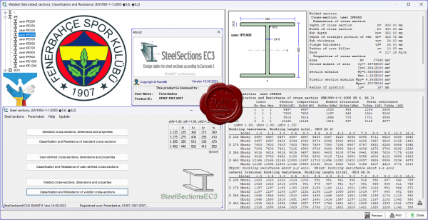
Design tables for Structural Steel Sections according to Eurocode 3, EN 1993-1-1:2005
Tables with all the international steel sections, with their dimensions, properties, classification, resistance and buckling resistance values according to Eurocode 3, EN1993-1-1:2005. The tables are extended to non-standard steel sections and welded section with dimensions given from the user. |
| |
 Читать статью дальше (комментариев - 6)
| |
|
 |
 Автор: Williams Автор: Williams
 Дата: 15 августа 2023 Дата: 15 августа 2023
 Просмотров: 1 325 Просмотров: 1 325 |
| |
GEO-SLOPE GeoStudio 2023.1.1.829
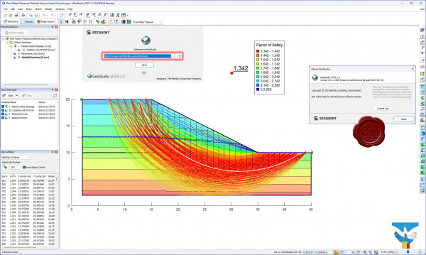
GEO-SLOPE GeoStudio - программный комплекс для решения инженерно-геологических задач и моделирования грунтовых конструкций. Данны пакет состоит из 8 продуктов: SLOPE/W - анализ устойчивости откосов; QUAKE / W - динамический анализ землетрясения; AIR / W - анализ потока воздуха; SEEP / W - анализ просачивания грунтовых вод; TEMP / W - геотермальный анализ; VADOSE/W - анализ зон аэрации и анализ почвенного покрова; SIGMA / W - анализ напряженно-деформированного состояния; CTRAN / W - анализ загрязнений транспорта.
GeoStudio is a product suite for geotechnical and geo-environmental modeling, broad enough to handle all your modeling needs. The suite consists of 8 products: SLOPE/W for slope stability; SEEP/W for groundwater seepage; SIGMA/W for stress-deformation; QUAKE/W for dynamic earthquake; TEMP/W for geothermal; CTRAN/W for contaminant transport; AIR/W for air flow; VADOSE/W for vadose zone covers.
Examples can be found here |
| |
 Читать статью дальше (комментариев - 23)
| |
|
 |
 Автор: Williams Автор: Williams
 Дата: 14 августа 2023 Дата: 14 августа 2023
 Просмотров: 805 Просмотров: 805 |
| |
Descon v8.0.2.287
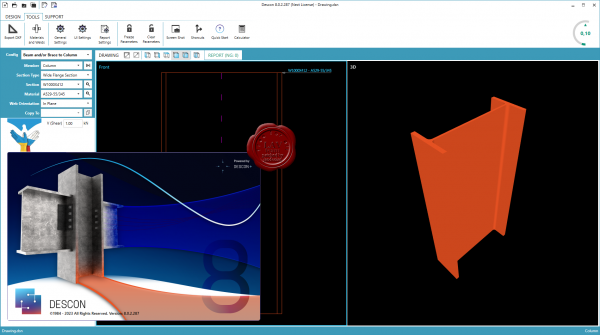
Descon is the industry standard for Structural Steel Connection Design Software. With over 27 years of market dominance, Descon keeps moving forward. Customers like you are the ones whose input is making what you want to use. Omnitech Associates developed and supported Descon software for over 25 years. They made their software the industry standard for steel connection design as they revolutionized the market. Omnitech has decided to pass their software along to a new team who will continue with moving Descon forward. DesconPlus was founded late in 2012 and took over DesconWin and DesconBrace.
Whether you work with structural connections constantly or just once in a while, Descon is a comprehensive tool that is used with each stage of the connection design process.
Descon is available in a variety of packages, allowing your schedule to call the shots. We have month-to-month plans called “Flex” that give the ability to adjust users and software levels by month. We also offer Annual Maintenance Plans (AMP) that give access year after year while keeping your software current.
More info |
| |
 Читать статью дальше (комментариев - 5)
| |
|
 |
 Автор: Williams Автор: Williams
 Дата: 13 августа 2023 Дата: 13 августа 2023
 Просмотров: 1 049 Просмотров: 1 049 |
| |
RUNET software Steel Portal Frame EC3 version 17.07/2023
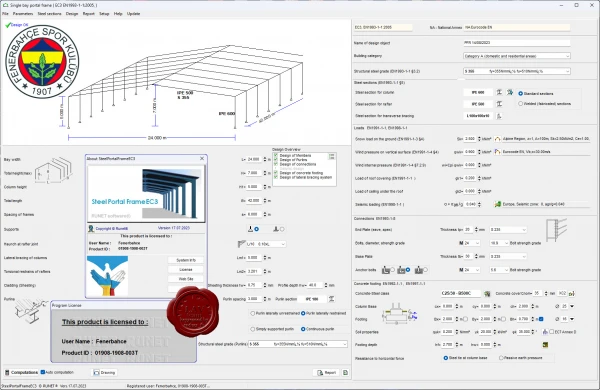
Design of Steel portal frame structures according to Eurocode 3
- All the loading conditions and load combinations according to Eurocode 0 and 1
- Seismic design according to Eurocode 8
- Design of the steel structure, according to Eurocode 3-1-1
- Steel joints according to Eurocode 3-1-8
- Lateral bracing system according to Eurocode 3-1
- Concrete foundation according to Eurocode 2-1 and Eurocode 7-1
- Detailed drawings of the structure and the connections
Concept design
- Elastic linear analysis, with allowance for second order effects. (Eurocode 3-1-1)
- Gravity loads, imposed loads, snow loads, wind loads (Eurocode 1-1, 1-3, 1-4)
- Seismic loads (Eurocode 8-1)
- All the load combinations (Eurocode 0)
- Analysis for seismic loads using lateral force method and modal superposition spectrum analysis. (Eurocode 8-1)
- Verification of the members (rafters, columns, haunch) in ultimate limit state (ULS) cross-section resistance and member flexural and lateral stability (Eurocode 3-1-1, 3-1-3, 3-1-5)
- Deflection checks in SLS, (Eurocode 3-1)
- Detailed design of bolted eave, apex and base connections. (Eurocode 3-1-8)
- Design of base anchoring (Eurocode 3-1-1, CEN/TS 1992-4-1)
- Design of purlins (Eurocode 3-1)
- Design of vertical and horizontal lateral bracing system (Eurocode 3-1)
- Design of concrete foundation. (Eurocode 2-1, Eurocode 7-1)
- Detailed drawings of the structure and the connections.
|
| |
 Читать статью дальше (комментариев - 7)
| |
|
 |
 Автор: Williams Автор: Williams
 Дата: 11 августа 2023 Дата: 11 августа 2023
 Просмотров: 668 Просмотров: 668 |
| |
DNV GeniE v8.7-01
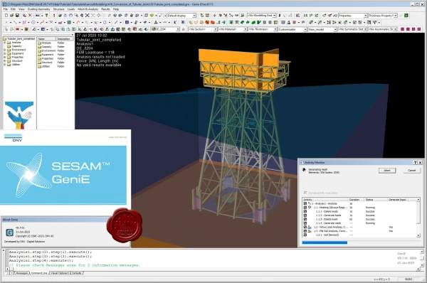
GeniE is conceptual modelling of offshore and maritime structures.
It's a powerful FEM modelling and analysis tool for innovation, flexibility and efficiency in offshore structural engineering.
GeniE is a tool for concept (high level geometry) modelling of beams, flat plates and stiffened shells. Load modelling includes equipment (with automatic load transfer), explicit loads, wind loads and generation of compartments in floating structures.
The concept model, or parts of it, can be meshed using a variety of beam, plate and shell finite element types. The mesh may be refined or modified using a comprehensive set of mesh editing features, whereupon the mesh quality may be verified.
Through running the modules Wajac and Sestra from the GeniE user interface, environmental loads (wave, current, buoyance and wind) may be calculated and a finite element stress analysis performed, including for jacket structures a pile-soil-structure interaction via the module Splice. |
| |
 Читать статью дальше (комментариев - 6)
| |
|
 |
 Автор: Williams Автор: Williams
 Дата: 10 августа 2023 Дата: 10 августа 2023
 Просмотров: 3 717 Просмотров: 3 717 |
| |
CSI ETABS v21.1.0 build 3261
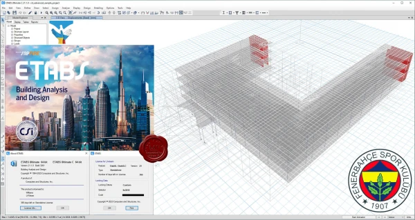
The innovative and revolutionary new ETABS is the ultimate integrated software package for the structural analysis and design of buildings. Incorporating 40 years of continuous research and development, this latest ETABS offers unmatched 3D object based modeling and visualization tools, blazingly fast linear and nonlinear analytical power, sophisticated and comprehensive design capabilities for a wide-range of materials, and insightful graphic displays, reports, and schematic drawings that allow users to quickly and easily decipher and understand analysis and design results.
From the start of design conception through the production of schematic drawings, ETABS integrates every aspect of the engineering design process. Creation of models has never been easier - intuitive drawing commands allow for the rapid generation of floor and elevation framing. CAD drawings can be converted directly into ETABS models or used as templates onto which ETABS objects may be overlaid. The state-of-the-art SAPFire 64-bit solver allows extremely large and complex models to be rapidly analyzed, and supports nonlinear modeling techniques such as construction sequencing and time effects (e.g., creep and shrinkage). Design of steel and concrete frames (with automated optimization), composite beams, composite columns, steel joists, and concrete and masonry shear walls is included, as is the capacity check for steel connections and base plates. Models may be realistically rendered, and all results can be shown directly on the structure. Comprehensive and customizable reports are available for all analysis and design output, and schematic construction drawings of framing plans, schedules, details, and cross-sections may be generated for concrete and steel structures.
ETABS provides an unequaled suite of tools for structural engineers designing buildings, whether they are working on one-story industrial structures or the tallest commercial high-rises. Immensely capable, yet easy-to-use, has been the hallmark of ETABS since its introduction decades ago, and this latest release continues that tradition by providing engineers with the technologically-advanced, yet intuitive, software they require to be their most productive. |
| |
 Читать статью дальше (комментариев - 21)
| |
|
 |
 Автор: Williams Автор: Williams
 Дата: 9 августа 2023 Дата: 9 августа 2023
 Просмотров: 188 Просмотров: 188 |
| |
Cadence 6SigmaDCX DataCenter Design Pro 2023.2
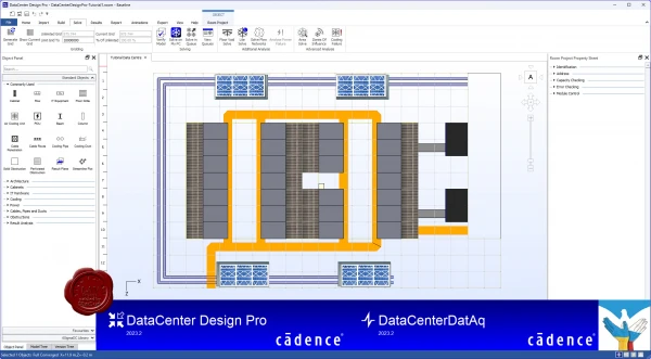
Cadence is a pivotal leader in electronic systems design, building upon more than 30 years of computational software expertise. The company applies its underlying Intelligent System Design strategy to deliver software, hardware, and IP that turn design concepts into reality.
Cadence DataCenter Design Software and Insight Platform (formerly Future Facilities 6SigmaDCX product line) offers physics-based simulation software for the next generation of data center design and management to maximize operational performance. 6SigmaRoom by Future Facilities Ltd. has been rebranded into two distinct product offerings from Cadence Design Systems: DataCenter Design and DataCenter Insight. See About DataCenter 2023.2 for more information about these two product offerings. DataCenter Design and DataCenter Insight Desktop 2023.2 follow on directly from 6SigmaRoom Release 17.1, so all known and fixed issues that applied to 6SigmaRoom Release 17.1 also apply to DataCenter Design and DataCenter Insight Desktop 2023.2 |
| |
 Читать статью дальше (комментариев - 1)
| |
|
 |
 Автор: Williams Автор: Williams
 Дата: 8 августа 2023 Дата: 8 августа 2023
 Просмотров: 525 Просмотров: 525 |
| |
UniSoft Geotechnical Solutions UniPile v5.0.0.60
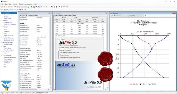
UniPile is an application for the analysis of piles and pile groups according to various design methods. UniPile considers bearing capacity, pile group settlement, negative skin friction, and drag load. Aspects of drivability and residual stress are also included. It also simulates the load-movement behaviour of the pile in a static Head-Down and Bidirectional (O-Cell) loading test. Pile ultimate resistance may be calculated using the Static (Beta or Alpha), Eslami & Fellenius (CPTu), Schmertmann & Nottingham (CPT), deRuiter & Beringen - Dutch (CPT), Bustamente - LCPC (CPT), Decourt (SPT), O'Neill-Reese (SPT), or the Meyerhof (SPT) methods. |
| |
 Читать статью дальше (комментариев - 8)
| |
|
 |
| ПОИСК ПО САЙТУ |
 |
|
 |
| КАЛЕНДАРЬ | | |
 |
| « Октябрь 2025 » |
|---|
| Пн | Вт | Ср | Чт | Пт | Сб | Вс |
|---|
| | 1 | 2 | 3 | 4 | 5 | | 6 | 7 | 8 | 9 | 10 | 11 | 12 | | 13 | 14 | 15 | 16 | 17 | 18 | 19 | | 20 | 21 | 22 | 23 | 24 | 25 | 26 | | 27 | 28 | 29 | 30 | 31 | |
|
 | |
| |
|