|
 |
 Автор: Williams Автор: Williams
 Дата: 26 сентября 2023 Дата: 26 сентября 2023
 Просмотров: 199 Просмотров: 199 |
| |
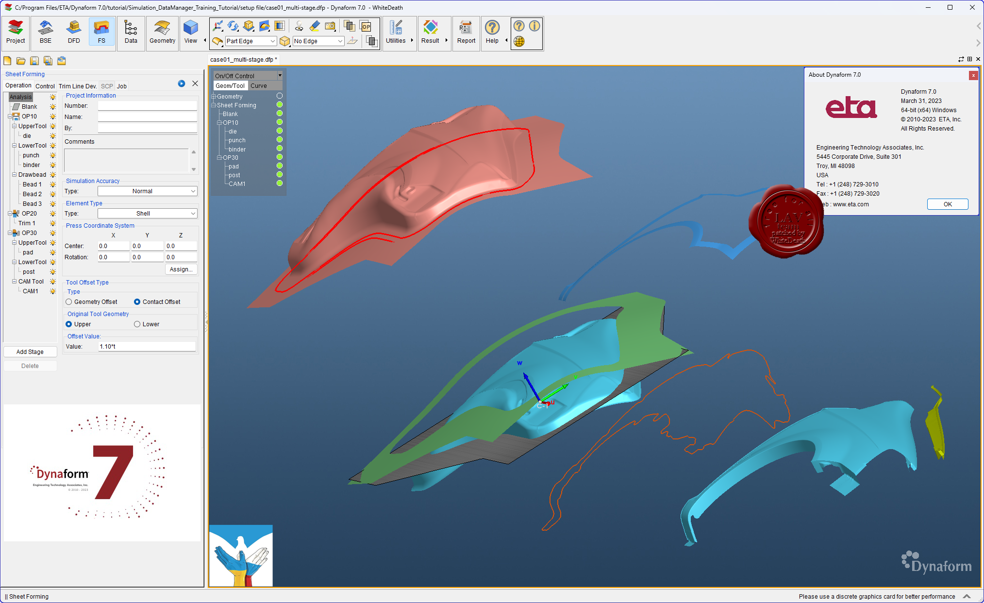
Engineering Technologies Associates Dynaform v7.0
ETA Dynaform - специализированный программный комплекс, ориентированный на моделирование процессов листовой штамповки и использующий в качестве ядра математический аппарат программы LS-DYNA. Пре- и постпроцессинг Dynaform построен с учетом всех специфических особенностей техпроцесса - он автоматизирует стандартные операции подготовки расчетной схемы и функции оценки и интерпретации результатов анализа и базируется на общепринятой терминологии, знакомой каждому инженеру-технологу. Инструментарий программы включает:
-
Автоматическое построение сеток;
-
Адаптивные сетки с анимацией истории построения;
-
Обширную библиотеку промышленных материалов;
-
Автоматизированное позиционирование инструмента;
-
Вовлечение явлений потери устойчивости листа – коробления;
-
Расчет тангенциальных усилий под прижимами (тормозными ребрами);
-
Расчет упругой разгрузки изделия;
-
Высококачественную визуализацию всех результатов и анимацию;
-
Построение предельной диаграммы ”формуемости”.
Dynaform - a complete die-system evaluation tool for the automotive industry. Dynaform encompasses the entire die system process in one simple interface. Simulating every detail during the design stage, Dynaform ensures the highest quality formed part and best manufacturing process. The system guides the engineer through cost estimation, quoting, die evaluation and formability. Dynaform makes it possible to completely bypass soft tooling, reduce overall tryout time, lower costs, increase productivity and provide complete confidence in die system design. Makes possible evaluation alternative designs and materials. Dynaform’s tube forming simulation now supports multi-stage tube forming, including tube bending, tube pre-forming, tube hydroforming, trimming, and annealing. The simulations can accurately predict failures like wrinkles, cracks, spring back, and feasibility of hydroforming. No matter what process you are using or which stage you are focusing on, you can easily find the function you are looking for. Dynaform’s bending table now supports editing, inserting, and deleting operations. Users can now also import the bending table manually or automatically generate it from the center line. Our bending table generation algorithm improvements now serve to save users significant amounts of time generating tables. Hydroforming in Dynaform now supports comprehensive die face design including tube end extensions, centerline auto calculating, quick generating of die separating lines, mesh model separation based on separating lines, and more. Instead of switching to CAD software to create the tools, users can finish almost all major FEA model preparation works in Dynaform. Dynaform’s forming simulation software makes it possible to uncover design flaws early in the process. Using the various modules engineers can more-fully evaluate alternative–and unconventional–designs. Doing so helps ensure higher quality outcomes. |
| |
 Читать статью дальше (комментариев - 0)
| |
|
|
Автор: Williams
Дата: 25 сентября 2023
Просмотров: 806 |
| |
Applied Flow Technology Fathom 2023 v13.0.1100
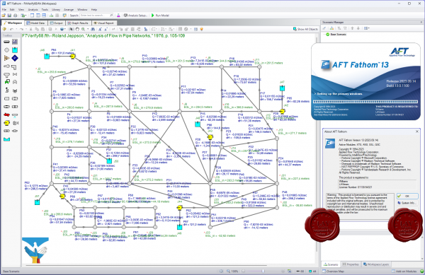 Applied Flow Technology Fathom - программно-аналитический комплекс моделирования потока в трубопроводе. Удобный графический интерфейс, встроенная библиотека оборудования, арматуры и флюидов, широкие аналитические возможности, схематическое изображение создаваемого объекта, все это реализовано в AFT Fathom и предоставляет инженеру проектировщику возможность системного подхода в реализации проектов любой сложности. AFT Fathom обладает большим спектром возможностей не являясь при этом компромиссом между функциональностью и сложностью в освоении и использовании. Applied Flow Technology Fathom - программно-аналитический комплекс моделирования потока в трубопроводе. Удобный графический интерфейс, встроенная библиотека оборудования, арматуры и флюидов, широкие аналитические возможности, схематическое изображение создаваемого объекта, все это реализовано в AFT Fathom и предоставляет инженеру проектировщику возможность системного подхода в реализации проектов любой сложности. AFT Fathom обладает большим спектром возможностей не являясь при этом компромиссом между функциональностью и сложностью в освоении и использовании.
Features:
- Advanced hydraulic solver
- Detailed modeling for centrifugal and positive displacement pumps
- Scenario Manager to track all design variants and operational possibilities in a single model file
- Pump vs. system curve generation including individual head curves and composite efficiency
- Thermal analysis including piping heat transfer and heat exchanger modeling
- Supports Newtonian and non-Newtonian fluids, including non-settling slurries
- Optional ChempakTM add-on utility provides a thermophysical database of almost 700 fluids
AFT Fathom add-on modules:
- Settling Slurry (SSL) - models the effects of pumping fluids containing settling solids using the Wilson/GIW method
- Extended Time Simulation (XTS) - models dynamic system behavior
- Goal Seek and Control (GSC) - identifies input parameters that yield desired output values and simulates control functions
- Automated Sizing (APS and ANS) - automate the process of sizing pipelines and piping networks based on required conditions, such as maximum pressure or minimum flow, to reduce cost or weight
Improvements:
1. Added the capability to copy Warnings and Design Alerts from the Output Primary Window.
2. Fixed an issue that could cause the application to freeze when generating certain graphs in property windows.
3. Fixed an issue that caused the Undefined Objects panel to open unexpectedly after visiting the Pipes and Junctions panel in Analysis Setup.
4. Corrected a program behavior that allowed users to check out both ANS Module and GSC Module at the same time, which should not be allowed.
5. Improved Analysis Setup 'Same as Parent' feature to support more data fields.
6. Fixed an issue that caused Output to clear without warning if junctions were moved on the Workspace with ctrl+click.
7. When switching between Design Alerts for junctions of the same type, the previously checked (selected) items would remain selected. This was only a display issue and did not actually change the Design Alert.
8. Fixed an issue in Graph Results where Opening Select Palette window then canceling resets all colors - it does not keep the previous colors.
9. Fixed various issues with Output right-click menu command visibility.
10. Fixed an issue where the "Batch Run Status" form ends up behind the main application form.
11. Fixed Issue: Model Data tab not showing updated parameters after using Global Edit.
12. Changed the behavior of the Scenario Tree in the Quick Access Panel. The tree will now keep its collapse/expand state for all nodes after a 'clone', 'create child', or 'delete' operations.
13. Fixed an issue where the Property Window during Import will float over all other windows.
14. Fixed an issue where the Quick Access Panel (QAP) properties tab not updating after selecting a workspace object using the Search tool.
15. Fixed several language phrases that were not translating properly.
16. Changed Output Grid right-click logic to allow quick graph plots in more cases, such as columns with some numeric and some N/A data.
17. Fixed an issue that prevented Submerged Pump modeled junctions from being exported to EPANET.
18. Added junction name to the Design Alert report in the Output.
19. Fixed an issue that prevented annotations from translating on the workspace when Arrange->Scale/Flip Workspace was used.
20. Updated the Startup window's Model Preference's pane to require the user to click "Remember My Preferences and Hide" in order to apply the selection in the Units section.
21. Corrected a program behavior that allowed users to check out both ANS Module and GSC Module at the same time, which should not be allowed.
22. Fixed an issue where models could be run while Sliding Friction Coefficient value was not yet entered in Slurry Definition, in cases where it should have been required to run.
23. Fixed an issue that caused Relief Valves to be defined when Exit Temperature was not entered and should have been required.
Video tutorials |
| |
Читать статью дальше (комментариев - 10)
| |
|
|
Автор: Williams
Дата: 24 сентября 2023
Просмотров: 3 854 |
| |
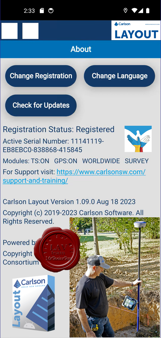
Carlosn Layout v1.09
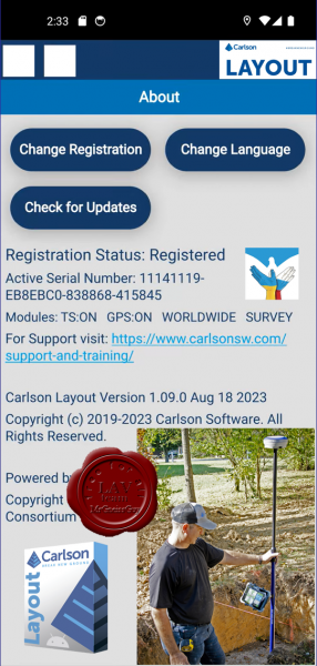
Carlosn Layout - программа на платформе Android является эффективным, доступным и простым в использовании решением для работы в полевых условиях с GNNS приемниками, инженерными и роботизированными тахеометрами. В основе Layout лежит опыт компании Carlson в области разработки программных решений для работы в поле, а также проверенная временем техническая поддержка.
Уникальность Layout заключается в поддержке самого большого списка популярного и нового геодезического оборудования, возможности выполнять задачи координатной геометрии в поле, а также работать с различными форматами файлов, включая DWG и DXF.
КЛЮЧЕВЫЕ ОСОБЕННОСТИ
-
Поддержка большинства известных GNSS приемников и тахеометров
-
Интуитивно понятный интерфейс пользователя требует меньше времени на изучение программы
-
Полная поддержка работы с DXF и DWG файлами чертежей на базе нового мобильного графического ядра IntellICAD
-
Поддерживает все библиотеки систем координат Carlson
-
Совместим со стандартными форматами файлов координат Carlson CRD и CRDB
-
Возможность использования Google Drive, Dropbox и других облачных хранилищ для простого обмена проектами
-
Возможность использования карт Google, OpenStreeMap, ArcGIS или локальных сервисов в качестве подложки
-
Прием GNSS RTK поправок через мобильный телефон, встроенный модем, встроенное или внешнее радио
-
Вынос точек с использованием поверхностей (ЦММ) или фиксированных отметок
-
Разбивка по расстоянию и смещению от линии на чертеже или между точек
-
Простая проверка отметок поверхности (ЦММ) или фиксированных отметок без создания точек
|
| |
Читать статью дальше (комментариев - 76)
| |
|
|
Автор: Williams
Дата: 23 сентября 2023
Просмотров: 994 |
| |
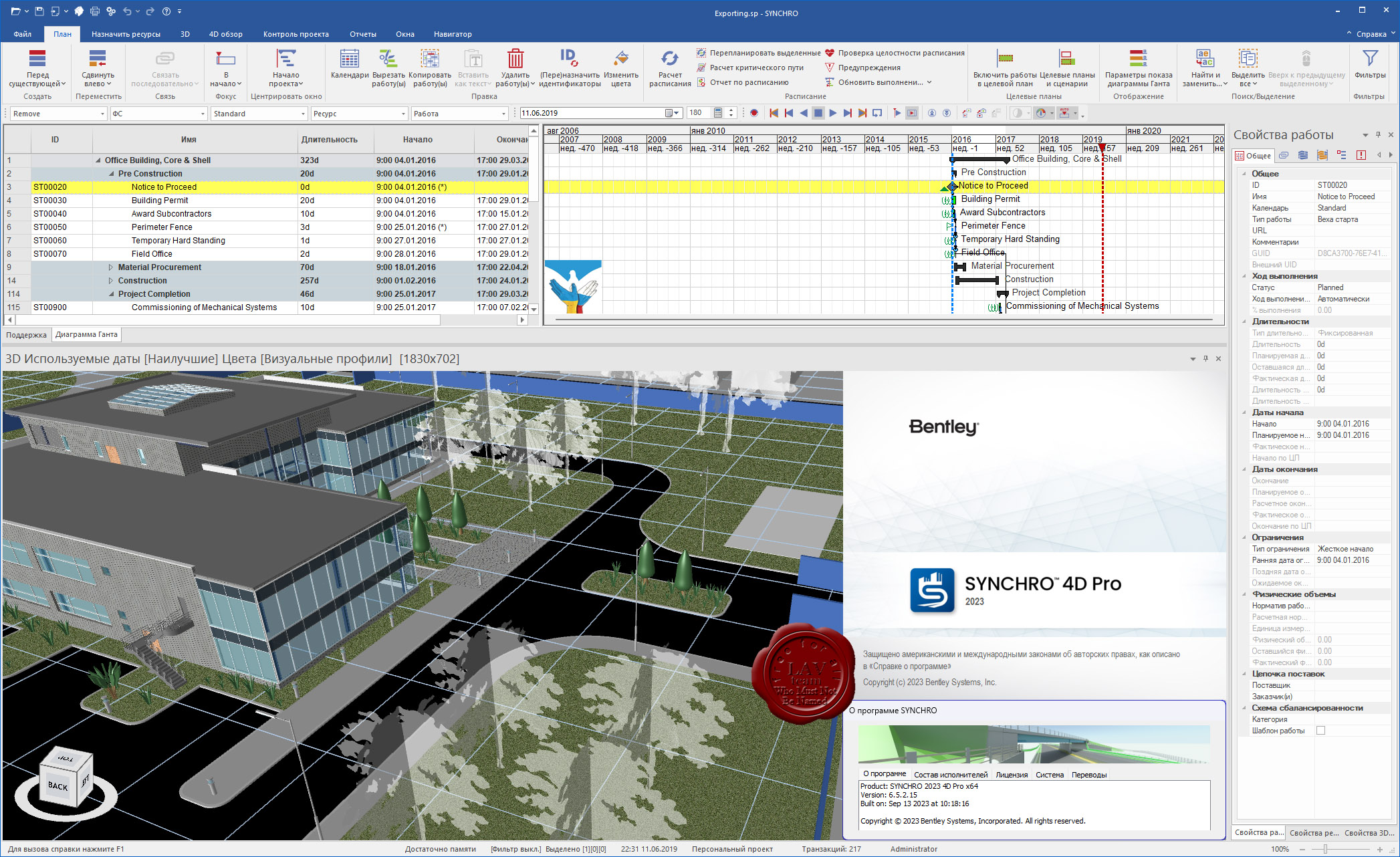
Bentley (ex. Synchro Ltd) SYNCHRO 2023 v6.5.2.15
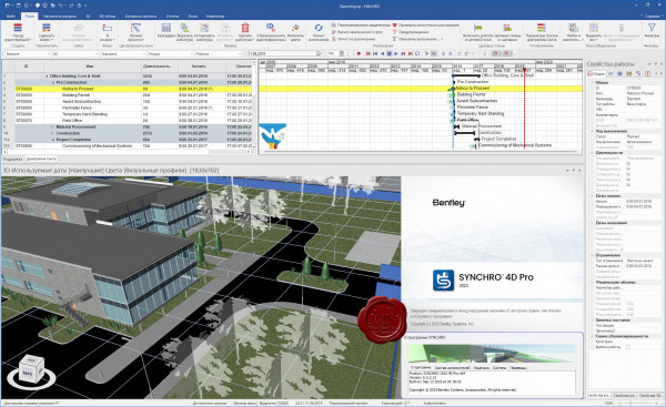 Synchro PRO, изначально разработанный компанией Synchro Ltd, в 2018 г. был куплен корпорацией Bentley System. Назначение Synchro - подготовка план-графиков строительных проектов (4D) на основании геометрических проектных данных и информации из других приложений. Synchro PRO также позволяет в порядке контроля проекта, проводить ценовой анализ, прослеживать исполнение бюджета (5D). Synchro PRO, изначально разработанный компанией Synchro Ltd, в 2018 г. был куплен корпорацией Bentley System. Назначение Synchro - подготовка план-графиков строительных проектов (4D) на основании геометрических проектных данных и информации из других приложений. Synchro PRO также позволяет в порядке контроля проекта, проводить ценовой анализ, прослеживать исполнение бюджета (5D).
Еще недавно всем казалось, что 3D-модель — это ответы на все вопросы и решение всех проблем, но в процессе реализации проекта по-прежнему возникают многочисленные коллизии, несовпадение плана с фактом, несвоевременные и неточные отчеты. В итоге, приходится тратить время, деньги и материалы на исправление того, что можно предотвратить еще на этапе проектирования.
Решение этой проблемы — программный продукт Synchro PRO от компании Bentley Systems, который позволяет интегрировать в свою среду готовую 3D-модель объекта и дополнять ее визуальным календарно-сетевым графиком. Благодаря полученной 4D-модели отслеживание выполнения плана-факта становится крайне простой задачей. В наглядной модели отображаются плановые и освоенные объемы работ, даты поставок материалов и оборудования, расположения единиц техники и бригад на конкретных участках строительства в конкретный промежуток времени. Все это позволяет оперативно выявлять пространственно-временные коллизии и принимать корректирующие меры, эффективно управляя процессом строительства.
Последнее обновление, о котором нам не терпится рассказать — Bentley Systems выводит Synchro PRO на строительную площадку, и сейчас мы можем говорить об управлении процессами контроля качества. Это становится возможным благодаря интеграции инструментов визуального планирования с инструментами строительного контроля. |
| |
Читать статью дальше (комментариев - 5)
| |
|
|
Автор: Williams
Дата: 22 сентября 2023
Просмотров: 145 |
| |
BioSolvetIT SeeSAR v13.0.2
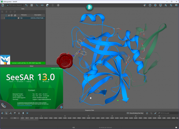 SeeSAR fosters innovation during every step of your drug design process. The app includes all tools vital for handling your compounds and target structures which have been fine-tuned to the needs of any chemist. Helpful features such as ADME properties assessment, comprehensive color coding, unoccupied binding pocket visualization, and many others, support you in making sound and interactive decisions. All our tools are based on solid and transparent science cited in over a thousand publications. Follow the button if you want to learn more about the science behind SeeSAR. SeeSAR fosters innovation during every step of your drug design process. The app includes all tools vital for handling your compounds and target structures which have been fine-tuned to the needs of any chemist. Helpful features such as ADME properties assessment, comprehensive color coding, unoccupied binding pocket visualization, and many others, support you in making sound and interactive decisions. All our tools are based on solid and transparent science cited in over a thousand publications. Follow the button if you want to learn more about the science behind SeeSAR.
Drag and drop your protein, or search comfortably in an online database. Within seconds, your target is prepared and you can get started.
Modify your protein according to your needs. Explore rotamers, introduce mutations, and customize side chains.
SeeSAR automatically detects the binding site of a ligand for you. In addition, you can precisely expand it by adding individual residues — or with a single click to find empty pockets in your protein.
Modify molecules to your taste in 2D or 3D on-the-fly. Once you are done, the molecules are directly prepared for your tasks.
Estimate affinities and interpret the results using the visualized HYDE score. Filter your compounds for relevant parameters, calculate ADME properties, and gain full control over ligand-target interactions.
Ideate without limits! Discover new scaffolds, explore, and grow into free cavities, or link molecules using fragment libraries for elegant solutions.
Dock your compounds with one single click! Screen libraries for actives, and instinctively evaluate your results.
Align your compounds without the need of a target structure based on their molecular similarity.
Change log |
| |
Читать статью дальше (комментариев - 1)
| |
|
|
Автор: Williams
Дата: 21 сентября 2023
Просмотров: 338 |
| |
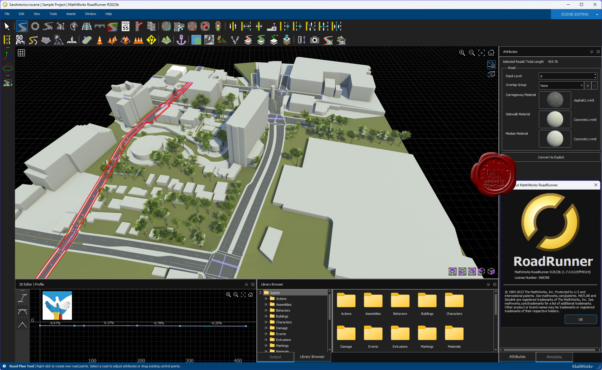
MathWorks RoadRunner R2023b Windows + Linux
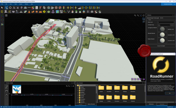
RoadRunner is an interactive editor that lets you design 3D scenes for simulating and testing automated driving systems. You can customize roadway scenes by creating region-specific road signs and markings. You can insert signs, signals, guardrails, and road damage, as well as foliage, buildings, and other 3D models. RoadRunner provides tools for setting and configuring traffic signal timing, phases, and vehicle paths at intersections.
RoadRunner supports the visualization of lidar point cloud, aerial imagery, and GIS data. You can import and export road networks using OpenDRIVE. 3D scenes built with RoadRunner can be exported in FBX, glTF, OpenFlight, OpenSceneGraph, OBJ, and USD formats. The exported scenes can be used in automated driving simulators and game engines, including CARLA, Vires VTD, NVIDIA DRIVE Sim, rFpro, Baidu Apollo, Cognata, Unity, and Unreal Engine.
RoadRunner Asset Library lets you quickly populate your 3D scenes with a large set of realistic and visually consistent 3D models. RoadRunner Scene Builder lets you automatically generate 3D road models from HD maps. |
| |
Читать статью дальше (комментариев - 3)
| |
|
|
Автор: Williams
Дата: 20 сентября 2023
Просмотров: 4 320 |
| |
Adobe Photoshop 2024 v25.0
Adobe Photoshop – это самый популярный фоторедактор в мире! Его используют как обычные фотолюбители, так и профессионалы. Если вам часто приходится заниматься обработкой фотографий, созданием графического дизайна (в том числе трехмерного и веб-дизайна), то лучшим помощником в этом творческом деле является именно программа Фотошоп.
Преимущества Adobe Photoshop 2024:
- Функции «Генеративная заливка» и «Генеративное расширение» доступны в Photoshop
Оцените возможности функций «Генеративная заливка» и «Генеративное расширение» на базе технологии Firefly при работе с Adobe Photoshop: теперь они доступны для коммерческого использования, а учетные данные для содержимого добавляются автоматически.
- Новые взаимодействия с инструментом «Удалить»
Воспользуйтесь инструментом «Удалить», чтобы нарисовать контур вокруг объекта, который нужно удалить, вместо того, чтобы полностью его закрашивать. Такое взаимодействие позволяет уменьшить вероятность ошибки и часто занимает меньше времени.
- Новые возможности контекстной панели задач теперь доступны для работы с инструментами маскирования
Теперь в Photoshop у контекстной панели задач появились новые возможности для работы с инструментами маскирования и генеративного ИИ.
- Другие улучшения и изменения
Синхронизация наборов в Photoshop 2024 не поддерживается, и эта функция больше не будет работать. Оцените повышенную производительность при запуске Photoshop, достигнутую благодаря оптимизации процесса загрузки.
Обзор новых возможностей на оффсайте |
| |
Читать статью дальше (комментариев - 7)
| |
|
|
Автор: Williams
Дата: 19 сентября 2023
Просмотров: 335 |
| |
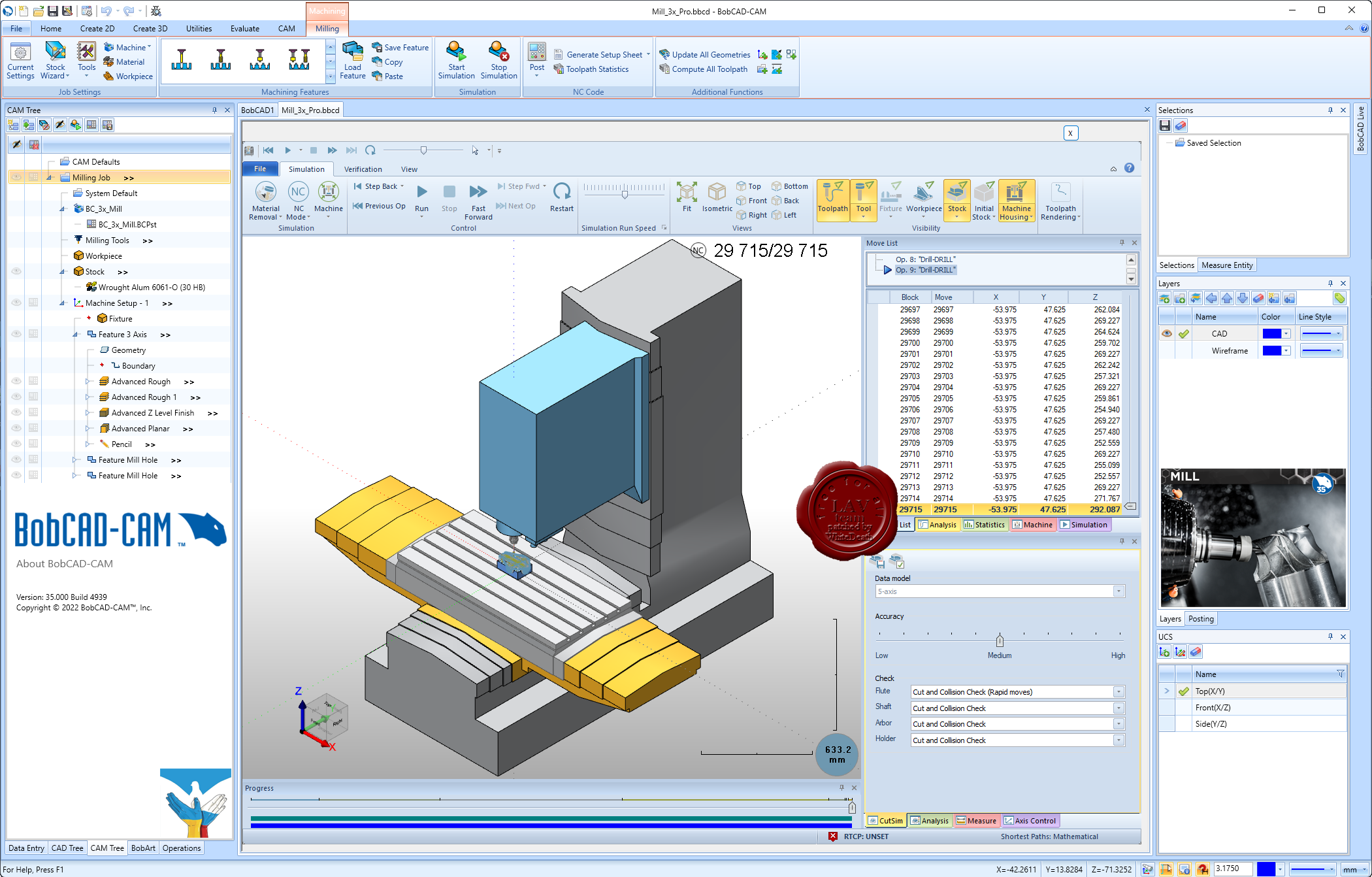
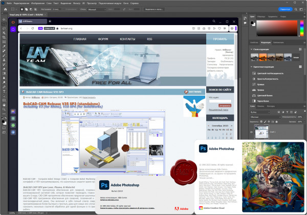
BobCAD-CAM Release V35 SP3 (standalone)
including V3 (for Rhino), V10 SP4 (for SolidWorks)

BobCAD-CAM - Computer-Aided Design (CAD) и Computer-Aided Machining (CAM) программное обеспечение разработано для инженеров, имеет доступный и простой в использовании интерфейс и ЧПУ программирование, что значительно сократит время программирования и обработку, как простых так и сложных задач.
BobCAD-CAM ЧПУ для Laser, Plasma, & WaterJet
BobCAD-CAM ЧПУ программное обеспечение для лазерной, плазменной и гидроабразивной машины предлагает мощные возможности 2-5 -координатного резки с полностью интегрированной системой CAD, которая позволяет переходить плавно от создания вашей модели до назначения передовых стратегии обработки маршрута для программирования вашего G-кода. CAD-CAM программное обеспечение предлагает различные варианты инструментов, чтобы дать вам полный контроль над резанием ваших деталей.
CAD-CAM ЧПУ программное обеспечение для лазерной, плазменной и гидроабразивной машин обеспечивает необходимой для машины, от простой 2-координатной к комплексной многокоординатной резке. Она включает в себя полный спектр современных и полностью ассоциативных стратегий обработки с помощью простого интерфейса, чтобы сделать программирование более быстрым и простым, даже для новых или случайных пользователей. Технология Dynamic Machining Strategies минимизирует время программирования, позволяет назначить несколько стратегий обработки для одной функции в то время как расширенные функциональные возможности моделирования позволяют проверить и подтвердить вашу работу.
BobCAD-CAM CAD Design
BobCAD-CAM Computer-Aided Design (CAD) - программное обеспечение, обеспечивает передовыми 2D и 3D дизайн технологиями с интуитивно понятным интерфейсом, что делает создание и редактирование простых и сложных деталей проще и эффективнее, чем когда-либо.
Параметры настроек программного обеспечения дают вам возможность адаптировать свой дизайн интерфейса для повышения производительности вашего рабочего процесса, экономя время проектирования на каждом проекте. BobCAD-CAM обеспечивает одним из крупнейших выбором профессиональных инструментов рисования и моделирования между CAD продуктами, доступними в своей ценовой категории.
Использование более 100 простых в использовании геометрических инструментов для быстрого и эффективного создания и редактирования сложных моделей деталей. Широкий спектр мощных каркасных, поверхностных и твердых моделей инструментов проектирования обеспечивают производительность, необходимую для создания всего, начиная от простых плоских моделей до сложных 3D-моделей со сложными деталями. BobCAD-CAM программное обеспечение легкое в использовании для новых или случайных пользователей, и в то же время достаточно мощное, чтобы удовлетворить потребности опытного дизайнера.
BobCAD-CAM Mill CAD-CAM
BobCAD-CAM Mill программное обеспечение для обработки обеспечивает передовые возможности 2.5, 3, 4, и 5 -координатнои обработки с полностью интегрированной системой проектирования CAD, позволяет плавно перейти от разработки модели детали к созданию маршрута реза. Программное обеспечение CAD-CAM для фрезерования предлагает мощные возможности, чтобы позволить вам выполнить высокоскоростную обработку и многоосевые операции, в полной мере используют возможности вашего ЧПУ станка. BobCAD-CAD для фрезерования обеспечивается инструментами ЧПУ программирования, которые гарантируют скорость и эффективность в разработке моделей и фрезерования.
BobCAD-CAM Mill программное обеспечение для фрезерования гарантирует функциональность, необходимую для завершения всего, начиная от простого 2,5 координатной резки к сложной 4 и 5 -координатной одновременного фрезерования.
Она включает в себя полный спектр современных и полностью ассоциативных стратегий обработки с помощью простого интерфейса, чтобы сделать программирование быстрым и простым, даже для новых или случайных пользователей.
Технология Dynamic Machining Strategies минимизирует время программирования, позволяет назначить несколько стратегий обработки для одной функции, в то время как расширенные функциональные возможности моделирования позволяют проверить и подтвердить вашу работу.
BobCAD-CAM Mill 3 Axis программное обеспечение обеспечивает мощную систему проектирования и полностью ассоциативную платформу ЧПУ программирования для простой и сложной 2D и 3D обработки деталей.
BobCAD-CAM Mill 4 Axis программное обеспечение предлагает высокопроизводительную функциональность и опции траекторий Mill 3 axis продукта, включая мощную CAD дизайн платформу, мастер интерфейса, Dynamic Machining Strategies технологию и многое другое.
BobCAD-CAM Mill 5 Axis программное обеспечение предлагает высокопроизводительную функциональность и опции траекторий Mill 4 axis продукта, включая мощную CAD дизайн платформу, мастер интерфейса, Dynamic Machining Strategies технологию и многое другое. Она также включает в себя дополнительную 5-координатную чистку, SWARF обработку, многокоординатность.
BobCAD-CAM Mill Express загружается с мощными функциями. Он предлагает полный CAD дизайн и твердотельные возможности моделирования для простых и сложных задач, включает в себя интуитивно понятный интерфейс, который упрощает настройку обработки маршрута.
BobCAD-CAM Mill Turn CAD-CAM
Mill Turn является полным многозадачным CAD-CAM программным обеспечением, которое сочетает в себе все функциональные возможности ЧПУ программирования, фрезерного и токарного в единую модернизированную многоосевую обработку. BobCAD-CAM многозадачное ЧПУ программное обеспечение обеспечивает высоко производительные характеристики и простой в использовании интерфейс, разработанный для выполнения сложных требований программирования токарно-фрезерной обработки.
Mill Turn ЧПУ CAD-CAM программное обеспечение предоставляет все, начиная от простого 2-кординатного токарного и 3, 4 -координатного фрезерования до полных 4 и 5 -координатних возможностей одновременного фрезерования. Она включает в себя полный спектр современных и полностью ассоциативных стратегий обработки с помощью простого интерфейса, чтобы сделать программирование более быстрым и простым. BobCAD-CAM дает вам контроль легкого программирования на безперпендикулярны многокоординатные инструменты движения, необходимые для машин со сложными особенностями и углами соединения, которые находятся во многих сложных деталях, таких как, различные медицинские компоненты, сложные клапаны, держатели для инструментов, инструменты бурения нефтяных скважин, и многие другие.
BobCAD-CAM Lathe CAD-CAM
BobCAD-CAD программное обеспечение для 2-координатного токарного станка и токарных центров предлагает модернизированную CAD дизайн платформу и полностью ассоциативную модель программирования станков. Lathe CAD-CAM позволяет легко установить дополнительные 2 координаты для OD и ID черновой обработки, конечной обработки, нарезания резьбы, обработки канавок, расточки, сверление, и вырезания. Lathe CAD-CAM программное обеспечение является комплексным решением ЧПУ программирования для ваших токарных простых и сложных деталей.
CAD-CAM Lathe для ЧПУ станка позволяет проектировать или импортировать детали и легко назначать эффективные стратегии обработки маршрута с помощью интуитивно понятного интерфейса. Технология Dynamic Machining Strategies минимизирует время программирования, позволяет назначить несколько стратегий обработки для одной функции в то время как расширенные функциональные возможности моделирования позволяют проверить и подтвердить вашу работу.
BobCAD-CAM Wire EDM CAD-CAM
Wire EDM (электроэрозионная обработка) это - полное, каркасное, поверхностное и твердотельное моделированием CAD-CAM системы, обеспечивающей точность резки легким в использовании ЧПУ программным обеспечением. Позволяет создавать и импортировать часть модели, назначать стратегии электроэрозионной обработки и генерировать G-коды, специфические для вашей машины.
Программное обеспечение Wire EDM предлагает интуитивную понятную систему для настройки точности резки ваших производственных деталей. Этот продукт дает результаты, которые соответствуют строгим требованиям резки, изготовлением пресс-форм и инструментов.
Создание 2 и 4 -координатного маршруту ЧПУ программирования быстрое и легкое с помощью CAD-CAM для Wire EDM. Программное обеспечение позволяет настроить открытые и закрытые, внутри и снаружи формы программирования и дает вам возможность настроить независимых ввода и вывода, glue stops, и многое другое для полного программирования электроэрозионной обработки, работает с Mitsubishi, Japax, Brothers, Fanuc, Sodick и другой ЧПУ электроэрозионной обработкой.
BobCAD-CAM BobART
BobART доступен в качестве дополнительного модуля к любому из фрезерных CAD-CAM программных продуктов. Это позволяет применять креативные произведения искусства для ЧПУ изготовления деталей. Это программное обеспечение позволяет сделать картинку или рисунок и конвертировать его в рельефную модель или векторную геометрию, которые могут быть обработаны с помощью ЧПУ фрезеровки, гидроабразивной, лазерной или сверлильной машины.
Просто откройте файл изображения, и вы всего в нескольких шагах от гравировки с мощным CAM программированием. ЧПУ фрезерное программное обеспечение и инструмент CAD проектирования, предназначенные для обработки дерева, изготовление ювелирных изделий, механической обработки, гравировальных работ, изготовление пресс-форм, и многое другое.
BobCAD-CAM BobART программное обеспечение легкое в использовании для новых или случайных пользователей, и в то же время достаточно мощное, чтобы удовлетворить потребности опытного дизайнера. Художественные особенности BobART включают: возможность поворота моделей, рельефность модели с импортируемых STL файлов, хранения компонентов или всего проекта, как STL, доступ к 64 различных уровней векторных цветов, использование пользовательских секций, для большего контроля над созданием ваших рельефных моделей и многое другое. От начальной 2 до 3 -координатной обработки, интегрированное и полностью ассоциативное CAM программное обеспечение предоставляет средства для создания некоторых наиболее сложных и удивительных художественных результатов. |
| |
Читать статью дальше (комментариев - 1)
| |
|
|
Автор: Williams
Дата: 18 сентября 2023
Просмотров: 200 |
| |
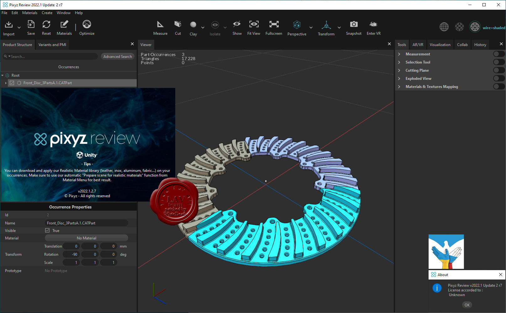
Unity Technologies Pixyz Review 2022.1.2.7

We believe 3D data should be accessible for study to anyone. Use Pixyz Review to instantly review, collaborate and interact with complex assemblies in desktop and/or VR.
Simply drag & drop your files. No conversion, no concern about formats: Pixyz Review deals with most native CAD, Mesh and Point Clouds files.
Study immediately your product – forget about lags. Navigate through dense product hierarchy, inspect and analyze large or complex assemblies with Pixyz Review’s powerful viewer.
Connect your headset, grab your controllers and switch to Virtual Reality. No VR expertise required. Analyze or interact with your model, fully immersed and focused.
Release notes |
| |
Читать статью дальше (комментариев - 2)
| |
|
|
Автор: Williams
Дата: 17 сентября 2023
Просмотров: 252 |
| |
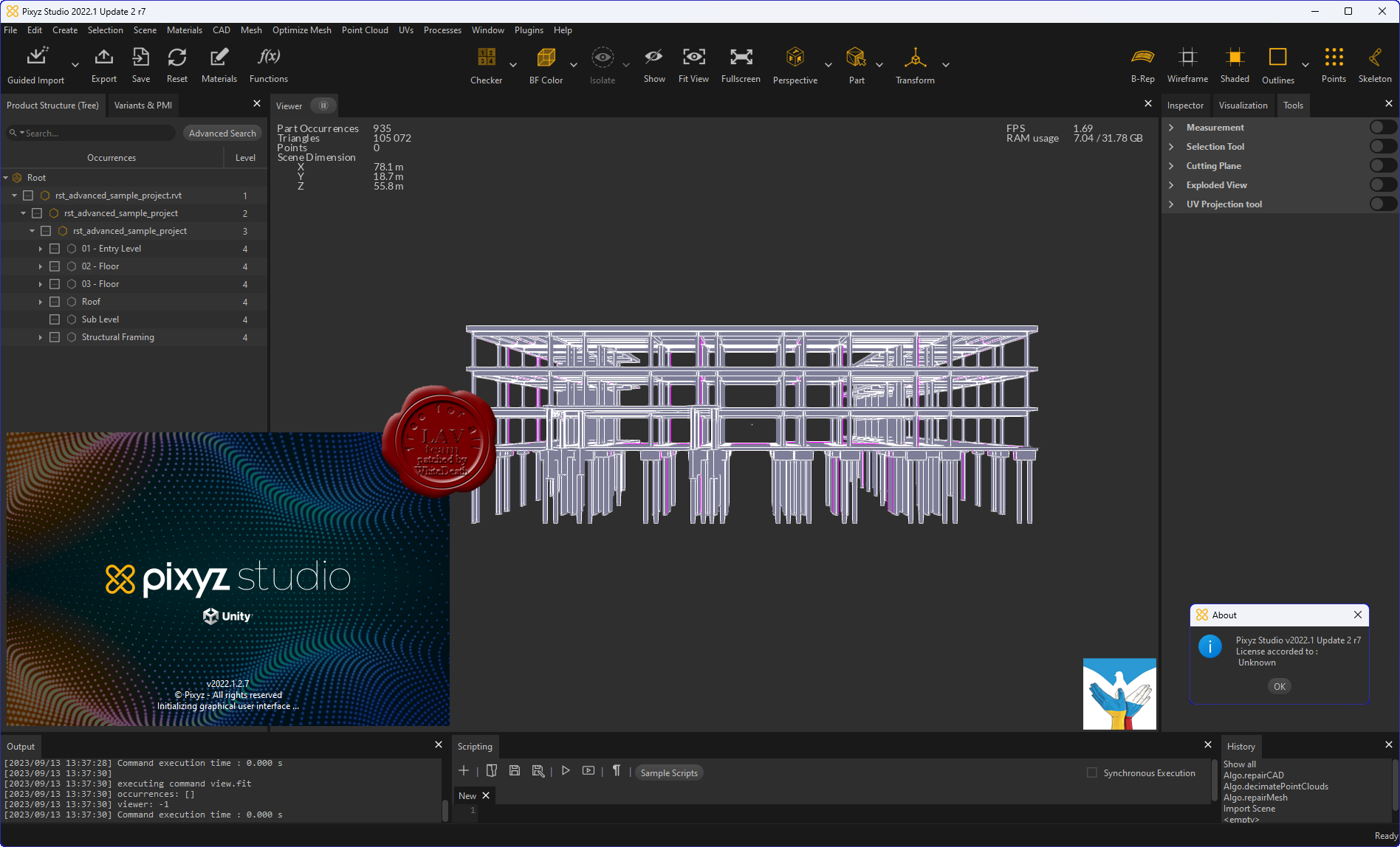
Unity Technologies Pixyz Studio 2022.1.2.7
 Pixyz Studio is a unique 3D data preparation tool providing the best-in-class tessellation algorithm, enabling the transformation of CAD data from industry-leading solutions (Catia, NX, SolidWorks…) into lightweight, optimized meshes. Pixyz Studio is a unique 3D data preparation tool providing the best-in-class tessellation algorithm, enabling the transformation of CAD data from industry-leading solutions (Catia, NX, SolidWorks…) into lightweight, optimized meshes.
Pixyz Studio’s interactive user interface gives access to a large set of features and algorithms for 3D data optimization. It also embeds a Python API, allowing advanced users to create powerful scripts and plugins, to automate complex data preparation tasks.
Pixyz Studio helps companies leverage their 3D/CAD data, preparing it for Real-time 3D use, and for any visualization scenario.
Release notes |
| |
Читать статью дальше (комментариев - 0)
| |
|
|
| ПОИСК ПО САЙТУ |
|
|
|
| КАЛЕНДАРЬ | | |
|
| « Октябрь 2025 » |
|---|
| Пн | Вт | Ср | Чт | Пт | Сб | Вс |
|---|
| | 1 | 2 | 3 | 4 | 5 | | 6 | 7 | 8 | 9 | 10 | 11 | 12 | | 13 | 14 | 15 | 16 | 17 | 18 | 19 | | 20 | 21 | 22 | 23 | 24 | 25 | 26 | | 27 | 28 | 29 | 30 | 31 | |
|
| |
| |
|