|
 |
 Автор: Williams Автор: Williams
 Дата: 9 февраля 2024 Дата: 9 февраля 2024
 Просмотров: 640 Просмотров: 640 |
| |
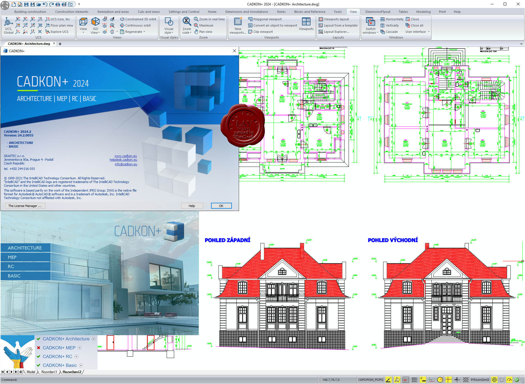
Graitec AB Studio CADKON+ 2024.2
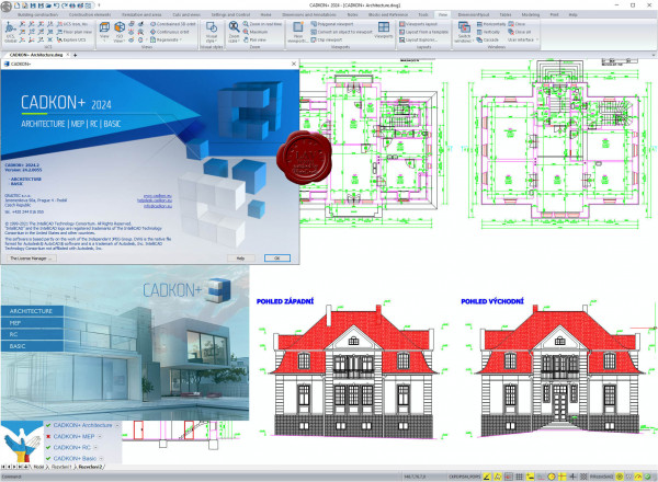
CADKON+ BASIC
All powerful drawing functions that you know from ordinary CAD software, including a full support of DWG format, work with layers, viewports and much more. All functions commonly used for drawing and drawing modifications are available. They are for example lines, polylines, copy, move, rotate, stretch, measure and many others. You can choose between a modern control environment using tool ribbons or a classic icon environment. Keyboard shortcut support or so called "Command Suggestion" are self-evident.
CADKON+ ARCHITECTURE
All efficient drawing functions, that you know from regular CAD programs, including full support of the latest DWG format. CADKON+ enables the drawing enviroment to be set according to existing company standards. It includes mainly a layer system and settings of linetypes and lineweights connected with it, furthermore drawing scale, units, display of elements and library sharing which is pre-set but can be also modified and set according to your company standards. CADKON+ offers compact command groups used to draw building construction that enable you render a specific construction in a drawing simply by entering its parameters. Consequent modifications and parameter changes can be done using specialized functions or basic editing tools. Unifying feature of all the rendered constructions are quick changes. To draw vertical cuts and views, CADKON+ provides tools, which you use to create cuts and views effectively and take use of already existing information from floor plan drawings. Rendered construction elements can be itemized and you may generate a table with a piece list and view schemes. It takes only a few clicks to create a room legend or a floor structure legend depending on the rooms. Apart from creating new projects, CADKON+ allows you to take over and modify other projects created originally in other CAD environments. This is possible thanks to independence and openness of the whole system. Access to libraries of manufacturers and common elements contributes to a higher productivity and to a efficient drawing. The option to save created constructions to be used later and by other users is another advantage. CADKON+ offers a wide variety of useful functions that can be used to finish a construction drawing with ease. They include dimensioning, text labels and references, legends of materials and used lines for cables, pipes, borders etc., stake points, stamps, drawing frames and much more.
CADKON+ MEP
Is absent in the installer.
CADKON+ RC
CADKON+ RC is CAD software fully compatible with DWG format. It offers to its users a simple, natural and cost-effective solution for frequent demands when creating and modifying drawings. With a modern and easy-to-use interface, CADKON+ RC creates all 2D and 3D elements, it contains functions to navigate in the drawing and visualise it and also works with terms such as "layers", "grip points", "windows" etc. The program includes a library of frequently used reinforcement shapes, including 3D shapes. Other shapes can be defined using a curve or by formwork. A variable length item is available for form-complex constructions, and you can use an item in linear meters to reinforce wreaths or like wall secondary reinforcement. Lists automatically contains inserted reinforcement with respect to user settings. You can choose whether to show items from the entire drawing, selected elements, or layers. Any change in reinforcement will immediately appear in the list so that these are always up to date. Tables are usually placed in the drawing, but they can also be exported to Excel. All inserted reinforcement also has its 3D model, which acts as a basis for its display and evaluation. This guarantees a clear evaluation of the amount of reinforcement used and also the display of reinforcement in 2D views. Changes made in one view are automatically taken into account in all other views. Each reinforcement bar can be displayed and described in each 2D-view in different way. The contents of annotations is filled and updated automatically according to the reinforcement. You can freely specify the shape of the annotations by assembling your own mask from different reinforcement parameters. Rebar meshes tools include a user-extensible meshes library, inserting single meshes, modifying and cutting them, pulling networks out of the floor plan with dimensioning, and a mesh schedule. There are a wide range of mesh presentation settings. |
| |
 Читать статью дальше (комментариев - 2)
| |
|
|
Автор: Williams
Дата: 8 февраля 2024
Просмотров: 912 |
| |
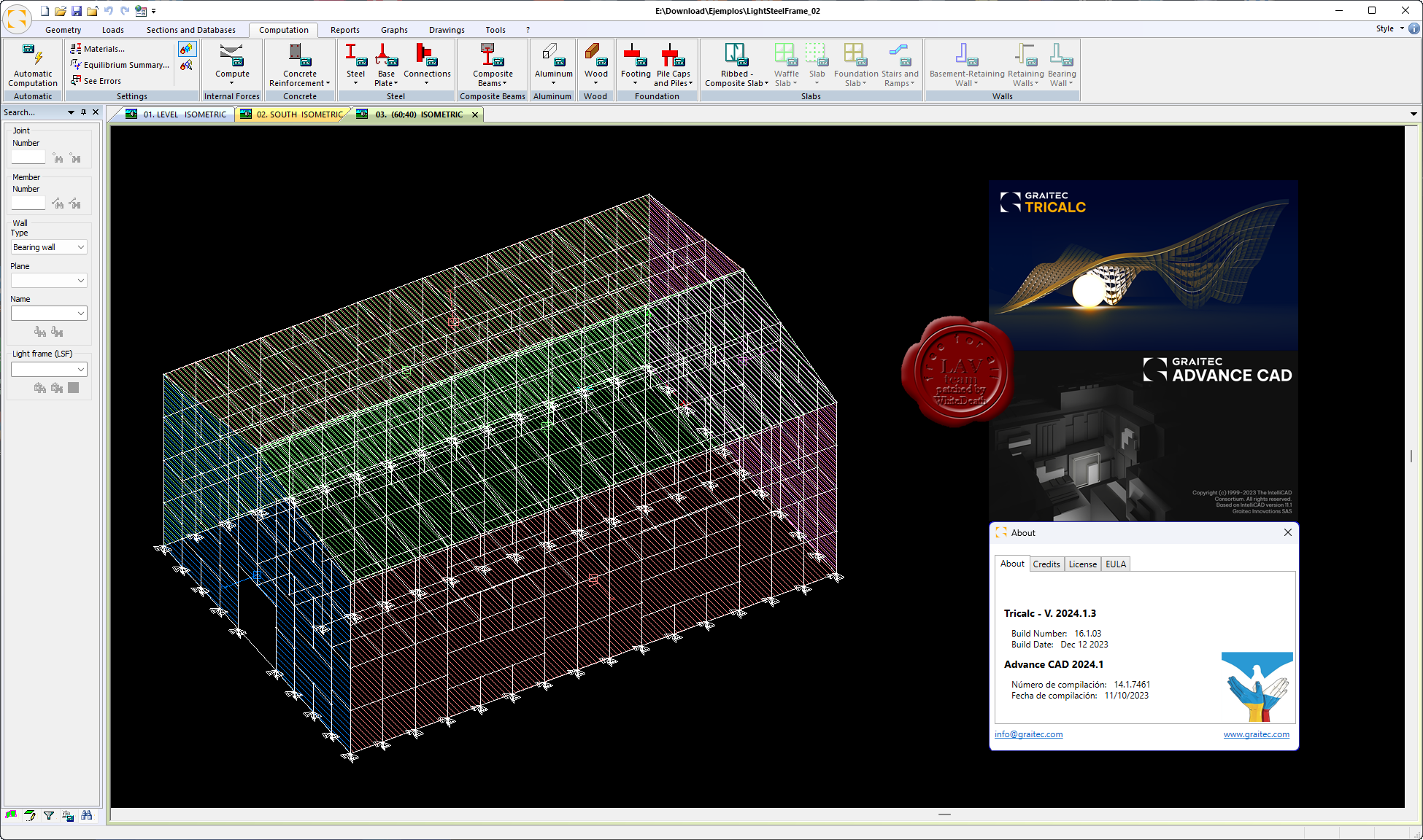
Graitec (ex. Arktec) Tricalc 2024.1.3 build 2023.12.12 incl. Advance CAD 2024.1 build 2023.10.11
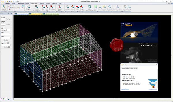
Tricalc es un software completo e integrado para el proyecto de estructuras, desde el modelo estructural hasta el dimensionamiento, detalle y fabricaciуn final de las estructuras. En cada una de las fases del proyecto, Tricalc presenta funcionalidades que son muy valiosas para los proyectistas de estructuras.
Eficacia y seguridad son fundamentales para el йxito de los proyectos. La capacidad de modelizaciуn y de anбlisis de Tricalc, lo sitъan como la soluciуn idуnea para garantizar una modelizaciуn eficaz y un anбlisis con seguridad, permitiendo dedicar mбs tiempo al diseсo y concepciуn del proyecto y menos a los procesos de trabajo.
Las nuevas arquitecturas, los nuevos edificios en altura, las nuevas tipologнas constructivas y el trabajo dentro de la globalizaciуn, exigen de nuevas capacidades: la capacidad de poder modelizar los nuevos edificios con versatilidad, la capacidad de incluir nuestros proyectos en las nuevas tipologнas constructivas y la capacidad de trabajar en ambiente colaborativo BIM.
El dimensionamiento y el detalle de las armaduras de todos los elementos estructurales de hormigуn, con el cumplimiento automбtico de las exigencias de las normativas y aspectos constructivos, proporciona al proyectista de estructuras una soluciуn altamente productiva y segura.
Tricalc mantiene desde su creaciуn una filosofнa BIM, consistente en un ъnico modelo tridimensional con toda la informaciуn asociada y vinculada, para el proyecto de estructuras. Este modelo es hoy posible de ser exportado e importado a travйs de formato BIM/IFC 4.0, para el trabajo colaborativo, y para la entrega a los clientes finales.
Los usuarios de Tricalc acostumbran a decir ”tanto mбs importante como el software es el soporte tйcnico que hay por detrбs del mismo”. Es el soporte tйcnico, siempre presente, el que permite tener una garantнa adicional sobre la seguridad de los proyectos que desarrollemos. Es el soporte tйcnico, siempre presente y prestado por el propio fabricante del software, el que nos da una garantнa ъnica de calidad. |
| |
Читать статью дальше (комментариев - 7)
| |
|
|
Автор: Williams
Дата: 6 февраля 2024
Просмотров: 355 |
| |
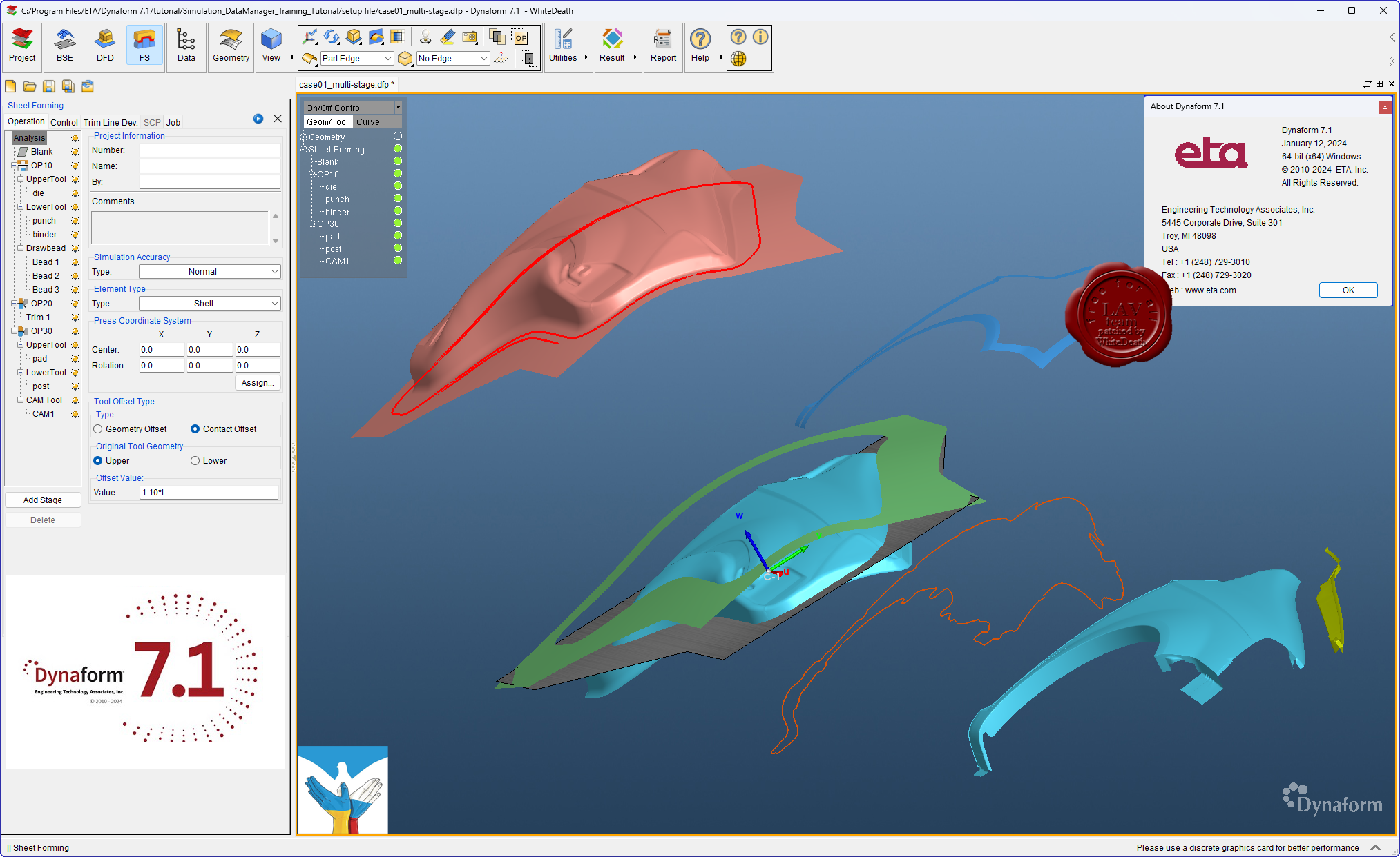
Engineering Technologies Associates Dynaform v7.1
 ETA Dynaform - специализированный программный комплекс, ориентированный на моделирование процессов листовой штамповки и использующий в качестве ядра математический аппарат программы LS-DYNA. Пре- и постпроцессинг Dynaform построен с учетом всех специфических особенностей техпроцесса - он автоматизирует стандартные операции подготовки расчетной схемы и функции оценки и интерпретации результатов анализа и базируется на общепринятой терминологии, знакомой каждому инженеру-технологу. Инструментарий программы включает: ETA Dynaform - специализированный программный комплекс, ориентированный на моделирование процессов листовой штамповки и использующий в качестве ядра математический аппарат программы LS-DYNA. Пре- и постпроцессинг Dynaform построен с учетом всех специфических особенностей техпроцесса - он автоматизирует стандартные операции подготовки расчетной схемы и функции оценки и интерпретации результатов анализа и базируется на общепринятой терминологии, знакомой каждому инженеру-технологу. Инструментарий программы включает:
- Автоматическое построение сеток;
- Адаптивные сетки с анимацией истории построения;
- Обширную библиотеку промышленных материалов;
- Автоматизированное позиционирование инструмента;
- Вовлечение явлений потери устойчивости листа – коробления;
- Расчет тангенциальных усилий под прижимами (тормозными ребрами);
- Расчет упругой разгрузки изделия;
- Высококачественную визуализацию всех результатов и анимацию;
- Построение предельной диаграммы ”формуемости”.
Dynaform - a complete die-system evaluation tool for the automotive industry. Dynaform encompasses the entire die system process in one simple interface. Simulating every detail during the design stage, Dynaform ensures the highest quality formed part and best manufacturing process. The system guides the engineer through cost estimation, quoting, die evaluation and formability. Dynaform makes it possible to completely bypass soft tooling, reduce overall tryout time, lower costs, increase productivity and provide complete confidence in die system design. Makes possible evaluation alternative designs and materials. Dynaform’s tube forming simulation now supports multi-stage tube forming, including tube bending, tube pre-forming, tube hydroforming, trimming, and annealing. The simulations can accurately predict failures like wrinkles, cracks, spring back, and feasibility of hydroforming. No matter what process you are using or which stage you are focusing on, you can easily find the function you are looking for. Dynaform’s bending table now supports editing, inserting, and deleting operations. Users can now also import the bending table manually or automatically generate it from the center line. Our bending table generation algorithm improvements now serve to save users significant amounts of time generating tables. Hydroforming in Dynaform now supports comprehensive die face design including tube end extensions, centerline auto calculating, quick generating of die separating lines, mesh model separation based on separating lines, and more. Instead of switching to CAD software to create the tools, users can finish almost all major FEA model preparation works in Dynaform. Dynaform’s forming simulation software makes it possible to uncover design flaws early in the process. Using the various modules engineers can more-fully evaluate alternative–and unconventional–designs. Doing so helps ensure higher quality outcomes. |
| |
Читать статью дальше (комментариев - 5)
| |
|
|
Автор: Williams
Дата: 5 февраля 2024
Просмотров: 603 |
| |
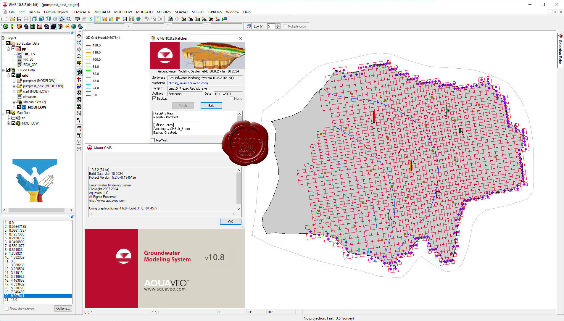
Aquaveo Groundwater Modeling System Premium v10.8.2
 Aquaveo GMS - комплексная среда моделирования подземных вод с системой предварительной графический обработки информации. Aquaveo GMS легко взаимодействует с MODFLOW и рядом других моделей по моделированию подземных вод и предоставляет расширенные графические возможности для просмотра и калибровки результатов моделирования. Aquaveo GMS - комплексная среда моделирования подземных вод с системой предварительной графический обработки информации. Aquaveo GMS легко взаимодействует с MODFLOW и рядом других моделей по моделированию подземных вод и предоставляет расширенные графические возможности для просмотра и калибровки результатов моделирования.
What's new
Bug's fixed
Nice pricing |
| |
Читать статью дальше (комментариев - 5)
| |
|
|
Автор: Williams
Дата: 4 февраля 2024
Просмотров: 271 |
| |
AutoForm TubeXpert R11.0
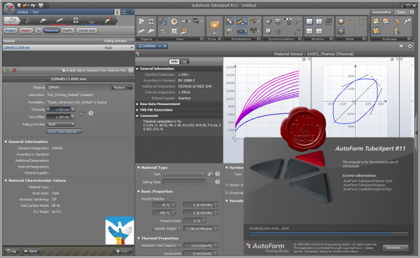 AutoForm TubeXpert – это простое в использовании и интуитивно понятное программное решение для быстрой разработки оснастки и моделирования процессов гибки, формовки и гидроформовки труб. Это ПО позволяет удовлетворить возрастающие требования в отношении сложности форм трубчатых деталей, требования к качеству изделий и необходимости применения современных материалов, таких как сталь повышенной прочности и алюминий, а также увеличивающуюся сложность и многообразие технологических процессов формовки. AutoForm TubeXpert – это простое в использовании и интуитивно понятное программное решение для быстрой разработки оснастки и моделирования процессов гибки, формовки и гидроформовки труб. Это ПО позволяет удовлетворить возрастающие требования в отношении сложности форм трубчатых деталей, требования к качеству изделий и необходимости применения современных материалов, таких как сталь повышенной прочности и алюминий, а также увеличивающуюся сложность и многообразие технологических процессов формовки.
С AutoForm TubeXpert вы можете проводить всесторонний анализ виртуальных испытаний процесса формовки трубчатых деталей по всем этапам процесса от гибки и предварительной формовки до гидроформовки, отжига и калибровки, резки и формовки законцовок труб. Может рассматриваться как холодная, так и горячая формовка. В дополнение к этому, ПО позволяет точно моделировать пружинение после любого этапа формовки, автоматически вносить необходимые поправки в геометрию инструмента и параметры процесса, чтобы компенсировать последствия пружинения. Полная интеграция технологии AutoForm-Sigma в AutoForm TubeXpert позволяет вам как проектировщику деталей, инженеру-технологу или производителю оснастки систематически улучшать форму инструмента и схему процесса, а также оценивать надежность и устойчивость производственного процесса. |
| |
Читать статью дальше (комментариев - 2)
| |
|
|
Автор: Williams
Дата: 3 февраля 2024
Просмотров: 4 420 |
| |
Agisoft Metashape Pro v2.1.0 build 17532
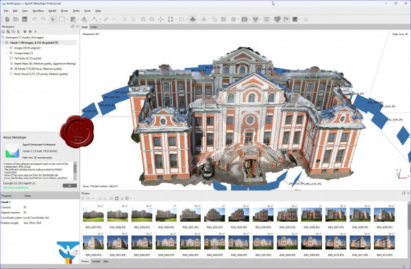
Agisoft Metashape Professional - это передовое программное обеспечение, максимально раскрывающее возможности фотограмметрии, а также включающее в себя технологии машинного обучения для анализа и пост-обработки, что позволяет получать максимально точные результаты.
Metashape позволяет обрабатывать изображения, получаемые с помощью RGB- или мультиспектральных камер, включая мультикамерные системы, преобразовывать снимки в плотные облака точек, текстурированные полигональные модели, геопривязанные ортофотопланы и цифровые модели рельефа/местности (ЦМР/ЦММ).
Дальнейшая постобработка позволяет удалять тени и искажения текстур с поверхности моделей, рассчитывать вегетационные индексы и составлять файлы предписаний для агротехнических мероприятий, автоматически классифицировать плотные облака точек и т.д.
Возможность экспорта во все внешние пакеты для постобработки делает Agisoft Metashape Professional универсальным фотограмметрическим инструментом.
Подробнее тут |
| |
Читать статью дальше (комментариев - 25)
| |
|
|
Автор: Williams
Дата: 2 февраля 2024
Просмотров: 1 149 |
| |
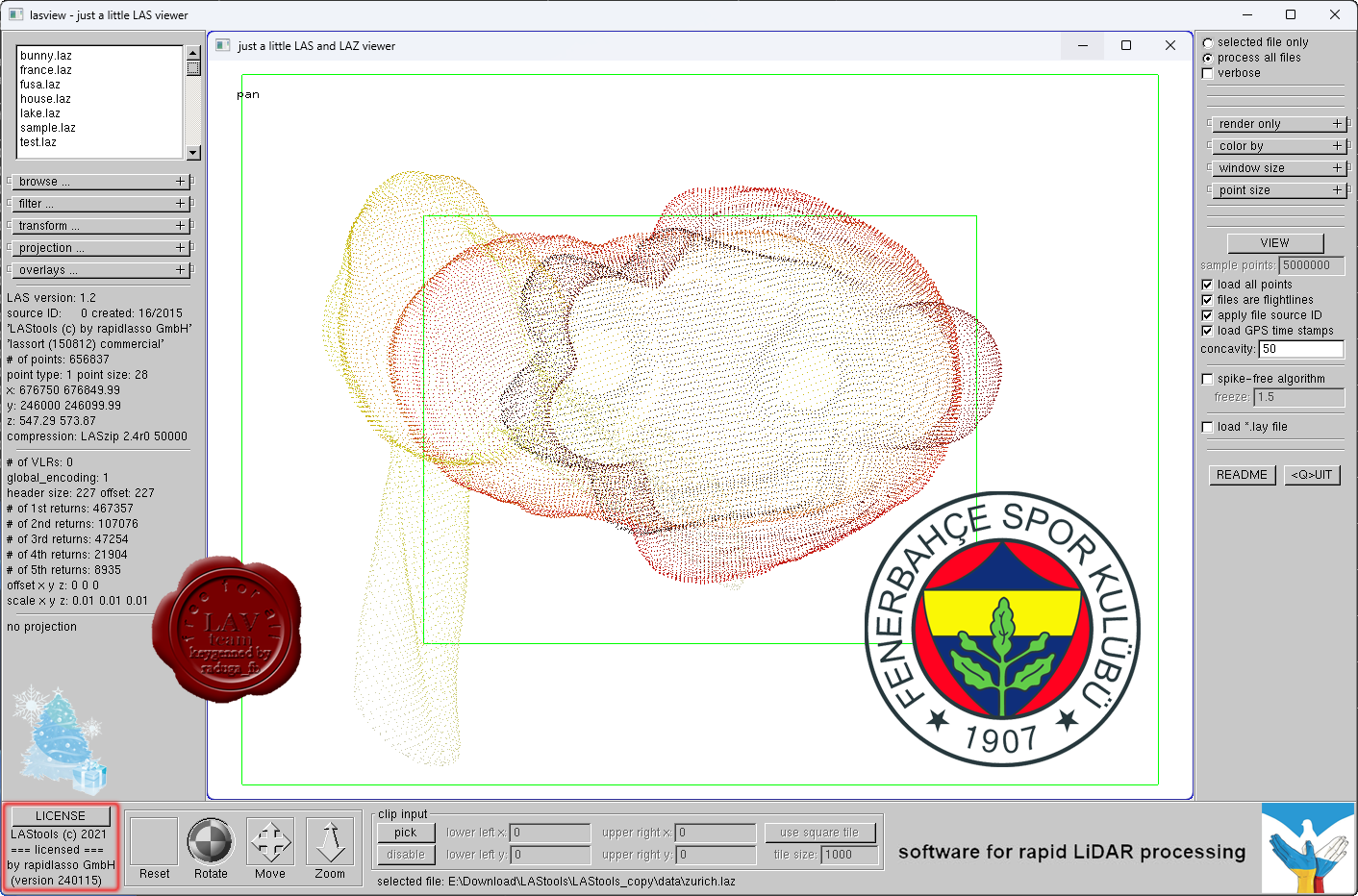
rapidlasso LAStools Suite 2024

Our LiDAR processing tools are widely known for their blazing speeds and high productivity. Our software combines robust algorithms with efficient I/O and clever memory management to achieve high throughput for data sets containing billions of points.
Our popular LAStools software suite has deep market penetration and is heavily used in the commercial sector, government agencies, research labs, and educational institutions alike — filtering, tiling, rasterizing, triangulating, converting, clipping, quality-checking, etc. TeraBytes of LiDAR every day.
Our open-source LiDAR compressor LASzip has become the de facto industry standard for compressed LiDAR. It has won the 2012 Geospatial World Forum Technology Innovation Award and was voted 2nd place for “most innovative product” at INTERGEO 2012. |
| |
Читать статью дальше (комментариев - 9)
| |
|
|
Автор: Williams
Дата: 1 февраля 2024
Просмотров: 619 |
| |
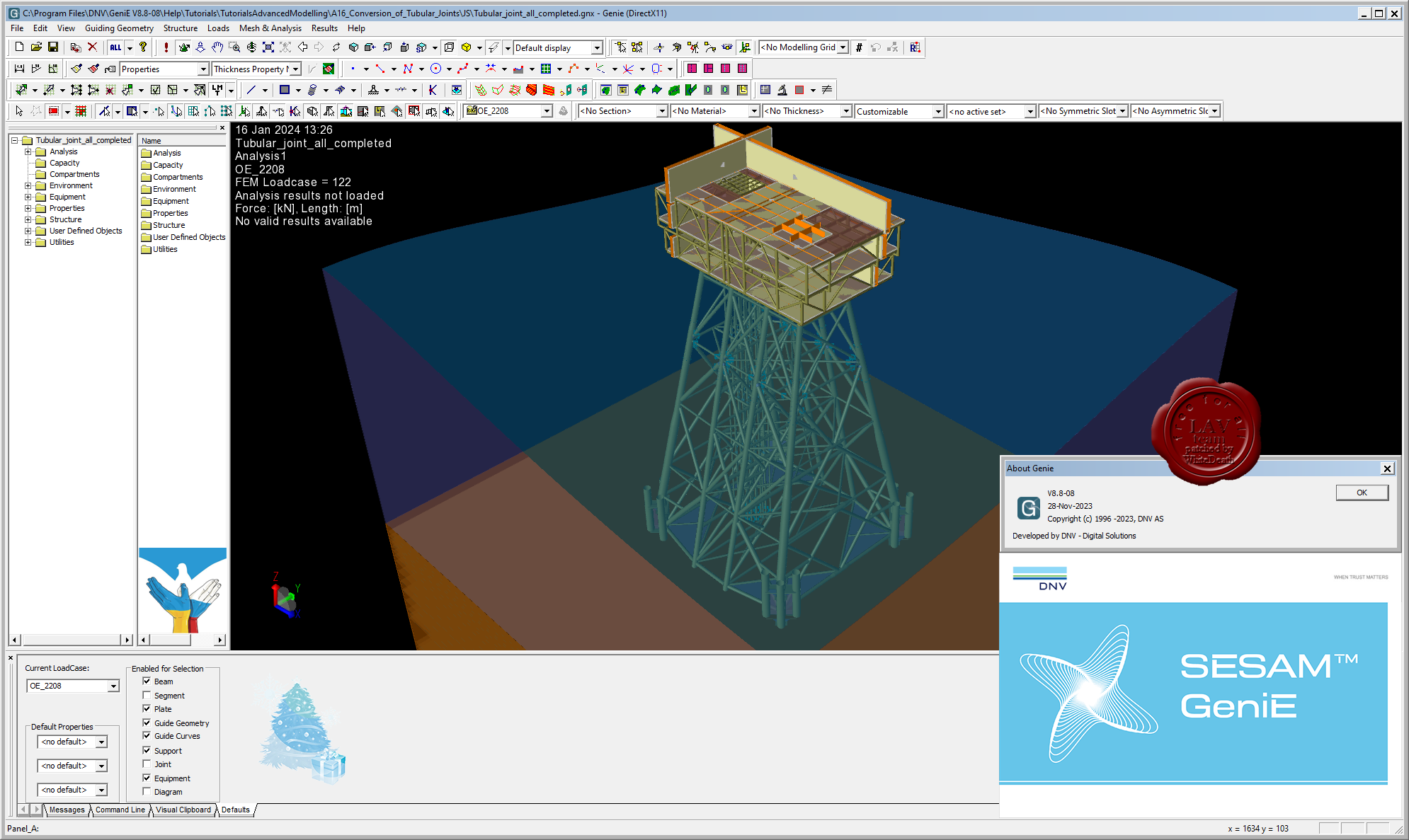
DNV GeniE v8.8-08

GeniE is conceptual modelling of offshore and maritime structures.
It's a powerful FEM modelling and analysis tool for innovation, flexibility and efficiency in offshore structural engineering.
GeniE is a tool for concept (high level geometry) modelling of beams, flat plates and stiffened shells. Load modelling includes equipment (with automatic load transfer), explicit loads, wind loads and generation of compartments in floating structures.
The concept model, or parts of it, can be meshed using a variety of beam, plate and shell finite element types. The mesh may be refined or modified using a comprehensive set of mesh editing features, whereupon the mesh quality may be verified.
Through running the modules Wajac and Sestra from the GeniE user interface, environmental loads (wave, current, buoyance and wind) may be calculated and a finite element stress analysis performed, including for jacket structures a pile-soil-structure interaction via the module Splice. |
| |
Читать статью дальше (комментариев - 4)
| |
|
|
| ПОИСК ПО САЙТУ |
|
|
|
| КАЛЕНДАРЬ | | |
|
| « Октябрь 2025 » |
|---|
| Пн | Вт | Ср | Чт | Пт | Сб | Вс |
|---|
| | 1 | 2 | 3 | 4 | 5 | | 6 | 7 | 8 | 9 | 10 | 11 | 12 | | 13 | 14 | 15 | 16 | 17 | 18 | 19 | | 20 | 21 | 22 | 23 | 24 | 25 | 26 | | 27 | 28 | 29 | 30 | 31 | |
|
| |
| |
|