|
 |
 Автор: Williams Автор: Williams
 Дата: 11 марта 2024 Дата: 11 марта 2024
 Просмотров: 2 749 Просмотров: 2 749 |
| |
Ensoft Suite 2024.03
APILE 2023.10.5, APILE Offshore 2023.10.5, DynaMat 2018.3.2, DYNA-N v3.0.15, DynaPile 2016.3.2,
EnCPT 2019.1.5, EnFEM 2019.1.1, GeoMat 2022.3.1, Group 2022.12.6, LPile 2022.12.10, PYWall 2022.7.7,
SETOFF 2020.4.3, SHAFT 2023.9.3, StablPro 2015.4.5, TZPILE 2021.4.3
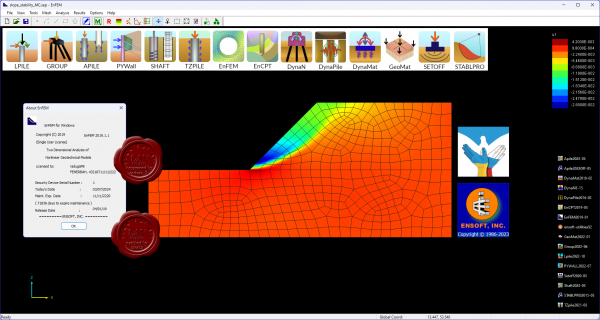 LPILE - Analyze response of piles and shafts in multi-layered soil media. LPILE - Analyze response of piles and shafts in multi-layered soil media.
APILE - Analyze the axial capacity of driven piles in mutli-layered soils.
GROUP - Analyze response of pile groups in multi-layered soil media.
PYWall - Analyze flexible retaining walls in layered soils.
SHAFT - Study the response of drilled shafts under axial loading.
TZPILE - Analyze load-settlement relationships of vertically loaded piles with downdrag.
EnFEM - 2D finite element analysis with ability to perform soil-structure interaction and stage construction.
EnCPT - Process raw CPT data, generating and exporting soil layering and properties to LPILE.
DynaN - Determine the dynamic response of shallow and deep foundations.
DynaPile - Analyze the dynamic response of pile groups in horizontally layered elastic media.
DynaMat - Analyze the dynamic response of mat foundations under dynamic loading.
GeoMat - Analyze mat or structural slabs supported on soil media.
SETOFF - Software for computing foundation settlement.
STABLPRO - Software for computing the slope stability. |
| |
 Читать статью дальше (комментариев - 15)
| |
|
 |
 Автор: Williams Автор: Williams
 Дата: 10 марта 2024 Дата: 10 марта 2024
 Просмотров: 300 Просмотров: 300 |
| |
Coreform Cubit (ex. csimsoft Trelis) 2024.3.46968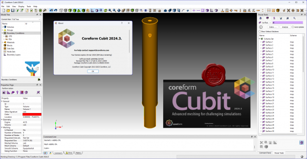
Coreform Cubit’s pre-processing capabilities and Flex IGA modeling with advanced hex meshing and hex dominant meshing minimize the time spent on model preparation for FEA and CFD while maximizing control over mesh quality to get the right mesh for quality solutions allowing you to maximize your investment in simulation technoloogy. Coreform Cubit helps you maximize the benefit of your investment in simulation technology.
Key Features & Capabilities:
- Comprehensive toolset. Everything you need for CAD Import, preprocessing, hex meshing, hex dominant meshing, and export.
- Semi-automated hex meshing. Rich set of hex meshing and hex dominant meshing tools for streamlining the creation of analysis-ready models for challenging simulations.
- Expert-level mesh control. Industry-leading mesh analysis and improvement tools for complete control from Jacobians to vertices.
Scripting & automation. Python integration and scripting tools support automation to increase model generation throughput.
Coreform Cubit includes everything needed for streamlined progress from CAD to analysis, with full-featured capabilities for geometry preparation and mesh generation, analysis, and fine-tuning. Preparing CAD geometry for meshing consumes more time and resources than any other stage of the CAE process. Coreform Cubit provides powerful, user-guided automated tools to make geometry cleanup and simplification fast and satisfying.
Coreform Cubit supplies a comprehensive meshing feature-set for surface and solid meshing with a wide variety of element types and methods for automating and streamlining mesh creation.
Create faster high-quality hex meshes by deploying Coreform Cubit’s interactive automation capabilities, on demand and to your precise specifications. |
| |
 Читать статью дальше (комментариев - 2)
| |
|
 |
 Автор: Williams Автор: Williams
 Дата: 9 марта 2024 Дата: 9 марта 2024
 Просмотров: 2 260 Просмотров: 2 260 |
| |
KobiLabs Kobi Toolkit v2024.2.138 for Autodesk Civil 3D 2018-2024
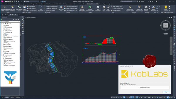
KobiLabs is a team of engineers and developers with more than 100 man years experience in CAD/BIM consultation and software development.
All of our senior developers have extensive experience in C++, .NET and jаvascript, as well as database systems MS SQL, MongoDB and others.
By developing our own software – used globally by companies large and small – we have gained valuable experience in building software for the Autodesk platform and helping customers use the software to its fullest potential.
Our customers are primarily architects, structural and civil engineers, but our experiences also covers fields such as mechanical engineering, piping and surveying. Our customers work with different software platforms (mostly Revit, AutoCAD, Civil 3D, Tekla and similar). Our development experience includes CAD/BIM plugins and desktop and web applications. |
| |
 Читать статью дальше (комментариев - 15)
| |
|
 |
 Автор: Williams Автор: Williams
 Дата: 8 марта 2024 Дата: 8 марта 2024
 Просмотров: 1 716 Просмотров: 1 716 |
| |
KobiLabs Kobi Toolkit v2024.2.82 for Autodesk AutoCAD 2018-2024
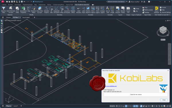
KobiLabs is a team of engineers and developers with more than 100 man years experience in CAD/BIM consultation and software development.
All of our senior developers have extensive experience in C++, .NET and jаvascript, as well as database systems MS SQL, MongoDB and others.
By developing our own software – used globally by companies large and small – we have gained valuable experience in building software for the Autodesk platform and helping customers use the software to its fullest potential.
Our customers are primarily architects, structural and civil engineers, but our experiences also covers fields such as mechanical engineering, piping and surveying. Our customers work with different software platforms (mostly Revit, AutoCAD, Civil 3D, Tekla and similar). Our development experience includes CAD/BIM plugins and desktop and web applications. |
| |
 Читать статью дальше (комментариев - 12)
| |
|
 |
 Автор: Williams Автор: Williams
 Дата: 7 марта 2024 Дата: 7 марта 2024
 Просмотров: 2 154 Просмотров: 2 154 |
| |
Bentley RAM 2024.0
RAM Connection Standalone 24.00.00.140, RAM Elements 24.00.00.154
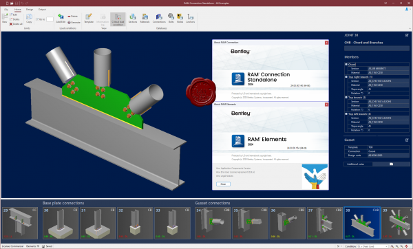
Легко реализовывайте высококачественные и экономичные проекты с использованием различных бетонных, стальных и балочных строительных конструкций. Проектируйте, анализируйте и создавайте документацию по вашим проектам зданий для экономии времени и средств. Максимально повысьте рентабельность ваших инвестиций в ПО благодаря полностью интегрированному набору приложений для комплексного анализа, проектирования и оформления документации для стальных и бетонных конструкций. Повышение вашей производительности за счет устранения утомительных и трудоемких задач с помощью практических приложений RAM. Любые виды проектирования: от отдельных компонентов до крупномасштабного строительства и фундаментов.
RAM Connection
Анализ, проектирование и мгновенная проверка всех типов соединений с комплексными расчетами и соблюдением сейсмических требований.
RAM Elements
Выполнение анализа и проектирование – включая 3D конечно-элементный анализ – практически любого типа строительной конструкции и структурных компонентов в едином доступном приложении. |
| |
 Читать статью дальше (комментариев - 14)
| |
|
 |
 Автор: Williams Автор: Williams
 Дата: 6 марта 2024 Дата: 6 марта 2024
 Просмотров: 1 812 Просмотров: 1 812 |
| |
modri planet d.o.o. 3Dsurvey v2.18.0
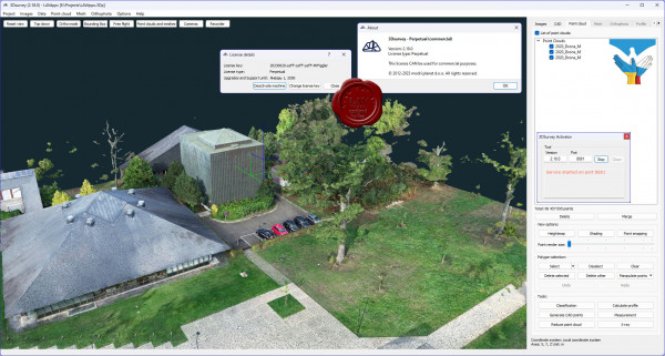
3Dsurvey is a software solution for land surveying data processing. Take a photo with any standard digital camera, import images into 3Dsurvey and produce your own orthophoto maps, digital surface models and calculate volumes faster and more easily. Data is processed automatically based on matching algorithms. Use our smart tools to be even more efficient.
More info
What's new |
| |
 Читать статью дальше (комментариев - 19)
| |
|
 |
 Автор: Williams Автор: Williams
 Дата: 5 марта 2024 Дата: 5 марта 2024
 Просмотров: 1 061 Просмотров: 1 061 |
| |
JTB World 2024 for AutoCAD & Civil 3D 2018-2024
ACA Tools 1.0.0, Batch Change v2.6.0, CAD Automation Tools v5.10.0, Catenary v3.4.0, FixRefs v3.6.0,
Layout Palette v2.5.0, Rebar v2.4.0, SmartBatch v6.2.0, SSMPropEditor v2024.1.1, Steel v1.9.0, TimberTool v2.4.0
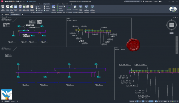 ACA Tools includes editing tools for Property Sets, Classifications and List Definitions for AutoCAD Architecture (ACA) based products including MEP, Map 3D and Civil 3D. ACA Tools includes editing tools for Property Sets, Classifications and List Definitions for AutoCAD Architecture (ACA) based products including MEP, Map 3D and Civil 3D.
Batch Change brings the AutoCAD ActiveX Object Model to your command via Excel design spreadsheets.
CAD Automation Tools automate creation and updates on drawings, multiple drawings can be automatically created from a typical drawing or updated based on a control file that can be created with an Excel template. Make the changes in Excel and let the program do all the work for you. This is a real time saver if you need to make adjustments on hundreds or thousands of drawings.
Catenary program makes it easy to create or draw a catenary curve as a polyline by specifying the start and end point and the length or sag and optionally a diameter.
FixRefs - powerful AutoCAD reference manager app gives you a lot of options to make changes on external references on multiple drawings.
Layer Palette allows manage layers in BricsCAD without leaving drawing screen. Customizable view, multiple layers tasking, this will make managing layers much more easier.
Rebar - is a BIM-like Rebar Callout - Automatic Rebar Table - Dynamic Beam Detailing app for AutoCAD.
SmartBatch - is a batch and script utility for processing multiple DWG drawings with full control with AutoCAD, BricsCAD, ZWCAD, GstarCAD, DraftSight, NanoCAD, Graebert's ARES Commander and more.
SSMPropEditor - edit properties on multiple sheets belonging to Sheet Set Manager (SSM) for AutoCAD, GstarCAD and BricsCAD, NanoCAD Plus/Pro, Graebert's ARES Commander 2022 and newer, DraftSight 2021 and newer, or AutoCAD Architecture's Project Navigator (PN) Sheet Set View with ease. If you want to change properties like a revision, date or name on two or more sheets at the same time SSMPropEditor is for you. Your productivity will increase and you will save time avoiding a lot of manual work.
Steel is an app running inside AutoCAD, adding powerful command features to help you draw simple and complex steelwork frames and details efficiently. You can select and insert Steel Sections from JTB Steel library to AutoCAD drawing just as inserting blocks. You can draw Steel Frames just as drawing lines by 2 pickpoints. All created drawing objects are either blocks or dynamic blocks. Once Steel members are inserted, you can edit these using powerful editing commands located on Tools Palette.
TimberTool makes it easy to convert closed polylines into mass elements and makes the bounding box width and depth correct for scheduling purposes.
All other tools can be found here
Videos |
| |
 Читать статью дальше (комментариев - 7)
| |
|
 |
 Автор: Williams Автор: Williams
 Дата: 4 марта 2024 Дата: 4 марта 2024
 Просмотров: 180 Просмотров: 180 |
| |
FIFTY2 Technology PreonLab v6.1.1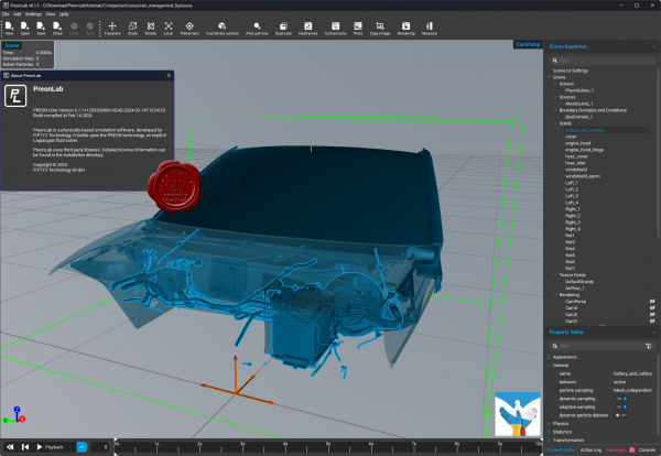
FIFTY2 PreonLab - CFD simulation tool for the analysis of fluids and their behavior in and around the vehicle.
The difference between classic CFD and PreonLab is quickly explained. Classical CFD is based on mesh creation, for PreonLab a different approach was chosen: Smoothed-Particle Hydrodynamics (SPH) is the basis of the revolutionary PREON technology.
Without the need for a mesh, all hydrodynamic challenges can be solved quickly and, most importantly, easily. PreonLab provides you with reliable results that are impressively visualized.
Here we go! PreonLab 6.1 is out now.
It is loaded with new features and improvements, enabling new engineering possibilities and applications. Empowered by the new GPU capabilities, PreonLab 6.1 takes another leap forward in efficient computing, delivering results even quicker.
- Enhanced GPU performance: PreonLab’s GPU implementation just got a significant boost. Not only does PreonLab 6.1 support multi-GPU computing now, but it also enables continuous particle size (CPS), dynamic sampling, and adaptive sampling on GPU, making your simulations even more efficient.
- Airflow and Car Suspension Model (CSM): PreonLab 6.1 also enables airflow import and CSM support for simulations on GPU. These are some of the key application enablers making it possible to simulate various use cases also on GPU.
- Snow Model on GPU: Snow modeling has been an important part of existing PreonLab capabilities. We are thrilled to announce that our snow model is now also available on the GPU platform.
- Enhanced Thermodynamics: Convective boundary condition has been added to the list of available boundary conditions. Convective Boundary Conditions can represent a more physical heat transfer, that predominantly occurs due to convective heat transport at fluid-fluid or fluid-solid interfaces. It is designed to conveniently represent natural or forced convection of heated solid bodies or fluids, in applications like heat exchangers, heat sinks, and even e-motors.
|
| |
 Читать статью дальше (комментариев - 3)
| |
|
 |
 Автор: Williams Автор: Williams
 Дата: 3 марта 2024 Дата: 3 марта 2024
 Просмотров: 2 405 Просмотров: 2 405 |
| |
Bentley Seequent GEO-SLOPE GeoStudio 2024.1.0.1406
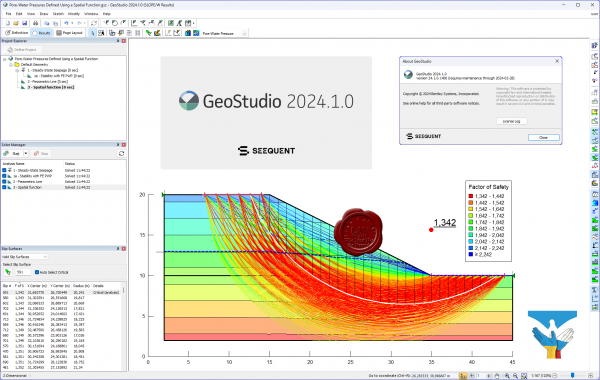 GEO-SLOPE GeoStudio - программный комплекс для решения инженерно-геологических задач и моделирования грунтовых конструкций. Данны пакет состоит из 8 продуктов: SLOPE/W - анализ устойчивости откосов; QUAKE / W - динамический анализ землетрясения; AIR / W - анализ потока воздуха; SEEP / W - анализ просачивания грунтовых вод; TEMP / W - геотермальный анализ; VADOSE/W - анализ зон аэрации и анализ почвенного покрова; SIGMA / W - анализ напряженно-деформированного состояния; CTRAN / W - анализ загрязнений транспорта. GEO-SLOPE GeoStudio - программный комплекс для решения инженерно-геологических задач и моделирования грунтовых конструкций. Данны пакет состоит из 8 продуктов: SLOPE/W - анализ устойчивости откосов; QUAKE / W - динамический анализ землетрясения; AIR / W - анализ потока воздуха; SEEP / W - анализ просачивания грунтовых вод; TEMP / W - геотермальный анализ; VADOSE/W - анализ зон аэрации и анализ почвенного покрова; SIGMA / W - анализ напряженно-деформированного состояния; CTRAN / W - анализ загрязнений транспорта.
GeoStudio is a product suite for geotechnical and geo-environmental modeling, broad enough to handle all your modeling needs. The suite consists of 8 products: SLOPE/W for slope stability; SEEP/W for groundwater seepage; SIGMA/W for stress-deformation; QUAKE/W for dynamic earthquake; TEMP/W for geothermal; CTRAN/W for contaminant transport; AIR/W for air flow; VADOSE/W for vadose zone & covers.
More info
Examples can be found here |
| |
 Читать статью дальше (комментариев - 30)
| |
|
 |
 Автор: Williams Автор: Williams
 Дата: 2 марта 2024 Дата: 2 марта 2024
 Просмотров: 792 Просмотров: 792 |
| |
Meteotest Meteonorm v8.2.0
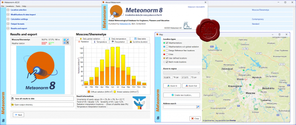 Meteonorm is a software tool that allows you to access data about solar radiation and other weather parameters around the world. Although the program has a straightforward interface, the correct interpretation of the data provided depends on knowledge well beyond being able to use the software. Meteonorm is a software tool that allows you to access data about solar radiation and other weather parameters around the world. Although the program has a straightforward interface, the correct interpretation of the data provided depends on knowledge well beyond being able to use the software.
Luckily, you can easily configure the program if you follow a series of steps suggested by the wizard. First, you need to pick the desired locations from those available. Second, you should decide on the data source and the way to process the information. Third, it is necessary to set the calculation methods, including radiation and temperature periods, with the possibility of adding scenarios for future periods.
Fourth, you can set the output formats from a wide range that comprises not only Meteonorm data but also Building Simulation, PV, Solar Thermal and General Use. What is more, you can even customize the output format to your specific needs. Finally, you will be presented with the results, including graphs portraying such meteorological parameters as daily temperature, radiation, temperature, precipitation, sunshine radiation and daily global radiation. Likewise, you can also visualize the exact figures from a table and export these results to disk.
Meteonorm is not only a software program but a meteorological service as well. As a result, the quality of the data depends on the reliability of the service. In this respect, you should know that Meteonorm is widely recognized as one of the leading services of this kind in the world and used as a standard for solar energy simulations.
In this regard, it offers more than 30 meteorological parameters collected over several years. It receives weather reports from a wide network of more than 8000 ground meteorological stations around the globe as well as five geostationary satellites. However, there have been concerns about the methods used to model data as well as the uneven distribution of the stations.
All in all, Meteonorm is undoubtedly a great source of data for all kinds of activities that require evaluating meteorological parameters, such as architecture, cooling systems, agriculture, forestry and others. It also has the advantage of being quite affordable; yet, there are other similar tools available and it is always a good idea to check what is best for you. |
| |
 Читать статью дальше (комментариев - 5)
| |
|
 |
| ПОИСК ПО САЙТУ |
 |
|
 |
| КАЛЕНДАРЬ | | |
 |
| « Октябрь 2025 » |
|---|
| Пн | Вт | Ср | Чт | Пт | Сб | Вс |
|---|
| | 1 | 2 | 3 | 4 | 5 | | 6 | 7 | 8 | 9 | 10 | 11 | 12 | | 13 | 14 | 15 | 16 | 17 | 18 | 19 | | 20 | 21 | 22 | 23 | 24 | 25 | 26 | | 27 | 28 | 29 | 30 | 31 | |
|
 | |
| |
|