|
 |
 Автор: Williams Автор: Williams
 Дата: 30 апреля 2024 Дата: 30 апреля 2024
 Просмотров: 1 131 Просмотров: 1 131 |
| |
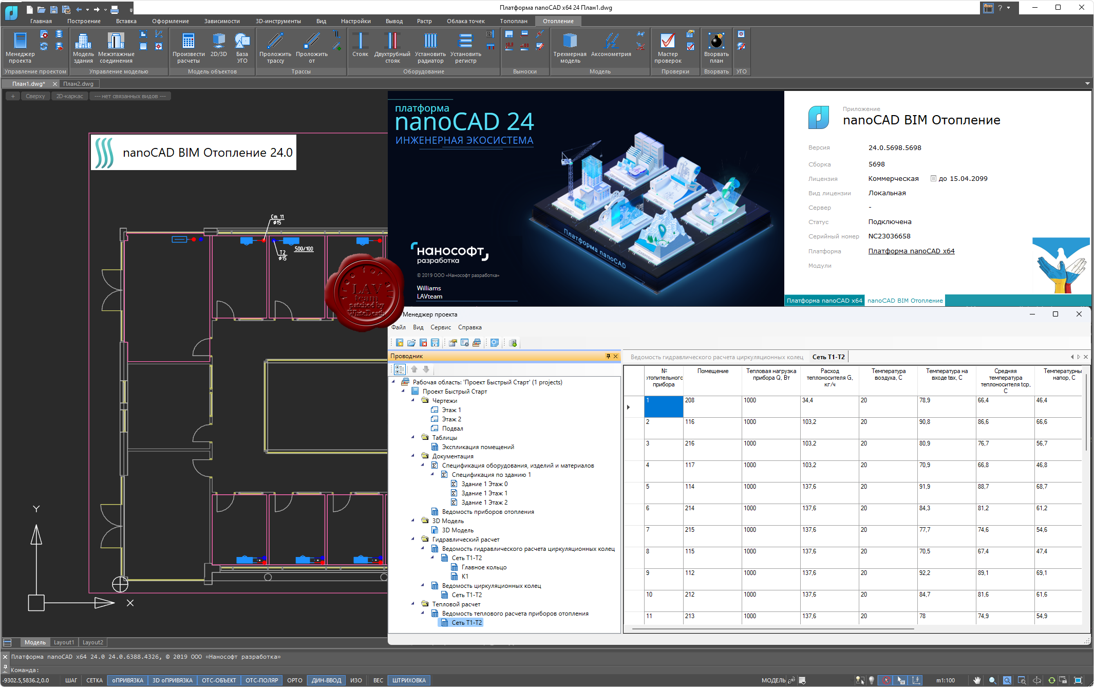
nanoSoft nanoCAD BIM Отопление 2024 v24.0
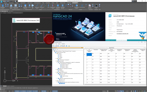
nanoCAD BIM Отопление - BIM/ТИМ-решение на Платформе nanoCAD для проектирования и расчета моделей систем отопления зданий и сооружений.
Задачи:
- Проектирование систем отопления.
- Автоматизация прокладки двухтрубной системы.
- Автоматические расчеты модели и оборудования.
- Автоматическая генерация аксонометрических схем.
- Автоматическое формирование отчетов и спецификаций.
- Автоматические проверки модели на корректность ее построения.
Преимущества продукта:
- Оформление документации по российским нормативным документам. Строгое соответствие требованиям СП 60.13330.2020, гидравлический и тепловой расчет с подбором арматуры, отопительных приборов, диаметра труб.
- Базы моделей оборудования включают трубопроводы, запорную арматуру, отопительные приборы, спецоборудование. Все базы открыты для редактирования и пополнения.
- Функционал программы позволяет автоматически получить корректную 3D-модель по 2D-чертежам, не прибегая к дополнительной ручной доработке модели.
- Автоматически формируется широкий спектр проектных документов: планы расположения оборудования и прокладки трубопроводов, аксонометрические схемы, гидравлические и тепловые отчеты, спецификация и т.д.
Ключевые возможности:
- Гидравлический расчет системы отопления. Соответствие требованиям СП 60.13330.2020. При выполнении расчета программа просчитывает трехмерную модель системы, вычисляет скорости движения, потери давления в трубах и на местных сопротивлениях. По результатам этих расчетов осуществляется подбор арматуры, приборов, диаметра труб и формируется отчет по каждой системе.
- Тепловой расчет системы отопления. Соответствие требованиям СП 60.13330.2020. При выполнении расчета программа анализирует параметры каждого участка сети. На участках производится расчет тепловой нагрузки, расхода теплоносителя. По результатам расчета осуществляется подбор числа секций радиаторов и формируется тепловой отчет по каждой системе.
- Автоматическое создание аксонометрических схем. Программа nanoCAD BIM Отопление автоматически формирует аксонометрическую схему, тогда как подавляющее большинство зарубежных решений создает изометрию, не предусмотренную ГОСТ. Все табличные формы отвечают требованиям ГОСТ 21.602-2016 и ГОСТ 21.110-2013, а основная надпись на чертежах – ГОСТ Р 21.101-2020.
|
| |
 Читать статью дальше (комментариев - 6)
| |
|
|
Автор: Williams
Дата: 29 апреля 2024
Просмотров: 2 372 |
| |
САПРОТОН NormCAD v11.12.2 x32+x64
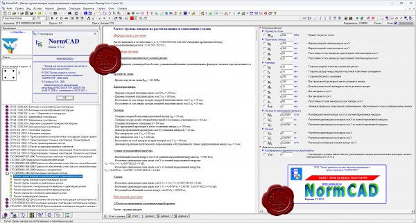
NormCAD выполняет расчеты строительных конструкций по СНиП и готовит проектную документацию для представления заказчику и в органы экспертизы:
- расчет стальных конструкций (расчет балок, колонн сплошного и составного сечения, профнастила и узлов ферм из гнутых профилей);
- расчет железобетонных конструкций (расчет балок, колонн, стен и плит: подбор арматуры, проверка сечений - в т.ч. тавровых и двутавровых, косое внецентренное сжатие, расчет круглых колонн и колонн с распределенной арматурой, трещиностойкость, проверка прогиба, расчет на смятие и продавливание);
- расчет каменных и армокаменных конструкций (проверка сечений - прямоугольных и тавровых на центральное и внецентренное сжатие, растяжение, срез, трещиностойкость и смятие);
- расчет фундаментов;
- теплотехнический расчет (сопротивление теплопередаче и паропроницанию стен, покрытий, перекрытий и светопрозрачных конструкций);
- другие строительные и машиностроительные расчеты.
Главное преимущество - на сегодня это единственная программа, в которой расчет оформляется в виде текстового документа (в формате Word), подобному созданному опытным конструктором вручную, что позволяет легко проконтролировать любую часть расчета.
О новом в версии 11.12.2 тут |
| |
Читать статью дальше (комментариев - 16)
| |
|
|
Автор: Williams
Дата: 28 апреля 2024
Просмотров: 894 |
| |
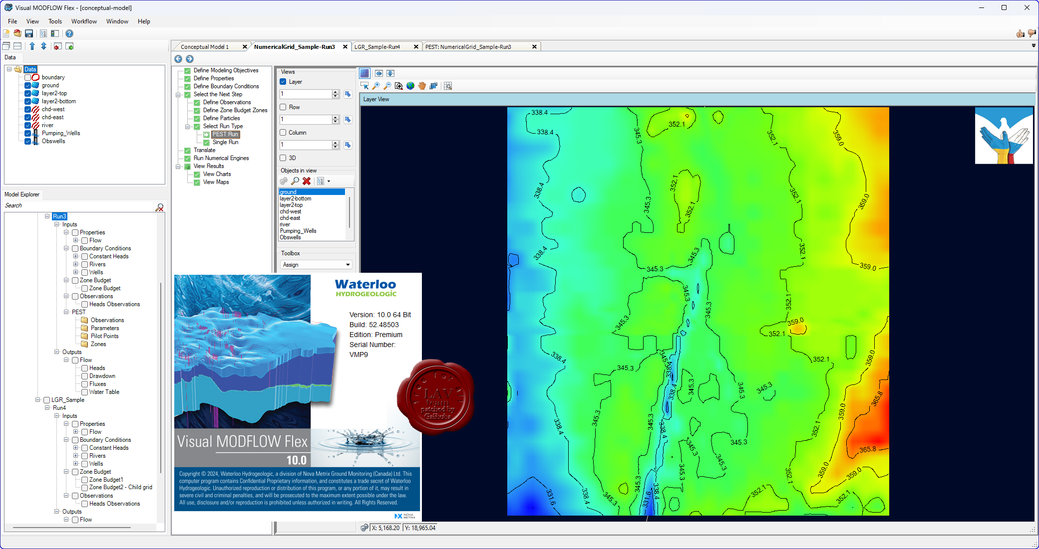
Schlumberger Waterloo Hydrogeologic Visual MODFLOW Flex v10.0 x64

Visual MODFLOW Flex is the industry standard software for 3D groundwater flow, heat and contaminant transport modeling.
- Integrated Conceptual and Numerical Groundwater Modeling.
- Powerful 2D and 3D Visualization Capabilities.
- Intuitive and Easy-to-Use.
Более побдробно тут |
| |
Читать статью дальше (комментариев - 5)
| |
|
|
Автор: Williams
Дата: 27 апреля 2024
Просмотров: 2 900 |
| |
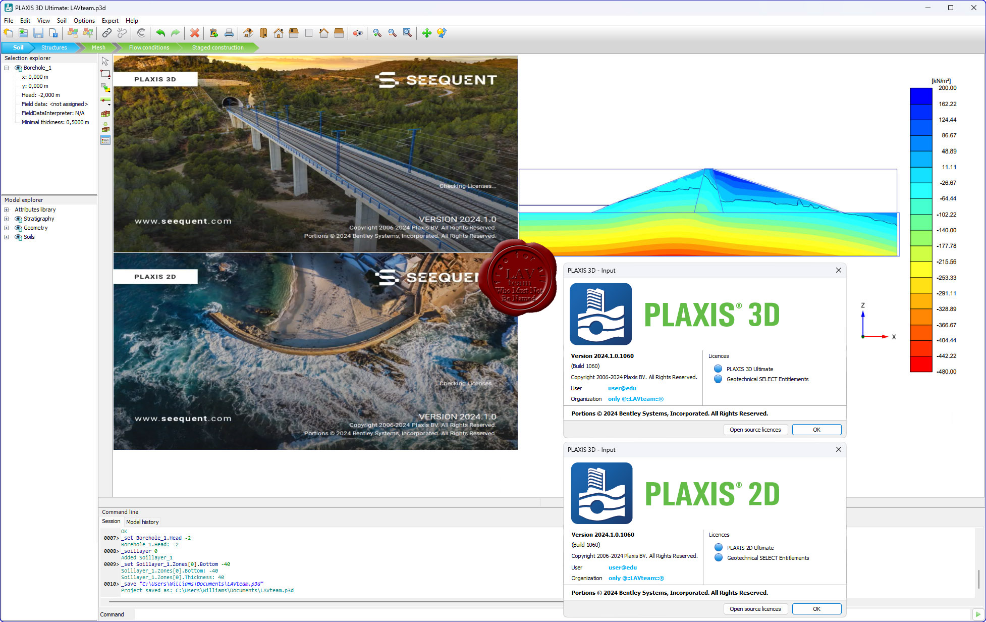
Bentley Seequent PLAXIS 2D / 3D Ultimate 24.01.00.1060 - online installers
 PLAXIS - программная система, основанная на методе конечных-элементов, используемая для решения задач инженерной геотехники, проектирования и инженерной геологии. Представляет собой пакет вычислительных программ для конечно-элементного расчёта напряжённо-деформированного состояния сооружений, фундаментов и оснований. PLAXIS - программная система, основанная на методе конечных-элементов, используемая для решения задач инженерной геотехники, проектирования и инженерной геологии. Представляет собой пакет вычислительных программ для конечно-элементного расчёта напряжённо-деформированного состояния сооружений, фундаментов и оснований.
PLAXIS 2D. Выполняйте геотехнический 2D анализ деформаций и устойчивости с помощью PLAXIS 2D WorkSuite, мощного пакета инструментов для анализа методом конечных элементов и предельного равновесия, который включает специализированный функционал для анализа вибраций, грунтовых вод и теплового потока.
PLAXIS 3D. Выполняйте 3D анализ деформаций и устойчивости в своем следующем геотехническом проекте с использованием PLAXIS 3D WorkSuite. Он представляет собой пакет для анализа методом конечных элементов и предельного равновесия, который включает в себя специализированный функционал для анализа вибраций и грунтовых вод. |
| |
Читать статью дальше (комментариев - 12)
| |
|
|
Автор: Williams
Дата: 26 апреля 2024
Просмотров: 452 |
| |
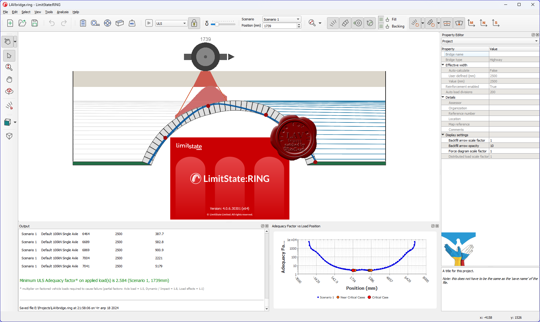
LimitState RING v4.0.6.30301
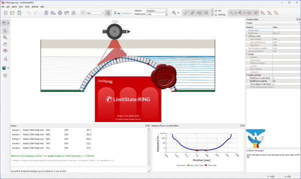
LimitState RING is the popular software product for the analysis of masonry arch bridges - designed from the ground up with the needs of professional engineers in mind:
- Modern, intuitive user interface.
- Multi-ring, multi-span analysis (no need to balance thrusts).
- Use a wide range of built-in and user-defined arch profiles.
- Include local defects such as mortar loss and weak masonry.
- Undertake support settlement analyses.
- View moment, shear and normal force diagrams.
- Allocate separate properties to nearsurface and deep fill.
- Model reinforcement.
LimitState RING uses rigorous mathematical optimization to directly identify a wide range of potential modes of response, including those involving:
- Hinging and/or masonry failure.
- Radial sliding.
- Ring separation.
- Single or multi-spans.
- Support movement.
|
| |
Читать статью дальше (комментариев - 3)
| |
|
|
Автор: Williams
Дата: 25 апреля 2024
Просмотров: 2 012 |
| |
nanoSoft nanoCAD Suite 2024 v24.0 Multilingual
(English, French, German, Korean, Spanish)
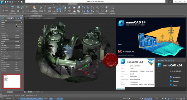
nanoCAD is a modern computer-aided design (CAD) platform that provides designers with powerful capabilities in 2D drafting and 3D modeling. nanoCAD can be used on its own as a cost-effective DWG-editor, or customized with essential modules: Construction, Mechanica, Raster, Topoplan and 3D Solid Modeling.
More info |
| |
Читать статью дальше (комментариев - 15)
| |
|
|
Автор: Williams
Дата: 24 апреля 2024
Просмотров: 1 588 |
| |
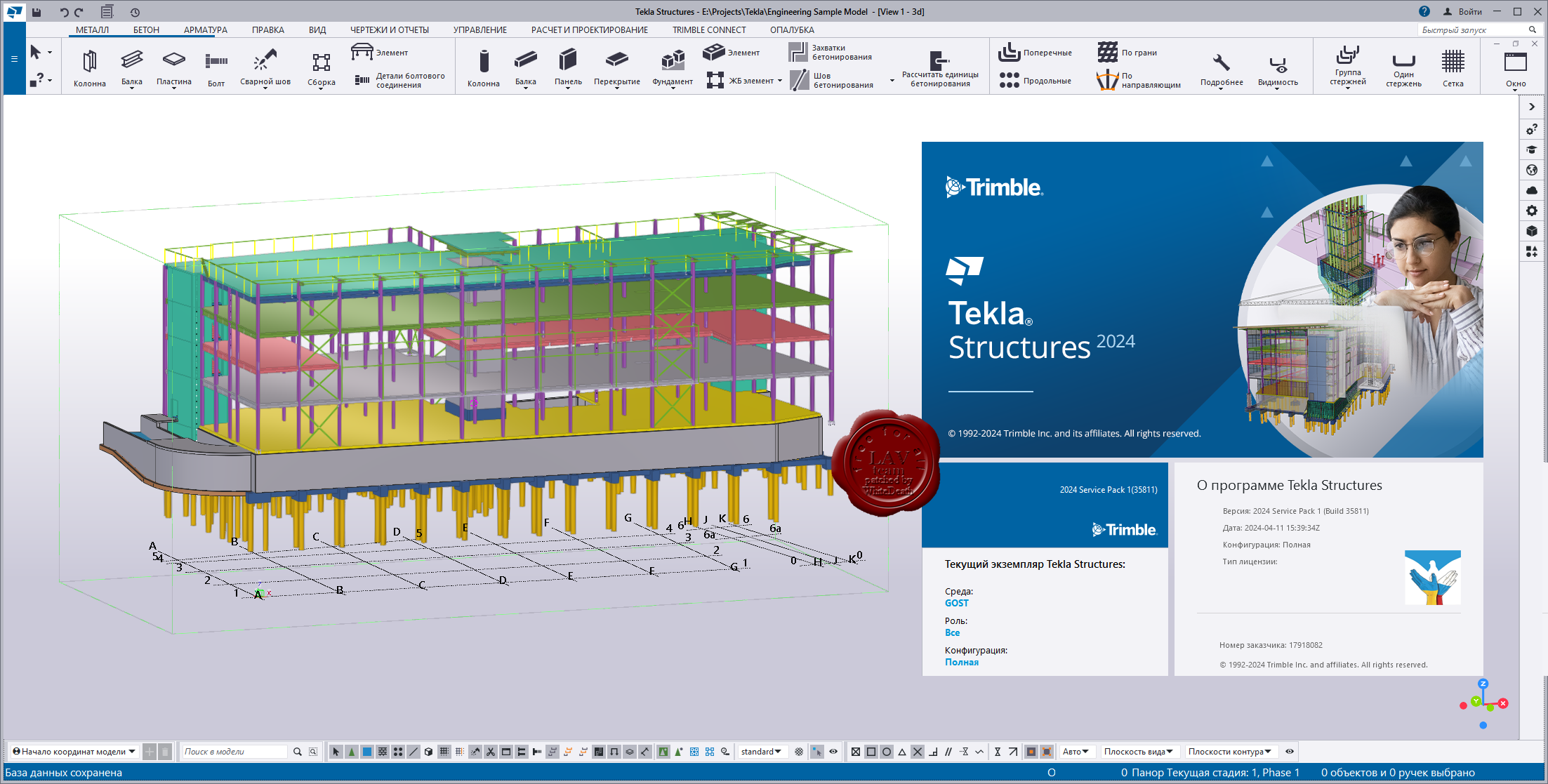
Trimble Tekla Structures 2024 SP1 build 35811
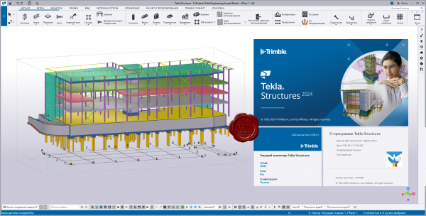 Tekla Structures - комплексное решение, которое позволяет значительно увеличить производительность проектирования промышленных и гражданских зданий с использованием различных конструкционных материалов, таких как: металлоконструкции, сборные железобетонные изделия и монолитные бетонные конструкции. Tekla Structures - комплексное решение, которое позволяет значительно увеличить производительность проектирования промышленных и гражданских зданий с использованием различных конструкционных материалов, таких как: металлоконструкции, сборные железобетонные изделия и монолитные бетонные конструкции.
Tekla Structures представляет собой программное обеспечение информационного моделирования зданий (BIM), которое позволяет создавать точные, подробные, удобные для конструирования 3D модели из любого материала и любой сложности и управлять ими. Модели Tekla Structures можно использовать во всем процессе строительства от эскизов до производства, монтажа и управления строительными работами.
Tekla Structures можно использовать с другими существующими приложениями или отдельно как платформу для разработки собственных рабочих процессов. Открытая платформа поддерживает совместимость и стандартизацию. Tekla Structures стыкуется с различными системами через Tekla Open API через программный интерфейс приложения, который внедряется с использованием технологии Microsoft.NET. Например, Tekla Structures поддерживает следующие стандартные форматы: IFC, CIS/2, SDNF и DSTV. Tekla Structures поддерживает собственные форматы, например DWG, DXF и DGN.
Конфигурации Tekla Structures:
- Tekla Structures, Full Detailing представляет собой универсальную конфигурацию, содержащую модули деталировки металлических конструкции, сборных железобетонных изделий и монолитных бетонных изделий. Предусмотрено создание трехмерных моделей конструкций из стали и бетона, а также автоматическая генерация чертежей КМ и КМД.
- Tekla Structures, Steel Detailing представляет собой конфигурацию, предназначенную для проектирования металлоконструкций. Пользователь может создавать детальные трехмерные модели любых металлических конструкций и получать соответствующие данные для производства и монтажа, используемые всеми участниками проекта.
- Tekla Structures, Precast Concrete Detailing представляет собой стандартную конфигурацию, дополненную важными функциями деталировки сборных железобетонных конструкций. Пользователь может создавать детальные трехмерные модели бетонных конструкций и получать соответствующие данные по производству и монтажу, используемые совместно со всеми участниками проекта.
- Tekla Structures, Reinforced Concrete Detailing представляет собой стандартную конфигурацию, дополненную важными функциями деталировку монолитных железобетонных изделий. Пользователь может создавать детальные трехмерные модели монолитных железобетонных изделий и получать соответствующие данные по производству и монтажу, используемые совместно со всеми участниками проекта.
- Tekla Structures, Engineering представляет собой стандартную конфигурацию, позволяющую выполнять синхронизированное конструирование. Проектировщики металлоконструкций и инженеры, проектирующие внутренние инженерные системы, могут сотрудничать в рамках совместно используемой модели.
Системный курс изучения Tekla Structures (rus)
Release notes |
| |
Читать статью дальше (комментариев - 10)
| |
|
|
Автор: Williams
Дата: 23 апреля 2024
Просмотров: 588 |
| |
CTiWare Vespa Wall Designer v2.13.1.8046
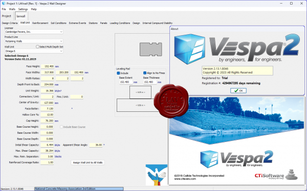
Vespa MSE (Mechanically Stabilized Earth) Design Software is different. Created by experts in MSE design, Vespa saves time by automating processes currently done manually, and by integrating the design and drawing process. Compared to existing MSE Design Software options, Vespa increases design efficiency, improves accuracy, and promotes a seamless flow of information between design stages and parties. Vespa allows the user to import grading and layout information directly from CAD using a CAD routine called AWall that is included with the Vespa Software package. The AWall CAD routine allows the designer to lay out the proposed wall right on the CAD grading plan to show accurate plan views of the wall, and then can export the wall geometry to Vespa. Once the wall geometry is imported or manually input, the user can then design walls using ANY user input or Vendor supplied Modular Block/Geogrid combination. Vespa then generates full wall layouts with accurate quantity estimates and comprehensive reports. The Vespa Calculation Engine can simultaneously run Static, Seismic, and ICS Analysis in accordance to NCMA or AASHTO (LRFD) Design Methodologies. Vespa MSE Design Software is built around the understanding that the goal of the Design Engineer is to produce a set of clear, comprehensive construction drawings. That’s why Vespa automatically generates CAD cross sections and elevation views of the walls you’ve just designed. Once the design is complete, Vespa also allows you to export the wall geometry, soil conditions, and loading conditions to select Global Stability software programs. Vespa MSE Design Software helps put all parties on the same page and all the pieces of the design puzzle together. For the MSE Designer, the real time savings you gain using Vespa can pay for itself on the very first project. |
| |
Читать статью дальше (комментариев - 2)
| |
|
|
Автор: Williams
Дата: 22 апреля 2024
Просмотров: 758 |
| |
RockWare LogPlot 2024.3.6
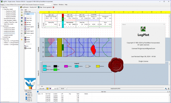
LogPlot is an easy-to-use log plotting program with a flexible log layout and intuitive data editor. LogPlot software has been used by geoscientists since 1983 to display their geotechnical, environmental, geophysical, mud/gas, and mining data as a graphic boring log.
Plot single-page logs for shallow borings or multi-page/continuous logs for deep wells. Share logs with clients via PDF or post HTML log pages on your website. Export single pages or continuous logs to JPG, BMP, TIFF, and PNG images. |
| |
Читать статью дальше (комментариев - 7)
| |
|
|
| ПОИСК ПО САЙТУ |
|
|
|
| КАЛЕНДАРЬ | | |
|
| « Октябрь 2025 » |
|---|
| Пн | Вт | Ср | Чт | Пт | Сб | Вс |
|---|
| | 1 | 2 | 3 | 4 | 5 | | 6 | 7 | 8 | 9 | 10 | 11 | 12 | | 13 | 14 | 15 | 16 | 17 | 18 | 19 | | 20 | 21 | 22 | 23 | 24 | 25 | 26 | | 27 | 28 | 29 | 30 | 31 | |
|
| |
| |
|