|
 |
 Автор: Williams Автор: Williams
 Дата: 28 июня 2024 Дата: 28 июня 2024
 Просмотров: 1 035 Просмотров: 1 035 |
| |
ZwSoft ZWCAD Architecture 2025 ENG x64
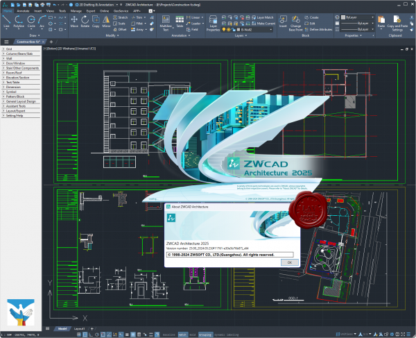
ZWCAD Architecture - это современное ПО для автоматизированного проектирования (САПР), специально разработанное для удовлетворения архитектурных потребностей профессионалов отрасли. Данный софт оснащен различными функциями и инструментами, которые повышают производительность, упрощают задачи черчения и устраняют ошибки, что делает ее отличным выбором как для начинающих, так и для опытных пользователей.
Особенности:
- Одним из основных преимуществ является библиотека готового контента, включая 2D и 3D архитектурные объекты, символы и шаблоны. Эти инструменты облегчают архитекторам быструю генерацию планов этажей, высот, разрезов и других архитектурных чертежей. Кроме того, редактор предлагает вам обширный набор инструментов редактирования и модификации, которые могут быть использованы для настройки проектов в соответствии с индивидуальными спецификациями.
- Еще одной ключевой особенностью ZWCAD Architecture является технология интеллектуальных объектов. Эта функция позволяет пользователям создавать пользовательские объекты и компоненты, такие как двери, окна и стены, и автоматически настраивать их свойства в зависимости от проекта. Такая автоматизация экономит время и снижает вероятность ошибок, делая процесс проектирования более эффективным
- Программа также включает в себя различные инструменты повышения производительности, такие как пакетное черчение и управление слоями. Эти инструменты оптимизируют процесс проектирования, позволяя пользователям работать более эффективно и точно. Кроме того, ПО совместимо с различными форматами файлов, включая DWG, DXF и DWF, что упрощает обмен проектами с клиентами и коллегами.
|
| |
 Читать статью дальше (комментариев - 6)
| |
|
 |
 Автор: Williams Автор: Williams
 Дата: 26 июня 2024 Дата: 26 июня 2024
 Просмотров: 349 Просмотров: 349 |
| |
Technia BRIGADE Plus 2024.2
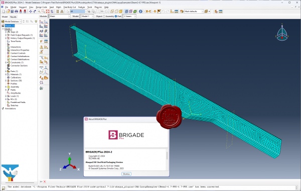
BRIGADE/Plus provides an easy-to-use environment for modeling of all types of bridges and civil structures. The intuitive user-interface integrates modeling, analysis and visualization of results. The parametric, feature-based, concept enables efficient modelling of complex structures.
Software includes predefined loads, vehicles and load combinations in accordance with a wide range of design codes including the Eurocodes with various National Annexes.
BRIGADE/Plus offers a complete range of advanced capabilities such as transient- and steady state dynamic analysis, non-linear material models and contact interactions. The results are easily visualized in 3D plots and 2D graphs. The integrated report generator can be used for efficient creation of input and result reports. Results can be automatically exported to the reinforcement module ConcreteDesigner or to customers own tool for design of reinforcement.
More info |
| |
 Читать статью дальше (комментариев - 1)
| |
|
 |
 Автор: Williams Автор: Williams
 Дата: 25 июня 2024 Дата: 25 июня 2024
 Просмотров: 1 460 Просмотров: 1 460 |
| |
CSoft Model Studio Трубопроводы v3.0.24.5815
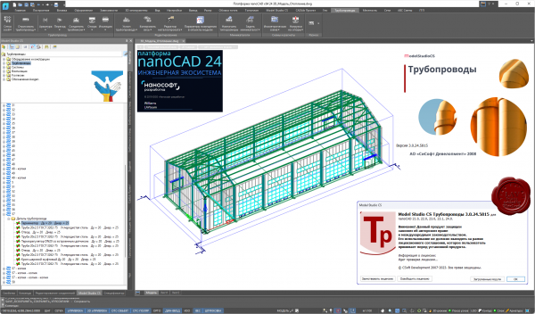
Программный комплекс Model Studio CS Трубопроводы предназначен для трехмерного проектирования, компоновки и выпуска проектной/рабочей документации по технологическим установкам и трубопроводам на проектируемых или реконструируемых объектах.
Model Studio CS Трубопроводы значительно расширяет возможности платформ AutoCAD и nanoCAD в области трехмерного проектирования промышленных объектов, делая работу инженера более комфортной и эффективной.
Комплекс позволяет решать следующие основные задачи:
- трехмерная компоновка и моделирование;
- расчеты и проверка инженерных решений;
- формирование и выпуск проектной и рабочей документации.
Подробнее тут |
| |
 Читать статью дальше (комментариев - 5)
| |
|
 |
 Автор: Williams Автор: Williams
 Дата: 24 июня 2024 Дата: 24 июня 2024
 Просмотров: 195 Просмотров: 195 |
| |
Thermo Fisher Scientific Amira/Avizo 2024.1
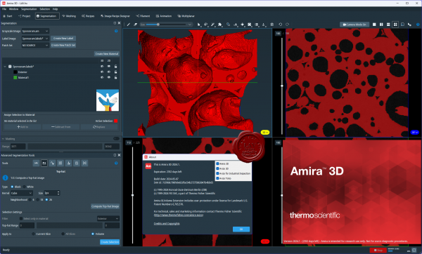 AVIZO is materials characterization and quality control software for imaging data analysis and quality assurance. Analysis and visualization of your imaging data allows better understanding of your materials structure, properties and performances. No matter what scale and data modality you use, your organization profile (large industrial company, core imaging facility, national or local service laboratory, academic institution) AVIZO provides optimized workflows for advanced materials characterization and quality control from a single environment. AVIZO is universal, reliable, fully automatable and customizable digital analytical labs. Materials scientists and engineers can innovate faster, produce more reliable and better performing materials and processes while reducing cost and time to discoveries. AVIZO is materials characterization and quality control software for imaging data analysis and quality assurance. Analysis and visualization of your imaging data allows better understanding of your materials structure, properties and performances. No matter what scale and data modality you use, your organization profile (large industrial company, core imaging facility, national or local service laboratory, academic institution) AVIZO provides optimized workflows for advanced materials characterization and quality control from a single environment. AVIZO is universal, reliable, fully automatable and customizable digital analytical labs. Materials scientists and engineers can innovate faster, produce more reliable and better performing materials and processes while reducing cost and time to discoveries.
AMIRA is software for biomedical and life science research. Powerful, multifaceted 2D–5D software for visualization, processing and analysis of microscopy imaging serving Life and Biomedical Sciences. AMIRA is a powerful, comprehensive, and versatile 2D–5D solution for visualizing, analyzing and understanding life science and biomedical research data from many image modalities, including Optical and Electron Microscopy, CT, MRI and other imaging techniques. With incredible speed and flexibility, Amira Software supports advanced 2D–5D bioimaging workflows in research areas ranging from structural and cellular biology to tissue imaging, neuroscience, preclinical imaging and bioengineering. From any 3D image data, including time series and multi-channel, AMIRA delivers a comprehensive range of data visualization, processing and analysis capabilities. Amira Software allows life science and biomedical researchers to gain invaluable insights into their data, at different scales and from any modality. |
| |
 Читать статью дальше (комментариев - 0)
| |
|
 |
 Автор: Williams Автор: Williams
 Дата: 23 июня 2024 Дата: 23 июня 2024
 Просмотров: 1 917 Просмотров: 1 917 |
| |
Trimble Tekla Structures 2024 SP3 build 37355
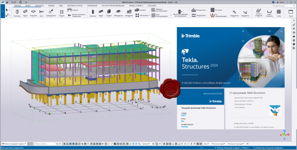
Tekla Structures - комплексное решение, которое позволяет значительно увеличить производительность проектирования промышленных и гражданских зданий с использованием различных конструкционных материалов, таких как: металлоконструкции, сборные железобетонные изделия и монолитные бетонные конструкции.
Tekla Structures представляет собой программное обеспечение информационного моделирования зданий (BIM), которое позволяет создавать точные, подробные, удобные для конструирования 3D модели из любого материала и любой сложности и управлять ими. Модели Tekla Structures можно использовать во всем процессе строительства от эскизов до производства, монтажа и управления строительными работами.
Tekla Structures можно использовать с другими существующими приложениями или отдельно как платформу для разработки собственных рабочих процессов. Открытая платформа поддерживает совместимость и стандартизацию. Tekla Structures стыкуется с различными системами через Tekla Open API через программный интерфейс приложения, который внедряется с использованием технологии Microsoft.NET. Например, Tekla Structures поддерживает следующие стандартные форматы: IFC, CIS/2, SDNF и DSTV. Tekla Structures поддерживает собственные форматы, например DWG, DXF и DGN.
Конфигурации Tekla Structures:
- Tekla Structures, Full Detailing представляет собой универсальную конфигурацию, содержащую модули деталировки металлических конструкции, сборных железобетонных изделий и монолитных бетонных изделий. Предусмотрено создание трехмерных моделей конструкций из стали и бетона, а также автоматическая генерация чертежей КМ и КМД.
- Tekla Structures, Steel Detailing представляет собой конфигурацию, предназначенную для проектирования металлоконструкций. Пользователь может создавать детальные трехмерные модели любых металлических конструкций и получать соответствующие данные для производства и монтажа, используемые всеми участниками проекта.
- Tekla Structures, Precast Concrete Detailing представляет собой стандартную конфигурацию, дополненную важными функциями деталировки сборных железобетонных конструкций. Пользователь может создавать детальные трехмерные модели бетонных конструкций и получать соответствующие данные по производству и монтажу, используемые совместно со всеми участниками проекта.
- Tekla Structures, Reinforced Concrete Detailing представляет собой стандартную конфигурацию, дополненную важными функциями деталировку монолитных железобетонных изделий. Пользователь может создавать детальные трехмерные модели монолитных железобетонных изделий и получать соответствующие данные по производству и монтажу, используемые совместно со всеми участниками проекта.
- Tekla Structures, Engineering представляет собой стандартную конфигурацию, позволяющую выполнять синхронизированное конструирование. Проектировщики металлоконструкций и инженеры, проектирующие внутренние инженерные системы, могут сотрудничать в рамках совместно используемой модели.
Системный курс изучения Tekla Structures (rus)
Release notes |
| |
 Читать статью дальше (комментариев - 6)
| |
|
 |
 Автор: Williams Автор: Williams
 Дата: 22 июня 2024 Дата: 22 июня 2024
 Просмотров: 797 Просмотров: 797 |
| |
Opencartis Spatial Manager Professional Desktop Edition & for AutoCAD v9.1.2.15600
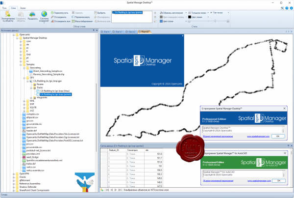 Spatial Manager Desktop is a Windows desktop application designed to manage spatial data in a simple, fast and inexpensive way. Developed by a group of professionals working in the areas of GIS, Planning, Infrastructure and Civil Engineering, it provides the user with powerful tools to address the most common tasks of management and operation in the world of spatial information. Spatial Manager Desktop is a Windows desktop application designed to manage spatial data in a simple, fast and inexpensive way. Developed by a group of professionals working in the areas of GIS, Planning, Infrastructure and Civil Engineering, it provides the user with powerful tools to address the most common tasks of management and operation in the world of spatial information.
Key Features:
- Read and write spatial data using a wide range of file formats and spatial servers.
- Calculate geometric transformations of the features in the import and export processes.
- Choose from among a lot of dynamic Backgrounds Maps from providers such as Google Maps, OpenStreetMap, Bing, MapBox, Ordnance Survey, etc., or configure your own maps from TMS, WMS or WMTS servers.
- Export all or part of the elements in the visible Layers of the map and their data to a KML or KMZ file.
- Arrange your maps in Layers that can be fully managed by the application.
- Manage the alphanumeric data attached to the elements, design and edit the structure which will be used to store the data.
- Calculate simple or complex expressions using operators and functions that can be applied to field values in a table and/or to constant values.
- Perform spatial analysis operations over the objects in the drawing or map generating new objects from such analysis.
- Location and geo-coding tools help to add reference elements and enhanced data to existing objects.
- Spatial Manager Desktop includes the ability to save tasks that make it easy to run repetitive import and export processes.
More info |
| |
 Читать статью дальше (комментариев - 11)
| |
|
 |
 Автор: Williams Автор: Williams
 Дата: 21 июня 2024 Дата: 21 июня 2024
 Просмотров: 250 Просмотров: 250 |
| |
Dassault Systemes SIMULIA CST Studio Suite 2024 SP4
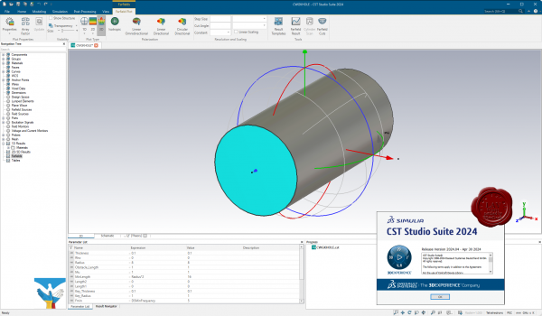
CST Studio Suite — это высокопроизводительный пакет программного обеспечения для ЭМ-анализа в 3D, предназначенный для проектирования, анализа и оптимизации электромагнитных компонентов и систем.
Решающие программы для всего спектра электромагнитных полей доступны в едином пользовательском интерфейсе пакета CST Studio Suite. Эти решающие программы можно объединять для гибридного имитационного моделирования, что дает конструкторам возможность эффективно и быстро анализировать целые системы, состоящие из множества компонентов. Совместное проектирование с использованием других продуктов SIMULIA позволяет интегрировать ЭМ-имитационное моделирование в процесс проектирования и управлять процессом разработки с самых ранних этапов.
К наиболее распространенным предметам ЭМ-анализа относятся производительность и эффективность антенн и фильтров, электромагнитная совместимость и помехи (ЭМС/ЭМП), воздействие человеческого тела на электромагнитные поля, электромеханические эффекты в двигателях и генераторах, а также тепловые эффекты в устройствах высокой мощности.
CST Studio Suite используется в ведущих технологических и инженерных компаниях по всему миру. Это решение обеспечивает значительные преимущества на рынке, сокращая циклы разработки и затраты. Имитационное моделирование позволяет использовать виртуальное прототипирование. Можно оптимизировать производительность устройства, выявлять потенциальные несоответствия нормативным требованиям и устранять их на ранних этапах процесса проектирования, уменьшить количество необходимых физических прототипов и свести к минимуму риск ошибок и отзывов продукции. |
| |
 Читать статью дальше (комментариев - 0)
| |
|
 |
 Автор: Williams Автор: Williams
 Дата: 20 июня 2024 Дата: 20 июня 2024
 Просмотров: 573 Просмотров: 573 |
| |
CSI Bridge Advanced with Rating v25.3.0 build 2761
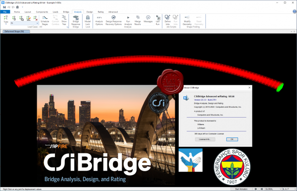
Modeling, analysis and design of bridge structures have been integrated into CSI Bridge to create the ultimate in computerized engineering tools. The ease with which all of these tasks can be accomplished makes CSI Bridge the most versatile and productive software program available on the market today.
Using CSI Bridge, engineers can easily define complex bridge geometries, boundary conditions and load cases. The bridge models are defined parametrically, using terms that are familiar to bridge engineers such as layout lines, spans, bearings, abutments, bents, hinges and post-tensioning. The software creates spine, shell or solid object models that update automatically as the bridge definition parameters are changed.
CSI Bridge design allows for quick and easy design and retrofitting of steel and concrete bridges. The parametric modeler allows the user to build simple or complex bridge models and to make changes efficiently while maintaining total control over the design process. Lanes and vehicles can be defined quickly and include width effects. Simple and practical Gantt charts are available to simulate modeling of construction sequences and scheduling.
CSI Bridge includes an easy to follow wizard that outlines the steps necessary to create a bridge model.
Completely integrated within the CSI Bridge design package is the power of the SAPFire analysis engine, including staged construction, creep and shrinkage analysis, cable tensioning to target forces, camber and shape finding, geometric nonlinearity (P-delta and large displacements), material nonlinearity (superstructure, bearings, substructure and soil supports), buckling and static and dynamic analysis. All of these apply to a single comprehensive model. In addition, AASHTO LRFD design is included with automated load combinations, superstructure design and the latest seismic design.
News in release 25.3.0 |
| |
 Читать статью дальше (комментариев - 7)
| |
|
 |
 Автор: Williams Автор: Williams
 Дата: 19 июня 2024 Дата: 19 июня 2024
 Просмотров: 1 475 Просмотров: 1 475 |
| |
CSI SAP2000 Ultimate v25.3.0 build 2708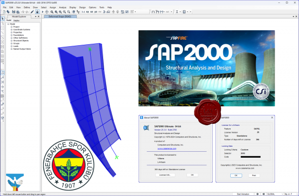
CSI SAP2000 - cистема трехмерного статического и динамического анализа методом конечных элементов и проектирования сооружений.
SAP2000 следует принципам, основными чертами которых являются современный, интуитивно понятный и универсальный пользовательский интерфейс, основанный на уникальном расчетном ядре и инструментах проектирования конструкций для инженеров, разрабатывающих объекты транспортной инфраструктуры, промышленные и гражданские здания, спортивные сооружения и другие объекты.
Начиная с трехмерной объектно-ориентированной рабочей среды моделирования и до широчайшего спектра опций расчета и проектирования конструкций, комплексно интегрированных в один мощный пользовательский интерфейс, SAP2000 – это наиболее интегрированный, производительный и практичный расчетный комплекс общего назначения, существующий на сегодняшнем рынке. Интуитивно понятный интерфейс позволяет Вам создавать модели конструкций в кратчайшие сроки без долгого процесса обучения. Сегодня Вы можете использовать SAP2000 для всех Ваших задач по расчету и проектированию, в том числе и для небольших повседневных задач.
Комплексные модели могут быть созданы и разбиты на конечные элементы с использованием встроенных шаблонов. Интегрированные инструменты проектирования конструкций способны автоматически сгенерировать ветровые, волновые, нагрузки от транспорта и сейсмические нагрузки на модель, а также выполнить полную автоматическую проверку стальных и железобетонных элементов согласно нормам проектирования различных стран.
News in release 25.3.0 |
| |
 Читать статью дальше (комментариев - 21)
| |
|
 |
| ПОИСК ПО САЙТУ |
 |
|
 |
| КАЛЕНДАРЬ | | |
 |
| « Октябрь 2025 » |
|---|
| Пн | Вт | Ср | Чт | Пт | Сб | Вс |
|---|
| | 1 | 2 | 3 | 4 | 5 | | 6 | 7 | 8 | 9 | 10 | 11 | 12 | | 13 | 14 | 15 | 16 | 17 | 18 | 19 | | 20 | 21 | 22 | 23 | 24 | 25 | 26 | | 27 | 28 | 29 | 30 | 31 | |
|
 | |
| |
|