|
 |
 Автор: Williams Автор: Williams
 Дата: 16 августа 2024 Дата: 16 августа 2024
 Просмотров: 351 Просмотров: 351 |
| |
Graitec FileSync 2025
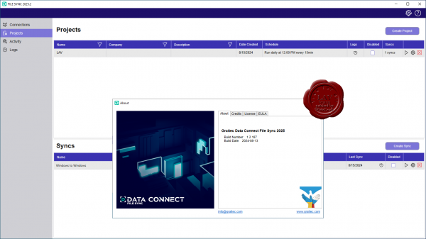 Automatically synchronise project critical files, streamline project team collaboration and enjoy peace of mind with routine file backups. Automatically synchronise project critical files, streamline project team collaboration and enjoy peace of mind with routine file backups.
Improving project teams’ collaboration across AEC and MFG.
Automatically synchronise project files across: Autodesk Construction Cloud, Autodesk BIM 360, Procore, SharePoint, OneDrive, Windows.
Backing up cloud files ensures continuity for the project team. |
| |
 Читать статью дальше (комментариев - 2)
| |
|
|
Автор: Williams
Дата: 15 августа 2024
Просмотров: 419 |
| |
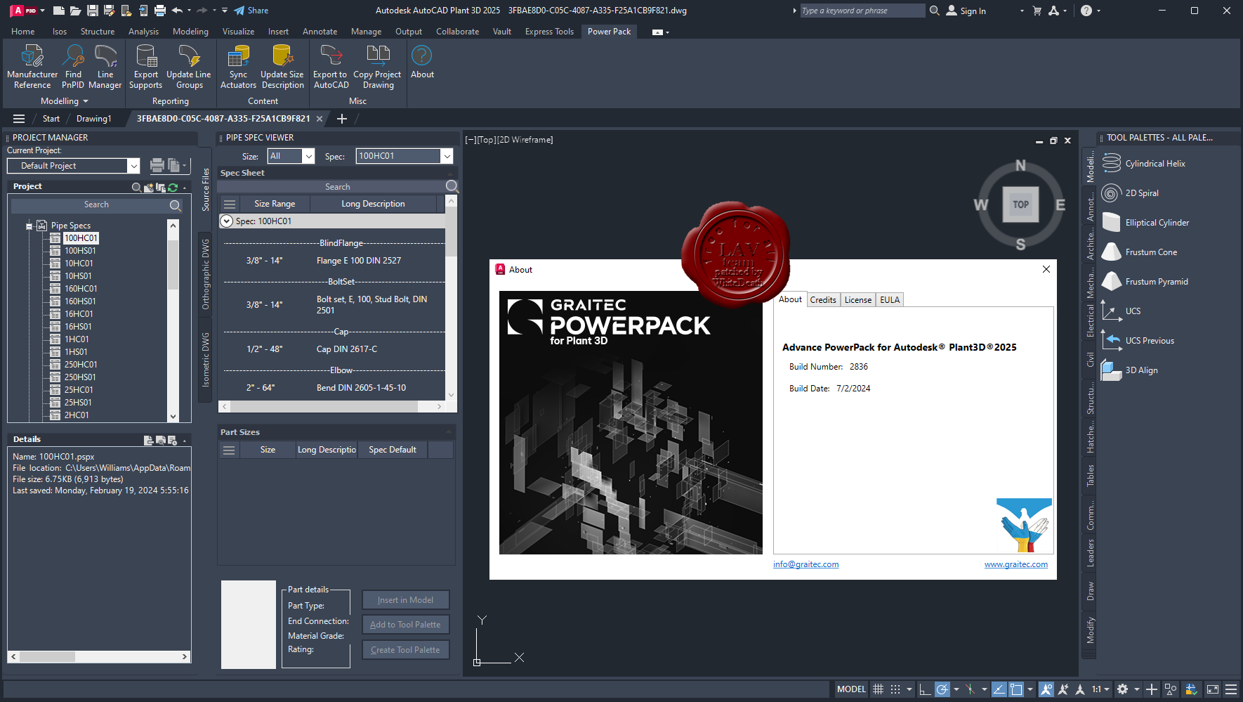
Graitec PowerPack 2025 for Plant 3D
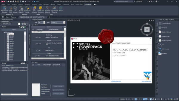 Streamline your Plant 3D workflows and boost design efficiency. Advanced tools and features help streamline plant design workflows: automated tasks, enhanced pipe routing, customizable libraries, and more. Engineers and designers can produce high quality designs in less time. Streamline your Plant 3D workflows and boost design efficiency. Advanced tools and features help streamline plant design workflows: automated tasks, enhanced pipe routing, customizable libraries, and more. Engineers and designers can produce high quality designs in less time.
Pipe Supports to Excel
Create more accurate pipe support takeoffs based on real model parameters.
Copy Project Drawings
Batch transfer drawings between projects. Copy all project files with folder structures, including isometrics.
Sync Actuators
Synchronize actuators by processing all valves in a spec. Update the assigned operator to match the source catalog.
Export to AutoCAD
Save time by using the built-in scheduling tool for consistent, hands-off creation. Batch export all project files to native AutoCAD objects.
Update Line Size and Spec
Save time on data entry by populating nominal size and spec properties in P&IDs and 3D models.
Line Manager
This new tool simplifies the process of managing iso sheet numbering, allowing for faster and easier creation of Production ISOs.
The release of PowerPack for Plant 3D 2025 introduces enhanced features like the Copy Project Drawings tool, a powerful tool for plant designers and process engineers. This enhancement promises to speed up your work by seamlessly reusing existing design data from other projects, making project copying and model transfers more efficient than ever. |
| |
Читать статью дальше (комментариев - 4)
| |
|
|
Автор: Williams
Дата: 14 августа 2024
Просмотров: 289 |
| |
Cadence Fidelity 2024.1
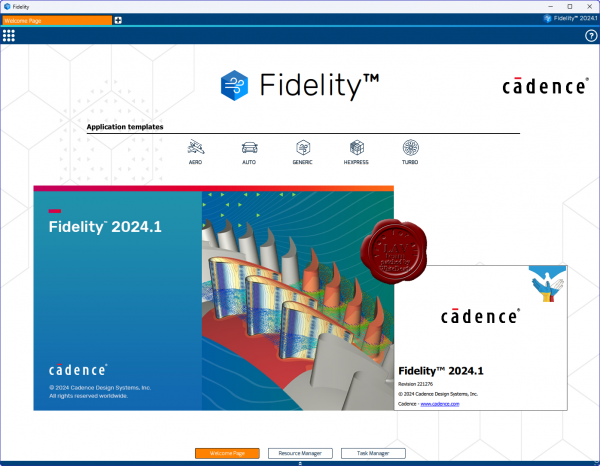 The computational fluid dynamics (CFD) industry faces increasing demand for efficiency, fidelity, and speed. Don’t settle for tried-and-true solutions when you step into environments that have yet to be developed. Improved real behavioral modeling of systems yields greater degrees of fidelity and security for the products you send out into the world. The requirements for multidisciplinary modeling, analysis, and optimization are vast and include: The computational fluid dynamics (CFD) industry faces increasing demand for efficiency, fidelity, and speed. Don’t settle for tried-and-true solutions when you step into environments that have yet to be developed. Improved real behavioral modeling of systems yields greater degrees of fidelity and security for the products you send out into the world. The requirements for multidisciplinary modeling, analysis, and optimization are vast and include:
- Conjugate Heat Transfer (CHT) coupling flow and heat transfer
- Fluid-structure interactions (FSI)
- Fluid-chemistry and multiphase interactions such as combustion
- Aeroacoustics coupling flow and noise
Fidelity CFD is the end-to-end solution for all CFD-related applications. The dedicated tools within the Fidelity CFD environment can solve each step of the simulation process quickly and efficiently. Furthermore, Fidelity CFD was designed with ease-of-use in mind with an intuitive and application-driven interface or through automated processes with the Python API or optimization module available.
The software necessary for realistic modeling of fluid flows grows increasingly competent and complex. Using the Fidelity CFD environment, you can trust any computational challenge to be handled with both accuracy and speed. Custom fit this CFD simulation software to solve the difficulties you are experiencing in your design and verification cycle.
With CFD workflows being reassessed every cycle to optimize and improve for greater levels of fidelity and speed, Fidelity CFD serves your simulation necessities by offering a highly automated, customizable solution. |
| |
Читать статью дальше (комментариев - 3)
| |
|
|
Автор: Williams
Дата: 13 августа 2024
Просмотров: 1 591 |
| |
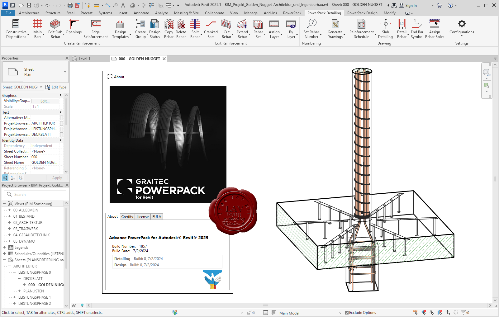
Graitec PowerPack 2025 for Revit

PowerPack for Autodesk Revit is an add-on packed with tools that deliver more functionality, better control, and more automation for Revit users across all industries.
With more than 80 tools available, the PowerPack increases the productivity of both engineers and designers, helping to ensure data reliability, whilst automating documentation and improving BIM coordination.
Numbering Tool
Elements’ numbering in Revit requires a manual selection of objects, one after the other, within the project. Locating or renumbering several hundred objects can thus become a tedious, time-consuming and error-prone task. Numbering using the GRAITEC PowerPack saves time and eliminates the risk of errors such as duplicates or omissions, also preventing inherent information inconsistencies.
Link To Excel
Exporting BIM information from Revit to Excel can be a long manual operation. The “Dynamic Link to Excel” function in the PowerPack allows users to transfer data directly into Excel (BOMs) either dynamically or by a simple click. Similarly, integrating Excel data into Revit is carried out just as easily.
Family Manager
By default, Revit offers a basic families library depending on the localization country. The PowerPack “Family Manager” is the necessary step-up to optimize the BIM model creation and facilitate collaborative work! In order to guarantee effective collaboration and ensure coherence between project elements within an agency or a design office, the library is accessible to the entire team. Easy to use, this tool has a visual graphical interface that allows for very intuitive handling.
Element Lookup
Currently, certain Revit parameters are difficult to access and thus cannot be effectively exploited when Revit filters are activated. The PowerPack for Revit provides advanced searching features that offer the flexibility needed to allow easy object selection based on their characteristics, for batch-processing purposes.
Batch Exporter
Exporting Drawings and views to different file formats is time-consuming, Batch Exporter gives you the ability to export Views and Sheets from your Revit project to various file formats simultaneously. Batch exporter has over 10 different file formats available to the user, including DWG, PDF, DGN FBX, SAT, NWC. The export naming convention can also be customized to the user’s needs.
Main Bars
The Main Bars tool is an intelligent interface that will automatically change depending on the type of element you wish to reinforce. The user is presented with an intuitive interface where all aspects of reinforcement related to that type of element are listed. Supported elements include Footings, Columns, Beams and Walls. A key feature in both Beams and Columns is the ability to easily create “Packages” that allow for varying distribution of Transversal bars such as stirrups.
Visibility
Setting rebar visibility in Revit can be a time-consuming job, newly created reinforcement will not automatically inherit the existing view settings. Graitec has created several tools to optimize and control the visibility of reinforcement. The Browse Reinforcement command enables users to browse all reinforcement through filters based on rebar parameters ( type, partition, mark, shape, diameter…) and highlights all corresponding instances in the view.
Bending Details
PowerPack for Revit comes with the ability to create intelligent Bar bending details based on the modeled reinforcement. It can create a 2D fully dimensioned bar bending detail, that will update as the design changes. Both the placement and scale of these details can be controlled to help increase the speed of the documentation process. |
| |
Читать статью дальше (комментариев - 8)
| |
|
|
Автор: Williams
Дата: 12 августа 2024
Просмотров: 1 135 |
| |
Graitec PowerPack 2025 for Advance Steel
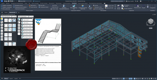
PowerPack for Autodesk Advance Steel is an essential productivity companion for the professionals in the AEC industry, extending and pushing the boundaries of Advance Steel. A user-centric powerful extension, the PowerPack for Advance Steel is designed to help delivering projects with increased productivity and efficiency, enhancing tools to provide better control and accuracy, improving everyday work.
KEY FEATURE 1: Multi Grid Level
The Multi Grid Level tool allows the user to quickly create grid lines and levels within the Advance Steel model space, combining also with options to create model views and cameras within those model views.
KEY FEATURE 2: Camera Creator/Browser
The ‘Camera Creator’ is designed to allow users to quickly create a series of new cameras within the model space, it allows the user to remain within the dialog and change the parameters for each camera placed. This tool is design to compliment the previous Grid tools that allow for use of Cameras within dedicated model views, this is aimed at allowing the user the ability to place cameras as bespoke locations to predefined View orientations, with provision for used defined orientation based upon current model UC. In addition, the Camera Browser is an additionnal tool to allow the user management of the multiple camera instances within the model space, allowing for the selection and editing of their parameters.
KEY FEATURE 3: Connection Vault
PowerPack for Advance Steel extends the standard library with a variety of parametric and intelligent advanced connections: Threaded Rod Connection, Tube to Tube Connection, Purlin Connection, Plates on Profile, Plate for Multiple Bracings, Curved End Plate – Plate & Grating Stiffeners.
KEY FEATURE 4: IGES/STEP export
The IGES/STEP export functionality is the key to the collaboration with manufacturers. Formats are widely requested by many manufacturers for designing moulds or for pricing manufactured parts, the export in IGES and STEP formats completes the PowerPack solution. These types of file formats are helping the user to be more productive when it comes to sending files to third applications for the fabrication process.
KEY FEATURE 5: Platform Cover Creator
Automatically create grating or plate cover based on the selected supporting members. Platform Cover Creator is one of the stars of the PowerPack thanks to its versatility. The joint helps to automatically create grating or plate cover based on selected members, and gives the user many possibilities.
KEY FEATURE 6: Stairs and Railings
The Stairs and Railings module in the Graitec PowerPack for Autodesk Advance Steel simplifies stair and railing design, offering extensive customization options for precise and visually appealing configurations. Create varying flight arrangements, from single flights to multi-flights with different shapes, and incorporate plate or grating landings. With options for open or closed stringers made from beams or plates, users have detailed control over the design parameters. This module streamlines the design process, enhances productivity, and ensures structurally sound and aesthetically pleasing stairs and railings.
KEY FEATURE 7: Transmission Towers
The 'Transmission Towers Command' under the new Towers Designer allows users to create intricate structural frameworks for transmission towers with ease. The command is highly customizable, letting users define cage arrangements, segment divisions, and bracing schemes for each tower. It also allows for variations in tower arm arrangements and the addition of a tower top element. The command enhances productivity by automating the creation of complex tower structures, offering numerous bracing schemes, and providing options for multiple configurations and section size selection. |
| |
Читать статью дальше (комментариев - 7)
| |
|
|
Автор: Williams
Дата: 11 августа 2024
Просмотров: 884 |
| |
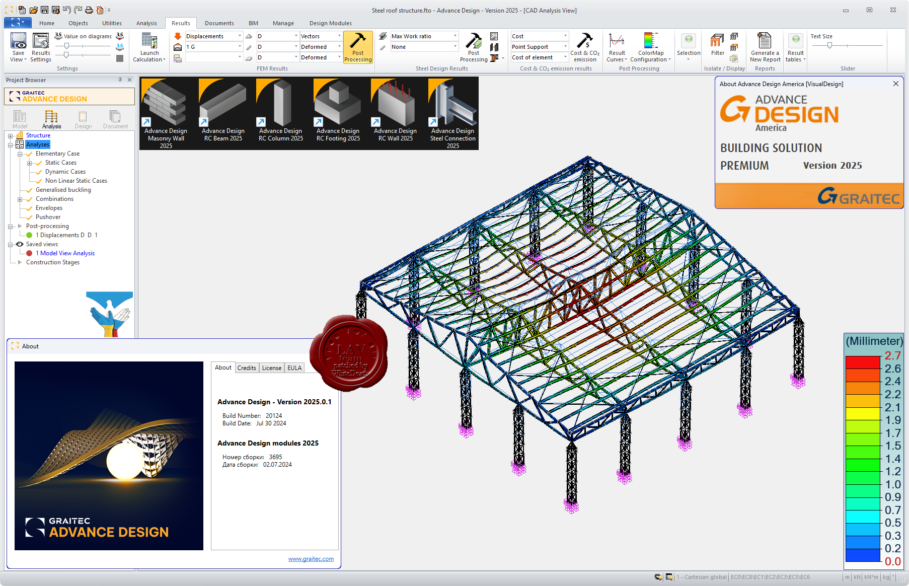
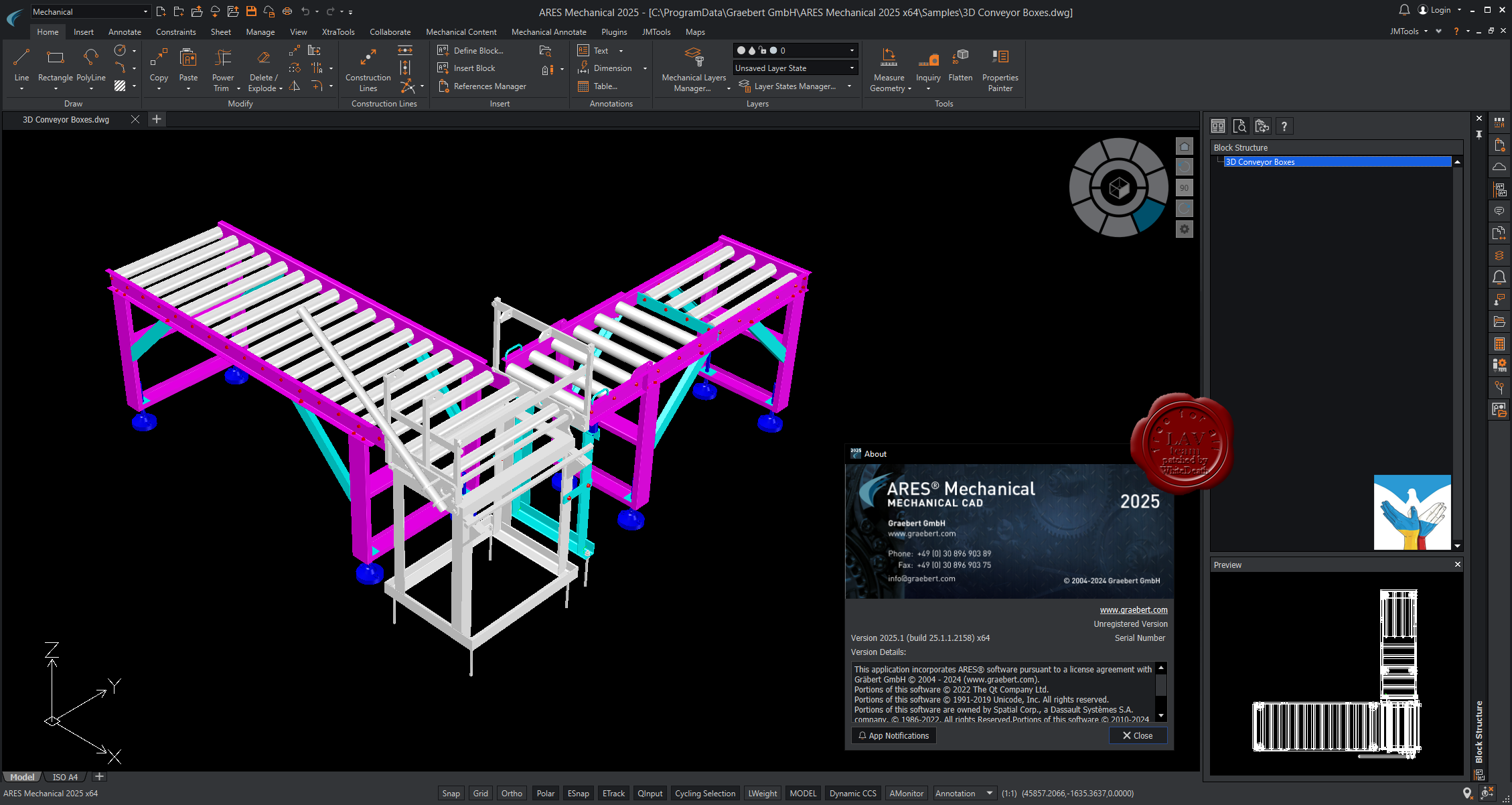
Graitec Advance Design 2025.0.1
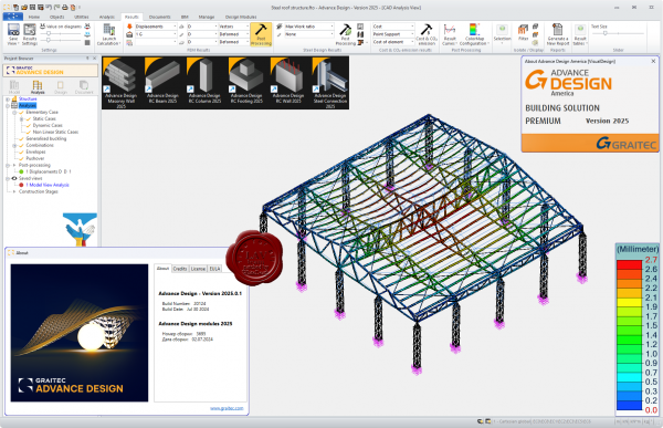
Graitec Advance - программный комплекс проектирования металлоконструкций.
Advance Design was specifically developed for industry professionals that require a superior solution for the structural analysis and design of Reinforced Concrete and Steel structures according to the latest versions of Eurocodes (EC0, EC1, EC2, EC3 and EC8). Advance Design features include easy modeling, a powerful FEM analysis engine, top-level design wizards, automated post-processing of results and automated reports. Achieve a new level of computer-assisted engineering with Advance Design. |
| |
Читать статью дальше (комментариев - 5)
| |
|
|
Автор: Williams
Дата: 8 августа 2024
Просмотров: 740 |
| |
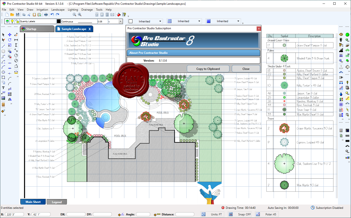
Software Republic Pro Contractor Studio v8.1.0.6
 Pro Contractor Studio is stand-alone design program that does not require any other CAD software to operate. The software is easy to use yet robust in its capabilities. Pro Contractor Studio installs directly onto your computer and does not require an Internet connection to operate. The intended use of the program is for any size residential project to medium size commercial drawings. With Pro Contractor Studio's easy to use drafting features you can be designing within minutes. Users can draft a property using the commands in the software, or import a scanned image of a plot plan and begin the design. The drawing screen is a WYSIWYG interface that shows the designer exactly what they will see when printing/plotting. Symbol sizes, colors, line types and scales all appear on the screen exactly as they will when output to a sheet of paper. The Online Learning Center includes a host of video tutorials to get users up and running as quickly as possible.The irrigation design features of Pro Contractor Studio™ are based on the powerful and proven RainCAD™ technology providing sprinkler placement, sprinkler distribution analysis, automatic pipe sizing, hydraulic calculations, material takeoffs, estimates of installation costs and more. Pro Contractor Studio is stand-alone design program that does not require any other CAD software to operate. The software is easy to use yet robust in its capabilities. Pro Contractor Studio installs directly onto your computer and does not require an Internet connection to operate. The intended use of the program is for any size residential project to medium size commercial drawings. With Pro Contractor Studio's easy to use drafting features you can be designing within minutes. Users can draft a property using the commands in the software, or import a scanned image of a plot plan and begin the design. The drawing screen is a WYSIWYG interface that shows the designer exactly what they will see when printing/plotting. Symbol sizes, colors, line types and scales all appear on the screen exactly as they will when output to a sheet of paper. The Online Learning Center includes a host of video tutorials to get users up and running as quickly as possible.The irrigation design features of Pro Contractor Studio™ are based on the powerful and proven RainCAD™ technology providing sprinkler placement, sprinkler distribution analysis, automatic pipe sizing, hydraulic calculations, material takeoffs, estimates of installation costs and more.
The irrigation design features of Pro Contractor Studio are based on the powerful and proven RainCAD technology providing sprinkler placement, sprinkler distribution analysis, automatic pipe sizing, hydraulic calculations, material takeoffs, estimates of installation costs and more. The landscape design features allow for the creation of beautifully colored drawings sure to help increase your sales closure rate. Commands include plant placement, a symbol trim command to combine overlapping symbols into one single symbol, shadow placement, quantity labels, area and volume calculations, complete symbol legend, material takeoff and more. The lighting design features allow for the creation of accurate accent lighting designs. Commands include fixture and transformer placement, wire and wire hops, total wattage and voltage drop calculations, complete symbol legend, material takeoff and more. The drainage design features allow for the easy creation of drainage designs. Commands include catch basin placement, linear drain placement, drainage pipe, runoff calculations, complete symbol legend, material takeoff and more. |
| |
Читать статью дальше (комментариев - 2)
| |
|
|
Автор: Williams
Дата: 7 августа 2024
Просмотров: 485 |
| |
Luxion KeyShot Studio Enterprise 2024.2 v13.1.0 Mac+Win
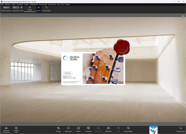
Luxion KeyShot - средство интерактивной визуализации 3D сцен и моделей, позволяет получать результат в режиме реального времени и по утверждению разработчиков - это цифровой фотоаппарат для 3D моделей.
Это один из первых рендеров, с которым даже новички смогут создавать фото-реалистичные изображения, 3D модели за считанные секунды, проектировать трехмерные сцены так, что они будут похожи на реалистичную фотографию, а не на 3D модель.
Основные особенности:
- Программа может работать как отдельное приложение, либо как дополнение (plugin), со следующими форматами: OBJ, Autodesk Alias Maya, FBX, 3DS, Rhinoceros Plugin, SketchUp, SolidWorks, Pro/ENGINEER Plugin, ALIAS, JT.
- Учитывая,что используется глобальное освещение и материалы, основанные на реальных физических параметрах, итоговые изображения получаются фотографического качества.
- Результат вы получаете в режиме реального времени.
- KeyShot поддерживает много собственных форматов файлов, включая Pro/ENGINEER, SolidWorks, Rhino, SketchUp, Obj, IGES и STEP и другие.
- Управляемый процессор, работающий на любом современном PC.
- Использование "методики несмещённой выборки" (Unbiased Sampling Technique), которая вычисляет математически правильные результаты.
- Использование точных материалов с научной точки зрения.
- Многоядерное фотонное проецирование (Photon Mapping).
- Адаптивная выборка материала и использование ядра динамического освещения (Dynamic Light Core), позволяющего увидеть результаты во время изменений.
- KeyShot Pro использует физически правильный и проверенный CIE движок визуализации, обладающий многими новшествами.
- Программа не требует никаких специальных навыков.
- KeyShot позволяет Вам видеть результаты сразу же, когда Вы производите какие-либо изменения.
- KeyShot — прекрасный инструмент для любого, кто связан с трехмерными данными: художников, инженеров, фотографов.
- Единственное ограничение — Ваш творческий потенциал.
Возможности реалтайм-рэйтрейсинга:
- Interactive wysiwyg raytracing
- Photon mapping
- HDRI lighting
- Global illumination
- Ambient occlusion
- Final gathering
- Environment shadow casting
- Self and inter-object shadow casting
- Environment reflections
- Refraction
- Caustics
- Inter-object light bouncing
Поддержка форматов:
- ALIAS 2015 and prior
- AutoCAD (DWG/DXF)
- CATIA v5
- PTC Creo 2.0 and prior
- Inventor 2015 and prior
- NX 8.5 and prior
- Pro/ENGINEER Wildfire 2 – 5
- Rhinoceros 5 and prior
- SketchUp 2015 and prior
- Solid Edge ST5 and prior
- SolidWorks 2015 and prior
- IGES
- JT
- Maya 2015 and prior
- STEP AP203/214
- OBJ
- Parasolid
- FBX
- Collada
- 3DS
|
| |
Читать статью дальше (комментариев - 1)
| |
|
|
| ПОИСК ПО САЙТУ |
|
|
|
| КАЛЕНДАРЬ | | |
|
| « Октябрь 2025 » |
|---|
| Пн | Вт | Ср | Чт | Пт | Сб | Вс |
|---|
| | 1 | 2 | 3 | 4 | 5 | | 6 | 7 | 8 | 9 | 10 | 11 | 12 | | 13 | 14 | 15 | 16 | 17 | 18 | 19 | | 20 | 21 | 22 | 23 | 24 | 25 | 26 | | 27 | 28 | 29 | 30 | 31 | |
|
| |
| |
|