|
 |
 Автор: Williams Автор: Williams
 Дата: 24 декабря 2024 Дата: 24 декабря 2024
 Просмотров: 316 Просмотров: 316 |
| |
Astah Suite 2024/12
Professional, UML, System Safety, SysML v10.0.0
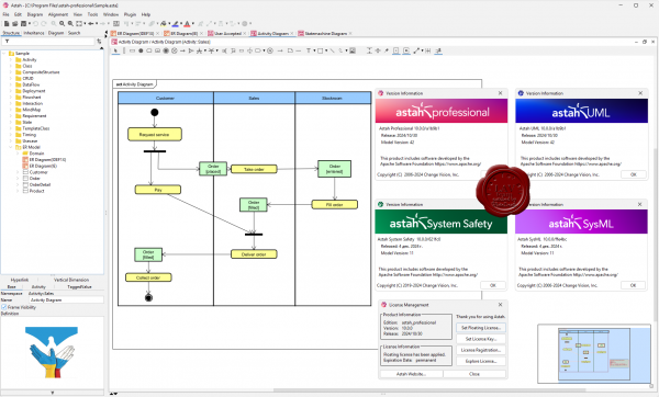
Professional
Create UML, ER Diagram, Flowchart, and Data Flow Diagram and develop a clear understanding of your software design for yourself and your teams. You can easily draw a variety of diagrams to visualize complex systems and keep them consistent. API and free plug-ins are also available to tailer Astah to fit your needs!
UML
When UML modeling drives your development process, you need a tool that is specifically designed for UML and will give you all the features you need – without being too complicated. That’s Astah UML. A simple to learn, simple to use tool, Astah UML will allow you to create the UML diagrams you need.
System Safety
Astah System Safety is a modeling tool for safety-critical systems to support system architecture modeling, system safety assessment and analysis by incorporating the following modeling languages and techniques in one tool: SysML, UAF (Unified Architecture Framework), STAMP/STPA, GSN/D-Case, ASAM SCDL. Traceability is assured between models (e.g. requirements and solutions) and API enables the integration with other applications.
SysML
Astah SysML is a powerful SysML (Systems Modeling Language) modeling tool which is perfect for systems engineering. Our user-friendly tool helps create a clear understanding among business analysts, engineers, developers, and quality assurance specialists with Astah SysML. |
| |
 Читать статью дальше (комментариев - 0)
| |
|
 |
 Автор: Williams Автор: Williams
 Дата: 22 декабря 2024 Дата: 22 декабря 2024
 Просмотров: 4 316 Просмотров: 4 316 |
| |
Dlubal RFEM v6.04.0011
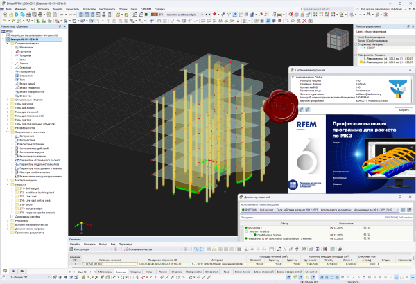
Программа RFEM для расчета методом конечных элементов - это мощное программное обеспечение для быстрого и простого моделирования, структурного анализа и проектирования 2D и 3D моделей, состоящих из стержней, плит, стен, составных плит, оболочек и твердых элементов. Благодаря модульному концепту программного обеспечения, возможно объединение основной программы RFEM с соответствующими дополнительными модулями для удовлетворения ваших индивидуальных требований.
Программа для расчета конструкций RFEM является основой модульного программного комплекса. Базовая программа RFEM используется для задания конструкций, материалов и нагрузок для плоских и пространственных конструктивных систем, состоящих из плит, стен, оболочек и стержней. Возможно создание комбинированных конструкций, а также моделирование объемных и контактных элементов. В программе RFEM рассчитываются деформации, внутренние силы, напряжения, опорные реакции, а также контактные напряжения основания. Дополнительные модули облегчают ввод данных путем автоматического создания конструкций и соединений либо могут выполнять дальнейший анализ и моделирование в соответствии с различными стандартами.
Благодаря широкому спектру интерфейсов RFEM обеспечивает идеальное взаимодействие с программами САПР и расчета конструкций в информационном моделировании зданий (BIM). Например существует двусторонний обмен данными между RFEM и программами Tekla Structures, Revit Structure, Bentley ISM. |
| |
 Читать статью дальше (комментариев - 56)
| |
|
 |
 Автор: Williams Автор: Williams
 Дата: 21 декабря 2024 Дата: 21 декабря 2024
 Просмотров: 135 Просмотров: 135 |
| |
Thermo Fisher Scientific Amira/Avizo 2024.2
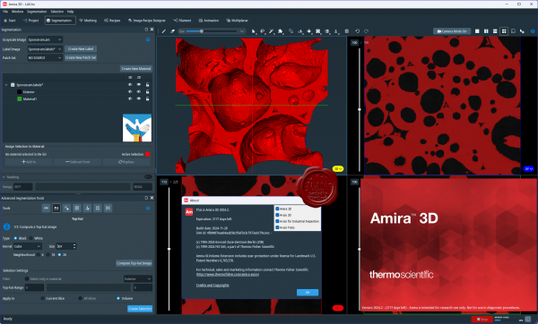 AVIZO is materials characterization and quality control software for imaging data analysis and quality assurance. Analysis and visualization of your imaging data allows better understanding of your materials structure, properties and performances. No matter what scale and data modality you use, your organization profile (large industrial company, core imaging facility, national or local service laboratory, academic institution) AVIZO provides optimized workflows for advanced materials characterization and quality control from a single environment. AVIZO is universal, reliable, fully automatable and customizable digital analytical labs. Materials scientists and engineers can innovate faster, produce more reliable and better performing materials and processes while reducing cost and time to discoveries. AVIZO is materials characterization and quality control software for imaging data analysis and quality assurance. Analysis and visualization of your imaging data allows better understanding of your materials structure, properties and performances. No matter what scale and data modality you use, your organization profile (large industrial company, core imaging facility, national or local service laboratory, academic institution) AVIZO provides optimized workflows for advanced materials characterization and quality control from a single environment. AVIZO is universal, reliable, fully automatable and customizable digital analytical labs. Materials scientists and engineers can innovate faster, produce more reliable and better performing materials and processes while reducing cost and time to discoveries.
AMIRA is software for biomedical and life science research. Powerful, multifaceted 2D–5D software for visualization, processing and analysis of microscopy imaging serving Life and Biomedical Sciences. AMIRA is a powerful, comprehensive, and versatile 2D–5D solution for visualizing, analyzing and understanding life science and biomedical research data from many image modalities, including Optical and Electron Microscopy, CT, MRI and other imaging techniques. With incredible speed and flexibility, Amira Software supports advanced 2D–5D bioimaging workflows in research areas ranging from structural and cellular biology to tissue imaging, neuroscience, preclinical imaging and bioengineering. From any 3D image data, including time series and multi-channel, AMIRA delivers a comprehensive range of data visualization, processing and analysis capabilities. Amira Software allows life science and biomedical researchers to gain invaluable insights into their data, at different scales and from any modality. |
| |
 Читать статью дальше (комментариев - 1)
| |
|
 |
 Автор: Williams Автор: Williams
 Дата: 20 декабря 2024 Дата: 20 декабря 2024
 Просмотров: 458 Просмотров: 458 |
| |
Bentley OpenUtilities Substation 2024 v24.00.00.84
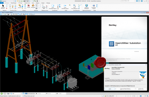
OpenUtilities Substation is an electric substation design software.
OpenUtilities Substation provides a comprehensive, integrated set of capabilities that make the design process faster, easier, and more efficient. Avoid rework, reduce errors, and enhance collaboration with linked and cross-referenced 3D layouts and electrical drawings. Capture best practices and enforce standards with automatic error checks, bills of material, and construction prints.
Easily create intelligent 3D substation models from a database of intelligent objects. You can use the model to seed, create, link, and maintain consistency across 2D drawings, electrical schematics, and reports. And maximize efficiencies when your project moves beyond the design phase, speed construction and enhance operations by sharing the 3D model produced.
Design Substation Physical Layout
- Perform layout in 3D using a catalog of equipment objects that snap together at predefined hook points.
- Move groups of connected equipment as units to change positions quickly.
- Use built-in 3D tools to design the grounding grid and lightning protection and analyze cable sag, clearances, and clashes.
Design Substation Protection And Control
- Produce linked and cross-referenced one-line diagrams, wiring diagrams, schematics, and panel layouts.
- Speed design with wires that break and heal automatically as you place or remove symbols.
- Save time and increase quality with automatic wire numbering, device tagging, error checking, and more.
Estimate Substation Materials
- Create reports automatically with a parts database that connects every 3D object and electrical symbol to detailed parts data.
- Publish accurate bills of materials, wire length reports, purchase order lists, and more.
- Update these reports quickly to keep up with design revisions.
Generate Substation Construction Deliverables
- Produce 2D construction drawings automatically from the 3D substation model.
- Define and publish plan, elevation, and isometric views using configurable drawing templates that promote company standards.
- Eliminate hours of manual updates by simply republishing drawings when design changes occur.
|
| |
 Читать статью дальше (комментариев - 2)
| |
|
 |
 Автор: Williams Автор: Williams
 Дата: 18 декабря 2024 Дата: 18 декабря 2024
 Просмотров: 372 Просмотров: 372 |
| |
Bentley Promis.e 2024 v24.00.00.84
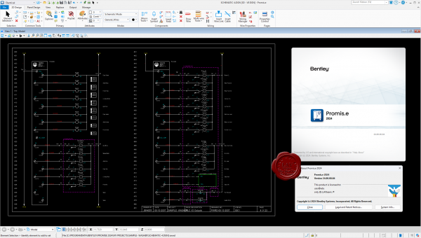
Promis.e is intelligent software for control system design. With Promis.e users can generate electrical schematics, panel layouts, bills of material, wire lists, terminal plans, and more in record time. Promis.e streamlines the design process by performing many tedious operations automatically, including ID assignment, cross referencing, wire numbering, and list generation. These tasks are completed much faster and with fewer errors compared to manual methods. Support for multiple disciplines allows users to include electrical, hydraulic, pneumatic, and process control diagrams in projects. Promis.e runs as a MicroStation PowerPlatform product. |
| |
 Читать статью дальше (комментариев - 3)
| |
|
 |
 Автор: Williams Автор: Williams
 Дата: 15 декабря 2024 Дата: 15 декабря 2024
 Просмотров: 225 Просмотров: 225 |
| |
Tecplot 360 EX + Chorus 2024 R1 Maintenance Release 1
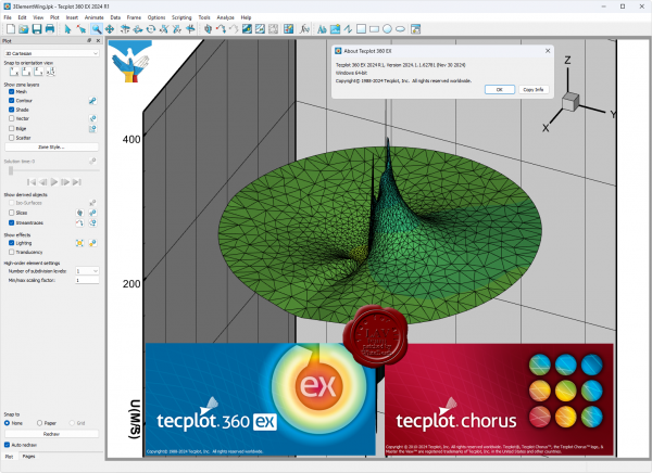
Tecplot 360 integrated postprocessing environment allows you to analyze detailed flow-field data while producing exceptional visual output. Spend less time waiting and more time discovering. More CFD simulations are being run, grid sizes are getting larger, and data sets are being stored remotely. It’s essential that you have the right tools to handle large data sets, automate workflows, and visualize parametric results. Integrate XY, 2D, & 3D plots and get them looking exactly the way you want. Communicate your results with brilliant images and animations. Analyze complex results, explore billion-cell models, verify engineering designs, automate routine tasks, and get excellent technical help when you need it.
Tecplot Chorus has a unique set of features that help you explore datasets from multiple simulations, compare results and evaluate overall system performance. This tool helps engineers who run and generate many simulation or test data sets. The most common applications are: Optimizing your designs; Developing aero databases; Predicting performance over the operating envelope; Investigation an engineering problem. In all these scenarios engineers need to manage their solution data, discover the trends and anomalies in output variables, and understand the underlying physics that cause these variations. |
| |
 Читать статью дальше (комментариев - 2)
| |
|
 |
| ПОИСК ПО САЙТУ |
 |
|
 |
| КАЛЕНДАРЬ | | |
 |
| « Октябрь 2025 » |
|---|
| Пн | Вт | Ср | Чт | Пт | Сб | Вс |
|---|
| | 1 | 2 | 3 | 4 | 5 | | 6 | 7 | 8 | 9 | 10 | 11 | 12 | | 13 | 14 | 15 | 16 | 17 | 18 | 19 | | 20 | 21 | 22 | 23 | 24 | 25 | 26 | | 27 | 28 | 29 | 30 | 31 | |
|
 | |
| |
|