|
 |
 Автор: Williams Автор: Williams
 Дата: 26 апреля 2019 Дата: 26 апреля 2019
 Просмотров: 5 992 Просмотров: 5 992 |
| |
Schlumberger Petrel 2016.3
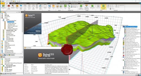
Petrel is an integrated software solution that enables you to solve all your subsurface challenges - from seismic interpretation through reservoir simulation. Petrel eliminates the communication problems that exist between different software packages and associated technical disciplines. All work processes in Petrel contribute to developing and refining the same volumetric earth model, static to dynamic. The common environment and workflow automatically captures your knowledge as your work progresses. This eliminates the information mismatch or information loss that is common when using individual applications. Now you can easily integrate new data, rapidly updating earth models and lowering your overall E&P risk.
Benefits
- All tools from seismic interpretation to simulation are integrated in one application, eliminating import and export problems and promoting collaboration.
- Strong visualization capabilities give you instant QC of all data in 3D.
- Models can be updated instantly when new data arrives to make quicker and more reliable decisions.
- All results can be copy-pasted to any Windows application making it quick and easy to report and present your latest results.
- Petrel has a familiar Windows user interface, undo/redo functionality, and stores modeling history, making it easy to use and learn.
- Petrel Modules.
- Geophysics.
- Geology.
- Reservoir Engineering
- Well Engineering.
- Data and Results Viewer.
|
| |
 Читать статью дальше (комментариев - 26)
| |
|
 |
 Автор: Williams Автор: Williams
 Дата: 24 апреля 2019 Дата: 24 апреля 2019
 Просмотров: 2 820 Просмотров: 2 820 |
| |
Applications in CADD n4ce Designer v4.10d
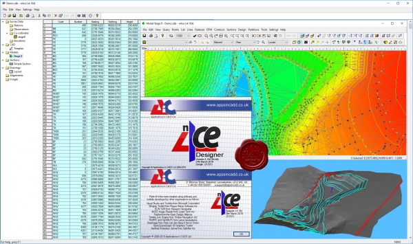
n4ce is a powerful survey processing and modelling all in one Field to Finish software suite!
Survey data import and processing from all modern survey instruments including total stations and GNNS. Providing building surveys, traverse, free station and LS network adjustments with error checking and reporting.
Includes a CAD editor, section creation and plotting, volumes, design and point cloud processing. Applications are available for geological modelling, roads design and river sections. I/O data formats include AutoCAD DWG, Bentley MX, LiDAR, Excel CSV and universal XML. Three editions are available; Lite, Professional and Designer.
Whist n4ce Professional more than satisfies most users needs, the n4ce Designer edition introduces advanced user tools for geological modelling, alignments, rail surveys, LiDAR modelling and point cloud editing.
The point cloud tools are extended within n4ce Designer, to include sectioning. This is useful when working with elevations, as points can be isolated and height shaded, based on distance from the sectioning plane. Shapes can also be automatically recognised in sectioning planes, such as circles.
LiDAR models allow n4ce to work with mass data for contours, sections and volumes. n4ce Designer provides tools for editing these models, including updating grid levels with ground survey data. LiDAR grids can be generated from point clouds. The point cloud engine can be used to bring in mass LiDAR data, so isolated areas can be identified, and points exported to a smaller LiDAR model for further processing.
Alignments are introduced with n4ce Designer, allowing the creation and I/O of both horizontal and vertical alignments. Simple carriageways can be designed, with both super elevation and road widening.
|
| |
 Читать статью дальше (комментариев - 12)
| |
|
 |
 Автор: Williams Автор: Williams
 Дата: 23 апреля 2019 Дата: 23 апреля 2019
 Просмотров: 1 662 Просмотров: 1 662 |
| |
Studio Tecnico Guerra Thopos 2019 v7.06.00
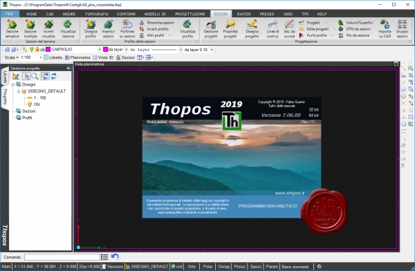
Thopos is a software topography equipped with CAD autonomous instruments, entities and functionality targeted for use in field surveying. The program is suitable for surveyors and engineers and surveyors is a comprehensive and reliable to manage all operations topographic relief in the country, thanks to the controller integrated GPS, development, design to final drafting of the drawings.
|
| |
 Читать статью дальше (комментариев - 20)
| |
|
 |
 Автор: Williams Автор: Williams
 Дата: 22 апреля 2019 Дата: 22 апреля 2019
 Просмотров: 1 191 Просмотров: 1 191 |
| |
Chemstations CHEMCAD Suite v7.1.5.11490
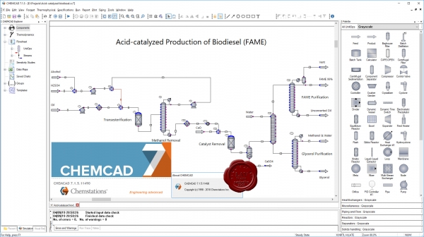
CHEMCAD – пакет программ для моделирования и расчета технологических схем с рециклическими потоками органических и неорганических веществ и непрерывных смесей (в случае нефтяных фракций), а также энергетических потоков. CHEMCAD позволяет создавать, анализировать и оптимизировать различные варианты технологического оформления производственных процессов, оценивать их эффективность и выбирать наилучший из них. Комплекс исследований с использованием CHEMCAD дает возможность добиться удовлетворительного совпадения результатов расчетов с данными промышленных экспериментов, что позволяет решать задачи автоматического управления процессами и повышения эффективность действующих производств, определения оптимальных режимных и конструкционных параметров процессов в отдельных аппаратах с позиции всего производства в целом.
CHEMCAD предназначен для:
- подготовки оптимальных исходных данных по единицам оборудования и трубопроводным системам для рабочего инженерно-технического проектирования при создании новых, а также реконструкции и диверсификации действующих химических и нефтехимических производств;
- исследования и оптимизации работы систем автоматического регулирования химико-технологических процессов, в том числе и в составе систем автоматизированного управления технологическими процессами (АСУТП);
разработки динамических моделей действующих технологических процессов, так называемых «виртуальных производств» при создании тренажеров для операторов и инженеров химических производств.
CHEMCAD включает:
- базы данных по свойствам индивидуальных веществ и различные методы их прогнозирования;
- программные модули для вычисления отсутствующих в базе данных свойств индивидуальных веществ и их смесей (а также параметров уравнений для их расчета) по минимальному объему экспериментальных данных и структурным формулам их молекул;
базы данных по расчетным модулям типовых процессов химической технологии, протекающих в реакторах, абсорбционных, ректификационных и экстракционных колоннах (с тарелками и насадками различных типов, а также для случая совмещенных процессов хемосорбции и хеморектификации), дистилляционных аппаратах, теплообменниках различных типов (кожухотрубных и пластинчатых, аппаратах воздушного охлаждения и теплообменниках типа «труба в трубе»), компрессорах, насосах, фильтрах, центрифугах, дробилках, кристаллизаторах, циклонах, сушилках и др.;
- расчетные модули для определения конструкционных параметров типового оборудования химических производств – колонных аппаратов, теплообменников, резервуаров, трубопроводов, диафрагм, аппаратов высокого давления и др.;
- программные модули для проведения расчетных исследований и оптимизации технологических схем химических производств, в том числе и периодической ректификации;
- программные модули для расчета параметров динамических режимов химических реакторов и колонных аппаратов абсорбции и ректификации совместно регуляторами и исполнительными устройствами;
- программные модули для расчета стоимости единиц оборудования химических производств. |
| |
 Читать статью дальше (комментариев - 9)
| |
|
 |
 Автор: Williams Автор: Williams
 Дата: 21 апреля 2019 Дата: 21 апреля 2019
 Просмотров: 16 382 Просмотров: 16 382 |
| |
Autodesk AutoCAD Civil 3D 2020 x64 eng+rus
+ LYNDA Autodesk Civil 3D 2020 Essential Training
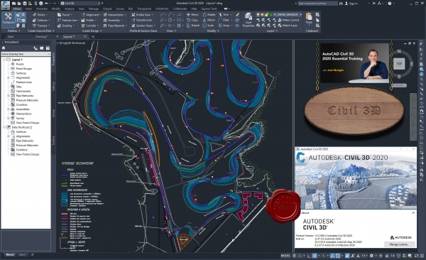
AutoCAD Civil 3D - программа, базирующаяся на платформе AutoCAD и предназначенная для землеустроителей, проектировщиков генплана, проектировщиков линейных сооружений. Ключевой особенностью программы является интеллектуальная связь между объектами, позволяющая динамически обновлять все связанные объекты при внесении изменений в результаты изысканий или проектные решения.
Благодаря таким возможностям, как передача полевых данных, расчеты и автоматизированное черчение, инструменты AutoCAD Civil 3D оптимизируют все процессы, связанные со строительством инженерных сооружений. AutoCAD Civil 3D объединяет весь цикл проектных работ - от геодезических изысканий до возведения объекта.
Основные преимущества:
- быстрое формирование концепции и выполнение проекта;
- гибкое проектирование, основанное на взаимодействии объектов, позволяющее добиться аккуратности и связности всех частей проекта;
- многопользовательский доступ к проекту и его элементам;
- возможность быстрой разработки, оценки проекта и подготовки выходной документации;
- совмещение чертежных возможностей AutoCAD и специализированных функций проектирования;
- богатый набор функций API (интерфейс прикладного программирования), позволяющий строить решения, основанные на общих моделях данных;
- возможность расширения функционала;
- модель динамического проектирования, содержащая основные элементы геометрии и поддерживающая интеллектуальные связи между объектами (точки, поверхности, земельные участки, дороги и планировка);
- поддержка чертежных стандартов и стилей;
- автоматическое формирование планов;
- функциональные возможности AutoCAD Map 3D.
Геопространственный анализ при концептуальном проектировании
Интеграция растровых и геопространственных данных помогает принимать оптимальные решения на ранних этапах проекта. Для визуализации экосистемы проекта вы можете извлекать изображения и модели поверхности из службы Google Earth, а также из других источников. Вы также можете импортировать геопространственные данные, такие как типы почвы, информацию по землепользованию и экологические ограничения, для быстрого анализа возможного влияния различных проектных альтернатив.
Геодезические изыскания и системы координат
Возможности обработки геодезических данных полностью встроены в AutoCAD Civil 3D. Поддерживается широкий круг задач - импорт полевых журналов, обработка методом наименьших квадратов, задание и преобразование системы координат, редактирование результатов съемки, автоматическое создание фигур съемки и поверхностей. Таким образом обеспечивается сквозное проектирования: точки, фигуры съемки и поверхности могут использоваться на протяжении всего процесса проектирования, что исключает необходимость ручного преобразования систем координат и переноса данных из геодезического приложения в приложение для проектирования. Введение в проект данных съемки приведет к автоматическому обновлению элементов проекта.
Профилирование и динамические взаимосвязи
Модели сложных поверхностей в AutoCAD Civil 3D поддерживают динамические связи с исходными данными - горизонталями, характерными линиями, моделями коридоров и объектами профилирования. Поверхности используются в качестве основы при создании профилей, сечений и коридоров. Любые изменения исходных данных приводят к автоматическому обновлению поверхностей и ссылок, что способствует экономии времени и сокращению количества ошибок. Набор инструментов для профилирования позволяет моделировать поверхности для проекции профиля любого типа. Графические и табличные функции управления профилированием удобны в использовании. Функции профилирования используют динамическую взаимосвязь между моделями коридоров и трассами/профилями.
Информационное моделирование дорог
На основе заданных локальных проектных критериев можно осуществлять быстрое построение динамических планов и профилей. Определенные в критериях зависимости продолжают действовать и при оптимизации трасс - например, поэлементной и по вершинам углов. Средства моделирования коридоров позволяют создавать интеллектуальные модели дорог и других линейных объектов. При моделировании коридоров для объектов различного назначения используются настраиваемые компоненты поперечного сечения, называемые элементами конструкции. При описании переходов в коридорах допускается непосредственное использование трасс, фигур съемки, характерных линий и полилиний AutoCAD. Функция интерактивного построения перекрестков позволяет создавать комплексные модели пересечений дорог, которые отражают все изменения в проекте. Модели коридоров могут использоваться при создании проектных поверхностей, вычислении объема земляных работ, ведомостей материалов, построения поперечных сечений и в других задачах.
Интеллектуальная компоновка трубопроводов
Системы хозяйственно-бытовой и ливневой канализации строятся на основании правил. Трубы и колодцы редактируют с использованием как графического, так и ручного ввода; для них существует также функция проверки пересечений. Вы можете формировать чертежи трубопроводных сетей на видах в плане, профилях и сечениях. Для анализа трубопроводной сети, например, по отметкам, размерам, уклону и типу можно экспортировать данные во внешние приложения для расчетов, либо использоватьвстроенное в AutoCAD Civil 3D расширение Hydraflow Extensions.
Гидравлические и гидрологические расчеты
Используя встроенные средства, можно выполнять предпроектные и постпроектные гидрологические расчеты. По гидрологическим графикам в AutoCAD Civil 3D можно анализировать модели трубопроводных сетей, водопропускных труб и каналов с целью нахождения наиболее оптимального проектного решения. Кроме того, вы можете формировать полноценные отчеты для предъявления надзорным органам.
Динамические ведомости материалов и расчет объемов земляных работ
Информация по покупным изделиям может быть непосредственно импортирована в AutoCAD Civil 3D для назначения стоимостей объектам чертежа, включая объекты AutoCAD и элементы модели AutoCAD Civil 3D. Поддерживается автоматическое вычисление количества покупных изделий и создание отчетов. Возможности расчета перемещения земляных масс и объема земляных работ позволяют инженерам и подрядчикам подробно планировать строительные работы. При внесении изменения в проект AutoCAD Civil 3D может быстро сформировать диаграммы перемещения земляных масс, которые позволяют получить представление о расстояниях, объемах и направлениях перемещения грунта, расположении карьеров и местах выгрузки.
Визуализация и передача проектного замысла
Публикация данных по модели в форматах Google Earth и 3D DWF позволяет просто и эффективно донести информацию до нетехнических специалистов и заказчиков. Для более убедительной визуализации моделей коридоров вы можете применять при тонировании различные материалы для элементов коридора, например асфальт, бетон или гравий. Autodesk 3ds Max Design поможет вам создавать фотореалистичные анимационные ролики на основе данных AutoCAD Civil 3D. |
| |
 Читать статью дальше (комментариев - 23)
| |
|
 |
 Автор: Williams Автор: Williams
 Дата: 20 апреля 2019 Дата: 20 апреля 2019
 Просмотров: 1 683 Просмотров: 1 683 |
| |
midas MeshFree V300 R2 Advanced
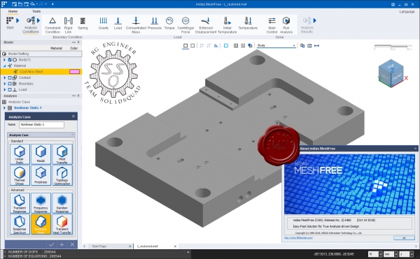
midas MeshFree - доступное комплексное программное обеспечение для инженерных расчетов и оптимизации проектных решений.
midas MeshFree is a design and analysis cutting-edge technology developed as a joint project with Samsung Electronics. MeshFree performs finite element analysis on the original CAD model without need for meshing or defeaturing. MeshFree frees you from all the difficulties of today’s design and analysis software. |
| |
 Читать статью дальше (комментариев - 9)
| |
|
 |
 Автор: Williams Автор: Williams
 Дата: 19 апреля 2019 Дата: 19 апреля 2019
 Просмотров: 1 600 Просмотров: 1 600 |
| |
CCTV Design Software IP Video System Design Tool v10.0.1805
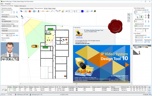
With IP Video System Design Tool you can:
- Increase efficiency of your security system while lowering costs finding the best camera locations.
- Calculate precise camera lens focal length , viewing angles and pixel density (PPM/PPF) in seconds.
- Check identification, recognition, observation, detection and monitoring zones of each camera on your site plan.
- Minimize dead zones to increase the security level of your premises using 2D and 3D modeling.
- Get estimations of required network bandwidth and calculate the required HDD storage space for video archives.
- Load site plan or floor plan from JPEG, PNG, PDF, TIFF file. Import AutoCAD DWG drawings (Pro)
- Print or export your project to PDF. Copy your calculations, drawings and 3D mockups to MS Word, Excel, Visio or other software to create an excellent project documentation.
Only with IP Video System Design Tool you can calculate both network bandwidth and storage space for 15 camera resolutions and several compression methods, including H.264, MPEG-4 and Motion JPEG. IP Video System Design Tool enables the system designer to find optimal FPS and compression that tailors to LAN capabilities and calculate required HDD storage space. Frame size estimations are based on the result of our own compression research, thanks to our extensive knowledge of compression algorithms and wide range of real-life CCTV experimental data.
IP Video System Design Tool includes a field of view calculator, lens focal length, CCTV storage and bandwidth calculators, pixel density and resolution calculator and many other CCTV tools so you can design a video surveillance system quickly, easily and professionally. |
| |
 Читать статью дальше (комментариев - 9)
| |
|
 |
 Автор: Williams Автор: Williams
 Дата: 17 апреля 2019 Дата: 17 апреля 2019
 Просмотров: 620 Просмотров: 620 |
| |
Wolverine Software Student P5 v1.2
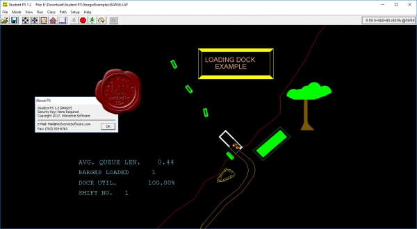
At Wolverine, we develop discrete-event simulation software that allows you to place your system under a microscope and explore its operation under laboratory conditions. Wolverine Software Student P5 is 2D Process Simulator and Animator Software.
All 'Student' limitations are removed. |
| |
 Читать статью дальше (комментариев - 3)
| |
|
 |
| ПОИСК ПО САЙТУ |
 |
|
 |
| КАЛЕНДАРЬ | | |
 |
| « Октябрь 2025 » |
|---|
| Пн | Вт | Ср | Чт | Пт | Сб | Вс |
|---|
| | 1 | 2 | 3 | 4 | 5 | | 6 | 7 | 8 | 9 | 10 | 11 | 12 | | 13 | 14 | 15 | 16 | 17 | 18 | 19 | | 20 | 21 | 22 | 23 | 24 | 25 | 26 | | 27 | 28 | 29 | 30 | 31 | |
|
 | |
| |
|