|
 |
 Автор: Williams Автор: Williams
 Дата: 14 декабря 2019 Дата: 14 декабря 2019
 Просмотров: 2 327 Просмотров: 2 327 |
| |
Golden Software Voxler v4.6.913 x32+x64
Golden Software Voxler - это инновационный способ графического представления трёхмерных данных. Оно позволяет импортировать данные из различных источников и создавать высококачественные графики, отражающие сложные взаимосвязи между данными. Golden Software Voxler представляет собой многофункциональную интерактивную графическую среду для обработки моделей и данных любой сложности. Удобный интерфейс обеспечивает быструю визуализацию, оценку, исследование и проверку ваших данных.
Golden Software Voxler может использоваться в различных областях:
- В геологии (при работе с трёхмерными данными по скважинам) и петрографии, для проведения сейсмических исследований.
- В метеорологии для исследования атмосферы путём сбора и обработки трехмерных данных.
- В океанологии для исследования температуры воды, уровня солёности и степени загрязнения.
- В биологии и медицине (для проведения ультразвуковых исследований).
- В инженерном деле, статистике, сейсмологии и др.
Основные спецификации:
- Возможность создания изоповерхностей, позволяет расширить возможности контурного графика и изобразить поверхность постоянных значений в трех измерениях. Вы можете изобразить несколько изоповерхностей на одном графике, выбрав для каждой свой цвет и степень прозрачности.
- На объёмном графике каждому элементу трехмерной сетки назначается цвет и уровень прозрачности. Функция ClipPlane позволяет сделать срез под любым углом.
- На контурном графике отображаются линии постоянных значений плоскости. Вы можете размещать плоскость и контуры под любым углом.
- На графиках height field данные обозначаются различными цветами на прямоугольной плоскости, расположенной в трехмерном пространстве, или на двухмерной криволинейной сетке. Амплитуда данных представляется в виде сдвига вверх или вниз перпендикулярно этой плоскости или криволинейной сетке.
- График потоковых линий отображает путь частиц в поле скорости, распределение скоростей среднего в трёхмерном пространстве. С помощью цвета обозначается амплитуда скоростей.
- На векторном графике изображаются линии или вектора, указывающие направление и амплитуду значений компонентов трехмерной сетки или точечного набора данных. Амплитуда значений обозначается длиной и цветом вектора.
- График рассеяния отображает символы в пространстве координат (XYZ), указанном в файле данных. Если в файле данных содержатся значения для каждой точки, эти значения обозначаются различными цветами.
- Вы можете в любом графике расположить несколько отсекающих плоскостей под различным углом, для отображения только той его области, которая представляет интерес.
- Voxler позволяет создавать равномерную трехмерную сетку, используя метод инверсного расстояния и локального многочлена, для данных XYZC, имеющих разброс, (координаты XYZ со значением C). Также вы можете вычислять различные показатели в рамках заданного радиуса поиска, включая минимальное, максимальное и среднее значение, квартили, стандартное отклонение, дисперсию, численность, плотность и расстояние до ближайшей или самой дальней точки.
- Voxler предоставляет вам различные возможности для выполнения вычислений, включая фильтры для избежания повторяющихся точек, удаления данных на основе значений осей X, Y, Z или данных, вычисления различных показателей и обработки изображения. Дополнительные модули позволяют производить вычисления одновременно с тремя файлами, содержащими трёхмерные графики, объединять до пяти таких файлов, осуществлять повторную выборку, работать с подмножествами и выполнять операции преобразования.
- Вы можете добавлять освещение в график, используя такие опции как рассеянный свет, осветитель, направленный свет, световое пятно, освещение точечным источником света, а также выбирать цвет, интенсивность и направление освещения. Для размещения источников света можно воспользоваться графическим инструментом Dragger.
|
| |
 Читать статью дальше (комментариев - 10)
| |
|
 |
 Автор: Williams Автор: Williams
 Дата: 13 декабря 2019 Дата: 13 декабря 2019
 Просмотров: 3 125 Просмотров: 3 125 |
| |
Rarlab WinRAR v5.80 bra+chi+eng+fra+ger+ita+rus+tur x32+x64
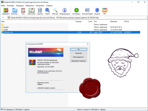
Архиватор RAR является самой распространенной программой после операционной системы и браузера, ведь большинство программ и в Интернете, и у пользователей хранятся в сжатом виде в архивах.
WinRAR – мощная утилита для создания и управления архивами, содержащая целый спектр дополнительных полезных функций. Программа WinRAR ежедневно используется миллионами людей во всем мире для экономии места на ПК и быстрой передачи файлов.
WinRAR больше не поддерживает Windows 98, Windows Me, Windows NT.
What's new in the latest version:
Version 5.80
1. "Preserve source files last access time" option on "Time" page
of archiving dialog permits to preserve the original last access time
of archiving files.
2. Command line -tsp switch can be used to preserve the original
last access time of archiving files. It can be combined with other
-ts switches, like: rar a -tsc -tsp arcname files
3. It is allowed to combine several modifiers in the same -ts switch.
For example, we can use -tscap instead -tsc -tsa -tsp.
4. WinRAR can read default values of command line switches from rar.ini
text file, which can be stored either in the same folder as WinRAR.exe
or in %APPDATA%\WinRAR folder. This file includes strings in following
format:
switches=<any RAR switches separated by spaces>
switches_<command>=<any RAR switches separated by spaces>
First applies switches to all and second to individual commands.
For example:
switches=-m5 -s
switches_x=-o+
Most of switches specified in rar.ini are used only in the command line
mode. Some switches can be applicable both in shell and in command line
modes. Previously this rar.ini format was supported only by console RAR.
5. Command line -agf<default_format> switch specifies the default format
string for -ag switch. It has a practical value only if placed to
rar.ini configuration file or to RAR environment variable.
For example, if we set RAR environment variable to -agfYYYY-MMM-DD,
we can use -ag without a parameter with YYYY-MMM-DD format string
assumed.
6. Switches -ed and -e+d can be used in archive processing commands
for any combination of RAR and archive operating systems.
In older versions RAR for Windows could not use them for Unix RAR
archives also as RAR for Unix for Windows RAR archives.
7. Previously "Test" command failed to check integrity of archived NTFS
alternate data streams and issued "Unknown data header format" warning
if size of such stream exceeded 16 MB. This limitation is removed now.
8. Archiving speed for large NTFS alternate data streams on multi-core
CPUs is increased.
9. "Find" command:
a) when extracting encrypted files directly from "Search results"
dialog, password prompt was issued for every found file
even if all files belonged to same archive.
Now password is requested only once per archive;
b) Ctrl+A hotkey selects all files in "Search results".
10. Archive comment window:
a) previous versions did not allow to use Ctrl+W shortcut to close
WinRAR when comment window had keyboard focus. Now Ctrl+W works
also from comment window;
b) mouse wheel is supported also for comments with ANSI Escape sequences;
c) for some lenghty comments with ANSI Escape sequences last line
of comment was visible only partially even after scrolling up to
bottom. It is displayed comletely now.
11. Maximum path length for files in 7z archives is increased up to
2048 characters. While such lengthy paths were already supported
for RAR and ZIP formats, previous versions limited the path length
to 260 characters for 7z archives.
12. If archive or file name is too lengthy to fit to archiving
or extraction progress window, it is truncated. Previously such names
were truncated at the end, making the file extension invisible.
This version truncates them removing the path component and symbols
in the middle, but preserving beginning of file name and file extension.
13. If files selected for archiving differ only by extension,
a proposed archive name is based on their name part.
For example, archiving dialog will propose Readme.rar if we selected
Readme.txt and Readme.doc.
Previous versions always generated the archive name based on parent
folder name for several selected files.
14. "Symlink" and "Hardlink" is diplayed in "Type" column for symlink
and hardlink records in .tar archives. Previous versions displayed
a proper type for such records only in .rar archives.
15. Copying and pasting files from large archives could fail if
extraction took a lot of time. This version can paste files from
such archives as well, but we have to start extraction already on
"Copy" command and not on "Paste" to achieve this.
16. Similarly to RAR5 volumes, recovery volumes in RAR4 format use
the same width of volume number field as corresponding RAR volumes.
While previously WinRAR could create arc.part01.rar and arc.part1.rev
in RAR4 format, now both types of volumes will use "part01".
17. "Set font..." button in "Settings/File list" also changes the folder
tree panel font. Previously it changed only the file list font.
18. "Find files" and command line mode "i" commands:
a) if "Use all tables" option or "t" modifer of "i" command are used,
additionally to already supported ANSI, OEM and UTF-16 encodings
WinRAR will search the specified string in UTF-8 files as well;
b) better support for Unicode text strings;
c) better performance, especially for case insensitive search;
d) hexadecimal search output includes both text and hexadecimal
representation of found matches.
19. File and total progress bar is displayed when unpacking
tar.bz2, tar.gz, tar.lz, tar.xz, tar.z archives.
Previously only the total progress was displayed properly for tar.bz2,
tar.gz and tar.z. Neither file nor total progress was displayed
for tar.lz and tar.xz.
20. "File list/Files/Exact sizes" option also changes the file size format
in WinRAR status bar.
21. Bugs fixed:
a) if non-existent path is specified in archive name in archiving
dialog, WinRAR proposes to create such path. Previous versions
could create such path in WinRAR start-up folder instead of
currently displayed folder;
b) WinRAR could crash when adding the recovery record in RAR5 format
on CPUs not supporting CPUID EAX=7 command and returning random
data in response. These are some CPUs from early 2000s;
c) WinRAR failed to create archives after dragging files with
right mouse button in Windows shell, dropping them to another folder,
selecting "Add to archive..." in context menu and enabling
"Put each file to separate archive" option;
d) "winrar r *.zip" command repaired only the first ZIP archive
in the set if all archives had numeric names like 1.zip, 2.zip
and signatures in the beginning of archives were missing;
e) previous WinRAR version failed to unpack folder records
in archives created by RAR 1.50;
f) in rare cases WinRAR failed to extract and reported an error
for valid .gz archives produced by some compression optimization
tools;
g) progress bar in tray icon never reached 100% in high DPI mode;
h) creation and last access time was not displayed for archived folders
if folder records were stored in archive after folder contents;
i) "Skip encrypted archives" option in "Convert archives" command
did not work for 7-Zip archives with headers encryption. |
| |
 Читать статью дальше (комментариев - 17)
| |
|
 |
 Автор: Williams Автор: Williams
 Дата: 12 декабря 2019 Дата: 12 декабря 2019
 Просмотров: 5 992 Просмотров: 5 992 |
| |
CSI ETABS v18.1.0 build 2117 x64
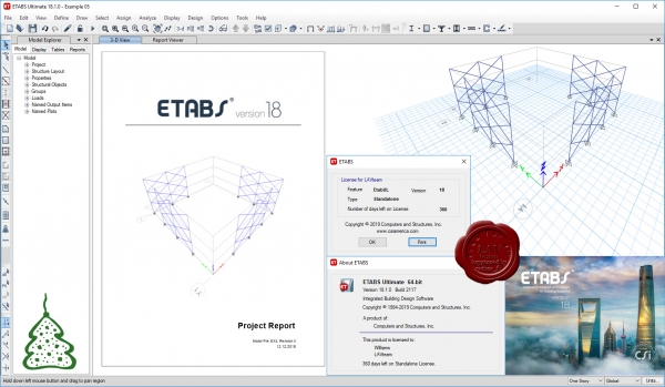
The innovative and revolutionary new ETABS is the ultimate integrated software package for the structural analysis and design of buildings. Incorporating 40 years of continuous research and development, this latest ETABS offers unmatched 3D object based modeling and visualization tools, blazingly fast linear and nonlinear analytical power, sophisticated and comprehensive design capabilities for a wide-range of materials, and insightful graphic displays, reports, and schematic drawings that allow users to quickly and easily decipher and understand analysis and design results.
From the start of design conception through the production of schematic drawings, ETABS integrates every aspect of the engineering design process. Creation of models has never been easier - intuitive drawing commands allow for the rapid generation of floor and elevation framing. CAD drawings can be converted directly into ETABS models or used as templates onto which ETABS objects may be overlaid. The state-of-the-art SAPFire 64-bit solver allows extremely large and complex models to be rapidly analyzed, and supports nonlinear modeling techniques such as construction sequencing and time effects (e.g., creep and shrinkage). Design of steel and concrete frames (with automated optimization), composite beams, composite columns, steel joists, and concrete and masonry shear walls is included, as is the capacity check for steel connections and base plates. Models may be realistically rendered, and all results can be shown directly on the structure. Comprehensive and customizable reports are available for all analysis and design output, and schematic construction drawings of framing plans, schedules, details, and cross-sections may be generated for concrete and steel structures.
ETABS provides an unequaled suite of tools for structural engineers designing buildings, whether they are working on one-story industrial structures or the tallest commercial high-rises. Immensely capable, yet easy-to-use, has been the hallmark of ETABS since its introduction decades ago, and this latest release continues that tradition by providing engineers with the technologically-advanced, yet intuitive, software they require to be their most productive.
|
| |
 Читать статью дальше (комментариев - 33)
| |
|
 |
 Автор: Williams Автор: Williams
 Дата: 11 декабря 2019 Дата: 11 декабря 2019
 Просмотров: 6 027 Просмотров: 6 027 |
| |
Udemy - CSI ETABS Professional Training Series 2019/10
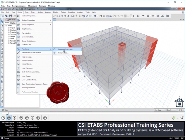
In this training course, you will learn the following contents with concepts, as per code ASCE 7-16 / UBC 97. Materials, Frame Section Definitions, Mass Source, Load combinations. Import grid from AutoCAD, Reference points, Earthquake and wind Loads. Structural Modelling checks. Stiffness, Mass, Torsion and Building eccentricity checks. Concrete Slab Design with Strip Based Method and Finite Element Method (FEM). P-Delta checks and how to apply. Equivalent static Force Method. Response Spectrum Analysis. Time History Analysis. Slab and foundation Export to CSI SAFE for slab and foundation design. This course will help you to optimize your design with full control of parameters such as deflection, reinforcement for your concrete columns, beams, slabs and shear walls and design of structures with Static and Dynamic Loading. |
| |
 Читать статью дальше (комментариев - 28)
| |
|
 |
 Автор: Williams Автор: Williams
 Дата: 10 декабря 2019 Дата: 10 декабря 2019
 Просмотров: 1 568 Просмотров: 1 568 |
| |
Parking Generation Manual, 5th Edition
Institute of Transportation Engineers, 2019
pdf, 838 pages, english
ISBN-10: 1-933452-95-1
ISBN-13: 978-1-933452-95-1

The Institute of Transportation Engineers (ITE) is an international membership association of transportation professionals who work to improve safety and mobility for all transportation system users and help build smart and livable communities. Through its products and services, ITE promotes professional development and career advancement for its members, supports and encourages education, identifies necessary research, develops technical resources including standards and recommended practices, develops public awareness programs, and serves as a conduit for the exchange of professional information. ITE develops the next generation of transportation professionals through its K–12 STEM program and its more than 150 student chapters.
Parking Generation Manual, 5th Edition is a publication of the Institute of Transportation Engineers (ITE). Parking Generation Manual is an educational tool for planners, transportation professionals, zoning boards, and others who are interested in estimating parking demand of a proposed development. Parking Generation Manual includes a complete set of searchable electronic files including land use descriptions and data plots for all available combinations of land uses, time periods, independent variables, and settings. Data contained in Parking Generation Manual are presented for informational purposes only and do not include ITE recommendations on the best course of action or the preferred application of the data. The information is based on parking generation studies submitted voluntarily to ITE by public agencies, developers, consulting firms, student chapters, and associations. |
| |
 Читать статью дальше (комментариев - 9)
| |
|
 |
 Автор: Williams Автор: Williams
 Дата: 9 декабря 2019 Дата: 9 декабря 2019
 Просмотров: 746 Просмотров: 746 |
| |
ECS FEMFAT v5.4 x64
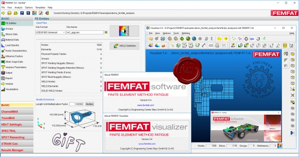
FEMFAT (Finite Element Method Fatigue) is the globally leading software for finite element based fatigue life prediction. It increases the reliability and robustness of components in the automotive industry as well as in machinery and plant construction. FEMFAT allows critical points in terms of fatigue to be recognized quickly and assists the optimization process at a very early stage of development – long before time and cost-intensive testing is carried out. This leads to more robust prototypes and thus to a reduction in the number of development cycles and expensive hardware tests. The FEMFAT software, developed continuously over the course of the last 25 years, enjoys great trust far beyond the realm of the automotive industry and is considered the tool of choice for numerical fatigue analysis.
Программное обеспечение FEMFAT выполняет расчетов на усталость в сочетании с широко используемыми конечно-элементными программами, такими как NASTRAN, ABAQUS, ANSYS, I-DEAS, Медина, PATRAN, PRO/MECHANICA. Обеспечивает полную и удобнную интеграцию в пользовательские CAE процессы. На ранней стадии процесса проектирования FEMFAT предоставляет инженерам достоверной информации по усталостной долговечности конструкций, что позволяет уменьшить массо-габаритные характеристики модели и ее стоимость. Результаты расчетов FEMFAT могут быть представлены в графическом виде с помощью FE пост-процессора или модуля VISUALIZER.
Модули
FEMFAT BASIC
FE-ориентированного программного обеспечения для прогнозирования усталостной долговечности/повреждения и выносливости компонентов. Включает в себя комплексный FE-интерфейс и базу данных материалов.
FEMFAT PLAST
Программный модуль для моделирования эффекта перераспределения средних напряжений при наличии местной пластической деформации.
FEMFAT MAX
Программный модуль для анализа усталости при многоосевой нагрузке модели, с использованием истории нагрузок или серии статических напряженных состояний.
FEMFAT WELD
Программный модуль для анализа усталости сварных швов для стали и алюминия стандартов (DIN 15018, EUROCODE 3 и 9, BS 7608, МИС).
FEMFAT SPOT
Программный модуль для прогнозирования усталости "точечных" соединений (точечная сварка, клепка) в FE-оболочечных конструкциях.
FEMFAT BREAK
Программный модуль для оценки статических факторов безопасности.
FEMFAT STRAIN
Программный модуль для оценки разрушения от измеряемых напряжений и сравнения расчетных и измеренных напряжений.
FEMFAT VISUALIZER
Быстрый, 3D постпроцессор для отображения состояния FE-модели под воздействием приложенных нагрузок.
FEMFAT HEAT
Программный модуль для анализа циклической усталости компонентов под воздействием тепловых нагрузок (напр. головки цилиндра, выпускной коллектор и т.п.)
FEMFAT EHD
Эласто гидро-динамический анализ трения в подшипниках.
FEMFAT NVH
Подготовка данных для акустического анализа с использованием MSC/NASTRAN и ADAMS. Расчет поверхности шума и визуализации Кэмпбелл диаграмм. |
| |
 Читать статью дальше (комментариев - 5)
| |
|
 |
 Автор: Williams Автор: Williams
 Дата: 8 декабря 2019 Дата: 8 декабря 2019
 Просмотров: 2 448 Просмотров: 2 448 |
| |
Dassault Systemes SIMULIA Suite 2020
(incl. Abaqus, Isight, Fe-safe, Tosca)
SIMULIA обеспечивает пользователей ведущими решениями, позволяющими получить максимальную отдачу при использовании различных программных пакетов. Isight и SIMULIA Execution Engine (ранее называемый Fiper) позволяют комбинировать многочисленные междисциплинарные модели и приложения в потоке процессов имитационного моделирования, автоматизировать их выполнение в распределенных вычислительных ресурсах, исследовать полученное проектное пространство и идентифицировать оптимальные проектные параметры в соответствии с требованиями и ограничениями.
Возможности наших опробованных решений по автоматизации и оптимизации имитационного моделирования:
- Радикальное сокращение сроков проектирования благодаря интеграции рабочих процессов в автоматизированную среду;
- Выпуск более надежной, высококачественной продукции благодаря сокращению сроков рассмотрения проектных вариантов;
- Снижение объема вложений в аппаратные средства благодаря эффективному использованию существующих систем и распределению работы;
- Эффективная коммуникация благодаря крепкому соотрудничеству партнеров в рамках проектирования.
Abaqus - мощный программный комплекс для прочностного конечноэлементного анализа, с помощью которого можно получать самые точные и достоверные решения для сложных линейных и нелинейных инженерных проблем. Abaqus позволяет проводить реальное моделирование конструкций находясь в общем жизненном цикле создания изделий, что позволяет значительно улучшать потребительские качества создаваемого изделия, а так же уменьшать число необходимых экспериментов и способствовать внедрению инноваций. Семейство продуктов Abaqus разрабатывается и поддерживается компанией ABAQUS, Inc. с 1978 года. C 2005 года ABAQUS, Inc. входит в компанию Dassault Systemes (разработчик известной CAD системы CATIA и систем управления жизненным циклом изделий PLM SmarTeam и Enovia). В качестве стратегии дальнейшего развития компанией ABAQUS было анонсировано создание универсальной среды моделирования SIMULIA, обобщающей не только решения компаний Dassault Systemes и ABAQUS в области компьютерного инжиниринга, но и объединяющей лучшие решения третьих фирм для создания мощного инструментария реалистичного проектирования и многодисциплинарного анализа конструкции.
Ключевые функции Isight:
- Построение модели
- Наборы файлов Наборы файлов (File Set) представляют собой новый и усовершенствованный способ определения динамических массивов входящих и исходящих файлов.
- Они позволяют производить конфигурацию массивов файлов путем определения расположения файла и схемы соответствия файла.
- Размер массива файлов определяется во время прогона программы и каждый раз может меняться.
- Содержание набора файлов можно отсортировать по имени (в алфавитном порядке) или по дате изменения.
- Замена ключевого слова Jobid Новое ключевое слово {jobid} соответствует текущему идентификатору задания Jobid в Isight.
- Замена ключевого слова {jobid} производится в параметрах файла и в компонентах.
- Замена ключевого слова User Новое ключевое слово {user} - это имя пользователя, который запустил задачу в автономном режиме в Isight.
- В предыдущих версиях ключевое слово {user} было доступно только в SEE.
FE-safe - пакет для моделирования усталости конструкций.
Tosca - пакет геометрической оптимизации с применением сторонних решателей (Fluent, STAR-CCM+) |
| |
 Читать статью дальше (комментариев - 11)
| |
|
 |
 Автор: Williams Автор: Williams
 Дата: 7 декабря 2019 Дата: 7 декабря 2019
 Просмотров: 1 848 Просмотров: 1 848 |
| |
Tayseer Almattar - Learn SoldWorks 2020
Packt Publishing, 2019
pdf, 576 pages, english
ISBN 978-1-78980-410-2
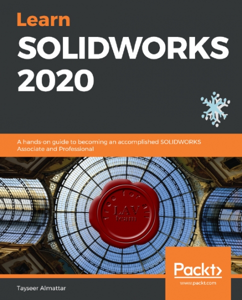
Tayseer Almattar holds a bachelor's (B.S.) degree in mechanical engineering and a Master of Design (MDes) degree in international design and business management. He has 6 years of experience in corporate training, instructional design, and quality assurance training. He has also been an avid user of SOLIDWORKS for over 10 years and has published multiple online SOLIDWORKS training courses with about 15,000 enrolled students from over 100 countries. With this book, Tayseer has brought together his experience of design and training to produce a unique and practical SOLIDWORKS training experience in writing.
SOLIDWORKS is one of the most used pieces of software for 3D engineering and product design applications. These applications cover areas such as aviation, automobiles, consumer product design, and more. This book takes a practical approach to mastering the software at a professional level. The book starts with the very basics, such as exploring the software interface and opening new files. However, step by step, it progresses through different topics, from sketching and building complex 3D models to generating dynamic and static assemblies.
This book takes a hands-on approach when it comes to covering different tools in SOLIDWORKS. Whenever a new tool is introduced, we will go through a practical exercise of using it to create sketches, 3D part models, assemblies, or drawings. When required, we will provide you with supporting files that you can download in order to follow up on the concepts and exercises in your own time. If you are a complete beginner in SOLIDWORKS, it will be best to follow the book from start to finish, like a story. However, you can also jump between chapters. |
| |
 Читать статью дальше (комментариев - 5)
| |
|
 |
 Автор: Williams Автор: Williams
 Дата: 6 декабря 2019 Дата: 6 декабря 2019
 Просмотров: 1 193 Просмотров: 1 193 |
| |
Gray Technical DATA to ASCII v1.0.0.1
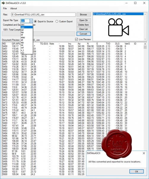
Specifically made for 3D Model and Geological drilling logs, DATA to ASCII is an application that quickly takes XYZ data stored in various formats and converts them into a standardized CSV Data Sheet that any program can read. No longer do you need to fumble through multiple applications or data editors just to see your raw data. DATA to ASCII can read, preview, convert and export your data into multiple formats, including Excel formatted CSV data tables.
Do you need the location data from your 3D rendered object, or exact XYZ locations of a point inside of your geographical map? DATA to ASCII can convert many file formats directly into other data formats with ease!
DATA to ASCII has the ability to preview and convert multiple files at once. Simply load your data into the application, select your output source and click convert. It is so simple; you will wonder how you ever gathered raw data from your files before.
|
| |
 Читать статью дальше (комментариев - 9)
| |
|
 |
 Автор: Williams Автор: Williams
 Дата: 5 декабря 2019 Дата: 5 декабря 2019
 Просмотров: 1 646 Просмотров: 1 646 |
| |
Gray Technical XYZ Mesh v6.0.5.10
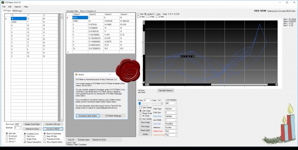
If you have tried to take X Y Z data and graph it three dimensionally inside of Microsoft Excel you know that Excel’s graphing capabilities are quite limited. With XYZ Mesh you can convert and copy your data directly into Excel’s native format of MESH, Surface/Wireline Graph or 3D Line/Scatter Plot and even export them directly into Microsoft Excel and CAD. XYZ Mesh is currently the only software available that converts X Y Z data directly into Microsoft Excel’s native graphing formats! Version 6 has many new features that make creating true 3D graphs like Surface Charts, Wireframes and 3D lines from XYZ data inside Excel much easier!
|
| |
 Читать статью дальше (комментариев - 9)
| |
|
 |
| ПОИСК ПО САЙТУ |
 |
|
 |
| КАЛЕНДАРЬ | | |
 |
| « Октябрь 2025 » |
|---|
| Пн | Вт | Ср | Чт | Пт | Сб | Вс |
|---|
| | 1 | 2 | 3 | 4 | 5 | | 6 | 7 | 8 | 9 | 10 | 11 | 12 | | 13 | 14 | 15 | 16 | 17 | 18 | 19 | | 20 | 21 | 22 | 23 | 24 | 25 | 26 | | 27 | 28 | 29 | 30 | 31 | |
|
 | |
| |
|