|
 |
 Автор: Williams Автор: Williams
 Дата: 18 апреля 2020 Дата: 18 апреля 2020
 Просмотров: 1 945 Просмотров: 1 945 |
| |
Andreas Ochsner - Computational Statics and Dynamics
An Introduction Based on the Finite Element Method, 2 Edition
Springer, 2020
pdf, 616 pages, english
ISBN: 978-981-15-1277-3
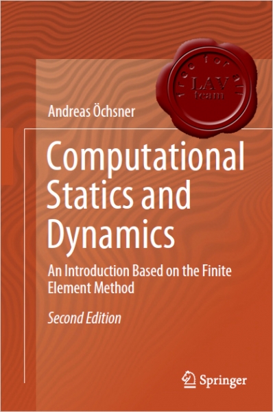
This book is the 2nd edition of an introduction to modern computational mechanics based on the finite element method. It includes more details on the theory, more exercises, and more consistent notation; in addition, all pictures have been revised. Featuring more than 100 pages of new material, the new edition will help students succeed in mechanics courses by showing them how to apply the fundamental knowledge they gained in the first years of their engineering education to more advanced topics. In order to deepen readers’ understanding of the equations and theories discussed, each chapter also includes supplementary problems. These problems start with fundamental knowledge questions on the theory presented in the respective chapter, followed by calculation problems. In total, over 80 such calculation problems are provided, along with brief solutions for each. This book is especially designed to meet the needs of Australian students, reviewing the mathematics covered in their first two years at university. The 13-week course comprises three hours of lectures and two hours of tutorials per week. |
| |
 Читать статью дальше (комментариев - 10)
| |
|
 |
 Автор: Williams Автор: Williams
 Дата: 17 апреля 2020 Дата: 17 апреля 2020
 Просмотров: 5 087 Просмотров: 5 087 |
| |
CSI SAP2000 v22.0.0 build 1587 x64
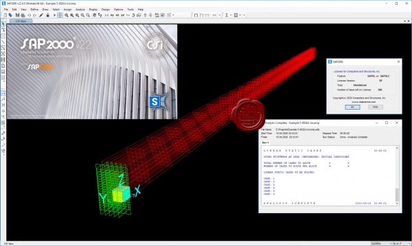
CSI SAP2000 - cистема трехмерного статического и динамического анализа методом конечных элементов и проектирования сооружений.
SAP2000 следует принципам, основными чертами которых являются современный, интуитивно понятный и универсальный пользовательский интерфейс, основанный на уникальном расчетном ядре и инструментах проектирования конструкций для инженеров, разрабатывающих объекты транспортной инфраструктуры, промышленные и гражданские здания, спортивные сооружения и другие объекты.
Начиная с трехмерной объектно-ориентированной рабочей среды моделирования и до широчайшего спектра опций расчета и проектирования конструкций, комплексно интегрированных в один мощный пользовательский интерфейс, SAP2000 – это наиболее интегрированный, производительный и практичный расчетный комплекс общего назначения, существующий на сегодняшнем рынке. Интуитивно понятный интерфейс позволяет Вам создавать модели конструкций в кратчайшие сроки без долгого процесса обучения. Сегодня Вы можете использовать SAP2000 для всех Ваших задач по расчету и проектированию, в том числе и для небольших повседневных задач.
Комплексные модели могут быть созданы и разбиты на конечные элементы с использованием встроенных шаблонов. Интегрированные инструменты проектирования конструкций способны автоматически сгенерировать ветровые, волновые, нагрузки от транспорта и сейсмические нагрузки на модель, а также выполнить полную автоматическую проверку стальных и железобетонных элементов согласно нормам проектирования различных стран.
|
| |
 Читать статью дальше (комментариев - 36)
| |
|
 |
 Автор: Williams Автор: Williams
 Дата: 16 апреля 2020 Дата: 16 апреля 2020
 Просмотров: 2 970 Просмотров: 2 970 |
| |
Strand7 R2.4.6 + Webnotes
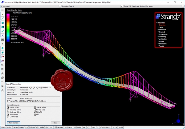
Strand7's fully-integrated visual environment - combined with a suite of powerful solvers - gives you unparalleled functionality in a single application. Construct models, run analyses and investigate results simultaneously using a seamless interface. Strand7 lets you build models quickly. Create, delete and manipulate elements with a comprehensive set of tools, automatic meshing and unlimited undo. Organise a complicated model into a simple set of parts using the Group Tree. Define your own coordinate systems and beam cross-sections. Check mesh quality with aspect ratio and warping contours and free edge detection. Strand7 harnesses the power of Windows. Open multiple models at the same time. Cut-and-paste elements in 3D - even between models - and copy data to and from other Windows® programs. Import geometry data from IGES, ACIS, STEP and DXF files. Choose drawing styles and colours. Set the physical units for viewing and entering data. Dynamically rotate, pan and zoom in real time with a single click. Strand7 gives you a range of result options. Visualise results with contour maps, vector maps and X-Y graphs. Use the Peek tool to inspect result quantities at any point, directly on the model. View, sort and filter results with the Result Listings spreadsheet. Strand7 offers a full set of previewing and printing tools for documenting and reporting your work. Choose your own fonts, titleblocks and logos for a consistent, professional look across all your printing.
Extensive element library
- 1D: Beam, truss, pipe, spring, damper, connection, catenary cable and contact elements (2D and 3D)
- 2D: Plane stress, plane strain, plate/shell, 3D membrane, shear panel and axisymmetric elements
- 3D: Tetrahedral, wedge, pyramid and hexahedral elements
- Constraints: Rigid links, pinned links, master/slave links, sector-symmetry links, coupling links, attachment links
Comprehensive range of solvers
- Static: Linear, buckling, influence and non-linear (geometric, material and boundary non-linearity)
- Dynamic: Natural frequency, harmonic response and spectral response
- Transient: Linear and non-linear (geometric, material and boundary non-linearity)
- Heat transfer: Steady-state and transient (linear and non-linear)
Standard and specialist materials
- Linear and non-linear material models, including: Isotropic, orthotropic, anisotropic, soil, rubber, composite laminates and user-defined materials
Industry-standard data libraries
- Materials: Engineering properties for common materials - steel, timber, aluminium, concrete and glass
- Sections: Industry-standard cross-sections, including I-beams, tubes, channels and angles
|
| |
 Читать статью дальше (комментариев - 46)
| |
|
 |
 Автор: Williams Автор: Williams
 Дата: 15 апреля 2020 Дата: 15 апреля 2020
 Просмотров: 4 131 Просмотров: 4 131 |
| |
Autodesk Inventor Nastran (ex. In-CAD) 2021 x64
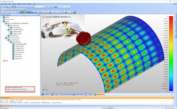
Autodesk Inventor Nastran - программный комплекс для расчетов задач механики твердого деформируемого тела, основанный на методе конечных элементов. Решатель Nastran является одним из лучших решателей для задач механики деформируемого тела.
Задачи, которые позволяет рассчитывать программный комплекс Autodesk Inventor Nastran:
- линейный и нелинейный статический анализ;
- расчет устойчивости;
- модальный анализ;
- стационарный и нестационарный тепловой расчет;
- расчет композитных материалов;
- расчет температурных напряжений;
- тепловой расчет с нелинейными граничными условиями;
- отклик на случайные частотные нагрузки;
- расчет вынужденных колебаний;
- расчет динамических нагрузок;
- расчет пластических и гиперупругих свойств;
- расчет падения тела.
|
| |
 Читать статью дальше (комментариев - 5)
| |
|
 |
 Автор: Williams Автор: Williams
 Дата: 14 апреля 2020 Дата: 14 апреля 2020
 Просмотров: 1 793 Просмотров: 1 793 |
| |
Paul Chess, Warren Green - Durability of Reinforced Concrete Structures
CRC Press, 2020
pdf, 149 pages, english
ISBN-13: 978-0-367-27838-0
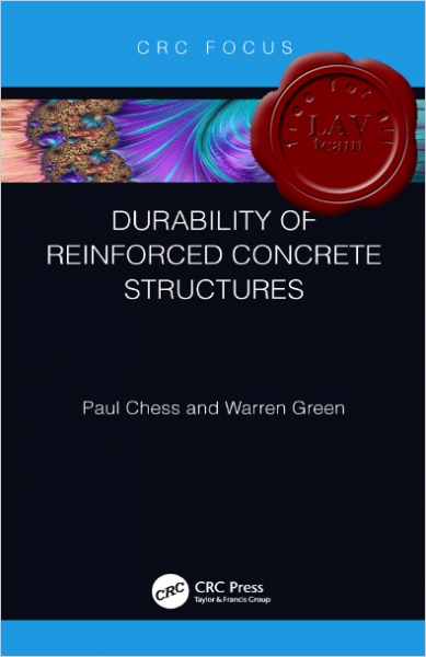
Reinforced concrete structures corrode as they age, with significant financial implications, but it is not immediately clear why some are more durable than others. This book looks at the mechanisms for corrosion and how corrosion engineering can be used for these problems to be minimized in future projects. Several different examples of reinforced concrete structures with corrosion problems are described and the various life enhancement solutions considered and applied are discussed. The book includes a chapter on the effectiveness of corrosion monitoring techniques and questions why the reality is at odds with current theory and standards.
Specialist contractors, consultants and owners of corrosion damaged structures will find this an extremely useful resource. It will also be a valuable reference for students at postgraduate level. |
| |
 Читать статью дальше (комментариев - 12)
| |
|
 |
 Автор: Williams Автор: Williams
 Дата: 12 апреля 2020 Дата: 12 апреля 2020
 Просмотров: 4 090 Просмотров: 4 090 |
| |
nanoSoft nanoCAD Конструкторский BIM v1.0.4826.32154
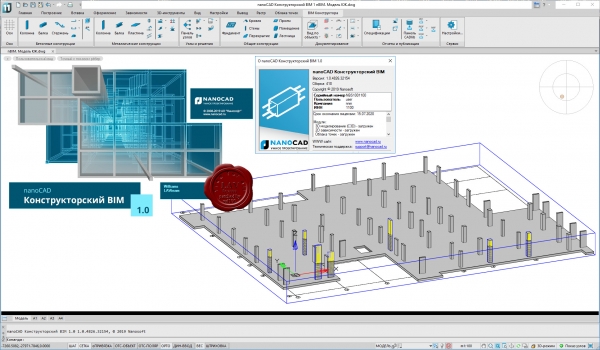
Компания «Нанософт», ведущий российский разработчик и дистрибьютор программного обеспечения для проектирования, выпускает новое решение для информационного моделирования: nanoCAD Конструкторский BIM.
nanoCAD Конструкторский BIM предназначен для проектирования металлических и бетонных конструкций зданий/сооружений на принципах информационного моделирования (Building Information Modeling).
Концепция продукта проста: конструктор создает трехмерную информационную модель с помощью интеллектуальных инструментов, задающих типовые конструкции здания, и готовых параметризованных объектов из базы данных. Все элементы модели обладают поведением и логикой взаимодействия друг с другом, которая определяется их классом, значениями параметров и даже расчетами формул. При этом вся документация (чертежи, спецификации, отчеты) автоматизированно формируется из модели, базируется на формате *.dwg и заточена под оформление по отечественным стандартам проектирования. Такой подход позволяет повысить качество проекта, а также автоматизировать процесс согласования с заказчиками и смежными специалистами благодаря более наглядному представлению и более глубокой проработке проектных решений по сравнению с классическими методами проектирования. Кроме того, принципы информационного моделирования открывают перспективы тесного сотрудничества проектных и строительных организаций, ускоряя взаимодействие, согласование изменений и повышая качество создаваемых объектов.
Немаловажным преимуществом нового продукта является то, что он базируется на САПР-платформе nanoCAD Plus версии 11 – самой современной версии универсальной российской системы автоматизированного проектирования, работающей с самым популярным в строительной отрасли форматом *.dwg. Таким образом, применяя nanoCAD Конструкторский BIM, проектировщики получают сразу два мощных решения: инструмент классического черчения, поддерживающий все предыдущие наработки (*.dwg-документы, библиотеки блоков, типовые решения и т.д.), и инструмент современного проектирования, реализующий методы информационного моделирования (BIM). Это позволяет организациям осуществлять плавный переход от черчения к моделированию – контролируемый и не связанный с риском срыва сроков проектирования. А благодаря тому что nanoCAD Конструкторский BIM создан в России, можно в постоянном контакте с разработчиками настраивать решение как под требования отечественных норм и стандартов, так и под интеграцию с наиболее популярными сторонними программами, используемыми в нашей стране. |
| |
 Читать статью дальше (комментариев - 12)
| |
|
 |
 Автор: Williams Автор: Williams
 Дата: 11 апреля 2020 Дата: 11 апреля 2020
 Просмотров: 2 223 Просмотров: 2 223 |
| |
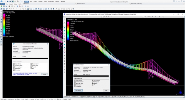
REQUEST: Strand7 Webnotes
Strand7 Webnotes are a comprehensive online library of resource materials covering Strand7 modelling, application, usage and installation, plus general background and theory of FEA. Access to the library is available to supported Strand7 users via a secure login and forms part of our Strand7 Support and Maintenance subscription service.
Ready to offer in return Strand7 version 2 and even not published yet version 3 fully keygenned.
ADDED
Almost all Webnotes are already collected. There are only a few webnotes left that MUST BE found!!!
ST7-1.10.20.20 Static and Dynamic
Stiffness
ST7-1.20.10.4 Determining the
Onset of Buckling in a Nonlinear Static Analysis
ST7-1.20.40.10 Modelling
Nonlinear Concrete with Nonlinear Elastic Material
ST7-1.20.60.3 Applying Pre Strain
Attributes in Construction Sequence Analysis
ST7-1.30.20.15 Analysis of Steel
Vessel Subjected to Hot Dip Galvanising Process
ST7-1.40.10.3 Analysis of Rocket
Inertial Effects with Fuel and Payload
ST7-1.40.10.7 Panel Buckling
Analysis
ST7-1.40.10.8 PSD Analysis of a
Wing-Mounted Missile
ST7-1.40.20.4 Transverse
Stability of a Ship
ST7-1.40.20.5 Dynamic Impact
Analysis of a Moored Ship
ST7-1.40.30.22 Analysis of Soil
Slope Stability Using Strand7
ST7-1.40.35.4 Modelling Timber as
an Orthotropic Material
ST7-1.40.35.5 Reinforced Concrete
Slab Ductility
ST7-1.40.35.49 Modelling
Bond Slip in Reinforced Concrete
<- most important
ST7-1.40.40.28 Modelling
Interference Fits by Using Contact Elements
ST7-1.40.40.33 Press Fit Shaft
Extension Torsional Analysis
ST7-1.40.50.6 Aligning
Orthotropic Brick Axes
ST7-1.40.70.15 Engine Head Gasket
Analysis
ST7-1.40.70.17 Multi-Cylinder
Engine Vibration Analysis
ST7-1.40.70.20 Thermal Analysis
of a Disk Brake Rotor
ST7-1.40.70.27 ROPS Analysis per
ISO 3471-2008
ST7-1.40.130.1 Calculating and
Analysing Acoustic Cavity Modes
ST7-1.40.130.5 Acoustic Cavity
Modes with Flexible Boundaries
ST7-1.50.10.7 Generating Geometry
in Strand7
ST7-1.50.20.12 Interfacing
Different Element Types
ST7-1.50.20.14 Using the Points
and Lines Tool to Build Models
ST7-1.50.30.8 Global Pressure
Attribute Projection Options
ST7-1.50.30.14 Balancing Load in
Pressure Vessels with Openings
ST7-1.50.50.4 Modelling with
Cables
ST7-1.50.60.5 Using Master-Slave
Links
ST7-1.50.80.12 Importing and
Exporting Strand7 Model Data with Spreadsheets
ST7-1.50.80.17 Aligning Beam
Elements
ST7-1.55.10.14 Linear Buckling
Analysis of Flat Panels
ST7-1.55.30.5 Evolution of Beam
Temperature using ISO834 Fire Curve
ST7-1.55.40.10 Strand7 FAQ
ST7-1.57.10.5 Elastic and Plastic
Strain
ST7-1.57.20.16 Comparison of the
Moment Curvature and Fibre Stress Beam
ST7-1.57.20.17 Curved Pipe
Element Stress
ST7-1.57.40.6 Deviatoric and
Hydrostatic Stresses and Their Application
Let's get busy and collect the rest!!!
|
| |
 Читать статью дальше (комментариев - 74)
| |
|
 |
 Автор: Williams Автор: Williams
 Дата: 11 апреля 2020 Дата: 11 апреля 2020
 Просмотров: 3 083 Просмотров: 3 083 |
| |
Ram S. Gupta - Principles of Structural Design. Wood, Steel, and Concrete. Third Edition
CRC Press, 2020
pdf, 619 pages, english
ISBN-13: 978-1-138-49353-7
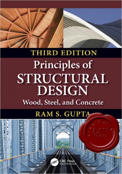
Timber, steel, and concrete are common engineering materials used in structural design. Material choice depends upon the type of structure, availability of material, and the preference of the designer. The design practices the code requirements of each material are very different. In this updated edition, the elemental designs of individual components of each material are presented, together with theory of structures essential for the design. Numerous examples of complete structural designs have been included. A comprehensive database comprising materials properties, section properties, specifications, and design aids, has been included to make this essential reading. |
| |
 Читать статью дальше (комментариев - 13)
| |
|
 |
 Автор: Williams Автор: Williams
 Дата: 10 апреля 2020 Дата: 10 апреля 2020
 Просмотров: 985 Просмотров: 985 |
| |
Applied Flow Technology Arrow v8.0.1110 build 2020.03.30
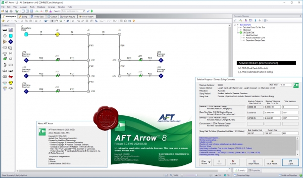
Applied Flow Technology Arrow - отличная программа для гидравлического расчета различных разветвленных сетей со сжимаемыми средами (включает также расчет теплопотерь). Осуществляет анализ системы при скоростях вплоть до звуковой (также включен анализ сети при звуковом ударе).
|
| |
 Читать статью дальше (комментариев - 11)
| |
|
 |
| ПОИСК ПО САЙТУ |
 |
|
 |
| КАЛЕНДАРЬ | | |
 |
| « Октябрь 2025 » |
|---|
| Пн | Вт | Ср | Чт | Пт | Сб | Вс |
|---|
| | 1 | 2 | 3 | 4 | 5 | | 6 | 7 | 8 | 9 | 10 | 11 | 12 | | 13 | 14 | 15 | 16 | 17 | 18 | 19 | | 20 | 21 | 22 | 23 | 24 | 25 | 26 | | 27 | 28 | 29 | 30 | 31 | |
|
 | |
| |
|