|
 |
 Автор: Williams Автор: Williams
 Дата: 10 ноября 2020 Дата: 10 ноября 2020
 Просмотров: 736 Просмотров: 736 |
| |
TRC Consultants PHDWin v2.10.6
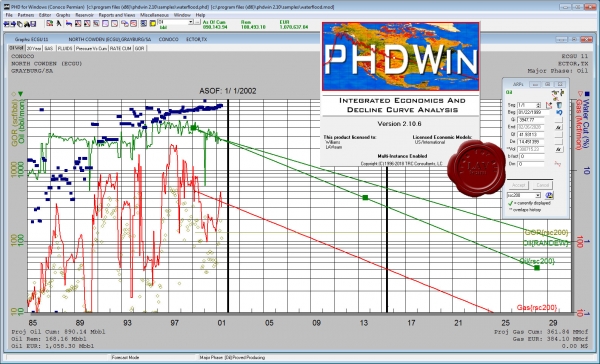
PHDWin is a full-featured, completely integrated economics and decline curve software package written by petroleum engineers for the oil and gas industry. It offers a complete solution to manage, organize, and evaluate reserves and economics.
|
| |
 Читать статью дальше (комментариев - 9)
| |
|
 |
 Автор: Williams Автор: Williams
 Дата: 9 ноября 2020 Дата: 9 ноября 2020
 Просмотров: 2 967 Просмотров: 2 967 |
| |
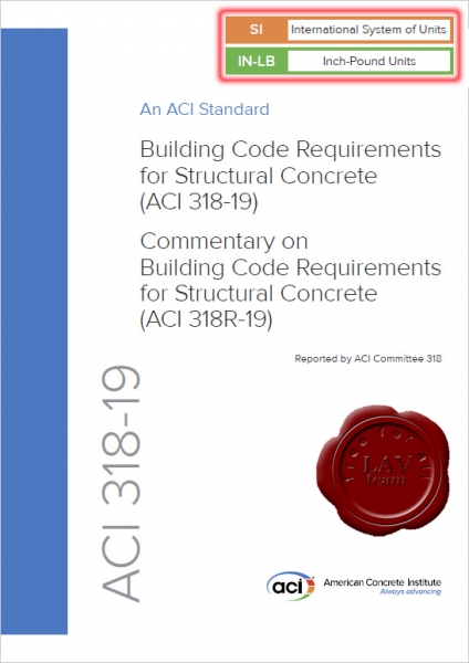
American Concrete Institute:
Building Code Requirements for Structural Concrete (ACI 318-19)
Commentary on Building Code Requirements for Structural Concrete (ACI 318R-19)
SI + IN/LB
ACI, 2019
pdf, 2x628 pages, english
ISBN: 978-1-64195-056-5
The "Building Code Requirements for Structural Concrete” ("Code”) provides minimum requirements for the materials, design, and detailing of structural concrete buildings and, where applicable, nonbuilding structures. This Code was developed by an ANSI-approved consensus process and addresses structural systems, members, and connections, including cast-in-place, precast, shotcrete, plain, nonprestressed, prestressed, and composite construction. Among the subjects covered are: design and construction for strength, serviceability, and durability; load combinations, load factors, and strength reduction factors; structural analysis methods; deflection limits; mechanical and adhesive anchoring to concrete; development and splicing of reinforcement; construction document information; field inspection and testing; and methods to evaluate the strength of existing structures.
The Code was substantially reorganized and reformatted in 2014, and this Code continues and expands that same organizational philosophy. The principal objectives of the reorganization were to present all design and detailing requirements for structural systems or for individual members in chapters devoted to those individual subjects, and to arrange the chapters in a manner that generally follows the process and chronology of design and construction. Information and procedures that are common to the design of multiple members are located in utility chapters. Additional enhancements implemented in this Code to provide greater clarity and ease of use include the first use of color illustrations and the use of color to help the user navigate the Code and quickly find the information they need. Special thanks to Bentley Systems, Incorporated, for use of their ProConcrete software to produce many of the figures found in the Commentary.
Uses of the Code include adoption by reference in a general building code, and earlier editions have been widely used in this manner. The Code is written in a format that allows such reference without change to its language. Therefore, background details or suggestions for carrying out the requirements or intent of the Code provisions cannot be included within the Code itself. The Commentary is provided for this purpose.
Some considerations of the committee in developing the Code are discussed in the Commentary, with emphasis given to the explanation of new or revised provisions. Much of the research data referenced in preparing the Code is cited for the user desiring to study individual questions in greater detail. Other documents that provide suggestions for carrying out the requirements of the Code are also cited.
Keywords: admixtures; aggregates; anchorage (structural); beam-column frame; beams (supports); caissons; cements; cold weather; columns (supports); combined stress; composite construction (concrete to concrete); compressive strength; concrete; construction documents; construction joints; continuity (structural); contraction joints; cover; curing; deep beams; deep foundations; deflections; drilled piers; earthquake-resistant structures; flexural strength; floors; footings; formwork (construction); hot weather; inspection; isolation joints; joints (junctions); joists; lightweight concretes; load tests (structural); loads (forces); mixture proportioning; modulus of elasticity; moments; piles; placing; plain concrete; precast concrete; prestressed concrete; prestressing steels; quality control; reinforced concrete; reinforcing steels; roofs; serviceability; shear strength; shotcrete; spans; splicing; strength analysis; stresses; structural analysis; structural design; structural integrity; structural walls; T-beams; torsion; walls; water; welded wire reinforcement. |
| |
 Читать статью дальше (комментариев - 14)
| |
|
 |
 Автор: Williams Автор: Williams
 Дата: 8 ноября 2020 Дата: 8 ноября 2020
 Просмотров: 9 480 Просмотров: 9 480 |
| |
CSI ETABS v19.0.0 build 2277 x64
The innovative and revolutionary new ETABS is the ultimate integrated software package for the structural analysis and design of buildings. Incorporating 40 years of continuous research and development, this latest ETABS offers unmatched 3D object based modeling and visualization tools, blazingly fast linear and nonlinear analytical power, sophisticated and comprehensive design capabilities for a wide-range of materials, and insightful graphic displays, reports, and schematic drawings that allow users to quickly and easily decipher and understand analysis and design results.
From the start of design conception through the production of schematic drawings, ETABS integrates every aspect of the engineering design process. Creation of models has never been easier - intuitive drawing commands allow for the rapid generation of floor and elevation framing. CAD drawings can be converted directly into ETABS models or used as templates onto which ETABS objects may be overlaid. The state-of-the-art SAPFire 64-bit solver allows extremely large and complex models to be rapidly analyzed, and supports nonlinear modeling techniques such as construction sequencing and time effects (e.g., creep and shrinkage). Design of steel and concrete frames (with automated optimization), composite beams, composite columns, steel joists, and concrete and masonry shear walls is included, as is the capacity check for steel connections and base plates. Models may be realistically rendered, and all results can be shown directly on the structure. Comprehensive and customizable reports are available for all analysis and design output, and schematic construction drawings of framing plans, schedules, details, and cross-sections may be generated for concrete and steel structures.
ETABS provides an unequaled suite of tools for structural engineers designing buildings, whether they are working on one-story industrial structures or the tallest commercial high-rises. Immensely capable, yet easy-to-use, has been the hallmark of ETABS since its introduction decades ago, and this latest release continues that tradition by providing engineers with the technologically-advanced, yet intuitive, software they require to be their most productive.
|
| |
 Читать статью дальше (комментариев - 69)
| |
|
 |
 Автор: Williams Автор: Williams
 Дата: 7 ноября 2020 Дата: 7 ноября 2020
 Просмотров: 1 643 Просмотров: 1 643 |
| |
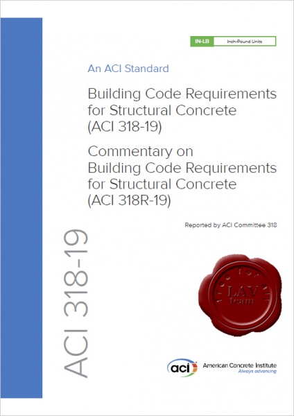
American Concrete Institute:
Building Code Requirements for Structural Concrete (ACI 318-19)
Commentary on Building Code Requirements for Structural Concrete (ACI 318R-19)
ACI, 2019
pdf, 628 pages, english
ISBN: 978-1-64195-056-5
The "Building Code Requirements for Structural Concrete” ("Code”) provides minimum requirements for the materials, design, and detailing of structural concrete buildings and, where applicable, nonbuilding structures. This Code was developed by an ANSI-approved consensus process and addresses structural systems, members, and connections, including cast-in-place, precast, shotcrete, plain, nonprestressed, prestressed, and composite construction. Among the subjects covered are: design and construction for strength, serviceability, and durability; load combinations, load factors, and strength reduction factors; structural analysis methods; deflection limits; mechanical and adhesive anchoring to concrete; development and splicing of reinforcement; construction document information; field inspection and testing; and methods to evaluate the strength of existing structures.
The Code was substantially reorganized and reformatted in 2014, and this Code continues and expands that same organizational philosophy. The principal objectives of the reorganization were to present all design and detailing requirements for structural systems or for individual members in chapters devoted to those individual subjects, and to arrange the chapters in a manner that generally follows the process and chronology of design and construction. Information and procedures that are common to the design of multiple members are located in utility chapters. Additional enhancements implemented in this Code to provide greater clarity and ease of use include the first use of color illustrations and the use of color to help the user navigate the Code and quickly find the information they need. Special thanks to Bentley Systems, Incorporated, for use of their ProConcrete software to produce many of the figures found in the Commentary.
Uses of the Code include adoption by reference in a general building code, and earlier editions have been widely used in this manner. The Code is written in a format that allows such reference without change to its language. Therefore, background details or suggestions for carrying out the requirements or intent of the Code provisions cannot be included within the Code itself. The Commentary is provided for this purpose.
Some considerations of the committee in developing the Code are discussed in the Commentary, with emphasis given to the explanation of new or revised provisions. Much of the research data referenced in preparing the Code is cited for the user desiring to study individual questions in greater detail. Other documents that provide suggestions for carrying out the requirements of the Code are also cited.
Keywords: admixtures; aggregates; anchorage (structural); beam-column frame; beams (supports); caissons; cements; cold weather; columns (supports); combined stress; composite construction (concrete to concrete); compressive strength; concrete; construction documents; construction joints; continuity (structural); contraction joints; cover; curing; deep beams; deep foundations; deflections; drilled piers; earthquake-resistant structures; flexural strength; floors; footings; formwork (construction); hot weather; inspection; isolation joints; joints (junctions); joists; lightweight concretes; load tests (structural); loads (forces); mixture proportioning; modulus of elasticity; moments; piles; placing; plain concrete; precast concrete; prestressed concrete; prestressing steels; quality control; reinforced concrete; reinforcing steels; roofs; serviceability; shear strength; shotcrete; spans; splicing; strength analysis; stresses; structural analysis; structural design; structural integrity; structural walls; T-beams; torsion; walls; water; welded wire reinforcement. |
| |
 Читать статью дальше (комментариев - 18)
| |
|
 |
 Автор: Williams Автор: Williams
 Дата: 6 ноября 2020 Дата: 6 ноября 2020
 Просмотров: 1 716 Просмотров: 1 716 |
| |
Schlumberger Hydro GeoAnalyst Plus v9.0
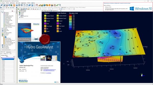
Schlumberger Hydro GeoAnalyst - комплексное программное решение для анализа данных и управления эксплуатацией подземных скважин.
Hydro GeoAnalyst is an environmental data management software that integrates a complete suite of analysis, visualization and reporting tools, with a powerful and flexible database. |
| |
 Читать статью дальше (комментариев - 12)
| |
|
 |
 Автор: Williams Автор: Williams
 Дата: 5 ноября 2020 Дата: 5 ноября 2020
 Просмотров: 1 400 Просмотров: 1 400 |
| |
Ghazi G. Al-Khateeb - Traffc and Pavement Engineering
CRC, 2021
pdf, 575 pages, english
ISBN-13: 978-0-367-14983-3
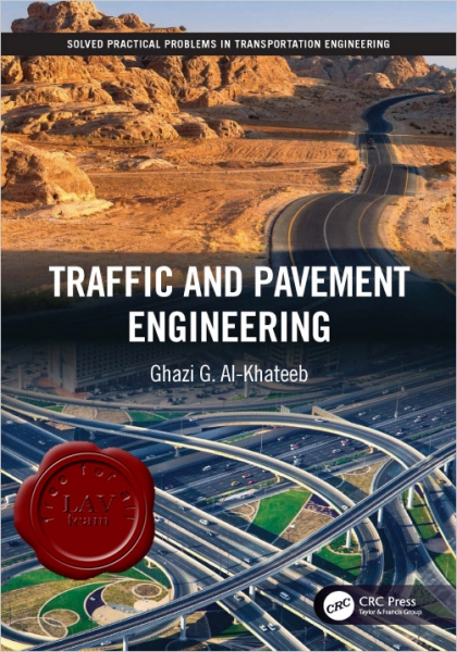
This book, comprising of two volumes and encompassing a total of fve parts, is the outcome of a great deal of effort and time spent over the years in studying and teaching at outstanding academic institutes like Jordan University of Science and Technology, Applied Science University, University of Illinois at Urbana-Champaign, the American University of Sharjah, and the University of Sharjah, and in conducting advanced scientifc research at some of the highly recognized research centers worldwide like the Advanced Transportation Research and Engineering Laboratory (ATREL) at the University of Illinois in Urbana-Champaign, the Federal Highway Administration’s Turner-Fairbank Highway Research Center (TFHRC), advanced research labs at Jordan University of Science and Technology and the Advanced Pavement Research Lab at the University of Sharjah.
The book implements a unique kind of approach and categorizes transportation engineering topics into fve major key areas, as shown below:
- Volume I: Traffc and Pavement Engineering
- Part I ”Traffc Engineering” deals with the functional part of transportation systems and introduces engineering techniques, practices, and models that are applied to design traffc systems, control traffc fow and movement, and construct proper roads and highways to achieve safe and effcient movement of people and traffc on roadways.
- Part II ”Pavement Materials, Analysis, and Design” deals with both the structural and functional parts of transportation facilities and introduces engineering techniques and principles of the uses of high-quality and sustainable materials that are employed to design, maintain, and construct asphalt-surfaced road pavements and concrete rigid pavements. The ultimate goal of pavement engineering is to provide a pavement structure that is safe, durable, sustainable, and capable of carrying the predicted traffc loads under prevailing climatic conditions. Proper structural design of pavements is one that takes into consideration the mechanistic analysis of pavements for stresses and strains that can predict the performance of the pavement with time. This section fulflls this goal by presenting the subject in a unique manner.
- Volume II: Highway Planning, Survey, and Design
- Part I ”Urban Transportation Planning” presents a process that involves a multi-modal approach and comprehensive planning steps and models to design and evaluate a variety of alternatives for transportation systems and facilities, predict travel demand and future needs, and manage the facilities and services for the different modes of transportation to fnally achieve a safe, effcient, and sustainable system for the movement of people and goods.
- Part II ”Highway Survey” presents the basic concepts and standard procedures necessary to make precise and accurate distance, angle, and level measurements for highway alignment, cross-sections, and earth quantities used in the design of highways.
- Part III ”Geometric Design of Highways” deals with engineering design techniques, standards, and models that control the three main elements of highway geometric design: horizontal and vertical alignments, profle, and cross-section to achieve the primary objectives of geometric design: safety, effciency, and sustainability.
|
| |
 Читать статью дальше (комментариев - 6)
| |
|
 |
 Автор: Williams Автор: Williams
 Дата: 4 ноября 2020 Дата: 4 ноября 2020
 Просмотров: 460 Просмотров: 460 |
| |
ADINA v9.6.3 x64
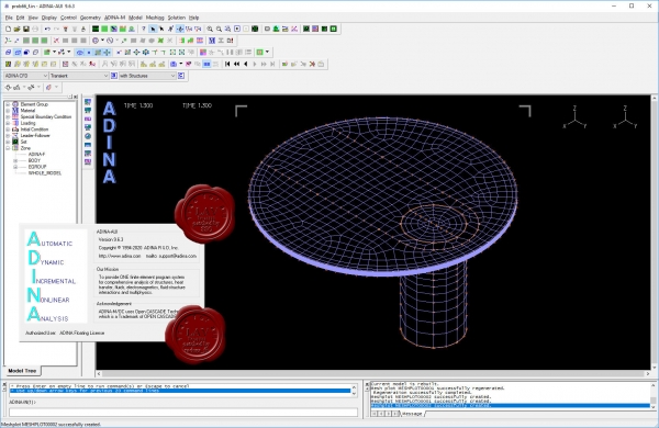
ADINA (Automatic Dynamic Incremental Nonlinear Analysis) - универсальная программа, работающая на основе метода конечных элементов, используемой для инженерных линейных и нелинейных расчётов. ADINA позволяет решать структурные и температурные задачи, рассчитывать течение, проводить мультифизические и электростатические симуляции. Внедрение программы при разработке или производстве продукта является лучшим решением для снижения затрат на производство прототипов и сокращения времени их тестирования. Современные расчётные методы, лежащие в основе программы ADINA , выгодно отличают её от остальных программ благодаря точным и надёжным результатам решения нелинейных задач.
Основные функциональные возможности пакета:
- Линейный анализ конструкций.
- Высоконелинейный анализ конструкций.
- Тепловой анализ.
- Гидродинамика.
- Взаимодействие потоков с конструкциями.
NX Nastran использует ADINA как модуль нелинейных расчетов.
Пакет ADINA состоит из следующих модулей:
- ADINA Structures - модуль расчёта статической и динамической прочности твёрдых тел и конструкций. Расчёт может быть проведён как в линейной, так и в высоконелинейной постановке с учётом нелинейности материала, больших деформаций и контакта.
- ADINA CFD – программный комплекс для моделирования течений сжимаемой и несжимаемой жидкости, использующий конечно-объемную и конечно-элементную дискретизацию.
- ADINA Thermal - программный модуль для решения задач теплопереноса в твёрдых телах и конструкциях.
- ADINA-FSI - модуль, предназначенный для анализа взаимодействия потока и конструкции, причём возможно рассмотрение высоконелинейного поведения материала вследствие больших перемещений, неупругости, контакта и температурной зависимости.
- ADINA-TMC - программный модуль, предназначенный для решения связанных термопрочностных задач, когда термические явления влияют на прочностные, и наоборот.
- ADINA User Interface (AUI) - пре- и постпроцессорный модуль, дающий возможность создавать и редактировать геометрические и конечно-элементные модели и осуществлять визуализацию результатов расчёта. Совместим со всеми модулями комплекса.
Дополнительные модули:
- ADINA Modeler (ADINA M) - встраиваемый в AUI модуль, использующий графическое ядро Parasolid и обеспечивающий твёрдотельное моделирование и прямое взаимодействие с другими CAD-системами, использующими Parasolid (Unigraphics, SolidWorks, Solid Edge).
- TRANSOR for I-DEAS, Patran - отдельный модуль, дающий возможность импортировать в ADINA и экспортировать из ADINA файлы данных в форматах I-DEAS и MSC.Patran
|
| |
 Читать статью дальше (комментариев - 1)
| |
|
 |
 Автор: Williams Автор: Williams
 Дата: 3 ноября 2020 Дата: 3 ноября 2020
 Просмотров: 7 796 Просмотров: 7 796 |
| |
Udemy (Cezary Wozniak) - Advanced UAV Photogrammetry - Part 2 - Pix4D Mapper - 2019
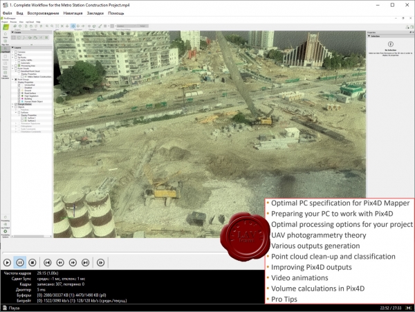
Master UAV Photogrammetry data processing in Pix4D Mapper with the most complete course on the market!
Achieve the most accurate results with UAV Photogrammetry on real-world examples.
This course covers:
- Creating a new project.
- Choosing optimal processing options.
- Accurate georeferencing using GCPs.
- GCP marking.
- Ellipsoid error correction.
- Quality assessment.
- Project splitting and merging.
- Tips and tricks.
- and more!
|
| |
 Читать статью дальше (комментариев - 25)
| |
|
 |
 Автор: Williams Автор: Williams
 Дата: 2 ноября 2020 Дата: 2 ноября 2020
 Просмотров: 2 535 Просмотров: 2 535 |
| |
modri planet d.o.o. 3Dsurvey v2.12.1 x64
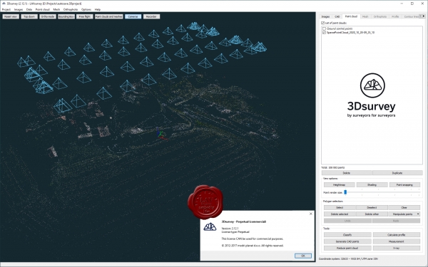
3Dsurvey is a software solution for land surveying data processing. Take a photo with any standard digital camera, import images into 3Dsurvey and produce your own orthophoto maps, digital surface models and calculate volumes faster and more easily. Data is processed automatically based on matching algorithms. Use our smart tools to be even more efficient.
|
| |
 Читать статью дальше (комментариев - 19)
| |
|
 |
 Автор: Williams Автор: Williams
 Дата: 1 ноября 2020 Дата: 1 ноября 2020
 Просмотров: 1 975 Просмотров: 1 975 |
| |
Nandipati Subba Rao - Hydrogeology problems with solutions
PHI Learning Private Limited, 2016
pdf, 336 pages, english
ISBN: 978-81-203-5278-0

Numerical calculations are inevitably required in the field of hydrogeology and play a significant role in dealing with its various aspects. As often as not, students are seen struggling while solving numerical problems based on hydrogeology, as they find difficulty in identifying the correct concept behind the problem and the formula that can be applied to it. Also, there is a dearth of books, which help the readers in solving numerical problems of varied difficulty level and enable them to have a firm grounding in the subject of hydrogeology. The book Hydrogeology: Problems with Solutions fills this void in the finest way, and as desired, chiefly focuses on the sequential steps involved in solving the problems based on hydrogeology. It concisely covers the fundamental concepts, advanced principles and applications of hydrogeological tasks rather than overemphasising the theoretical aspects.
The text comprises sixty solved hydrogeological problems, which are logically organised into ten chapters, including hydrological cycle, morphometric analysis, hydrological properties, groundwater flow, well hydraulics, well design and construction, groundwater management, seawater intrusion, groundwater exploration and groundwater quality. The practice of pedagogy of hydrogeology in yesteryears was a two-tier approach of theoretical principles with toy problems and in-situ case studies for research start-up. This book bridges the gap between routine problem-solving and state-of-the-practice for future.
The book is primarily intended for the undergraduate and postgraduate students of Earth Sciences, Civil Engineering, Water Resources Engineering, Hydrogeology and Hydrology. It also serves as an excellent handy reference for all professionals. |
| |
 Читать статью дальше (комментариев - 12)
| |
|
 |
| ПОИСК ПО САЙТУ |
 |
|
 |
| КАЛЕНДАРЬ | | |
 |
| « Октябрь 2025 » |
|---|
| Пн | Вт | Ср | Чт | Пт | Сб | Вс |
|---|
| | 1 | 2 | 3 | 4 | 5 | | 6 | 7 | 8 | 9 | 10 | 11 | 12 | | 13 | 14 | 15 | 16 | 17 | 18 | 19 | | 20 | 21 | 22 | 23 | 24 | 25 | 26 | | 27 | 28 | 29 | 30 | 31 | |
|
 | |
| |
|