|
 |
 Автор: Williams Автор: Williams
 Дата: 22 июня 2022 Дата: 22 июня 2022
 Просмотров: 10 295 Просмотров: 10 295 |
| |
Adobe Acrobat Pro DC 2022 v22.1.20142 Multilingual x32+x64
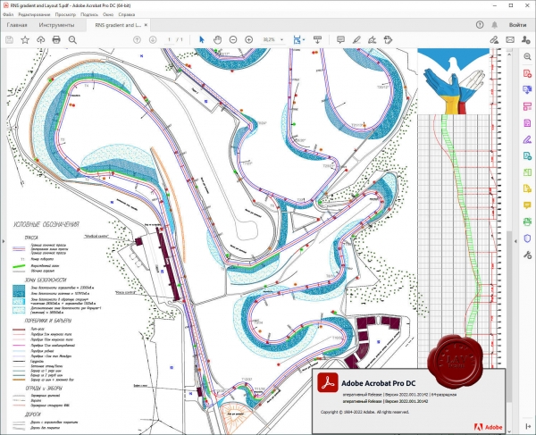
Acrobat DC - это полностью обновленная настольная версия лучшего в мире решения для работы с файлами PDF. В состав этого решения входит мобильное приложение, позволяющее подписывать и отправлять файлы PDF, а также заполнять формы с любых устройств. А с помощью облачных сервисов вы сможете создавать, экспортировать, редактировать и отслеживать файлы PDF, где бы вы ни находились. Последние версии файлов всегда будут у вас под рукой независимо от того, на каком устройстве вы работаете.
Приложение Acrobat DC включает множество инструментов для преобразования и редактирования документов PDF, а также добавления в них подписей. Вы можете использовать его где угодно. Начните создавать документ в офисе, откорректируйте его по пути домой и отправьте финальную версию на утверждение уже из дома - это просто, быстро и удобно.
|
| |
 Читать статью дальше (комментариев - 19)
| |
|
 |
 Автор: Williams Автор: Williams
 Дата: 20 июня 2022 Дата: 20 июня 2022
 Просмотров: 1 227 Просмотров: 1 227 |
| |
Bentley OpenCities Map 2022 - online installers
OpenCities Map Advanced 10.16.03.12 ENG
OpenCities Map Ultimate 10.16.03.12 ENG
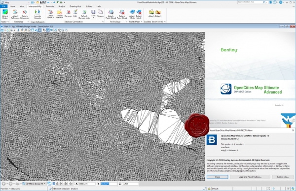
Bentley OpenCities Map - полнофункциональная ГИС и картографическая платформа. Программное обеспечение поддерживает и 2D/3D моделирование со способностью обрабатывать данные любого объёма.
ФУНКЦИОНАЛ
- Визуализация реальности в 3D.
- Интеграция инженерных данных, данных съемки, облаков точек и цифровых изображений для создания и обновления высокоточных трехмерных информационных моделей и баз данных города. Автоматическое создание трехмерных "сеток реальности" городов.
- 2D и 3D пространственный анализ.
- Создание масштабируемых моделей местности.
- Разработка пользовательских ГИС-приложений.
- Ввод данных в оригинальные форматы Esri.
- Внесение информации из геопространственных баз данных.
- Управление 3D-моделью города.
- Управление геопространственной информацией.
- Управление кадастровыми данными и информацией об участках.
- Моделирование геопространственных объектов.
- Создание анимаций и визуализации.
- Выполнение картографических работ.
- Выполнение растровых изображений.
- Регистрация векторных и растровых изображений.
- Визуализация и редактирование моделей реальности.
|
| |
 Читать статью дальше (комментариев - 13)
| |
|
 |
 Автор: Williams Автор: Williams
 Дата: 19 июня 2022 Дата: 19 июня 2022
 Просмотров: 1 854 Просмотров: 1 854 |
| |
Applied Imagery Quick Terrain Modeller v8.3.2 build 82788 USA Edition x64
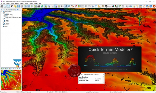
Quick Terrain Modeler is the world's premier 3D point cloud and terrain visualization software package. Designed for use with LiDAR, but flexible enough to accommodate other 3D data sources, Quick Terrain Modeler provides an easy to use software experience that allows users to work with significantly more data, render larger models, analyze data faster, and export a variety of products. These benefits enable very powerful, yet simple and intuitive, terrain exploitation.
Sample and training data can be found here
What's new in the version 8.3.2:
|
| |
 Читать статью дальше (комментариев - 12)
| |
|
 |
 Автор: Williams Автор: Williams
 Дата: 18 июня 2022 Дата: 18 июня 2022
 Просмотров: 1 872 Просмотров: 1 872 |
| |
ТЕХСОФТ mb AEC Ing+ 2019.051
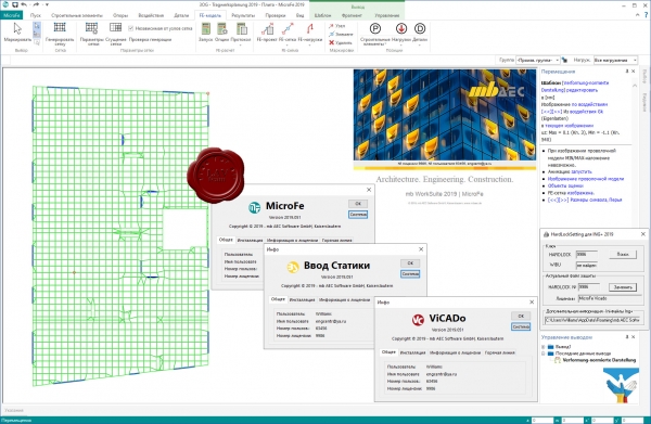
Фирма ТЕХСОФТ занимается разработкой и сбытом программного обеспечения и предоставлением услуг в области расчетов и проектирования строительных конструкций (с использованием пространственных расчетных схем, с учетом сейсмических и ветровых воздействий) Коллективом специалистов, работающих в ТЕХСОФТ, за последние 17 лет был выполнен большой объем работ, связанных с разработкой программного обеспечения САПР, как для немецких фирм, таких как mb Software AG (сейчас mb AEC Software GmbH), Inpro и Siemens (с использованием Европейских строительных норм EUROCODE 2,3 и DIN 1045-1, DIN 18800), так и для внутреннего рынка (с учетом требований российских "Строительных норм и правил" - СНиП) Высокий научный потенциал фирмы, опирающийся на 25-летний опыт работы института ЦНИИпроект в области САПР, тесное взаимодействие с институтами - разработчиками СНиП и Госстроем России, постоянный контакт с зарубежными и российскими пользователями, помогающий учитывать особенности реальных проектов, и использование новейших информационных технологий позволяет фирме ТЕХСОФТ занимать лидирующую позицию среди производителей программных средств для автоматизации расчетов и процессов проектирования в строительстве.
Система Ing+ - современный комплекс программ для проектирования строительных конструкций, сочетающий удобство использования с точностью получаемых результатов, соответствием требованиям нормативных документов стран СНГ и Европы, разнообразием решаемых задач. Данная система является уникальным предложением на российском рынке.
В систему проектирования входят следующие подсистемы:
- ViCADo – подсистема архитектурного и инженерного проектирования строительных объектов с широкими возможностями визуализации.
- MicroFe-СДК – подсистема конечноэлементных расчетов строительных конструкций на прочность, устойчивость, колебания.
- Статика – пакет программ для расчетов и конструирования железобетонных, стальных элементов строительных конструкций, фундаментов и подпорных стен.
- COSTRUC (Сталебетон) – пакет программ для расчетов и конструирования композитных (сталежелезобетонных) элементов.
Единая сервисная программа управления данными ProjektManager для проектирующей системы Ing+ позволяет организовать работу с проектами, архивами, выходными документами, дополнительными материалами, осуществлять связь с другими подсистемами Ing+. Также присутствуют широкий спектр сервисных возможностей (работа с электронной почтой, копирование, перемещение, архивирование разделов проекта и др.). В состав системы также входят дополнительные программы работы с сечениями (Profilmaker), вывода (Viewer) и другие. Присутствие набора сервисных программ позволяет формировать набор выходных документов в виде бумажного документа, электронного документа форматов pdf, rtf и других.
Система охватывает основные этапы проектирования конструкций, обеспечивая передачу данных от одного этапа к другому (ViCADo – MicroFe-СДК, MicroFe-СДК – Статика, MicroFe-СДК – ViCADo, Статика – ViCADo и др.). Наличие связей, предусмотренных на этапе создания подсистем, позволяет избежать ошибок при передаче данных и обеспечить наилучшую (наиболее полную) передачу информации о конструкции. |
| |
 Читать статью дальше (комментариев - 14)
| |
|
 |
 Автор: Williams Автор: Williams
 Дата: 17 июня 2022 Дата: 17 июня 2022
 Просмотров: 4 224 Просмотров: 4 224 |
| |
Agisoft Metashape Pro v1.8.4 build 14493 x64
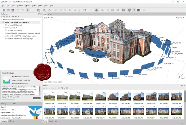
Agisoft Metashape Professional - это передовое программное обеспечение, максимально раскрывающее возможности фотограмметрии, а также включающее в себя технологии машинного обучения для анализа и пост-обработки, что позволяет получать максимально точные результаты.
Metashape позволяет обрабатывать изображения, получаемые с помощью RGB- или мультиспектральных камер, включая мультикамерные системы, преобразовывать снимки в плотные облака точек, текстурированные полигональные модели, геопривязанные ортофотопланы и цифровые модели рельефа/местности (ЦМР/ЦММ).
Дальнейшая постобработка позволяет удалять тени и искажения текстур с поверхности моделей, рассчитывать вегетационные индексы и составлять файлы предписаний для агротехнических мероприятий, автоматически классифицировать плотные облака точек и т.д.
Возможность экспорта во все внешние пакеты для постобработки делает Agisoft Metashape Professional универсальным фотограмметрическим инструментом.
|
| |
 Читать статью дальше (комментариев - 14)
| |
|
 |
 Автор: Williams Автор: Williams
 Дата: 16 июня 2022 Дата: 16 июня 2022
 Просмотров: 2 752 Просмотров: 2 752 |
| |
TechnoSoft AMETank v15.2.16
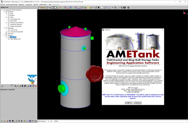
AMETank enables the rapid configuration, design, and detailing of above-ground shop-built and field-erected storage tanks. Design calculations conform to API 650. Calculations include seismic, internal and external pressures, and wind loading. AMETank supports a fully interactive 3D graphical user interface. The configuration and layout of the tank shell, floor, roof and structure, and subsystems is facilitated through intuitive menus with options customized specifically for tank design. The plates layout and fabrication details are provided. Output for NC machines is supported. Detailed assembly and components fabrication drawings for all substructures, appurtenances, ladders, platforms, stairs, and any other subsystems are supported. A complete design can be configured and detailed in less than two hours including the automatic generation of tank 3D geometry with production details, To-scale drawings, bill of material, and weight & cost reports. Also TechnoSoft provides services for laser scanning and digital reconstruction of tanks, terminals, refineries, and other assets. Assessments include bottom and foundation settlement, shell roundness and verticality, structural column verticality, and floating roof to shell operation. Tank calibration and generation of strapping tables is available. Inspection and integrity analysis services are available. Inspection services include a large array of NDE technologies including ultrasonic, magnetic particle, liquid penetrant, visual, magnetic flux leakage, and vacuum box testing. Tank report calculations on corrosion rates, safe fill height, seismic evaluation, maximum working pressure, and other evaluations as per API 653 are supported. |
| |
 Читать статью дальше (комментариев - 28)
| |
|
 |
 Автор: Williams Автор: Williams
 Дата: 15 июня 2022 Дата: 15 июня 2022
 Просмотров: 814 Просмотров: 814 |
| |
TechnoSoft AMETank v14.3.11 repack
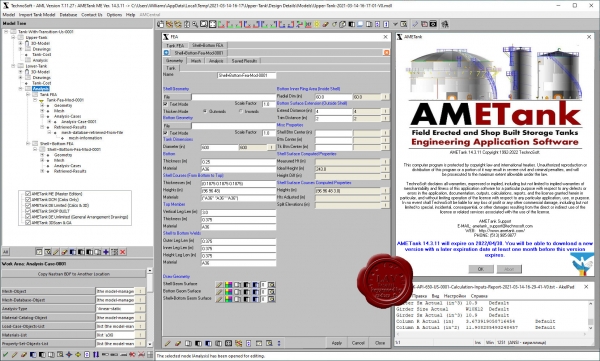
AMETank enables the rapid configuration, design, and detailing of above-ground shop-built and field-erected storage tanks. Design calculations conform to API 650. Calculations include seismic, internal and external pressures, and wind loading. AMETank supports a fully interactive 3D graphical user interface. The configuration and layout of the tank shell, floor, roof and structure, and subsystems is facilitated through intuitive menus with options customized specifically for tank design. The plates layout and fabrication details are provided. Output for NC machines is supported. Detailed assembly and components fabrication drawings for all substructures, appurtenances, ladders, platforms, stairs, and any other subsystems are supported. A complete design can be configured and detailed in less than two hours including the automatic generation of tank 3D geometry with production details, To-scale drawings, bill of material, and weight & cost reports. Also TechnoSoft provides services for laser scanning and digital reconstruction of tanks, terminals, refineries, and other assets. Assessments include bottom and foundation settlement, shell roundness and verticality, structural column verticality, and floating roof to shell operation. Tank calibration and generation of strapping tables is available. Inspection and integrity analysis services are available. Inspection services include a large array of NDE technologies including ultrasonic, magnetic particle, liquid penetrant, visual, magnetic flux leakage, and vacuum box testing. Tank report calculations on corrosion rates, safe fill height, seismic evaluation, maximum working pressure, and other evaluations as per API 653 are supported. |
| |
 Читать статью дальше (комментариев - 9)
| |
|
 |
 Автор: Williams Автор: Williams
 Дата: 14 июня 2022 Дата: 14 июня 2022
 Просмотров: 1 203 Просмотров: 1 203 |
| |
Bentley OpenPlant CONNECT Edition Update 10 RUS - online installers
Open Modeller 10.10.00.072, Open Isometrics Manager 10.10.00.071, Open PID 10.10.00.071
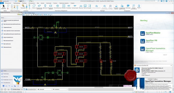
Решение Bentley OpenPlant завоевало популярность в среде инженеров благодаря тому, что позволяет легко создавать интеллектуальные модели сложных промышленных объектов. Моделирование трубопроводов, оборудования, опор и сложных опорных узлов, приборов, кабельных лотков, систем отопления, вентиляции и кондиционирования ведется на основе каталогов со значительной экономией времени, а практически вся рабочая документация генерируется автоматически. Это значит, что инженерам не приходится вручную дорабатывать изометрические и ортогональные чертежи, спецификации, ведомости и отчеты. К тому же OpenPlant сводит к минимуму возможные ошибки и в разы сокращает время подготовки каждого чертежа.
В процессе проектирования инженеры могут обмениваться данными и оперативно реагировать на изменения моделей инженерами смежных отделов, таких как отдел генплана, строительный, электротехнический отдел и другие отделы, работающие в программном обеспечении Bentley, за счет бесшовной интеграции всех систем друг с другом. Однократно внесенная информация повторно не вводится и доступна всем участникам проектной команды. Это позволяет сохранить время, затрачиваемое на повторный ввод данных, и устранить ошибки. Решение OpenPlant основано на стандартах ISO 15926, что позволяет обмениваться информацией между OpenPlant и другим программным обеспечением, каталогами производителей и любыми приложениями, поддерживающими эти стандарты.
OpenPlant PowerPID предназначен для создания интеллектуальных технологических и функциональных схем автоматизации. Продукт поставляется с библиотекой условных обозначений элементов, соответствующих стандартам ISA, ISO и ГОСТ, а также с каталогами оборудования и трубопроводных изделий российских и зарубежных производителей.
OpenPlant Modeler предназначен для размещения параметрического и стандартного оборудования из каталогов в трехмерном пространстве модели, а также для интерактивной трассировки трубопроводов и размещения элементов трубопроводов, опор, ОВиК, КИП и кабельных лотков в 3Dмодели. Продукт поставляется с базой данных оборудования и трубопроводных элементов российских и зарубежных производителей.
OpenPlant Isometrics Manager предназначен для быстрой и автоматической генерации изометрических чертежей по 3Dмоделям трубопроводов. В программе OpenPlant Isometrics Manager легко настроить внешний вид изометрических чертежей, в том числе условные графические обозначения элементов, типы размеров и отчетов. Продукт максимально прост в применении: нажали на кнопку — все чертежи сформировались автоматически за секунды. |
| |
 Читать статью дальше (комментариев - 9)
| |
|
 |
 Автор: Williams Автор: Williams
 Дата: 13 июня 2022 Дата: 13 июня 2022
 Просмотров: 1 781 Просмотров: 1 781 |
| |
modri planet d.o.o. 3Dsurvey v2.15.1 x64
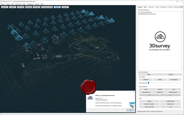
3Dsurvey is a software solution for land surveying data processing. Take a photo with any standard digital camera, import images into 3Dsurvey and produce your own orthophoto maps, digital surface models and calculate volumes faster and more easily. Data is processed automatically based on matching algorithms. Use our smart tools to be even more efficient.
|
| |
 Читать статью дальше (комментариев - 11)
| |
|
 |
| ПОИСК ПО САЙТУ |
 |
|
 |
| КАЛЕНДАРЬ | | |
 |
| « Октябрь 2025 » |
|---|
| Пн | Вт | Ср | Чт | Пт | Сб | Вс |
|---|
| | 1 | 2 | 3 | 4 | 5 | | 6 | 7 | 8 | 9 | 10 | 11 | 12 | | 13 | 14 | 15 | 16 | 17 | 18 | 19 | | 20 | 21 | 22 | 23 | 24 | 25 | 26 | | 27 | 28 | 29 | 30 | 31 | |
|
 | |
| |
|