|
 |
 Автор: Williams Автор: Williams
 Дата: 2 декабря 2022 Дата: 2 декабря 2022
 Просмотров: 1 310 Просмотров: 1 310 |
| |
Bentley OpenBuildings Designer CONNECT Edition Update 10 v10.10.00.197 - online installer
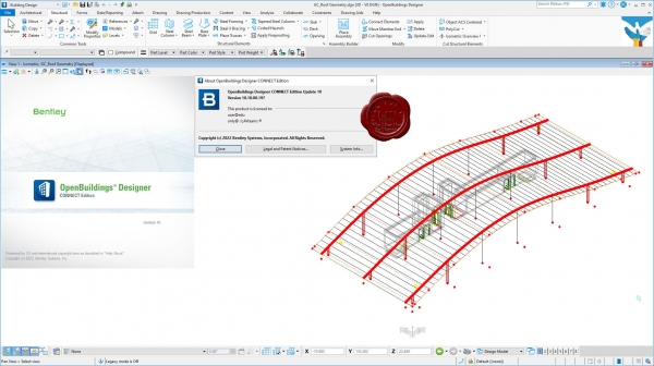
Почему OpenBuildings, больше, чем BIM. Ответ кроется в прошлом названии программы - AECOsim. Как правило, все современные BIM-решения, которые позиционируются, как комплексные, можно описать только тремя буквами: AEC – архитектура, инженерные сети, строительство. AECOsim кроме этого есть функционал для эксплуатации, к тому же в OpenBuildings в рамках одного файла легко можно объединить проект здания с большими инфраструктурными проектами.
7 причин, почему стоит работать в OpenBuildings:
- Упрощение процесса проектирования.
- Подключение существующей реальности.
- Создание архитектурных решений, конструктивных решений, комплексных инженерных систем.
- Совместимость с вычислительным проектированием.
- Управление данными и отчетностью.
- Всесторонняя совместимость и взаимодействие.
- Визуализация.
С OpenBuildings вы получите огромную библиотеку предварительно разработанных 3D-моделей различных архитектурных, конструктивных и инженерных компонентов, а также электрические символы.
Одной из наиболее важных частей моделирования OpenBuildings является то, что в нем есть возможность объединенного рабочего пространства. Это рабочий процесс, в котором разные специалисты могут работать над разными частями проекта, а затем объединять в один комплексный проект, который будет содержать все проектные и BIM данные.
Для анализа проекта и корректировки ваших решений, особенно на ранних этапах проекта, когда нет данных от смежников, вы можете воспользоваться моделированием реальности для создания точной цифровой копии любого объекта от помещения до целого города. Программа может обрабатывать облака точек, фотографии, 3д фотографии, сетки реальности.
Каждый элемент модели можно снабдить ссылками которые будут ссылаться либо на чертежи, либо на офисные документы ворд, пдф, эксель и дргие. Гипермоделирование - это особенность, уникальная для решения Bentley, основанного на технологии Power-Platform, которая накладывает чертежи на модель.
OpenBuildings может интегрировать в себя разные типы файлов: 3D Object file, Sketchup File, 3D Max file, Revit Family, DWG/DXF, gbXML (энергетический анализ), 3dm – Rhino.
Благодаря многообразию решений Бентли на платформе MicroStation все специалисты от ГИС до ПРОЕКТИРОВАНИЯ, СТРОИТЕЛЬСТВА, ДОРОГ И МОСТОВ получают междисциплинарную координацию с эталонной технологией MicroStation и ее федеративным подходом. Таким образом, платформа MicroStation и ее формат файла dgn представляют собой среду общего моделирования. За время существования проекта создается много данных. Каждый участник проекта должен иметь доступ к нужным данным в нужное время в нужном формате. |
| |
 Читать статью дальше (комментариев - 13)
| |
|
 |
 Автор: Williams Автор: Williams
 Дата: 1 декабря 2022 Дата: 1 декабря 2022
 Просмотров: 6 042 Просмотров: 6 042 |
| |
ProtaStructure Suite Enterprise 2022 v6.0.431
now fully offline
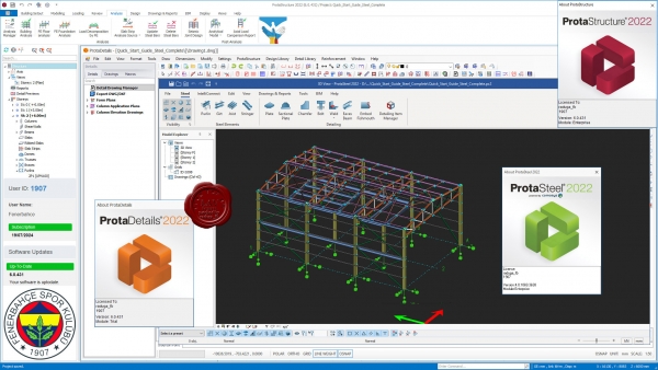
ProtaStructure Suite is the most comprehensive solution for multi-material analysis, design and automated detail drawings of structures. ProtaStructure Suite combines the power of ProtaStructure together with the full detailing capability of ProtaDetails for the ultimate building design and detailing solution for structural engineering professionals. See below for information on which system is best for your business. ProtaStructure Professional Suite is the all-in-one package for multi-material modelling with steel, concrete and composite members, 3-D finite element analysis, code-compliant design and detailing of building structures. ProtaStructure Enterprise Suite extends professional edition with advanced time-history, staged construction and nonlinear analyses, seismic isolators, nonlinear link elements and seismic assessment/retrofitting. ProtaStructure includes new module - ProtaSteel - for steel connection design and detailing. Hundreds of new features and enhancements in ProtaStructure and ProtaDetails for rapidly designing and documenting your building projects, and our dynamic new ProtaBIM for coordination with other leading BIM systems.
What's new:
|
| |
 Читать статью дальше (комментариев - 49)
| |
|
 |
 Автор: Williams Автор: Williams
 Дата: 29 ноября 2022 Дата: 29 ноября 2022
 Просмотров: 2 185 Просмотров: 2 185 |
| |
Bentley MicroStation CONNECT Edition Update 17 build 10.17.01.062 - online installer
with the newest Connection Client patch
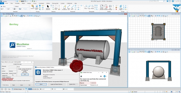
MicroStation - самая производительная, наиболее доступная и совместимая САПР-платформа для проектирования, строительства и эксплуатации мировой инфраструктуры.
Вам, вероятно, известно, что 95% инфраструктуры в мире проектируется, строится и поддерживается с применением файлов форматов DGN и DWG. При помощи MicroStation пользователи имеют возможность непосредственно редактировать содержимое обоих форматов файлов одновременно. Эта возможность превращает MicroStation в платформу для обеспечения совместимости, являющуюся обязательным атрибутом.
MicroStation также является платформой для инноваций, расположенной в центре полного спектра вертикальных программных приложений, обеспечивающей пользователей возможностью индивидуализации приложений с помощью VBA, а также возможностью "вертикального роста" при помощи узкоспециализированных решений для увеличения производительности при поддержании полной целостности данных по всему проекту.
С учетом лишь из этих двух соображений, то, что MicroStation используется всеми, включая архитекторов, инженеров, картографов и подрядчиков по проектам в области архитектуры, строительства и инженерного проектирования, не должно вызывать удивления. За счет этого данная система становится стандартом для лучших проектировщиков мира, являющихся участниками рейтинга ENR Global 150. |
| |
 Читать статью дальше (комментариев - 16)
| |
|
 |
 Автор: Williams Автор: Williams
 Дата: 28 ноября 2022 Дата: 28 ноября 2022
 Просмотров: 3 359 Просмотров: 3 359 |
| |
ProtaStructure Suite Enterprise 2022 v6.0.392 repack 3
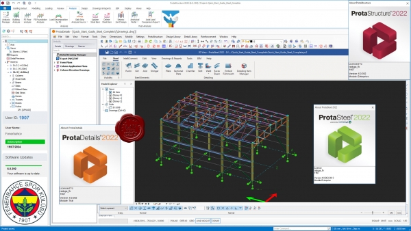
ProtaStructure Suite is the most comprehensive solution for multi-material analysis, design and automated detail drawings of structures. ProtaStructure Suite combines the power of ProtaStructure together with the full detailing capability of ProtaDetails for the ultimate building design and detailing solution for structural engineering professionals. See below for information on which system is best for your business. ProtaStructure Professional Suite is the all-in-one package for multi-material modelling with steel, concrete and composite members, 3-D finite element analysis, code-compliant design and detailing of building structures. ProtaStructure Enterprise Suite extends professional edition with advanced time-history, staged construction and nonlinear analyses, seismic isolators, nonlinear link elements and seismic assessment/retrofitting. ProtaStructure includes new module - ProtaSteel - for steel connection design and detailing. Hundreds of new features and enhancements in ProtaStructure and ProtaDetails for rapidly designing and documenting your building projects, and our dynamic new ProtaBIM for coordination with other leading BIM systems.
What's new:
|
| |
 Читать статью дальше (комментариев - 37)
| |
|
 |
 Автор: Williams Автор: Williams
 Дата: 26 ноября 2022 Дата: 26 ноября 2022
 Просмотров: 370 Просмотров: 370 |
| |
Stellar Converter for GroupWise Corporate v4.0.0.2
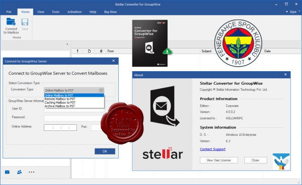
Stellar Converter for GroupWise is a powerful software to extract emails, attachments, GroupWise address book contacts, documents, calendars, appointments, tasks, reminders, and sticky notes from GroupWise mailbox to Outlook PST & MSG, EML, RTF, PDF, HTML. Supports GroupWise 2018, 2014, 2012, 8.0, 7.0, 6.5, 6.0.
|
| |
 Читать статью дальше (комментариев - 4)
| |
|
 |
 Автор: Williams Автор: Williams
 Дата: 24 ноября 2022 Дата: 24 ноября 2022
 Просмотров: 682 Просмотров: 682 |
| |
Ocean Data Systems Dream Report v5.0 R20-3
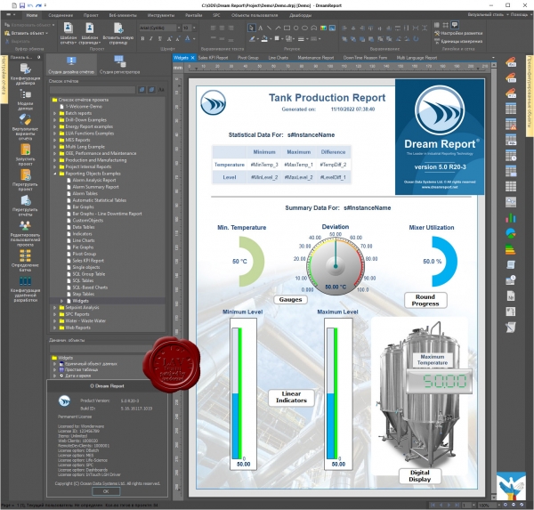
Dream Report is the leading solution for reports and dashboards, recommended and resold by more suppliers of automation than any other reporting solution.
While a fit for all general purpose applications, Dream Report offers specially developed functionality for; Water, Waste Water, Life Sciences – Pharmaceutical and Biotech, Building Automation, Oil and Gas – Upstream and Downstream, Automotive, Aerospace, Power Generation and Distribution, Utilities Distribution, and many more.
Based on modern technologies, Dream Report enables easy connectivity to automation systems and equipment (e.g. in buildings, factories, etc.), through over 80 different data interface drivers to both open and proprietary protocols. Dream Report collects and archives real-time information and accesses open or proprietary archives and databases, generating professional reports and dashboards on schedule, on event or manually, then publishing and e-distributing that information. The solution delivers Web-based reports management over the internet and intranet via an integrated web portal. Users can access generated reports, generate new reports and build web-based interactive dynamic dashboards in minutes. An intuitive and easy user interface allows fast project development and project maintenance with low engineering costs. Development is accomplished without a single line of code.
Interactive and dynamic web forms allow users to easily create web-based, dynamic and interactive reporting applications. These also deliver drill-down reporting functionality with user managed navigation.
Advanced manual data management offers market leading functionality which allows users to easily build manual browser-based data entry forms with features to support timestamps (user selected), via web browsers and mobile devices.
DATA ACCESS – FROM ANY/ALL SYSTEMS
Dream Report integrates robust communications to collect data and alarms from multiple real-time and history sources. It uses OPC, OLE and ODBC standards to connect and collect Data from different suppliers. Moreover, Ocean Data Systems develops custom drivers to leverage native history from SCADA systems, DCS, RTUs and more.
DATA LOGGING – WHEN DATA ISN’T ALREADY ARCHIVED
Dream Report integrates a powerful historian (Data Logger) module to log clean and accurate data to any standard database such as SQL Server, Oracle, MySQL, Access… This unique feature positions Dream Report™ not only as a reporting tool, but also as the complete solution for accessing data, aggregating data and integrating data from and across all your systems, both industrial and business oriented.
DATA EXTRACTION & ANALYSIS
Dream Report integrates a user friendly graphic object and analytics library to extract Data, generate statistics and format results for display as Values, Tables, Bars, Pies, Charts and more…
REPORT AND DASHBOARD DESIGN
Dream Report’s studio integrates an intuitive and easy to learn graphical editor to create beautiful reports and dashboards, delivering the results you need in any industry.
REPORT GENERATION & DISTRIBUTION
Dream Report generates reports and dashboards manually and automatically. The automatic mode enables generation based on events and on schedule. When ready, reports can be automatically printed, emailed, stored and published to any location, even over the web. |
| |
 Читать статью дальше (комментариев - 9)
| |
|
 |
| ПОИСК ПО САЙТУ |
 |
|
 |
| КАЛЕНДАРЬ | | |
 |
| « Октябрь 2025 » |
|---|
| Пн | Вт | Ср | Чт | Пт | Сб | Вс |
|---|
| | 1 | 2 | 3 | 4 | 5 | | 6 | 7 | 8 | 9 | 10 | 11 | 12 | | 13 | 14 | 15 | 16 | 17 | 18 | 19 | | 20 | 21 | 22 | 23 | 24 | 25 | 26 | | 27 | 28 | 29 | 30 | 31 | |
|
 | |
| |
|