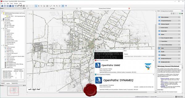
Bentley OpenPaths Ultimate 2024 24.00.00.26 (AGENT, EMME, CUBE, DYNAMEQ, CityPhi)

What is OpenPaths?
OpenPaths Answers Your Transport Planning “What If?” Questions and Opens Paths To More Efficient, Resilient, and Sustainable Mobility. OpenPaths incorporates both multimodal transport network modeling and modern travel demand forecasting capabilities to deliver the most comprehensive transport modeling platform for strategic and operational transport planning. Generational shifts to travel behavior, mobility service, and technology challenge every decision. You need the capabilities to build a model that represents your city or region, including multimodal networks, travel demand, and operational data, to successfully inform 21st century planning initiatives–faster and more accurately than ever before.
OpenPaths AGENT is game-changing travel demand modeling software used to forecast mobility decisions at any level of detail, from zones to individual people. From changing demographics, or residential and work locations, to daily trip patterns including time, location, and mode choice, OpenPaths AGENT captures realistic representations of mobility to address 21st-century transport planning challenges. And with machine learning built-in, OpenPaths AGENT takes advantage of new mobility data sources to achieve improved model calibration at reduced time and cost.
OpenPaths EMME is a complete transportation forecasting application for planning the urban, regional, and national movement of people. OpenPaths EMME is used to create digital transport models for travel demand forecasting, traffic planning, transit service planning, and related needs to provide an evidence base for transport strategy and policy decision-making. By modeling the people, places, processes, and options involved in travel, transport planners can evaluate transport system performance on any number of virtual scenarios prior to implementation.
OpenPaths CUBE Is multimodal transport planning software that is used to develop and apply predictive multimodal transportation models to simulate how changes in infrastructure, operations, technology, and demographics will impact movement and accessibility of a given area. OpenPaths CUBE lets you analyze the effects of new projects and policies on a city’s transportation network and its population. OpenPaths CUBE provides a desktop interface to link a model, data, and geographic information system (GIS), easing the development and application of your models.
OpenPaths DYNAMEQ is a traffic simulation and dynamic traffic assignment (DTA) software for transport planning and traffic management studies of virtually any size. Whether you are implementing freeway or urban congestion pricing, planning major infrastructure rehabilitation, or undertaking road improvements, transit planning or neighborhood redevelopments, OpenPaths DYNAMEQ allows you to accurately assess the related traffic and mobility impacts.
OpenPaths CityPhi provides an API to produce captivating data visualizations, interactive animations, and insightful analytics about mobility and location by turning data about the movement of people and things, their location, and their changing social, economic, and physical characteristics into dynamic scenes. With OpenPaths CityPhi you can create applications that let users explore time, space, and motion with interactive animations that stay responsive at scale.