|
 |
 Автор: Williams Автор: Williams
 Дата: 10 июня 2024 Дата: 10 июня 2024
 Просмотров: 1 108 Просмотров: 1 108 |
| |
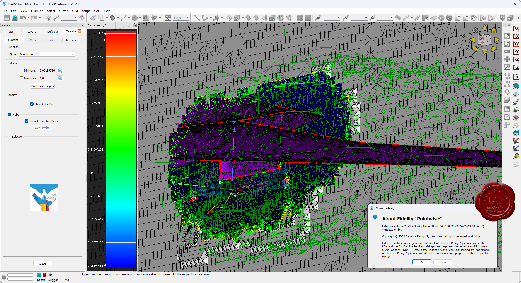
Deep Excavation DeepEX 2024 v24.0.6.2
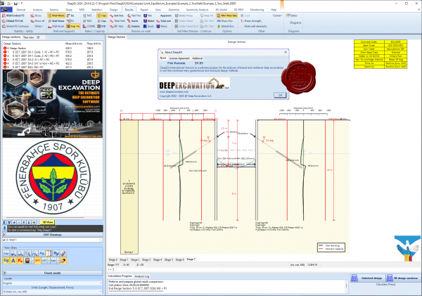
DeepEX is an innovative, easy to use, software program for deep excavations, developed by experts for engineers like you. It can perform both geotechnical and structural design for many wall types that include soldier pile walls, sheet pile walls, and diaphragm walls with multiple sections of reinforcement. DeepEX can also perform slope stability analysis with soil nailing. It comes packed with all structural and geotechnical design codes. DeepEX is an upgrade to our DeepEX 16 and DeepXcav 2012 versions.
What does DeepEX do?
- Deep excavation design: DeepEX helps you design deep excavations by offering the most comprehensive software in the world. Many clients have performed designs within 25% of the original time required time.
- Cost estimation: DeepEX is now the only software that offers preliminary cost estimation and quantity take offs.
- Slope stability: DeepEX also performs slope stability analyses so that you do not have to export data to another package, thus saving you time. Checkout below a slope stabilization analysis in Portland, Oregon, with reinforced concrete piles and ground anchors, during an extreme seismic event.
- Analysis methods: DeepEX is the only software in its category that can analyze a wall with limit-equilibrium or elastoplastic methods. In the elastoplastic analysis, the soil is divided in active and passive non-linear soil springs. In the elastoplastic analysis, the lateral soil pressures depend on the soil properties and the proposed construction stage history.
- Building Damage Assessment: DeepEX is the only software that can easily assess the damage potential of ajdacent buildings next to an excavation. DeepEX uses thorough methods to estimate potential crack widths and building settlement in three dimensions. The program then accesses for critial building elemens the damage potential as negligible, slight, moderate, severe, or very severe.
- Design standards: DeepXcav implements a wide range of US and European design standards. These include: AISC, ACI, AASHTO, AS 3600, BS, BS 5950-2000, EC2, EC3, EC7, DIN, DM08, etc.
- Frame Analysis: DeepEX allows you to create the full frame of your deep excavation, and optimize all members within typically 5 minutes
- Export to DXF: DeepEX has a new module that allows you to export 80% drawings to DXF. You can export multiple stages and create stage sequencing diagrams. You can also export stages with result diagrams.
- Pile Supported Abutments: Evaluate pile supported abutments with all pile types for lateral and vertical pile loads, and also examine their effects on an adjacent excavation.
|
| |
 Читать статью дальше (комментариев - 10)
| |
|
|
Автор: Williams
Дата: 8 июня 2024
Просмотров: 996 |
| |
Leica Hexagon MinePlan (ex. MineSight) 2024 Release 1
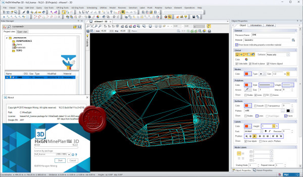
HxGN MinePlan provides geologists and engineers with powerful 3D modeling and data visualization. It supports seamless workflows, from exploration to production and it's backed by more than 50 years of innovation in partnership with thousands of global users.
Productive mines depend on being able to build detailed geological surfaces and solids. Statistical and geo-statistical analysis of project data is essential to producing an accurate block model with confidence.
Click here to interactively explore your own life-of-mine journey.
Geosciences
The Geosciences suite empowers resource geologists to store, manage and analyse drillhole data.
Open pit engineering
MinePlan open pit engineering suite offers software packages that help you improve efficiency and make informed decisions.
Underground engineering
CAD offers solutions for underground design challenges, including 3D visualisation and tools for pillar design, plus more.
HxGN MinePlan Survey
MinePlan Survey allows for management of survey data throughout the mining lifecycle using a comprehensive software solution. |
| |
Читать статью дальше (комментариев - 12)
| |
|
|
Автор: Williams
Дата: 7 июня 2024
Просмотров: 2 137 |
| |
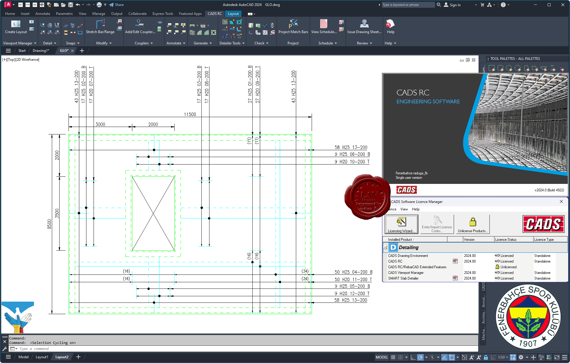
CADS RC 2024.0

CADS has established an enviable reputation for providing expertise as well as expert software for reinforced concrete detailers. Running in AutoCAD, CADS RC has been the market leading reinforced concrete detailing software in the UK and around the world for more than 20 years. CADS RC’s success is due to its advanced detailing features and technical excellence, which include integration with design and fabrication software. The automatic bar bending schedule is updated in real time which means errors are eliminated and time is saved. CADS RC can detail anything and has been successfully used on all sorts of building, transportation, water, process and power projects including precast concrete elements.
CADS RC builds on AutoCAD, the industry standard CAD platform. It fully exploits the stable 2D drawing environment of AutoCAD, tailoring a solution for rebar detailing and bar bending scheduling that meets the stringent requirements of the industry. As an integrated AutoCAD application, CADS RC adds functionality and toolbars to your AutoCAD system and is supported by quality user manuals and training.
If you are a CAD Manager you will find it easy to recruit trained and experienced technicians for such an industry standard solution, whilst the level of support, advice and expertise available through our help desk will impress all users.
CADS RC is a global player in the truest sense of the word. Since the original software was launched as CADS RC in the UK over 20 years ago, further versions for North America, India and South Africa have been released. High quality output, stability, integration and flexibility have seen the adoption of CADS RC across diverse worldwide markets. CADS RC is often the default choice for many international and prestige projects, the software having earned its’ reliability and consistency credentials.
CADS RC maintains a reinforcement database that always reflects exactly what is on the drawing. In addition, all new bars and changes are instantly added to the bar bending schedule which means that checking is reduced and errors virtually eliminated. Additional audit commands detect incomplete or unlabelled bars and ensure compliance with the configured detailing standard. CADS RC drawings require less manual checking, thus scheduling errors are virtually a thing of the past!
Rebar detailing can be a slow manual process, with no certainty as to the accuracy or consistency of the eventual drawing output. Scrap and wastage due to inaccurate reinforcement drawings, mistakes in Bar Bending Schedules (BBS) and unutilised off-cuts costs the construction industry. Reinforcement detailing and bar listing has never been easier. CADS RC helps you accomplish this faster and more accurately than manual methods by creating drawings whilst automating the preparation of BBS. |
| |
Читать статью дальше (комментариев - 23)
| |
|
|
Автор: Williams
Дата: 6 июня 2024
Просмотров: 364 |
| |
Valentin Software GeoT*SOL 2023 R3
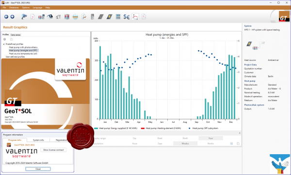
GeoT*SOL offers you the choice between different heat sources (soil, air and groundwater), operating modes (monovalent, monoenergetic and bivalent) and numerous system configurations for your location. The program allows for bivalent systems with boiler as heat generator as well as the integration of solar thermal systems and photovoltaic systems.
Based on a dynamic minute simulation, electricity consumption, seasonal performance factors, operating costs and other system data can be calculated, taking into account blocking periods and tariffs. With these parameters, GeoT*SOL helps you to develop efficient and economical heat pump systems. Selected results can be conveniently incorporated into the project report for the client. |
| |
Читать статью дальше (комментариев - 3)
| |
|
|
Автор: Williams
Дата: 5 июня 2024
Просмотров: 358 |
| |
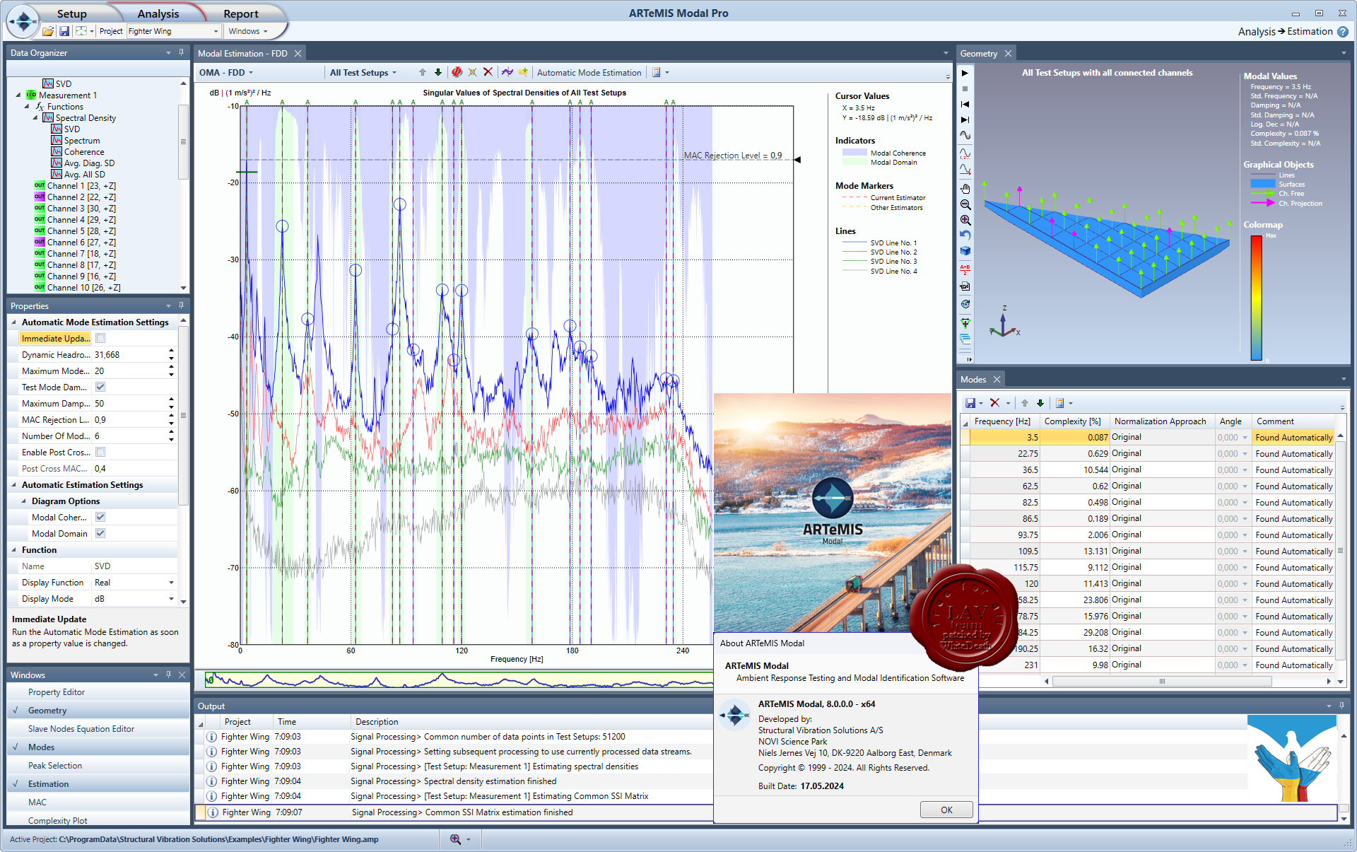
Structural Vibration Solutions DEWESoft ARTeMIS Modal Pro v8.0.0.0
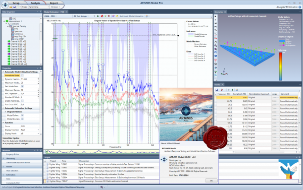
This is the basic version of ARTeMIS Modal having a frequency domain method for Operational Modal Analysis, and optionally direct data acquisition support and frequency domain methods for Experimental Modal Analysis. It is the software that allows you to get both modal analysis and operating deflection shapes analysis at a favorable entry price. The software includes setup tasks allowing you to create a project from scratch. There is a geometry generator where test geometries can be made in an object oriented manner, or you can upload gerometries into the software from various popular file formats. Measurements for Operational Modal Analysis and Operating Defection Shapes analysis can be loaded from more than 20 different file formats. Measurements channels can be assigned to the right geometry nodes and directions using drag and drop features. The software has a variety of built-in signal processing tools that can be used to enhance the performance of the analysis methods. In the basic version there are tools for detrending, decimation and filtering of the raw data as well as spectral density estimation. There is alsp an automatic selection of the so-called projection channels for more effective processing. The basic version has the effective Frequency Domain Decomposition (FDD) method for Operational Modal Analysis. There are various validation features available, such as mode shape animation and the Modal Assurance Criterion. In addition, it has time and frequency domain Operating Deflection Shapes analysis. It also comes with a built-in report generator which allow you to produce predefined reports in Microsoft Word and Microsoft Power Point. The basic version seamlessly integrates with the Direct Hardware Control, and Experimental Modal Analysis plugins. This opens up for direct measurements for Operational Modal Analysis as well as e.g. direct impact testing for Experimental Modal Analysis.
Standard is the mid-size version of ARTeMIS Modal that, besides all the tasks and features of the basic version, also includes additional frequency domain methods for Operational Modal Analysis and more validation features. This version includes signal processing for detection of harmonic peaks in the spectrum. Harmonic peaks are caused by the presence of rotating components during measurements of a structure. During operational modal analysis of rotating machinery, it is important to be able to distinguish peaks of structural modes from peaks caused by the excitation. Two additional Frequency Domain Decomposition methods are available, that can estimate mode shapes and natural frequencies with more accuracy. On top, these methods also provide an estimate of the damping ratios. Modal parameters from the three built-in modal estimators can be validated against each other in a special designed validation task. In addition, modes obtained from external tools can be imported through Universal File Format and validated against internally produced results. The Standard version seamlessly integrates with the Direct Hardware Control and Experimental Modal Analysis plugins.
In addition to all features and tasks of the Basic and Standard versions, this version has up to five different time domain methods for Operational Modal Analysis. The methods are all of the very fast en efficient Crystal Clear Stochastic Subspace Identification (CC-SSI) type. These methods estimate the modal parameters directly from the measured time series, and some methods even estimate the uncertainties of the modal parameters. This version also includes effective peak reduction techniques, that can be used for pre-processing of the measurements. It can effectively remove selected peaks that can be e-g. servere harmonic peaks caused by the presence of rotating components during measurements of a structure. The Pro version seamlessly integrates with the Direct Hardware Control and Experimental Modal Analysis plugins. It also integrates with the Structural Health Monitoring plugins for Damage Detection, Modal Parameter History tracking and Interstory Drift Analysis. An Automatic File Upload plugin is also available. With this plugin, files being dumped in a designated folder will automatically be uploaded and processed by the software. In this way, modal parameter estimation and damage detection can be performed automatically with user interaction. |
| |
Читать статью дальше (комментариев - 4)
| |
|
|
Автор: Williams
Дата: 4 июня 2024
Просмотров: 2 010 |
| |
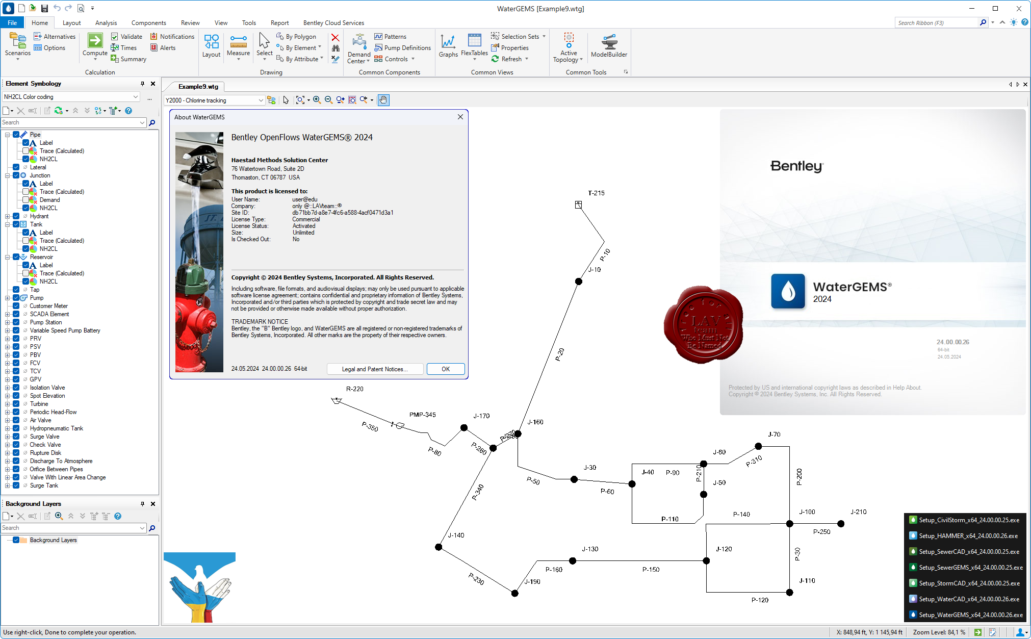
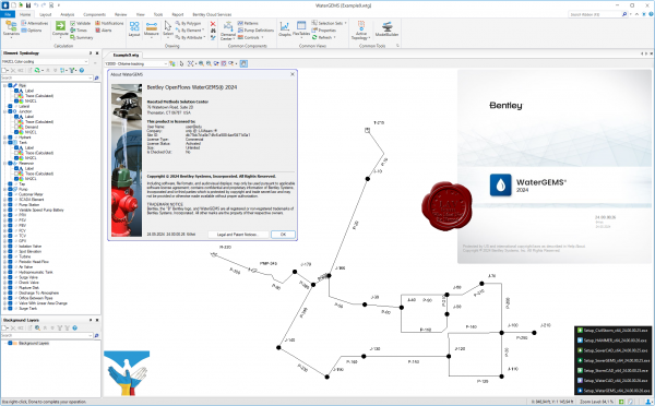
Bentley OpenFlows Hydraulics & Hydrology 2024.0.0.25/26
CivilStorm, HAMMER, SewerCAD, SewerGEMS, StormCAD, WaterCAD, WaterGEMS
 OpenFlows CivilStorm OpenFlows CivilStorm
Open Flows CivilStorm is a fully-dynamic hydraulic modeling application that analyzes complex stormwater systems and solves the St Venant equations. OpenFlows CivilStorm assists engineers working on both complex land development projects and large-scale stormwater management studies to model every aspect of their stormwater systems, including rainfall, runoff, inlet capture and bypass, gravity and pressure piping, detention ponds, outlet structures, open channels, culverts, and more.
OpenFlows HAMMER
OpenFlows HAMMER helps you perform transient analysis and modeling in water or sewer systems to locate trouble spots and determine appropriate serge control strategies. OpenFlows HAMMER’s computationally rigorous engine and easy-to-use interface to efficiently identify, manage, and mitigate the risks associated with transients.
OpenFlows SewerCAD
OpenFlows SewerCAD is used by engineers to design and analyze sanitary sewers. With automatic design features, OpenFlows SewerCAD is ideal for system design and rehabilitation, helping users invest capital improvement funds wisely. OpenFlows SewerCAD is a subset of OpenFlows SewerGEMS.
OpenFlows SewerGEMS
Engineers use OpenFlows SewerGEMS to analyze, design, and operate sanitary and combined sewer systems. Its dynamic wave engine solves the full St. Venant equations. The engine is especially suited for combined sewer systems where the hydrology of direct runoff into the collection system must be modeled. OpenFlows SewerGEMS is a superset of OpenFlows SewerCAD and can be run in Esri ArcGIS, AutoCAD, MicroStation, or as a stand-alone application.
OpenFlows StormCAD
OpenFlows StormCAD is a hydraulic modeling application for the peak flow analysis of storm sewer systems. OpenFlows StormCAD assists land and site developers, roadway and transportation designers, and stormwater master planners and reviewers, by automatically determining cost-effective pipe sizes, invert elevations and inlet sizes.
OpenFlows WaterCAD
OpenFlows WaterCAD is an easy-to-use hydraulic and water quality modeling application for water distribution systems from fire flow and constituent concentration analyses, to energy cost management and pump modeling. You can design new water systems and manage existing water networks effectively to reduce disruption risks and energy use. Use OpenFlows WaterCAD from within MicroStation, AutoCAD, or you can choose to use OpenFlows WaterCAD as a stand-alone application, for additional flexibility.
OpenFlows WaterGMS
OpenFlows WaterGEMS provides you with a comprehensive yet easy-to-use decision-support tool for water distribution networks. The software helps improve your knowledge of how infrastructure behaves as a system, how it reacts to operational strategies, and how it should grow as population and demands increase. From fire flow and water quality simulations, to criticality and energy cost analysis, OpenFlows WaterGEMS has everything you need in a flexible multiplatform environment. OpenFlows WaterGEMS is a superset of OpenFlows WaterCAD. |
| |
Читать статью дальше (комментариев - 21)
| |
|
|
Автор: Williams
Дата: 3 июня 2024
Просмотров: 7 834 |
| |
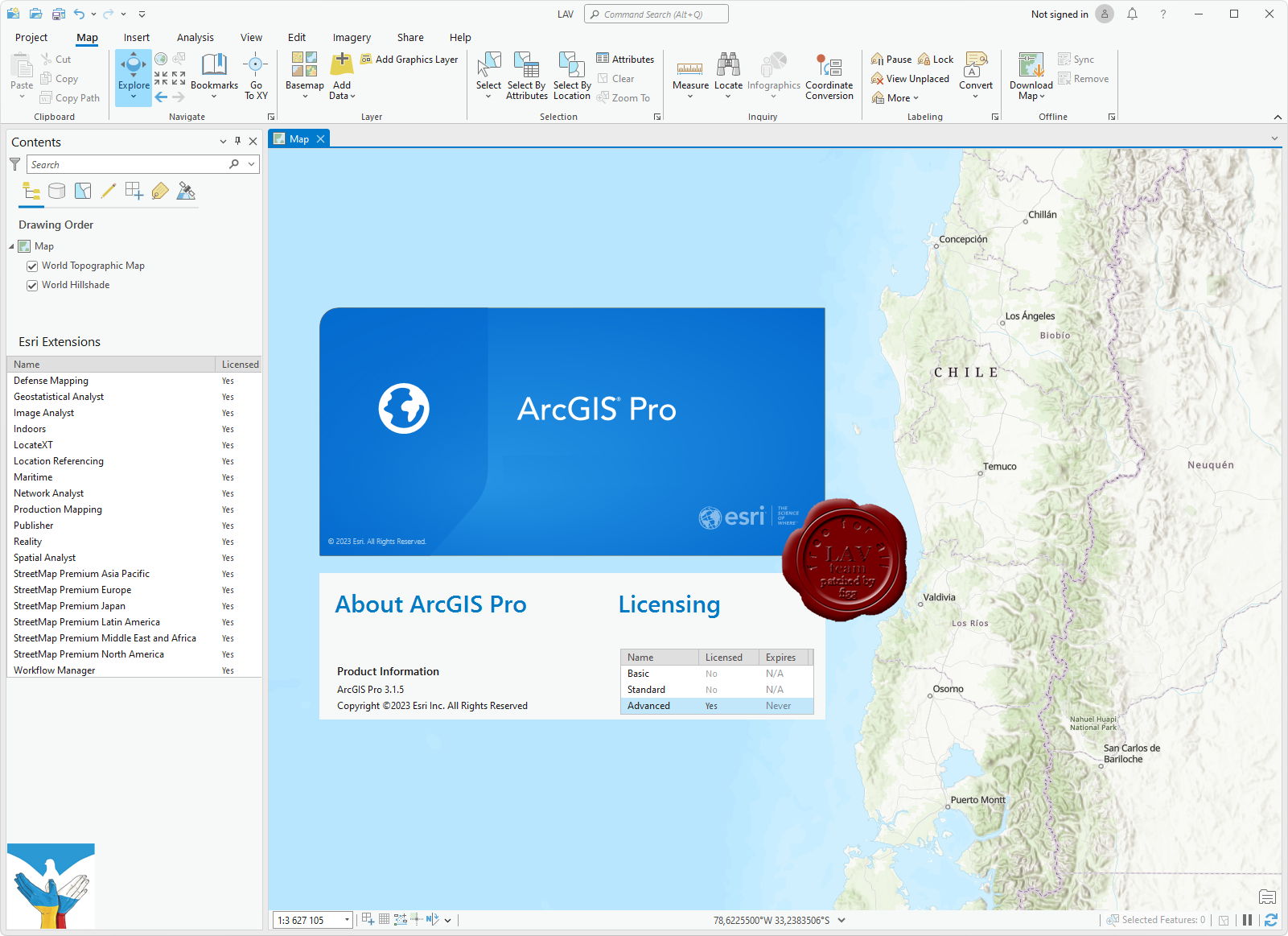
ESRI ArcGIS Pro v3.1.5 Multilingual
solution was updated 27/05/2024

ArcGIS Pro – это новейшее настольное приложение для создания и работы с пространственными данными. В нем есть инструменты для визуализации, анализа, компиляции и публикации данных.
ArcGIS Pro организует ресурсы, используемые в вашей работе, в проекты. В проекте находятся карты, компоновки, слои, таблицы, задания, инструменты и подключения к серверам, базам данных, папкам и стилям. Проекты также включают в себя ресурсы с портала вашей организации или ArcGIS Online.
- Создайте проект или начните работу, открыв шаблон проекта, созданного Esri или другими участниками сообщества.
- Ресурсы можно добавлять из папок, с портала или из ArcGIS Online, указывая их или находя по ключевым словам.
- Убедитесь, что сохранили ваш проект, чтобы он был готов к работе в следующем сеансе работы в ArcGIS Pro.
- Если вы хотите организовать общий доступ к проекту, можно создать шаблоны проектов для использования другими при начале работы или упаковать проект и его данные.
С помощью ArcGIS Pro можно визуализировать как 2D, так и 3D данные.
- Карты отображают 2D-данные, а сцены - 3D. Более подробно о работе с 3D в ArcGIS Pro.
- В одном проекте можно хранить столько карт, сколько необходимо, можно открыть несколько карт сразу и просматривать их одновременно. Связывайте виды], чтобы при перемещении и масштабировании экстент всех карт обновлялся одновременно.
- Быстрая работа с картой возможна благодаря встроенным функциям навигации и горячим клавишам клавиатуры и мыши, с их помощью исследовать данные стало гораздо удобнее.
- Создавайте эффектные карты, применяя надписи, символы и всплывающие окна.
- Для отображения данных в формате, доступном для печати и экспорта, в проекте можно создать компоновки.
Геообработка предоставляет богатый набор инструментов для выполнения пространственного анализа и управления ГИС-данными в автоматическом режиме. Используйте ArcGIS Pro для анализа и управления ГИС-данными, создавайте инструменты для автоматизации рабочего процесса и решения комплексных задач.
- Выбрав подходящий инструмент геообработки, укажите местоположение входного и выходного наборов данных, настройте влияющие на процесс дополнительные параметры и запустите его.
- ArcGIS Pro содержит множество встроенных инструментов, но можно создать свои собственные.
- Воспользуйтесь ModelBuilder – визуальным конструктором, который позволяет создать блок-схему или модель процессов пространственного анализа или управления данными.
- Автоматизируйте анализ, конвертацию и управление данными, картографирование с помощью библиотек скриптов Python и ArcPy.
- Включайте дополнительные модули для расширения аналитических возможностей, в т.ч. сетевых, пространственных и геостатистических функций.
С помощью ArcGIS Pro можно создавать и редактировать различные виды объектов: города, здания, дороги, леса, реки, горы и любые другие пространственные явления, при этом можно интегрировать в проекте данные из различных источников. Есть возможность визуализировать слои для редактирования как в 2D, так и в 3D, таким образом можно рассматривать пространственные объекты с любой перспективы.
- Разработайте схему данных для построения модели мира.
- Редактирование включает создание, обновление и поддержание геопространственной информации, которая хранится и организуется в слоях.
- Можно создавать новые объекты в слое, цифруя их на карте и добавляя атрибуты для задания их характеристик.
- Можно обновлять существующие пространственные объекты, чтобы отражать их текущее состояние на основании свежеполученных данных или поступающей из поля информации.
- Добавьте дополнительный модуль Data Reviewer для проверки качества данных.
- Для управления корпоративными рабочими процессами интегрируйте Workflow Manager в свою организацию.
Используя задачи, ГИС-администратор может разработать серию шагов, следуя которым пользователь выполнит необходимые операции, соответствующие стандартам организации. Задача – это набор преднастроенных шагов, которые помогут вам и другим пользователям выполнить рабочий или бизнес-процесс.
- Создавайте задачи для выполнения любой функции в ArcGIS Pro.
- Шаги в задаче могут выполняться вручную, либо запускаться автоматически. Шаги могут быть обязательными или дополнительными.
- Записывайте действия, чтобы затем легко воспроизвести их в виде отдельных шагов задачи.
Публикация своей работы – это важная часть ArcGIS Pro. Опубликовать можно все: от целых проектов до карт, слоев и прочих компонентов.
- В целях сотрудничества с другими пользователями, можно построить шаблоны проектов для применения их в начале работы или опубликовать имеющиеся файлы проекта и его элементы на ArcGIS Online или портале.
- Веб-карты можно использовать повторно в ArcGIS Pro, а также на всей платформе ArcGIS, в том числе в браузерах и на мобильных устройствах.
- Для общего доступа при помощи пакета создается сжатый файл, содержащий ГИС данные. Теперь можно упаковать проект целиком или его слои, чтобы поделиться ими с другими.
- Перед публикацией ресурсов ArcGIS Pro может проверить вашу работу на наличие ошибок и замечаний и дать рекомендации по улучшению производительности. Если ArcGIS Pro что-нибудь найдет, будет показано сообщение со ссылкой на раздел справки с информацией о том, как исправить эту ошибку.
- После создания карты или компоновки можно экспортировать ее в другой формат или вывести на печать. Поддерживается ряд стандартных файловых форматов.
ArcGIS Pro includes the following components:
- ArcGIS Pro - the next generation Desktop GIS for visualizing, editing, and performing analysis using local content, or content from your ArcGIS Online or Portal for ArcGIS organization.
- ArcGIS Pro Offline Help (optional) - ArcGIS Pro Help files are installed on your local machine, allowing you to access the help offline. The ArcGIS Pro application must be installed prior to installing the ArcGIS Pro Offline Help.
- ArcGIS Pro SDK for Microsoft .NET (optional) - allows you to extend the capabilities of the ArcGIS Pro application.
- ArcGIS Pro Database Support (optional) - The ProDatabaseSupport.zip file contains all the files necessary to enable Esri ST_Geometry and ST_Raster data types in an enterprise RDBMS or SQLite database. The ProDatabaseSupport.zip file contains files for each supported DBMS and operating system.
- ArcGIS Pro Coordinate Systems Data (optional) - Contains the data files required for the GEOCON transformation method and vertical transformation files for the United States (VERTCON and GEOID12B) and the world (EGM2008) for use with an ArcGIS Pro per user install.
- ArcGIS Coordinate Systems Data (optional) - Contains the data files required for the GEOCON transformation method and vertical transformation files for the United States (VERTCON and GEOID12B) and the world (EGM2008) for use with either ArcMap, ArcGIS Enterprise, ArcGIS Engine, or an ArcGIS Pro per machine install.
- ArcGIS Raster Data (optional) - Currently contains a compressed global elevation model primarily required by users of Ortho Mapping workflows who work offline and don’t have better elevation data required for orthorectification of satellite imagery or to initiate some photogrammetric workflows.
- ArcGIS Data Interoperability for Pro - ArcGIS Data Interoperability provides the ability to build complex spatial extraction, transformation, and loading (ETL) tools for data validation, migration, and distribution.
|
| |
Читать статью дальше (комментариев - 81)
| |
|
|
Автор: Williams
Дата: 2 июня 2024
Просмотров: 989 |
| |
Deep Excavation DeepFND 2024 v24.0.2.4
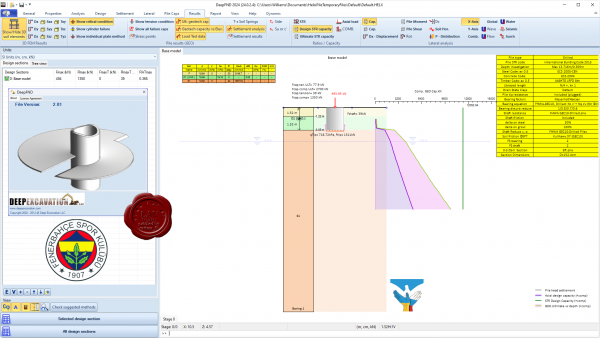 DeepFND is a powerful interactive software for deep foundation and pile design. Axial, lateral, settlement, structural and geotechnical analysis options. Incorporates AASHTO, FHWA, IBC, and Eurocode 7 standards. DeepFND is a powerful interactive software for deep foundation and pile design. Axial, lateral, settlement, structural and geotechnical analysis options. Incorporates AASHTO, FHWA, IBC, and Eurocode 7 standards.
Pile types: drilled piles, driven concrete, driven steel, driven timbe piles, monotube, CFA piles, drilled-in-displacement piles, micropiles, caissons, helical piles.
Methods:
- Settlement analysis, with linear, exponential, and other models
- Lateral pile analysis
- FHWA GEC8
- FHWA GEC10
- AASHTO Norlund
- Eurocode 7
- IBC 2015 standards
- NYC Building Code
- AASHTO LRFD
- Automatic pile length optimization based on geotechnical capacity
- Automatic pile length optimization based on settlement response
|
| |
Читать статью дальше (комментариев - 6)
| |
|
|
| ПОИСК ПО САЙТУ |
|
|
|
|