ГЛАВНАЯ             ФОРУМ             КОНТАКТЫ             RSS             20-YEARS ARCHIVE ПРОФИЛЬ
 
Логин:  
Пароль:  
 Чужой ПК
    Регистрация
    Вспомнить пароль

Strand7 R3.1.1 + WebNotes R3 Software
 
Strand7 R3.1.1 + WebNotes R3
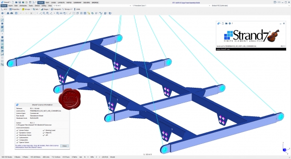
Strand7 R3.1.1 + WebNotes R3

Strand7's fully-integrated visual environment - combined with a suite of powerful solvers - gives you unparalleled functionality in a single application. Construct models, run analyses and investigate results simultaneously using a seamless interface. Strand7 lets you build models quickly. Create, delete and manipulate elements with a comprehensive set of tools, automatic meshing and unlimited undo. Organise a complicated model into a simple set of parts using the Group Tree. Define your own coordinate systems and beam cross-sections. Check mesh quality with aspect ratio and warping contours and free edge detection. Strand7 harnesses the power of Windows. Open multiple models at the same time. Cut-and-paste elements in 3D - even between models - and copy data to and from other Windows® programs. Import geometry data from IGES, ACIS, STEP and DXF files. Choose drawing styles and colours. Set the physical units for viewing and entering data. Dynamically rotate, pan and zoom in real time with a single click. Strand7 gives you a range of result options. Visualise results with contour maps, vector maps and X-Y graphs. Use the Peek tool to inspect result quantities at any point, directly on the model. View, sort and filter results with the Result Listings spreadsheet. Strand7 offers a full set of previewing and printing tools for documenting and reporting your work. Choose your own fonts, titleblocks and logos for a consistent, professional look across all your printing.


Extensive element library
1D: Beam, truss, pipe, spring, damper, connection, catenary cable and contact elements (2D and 3D)
2D: Plane stress, plane strain, plate/shell, 3D membrane, shear panel and axisymmetric elements
3D: Tetrahedral, wedge, pyramid and hexahedral elements
Constraints: Rigid links, pinned links, master/slave links, sector-symmetry links, coupling links, attachment links

Comprehensive range of solvers
Static: Linear, buckling, influence and non-linear (geometric, material and boundary non-linearity)
Dynamic: Natural frequency, harmonic response and spectral response
Transient: Linear and non-linear (geometric, material and boundary non-linearity)
Heat transfer: Steady-state and transient (linear and non-linear)

Standard and specialist materials
Linear and non-linear material models, including: Isotropic, orthotropic, anisotropic, soil, rubber, composite laminates and user-defined materials

Industry-standard data libraries
Materials: Engineering properties for common materials - steel, timber, aluminium, concrete and glass
Sections: Industry-standard cross-sections, including I-beams, tubes, channels and angles
    Читать статью дальше  (комментариев - 41)


Bentley MOSES Ultimate CONNECT Edition 12 Update 3 version 12.03.00.104 Software
 
Bentley MOSES Ultimate CONNECT Edition 12 Update 3 version 12.03.00.104 x64

Bentley MOSES Ultimate CONNECT Edition 12 Update 3 version 12.03.00.104

Minimize offshore project risks with designs optimized using MOSES integrated simulation software. Apply industry best practices for installation and design sequences, and explore design alternatives with the efficiency and flexibility of a unified modeling environment. Simulate complete system response with advanced, integrated solvers for hydrostatic, hydrodynamic, mooring, and structural behavior. Avoid rework and project delays by collaborating with structural teams using integration with SACS.


MOSES helps you solve complex offshore engineering problems and produce accurate high-quality models and platform designs for future reuse. Choose the version that aligns with your project needs:
  • MOSES – Satisfy general transportation requirements with capabilities for stability assessment and motions analysis in the frequency domain.
  • MOSES Advanced – Mitigate risks for marine operations by extending MOSES with capabilities for lifting, floatover, and global performance analyses.  Apply either strip theory or radiation-diffraction panel method for calculation of response in the frequency domain, as well as time domain predictions of non-linear vessel motions.
  • MOSES Ultimate – Save time by evaluating installation and global performance requirements in a unified offshore-specific system. Expand MOSES Advanced with a complete range of functions from hull modeling and stability calculation, to prediction of motions, mooring and riser analysis, pipelay, and jacket launch.
    Читать статью дальше  (комментариев - 9)


Topodrone TOPOSETTER v1.0.2.0 & TOPOSETTER P4RTK v1.0.2.2 Software
 
Topodrone TOPOSETTER v1.0.2.0 & TOPOSETTER P4RTK v1.0.2.2

Topodrone TOPOSETTER v1.0.2.0 & TOPOSETTER P4RTK v1.0.2.2

TOPOSETTER - простой, но мощный инструмент для автоматической постобработки ГНСС измерений в любых системах координат и замены навигационных координат в EXIF-тегах изображений на высокоточные координаты, полученные после постобработки ГНСС данных, обеспечивает высокий уровень точности выходных материалов.

TOPOSETTER обладает дополнительными возможностями автоматизации, которые значительно сокращают объем ручного труда и экономят время, выделенное на подготовку данных для дальнейшей фотограмметрической обработки:
  • Обработка ГНСС измерений в любых системах координат
  • Загрузка систем координат из PRJ файла
  • Постобработка ГНСС данных
  • Дополнительные настройки ГНСС измерений
  • Конвертация ГНСС данных из UBX формата в RINEX
  • Настройка XYZ смещения антенны
  • Коррекция наклона антенны на основании данных IMU дрона
  • Функция расчета калиброванного фокусного расстояния камеры
  • Корректировка XY координат фотографий в зависимости от выдержки
  • Пакетная обработка нескольких полетов от одной базовой станции
  • Автоматическое сопоставление изображений и координат
  • Автоматическое переименование снимков
  • Запись высокоточных координат XYZ горизонтальной и вертикальной погрешности в EXIF-теги фотографий
  • Возможность сохранения текстового файла с координатами в форматах совместимых с Pix4Dmapper и Agisoft Metashape
  • Расчет координат базовой станции с использованием технологии PPP
  • Поддержка форматов JPG, TIFF, DNG для загрузки аэрофотоснимков
TOPOSETTER for P4RTK — расширенная версия TOPOSETTER с поддержкой DJI Phantom 4 RTK. Простой, но мощный инструмент для автоматической постобработки ГНСС измерений в любых системах координат и замены навигационных координат в EXIF-тегах изображений на высокоточные координаты, полученные после постобработки ГНСС данных, обеспечивает высокий уровень точности выходных материалов. TOPOSETTER for P4RTK позволяет обрабатывать ГНСС данные с DJI Phantom 4 RTK в режиме PPK, таким образом вам не требуется выход в интернет в поле и отпадает необходимость подключения базовой станции в режиме RTK.
    Читать статью дальше  (комментариев - 24)


ПОИСК ПО САЙТУ

Что ищем:
Расширенный поиск

КАЛЕНДАРЬ
 
«    Декабрь 2021    »
ПнВтСрЧтПтСбВс
 12345
6789101112
13141516171819
20212223242526
2728293031 
 

ОБЛАКО ТЭГОВ


НАВИГАЦИЯ
 
 
НАШ ОПРОС


DONATE LAVteam
 
bitcoin

Donate.
 

ДРУЗЬЯ
 
BASARUNET.ORG SOFT
 

СКИН


LAVteam: 1999-2023