|
 |
 Автор: Williams Автор: Williams
 Дата: 10 июня 2019 Дата: 10 июня 2019
 Просмотров: 8 763 Просмотров: 8 763 |
| |
Dassault Systemes GEOVIA (ex. Gemcom) Surpac v6.7.4 x64
Gemcom Surpac является ведущей программой для геологоразведочных и горнодобывающих предприятий. Графический интерфейс разработан на языке Java. Используя передовую структуру обработки информации, Gemcom Surpac дает возможность работать с данными других программных продуктов и объектами, созданными при помощи большинства горно-геологических и геоинформационных программ.
Геологический модуль
Основой геологического модуля является база данных по разведочным выработкам. Геологический модуль предоставляет пользователю следующие возможности:
- ввод данных из журналов разведочного бурения;
- редактирование геологических данных по скважинам, пополнение базы данных результатами лабораторных анализов;
- интеграция данных по скважинам с графическими построениями;
- манипуляция с данными по геологоразведочным скважинам (простые и сложные пересчеты, композирование данных и т.д.);
- обработка данных методом классического статистического анализа геологоразведочной информации (по данным опробования) с выводом на печать графиков гистограмм, таблиц и результатов их анализа;
- полный геостатистический анализ любых трехмерных данных, включая расчет и моделирование вариограмм, карт вариаций изменчивости и оценку пространственной анизотропии минерализации;
- подсчет запасов различными методами (методом геологических разрезов в пределах объемных моделей, с использование блочных моделей, и т.д.);
- редактирование и модернизация графической и математической геологической модели.
Модуль обработки маркшейдерских данных и БВР
Данный модуль предоставляет пользователю следующие возможности:
- обработка данных ручной маркшейдерской съемки (теодолитный ход и др.);
- ввод и обработка данных цифровых маркшейдерских приборов;
- построение фактических контуров отработки по данным маркшейдерских съемок;
- генерация производственных отчетов;
- визуализация горных работ, выдача графической документации;
- проектирование сетей взрывных скважин, включая оконтуривающие наклонные скважины, автонумерация скважин, загрузка их в базу данных.
Объемное и блочное моделирование
Данный модуль предоставляет пользователю следующие возможности:
- возможность построения триангуляционных моделей любых объектов и поверхностей;
- наличие развитых инструментов создания параллельных сечений и пересекающихся полилиний в каркасных моделях, а также инструментов редактирования (сложение, вычитание, пересечение, изменение триангуляционной сети);
- построение и модернизация блочных моделей с заданным размером элементарных блоков и интерполяций содержаний в элементарных блоках моделей.
Модуль оптимизации и планирования
Данный модуль предоставляет пользователю следующие возможности:
- возможность разработки перспективного плана ведения открытых горных работ, создания отчетных документов;
- возможность решения задач оптимизации конечных контуров карьера, этапов его отработки и календарного плана горного предприятия;
- возможность детального проектирования карьера;
- возможность разработки и корректировки оперативного плана ведения открытых горных работ с использованием имитационного моделирования работы транспортно-погрузочных комплексов;
- визуализация плана горных работ, выдача графической документации;
- интеграция модуля планирования горных работ с модулями обслуживания горного оборудования, материально-технического снабжения, финансовым модулем;
- возможность создания и поддержки сетки технологических (пользовательских) координат.
|
| |
 Читать статью дальше (комментариев - 35)
| |
|
 |
 Автор: Williams Автор: Williams
 Дата: 7 июня 2019 Дата: 7 июня 2019
 Просмотров: 2 504 Просмотров: 2 504 |
| |
KobiLabs Kobi Toolkit for Revit 2012-2020
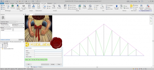
Kobi Toolkit are a series of add-in utilities for Autodesk Revit Architecture, Structure and MEP. The tools extend the capabilities of Revit in key areas. They are easy to use and make working in Revit easier.
|
| |
 Читать статью дальше (комментариев - 13)
| |
|
 |
 Автор: Williams Автор: Williams
 Дата: 5 июня 2019 Дата: 5 июня 2019
 Просмотров: 2 342 Просмотров: 2 342 |
| |
ITASCA 3DEC v5.20.277
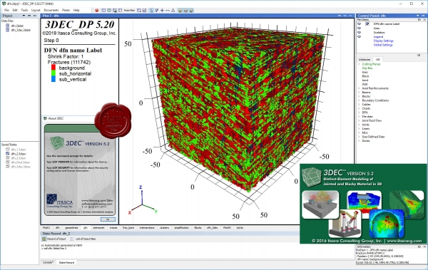
3DEC is a three-dimensional numerical modeling code for advanced geotechnical analysis of soil, rock, ground water, structural support, and masonry. 3DEC simulates the response of discontinuous media (such as jointed rock or masonry bricks) that is subject to either static or dynamic loading. The numerical formulation It is based on the distinct element method (DEM) for discontinuum modeling. UDEC is the two-dimensional version.
The discontinuous material is represented as an assemblage of discrete blocks. The discontinuities are treated as boundary conditions between blocks; large displacements along discontinuities and rotations of blocks are allowed. Individual blocks behave (based on constitutive and joint models) as either rigid or deformable (i.e., meshed into finite difference zones) material. Continuous and discontinuous joint patterns can be generated on a statistical basis. A joint structure can be built into the model directly from the geologic mapping. 3DEC also contains Itasca's powerful built-in scripting language FISH. With FISH, you can write your own scripts for users who wish to add functionality for custom analyses. |
| |
 Читать статью дальше (комментариев - 17)
| |
|
 |
 Автор: Williams Автор: Williams
 Дата: 4 июня 2019 Дата: 4 июня 2019
 Просмотров: 4 526 Просмотров: 4 526 |
| |
KobiLabs Kobi Toolkit for AutoCAD 2015-2020
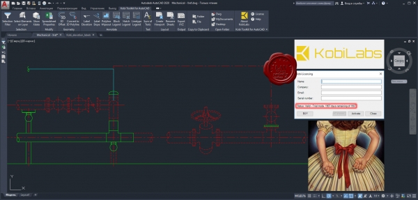
KobiLabs is a team of engineers and developers with more than 100 man years experience in CAD/BIM consultation and software development.
All of our senior developers have extensive experience in C++, .NET and javascript, as well as database systems MS SQL, MongoDB and others.
By developing our own software – used globally by companies large and small – we have gained valuable experience in building software for the Autodesk platform and helping customers use the software to its fullest potential.
Our customers are primarily architects, structural and civil engineers, but our experiences also covers fields such as mechanical engineering, piping and surveying. Our customers work with different software platforms (mostly Revit, AutoCAD, Civil 3D, Tekla and similar). Our development experience includes CAD/BIM plugins and desktop and web applications.
|
| |
 Читать статью дальше (комментариев - 16)
| |
|
 |
 Автор: Williams Автор: Williams
 Дата: 3 июня 2019 Дата: 3 июня 2019
 Просмотров: 3 868 Просмотров: 3 868 |
| |
ITASCA Flac2D v8.00.454
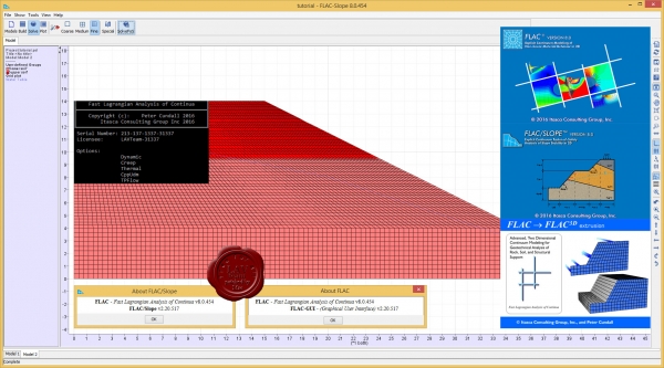
FLAC, Fast Lagrangian Analysis of Continua, is numerical modeling software for advanced geotechnical analysis of soil, rock, groundwater, and ground support in two dimensions. FLAC is used for analysis, testing, and design by geotechnical, civil, and mining engineers. It is designed to accommodate any kind of geotechnical engineering project that requires continuum analysis.
FLAC utilizes an explicit finite difference formulation that can model complex behaviors, such as problems that consist of several stages, large displacements and strains, non-linear material behavior, or unstable systems (even cases of yield/failure over large areas, or total collapse).
More info |
| |
 Читать статью дальше (комментариев - 18)
| |
|
 |
 Автор: Williams Автор: Williams
 Дата: 2 июня 2019 Дата: 2 июня 2019
 Просмотров: 972 Просмотров: 972 |
| |
Insight Numerics Detect3D v2.43
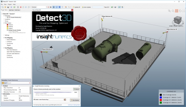
Detect3D is the most accurate and trusted 3D fire and gas mapping tool for the design and assessment of detector layouts. Using the integrated design environment, line-of-sight flame detectors, and point and open-path gas detectors can be interactively positioned and oriented within any geometry. The user can highlight zero-visibility zones and interactively adjust the position or orientation of the detectors and receive real-time feedback. Detect3D is the ONLY fire and gas mapping tool on the market that can be installed on Windows workstations.
Features:
- Import CAD in Microstation (.dgn), Autodesk AutoCAD (.dxf), STEP, IGES, OBJ and Stereolithography (.stl) formats.
- Define multiple fire zones and assign hazard categories for each one.
- Export the isovolumes to CAD so they can be loaded back in to your CAD software.
- Output auto-generated reports showing coverage statistics for each fire zone in pdf and MS Excel formats.
Fire:
- All obstructions are accounted for automatically - no need to represent the geometry using simplified primitive shapes such as spheres and cylinders. What is in your CAD file is what will obstruct the detector.
- The obstruction of the detector's field-of-view (FOV) is accurately calculated in full 3D by casting thousands of rays.
- Import flame detectors from our manufacturer's database or create a custom flame detector field-of-view.
Gas:
- Interactively re-position or re-orient detectors and receive immediate feedback for the improved layout.
- Add detectors one at a time or add them in a one or two dimensional array to expidite your design process.
- Quickly highlight zero-visibility areas within each fire zone using 3D isovolumes and 2D contour plots.
Acoustic:
- Using technologies akin to that used for concert hall design, Insight Numerics is in development of algorithms to quickly assest the acoustic soundscape of process areas to enable engineers to optimally position acoustic gas leak detectors.
|
| |
 Читать статью дальше (комментариев - 7)
| |
|
 |
 Автор: Williams Автор: Williams
 Дата: 1 июня 2019 Дата: 1 июня 2019
 Просмотров: 3 980 Просмотров: 3 980 |
| |
ITASCA Flac3D v6.00.69
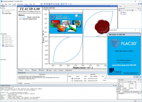
FLAC3D (Fast Lagrangian Analysis of Continua in 3 Dimensions) is numerical modeling software for geotechnical analyses of soil, rock, groundwater, constructs, and ground support. Such analyses include engineering design, factor of safety prediction, research and testing, and back-analysis of failure.
Continuum analysis can be applied to engineering design of civil, mining, and geotechnical excavations (e.g., slopes, tunnels, caverns, stopes, etc.) and constructs (dams, foundations, footings, walls, etc.) in soil, intact rock, and rock masses (i.e., heavily jointed rock). Using interfaces, FLAC3D can also simulate discontinuities such as faults, joints, bedding planes, and engineered boundaries along constructs.
FLAC3D utilizes an explicit finite volume formulation that captures the complex behaviors of models that consist of several stages, show large displacements and strains, exhibit non-linear material behavior, or are unstable (including cases of yield/failure over large areas, or total collapse).
|
| |
 Читать статью дальше (комментариев - 17)
| |
|
 |
| ПОИСК ПО САЙТУ |
 |
|
 |
|