|
 |
 Автор: Williams Автор: Williams
 Дата: 19 июня 2019 Дата: 19 июня 2019
 Просмотров: 1 801 Просмотров: 1 801 |
| |
Robert Christopherson, Ginger Birkeland - Geosystems: An Introduction to Physical Geography, 10th Edition
Pearson, 2018
pdf, 694 pages, english
ISBN-13: 9780134642512
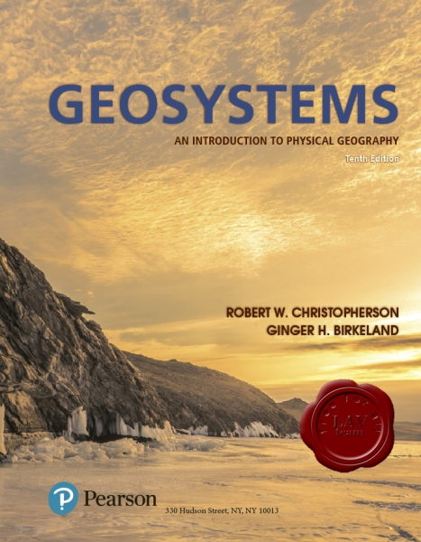
Among the most highly regarded texts in physical geography, Robert Christopherson’s best-selling Geosystems: An Introduction to Physical Geography is known for its meticulous attention to detail, up-to-date accuracy, and rich integration of climate change science. Uniquely organized, the text presents Earth systems topics as they naturally occur: atmosphere, hydrosphere, lithosphere, and biosphere. This interconnected and organic systems-based approach is highlighted in strong pedagogical tools, a structured learning path, and current, updated information. The 10th Edition includes new features and activities that help students apply geography to the real world, revised infographics, and new exercises designed to enhance learning.
Mastering Geography is an online homework, tutorial, and assessment product proven to improve results by helping students quickly master concepts. Students benefit from self-paced coaching activities that feature personalized wrong-answer feedback and hints that emulate the office-hour experience and help keep students on track. With a wide range of interactive, engaging, and assignable activities, students are encouraged to actively learn and retain challenging physical geography concepts. |
| |
 Читать статью дальше (комментариев - 14)
| |
|
 |
 Автор: Williams Автор: Williams
 Дата: 18 июня 2019 Дата: 18 июня 2019
 Просмотров: 6 651 Просмотров: 6 651 |
| |
Hexagon CAESAR II 2019 v11.00.00.4800 build 190424
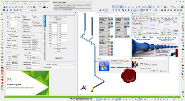
CAESAR II is the world’s most widely used pipe flexibility and stress analysis software, CAESAR II is a complete solution that enables quick and accurate analysis of piping systems subjected to a wide variety of loads, taking into account weight, pressure, thermal, seismic and other static and dynamic conditions, based on user-defined variables and accepted industry guidelines. CAESAR II analyzes piping systems of any size or complexity, whether the need is to design a new system or trouble-shoot an existing one. And, CAESAR II features the only bi-directional link between analysis and CAD design, allowing engineers and designers to easily share information while keeping the drawing and related data in sync.
|
| |
 Читать статью дальше (комментариев - 28)
| |
|
 |
 Автор: Williams Автор: Williams
 Дата: 17 июня 2019 Дата: 17 июня 2019
 Просмотров: 647 Просмотров: 647 |
| |
Howden Group (ex. Chasm Consulting) VentSim Design Premium v5.1.4.5
As part of Howden’s strategy to become the world’s leading provider of mine ventilation solutions, we are pleased to announce the acquisition of Chasm Consulting and its world leading products Ventsim/PumpSim. Providing industry-leading 3D design and simulation capability, the Ventsim/PumpSim software is widely used among the global mine ventilation community. Howden will now offer a full suite of solutions for mine ventilation, from modelling and design software to full turnkey projects including main and auxiliary fans, instrumentation, automation and Ventilation on Demand via the Simsmart product line.
Ventsim was originally introduced to mining operations in 1994 to help visually design, improve and optimize underground ventilation systems. It is now licensed to over 1000 mine sites, consultants, universities, governments and research agencies around the world. The new Ventsim Visual ventilation software was released in 2009 and offers a graphically rich and dynamic ventilation environment with many more features than the original Ventsim Classic. Ventsim Visual is available in three versions: Standard, Advanced and Premium.
Ventsim Visual Standard is a lower cost version based on incompressible flow simulation routines and includes dynamic animated 3D graphics showing real airway dimensions and shapes together with animated air flows. Colours show over 30 different data types including airflow, velocities, various pressures and costs. In addition, the Standard version comes with contaminant spread routines to help predict steady state flow of gases, dust, fumes and smoke.
Ventsim Visual Advanced uses advanced compressible flow modelling, including automatic density and fan curve adjustment, automatic natural ventilation simulation and prediction of temperatures and humidity due to rock strata, auto compression, diesel equipment and electric motors.
Ventsim Visual Premium includes all features of Ventsim Visual Advanced as well as VentFIRE fire simulation, VentLog ventilation survey record software, and the optional LiveView remote data connection and display module. |
| |
 Читать статью дальше (комментариев - 3)
| |
|
 |
 Автор: Williams Автор: Williams
 Дата: 16 июня 2019 Дата: 16 июня 2019
 Просмотров: 2 243 Просмотров: 2 243 |
| |
Boole & Partners StairDesigner Pro-PP v7.11a
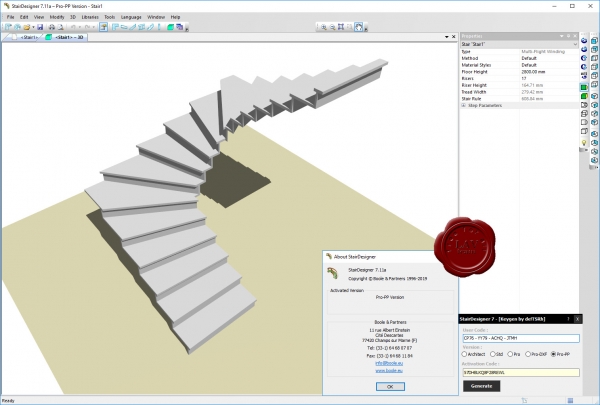
StairDesigner – программное обеспечение для проектирования лестниц и ступенек для любых жилых и промышленных строений.Быстрый расчёт для угловых,закруглённых и прочих вариантов,вычисление конфигурации ступеньки,стойки,перил,выбор нужного материала (дерево,камень,мрамор,железо).Готовый результат можно распечатать на принтере или экспортировать в формате DXF.
StairDesigner is a polyvalent straight, helicoidal, and balanced stair design software, used in the wood, marble, stone, and metal industries. StairDesigner allows a quick stairway parameters entry. Its Help and Control Function checks the Riser Height, Tread Length, and Stair Rule parameters (Blondel’s law), and helps reaching the stair compliance. StairDesigner is based on the Boole & Partners exclusive Global Balancing Function, which summarizes major balancing theories, and calculates «S-shaped» stairs, cut-off corners stairs, English styled stairs, and rounded stairs, and also optimizes concrete stairs coverage (StairDesigner-Pro_RB). StairDesigner calculates all the stair components : steps, risers, stringboards, racks, straws, poles, handrails and banisters, which may be printed, plotted in a scale 1/1 (jigs), or exported in DXF format. |
| |
 Читать статью дальше (комментариев - 13)
| |
|
 |
 Автор: Williams Автор: Williams
 Дата: 14 июня 2019 Дата: 14 июня 2019
 Просмотров: 2 108 Просмотров: 2 108 |
| |
Emerson PRV2SIZE v2.8.6481
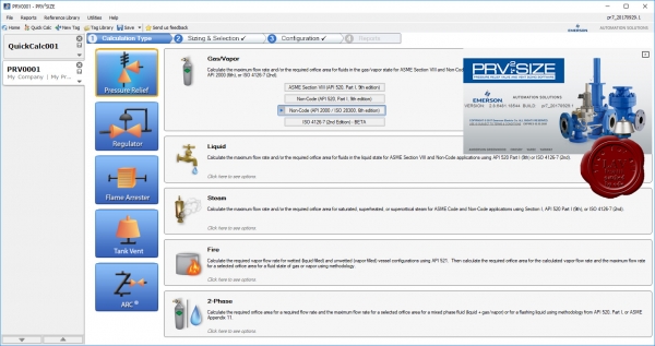
PRV2SIZE software is an easy to use and comprehensive program that offers sizing, selection and configuration capabilities for Anderson Greenwood, Crosby and Varec brand Over Pressure Protection Valves and for Yarway brand Automatic Recirculation Control Valves:
PRV2Size Software Sizing Methods include:
- ASME Section VIII (API 520, Part I, 9th edition) Gas, Liquid or Steam phase Orifice Area and Flow Calculations
- Non-Code (API 520, Part I, 9th edition) Gas, Liquid or Steam phase Orifice Area and Flow Calculations
- API 2000/ISO 28300, 6th edition Gas phase Orifice Area and Flow Calculations
- ISO 4126-7 (2nd Edition) Gas Liquid or Steam phase Orifice Area and Flow Calculations
- ASME Section I Steam phase Orifice Area and Flow Calculations
- Fire Sizing Calculations per API 521 /API 520, Part I, 9th edition for Wetted or Unwetted Vessels
- 2-Phase ASME Appendix 11: Saturated Water Orifice Area and Flow Calculations
- 2-Phase API 520, Part I, 9th Edition C.2.1(Mass Flux Direct Integration), C.2.2(Flashing/Non-Flashing) and C.2.3(Sub-cooled/Saturated Liquid) Orifice Area and Flow Calculations
- 2-Phase API 520, Part I, 7th Edition D.2.1(Flashing Liquid and its Vapor), D.2.1( Non-Flashing Liquid and Gas), D.2.2(Sub-cooled/Saturated Liquid) and D.2.3(Flashing Liquid, Vapor and Gas) Orifice Area and Flow Calculations
- 2-Phase API 520, Part I, 6th Edition: Separated Flow Method Orifice Area and Flow Calculations
- Tank Blanketing, Back Pressure or Pressure Reducing Regulator Sizing
- Varec Flame Arrester Sizing
- Yarway ARC Flow Control Valve Sizing
- Tank Vent Sizing for Pressure Relief Valve (API 200/ISO 28300) or Free Vent (API 2000/ ISO 28300, 6th edition) Sizing
- Reaction Force Calculations
- Noise Calculations
Sizing Inputs can be in English or Metric Units for:
- Fluid Properties
- Pressures, Vacuum and Back Pressures
- Temperature
- Flow Capacity
Valve Selection simplified with Filter Bar Options like:
- Valve Type Filter Option
- ASME or API dataset for K and A Values Filter Option
Valve Configuration allows:
- Main Valve Materials of Construction, Accessory Selection with display of Catalog Model and ERP Number
- Valve Customization
- Addition of Notes for Sizing Reports
- Generation of Valve Weight and Dimensions
|
| |
 Читать статью дальше (комментариев - 7)
| |
|
 |
 Автор: Williams Автор: Williams
 Дата: 12 июня 2019 Дата: 12 июня 2019
 Просмотров: 8 334 Просмотров: 8 334 |
| |
ГЕОНИКА CSoft GeoniCS 2015 v15.0.6.22 x64
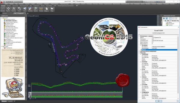
GeoniCS - отечественная технологическая линия на платформах AutoCAD и nanoCAD для обработки данных геодезических и инженерно-геологических изысканий, создания и ведения геоинформационного ресурса территории и промобъектов, геоинженерного проектирования в области гражданского, промышленного и транспортного строительства.
Модуль «Топоплан» - это ядро программы, позволяющее создавать топографические планы, вести базу точек съемки проекта, строить трехмерную модель рельефа и проводить анализ полученной поверхности. На основе построенной модели рельефа программа позволяет решать целый ряд прикладных задач.
Модуль «Генплан» используется при проектировании промышленных объектов различного назначения, а также объектов гражданского строительства. Модуль обеспечивает полное соответствие требованиям ГОСТ 21.508–93 «Правила выполнения рабочей документации генеральных планов предприятий, сооружений и жилищно-гражданских объектов».
Модуль «Сети» позволяет проектировать внешние инженерные сети и оформлять необходимые выходные документы.
Модуль «Трассы» позволяет проектировать линейно-протяженные объекты и оформлять необходимые выходные документы.
Модуль «Сечения» позволяет получить черные сечения и спроектировать красные. Оформление сечений (поперечников) присутствует в полной мере. Далее возможно создание 3D модели – коридора.
Модуль «Геомодель» предназначен для оформление данных геологических исследований и построение 3D модели для геологии.
|
| |
 Читать статью дальше (комментариев - 24)
| |
|
 |
 Автор: Williams Автор: Williams
 Дата: 11 июня 2019 Дата: 11 июня 2019
 Просмотров: 917 Просмотров: 917 |
| |
Correvate Vercator v2.2.37
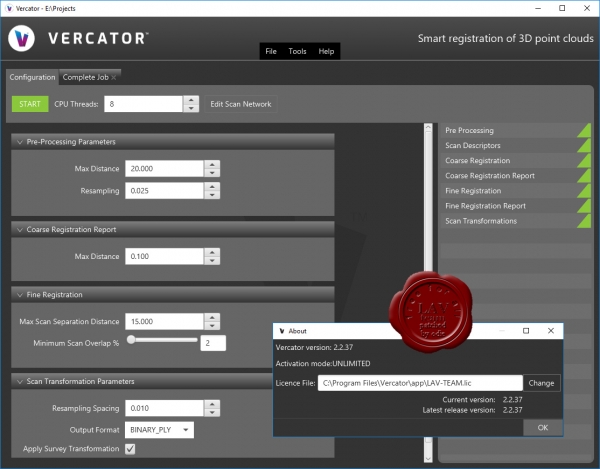
Correvate was formed to commercialise a technology that enables the automatic alignment and subsequent analysis of 3D point cloud datasets. The technology was initially created in the Department of Electronic and Electrical Engineering at University College London and then, on 1st January 2018, exclusively licensed to Correvate. It has since been enhanced by both Correvate and UCL. The technology can be applied to 3D point cloud datasets created using any scanning technology of any wavelength.
Vercator technology enables the automatic alignment and subsequent analysis of 3D point cloud datasets. Its performance at least matches and, in many aspects, exceeds that of conventional and newly emerging competing systems.
|
| |
 Читать статью дальше (комментариев - 8)
| |
|
 |
| ПОИСК ПО САЙТУ |
 |
|
 |
|