|
 |
 Автор: Williams Автор: Williams
 Дата: 23 июля 2023 Дата: 23 июля 2023
 Просмотров: 1 157 Просмотров: 1 157 |
| |
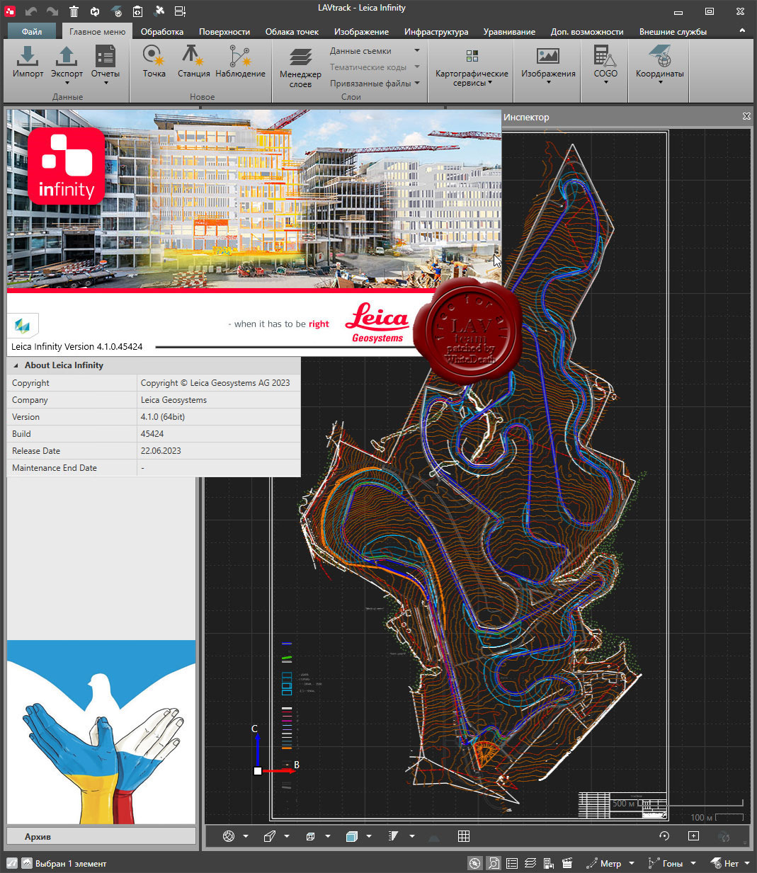
Leica Infinity v4.1.0.45424 
Leica Infinity — интуитивно понятное офисное программное обеспечение от компании Leica Geosystems — пришло на смену Leica Geo Office. Геодезическая съемка сегодня предполагает наличие возможности гибко и быстро обрабатывать полевые данные и информацию их офиса в любом месте и передавать их. Сегодня более, чем когда-либо прежде, существует потребность в едином Рабочем процессе для всех проектов. Для реализации этой потребности и было разработано Leica Infinity: дружественная, интеллектуальная программная платформа с интеллектуальной информационной архитектурой, которая открывает безграничные возможности по организации рабочего процесса. В результате получаем повышение эффективности, прозрачности и просто улучшения всего процесса съемки. Опционально программа имеет следующие модули и возможности: - Обработка данных тахеометрии
- Обработка нивелирования с возможностью уравнивания по высоте
- 3D уравнивание
- Работа с поверхностями
- Работа с результатами сканирования
- Обработка одночастотных и многочастотных GNSS
Leica Infinity осуществит для Вашего проекта комплексную обработку различных видов данных: TPS, GNSS, изображения, сканирование. Многочисленные форматы данных можно легко редактировать, архивировать и экспортировать в CAD-приложения (системы проектирования) без потери целостности и «борьбы» с трудностями, часто встречающимися при преобразованиях. Это относится не только к данным от различных типов инструментов, но и данных, полученных с разных сайтов и от изыскательских команд. |
| |
 Читать статью дальше (комментариев - 13)
| |
|
|
Автор: Williams
Дата: 26 мая 2023
Просмотров: 3 081 |
| |
Leica Cyclone 2023.0.2 build 8314
Leica Cyclone является лучшим на рынке программным обеспечением для обработки облаков точек. Это семейство программных модулей, обеспечивающих самый широкий диапазон технологических процессов при лазерном 3D-сканировании в машиностроении, геодезии, строительстве и смежных областях.
Для организаций, которым необходимо добавить данные облаков точек в свои технологические процессы, Leica Cyclone является единственным решением, способным сформировать все необходимые результаты. В отличие от ПО других поставщиков, Leica Cyclone эффективно работает в соответствии с любыми проектными требованиями, принося прибыль вашей организации.
Ключевой компонент комплексного решения — семейство Cyclone. Различные модули Cyclone проведут пользователя от начала и до конца технологического цикла при реализации проектов любого типа, предусматривающих работу с облаками точек.
Существуют модули, позволяющие использовать такие операции сбора данных на объектах с помощью лазерных сканеров Leica Geosystems, как маршрутная съемка, задний отсчет, визирование с обратными засечками, а также привязку данных сканерами Leica RTC360 с помощью визуальной инерциальной системы (VIS) для обеспечения комплексных сбора и регистрации данных на уровне профессиональной топографической съемки. Функциональность таких модулей включает процедуры автоматизации, работающие в режиме диалога с пользователем и выполняющие большинство задач за него, и богатейший набор инструментов для обеспечения и контроля качества, а также настройки и анализа процессов съемки.
Существуют и другие модули, предназначенные для формирования широкого спектра выходных материалов: от отчетов и карт до 3D-моделей, фильмов, анимированных роликов и компактных форматов 3D-данных, которые можно свободно пересылать по Интернету. Эти модули могут использоваться в различных процессах широкого спектра отраслей, включая проектирование сооружений, создание 3D-моделей готовых сооружений, топографическую съемку, информационное моделирование зданий и многие другие.
Используя файлы в разработанном компанией Leica Geosystems формате универсального проектного файла (LGS), пользователи могут передавать данные цифровой реальности между Cyclone и любым использующим технологию HDS программным обеспечением.
Для большего удобства использования, комплекс состоит из отдельных программных модулей, используемых для разных целей:
|
| |
Читать статью дальше (комментариев - 23)
| |
|
|
Автор: Williams
Дата: 25 мая 2023
Просмотров: 2 451 |
| |
Leica Cyclone REGISTER 360 2023.0.2

Leica Cyclone REGISTER 360 — последняя улучшенная версия ПО для регистрации облаков точек, занимающего лидирующее положение на рынке, — Cyclone REGISTER. Этот разработанный с нуля программный продукт обладает широким спектром новых упрощающих работу возможностей — от простых процессов с пошаговыми подсказками до автоматизированной регистрации и выдачи заказчикам итоговых результатов по нажатию одной кнопки.
Leica Cyclone REGISTER 360 ориентировано на пользователей и позволяет работникам любой квалификации задействовать его интеллектуальные возможности, с большей точностью выдавать итоговые результаты, выполнять более детализированную визуализацию и сотрудничать более эффективно.
Независимо от того, развертывается ли Cyclone REGISTER 360 автономно или как часть интегрированного решения цифровой реальности, этот программный комплекс позволит вам быстро и просто получать необходимые результаты. |
| |
Читать статью дальше (комментариев - 23)
| |
|
|
Автор: Williams
Дата: 29 апреля 2023
Просмотров: 1 109 |
| |
Leica Cyclone FIELDWORX 2022.0.1.8165

Leica Cyclone FIELDWORX является расширением программного обеспечения Cyclone REGISTER для использования с 3D лазерными сканерами ScanStation P-Series. Это простое и мощное программное обеспечение позволяет пользователям завершить высококачественный сбор данных за считанные минуты.
Cyclone FIELDWORX основан на мощных и лучших в своем классе возможностях для сбора данных в ПО Cyclone REGISTER и обладает оптимизированным, удобным в работе пользовательским интерфейсом, разработанным для сенсорной клавиатуры и простого в управлении рабочего процесса, который позволяет пользователю перейти от подключения к лазерному сканеру до выгрузки данных за 4 простых шага:
- Захват: Подключение к лазерным сканерам ScanStation P-Series через проводное или WiFi-соединение.
- Сбор данных: Автоматическая отработка меток, управляемое контрольными файлами съемки.
- Регистрация: Автоматическое сохранение отдельных настроек в соответствии с контрольной съемкой.
- Выгрузка: Выгружайте настройки E57 или PTS для немедленного использования в отраслевых инструментах анализа.
Ручная работа была сведена к минимуму благодаря интеллектуальной автоматизации. По завершении сканирования импорт данных производится автоматически, метки определяются и подгоняются, а когда три или более меток соответствуют контрольному файлу, автоматически запускается регистрация. Конечно, пользователи также могут вручную настраивать свои проекты.
Cyclone FIELDWORX не является заменой Cyclone FIELD 360, который обеспечивает автоматическое предварительное выравнивание объекта без меток на основе ручного визуального выравнивания или технологии VIS лазерного сканера RTC360.
|
| |
Читать статью дальше (комментариев - 11)
| |
|
|
Автор: Williams
Дата: 1 апреля 2023
Просмотров: 2 494 |
| |
Leica Hexagon MinePlan (ex. MineSight) 2023 Release 1

HxGN MinePlan provides geologists and engineers with powerful 3D modeling and data visualization. It supports seamless workflows, from exploration to production and it's backed by more than 50 years of innovation in partnership with thousands of global users.
Productive mines depend on being able to build detailed geological surfaces and solids. Statistical and geo-statistical analysis of project data is essential to producing an accurate block model with confidence.
Click here to interactively explore your own life-of-mine journey.
Geosciences
The Geosciences suite empowers resource geologists to store, manage and analyse drillhole data.
Open pit engineering
MinePlan open pit engineering suite offers software packages that help you improve efficiency and make informed decisions.
Underground engineering
CAD offers solutions for underground design challenges, including 3D visualisation and tools for pillar design, plus more.
HxGN MinePlan Survey
MinePlan Survey allows for management of survey data throughout the mining lifecycle using a comprehensive software solution. |
| |
Читать статью дальше (комментариев - 12)
| |
|
|
Автор: Williams
Дата: 6 марта 2023
Просмотров: 3 801 |
| |
Leica Cyclone 2023.0.0 build 8304

Leica Cyclone является лучшим на рынке программным обеспечением для обработки облаков точек. Это семейство программных модулей, обеспечивающих самый широкий диапазон технологических процессов при лазерном 3D-сканировании в машиностроении, геодезии, строительстве и смежных областях.
Для организаций, которым необходимо добавить данные облаков точек в свои технологические процессы, Leica Cyclone является единственным решением, способным сформировать все необходимые результаты. В отличие от ПО других поставщиков, Leica Cyclone эффективно работает в соответствии с любыми проектными требованиями, принося прибыль вашей организации.
Ключевой компонент комплексного решения — семейство Cyclone. Различные модули Cyclone проведут пользователя от начала и до конца технологического цикла при реализации проектов любого типа, предусматривающих работу с облаками точек.
Существуют модули, позволяющие использовать такие операции сбора данных на объектах с помощью лазерных сканеров Leica Geosystems, как маршрутная съемка, задний отсчет, визирование с обратными засечками, а также привязку данных сканерами Leica RTC360 с помощью визуальной инерциальной системы (VIS) для обеспечения комплексных сбора и регистрации данных на уровне профессиональной топографической съемки. Функциональность таких модулей включает процедуры автоматизации, работающие в режиме диалога с пользователем и выполняющие большинство задач за него, и богатейший набор инструментов для обеспечения и контроля качества, а также настройки и анализа процессов съемки.
Существуют и другие модули, предназначенные для формирования широкого спектра выходных материалов: от отчетов и карт до 3D-моделей, фильмов, анимированных роликов и компактных форматов 3D-данных, которые можно свободно пересылать по Интернету. Эти модули могут использоваться в различных процессах широкого спектра отраслей, включая проектирование сооружений, создание 3D-моделей готовых сооружений, топографическую съемку, информационное моделирование зданий и многие другие.
Используя файлы в разработанном компанией Leica Geosystems формате универсального проектного файла (LGS), пользователи могут передавать данные цифровой реальности между Cyclone и любым использующим технологию HDS программным обеспечением.
Для большего удобства использования, комплекс состоит из отдельных программных модулей, используемых для разных целей:
|
| |
Читать статью дальше (комментариев - 24)
| |
|
|
Автор: Williams
Дата: 16 февраля 2023
Просмотров: 1 047 |
| |
Leica Hexagon HxMap v4.2.0

The increased need for up-to-date geospatial information in many of the traditional applications as well as in emerging areas such as navigation or location-based apps requires a new approach to data processing: rapid updates over large areas in the shortest possible time. To be a true No 1, the world’s most efficient airborne sensors still rely on an efficient and fast data processing workflow.
By introducing HxMap, the unified high-performance multi-sensor workflow platform, Leica Geosystems offers exactly what the industry has been waiting for: a fast, intuitive and efficient post-processing platform, that allows you to produce all known data products within one single interface.
The Leica HxMap common sensor post-processing platform offers the following modules to meet your needs:
- HxMap Enabler: Enabler
- HxMap Provider: Ingest, Raw QC, Workflow Manager, Point Cloud Generator, Projection Engine
- HxMap Core Image: APM, Aerial Triangulation, Infocloud, Ortho Generator
- HxMap Core LiDAR: AutoCalibration, Registration, Colour Encoding, Data Metrics, LiDAR QC
- HxMap 3D Modeller: City Modeller, Texture Mapper, 3D Editor, Building Finder
Leica HxMap intuitively guides you along a common processing workflow. Starting from data download, raw QC, data ingest all the way to the final product generation. Depending on the input data, additional steps like aerial triangulation, radiometric adjustments and LiDAR point cloud registration are available.
Furthermore, the HxMap product generator allows a large number of products to be generated by the push of a button: referenced images, orthophotos, info clouds, point clouds as well as 3D city models.
These features build the right solution for large oblique projects, country-wide orthophoto or LiDAR mapping for small engineering projects alike.
To reach highest efficiency the data acquisition has been tightly integrated with the post processing workflow. Thus, HxMap can be enabled for individual sensor types. For flexible production, scalable and application-specific software modules are bundled with the matching hardware, namely Leica RealCity, Leica RealWorld and Leica RealTerrain.
RealCity supports you with your smart city and 3D city modelling applications, RealWorld is designed for Leica RCD30 and Leica DMCIII large area imaging projects in 2D and Leica RealTerrain is particularly effective for LiDAR mapping. To get the most out of your HxMap installation we highly recommend including both Core Image and Core LiDAR for all of our hybrid sensors. |
| |
Читать статью дальше (комментариев - 8)
| |
|
|
Автор: Williams
Дата: 9 января 2023
Просмотров: 3 405 |
| |
Leica Infinity v4.0.2 ENG+RUS

Leica Infinity - интуитивно понятное офисное программное обеспечение от компании Leica Geosystems - пришло на смену Leica Geo Office. Геодезическая съемка сегодня предполагает наличие возможности гибко и быстро обрабатывать полевые данные и информацию их офиса в любом месте и передавать их. Сегодня более, чем когда-либо прежде, существует потребность в едином Рабочем процессе для всех проектов. Для реализации этой потребности и было разработано Leica Infinity : дружественная, интеллектуальная программная платформа с интеллектуальной информационной архитектурой, которая открывает безграничные возможности по организации рабочего процесса. В результате получаем повышение эффективности, прозрачности и просто улучшения всего процесса съемки.
Опционально программа имеет следующие модули и возможности:
- Обработка данных тахеометрии.
- Обработка нивелирования с возможностью уравнивания по высоте.
- 3D уравнивание.
- Работа с поверхностями.
- Работа с результатами сканирования.
- Обработка одночастотных и многочастотных GNSS.
Leica Infinity осуществит для Вашего проекта комплексную обработку различных видов данных: TPS, GNSS , изображения, сканирование. Многочисленные форматы данных можно легко редактировать, архивировать и экспортировать в CAD-приложения(системы проектирования) без потери целостности и «борьбы» с трудностями, часто встречающимися при преобразованиях. Это относится не только к данным от различных типов инструментов, но и данных, полученных с разных сайтов и от изыскательских команд. |
| |
Читать статью дальше (комментариев - 15)
| |
|
|
Автор: Williams
Дата: 11 декабря 2022
Просмотров: 2 179 |
| |
Leica Hexagon MinePlan (ex. MineSight) 2022 Release 4

HxGN MinePlan provides geologists and engineers with powerful 3D modeling and data visualization. It supports seamless workflows, from exploration to production and it's backed by more than 50 years of innovation in partnership with thousands of global users.
Productive mines depend on being able to build detailed geological surfaces and solids. Statistical and geo-statistical analysis of project data is essential to producing an accurate block model with confidence.
Click here to interactively explore your own life-of-mine journey.
Geosciences
The Geosciences suite empowers resource geologists to store, manage and analyse drillhole data.
Open pit engineering
MinePlan open pit engineering suite offers software packages that help you improve efficiency and make informed decisions.
Underground engineering
CAD offers solutions for underground design challenges, including 3D visualisation and tools for pillar design, plus more.
HxGN MinePlan Survey
MinePlan Survey allows for management of survey data throughout the mining lifecycle using a comprehensive software solution. |
| |
Читать статью дальше (комментариев - 15)
| |
|
|
Автор: Williams
Дата: 8 ноября 2022
Просмотров: 811 |
| |
Leica CalMaster v3.2.402

Construction sites are harsh environments and put incredible strain on lasers. To ensure the most accurate results and to avoid costly mistakes, these tools need periodic care and calibration, but that can be a strenuous effort resulting in downtime and lost business. Another important reason to calibrate lasers regularly is known to all contactors who apply for construction tenders or are becoming ISO 9001 certified. A proof of equipment’s accuracy with reference to the international standards is often a must requirement in both processes. Your local Leica Geosystems representatives now offer quick and reliable calibrations with the Leica CalMaster.
Key Benefits
- Have all your rotating, grade, pipe, line and point lasers professionally checked, calibrated and certified for maximum accuracy at your local Leica representative.
- Avoid costly mistakes by having your lasers periodically checked and calibrated.
- Work with peace of mind that your lasers are calibrated to the highest accuracy standards.
- As the industry’s only calibration system issuing ISO certifications, you can trust that your Leica Geosystems rotating laser will perform with complete accuracy.
- Solidify your professional reputation.
- Maximize your chances of winning construction tenders with calibration certificates and thus, growing your business.
- Reduce your downtime and be back to work faster than ever.
|
| |
Читать статью дальше (комментариев - 3)
| |
|
|
| ПОИСК ПО САЙТУ |
|
|
|
| КАЛЕНДАРЬ | | |
|
| « Июль 2025 » |
|---|
| Пн | Вт | Ср | Чт | Пт | Сб | Вс |
|---|
| | 1 | 2 | 3 | 4 | 5 | 6 | | 7 | 8 | 9 | 10 | 11 | 12 | 13 | | 14 | 15 | 16 | 17 | 18 | 19 | 20 | | 21 | 22 | 23 | 24 | 25 | 26 | 27 | | 28 | 29 | 30 | 31 | |
|
| |
| |
|