Автор: Williams Дата: 7 апреля 2025
Просмотров: 735
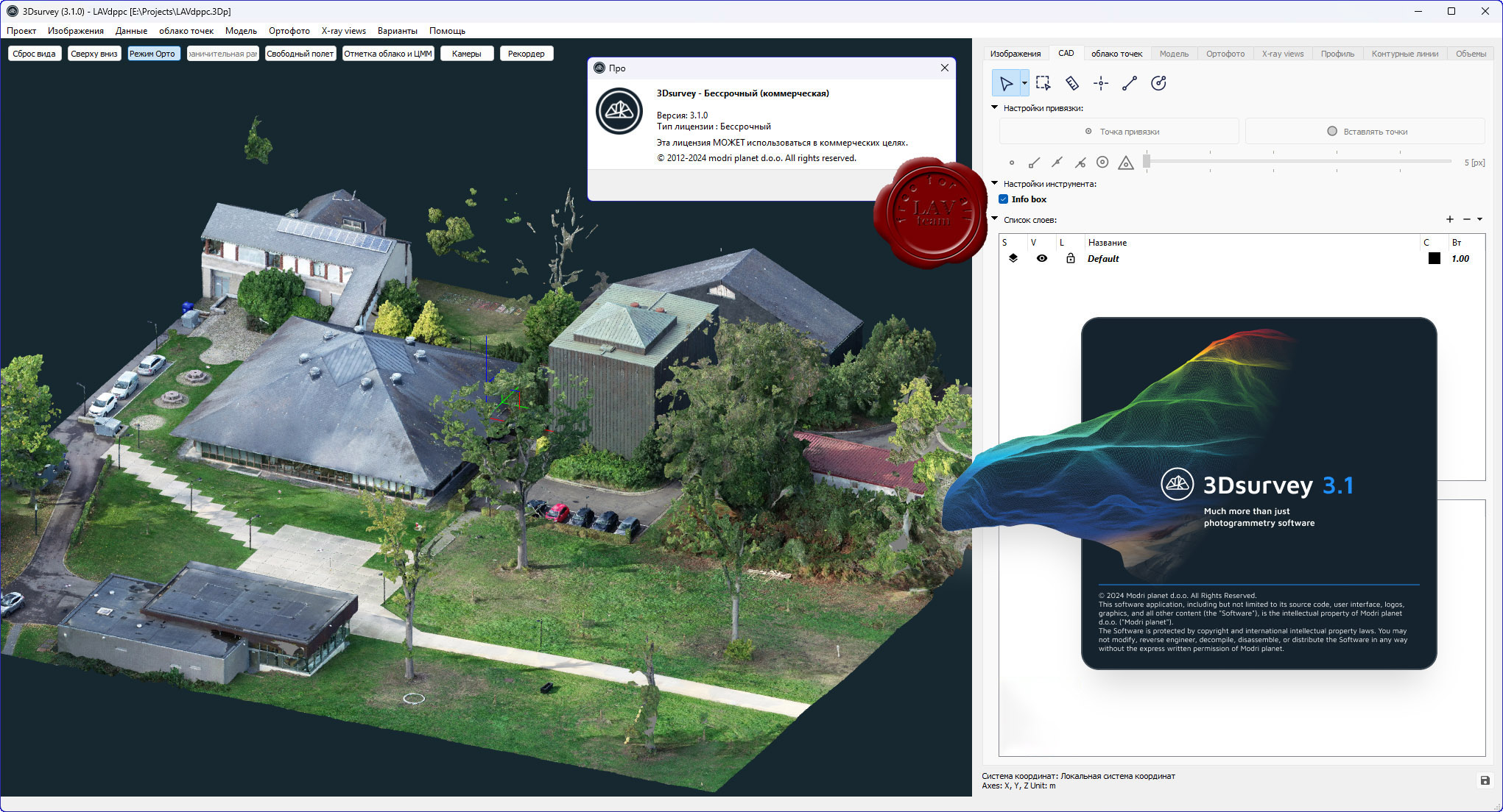
modri planet d.o.o. 3Dsurvey v3.1.0
3Dsurvey is a software solution for land surveying data processing. Take a photo with any standard digital camera, import images into 3Dsurvey and produce your own orthophoto maps, digital surface models and calculate volumes faster and more easily. Data is processed automatically based on matching algorithms. Use our smart tools to be even more efficient.
Автор: Williams Дата: 30 сентября 2024
Просмотров: 1 565
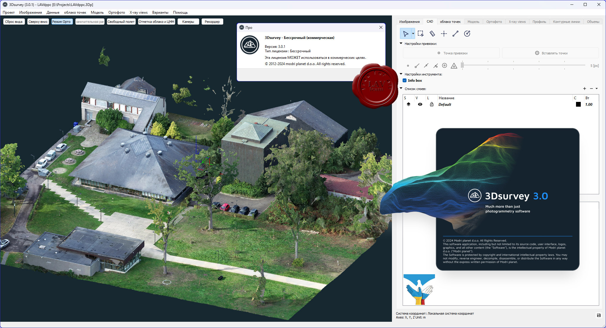
modri planet d.o.o. 3Dsurvey v3.0.1
3Dsurvey is a software solution for land surveying data processing. Take a photo with any standard digital camera, import images into 3Dsurvey and produce your own orthophoto maps, digital surface models and calculate volumes faster and more easily. Data is processed automatically based on matching algorithms. Use our smart tools to be even more efficient.
Автор: Williams Дата: 6 марта 2024
Просмотров: 1 809
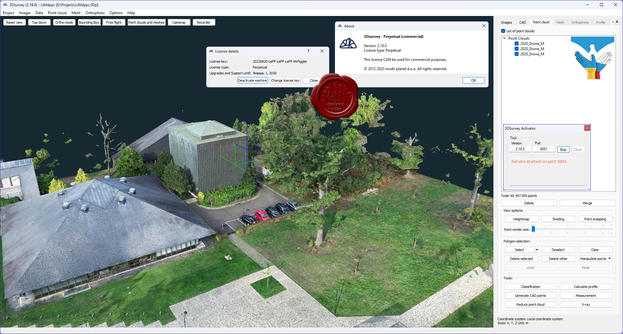
modri planet d.o.o. 3Dsurvey v2.18.0
3Dsurvey is a software solution for land surveying data processing. Take a photo with any standard digital camera, import images into 3Dsurvey and produce your own orthophoto maps, digital surface models and calculate volumes faster and more easily. Data is processed automatically based on matching algorithms. Use our smart tools to be even more efficient.
Автор: Williams Дата: 14 июля 2023
Просмотров: 2 326
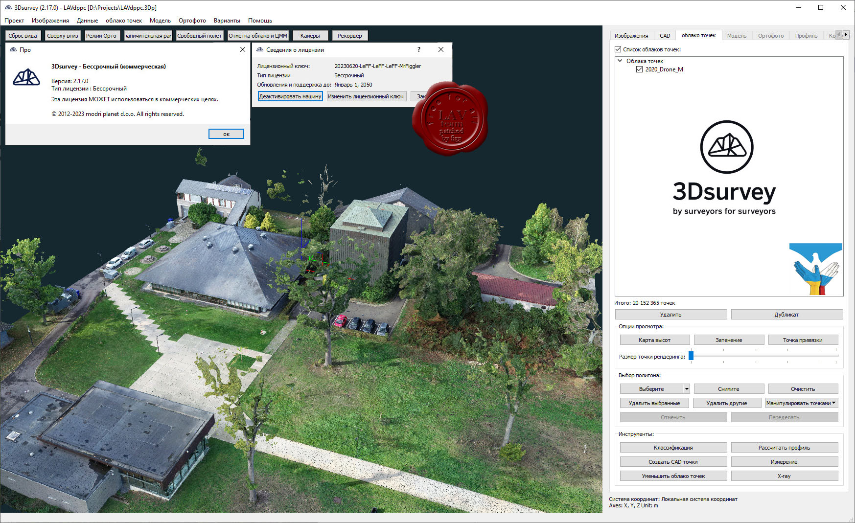
modri planet d.o.o. 3Dsurvey v2.17.0 repack
3Dsurvey is a software solution for land surveying data processing. Take a photo with any standard digital camera, import images into 3Dsurvey and produce your own orthophoto maps, digital surface models and calculate volumes faster and more easily. Data is processed automatically based on matching algorithms. Use our smart tools to be even more efficient.
Автор: Williams Дата: 5 июля 2023
Просмотров: 1 494
modri planet d.o.o. 3Dsurvey v2.17.0
3Dsurvey is a software solution for land surveying data processing. Take a photo with any standard digital camera, import images into 3Dsurvey and produce your own orthophoto maps, digital surface models and calculate volumes faster and more easily. Data is processed automatically based on matching algorithms. Use our smart tools to be even more efficient.
Автор: Williams Дата: 17 апреля 2023
Просмотров: 2 160
modri planet d.o.o. 3Dsurvey v2.16.1
3Dsurvey is a software solution for land surveying data processing. Take a photo with any standard digital camera, import images into 3Dsurvey and produce your own orthophoto maps, digital surface models and calculate volumes faster and more easily. Data is processed automatically based on matching algorithms. Use our smart tools to be even more efficient.
Автор: Williams Дата: 22 октября 2022
Просмотров: 1 938
modri planet d.o.o. 3Dsurvey v2.16.0 x64
3Dsurvey is a software solution for land surveying data processing. Take a photo with any standard digital camera, import images into 3Dsurvey and produce your own orthophoto maps, digital surface models and calculate volumes faster and more easily. Data is processed automatically based on matching algorithms. Use our smart tools to be even more efficient.
Автор: Williams Дата: 13 июня 2022
Просмотров: 1 780
modri planet d.o.o. 3Dsurvey v2.15.1 x64
3Dsurvey is a software solution for land surveying data processing. Take a photo with any standard digital camera, import images into 3Dsurvey and produce your own orthophoto maps, digital surface models and calculate volumes faster and more easily. Data is processed automatically based on matching algorithms. Use our smart tools to be even more efficient.
Автор: Williams Дата: 8 февраля 2022
Просмотров: 1 655
modri planet d.o.o. 3Dsurvey v2.15.0 x64
3Dsurvey is a software solution for land surveying data processing. Take a photo with any standard digital camera, import images into 3Dsurvey and produce your own orthophoto maps, digital surface models and calculate volumes faster and more easily. Data is processed automatically based on matching algorithms. Use our smart tools to be even more efficient.
Автор: Williams Дата: 7 января 2022
Просмотров: 1 384
modri planet d.o.o. 3Dsurvey v2.14.1 x64
3Dsurvey is a software solution for land surveying data processing. Take a photo with any standard digital camera, import images into 3Dsurvey and produce your own orthophoto maps, digital surface models and calculate volumes faster and more easily. Data is processed automatically based on matching algorithms. Use our smart tools to be even more efficient.