|
 |
 Автор: Williams Автор: Williams
 Дата: 31 октября 2020 Дата: 31 октября 2020
 Просмотров: 1 725 Просмотров: 1 725 |
| |
Avenza Geographic Imager Basic v6.2.0.930 x64
Компания Avenza Systems, разработчик системы подготовки ГИС карт к изданию (MAPublisher) в среде Adobe Illustrator и Macromedia FreeHand, а также баз данных MAPdataUSA и MAPdataWorld, объявила о выпуске новой версии расширения Geographic Imager, которое призвано дополнить эту мощную графическую систему возможностями работы с геопространственными данными. Новое расширение содержит новые инструментальные средства для поддержки импорта/экспорта ГИС-данных, аэрокосмических снимков и их редактирования, что позволит полностью использовать все функциональные возможности Adobe Photoshop для работы с графикой. С помощью Geographic Imager в среде Adobe Photoshop станут доступны операции с GeoTIFFs (растровый формат) и другими форматами географически привязанных изображений, автоматическое составление мозаик, преобразования в другие проекции на основе опорных точек.
В новой версии плагина обеспечена более полная поддержка форматов системы Adobe Photoshop с доступом к новым инструментам для импорта, редактирования экспорта геопространственных данных, в том числе аэрокосмических снимков. Кроме того, новая версия поддерживает работу со всеми функциями Adobe Photoshop, такими как, например, вырезка фрагментов графики, установка уровней прозрачности ее элементов, редактирование по пикселям и управление контрастом и яркостью. |
| |
 Читать статью дальше (комментариев - 8)
| |
|
 |
 Автор: Williams Автор: Williams
 Дата: 30 октября 2020 Дата: 30 октября 2020
 Просмотров: 2 955 Просмотров: 2 955 |
| |
Christopher Gorse, David Johnston, Martin Pritchard - Oxford Dictionary of Construction, Surveying and Civil Engineering
Oxford University Press, 2020
epub, 624 pages, english
ISBN-13: 978-0-198-83248-5

This new edition of A Dictionary of Construction, Surveying, and Civil Engineering is the most up-to-date dictionary of its kind. In more than 8,000 entries it covers the key areas of civil and construction engineering, construction technology and practice, construction management techniques and processes, as well as legal aspects such as contracts and procurement.
It has been updated with more than 600 new entries spanning subjects such as sustainability, new technologies, disaster management, and building software. New additions include terms such as Air source heat pump, hydraulic failure, mechanical ventilation with heat recovery, off-site construction, predictive performance, sustainable development, and value engineering. Useful diagrams and web links complement the text, which also includes suggestions for further reading.
With contributions from more than 130 experts from around the world, this dictionary is an authoritative resource for engineering students, construction professionals, and surveyors. |
| |
 Читать статью дальше (комментариев - 19)
| |
|
 |
 Автор: Williams Автор: Williams
 Дата: 29 октября 2020 Дата: 29 октября 2020
 Просмотров: 4 142 Просмотров: 4 142 |
| |
Blue Marble Global Mapper v22.0.1 build 101920 x32+x64
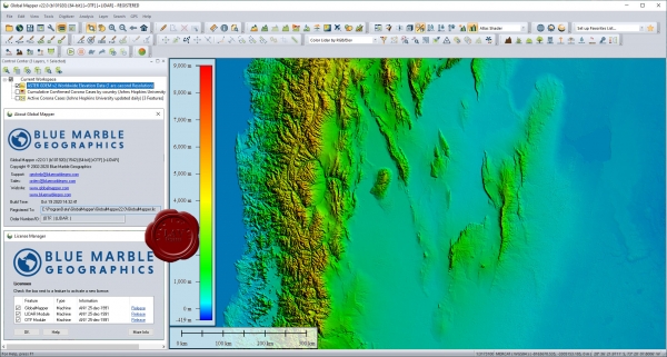
Вышла новая версия программы для просмотра карт и векторных изображений - Global Mapper v22.0.1
Global Mapper позволяет не только просматривать но и преобразовывать или редактировать, а даже и распечатывать всевозможные карты и векторные наборы данных. Global Mapper позволяет вам загружать ваши данные как слои ( только с условием, что вы работаете в Digital Elevation Model), или же как отсканированную карту, если вам надо изобразить местность в 3D. Есть также хорошая особенность, что позволяет вести работу в реальном времени. Происходит это путем загрузки данных с GPS приемника который подключен к компьютеру.
Global Mapper поддерживает огромнейшее число форматов. Работать с ней легко и просто, интерфейс не перенасыщен различными опциями, вы можете смело работать в ней и не задумываться о том, куда нажать, что бы сделать что - то. |
| |
 Читать статью дальше (комментариев - 20)
| |
|
 |
 Автор: Williams Автор: Williams
 Дата: 28 октября 2020 Дата: 28 октября 2020
 Просмотров: 941 Просмотров: 941 |
| |
Achim Schmidt - Technical Thermodynamics for Engineers, Basics and Applications
Springer, 2019
pdf, 831 pages, english
ISBN: 978-3-030-20396-2

Thermodynamics is a subject that all engineering students have to face and that most of them treat with great respect. This makes it all the more important to offer a good and easy-to-understand approach to the laws of energy conversion. This is what this textbook is intended to do: It covers the basics of classical technical thermodynamics as they are typically taught at universities: The first and second law of thermodynamics as well as equations of state are explained for idealized and real fluids which are subject to a phase change. Thermodynamic mixtures, e.g. humid air, are treated as well as chemical reactions. Components and thermodynamic cycle that convert energy are presented. The book attaches great importance to drawings and illustrations, which should make it easier to comprehend complex matter. Technical applications and apparatus are presented and explained. Numerous exercises and examples conclude the book and contribute to a better understanding of the theory. |
| |
 Читать статью дальше (комментариев - 6)
| |
|
 |
 Автор: Williams Автор: Williams
 Дата: 27 октября 2020 Дата: 27 октября 2020
 Просмотров: 6 138 Просмотров: 6 138 |
| |
CSI SAP2000 v22.2.0 build 1663 x64
CSI SAP2000 - cистема трехмерного статического и динамического анализа методом конечных элементов и проектирования сооружений.
SAP2000 следует принципам, основными чертами которых являются современный, интуитивно понятный и универсальный пользовательский интерфейс, основанный на уникальном расчетном ядре и инструментах проектирования конструкций для инженеров, разрабатывающих объекты транспортной инфраструктуры, промышленные и гражданские здания, спортивные сооружения и другие объекты.
Начиная с трехмерной объектно-ориентированной рабочей среды моделирования и до широчайшего спектра опций расчета и проектирования конструкций, комплексно интегрированных в один мощный пользовательский интерфейс, SAP2000 – это наиболее интегрированный, производительный и практичный расчетный комплекс общего назначения, существующий на сегодняшнем рынке. Интуитивно понятный интерфейс позволяет Вам создавать модели конструкций в кратчайшие сроки без долгого процесса обучения. Сегодня Вы можете использовать SAP2000 для всех Ваших задач по расчету и проектированию, в том числе и для небольших повседневных задач.
Комплексные модели могут быть созданы и разбиты на конечные элементы с использованием встроенных шаблонов. Интегрированные инструменты проектирования конструкций способны автоматически сгенерировать ветровые, волновые, нагрузки от транспорта и сейсмические нагрузки на модель, а также выполнить полную автоматическую проверку стальных и железобетонных элементов согласно нормам проектирования различных стран.
|
| |
 Читать статью дальше (комментариев - 32)
| |
|
 |
 Автор: Williams Автор: Williams
 Дата: 26 октября 2020 Дата: 26 октября 2020
 Просмотров: 1 815 Просмотров: 1 815 |
| |
Athanassios Nikolaides - Highway Engineering
Pavements, Materials and Control of Quality
CRC, 2015
pdf, 868 pages, english
ISBN-13: 978-1-4665-7997-2
Highway engineering is the term that replaced the traditional term road engineering used in the past, after the introduction of modern highways. Highway engineering is a vast subject that involves planning, design, construction, maintenance and management of roads, bridges and tunnels for the safe and effective transportation of people and goods.
This book concentrates on design, construction, maintenance and management of pavements for roads/highways. It also includes pavement materials since they are an integral part of pavements. It has been written for graduates, postgraduates as well as practicing engineers and laboratory staff and incorporates the author’s 30 years of involvement in teaching, researching and practicing the subject of highway engineering.
Advancements in pavement materials, design, construction, maintenance and pavement management and the globalisation of the market make it imperative for the highway engineer to be aware of the techniques and standards applied globally.
One of the objectives of the book is to provide integrated information on the abovementioned disciplines of highway engineering.
Another objective is to include in one book both European and American standards and practices (CEN EN, ASTM, AASHTO and Asphalt Institute). This would result in a more useful reference textbook to pavement engineering courses taught in European and American educational establishments.
Another objective of this book is to provide a reference textbook to practicing pavement engineers and materials testing laboratory staff, working in countries employing European or American standards and techniques.
Apart from information regarding European and American practices, the reader can also find some specific information on practices employed in countries such as the United Kingdom, France and Greece, as well as Australia.
In addition, this book also aims to provide integrated information related to pavement materials (soil, aggregates, bitumen, asphalts and reclaimed material), material testing for acceptability and quality assurance, asphalt mix design, flexible and rigid pavement design, construction, maintenance and strengthening procedures, quality control of production and acceptance of asphalts, pavement evaluation, asphalt plants and pavement recycling. It also covers the basic principles of pavement management.
The book in its 18 chapters contains many tables, graphs, charts and photographs to assist the reader in learning and understanding the subject of pavement engineering and materials. It also contains a great number of references, a valuable tool to help the reader seek more information and enhance his or her knowledge.
The short description of all pavement material testing procedures, required by Europeanand American standards, as well as pavement design and maintenance procedures covered, does not, by any means, substitute or replace the standards and procedures developed by the various organisations and agencies. The reader is advised to always consult the standards or manuals developed when engaged in testing, design, construction or maintenance works.
It is hoped that this textbook will not only contribute to the understanding of the wide and challenging subject of pavement engineering but also enable a more effective and economical design, construction and maintenance of pavements by employing updated standards, practices and techniques. |
| |
 Читать статью дальше (комментариев - 10)
| |
|
 |
 Автор: Williams Автор: Williams
 Дата: 25 октября 2020 Дата: 25 октября 2020
 Просмотров: 2 121 Просмотров: 2 121 |
| |
Blue Marble Global Mapper v22.0.1 build 101420 x32+x64
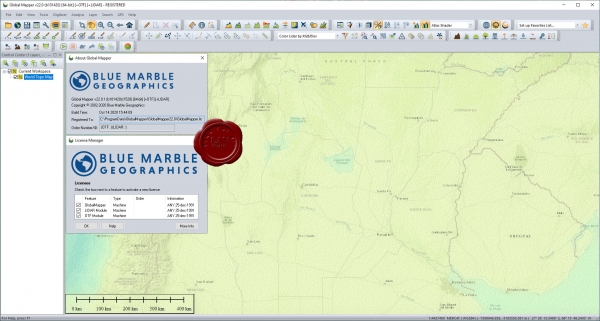
Вышла новая версия программы для просмотра карт и векторных изображений - Global Mapper v22.0.1
Global Mapper позволяет не только просматривать но и преобразовывать или редактировать, а даже и распечатывать всевозможные карты и векторные наборы данных. Global Mapper позволяет вам загружать ваши данные как слои ( только с условием, что вы работаете в Digital Elevation Model), или же как отсканированную карту, если вам надо изобразить местность в 3D. Есть также хорошая особенность, что позволяет вести работу в реальном времени. Происходит это путем загрузки данных с GPS приемника который подключен к компьютеру.
Global Mapper поддерживает огромнейшее число форматов. Работать с ней легко и просто, интерфейс не перенасыщен различными опциями, вы можете смело работать в ней и не задумываться о том, куда нажать, что бы сделать что - то. |
| |
 Читать статью дальше (комментариев - 23)
| |
|
 |
 Автор: Williams Автор: Williams
 Дата: 24 октября 2020 Дата: 24 октября 2020
 Просмотров: 2 102 Просмотров: 2 102 |
| |
M. Rashad Islam, Rafiqul A. Tarefder - Pavement Design
Materials, Analysis, and Highways
McGraw Hill, 2020
pdf, 574 pages, english
ISBN: 978-1-26-045892-3
The authors are delighted to introduce this pavement design book to civil engineering students. It focuses on the most recent invention in pavement design, the pavement mechanistic-empirical (ME) design approach. Practical design examples are included in this textbook to help students understand the pavement mechanics and models used in this new approach. Fundamentals of Engineering (FE) exam-style questions are also included so that this book can be helpful for the FE examination as well. The authors believe that this text will be valuable for understanding pavement engineering. |
| |
 Читать статью дальше (комментариев - 19)
| |
|
 |
 Автор: Williams Автор: Williams
 Дата: 23 октября 2020 Дата: 23 октября 2020
 Просмотров: 4 198 Просмотров: 4 198 |
| |
Arqcom CAD-Earth v6.1.9 for AutoCAD 2017-2021, BricsCAD 19-20
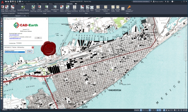
CAD-Earth is designed to easily import/export images, objects and terrain meshes between Google Earth and major CAD programs and create dynamic contour lines and profiles.
Features:
- Import Google Earth image to CAD.
- Export CAD screenshot to Google Earth.
- Insert georeferenced images.
- Import Google Earth objects to CAD.
- Export CAD objects to Google Earth.
- Import Google Earth terrain.
- More than 3000 supported coordinate systems worldwide.
- Cross section from mesh.
- Profile from mesh.
|
| |
 Читать статью дальше (комментариев - 30)
| |
|
 |
 Автор: Williams Автор: Williams
 Дата: 22 октября 2020 Дата: 22 октября 2020
 Просмотров: 2 243 Просмотров: 2 243 |
| |
Michael Law, Amy Collins - Getting to Know ArcGIS Pro v2.6
Esri Press, 2020
pdf, 236 pages, english
eISBN: 9781589486362
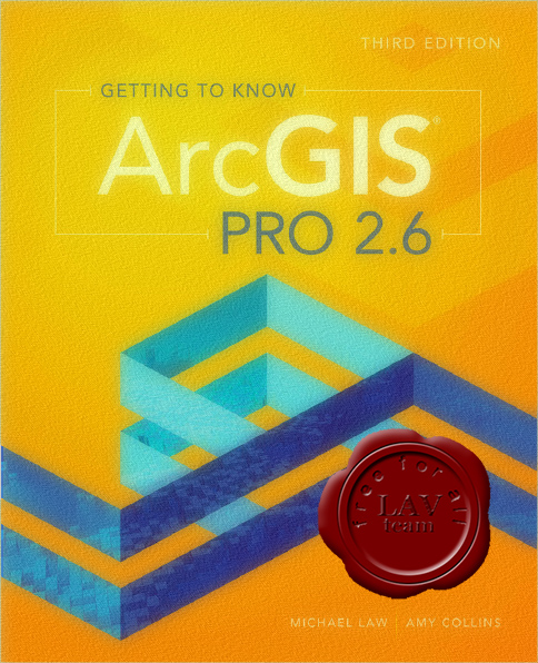
Continuing the tradition of the best-selling Getting to Know series, Getting to Know ArcGIS Pro 2.6 teaches new and existing GIS users how to get started solving problems using ArcGIS Pro. Using ArcGIS Pro for these tasks allows you to understand complex data with the leading GIS software that many businesses and organizations use every day.
Getting to Know ArcGIS Pro 2.6 introduces the basic tools and capabilities of ArcGIS Pro through practical project workflows that demonstrate best practices for productivity. Explore spatial relationships, building a geodatabase, 3D GIS, project presentation, and more. Learn how to navigate ArcGIS Pro and ArcGIS Online by visualizing, querying, creating, editing, analyzing, and presenting geospatial data in both 2D and 3D environments. Using figures to show each step, Getting to Know ArcGIS Pro 2.6 demystifies complicated process like developing a geoprocessing model, using Python to write a script tool, and the creation of space-time cubes. Cartographic techniques for both web and physical maps are included.
Each chapter begins with a prompt using a real-world scenario in a different industry to help you explore how ArcGIS Pro can be applied for operational efficiency, analysis, and problem solving. A summary and glossary terms at the end of every chapter help reinforce the lessons and skills learned.
Ideal for students, self-learners, and seasoned professionals looking to learn a new GIS product, Getting to Know ArcGIS Pro 2.6 is a broad textbook and desk reference designed to leave users feeling confident in using ArcGIS Pro on their own. |
| |
 Читать статью дальше (комментариев - 12)
| |
|
 |
| ПОИСК ПО САЙТУ |
 |
|
 |
|